
Scan the QR code and open PeakVisor on your phone
Kyrgyzstan is home to 1,146 named mountains. The highest is Pobeda Peak (Jengish Chokusu) at 7,439 m.
Shrouded in mysteries and legends, Kyrgyzstan aka Kyrgyz Republic is a rightful heir to the ancient empires of Central Asia. Due to its remoteness, high seismicity and wild expanses of bizarre endless steppes, Kyrgyzstan is quite underexplored. This land is not for the faint-hearted. Yet, once you venture to conquer the Heaven’s Rooftop of the Tien Shan and the Pamir, or plunge into the blue expanse of Lake Issyk-Kul, your heart will be left there forever.
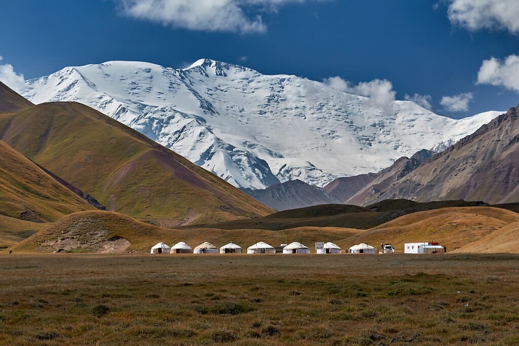
There is an abundance of natural and historical attractions, opportunities for mountaineering, trekking, beach recreation, and medical treatment in this country are truly unparalleled. There's so much to do for skiers that even the most discerning outdoor enthusiast will have plenty to choose from. Here grow relict walnut forests and hot sulfur springs spurt in rather unusual places. Even though you are not a daredevil, there are still plenty of things to do. You can leisurely stroll down the city streets or venture on short tours outside the urban environment to see colorful yurts and felt carpets, drink koumiss (a drink made of horse’s milk, really refreshing in the heat) and taste Osh pilaf, see traditional horse races, hear various chants, tales and legends. In a word, Asia in all its glory - that's what Kyrgyzstan is!
Located in Central Asia, the state was part of the Soviet Union. During the Soviet years it was called Kirghizia. In Russia, this name is still in use today. After the collapse of the Soviet Union, the country gained its autonomy and officially became known as Kyrgyzstan or the Kyrgyz Republic (according to the phonetics of the language of the local ethnic group). This is how it is recorded in the list of states that are members of the United Nations. The name Kyrgyzstan comes from the word "kyrgyz" (the ethnic group) and the suffix -stan (Persian for "country"), thus the toponym Kyrgyzstan means the country of the Kyrgyz.
The country's western border begins at the Fergana Valley where its neighbors are Uzbekistan and Tajikistan to the southwest. In the east and southeast, the state border with China runs right through the center of the Tien Shan mountain system. In the north Kyrgyzstan neighbors Kazakhstan, and in the south begin the northern Pamirs. The distance from the east to the west of Kyrgyzstan is about 900 km, and from north to south is about 410 km. An area of 199,951 sq.km. is inhabited by a population of 6,523,529 people, as of January 1, 2020, which is approximately half of Moscow's population. The capital is the largest city of the country, Bishkek.
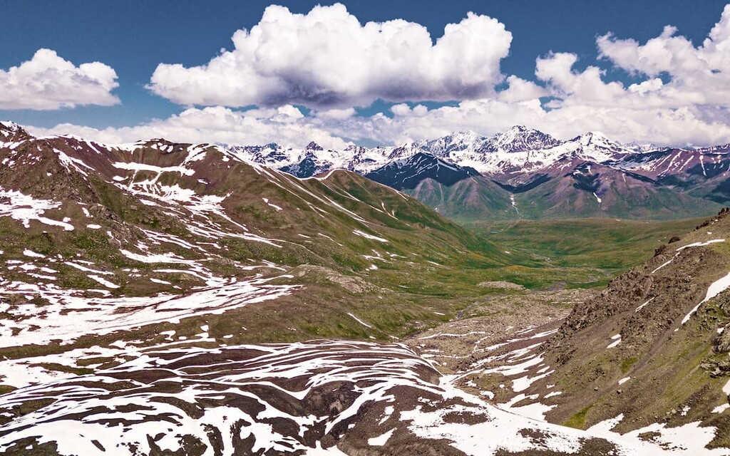
The Kyrgyz Republic is landlocked but it can boast an abundance of mountains which occupy about 92% of the country. Two mountain ranges, the Tien Shan and the Pamir-Alai, which are considered the highest in Asia, have spread majestically across the region. The main summit of the region is Pobedy (Victory) Peak (7,439 m), in China it is called Tomur Peak.
It is not for nothing that tours to Kyrgyz mountains are in great demand. Mighty mountain giants here have an alpine relief with distinctive mountain ridges and high, rather sharp peaks. Rarely can you find flat areas, and if you do stumble on them, rest assured they have a very ancient origin. The highlands accommodate many scree sites and glaciers. The snow line runs up to 3800-4200 m, the towering peaks are covered with eternal snow caps.
Some areas are dangerous because of the high probability of avalanches. According to scientists, about 97.8% of Kyrgyzstan's settlements are located in areas with high seismicity of 8-9 points on Richter’s scale.
Geographically, Kyrgyzstan is divided by its mountain ranges and passes into the north and south of the republic, which are connected by the Bishkek-Osh highway. Part of the road passes through a 3-km-long tunnel.
Glaciers in Kyrgyzstan are extremely important. They are the fresh water reserves not only of the country itself, but also of the whole Central Asia. In addition, they are the main sources of feeding the rivers. There are about 8,000 glaciers in the region, which together occupy 4% (about 8,000 sq. km) of the country. And together with eternal snows they occupy 40.5% of the territory as a whole.
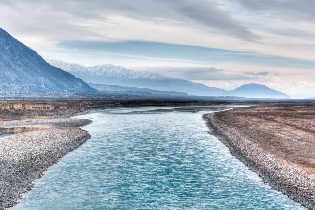
There are about 30 thousand rivers in Kyrgyzstan. The largest rivers originate high in the mountains. The character of the rivers varies from mountainous to plain due to the terrain. The largest river in the country is the Naryn, which is the main tributary of the Syr Darya River.
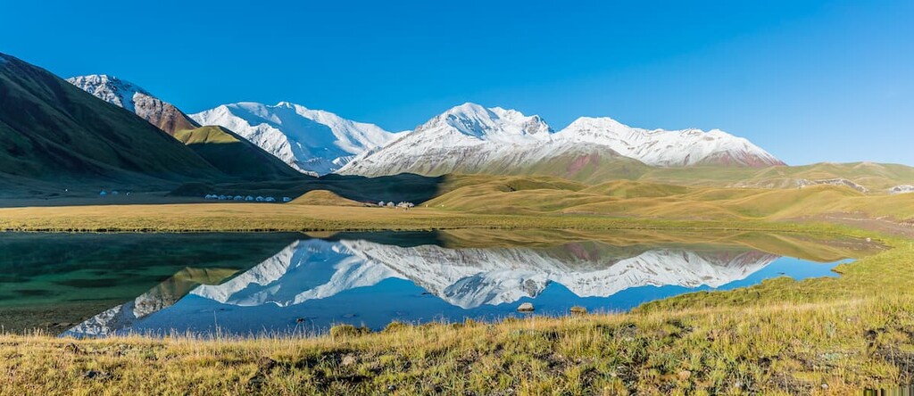
There are about 2,000 lakes in the republic, most of which are high-altitude, located 2,500 to 4,000 m above sea level. The melting of glaciers is the main reason for the formation of lakes in Kyrgyzstan. The three largest lakes of the republic are Issyk-Kul, Sonk-Kel, and Chatyr-Kel (Kel is also sometimes spelt as Koel, Kyol).
The flora of Kyrgyzstan has more than 4,000 plant species. Forests cover only 3.5% of the entire territory of the country. At an altitude of 2000-2500 m, there are sparse forests with various types of plants and herbs, including Tien Shan fir, edelweiss, and aigul.

Aigul or moonflower is an herbaceous plant, endemic only to the south of Kyrgyzstan. It also has a scientific name - Fritillaria - from Latin Fritillus, which translates as a glass for throwing dice, which is exactly the same shape as the flower's corolla. And because of its motley, ruffled color of the petals and resemblance to the feathers of birds, this amazing flower was given a Russian name - "hazel grouse (ryabchik)".
It is believed that the one who sees the opening of Aigul will be happy. However, not everyone is lucky because it has a very short blooming period - it blooms only for two weeks in April and only during the full moon! This flower is shrouded in many legends. Here is one of them. In ancient times, a rich and noble Urbokhan who ruled a nomadic Kyrgyz cla, gave birth to a girl of unprecedented beauty. She was named Aigul, the moonflower. Many noble young men tried to win the heart of the beautiful girl, but she fell in love with a common but strong guy, whose name was Kozu-Ulan. As often happened, the man failed to return home one day as he fell in the battle and his body was buried in the steppes as a hero. But his heart was returned home with honor and was buried by the girl, Aigul, under the highest mountain. After that, unable to bear the grief, she threw herself down from the neighboring mountain. A few days later flowers of amazing beauty sprang up in that place. They were called "aigul", and the mountain from which the intrepid girl threw herself was called Aigul-Tash. The mountain where Kozu-Ulan's heart was buried was called Kozu-Ulan-Tash. Both mountains became symbols of the great, pure and faithful love of two hearts. The residents believe that the lovers met after death, never to be separated again. This is the legend that lives among the Kyrgyz people and is passed from mouth to mouth.
As for the animal world of Kyrgyzstan, it is represented by over 500 species of vertebrates including 335 species of birds, as well as 49 species of fish and about 3,000 species of insects. Many of them are included in the Red Book. In the forests of the Tien Shan can be found herds of red deer and argali aka Marco Polo's sheep. The endemic Tien Shan brown bear also lives there.
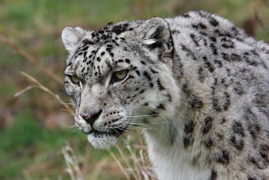
Snow leopards, which in the past inhabited most of the Republic of Kyrgyzstan, now live mainly in the highlands. Today the population of this red-book-listed species is very limited.
The mountain valleys are inhabited by wolves, foxes, gophers, marmots, pika (mouse hare) and others. Mountain rivers are filled with trout.
The climate in Kyrgyzstan is sharply continental and very arid which is due to several factors of its location: it is almost in the center of the continent, remote from seas and oceans and close to high-rise mountains. The temperature differences during the year are very high: from -30 °C (-22 F) in the mountain valleys in winter time, to +27 °C (81 F) in Fergana valley in summer time. But near Lake Issyk-Kul, there are no such sharp contrasts and the temperature regime is considered to be the best: from 0 °C (32 F) in winter to +18 °C - +25 °C (64 F - 77 F) in summer. The temperature maximum is +44 °C (111 F) and the lowest recorded temperature is -53.6 °C (-64 F).
The amount of precipitation varies considerably from place to place in the country. The high slopes receive up to 2,000 mm of rainfall per year, which cannot be said about the western bank of Issyk-Kul, where rainfall is sometimes less than 100 mm per year. The Republic of Kyrgyzstan is one of the sunniest countries in the world although there are valleys here where there is almost constant cloudiness. The sun here is more gentle and not too scorching than in neighboring Uzbekistan. In general, it is cloudy here only in winter and in the first days of spring. On the tops of the mountains snow lies all year round, and in winter the snow on the slopes can be at least one meter thick. In the Pamir Mountains, the climate is less humid compared to the Tien Shan mountain system, and at the same time, it's sunnier.
September is considered the most comfortable month to visit the country when the sun is not so scorching. You can go hiking in the high mountains from May to mid-autumn. Hiking and horseback riding tours are better from May to October in the south and from April in the north. You can conquer the mountain peaks all year round, but it is easier to climb the highest peaks in summer.

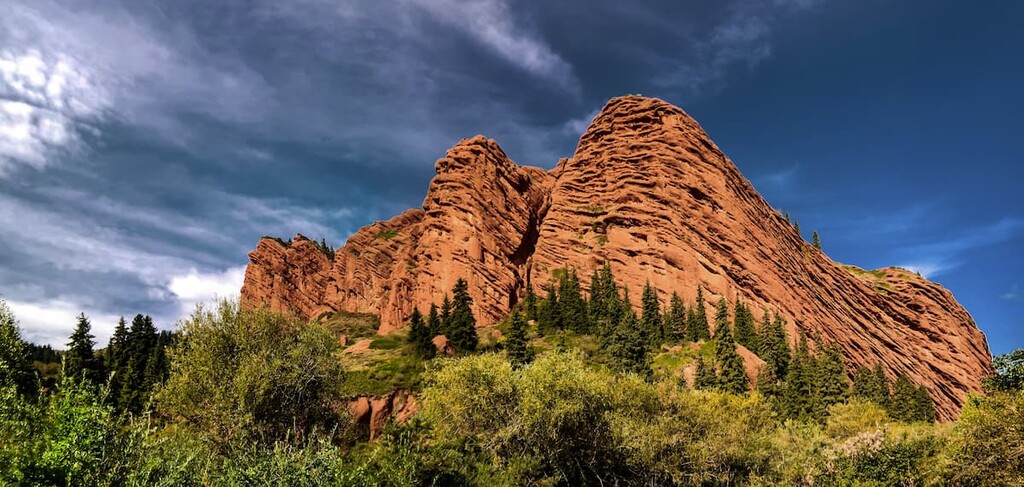
Surprisingly, the annual tourist inflow is as high as the whole population of the country. The most important attractions of Kyrgyzstan are surely the natural beauties. The country is a mountain paradise for climbers, skiers, rafters and lovers of outdoor activities. The Tien Shan and Pamir mountains are at your service! The Ala Archa Gorge, Dzhety-Oguz Gorge (or the Seven Oxen Cliffs) and nearby thermal springs will appeal to active tourists.
Those who prefer a more measured type of tourism and recreation, can take a helicopter ride over the mountains and valleys or admire the beautiful landscapes during hiking or jeep rides. You can go to the Alatau Ridge, the Alamedin Gorge, the Konorchek Canyons, the Altyn Arashan Gorge with a visit to the healing springs that are abundant in the vicinity of many cities.
Another favorite place for rest among those who love hiking is Arslanbob settlement which has a resort, tract, waterfalls, walnut forest.
Of particular interest are the many historical, cultural and architectural landmarks. Please note that to visit some of them you may need to sacrifice the usual comfort because some of the sites are located far from human settlements. Among the must-see ancient constructions, you should visit the Tash-Rabat caravanserai (situated near Chinese territory), the Burana Tower (20 km from Tokmak town), the Gumbez Manas Mausoleum (22 km to the north-east of Talas town), and one of the treasures of our planet - the Saimaly-Tash ancient petroglyphs (in the center of Fergana Range at the latitude ranging from 3,000 to 4,500 meters).
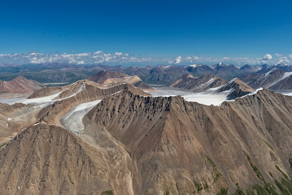
The "Heavenly Mountains" as the Tien Shan is called stretch their chain of 88 ridges from west to east. They are located on the territory of five countries: China, Kazakhstan, Kyrgyzstan, and Uzbekistan. It is the second longest range in Asia after the Kunlun Range (3,000 km), the Ural Range being the third. The highest and the most visited mountains are located in the center of the range: Victory Peak / Peak Pobedy (7,440 m), which is just 500 meters short of being called an eight-thousander, and Khan-Tengri Peak (7,010 m). By the way, the name of Khan Tengri is translated as "Lord of Heaven". The Tian Shan is sacred in Tengrism.
There are 40 more peaks with a height of over 6,000 meters. Most of the range is located on the territory of Kyrgyzstan.
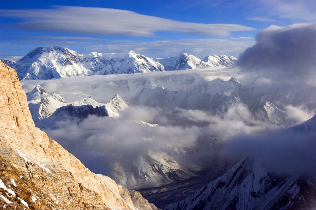
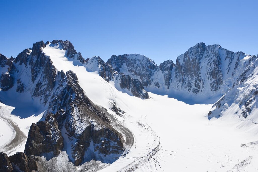
Mountain peaks and glaciers of the Tien-Shan mountain system
The Tien Shan mountain system is clearly visible even from the Earth's orbit. And those courageous travelers who climb to the heaven-high peaks will have the magnificent sights imprinted in their memory forever.
The Tien Shan can be roughly divided into five regions:
The Central Tien Shan is a real Mecca of international mountaineering. Due to its vicinity of the seven-thousanders, it is the most explored part of the Tien-Shan. The most popular points of attraction for mountaineers and trekkers are the areas of the Tengri-Tag Ridge and Khan-Tengri Peak, the Tomur Pass, the Pobeda Peak (7,439 m) and the Inylchek Glacier, the basin of the unique Lake Merzbacher in the eastern part of the mountain system, Semyonov-Tyan Shansky Peak (4,875 m), Peak Free Korea (4,740 m) and the famous Korona Peak (4,855 m) in the Kyrgyz Range. The ice walls of the Kakshaal-Too Range (Kokshaal-Tau) feature three peaks with heights above 6000 m and about fifteen peaks with heights above 5000 m.
You can see Kommunism Peak (7,495 m) and Korzhenevskaya Peak (7,105 m) from Central Tien Shan. Even those are already the Pamir, few climbers would agree to pass by these great mountains.
Victory Peak / Peak Pobedy (7,439 m) on the border of Kyrgyzstan and China remained unmeasured and unexplored for a long time because of the fact that it is covered on all sides by mountain ranges. The height was accurately determined only in 1943. Because of its smoothed and rather long top, the mountain seems calm, but in reality under the clouds hides the treacherous character of this beauty - the strongest winds come, fog falls from above, avalanches are frequent. There is an opinion that Victory Peak is one of the most difficult peaks. Climbing this mountain requires good physical shape, proper equipment, but most importantly - endurance and courage. Over a dozen of sportsmen managed to get here, which means that Victory can be conquered by the brave and persistent ones.
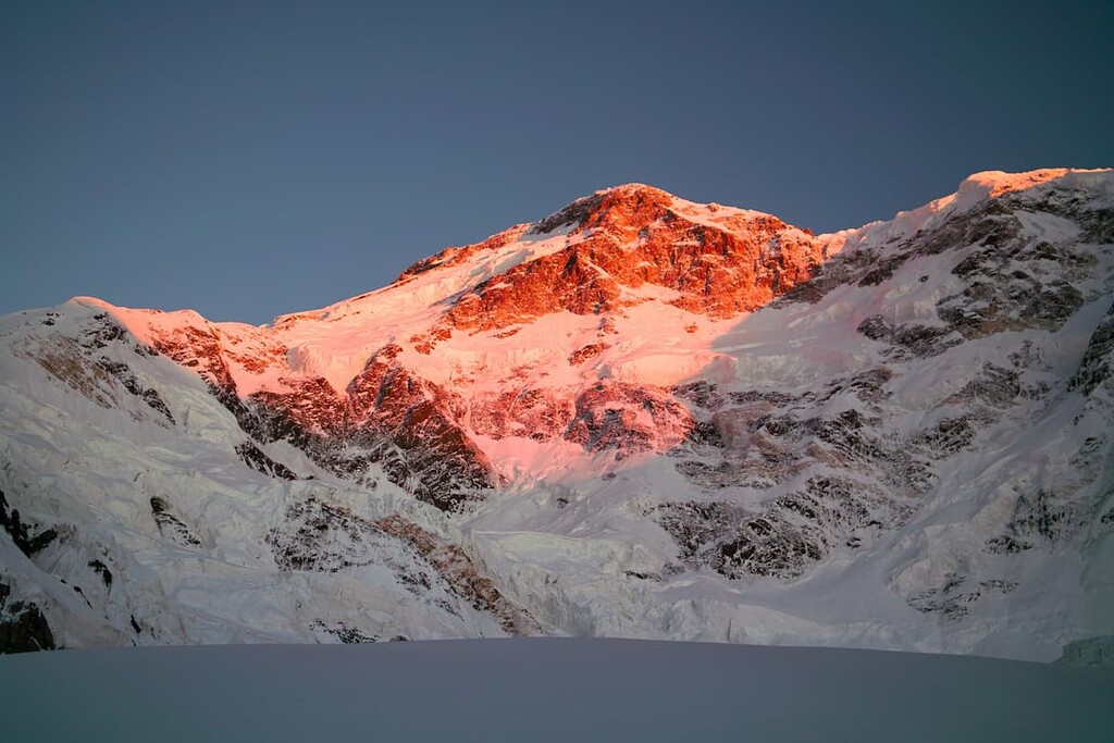
Khan-Tengri Peak (7,010m) has been known since times immemorial. Staring upwards, you can clearly see the regular pyramid rising to the sky. In ancient times, it was believed that the deity Tengri lived on the top, hence the name. There is also another name - Kan-Too or "bloody mountain". At sunset, Khan Tengri is colored bright red, and the snow cap remains scarlet even when the neighboring mountains have plunged into dusk. Khan Tengri is composed of pink marble, therefore it seems that the bloody sunset rivers, sparkling and shimmering, flow down the slope.
The proximity of the state borders of Kazakhstan and China for a long time made the geographical identity of Khan-Tengri controversial. Eventually, Kyrgyzstan, Kazakhstan and China agreed that the peak was the common property of the three states.

This seven-thousander has been successfully managed by climbers since the mid-1930s. The classic route runs along the western ridge. The weather here is unstable, strong frosts and winds may suddenly strike, so the hike to Khan-Tengri may become a strong test of strength and endurance. This only encourages more climbers to put themselves to test. The popularity of Khan-Tengri has another reason. Geographically, if you look from the north, the location of Khan-Tengri and its western cofferdam (5,900 m) to Chapaev Peak (6,371 m), although lower by two thousand meters, is still very similar to the giants of the Himalayas: Everest (8,848 m), its southern saddle (7,900 m) and the neighboring Lhotse Peak (8,516 m). That is why people also come to Kyrgyzstan to practice the Himalayan "classics".
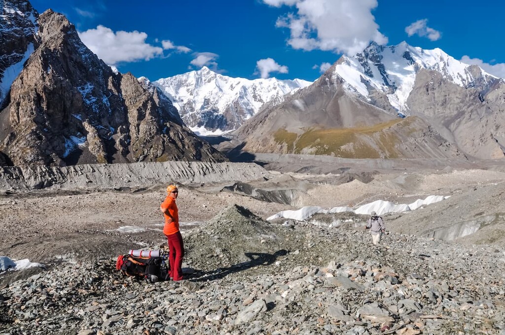
Those who are not confident of their shape and stamina may try their hand at trekking to the Base Camp on the South Inylchek Glacier. There is a wonderful view of the Tien Shan from there. By the way, Southern Inylchek is the largest of the 7.3 thousand square kilometers of Tian-Shan glaciers. It is shaped like a tree and occupies more than 500 square kilometers. It is joined by more than seventy smaller glaciers, which form its crown.
Its neighbor, the Northern Inylchek, is a little smaller. At the junction of the two ice arms there is the mysterious "disappearing" Lake Merzbacher. Every year - in winter and summer - for a week the lake is completely deprived of water, discharging it into the flowing rivers with a rumble. Iceberg blocks remain at the bottom. It is difficult to go around the lake during the high-water period - it is surrounded by rocks. The age of the reservoir, as well as the mechanisms of its origin and discharge are not fully understood. That's why adventurers and scientists come here. The glaciers of Tien-Shan are also studied because of global warming. Climate change has led to their rapid melting, so the shape of the glaciers and their size are carefully measured.
The Pamir is the greatest mountain system in the world. Sharp peaks seem unattainable, deep rocky gorges appear impregnable, winding roads going into the clouds can hardly be called reliable. Mountain peaks rising to the sky remember the Persian kings, the mysterious Bactria and the troops of Alexander the Great. Here made their way Tamerlane and Babur, Marco Polo and dozens of pioneer explorers. And on the roads laid above the abyss, caravans carried Chinese silk, lapis lazuli and rubies mined in the local mines. Its majestic mountains rise on the territory of Tajikistan, Kyrgyzstan and China.
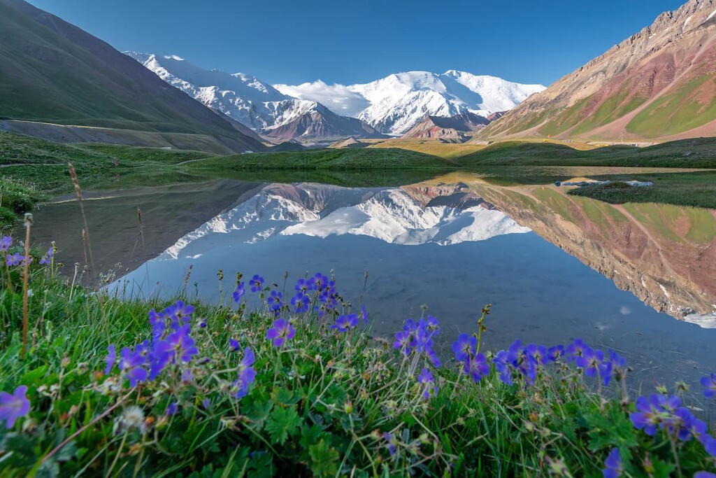
The Republic of Kyrgyzstan has only Pamir’s northern part. The highest point of the Pamir, located on the territory of the republic, is Lenin Peak (7,134 m). This is the most frequently climbed peak in the Pamirs, as climbing it is quite easy and there are no strict requirements for the mountaineers. Most often, tourists get to the base camp by car from Osh.
Mountain peaks that are slightly lower than the 7,000 m in height are: Shater Peak (6,700 m), Przewalski Peak (6,450 m), Marble Wall (6,400 m), Chapaev Peak (6,370 m), Karakol Peak (5,216 m), Nansen (5,697 m), Pyramid (5,621 m) and others.
The most famous Pamir ranges in Kyrgyzstan are the Zaalai and Turkestan ranges.
The northern outpost of the Pamir, the Zaalai Range, stretches for 200 kilometers along the Kyrgyz territory from west to east from the confluence of the rivers Muksu and Kyzylsu to Peak Irkeshtam on the border with China, and cuts into the lands of the Celestial Empire for another 50 kilometers. Here converge the Zaalai Range and the northern part of the Pamir-Alai Mountains – the Turkestan and the Alai Ranges – separating the Pamir and the Tian Shan.
Although the average height of the Zaalai Range is a little over 5 km, it is here that one of the seven-thousanders of the Pamir – Lenin Peak (7,134 m) and many six-thousanders are scraping the skies with their rugged tops. The number of glaciers is astounding – there are more than 500 treacherous ice bodies in this part of the Pamir. The most impressive are the Korzhenevsky (21.5 km long), Lenin (13.5 km long), Mushketova (20.5 km long), Dzerzhinsky, Kuzgun, East Kyzylsu, Oktyabrsky, Nura, Malaya and Bolshaya Saukdara glaciers.
The Kyzylart and Tersagar Passes divide the Zaalai Range into eastern, central and western parts.
Lenin Peak shrouded in the clouds was first documented in 1871 by a Russian geographer and traveler Alexei Fedchenko. Until 1928, it was named Kaufman Peak in honor of the Governor-General of Turkestan. With the advent of the Soviet power, it was renamed Lenin Peak. In 2006, the Tajik government unilaterally gave it the name of Abu Ali ibn Sina (Avicenna). In spite of its neighbors, or probably to spite them, in 2017 Kyrgyzstan offered to name it Manas Peak. However, tourists and climbers are more familiar with the old name, Lenin Peak. By the way, it is best seen from the Kyrgyz side. Today, 16 routes lead to the peak: nine on the southern slope and seven on the northern one. The most accessible way to the peak leads from the north through Mount Razdelnaya. It does not require any special skills and a great mountaineering experience, which makes Lenin Peak the most accessible 7K-peak in the world.
Another small note on Lenin Peak – it was depicted by a great Russian painter Nickolas Roerich who was called the Master of the Mountains.
The Turkestan Range serves as a natural border between Tajikistan, Uzbekistan and Kyrgyzstan. It is a high-latitudinal range of about 340 km long, which belongs to the Gissaro-Alai mountain system of the Pamir. The ridge connects with the Alay Range in the east through the Matcha mountain junction, and extends to the Samarkand Plain in the west. The northern slope is long and gentle, with juniper forests and sparse woodlands, while the southern slope is short and steep with rocks and scree. In the south, it is separated from the Zeravshan Range by the Zeravshan River valley.
The highest points are Skalisty Peak (5,621 m) and Pyramidal Peak (5,509 m). Karasu peak (5,309 m) is located to the west. Further to the east are such peaks as Dzhaupai(5,209 m), Granitny (5,287 m), Min-Teke (5,482 m), Fedchenko (5,484 m), Turkestan /Novosibirsk Peak (5,409 m), Zemlekhodtsy (5,407 m), Schurovsky (5,560 m), LGI (5,400 m), Kshkeshimbashi (5,282 m), Eagle (5301 m).
The crest of the range, especially in its eastern part, is covered by eternal snow and mountain glaciers. The largest glaciers are the Tolstoy, Shchurovsky, and the Zeravshan Glacier, which is the source of the Zeravshan River. On the northern slope also reside the Kshomysh, Mintake, Karatura, Tamyngen, Jaupai, Aksu, Karasu and Dukenek glaciers. Almost all of them meridionally slip down into deep gorges to the forest border. The rocky ridges separating them are fancifully decorated with hanging glaciers and snow-covered canyons. To the north, the pointed peaks and sharp ridges of the slope are replaced by smoothed domes and soft, rounded ridges of the foothills.
In the basin of the Shchurovsky glacier, 2-3 km above the end of the tongue, on its right moraine bank, there are three blue lakes, insignificant in size. The fourth lake - Turquoise Lake - is tucked away at the left side of the foot of the Dolgozhdanny Glacier, a tributary of the Shchurovsky Glacier. All four lakes are located at an altitude of about 3,600 m.
The highway Dushanbe-Khujand runs through one of the mountain passes, Shahristan, at the height of 3,378 m. The slopes are dissected by the valleys of Isfara, Ak-Suu, Kara-Suu rivers. On the northern slope, there is the mountain lake Ai-Kol.
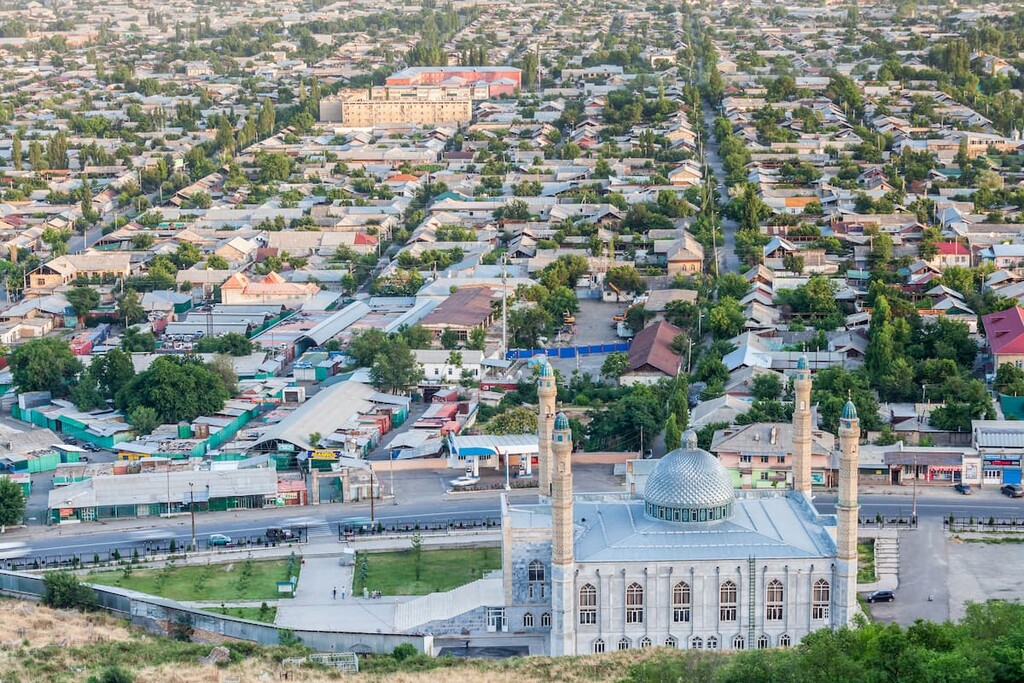
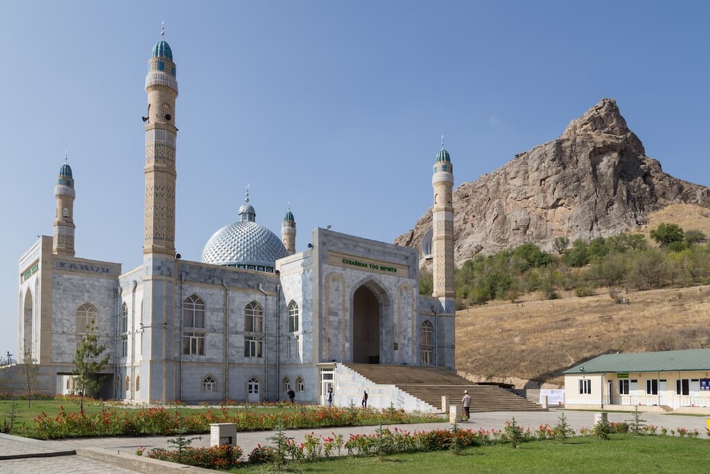
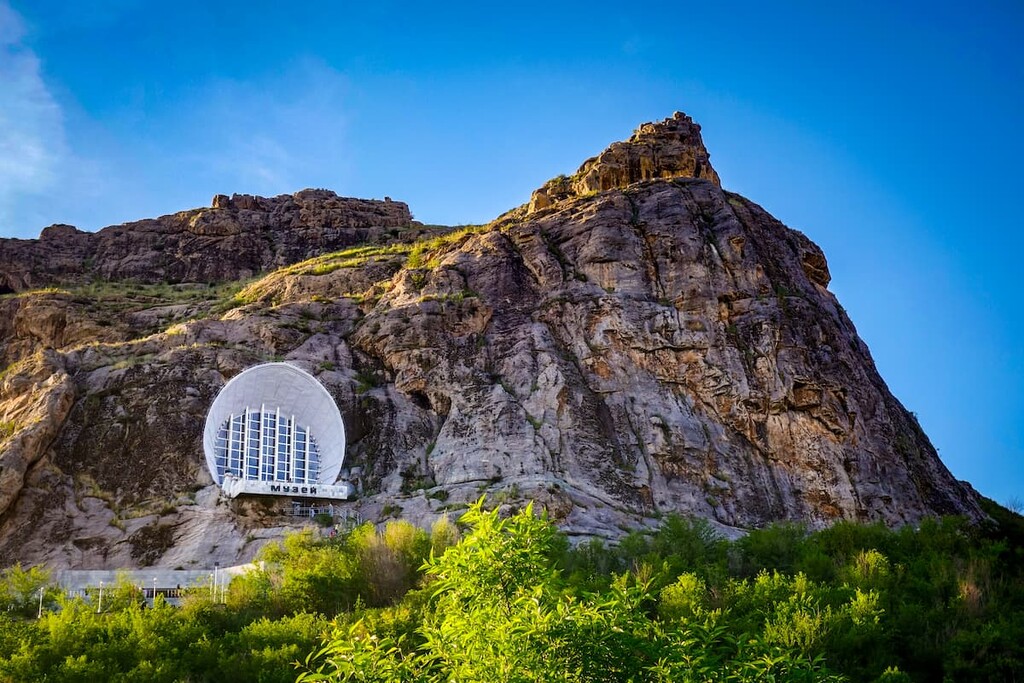
Mount Suleiman-Too (Suleiman's throne) in the city of Osh is considered sacred. Its height is 1,110 meters. Its ancient origin is confirmed by the petroglyphs found on it. In 2009 it was recognized as a World Heritage Site.
The names of the five-headed Suleiman Mountain from left to right are Buura-Too, or Takhty-Suleiman (Camel Mountain or Solomon's Throne), Shor-Too (Salt Mountain), Rushan-Too (it is the highest of the five, 1,172m a.s.l.), Kattama-Too (Layered Mountain), and Eer-Too (Saddle Mountain).
Suleiman Mount is similar to a giant transmitter which is passing on people’s wishes from the Earth to a higher power. That is why there are many spots considered to be healing various ailments. You can cure head, back, knees, arms or even ask for a baby. The mountain has many petroglyphs of islamic origin which have not been unpuzzled yet, sacred stones, caves and fantastic views from the top of the mountain. Allow at least a day to spend there. You can climb the mountain on trails for a small fee and there is even an opportunity to visit a local museum. By the way, it is very easy to go up the mountain because you have a feeling of some updraught blowing in your spine and pushing you forward.
Suleiman-Too Mountain has 7 caves, viz.
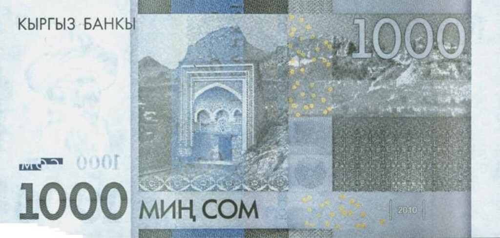
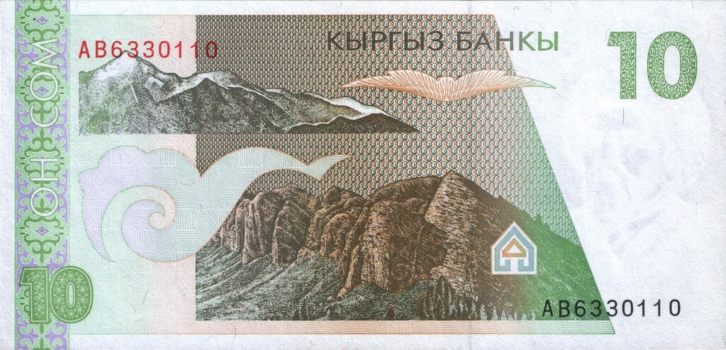
Suleiman-Too also features the country’s banknotes because the size doesn't really matter. If you want to read about other mountains who made it to banknotes of different countries, we have an article on that as well.
The Dzhety-Oguz aka Jetty Oguz Gorge aka the Cliffs of Seven Oxen is another landmark that you can see on Kyrgyz banknotes. It is formed by Mt. Kok-Debe (2,700m), Horseshoe Peak (Peak Podkova, 3,500 m), People’s Friendship Peak (Peak Druzhby Narodov 3,800m), Kok-Belle Peak (2,600m) and Asan-Tukum (3,600m). There is a resort called Karakol at the end of the gorge.
Basically, it is the picture of the gorge Dzhety-Oguz surrounded by unique red rocks that remind of oxen lying on the ground. As any unusual edifice, it has a background folklore story to it. Surely, it is about love, very much like that of Helen of Troy. A man had a beautiful wife, a neighbour wanted to have that woman as well, so he stole the femme fatal, a bloody war ensued and to end it, the neighbour devised a devilish plan. The husband, who was claiming his wife to be returned, did not state whether he wanted her to be dead or alive. So, the neighbour decided to kill the woman. The unsuspecting husband was invited to the fest after which he was told his wife would be given back. According to the old tradition, the fest should last a week, every day an ox/bull was killed to feed the guests, so when the seventh day came, the last bull was killed and so was the woman. Once the blood of that unlucky female was spilt, some drops of it got onto the cliffs and torrents of water flooded the gorge, killing the wicked neighbour and his friends (and assumedly the unlucky husband). Since that time, the gorge has been called Seven Oxen or Dzhety-Oguz.
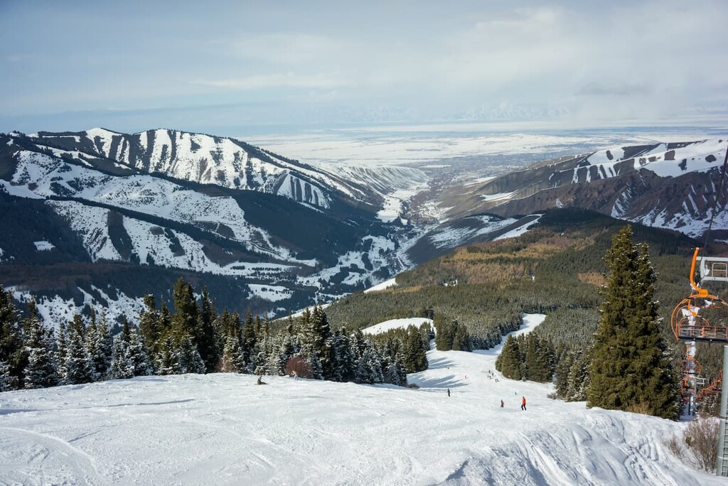
Kyrgyzstan is famous for a variety of ski resorts well-equipped both for hardcore skiiers and beginners. Almost all skiing bases have equipment rentals, experienced instructors, and hotels.
There are 88 specially protected areas in Kyrgyzstan, occupying about 7.38% of the area of the republic.

Also among the protected areas of the republic are lakes Issyk-Kul, Chatyr-Kul, and Son-Kul.
When planning a trip to the protected areas, it is necessary to obtain permission to visit them in advance. The official website of the Kyrgyz Ministry of Foreign Affairs sadly is only in two languages - Kyrgyz and Russian, so are the official websites of the nature reserves.
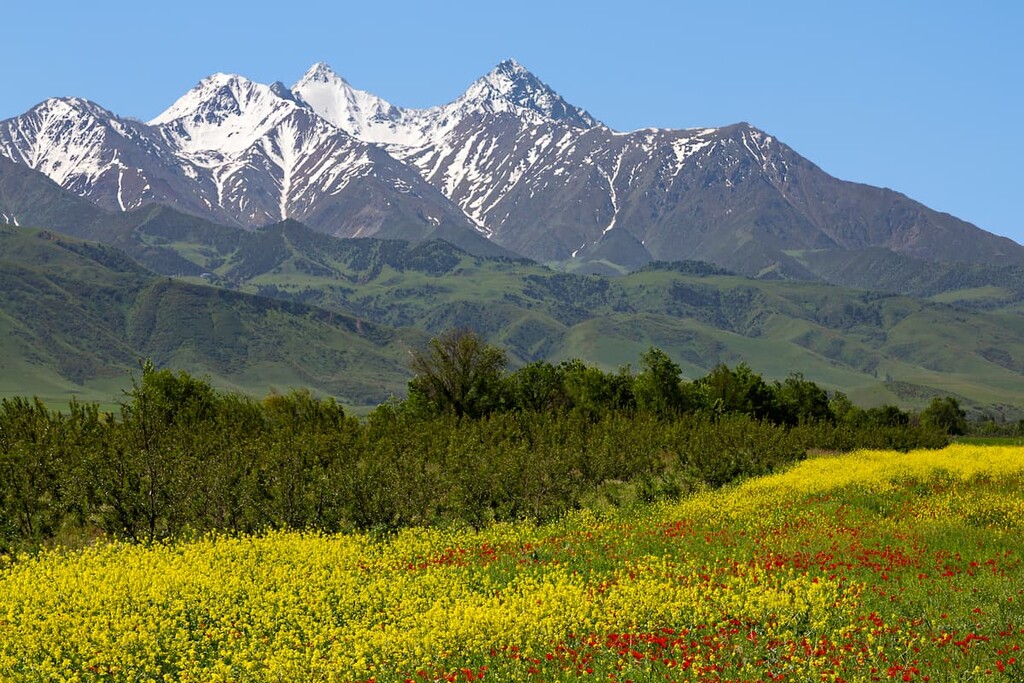
In spring, especially in May, the mountains and valleys of Kyrgyzstan are stunningly beautiful since they are all covered with flowers. The yellow and red carpets of tulips, blooming edelweiss and many other flowers and herbs delight the eye and fascinate at this time of year. The blooming valleys look strikingly bizarre against the backdrop of snow-covered mountains.
Should you wish to take a nice walk along the picturesque coast and explore the unusual flora and fauna, it is worth visiting Lake Sary-Chelek. It was formed at an altitude of over 1,800 m.
Another amazing water body worthy of a visit is located at an altitude of over 3K meters inside the Tien Shan - Lake Son-Kul (Sonkel). Part of the coastal area has the status of a nature reserve, and many of the animals and plants living near the lake are classified as rare and are included in the Red Book.
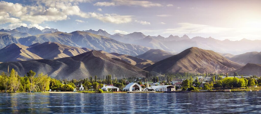
Lake Issyk-Kul is the largest lake in the Republic of Kyrgyzstan, the seventh deepest and one of the 30 largest lakes in the world by area. The water in the lake is salty. In terms of size, it is only slightly inferior to the Caspian Sea, and in terms of water transparency, it is comparable to Lake Sevan. Located at an altitude of 1,608 m above sea level in the northeastern part of the republic, between the ranges of the Northern Tien Shan (Kyungyu Ala-Too and Terskey Ala-Too), this popular place attracts tourists not only with its picturesque scenery and clean air but also with its comfortable climatic conditions - it combines mountain and sea climate. The great depth of the lake (the maximum is 702 m), makes it possible both to swim and do various water sports. The territory of the lake shores is well equipped for some leisurely rest, there are sun beds, umbrellas for shade, cafes, equipment rentals, etc. Leisure in Lake Issyk-Kul is best planned for the summer when the water temperature is most comfortable for swimming. On the northern shore of the lake, there is the cozily settled town Cholpon-Ata (240 km from Bishkek, 135 km from Karakol). It is the center of resort and recreation on the northern shore of Lake Issyk-Kul.
Lake Merzbacher (also can be seen spelt as Mertsbaher) with floating icebergs is 105 kilometers east of Lake Issyk-Kul, between the Sary-Jaz and Tengri-Tag Ridges, at the confluence of the Northern Inylchek and Southern Inylchek glaciers. It can rightly be called one of the wonders of the world. It is famous for its ability to disappear, hence the other name it goes by - the Vanishing Lake. The discoverer was a German scientist Godfried Merzbacher whose name was used to give the lake its name. The phenomenon is that twice a year (in winter and summer), when the water temperature begins to exceed 10°C (50 F), there is a formation of subglacial channels and then water rushes through them down to the river Inylchek. This phenomenon is accompanied by a loud noise. The rate of water leakage is rather high, so the lake is emptied in just 2-7 days. The filling of the lake takes place due to the glaciers. There are only a few lakes in the world known for a similar phenomenon of disappearance. Every year tourists from all over the world come to the lake hoping to witness this unusual natural process.
Nestled in the Chui Valley in northern Kyrgyzstan, Bishkek is considered the cultural capital of Kyrgyzstan, and its residents call the city the soul of the republic. During its history, it has changed several names - Pishpek and then Frunze. But one thing remained steady: it is the city bustling with vivacity and optimism.
The name Bishkek is translated as "koumiss whisk". The Kyrgyz call it the Green City not only because of the abundance of century-old oaks and poplars shadowing the busy boulevards, but also because of the young spirit and buoyancy that hangs in the air of the Kyrgyz capital. In Soviet times, Bishkek was called the "city of trees, flower beds and bushes", it was included in the list of the greenest cities in the world. In recent decades, green spaces have been cut down for the construction of new houses, but despite this, it is always easy to breathe in the city, even on a very hot day.
Founded as a fortress in the 7th century, Bishkek used to protect the Kokand khanate from the Russian army in ancient times. The modern Bishkek was laid in 1825 and called Pishpek at that time. Modern name Bishkek was given only in 1991 when independence of the Kyrgyz Republic was proclaimed.

There are many legends about the origin of the word "Bishkek". One of them says that the city was named after a mighty warrior (bogatyr) who lived on this territory back in the 18th century and was buried on the mound of the Alamedin bank.
Today it is very young and bustling with life: there are lots of bars and discos organically cohabitating with traditional teahouses and markets; the monuments to modern independence and sculptures of ancient Kyrgyz heroes don't create any cognitive dissonance, on the contrary, they complement each other. You can see century-old elders in kalpaks and colorful robes and young girls with very skint clothing in the streets. By the way, despite the massive advent of western culture, it's much easier to find koumiss here than some foreign mojito.
The city attracts not only by its natural beauty, but also by its architecture. It will be interesting to walk around Ala-Too Square. And if you have enough free time, you can stay there a little longer to see how the National Guard changes at the State Flag post. A walk around Manas Square and Victory Square will not leave you indifferent either.
Victory Square in Bishkek
The Art Gallery, National Philharmonic Hall, and Museum of Regional History open their doors for culture-vultures.
The Central Mosque in Bishkek is the largest mosque in Central Asia and Kyrgyzstan.
Central Mosque

It is also recommended to visit the Osh Bazaar, the largest bazaar in Asia. It is located on the west side of town, and is not far from the Western Bus Station. At the Osh Bazaar, one can buy food, almost any common household goods, clothes, souvenirs, and even musical instruments. Kyrgyz national clothes are sold in the national goods section called "Kyyal" or may be specially ordered through the bazaar vendors. The national goods section also includes vendors who sell carved wooden trunks, national bedding, national cradles, small souvenirs, and many other locally produced items relevant to the traditional and modern culture of Kyrgyzstan.

Another mind-blowing market is the Dordoy Bazaar, a large wholesale and retail market in Bishkek. It is one of Asia's greatest public market places, comparable to Bangkok's Chatuchak weekend market or Tehran's Grand Bazaar. It has been described by a Western journalist as "a modern monument to the power of raw commerce". The Dordoy Bazaar is a major shopping and employment centre for the Bishkek metropolitan area and the entire Chuy River Valley region. It is also one of the main entrepots through which consumer goods from China arrive at shops and markets in Kazakhstan, Russia, and Uzbekistan. According to some economists, this re-export is one of two largest economic activities of Kyrgyzstan.
There are direct flights from 12 countries and 30 cities of Russia. There are regular flights from Moscow to Bishkek. You can take Kyrgyzstan Airline or the Russian S7 and Aeroflot. Kyrgyzstan Airline flies four times a week from Moscow's Domodedovo. Aeroflot operates one direct flight daily and two on Wednesday and Friday from Sheremetyevo-F. The flight time is about 4 hours. S7 has a stopover in Novosibirsk. The Bishkek Manas International Airport is located about 30 km from the city. It takes half an hour by car to get from there to the center of the Kyrgyz capital.
Another way is to come to Bishkek by train. From the railway station, you can get to almost any part of the country. And from neighboring towns you can easily get to Bishkek by bus or car.
Inside the city you can travel by public transport (bus, trolley bus), cab, on foot or by renting a car. And on out-of-town trips there is an opportunity to order a jeep or ride a horse.
Situated in the northern centre of Kyrgyzstan just above the Tien Shan range, Bishkek makes an excellent hub for short trips into the mountains.
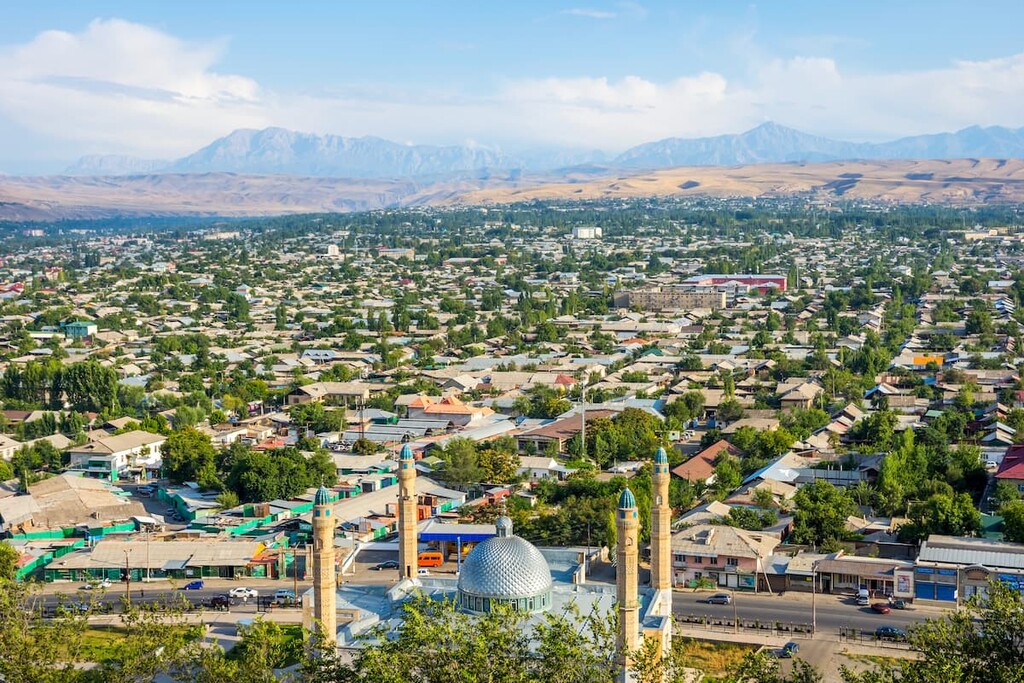
Osh is the second largest city in Kyrgyzstan and one of the oldest cities in Central Asia. Even though the exact date of its origin is unknown, archaeological findings (in the 1950s by Yury Zadneprovsky on the southern slope of Suleiman Too) go back to three thousand years ago and according to written history, Osh is at least a millennium years old.
Legends link the founding of the city with such ancient rulers as the Israelite King Solomon (Suleiman) and the Greek ruler Alexander of Macedon. Osh was first mentioned in Arabic sources of the 9th century. Scientists are still unable to come to a consensus on the etymology of the name of the city. The religious cultists are trying to link the origin of the city with the legends, but none of the legends explains either the origin of the city, or the etymology of its name.
Osh is officially the Southern capital of Kyrgyzstan, its population is quarter of a million people. It is located in an oasis on the southeastern edge of the Fergana depression at the northern foot of the Kichialai Range (the southwestern edge of the Tien Shan, and the northeastern edge of the Pamir-Alai) at an altitude of 700 - 1000 meters above sea level. On three sides, Osh is surrounded by spurs of this range, and in the center of the city rises Suleiman-Too Mount.
Osh used to be a transport hub for caravan routes from India and China to Europe and today it is still an economic and cultural centre with a unique veneer of mysterious ancient Orient.
Modern Osh is the industrial center of Kyrgyzstan. There is one of the largest cotton plants in Central Asia, a silk plant, construction, metal processing, machine building, light, food and wood processing industries, and an airport.
The trading Osh was very famous for its bazaars and caravanserais. The main bazaar located on the left bank of the Ak-Bura River is a classic example of an oriental covered market - a tima. For more than two thousand years, the main bazaar in Osh has lived its noisy and vibrant life in the same place, only changing buildings and expanding its boundaries.
Next to the bazaar is the biggest mosque in Kyrgyzstan - Shahid Tepa Mosque. The original, wooden mosque building was built in 1908-1910, but was later closed by a Soviet decree and served as a stall and blacksmith;s shop. The mosque was reopened only in 1943 as a sign of religious tolerance by the Soviet government. In recent years, the mosque has undergone renovations financed by Saudi Arabia and today it can accommodate up to 5,000 worshippers.
Other mosques are located at the foot of Suleiman-Too Mount. They are the famed Asaf-ibn-Burkhia Mausoleum (11th-17th centuries), Rawat-Abdullakhan Mosque (17th-18th centuries), and Mohammed Yusuf Bayhoji Ogly Mosque (1909).
Asaf ibn Bukhria Mausoleum is located at the foot of the eastern slope of Suleiman-Too. According to popular tradition, the mausoleum is named after a mythical associate of King Suleiman (Solomon), Asaf ibn Bukhria who willed to be buried after his death at the foot of this mountain, the wish was granted. And over his grave was erected an architectural structure, which over its centuries-long history has been repeatedly destroyed and erected again by new generations.
Along with Muslim monuments in the central square of the city is the only monument of Russian Orthodox architecture of the early 20th century - Mikhailo Archangel Church. Unfortunately, this monument had to endure all the hardships associated with the "cultural revolution" of the Soviet authorities, but in 1991 it was returned to the Orthodox religious community.
There are many parks, historical and cultural monuments in the city: the medieval bathhouse, the "Evening Fire" memorial complex, monuments to V. I. Lenin, Toktogul Satylganov, Abdykadyrov, Sultan Ibraimov Orozbekov, Kurmanzhan Datka, Alisher Navoi, The Echo of Love Cave, the Swallow's Nest grotto etc.
Osh is a starting point for trips to one of the most ancient Uighur cities - the mysterious Kashgar, as well as to the Pamir or Tien Shan Mountains. From here you can travel to the Uzbek and Tajik parts of the Fergana Valley.
Osh Region is famous for the largest caves in Kyrgyzstan: the Chil-Ustun, the Chil-Mairam, and the Keklik-Too Caves.
The entrance of the stalactite cave Chil-Ustun is situated on the nearly vertical cliff face at the height of 250 m. The name is translated as "Forty Columns". This cave is a cult place for pilgrims. The legend says that if a traveler walks along the rocky steepness and comes back unharmed to the foot of the mountain, then all sins will be forgiven. The crushed into powder pebbles brought from Chil-Ustun can cure any disease.
Osh is a perfect hub for mountain climbers and hikers. It is a starting point on the way to the base camp under Lenin Peak, which is administratively located in the Chon-Alai District of the Osh Region. The Base Camp, which is the closest to the beginning of the trail to the Puteshestvennikov Pass, is situated on the Edelweiss Glade. Mountaineers and hikers from around the world gather here. And when you have an exciting and adventurous journey ahead of you, Osh becomes the outermost island of civilization.
We’ll be happy to hear about your adventures in Kyrgyzstan at . Give us a shout when you are there adding Kyrgyz Republic to your bucket list.


ultra
snow-leopard-award
china-ultras
kyrgyzstan-ultras
ultra
snow-leopard-award
china-ultras
kyrgyzstan-ultras
kazakhstan-ultras
ultra
snow-leopard-award
china-ultras
kyrgyzstan-ultras
ultra
snow-leopard-award
china-ultras
kyrgyzstan-ultras
kazakhstan-ultras
Yes. Kyrgyzstan has 1,146 named mountains. The highest is Pobeda Peak (Jengish Chokusu) at 7,439 m.
The highest mountain in Kyrgyzstan is Pobeda Peak (Jengish Chokusu), at 7,439 m.
Kyrgyzstan has 1,146 named mountains.


