
Scan the QR code and open PeakVisor on your phone
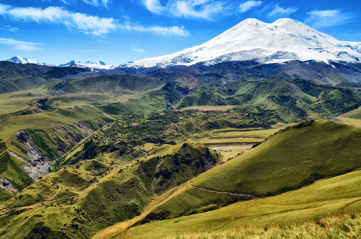
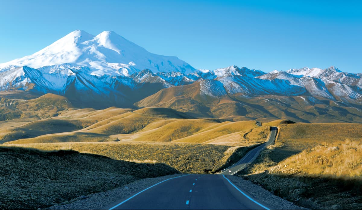
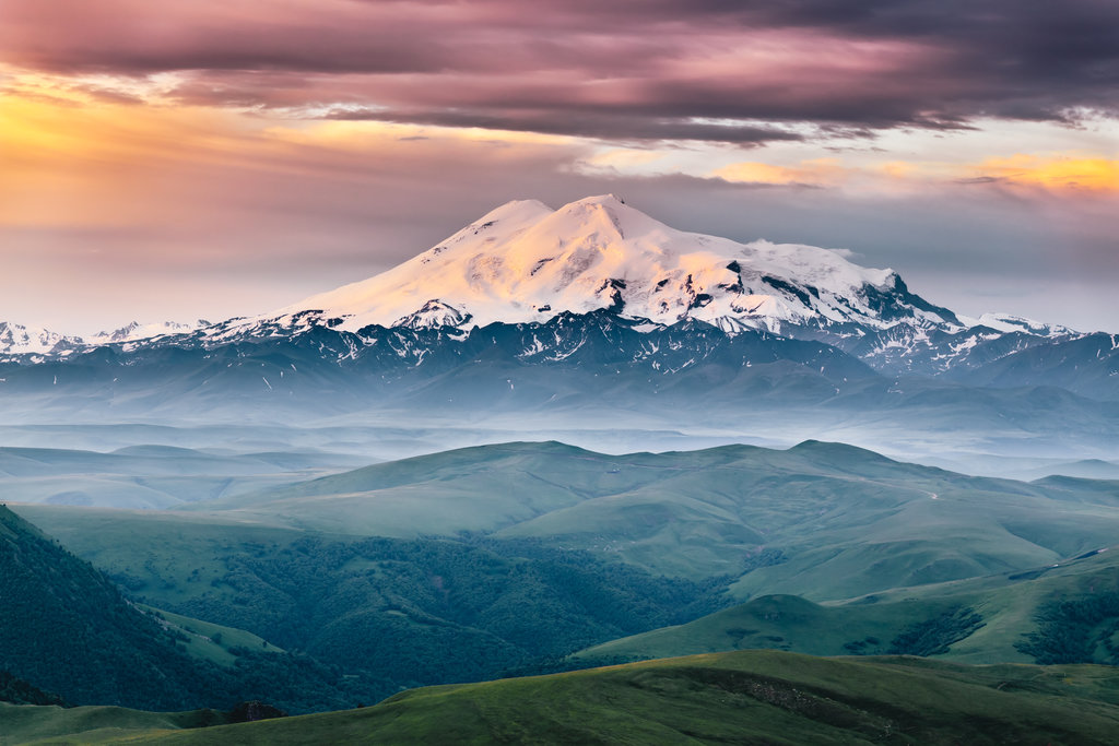
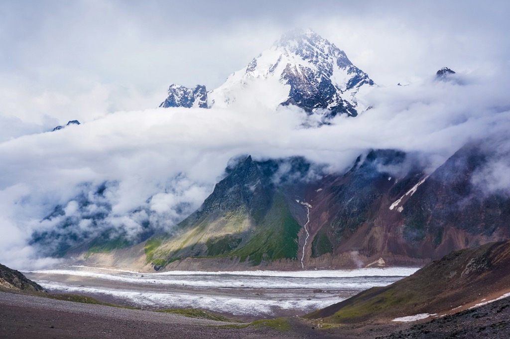
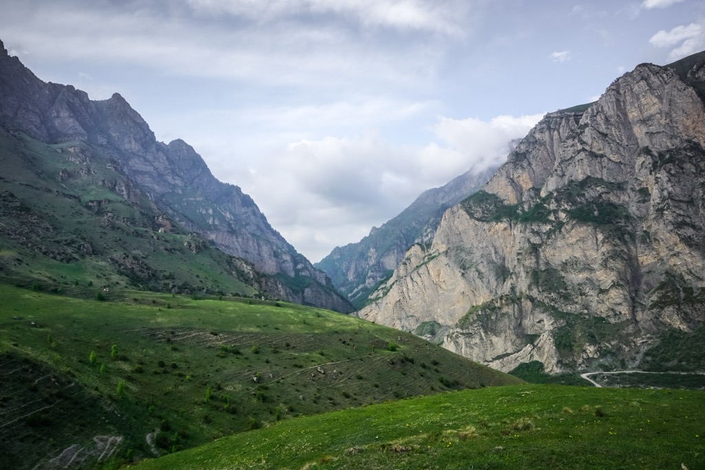
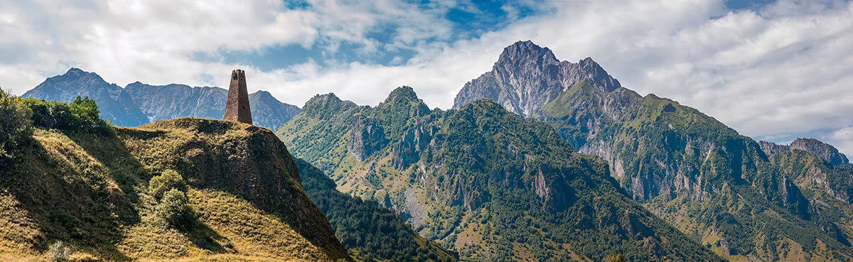
The Caucasus is one of the major mountain ranges in the world located between Europe, the Middle East, and Asia at the junction of many natural and cultural regions. The main feature of these mountains is Mount Elbrus (West Summit) of 5,642 m (18,510 ft), the highest and the most prominent peak in Europe and one of the World’s Seven Summits, or the highest mountains of each continent. Thanks to the gentle slope it is accessible for climbing to a wide range of people accompanied by a guide in the group, which, however, does not make it easy to climb because of the high altitude. The Caucasus are also known for their rich natural diversity, including many mineral springs. In total, there are 7979 named mountains in the Caucasus.
The Gem, the Jewel, the Grand-Spa, whatever the grandeur name is it is fit for the Caucasus. Don’t get me wrong or biased but this territory deserves every positive superlative one can think of.
However, the name Caucasus is a latinized version of Kaukasos, which the ancient Greek geographers and historians used; the Russian Kavkaz is of the same origin. The ultimate derivation is thought to be from Kaz-kaz, the Hittite name for a people living on the southern shore of the Black Sea. This ancient nomenclature reflects the historical importance of the region: in Greek mythology, the range was the scene of the sufferings of Prometheus, and the Argonauts sought the Golden Fleece in the land of Colchis (the modern Kolkhida Lowland of Georgia), which nestles against the range on the Black Sea coast.
The land north of the Greater Caucasus, the main range of the system, is called Ciscaucasia (Predkavkazye, or “Hither Caucasia”) and that south of it is Transcaucasia (Zakavkazye, or “Farther Caucasia”).
The whole Caucasus region, which has an area of 170,000 sq mi (440,000 sq km), is predominantly mountainous. It stretches over 1,100 km (683 mi) between the Black and Caspian Seas, and covers the territory of 160 km (99.4 mi) between Iran, Turkey, and the southern flank of the Russian steppe.
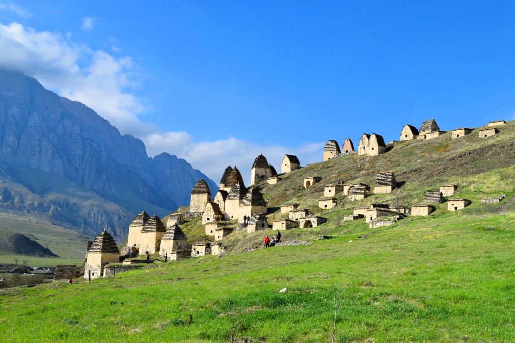
It is home to the countries of Georgia, Armenia, Azerbaijan, Abkhazia, and the Russian regions of Chechnya, Adygea, Kabardino-Balkaria, Karachaevo-Cherkessia, Dagestan, Ingushetia, and North Ossetia-Alania, Stavropol and Krasnodar.
The linguistic geography of the region is, shall we say, no less and even more diverse than the physical. The Caucasus is a fractured region that houses from 50 to 62 different ethnic groups and nationalities which have managed to hold on to their identities despite all the minglings with the Russian, Ottoman, and Persian empires. What is surprising, is that they find common ground, considering that the number of Caucasian languages has not been counted yet and the scientific studies give an approximate number of 60 languages (not idiolects!).
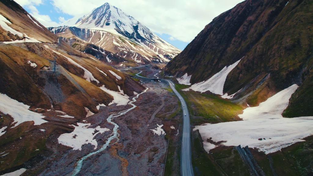
The Georgian Military Road, Ossetian Military Road, and Transcaucasian Highway traverse this mountain range at altitudes of up to 3,000 m (9,842 ft).
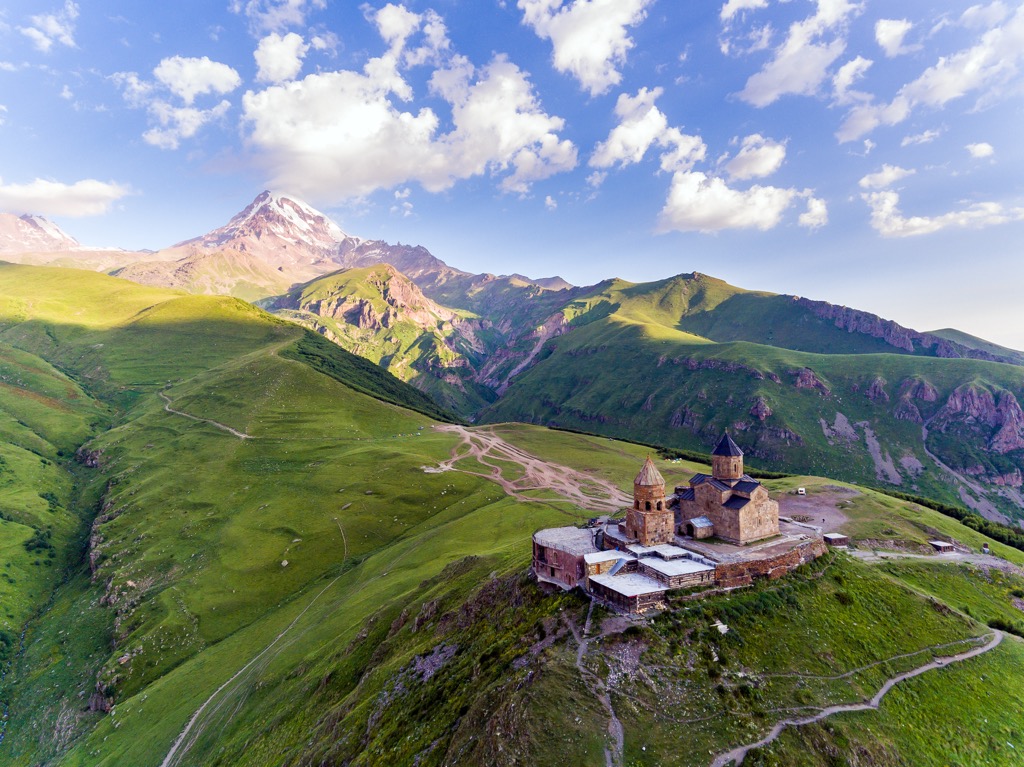
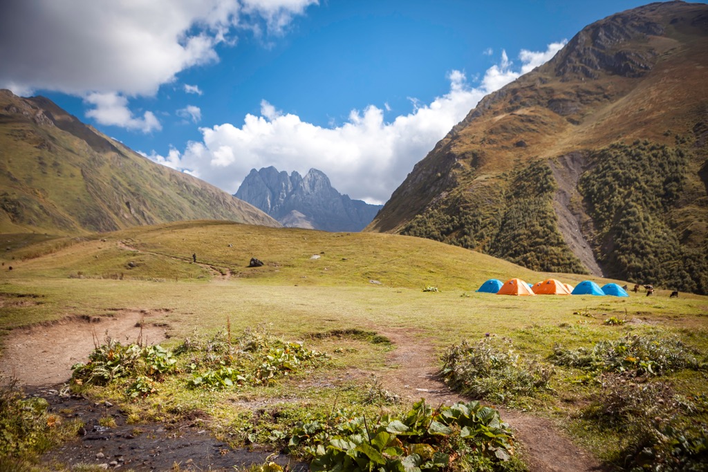
Among the three roads, the first one is the most famous and important because it connects Georgia and Russia. On the way you will cross the Great Caucasus range at Jvari Pass and spend unforgettable days surrounded by high mountains and narrow gorges. Kazbegi region, former Khevi province, is the easiest to access from the Tbilisi highland region. Unfortunately, the avalanches sometimes cut off any traffic for several days.
Another good trip is to the town of Vardzia in Samtskhe-Javakheti, which also starts in Tbilisi and goes through Kvemo Kartli and Shida Kartli. The central point of the tour is the Vardzia cave monastery complex in the upper valley of the river Mtkvari, which used to be the main transit road between central Georgia and Turkey, earlier Byzantium. So these places used to play an important role in medieval Georgian politics, economics, and culture. That’s why there are so many historical monuments in a comparatively small area.
Actually, there many more interesting places to visit, just to give you a few:
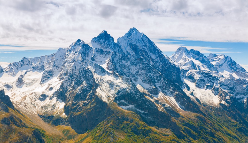
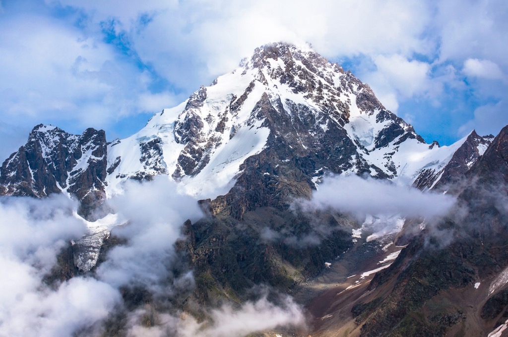
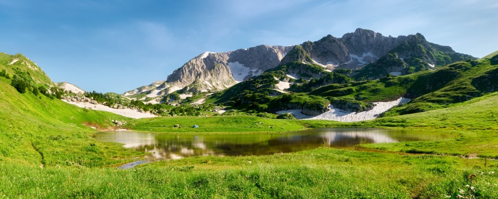
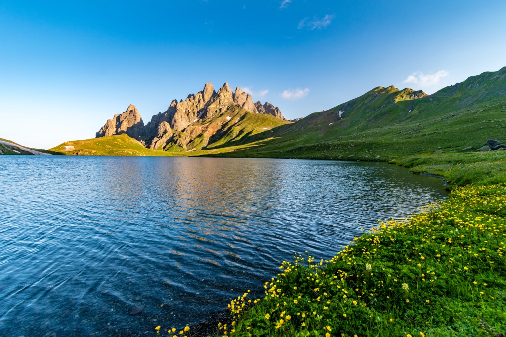
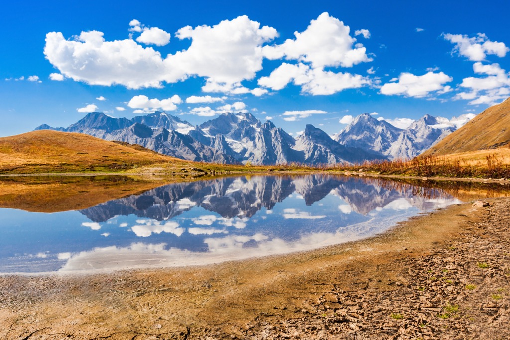
The Caucasus are beautiful mountains filled with forests, snow-capped peaks, and Alpine lakes. A member of a British expedition that explored the mountains in 1874 wrote that “in appearance and inaccessibility and in the boldness of form they are beyond the Alps, and probably when they are better known, they will be thought grander and more majestic than the Alps.”
The Caucasus Mountains are rugged, of volcanic origin and young. They are believed to be about 25 million years old. The range is relatively small in terms of the area it covers but in terms of the relief they are one of the highest mountain ranges in the world.
The Caucasus Mountains are technically considered to be a continuation of the Himalayas as well as either part of Asia or part of Europe. They have historically served as a geographic barrier at the convergence of the continents of Europe and Asia, and due to specific tectonic processes, it has been hard to determine the exact course of the continental borderline, causing the border to change throughout the turbulent history of the region. While there continues to be disagreement over where the border lies in relation to the range, there is a general acceptance of assigning the Caucasus to Asia due to the strong Asian influences throughout the region.
As there is no clear agreement on whether the Caucasus Mountains are a part of Europe or Asia, depending on the varying perspectives, Europe’s highest mountain is either Mount Elbrus (5,642 m / 18,510 ft) or Mont Blanc in the Alps, at the Italian-French border, with a height of 4,810 m (15,780 ft).
The Caucasus is a highly seismic territory with possible earthquakes reaching 6–7 Richter scale zones.
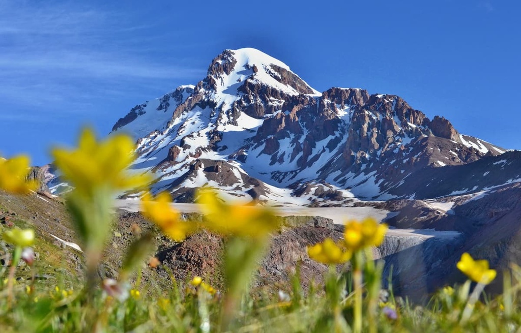
There are currently no active volcanoes in the Caucasus, but the dormant ones (Elbrus, Kazbek, Ararat, etc.) might still stir some trouble. Also, the Caucasus have some ‘stillborn’ volcanoes which look like a volcano and have geological parameters of a volcano, but the Earth’s forces were not strong enough to push the lava through the earth’s crust and lava solidified inside the mounts. So, these stillborn volcanoes have and will never come into life. There are 17 such geological losers in the Caucasus, the biggest and most beautiful laccolith is Beshtau (1,400 m / 4,593 ft), at the foot of which is Pyatigorsk city.
The Caucasus is a large and varied mountain system with many individual mountain ranges, which could be difficult to understand. I will help you.
The range is traditionally separated into three part from east to west and two ranges from north to east with many notable peaks in each of them.
From west to east:
From north to south:
In turn, both ranges are divided into smaller sub-ranges that look like the steps of a gigantic staircase if you look from the north to the south. So, there is Forest (Lesistiy) Range, Pasture Range, Rocky Range, and Lateral Range preceding a lower Great or Greater Caucasian Range (aka Dividing Ridge).
Except the two summits—Western (5,642 m / 18,510 ft) and Eastern (5,621 m / 18,441 ft)—of the highest mountain in Caucasus, Mount Elbrus in Russia, among the other high and most famous individual peaks of the this range can be distinguished the following eight to have a kind of top 10 Caucasus summits. Most of them are located in the Cherek District of Kabardino-Balkaria and Prigorodny District of North Ossetia-Alania in Russia, and Mestia Municipality of Samegrelo-Upper Svaneti and Kazbegi Municipality of Mtskheta-Mtianeti in Georgia:
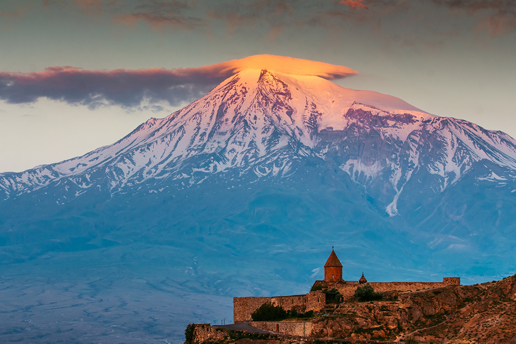
In a separate line is Mount Ararat (5,137 m / 16,853 ft) in Turkey, the star-mountain of the Bible and the destination point of the lucky Noah and his Ark as well as historians and archaeologists seeking fame, in the Lesser Caucasus. Ararat is also a dormant volcano; the last eruption was on June 2, 1840.
The story of Noah’s ark, as it is told in the Bible, is a reworking of an earlier Babylonian myth recorded in the Gilgamesh Epic. The hero of the earlier version is one Utnapishtim, the favorite of Ea, the god of wisdom. It seems probable that the Babylonian story was based on an unusually devastating flood in the Euphrates River basin, and that the ark in it grounded on the slopes of one of the Zagros mountains. The biblical word that we read as “Ararat” could as well be read as Urartu, which was a historical kingdom, but the word also meant “a land far away” and “a place in the north.”
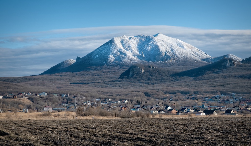
The peaks of the Ciscaucasia or the North Caucasus region are also worth mentioning in a separate line. This territory lies to the north of the Greater Caucasus between the Sea of Azov and the Black Sea on the west and the Caspian Sea on the east, within European Russia. It is geographically rich in steppes, semi-desert and tropical territories, and low-rise laccolith mountains such as Mashuk (992 m / 3,254 ft), Beshtau (1,402 m / 4,599 ft), Zheleznaya (856 m / 2,808 ft), Razvalka (926 m / 3,038 ft), the whole Tersko-Sunzhenskoe Plateau, and others.
The Caucasus is a trekker’s paradise, lest you hike in lousy weather. The number of trails to take routes to wander, and encounters to enjoy are numberless. You can find anything in the Caucasus: medieval villages, natural wonders, great cuisine across the region, and much more.
Unfortunately, the development of the region's international tourism has been hampered by some turmoil in the 1990s. Luckily it is over now and traveling is quite safe, the only drawback though is there is not much information available online in English, but many tour agencies see a world of opportunity and start providing English-speaking guides or at least have their sites in English.
In this section for the next three hikes, I asked Ivan Kuznetsov, an outdoor writer from the Dolomites, Italy, and Karelia, Finland, who is originally from Russia, to talk about what he considers the main hiking areas and trails in the Caucasus Mountains, where he lived for a total of three years before coming to Europe for permanent residence.
So, let’s walk together through the Caucasus Mountains from west to east:
In Russia, the Caucasus Mountains occupy a large area, so there are many areas for hiking, which is more difficult to choose than to find.
Hikes in Sochi National Park
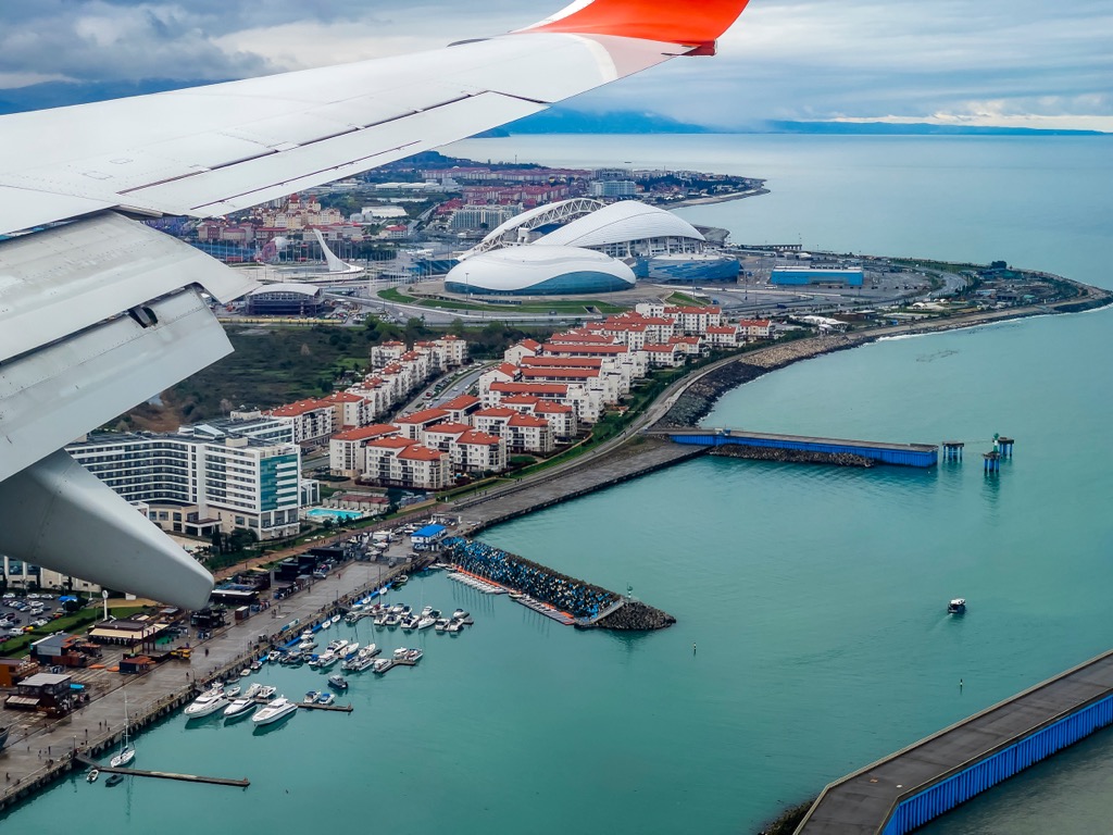
Ivan Kuznetsov: “Sochi National Park is a huge area adjacent to the city of the same name and the country’s main seaside resort on the Black Sea coast and one of more than 50 national parks in the country. The park stretches from the neighboring town of Tuapse to the west of Sochi to almost the border with Abkhazia to the east.
The number of visitors to the park has grown significantly in recent decades as the city, after hosting the 2014 Winter Olympics, has become Russia’s third capital (after Moscow in the center and St. Petersburg in the north). The country’s main ski resort, Krasnaya Polyana, where the main skiing competitions took place, is also part of the park.
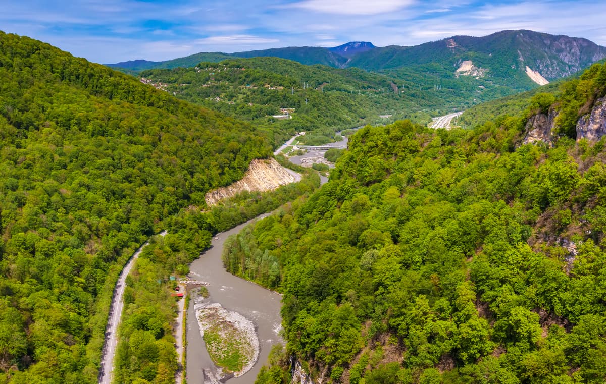
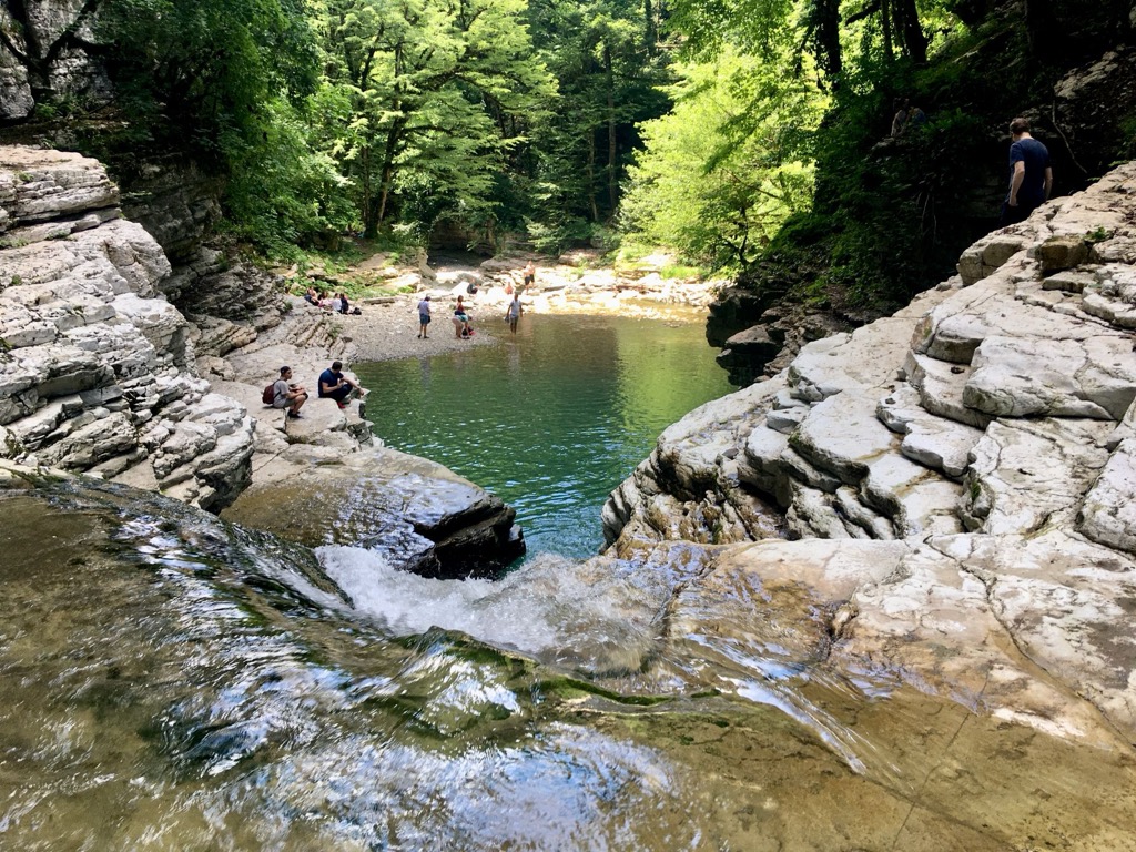
The park is notable for its accessibility with a wide variety of hiking trails of middle to moderate difficulty, most of which run through valleys of mountain rivers and streams, and lead to scenic waterfalls up to 100 m-high or an equally scenic series of two, three, five, or more waterfalls of a smaller high. In general, numerous mountain rivers and streams with waterfalls are the natural landmarks of this part of the Caucasus Mountains.
Not counting remote Krasnaya Polyana resort, among the main routes in the center of Sochi I would single out the following three, which, in my opinion, are the most picturesque and at the same time less touristy ones:
Hikes in Lago-Naki
Lago-Naki or Lagonaki is a famous Western Caucasian Plateau about 2 km (1.2 mi) up in the mountains. Alpine meadows, lakes that appear and disappear by some rules known only to them, solutional caves, relict forests, fast rivers, and waterfalls, you name it, you find it here. If you are fond of flowers, this is a place to be. You can see posh rhododendrons, valleys of thyme, and valeriana, the smell alone will make you tranquil for a long time.
The Plateau is located between two rivers: The Belaya (White) and the Pshekha and at the foot of three mountains: Fisht, Oshten, and Pshekha-Su. The sea is not far away, which is why there is enough precipitation all year round, which allows snow to form well enough for skiing purposes. Lago-Naki is heaven for free riders and snowboarders, and families with kids who crave some sledding or tobogganing. You can go climbing, rafting, trekking, paragliding, hang-gliding, caving, etc.
There are 125 caves in the south of the Plateau. The temperature in them hardly ever rises above 5 ºC (41 ºF), so make sure you dress appropriately. The surreal experience of the caves can be doubled by the Stone Sea (Kukarta) with its huge rocks.
Lago-Naki has been a tourist attraction since the Soviet times, the most popular route #30 called “Through the Mountains to the Sea” used to take 20 days to cover. It starts in Adygeya, goes through Dagomys, and ends at the Black Sea. As you go you see various climatic zones, climb a glacier on Mount Fisht, tread through mountainous areas, and breathe thin air for three weeks. What can be better to clear your lungs, blood vessels, and mind? Now, this route is called ‘Ecologo-touristic route No.1’ and you can cover it in 5 days. But please, don’t cheat and take a longer version. The majority of the time you traverse the lands of the Caucasian Reserve, and this is not free of charge, tourists pay per day.
Speaking of the treks to Mount Fisht, there are several ranging from the simplest 1B through the Fisht Glacier to the most difficult 5A route through Mount Fisht eastern wall (ice-axes and crampons are a must). The things not to miss as well are the Guamskoye Gorge, the Granite Canyon, Mount Trezubetz (Trident), etc.
There is one more resort in Lago-Naki, unfortunately not available for the humble hikers, that is President Putin’s residence called Lunnaya Polyana or Moon Lawn. There has been a lot of controversy over it regarding its impact on ecology and its accessibility to the general public.
Hike to Big Zeigelan Waterfall in North Ossetia
Ivan Kuznetsov: “Zeigalan Waterfall or Big Zeigelan Waterfall is one of the main natural attractions of the North Ossetia region in southern Russia in the Midagrabindon River valley, which I was able to visit in September 2017 during a working visit at the invitation of the Ministry of Tourism of the region with about a dozen other specialists.
The 648-meter-high (2,125 ft) waterfall (I’ll spell it out again: six hundred forty-eight meters (2,125 ft)!), flowing down a steep mountain wall from a melting glacier on one of the peaks of the massive Mount Dzhimara (4,649 m / 15,252 ft), is known as the highest in the region and one of the highest in Russia and Europe. In comparison, the highest waterfall in the world, Angel Falls in Venezuela, is 979 m (3,212 ft), ‘only’ almost twice as much.
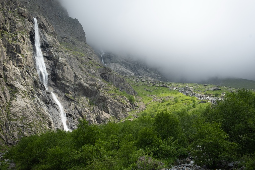
Moreover, the Zeigelan Waterfall is not alone, it is simply the highest. There are over 50 waterfalls in the Midagrabindon Valley, collectively known as the Midagrabinskiye Waterfalls. The greatest power they gain is in July during the maximum melting of the glaciers and freeze during the winter frost, with the exception of the eight largest, starting with Zeigalan.
The waterfall is located 7 km (4.3 mi) south of the village of Dzhimara, named after the same mountain above, which is also the second highest point of North Ossetia, located just 60 km from Vladikavkaz, the capital of the region. The road from the city to the valley is also incredibly scenic. How much? I could say it is one of the most scenic places on my list of 24 countries and more than 100 (just the main) natural locations I have visited and hiked.
You can get to the foot of Big Zeigelan Waterfall on foot along the valley, which you can reach on your own by car or taxi, or as part of a tourist group by buying a tour at one of the agencies in town. Be prepared to meet border control as well, given the location of the place on the border with Georgia, which starts right behind the Midagrabindon Valley, Zeigelan Waterfall, and Dzhimara mountain.”
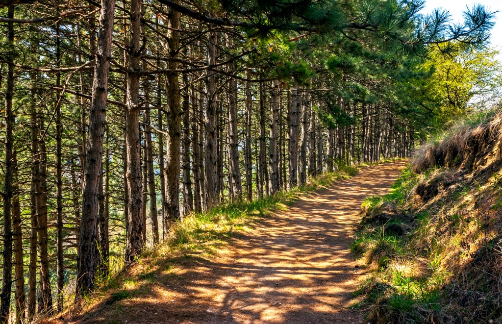
Hikes in Kislovodsk Terrenkur Park
If your main premises are a SPA resort make sure you take one-day trips, there are plenty of opportunities here, just check at the reception of your SPA / hotel and you’ll find good offers. Many towns have marked territories called “terrenkur” meant specially for treating people by leisure walking in pine forests.
In particular, Kislovodsk Terrenkur Park has 6 routes with 3 categories of difficulties, the length is up to 6 km (3.7 mi) with slope angles varying from mild 5 to steep 20 degrees. The park started in 1823 and now houses over 250 types of trees and over 900 types of smaller plants. If you are into the flora, this is the place to visit, even more so that it has a staggeringly beautiful Valley of Roses (35 types of roses).
Ivan Kuznetsov: “One of the main natural attractions in Abkhazia, is the picturesque Ritsa Lake, surrounded by mountains of the Gagra Range on the southern slopes of the Greater Caucasus Range up to 3,200 m (10,498 ft) in the Ritsa-Auadhara National Park of the same name.
The lake is popular not only for its beauty but also for its relative accessibility. It can be reached quickly from the town of Gagra, the main resort of Abkhazia on the coast of the Black Sea, which, in turn, is located near the border with Russia, crossing which you get to Sochi. Hence, there are a lot of Russian tourists. It is ‘relatively accessible’ because there are no regular buses to it, you can get to it either by excursion or by taxi from Gagra.
Around the lake, you can go backpacking with a tent and other stuff for one night in the mountains above it, and in the morning you can go down and come back to town. It is forbidden to camp on the shore of the lake.”
The Russian and Abkhaz parts of the Caucasus Mountains have many hiking areas, but it is the Georgian part, in my opinion, that has the most outstanding examples. Given their huge number, I will tell only about some longer journeys for up to a week:
Hike to Chaukhi Pass
This hike is for those who have already seen the Kazbegi region and wish to explore more. The region is also called Georgian Dolomites for the ragged rocks you see. The trek is 21 km (13 mi) — one-way, 1–2 days, 36 km (22.3 mi) returning by Sadzele pass, 3–4 days, or 52 km (32.3 mi) with return through Arkhoti, 5–6 days. It runs between Juta village in the Kazbegi region and Roshka, the Khevsureti.
You will find meadows with intriguing rock formations (Roshka stones) and Abudelauri lakes—three beautiful alpine lakes with different colors (green, blue, and white). It is attractive due to its proximity to the imposing Chaukhi massif with its seven sharp peaks and the necessity to scale 3,338 m (10,951 ft) high Chaukhi pass.
If you have more time, you can turn north and visit the communities of Arkhoti. The especially upper part of this remote valley is worth a visit—you can expect to find their nice gorges, waterfalls, and complete solitude. The next day you can cross Arkhoti pass and return to Juta—however, this last section lost a lot of its appeal since a few years ago, an original trail got replaced by a car road.
Another option is to return from Roshka to Juta via Sadzele pass—this route also takes a day but is much easier. In a few years, the government plans to build a road here so it’s worth seeing while it’s still “unspoiled”.
Hike to Tobavarchkhili Lake
This beautiful 80km trek crosses the Egrisi mountains which separate Svaneti from Samegrelo lowlands. You will not come close to the highest mountains of the Caucasus, but this small drawback is fully compensated by a very diverse environment. High passes with great views, magical lakes, rocky gorges, waterfalls, shepherd's huts, and remote valleys—this trek has everything. Or almost everything. There are no medieval stone villages, so typical for many Georgian regions. It is considered to be one of the most difficult and dangerous hiking routes in Georgia. You need several days to hike up to the lakes and the same amount of days to come back. However, the beauty of those crystal-clear waters is worth every step.
Other Hikes in Caucasus, Georgia
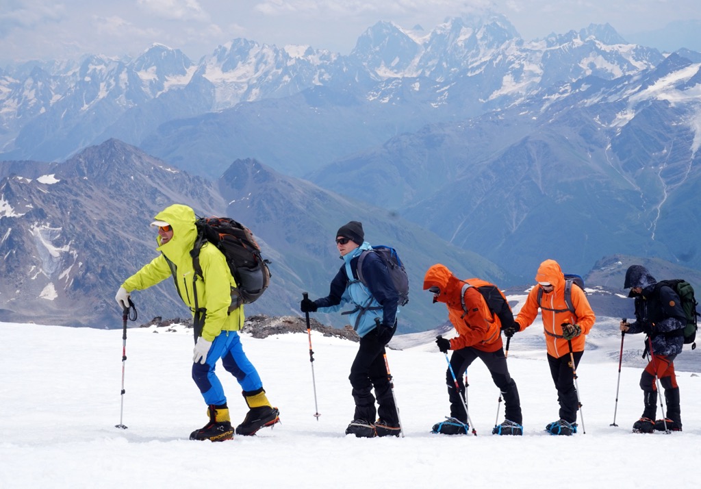
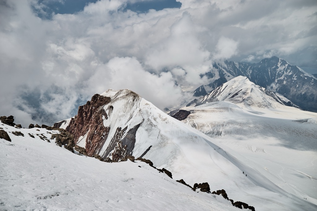
Of course, the Caucasus is also characterized by a great variety of climbing routes, not inferior and sometimes even superior in complexity (and of interest to climbers) to the Alps.
Mount Elbrus is one of the world's seven summits—the highest point on every continent—and is raved for mountaineers, which may come at a costly price. On average 26 people die trying to climb Elbrus every year, which is a higher death toll than that of Mount. Everest, the highest peak in the world.
Climbing Mount Elbrus, Europe’s watchtower is a perfect immersion into expedition climbing and gaining experience with the acclimatization process. Lack of oxygen, deep cold, and pure exhaustion take their toll, but all this will be forgotten beneath the joy and adrenaline of summiting Mt Elbrus, the highest mountain in Europe. Magnificent views await on this great outdoor adventure—at 5,642 m (18,510 ft), Elbrus and its double-coned volcano are 832 m (2,729 ft) higher than Western Europe’s highest mountain, Mont Blanc.
You will have to expect tricky terrain, evil weather, and some acclimatization. Snowfields of blinding white ascend gradually, allowing climbers to see far and wide. The snow can be deep and soft or, in peak season, firm and crunchy underfoot. In one section, climbers must use fixed ropes. Here, the gradient is steeper with a vertiginous drop to the basin below.
Like on all mountains, the weather on Elbrus can be harsh and unpredictable.
It’s quite normal to start a climb sweating beneath clear skies and minutes later be pulling on protective clothing under lashing wind and snowfall. Already icy temperatures regularly drop to well below freezing, particularly at night. On the mountain, most climbers stay at a refuge, in simple huts located at 4,000 m (13,123 ft). These are accessed by a series of cable cars and chair lifts or a day’s trek from Garabashi.
Dykhtau is derived from Turkic “dik dagh” which means Jagged Mount is a mountain located in Kabardino-Balkaria, Russia; its peak stands about 5 km (3 mi) north of the border with Georgia. Dykh-Tau is the second highest of the Caucasus Range, after Mount Elbrus, and is the second highest mountain in Europe. It is also not for the faint-hearted. The most popular climb is via the northern edge, the category of the climb is 4B according to the Russian classification.
Dykhtau is prone to frequent rockfalls, and avalanches and requires well-thought-over strategic climbing. You can conquer it any season. In winter time the temperatures may be unbearable, but it is compensated by the increased safety of the route because the frost holds fast to some treacherous patches. The best time to climb though is August to September.
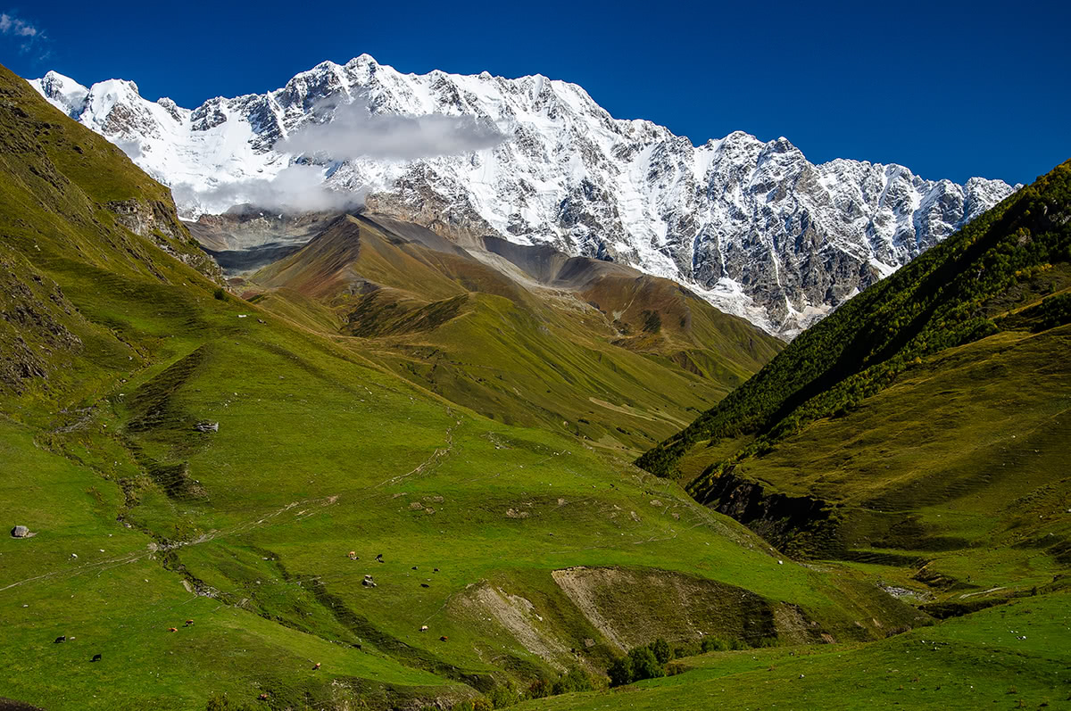
Shkhara is the highest point in Georgia. Located in the Svaneti region along the Georgian-Russian frontier, Shkhara lies 88 km (55 mi) north of the city of Kutaisi, Georgia’s second-largest city. The summit is quite difficult to climb. The Classical way is a 5B grade by Russian grade. The first ascent was made in 1888 by English and Swiss climbers.
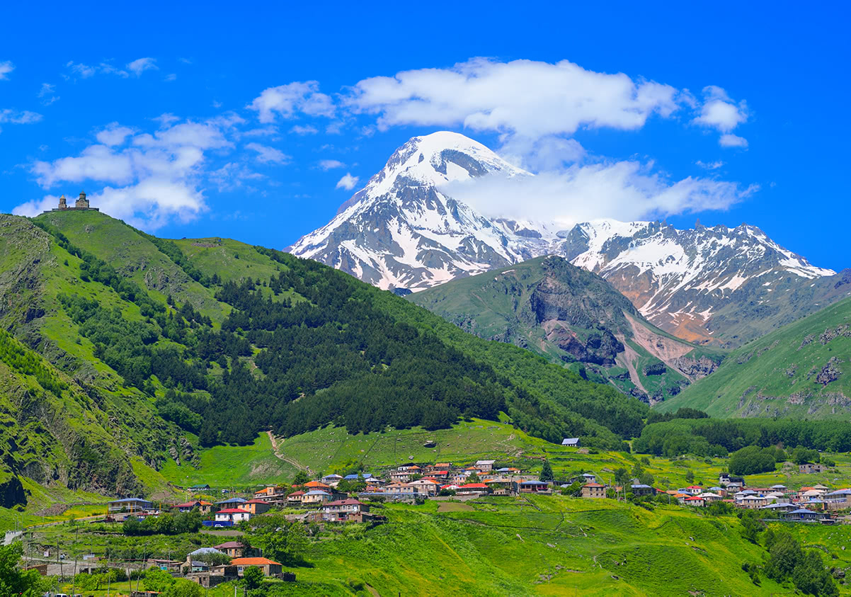
Kazbek lies on the border of Georgia and Russia, approximately 100 km (62.1 mi) northwards from Tbilisi. The start point of the climb is the village Kazbegi (1,730 m / 5,675 mi), lying on an important road connecting Tbilisi and Vladikavkaz in Russia. Kazbek is an inspiration for poets and writers, steeped in Greek myths and Georgian legends. Climbing this beautiful perpetually snow-covered peak of the Caucasus is sure to be an unforgettable experience. Kazbegi Climb—UIAA grade II.
When you have read this far, you have probably already assumed that the Caucasus Mountains are one of the main regions not only for hiking and mountaineering, but also for skiing, both in Europe and in Central Asia.
Next, I’ll talk about five major resorts: two in Russia, three in Georgia, and one in Armenia.
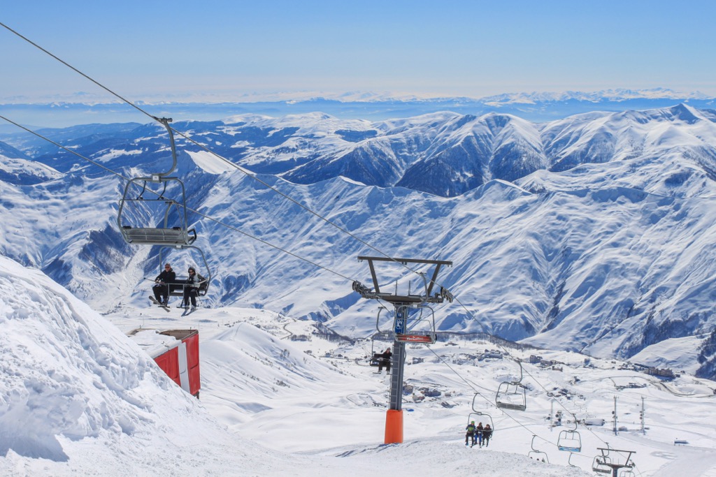
Krasnaya Polyana, Sochi, Krasnodar Krai is located in the Western Caucasus, it is home to Krasnaya Polyana Ski Resort, Gazprom, and of course, the new Rosa Khutor alpine ski resort, with a base elevation of 560 m (1,840 ft) along the Mzymta River, 39 km (24 mi) from its influx into the Black Sea in Adlersky City District of Sochi. The lift-served Rosa Khutor summit climbs to 2,320 m (7,610 ft), giving a vertical drop of over a mile at 1,760 m (5,770 ft).
The resort hosted the Alpine and Nordic events of the 2014 Winter Olympics in Sochi (Russia hosted winter Olympic games for the first time in history, and there were some amazing records set), having previously hosted World Cup alpine events from February 2012, two years earlier and is also the ashes of Canadian skier Sarah Burke were spread.
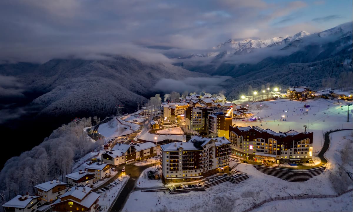
Krasnaya Polyana today offers many chalets, hotels, and restaurants. Its reputation owes a lot to the development of heliskiing (which is by the way now banned in Germany and France, Austria has only two landing pads available for it) in the middle of the 1990s, which provides access to an important skiing domain. Amateurs can ski downhill through a not-too-dense birch forest as well.
In general, this is a must-see, must-visit, must-ski. If you can’t ski or it is summertime, you are welcome to explore the trekking trails and see the dolmens, ancient pagan holy places, each of them has a cool legend attached.
Dombai is a Russian ski resort that hosts international competitions in freestyle riding, slalom, giant slalom, and snowboarding. It is also a cool place for paragliding, there are annual national competitions held here. Skiing is very comfortable and diverse, there are gentle and hardcore slopes available for off-piste riding as well. The ski runs are at 1,800–3,200 m (5,905–10,498 ft), with a maximal drop in elevation of 1,400 m (4,593 ft). Dombai is 190 km (118 mi) away from Pyatigorsk, the highest point of the ski resort is Dombai-Ulgen at 4,046 m (13,274 ft).
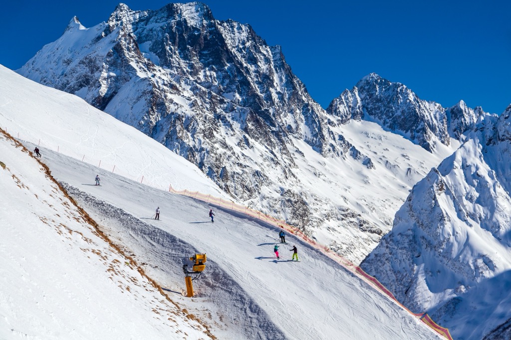
Other ski resorts, which can be considered as alternatives to Dombai, as well as Krasnaya Polyana in Sochi, are Arkhyz in the same Karachay-Cherkessia region, and Mt. Elbrus and Mt. Cheget in Kabardino-Balkaria with more than 20 km (12 mi) of slopes and more than 5 ski lifts each. These are the main areas for skiing near Nalchik, Kislovodsk, and Pyatigorsk.
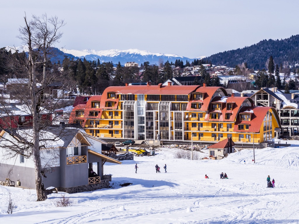
Gudauri is the youngest and the most promising ski resort in the Georgian Caucasus. It is in the Kazbegi region of Georgia, 120 km (74.5 mi) from Tbilisi, at the height of 2,196 m (7,200 ft) near the Cross Pass. The unique landscape offers great opportunities for backcountry skiing, there are only 4 ski lifts but innumerably tracks down the wide fields, apart from the specially cleared routes (8 pistes, 16 km in total, there are runs for slalom, giant slalom, etc., they are all FIS-certified) there are also some venues beautifully suited for free-riders. The guaranteed snow cover is from November till May, but the skiing season officially lasts from December to April, the height of snow on the slopes is 1,5 m (49 ft). Despite being high in the mountains, the weather is warm and sunny with almost no winds.
Even if you are no skier, go to the top of Sadzele (3,258 m / 10,688 ft) and enjoy the breathtaking panorama of the Caucasus.
There are also two smaller ski resorts near Mestia, the capital of Upper Svaneti region in the northwest of the country: Tetnuldi-Mestia and Hatsvali-Mestia with more than 13 and 5 km (8 and 3 mi) of slopes and more than 3 ski lifts each. So and still there you have more than 20 km (12 mi) of slopes and more than 10 ski lifs combined, which makes it the third biggest ski area in Georgia.
Bakuriani is one of the most famous Georgian ski resorts, yet it is also a balneo therapeutic spa. It is located 1,700 m (5,577 ft) on the northern slope of Trialetski Range, not far from Borjomi Gorge, hence the mineral waters available to drink and bathe. The skiing season is from November to March, the winters are cold, but not too severe, and with lots of snow. The avalanches are extremely rare. Presently, there are two two-stage runs Kokhta-1 (1,500 m / 4,921 ft), with a quite challenging first 400 m (1,321 ft) with a 52-degree angle), and Kokhta-2. If you want to see the girls skiing in swimming suits, Bakuriani is the place.
If you are not an adamant mountain skier, go trekking or cross-country skiing to Tzhratzkaro (13 km / 8 mi from Kakuriani, elevation 2,780 m / 9,120 ft). Bakuriani is conveniently located at the cross of Caucasian ranges and various geographical zones with rich flora and fauna. One-day trips can include going up Kokhta (2,155 m / 7,070 ft) or Sekvelomta with a drop to Tabatzkuri Lake, a trip to monastery site Timotesubani (11th-century church and a monastery in a cave), hot springs in Tzikhisdjvari or mineral water springs in Mitarbi. If you go down the Borjomi Gorge, there are several hot spots to see. Daba is a small village with a chapel hidden in a huge cave (just 500 m / 0.3 mi off the road), and there is a historical yew (2000 y.o.). Tzagveri with mineral water. For extreme climbers, once you turn towards Patara Tzemi into Bakurianistzkali gorge, there are relict crystallic ores—the bottom of the gorge is filled with gigantic ‘pencils’—30 m (0.1 mi) long hexahedral crystals. The view is gorgeous, and you can also devour some wild berries (brambleberries and dewberries) on the slopes of the gorge.
Tsaghkadzor is a city in Central Armenia, known for being a ski resort, with forests and an ancient monastery. In the summer, people go there to get away from the city life of Yerevan, and the heat, for the fresh air in the mountains. In the winter, the town is completely overtaken by skiers and people who just want to relax and enjoy the snow and scenery. The ski lift takes you up the Biblical Ararat Mountain and off you go down the crispy snow.
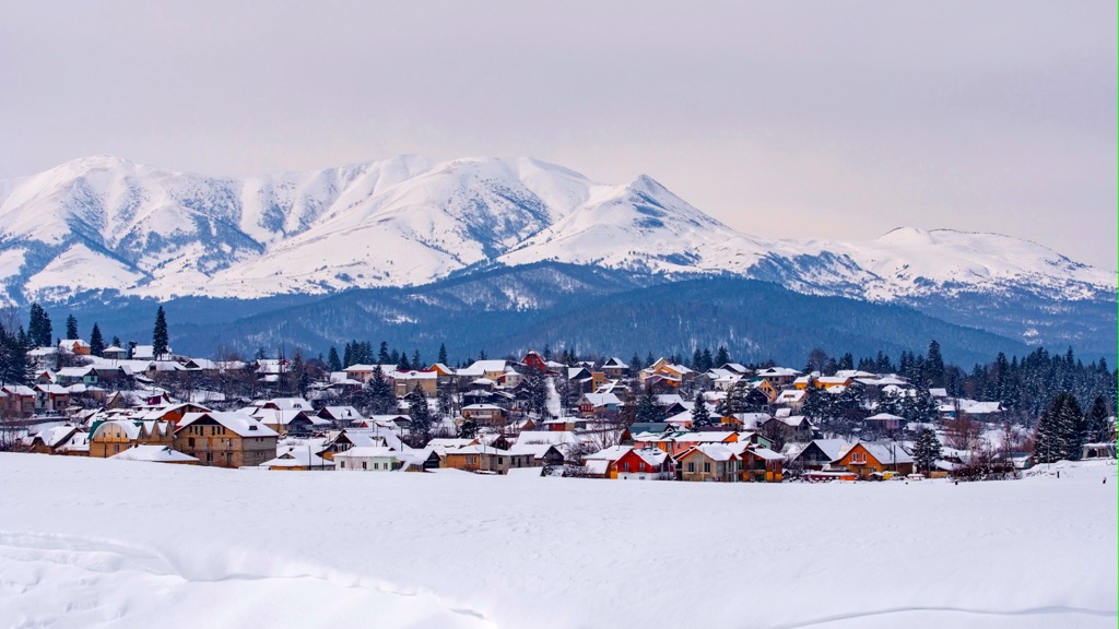
The main cities of the Caucasus Mountains are the capitals of the countries or major resorts on their territory: Yerevan in Armenia, Baku in Azerbaijan, Tbilisi in Georgia, Sukhumi in Abkhazia, and Sochi, Vladikavkaz, Grozny, Kislovodsk, Mineralnye Vody and Krasnodar in Russia.
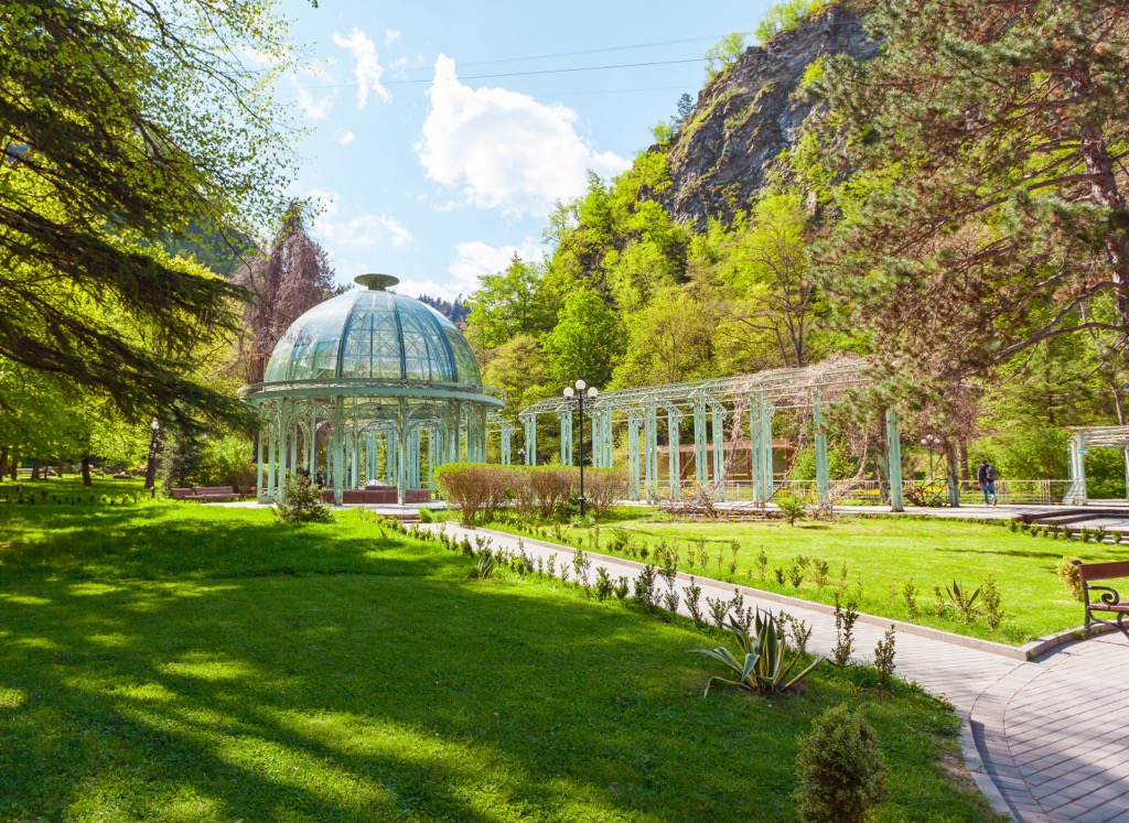
However, as I noted at the beginning of the guide, the region is even better known and unique for its spa resorts, which I will discuss in more detail below.
Being mountainous, the area is rich in hot springs that can cure any disease imaginable. The Caucasian Mineral Waters Region is the biggest balneotherapeutic spa in the world. You name a malady, they can find a treatment in the Caucasus. To name a few spots:
There are hot spring lakes accessible and available to the general public for some symbolic fee.
The most famous are Aushigerskiye hot springs which were discovered by a geological expedition hunting for oil in Kabardino-Balkaria. The most picturesque and unusual is probably a hot spring in selo Kazminskoe, Stavropol Krai. The water there is over 100 degrees Celsius, which is why it is diluted by cold spring water so that you don’t boil yourself. The composition of water is similar to that in Kamchatka and has the richest healing properties.
The hot spring in Staniza Suvorovskaya (Stavropol Krai) is also a must-visit for the physically challenged, or if you just want to relax after some awesome trekking in the area.
Actually, any Caucasian republic and country can boast of hot springs:
On a separate line is Borjomi, one of the major trademarks of Georgia. It is located in the River Kura Gorge at 850 m (2,788 ft), 152 km (94.4 mi) west of Tbilisi. According to an old Georgian legend, the name “Borjomi” comes from the combination of two words: “borj” (fortress) and “omi” (war). In the past, wars were frequent there, and Borjomi town had an advantageous location in the Borjomi Gorge.
In 1900, the production output of Borjomi mineral water, for the first time, exceeded one million bottles a year. The signature bluish-green color of the Borjomi bottle is patented and has its own name: Georgian Green. During Winston Churchill’s visits to the Soviet Union, Borjomi bottles were always placed on the table beside him as part of the official protocol. The bottles even found their way into movies: Andrei Tarkovsky’s Solaris features the bottles with the labels clearly visible because the director believed that Borjomi would definitely exist even in the distant future.
Borjomi is more than 1,500 years old by natural standards, but its mineral composition remains the same. Regular laboratory tests performed since 1890 confirm that. This water is closer to ‘every-day-drinking-mineral-water’ than to harder and more medical stuff like Essentuki No. 4 or No. 17 or Tarzan. Borjomi is used for treating digestive system disorders, liver, and biliary tracts. Borjomi is now more of a cluster of several spas, such as Tzagveri, Tzemi, Likani, Patara-Tzemi, Akhaldaba, Daba, Dviri, Tba, Tzikhidjvari etc.
Getting to the Caucasus Mountains from other parts of Europe and the world is both easy in the case of air travel and not in the case of land transport. I will briefly discuss the main routes, as well as how to travel within this mountainous region.
You can get a Russian visa or a Georgian visa and enjoy most of the Caucasus has to offer. Border crossing is not very difficult throughout the Caucasus. Both the Russian-Georgian border near Kazbegi and the Russia-Azerbaijan border used to be only open for citizens of CIS countries and closed for non-CIS citizens. However, now both the border crossing at Verkhniy Lars (near Kazbegi, using the Georgian Military Road between Tbilisi and Vladikavkaz) and the border crossing between Azerbaijan and Dagestan, has been reopened for non-CIS/ex-Soviet citizens, providing at least two land-based entry/exit points to/from Russia.
Aside from flying, there are ferries between Sochi, Russia, and Trabzon, Turkey; Odessa, Ukraine and Batumi, Georgia; and Baku, Azerbaijan & Aktau, Kazakhstan.
The Armenian-Azerbaijani border is closed because both countries remain at war. The Armenian-Turkish border is also closed due to tensions between both countries. To travel overland between Armenia and Azerbaijan and Armenia and Turkey, it is necessary to go through either Georgia or Iran.
Georgia’s borders with Turkey, Armenia, Russia (only in Upper Lars), and Azerbaijan are all open, making the country somewhat of a regional transit hub for the Caucasus. Since the 2003 Rose Revolution in Georgia, bribes are absolutely not necessary for foreign travelers entering Georgia. However, this cannot be guaranteed for Armenia and Azerbaijan.
Entering Azerbaijan with a used Armenian visa or vice versa could likely cause problems (suspicion) with border guards, but shouldn’t prohibit entry. Nevertheless, it is recommended to visit Azerbaijan first and then Armenia, to avoid potential problems and a refusal of entry to Azerbaijan. However, you will not be allowed entry to Azerbaijan with a Nagorno-Karabakh visa (you can ask to get the NKR visa on a separate piece of paper, though), otherwise, it would result in a permanent ban of entry to Azerbaijan. Naxchivan (Azerbaijan) can be entered from Turkey and Iran.
Rail services are pretty good, there are overnight trains between Moscow-Kislovodsk, Pyatigorsk, Tbilisi-Yerevan and Tbilisi-Baku, etc. When traveling by rail, you have the option of rooms containing four beds (coupe, pronounced koo-peh’) or two beds (SV, pronounced es veh). SV is a bit more expensive, but more comfortable and generally considered safer from pickpockets.
There are direct bus services between all major cities.
If you would prefer a more social mode of transport, minivans (marshrutkas) operate across all open borders and throughout the entire Caucasus region. Car rental is more expensive in the Caucasus than in the West, but car hire with a driver is quite affordable. For international travel, however, it will be necessary to pay for your driver’s lodging unless he was already planning to make the trip.
There are direct flights between Tbilisi, Baku, Yerevan, Moscow, and Saint Petersburg. Expect no trouble at the airports—they are small and efficient.


top10
ultra
glacier
volcano
europe-4500ers
caucasus-4500ers
russia-ultras
top10
ultra
europe-4500ers
caucasus-4500ers
russia-ultras
top10
glacier
europe-4500ers
caucasus-4500ers
top10
glacier
europe-4500ers
caucasus-4500ers
top10
glacier
europe-4500ers
caucasus-4500ers
top10
ultra
glacier
volcano
europe-4500ers
caucasus-4500ers
russia-ultras
top50
ultra
russia-ultras
azerbaijan-ultras
top10
ultra
glacier
volcano
europe-4500ers
caucasus-4500ers
russia-ultras
georgia-ultras
top50
ultra
russia-ultras
georgia-ultras
top10
ultra
europe-4500ers
caucasus-4500ers
russia-ultras
top50
ultra
russia-ultras
georgia-ultras


