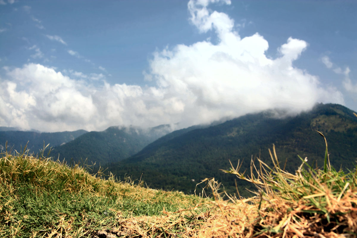
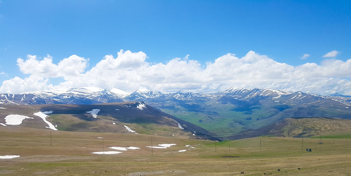
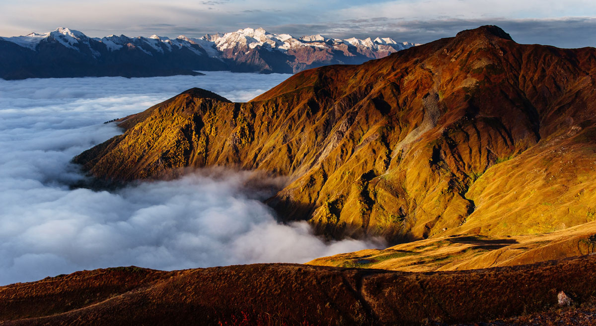
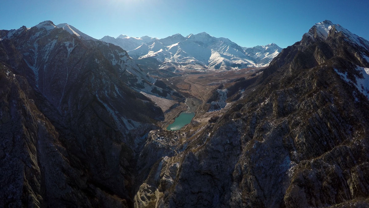
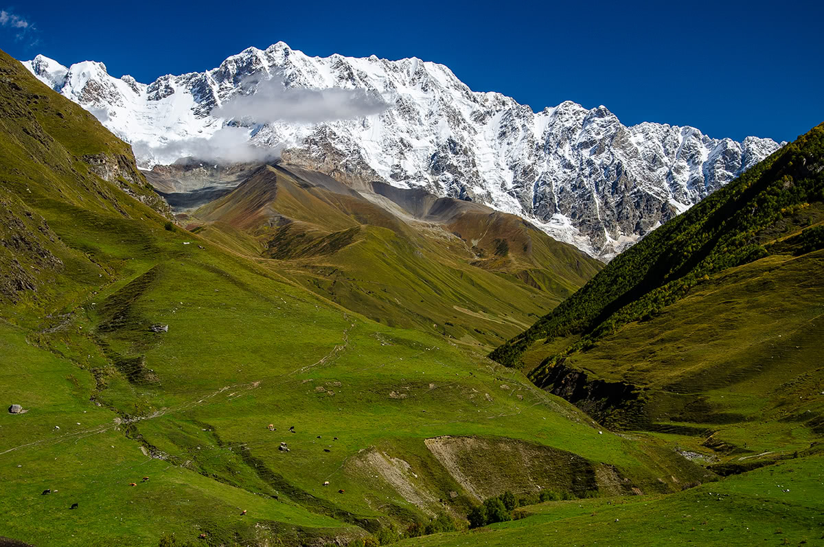
Georgia is home to 1,751 named mountains. The highest is Shkhara at 5,193 m.
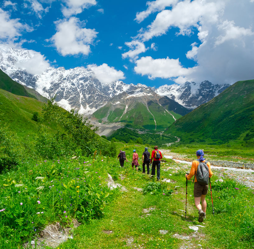
Georgia is a wild land with a relatively untapped and diverse array of hiking, camping and outdoor activities. The Caucasus Mountains that encompass Georgia boast some of the most impressive peaks in the world and draw hikers and mountaineers from all over the world. There are around 1751 named mountains in Georgia, and the top three peaks are Mounts Shkhara (5193m), Janga (5074m) and Mount Mkinvartsveri (Kazbegi) (5033m); this is compared to Mont Blanc, which sits at 4809m and is the highest in the Alps.
Geography
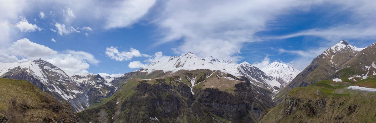
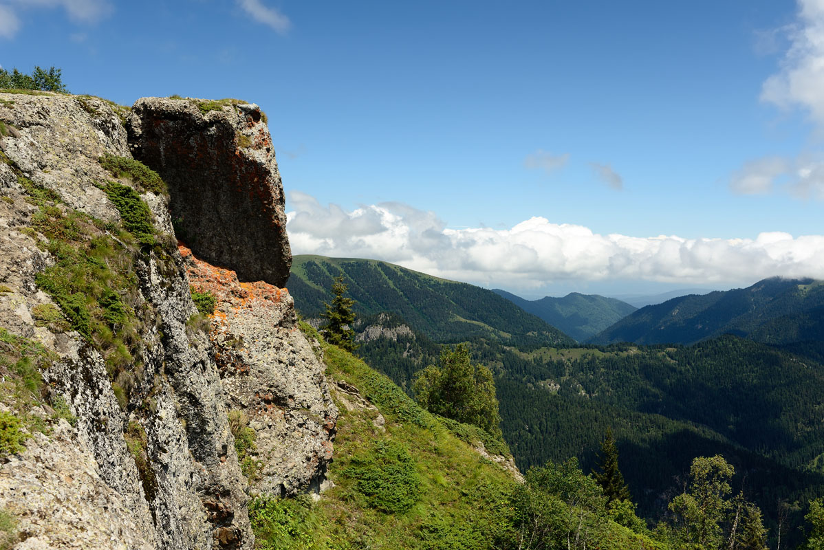
As the most ecologically diverse country in Europe, Georgia is home to 12 different climate zones and 49 different types of soil, giving hikers the opportunity to see everything from high alpine landscapes, to temperate rainforest, to desert steppe landscapes in the span of one long trek. Georgia is situated on the Arabian tectonic plate, which is still pushing the country upward. The Caucasus were formed just 25 million years ago, quite young by geological standards, and prior to becoming the mountainous gem it is today, Georgia used to by a sub-tropical island before joining the Eurasian landmass and moving upward.

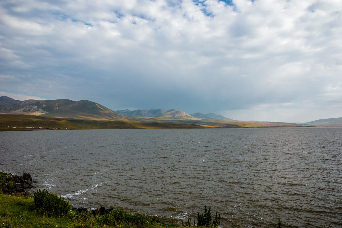
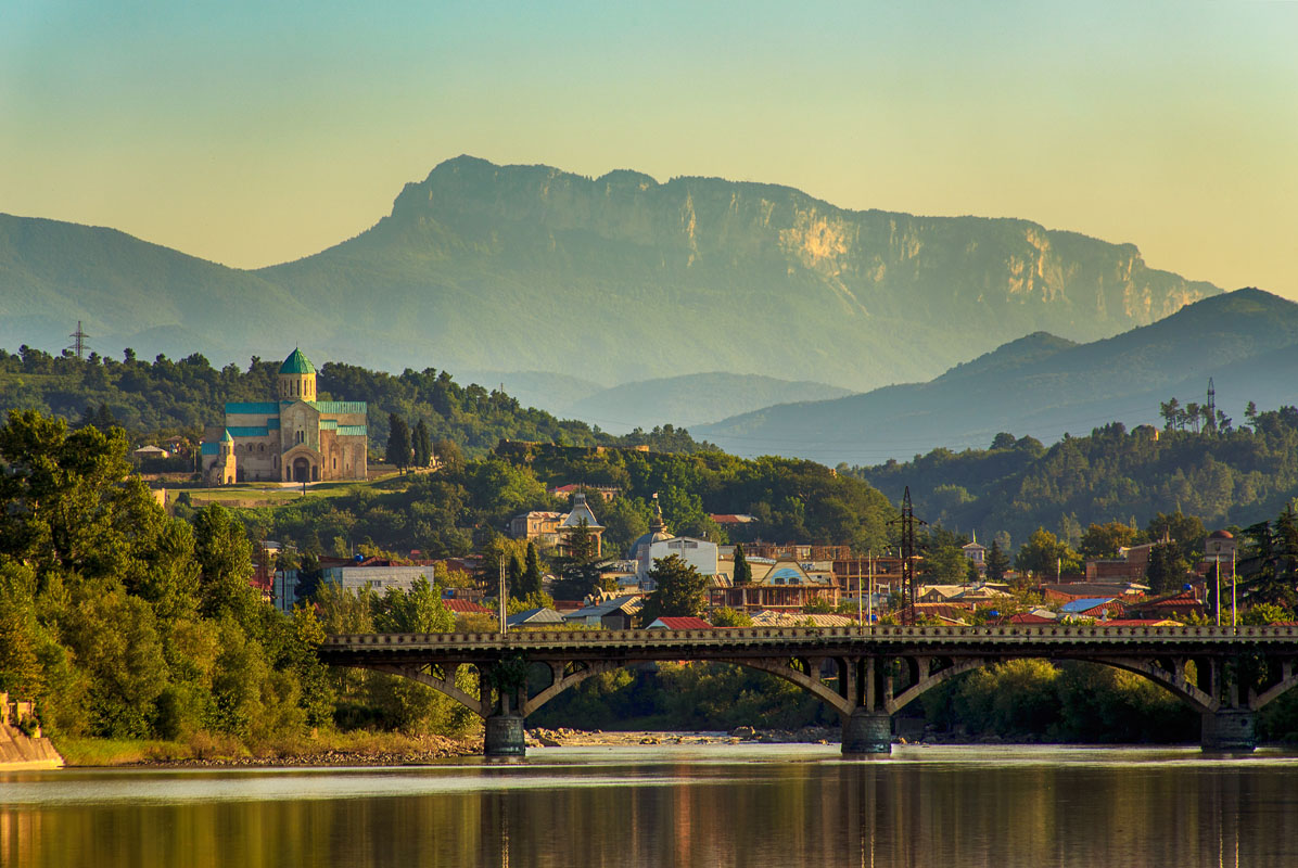
Georgia is bounded by the higher elevation Northern Caucasus region, running west-northwest to east-southeast from the Black Sea near Sochi, Russia towards Baku, Azerbaijan. The Northern Caucasus mountain range, encompasses the Abkhazia, Svaneti, Mtskheta-Mtianeti, and Shida Kartli administrative regions of Georgia and dictates the Russian border with Georgia (the Svaneti and Mtskheta-Mtianeti regions are the most popular for long trek hiking). The lower elevation Southern Caucasus (also referred to as the Lesser Caucasus) region creates the southernmost border with Turkey with ethnic minority muslim populations in the Adjara region.
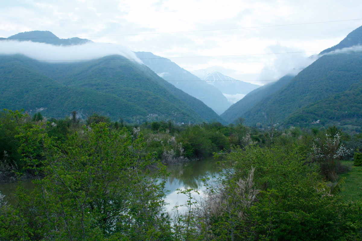
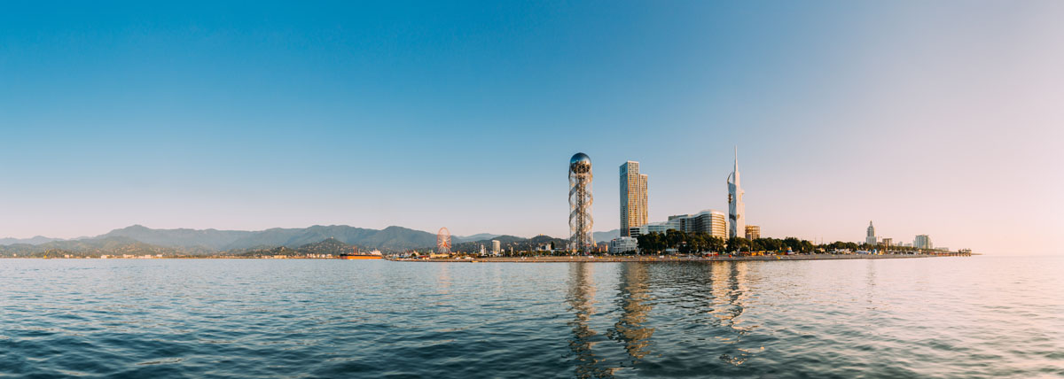
Georgia abuts the Black Sea to the west, a region historically known in Georgia as Colchis, where the climate is wetter and more humid and temperate. Armenia and Azerbaijan border Georgia to the east, in what was historically known as Iberia, in the majority winemaking desert steppe region of Kakheti, which is considerably drier and more arid. The eastern and western regions of Georgia are separated by the Likhi Mountain Range, the southern portion of which was historically known as Ghado, in the middle of the country, which connects the northern and the southern Caucasus mountain ranges. The Eastern and Western parts of Georgia are connected through the Surami Pass (949m) going through the Likhi Mountain Range.
Wildlife Considerations
Excluding Russia, Georgia has the most indigenous animals in Europe, which is a remarkable fact considering it’s small size, but it easily explained by the fact that 90% of Georgia’s genuine virgin forest is naturally planted, making it one of the more unspoiled landscapes in the region. Georgia is home to a number of natural predators that have long since been wiped out in the rest of Europe including; wild cats, in the low land forests; lynx, which are rare, but protected, and can be found up to 2500m; wolves, which are widespread up to 3500m, but have been wiped out at lower lying areas; jackals, which are widespread and can be found up to 1000m; and brown bear, whose numbers are dwindling, but can be found up to 3500m.
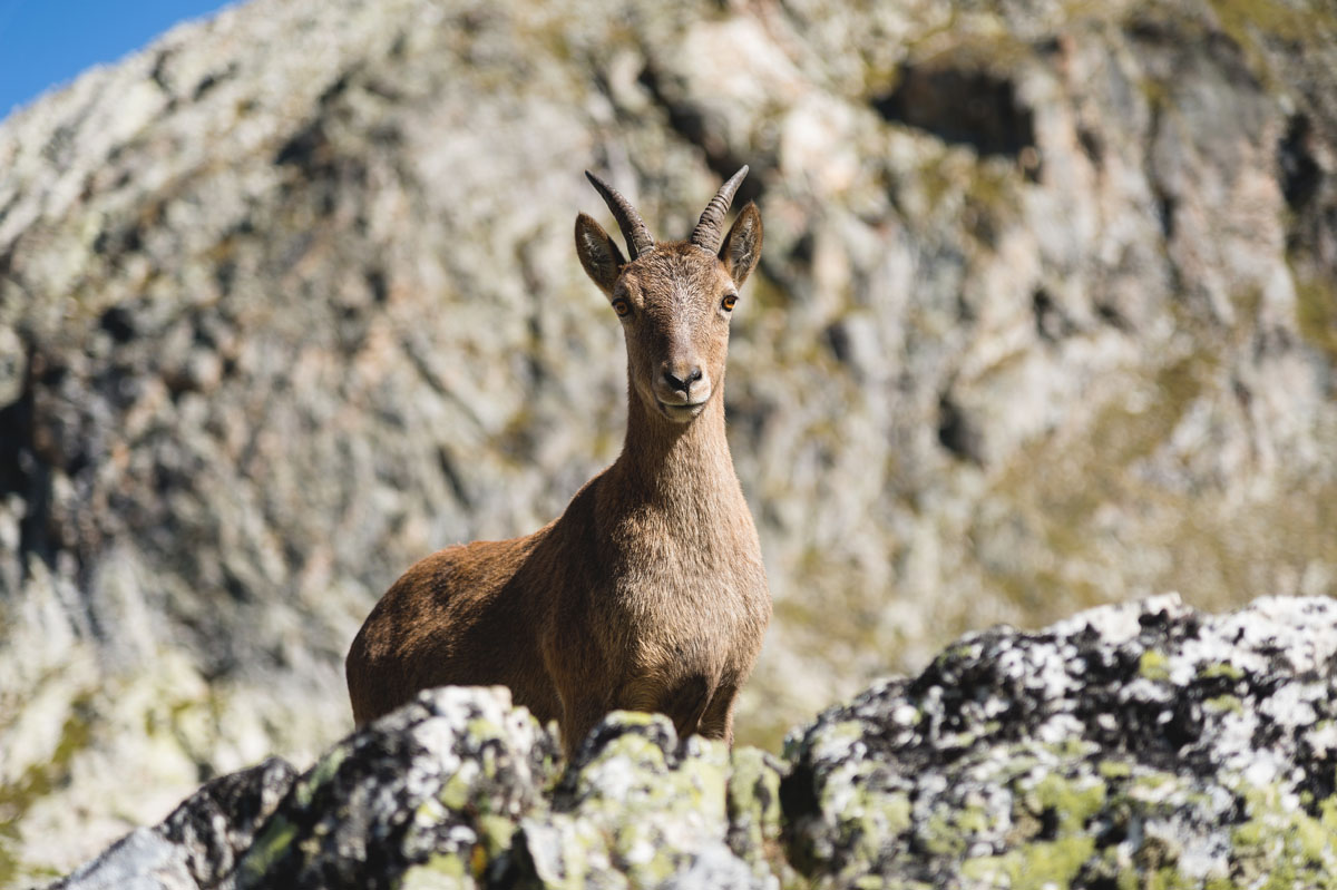
Other fauna include the; red deer, a large deer that can get up to 400 kilos, which are endangered due to overhunting, but are now protected; roe deer, which are much more common and game hunting is permitted on Georgian game farms, of which there are 20 in the country; Chamois, whose numbers have been depleted by 75% in recent years due to poaching, but are protected; Caucasian wild goats, which are largely found in the Tusheti region and are endangered, but protected; wild boar, which is found in forests and semi-arid regions up to 1500m; Caucasian tur, which Georgia is famous for and can be found at very high altitudes. The tur is famous for its dramatically curling horns, which are longer and more curled than even the European Ibex, and are currently endangered due to extreme over hunting, but are protected. The tur’s horns have traditionally been used as drinking horns for Georgian wine and their meat eaten by mountain villagers and tribes.
Georgia has few snakes, but there are 3 to note; the Lebetina viper, which is the most common poisonous snake in Georgia and is found mostly in the arid, sandy eastern part of the country, the Caucasian viper, which are endemic to Georgia and can be found in high alpine forests, but are extremely rare; and the more common, non-poisonous, Ring snake. You are more likely to run into Georgia’s many lizards, which are everywhere, than a poisonous snake during your hike.
Georgian Administrative Divisions
There are 10 administrative regions in Georgia:
As well as, one autonomous republic:
- Adjara - the largest percentage of Georgia’s muslim minority population live in this region.
And two regions under Russian occupation:
- Abkhazia
- South Ossetia, and which encompasses parts of:
The Caucasus Mountain Range
Georgia is situated in the middle of the Caucasus Mountain Range and it’s northern and southern borders are defined by the Greater (or Northern) and Lesser (or Southern) Caucasus. The Caucasus spans from southern Russia, through Georgia to Turkey, Armenia and Azerbaijan. The tallest peak in the Caucasus is Mount Elbrus (5642m), in Russia, just north of the Samegrelo - Zemo Svaneti administrative division in Georgia.
Major Mountain Ranges in Georgia
- Northern Caucasus
- Svaneti Range
- 85km long sub-mountain range of the Northern Caucasus
- Average elevation of 4009m
- Ridge is partially glacial
- Runs along the border of Racha-Lechkhumi - Kvemo Svaneti and Samegrelo - Zemo Svaneti in northern Georgia
- Is home to one of Georgia’s most popular 3-day treks from Ushguli to Mestia
- Subalpine and alpine landscape
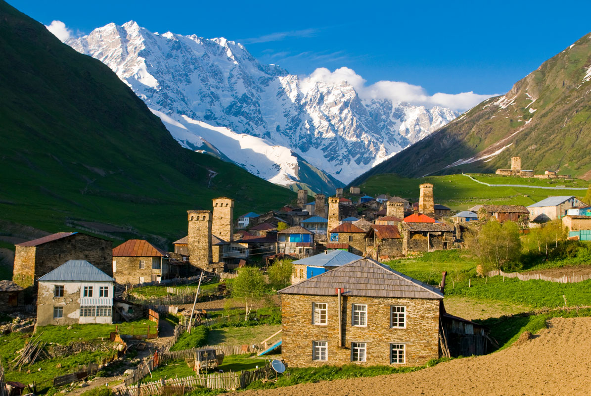
- Europe’s second highest permanently inhabited settlement of Ushguli (2200m) is located located at the head of the Enguri gorge.
- Gagra Range
- Located in Abkhazia
- It’s highest mountain is Mount Agepsta (3357m)
- Runs between the Bzyb and Psou rivers in a general North-South direction
- The landscape is mainly of limestone with pronounced karst landscapes
- Khokh Range
- Home to Georgia’s famous Mount Kazbek
- Home to the Truso Gorge, cut by the Terek River (about 2300m)
- Creates part of the Northern Georgian border with Russia
- Europe’s highest permanently inhabited settlement of Bochorna (2327m) with a permanent resident population of only one man at the time of the 2014 Georgian census and is located in Tusheti.
- Bzyb Range
- Located in Abkhazia
- Length is about 50km
- Elevation is 3033m at its highest
- The landscape is mainly of limestone with pronounced karst landscapes
- Is bounded by the northwest Bzyb River and the Kelasuri River
- Tsiv-Gombori Range
- Located in Kakheti region of eastern Georgia
- Is 107km wide
- The highest point is 1990m
- Lowest point of the Northern Caucasus in Georgia and connects the mountain range to the easter steppe
- Southern Caucasus
- Abul-Samsari Range
- It’s highest mountain is Didi Abuli (3301m)
- 40km long volcanic range southwest of Tbilisi rising above the Javakheti and Tsalka Plateaus
- Alpine Meadow and grassland landscapes
- Javakheti Range (also known as the Kechut Range or the Weeping Mountains)
- 50km long volcanic mountain range that runs north to south from Trialeti to Bazum Range
- Creates the southern border with Turkey and Armenia
- It’s highest peak is Achkasar (3196m)
- Other notable peaks include; Leyli (3154m), Yemlikli (3054m), Garanlig (3039m), Aghrigar (2973m) and Shambiani (2923m)
- Known for high rainfall
- Alpine Meadow and grassland landscapes
- Meskheti Range
- The length of the range is 150km
- It’s highest mountain is Mount Mepistskharo (2850m)
- Creates part of the southern border with Turkey and is home to the autonomous republic of Adjara
- Characterized by highest amounts of precipitation in Georgia and is the most humid region of Georgia
- Mainly covered by deciduous forests below 1200m and coniferous forests between 1200-1800m
- The highest regions are covered with subalpine and alpine meadows
- Trialeti Range
- The length range is 144km and the maximum width is 30km
- It’s highest mountain is Mount Shaviklde (2850m)
- The eastern edge runs along the western border of Tbilisi
- The western edge runs along River Mtkvari to the southwest of Borjomi
- Was built up by volcanic activity during the Paleogene Era
- Mainly covered by deciduous forests, though the western parts are covered by coniferous and mixed forests
- Arsiani Range
- Also referred to as the Yalnızçam Mountains
- It’s highest mountain is Mount Yalnızçam or Arsiani (3165m)
- Park of Turkey’s Eastern Anatolia Region
- Connects the Southern Caucasus to the Armenian highlands
- Much of this range is outside of Georgia
- North and South Caucasus connecting Mountain Ranges
- Likhi Range
- Also known as the Surami Range
- Highest point is 1926m
- The lowest and most important mountain pass is the Surami Pass at 949m which links eastern and western Georgia
- A railroad tunnel the Zestaponi-Khashuri highway run through the pass
- Region was historically known as Ghado
- Saguramo Range
- Located immediately to the north of the city of Tbilisi
- It’s highest mountain is Mount Saguramo (1392m)
- Moderately humid subtropical zone mainly covered by deciduous forests with the understory layer including characteristics of Colchian forests
Notable Mountain Peaks
- Mount Shkhara (5068m)
- Northern Caucasus
- The highest peak in Georgia
- 3rd highest peak in the Caucasus Mountains
- Located in the Svaneti region
- The first ascent was in 1888 via the North East Ridge route
- Mount Kazbek (5047m)
- Northern Caucasus - Khokh Range
- Also known as Mkinvartsveri, it is Georgia’s most famous peak
- 3rd highest peak in Georgia and the 7th highest peak in the Caucasus Mountains
- With a prominence of 2353m, Kazbek is the most prominent mountain in Georgia, and being higher than 1,500m is considered to be the Ultra prominent peak making it a draw to mountaineers.
- Kazbek is a dormant stratovolcano
- Located on the border of Georgia's Kazbegi District and Russia's Republic of North Ossetia–Alania
- Mount Janga (5059m)
- Northern Caucasus
- The second highest peak in Georgia
- It is located on the border of Svaneti and Kabardino-Balkaria in Russia
- Shota Rustaveli Peak (4860m)
- Northern Caucasus
- It is located on the border of Svaneti and Kabardino-Balkaria in Russia
- The 9th highest peak of the Caucasus
- Named after the medieval Georgian poet, Shota Rustaveli (1172-1216)
- Tetnuldi Peak (4858m)
- Northern Caucasus
- 5th highest peak in Georgia
- 10th highest peak in the Caucasus
- Mount Ushba (4700m)
- Northern Caucasus
- Made up of 2 peaks, the southern peak being 10m lower than the northern, spiraled peak
- Considered one of the most difficult ascents in Georgia
- Known as the "Matterhorn of the Caucasus"
- "Ailama Peak (4547m)
- Northern Caucasus
- The lower elevations are covered with subalpine and alpine meadows, while the upper elevations are covered in glacial landscapes
- Mount Agepsta (3357m)
- Northern Caucasus - Abkhazia
- Highest peak in the Gagra Range
- Didi Abuli (3300m)
- Southern Caucasus
- Highest peak in the Abul-Samsari Range
- Achkasar (3196m)
- Southern Caucasus
- Highest peak in the Javakheti Range
- Mount Mepistskharo (2850m)
- Southern Caucasus
- Highest peak in the Meskheti Range
- Mount Shaviklde (2,850m)
- Southern Caucasus
- Highest peak in the Trialeti Range
- Means "Black Cliff" in Georgian
Select Protected areas in Georgia
Georgia has a long tradition of protecting the wild nature that has made it such a hotspot for hikers, trekkers, skiers, rock climbers, cyclists and all around outdoorsmen, dating back to the Middle Ages when feudal lords would sequester land for hunting, continuing with the unofficial isolation of the Borjomi Gorge in 1871 by Emperor Mikhail Romanoff for preservation, and solidifying in 1912 with the creation of the Lagodekhi Strict Nature Preserve, which is the oldest Nature Preserve in the country. There are currently a wide variety of National Parks, Strict, Managed and Planned Nature Preserves, Natural Monuments and Protected Landscapes. About 7% of Georgia is protected land (about 384,684 hectares) and about 75% of that land is covered in various kinds of forests.
National Parks include:
- Algeti National Park
- Borjomi-Kharagauli National Park
- Javakheti National Park
- Kazbegi National Park
- Kolkheti National Park
- Machakhela National Park
- Mtirala National Park
- Tbilisi National Park
- Tusheti National Park
- Vashlovani National Park
- Pshav-Khevsureti National Park
Managed Nature Reserves include:
- Ajameti Managed Reserve
- Asa Managed Reserve
- Bugdasheni Managed Reserve
- Chachuna Managed Reserve
- Gardabani Managed Reserve
- Ilto Managed Reserve
- Iori Managed Reserve
- Kartsakhi Managed Reserve
- Katsoburi Managed Reserve
- Khanchali Managed Reserve
- Kobuleti Managed Reserve
- Korugi Managed Reserve
- Ktsia-Tabatskuri Managed Reserve
- Lagodekhi Managed Reserve
- Madatapa Managed Reserve
- Nedzvi Managed Reserve
- Sataplia Managed Reserve
- Sulda Managed Reserve
- Tetrobi Managed Reserve
Hiking in Georgia
Hiking in Georgia can be intense at times, but is always beautiful and well worth the effort. When hiking in Georgia you should get comfortable with going “off trail” from time to time as some side trails, connecting trails and natural attractions require you to explore the area to locate them. Trail development is relatively new to the country and priority for transcaucasian trail routes largely relies on the goals of independent trail development organizations, none of which seem to be very interconnected so this can make the level of development for various trails inconsistent. However, there is an increasing amount of investment in trail development in the country and many new trails are being cut while old trails are being improved and made to be feasible for a longer hiking season. In general, tourism for hiking and outdoor adventures is at the cusp of a boom, which will be seen in the coming years.
Hiking Season
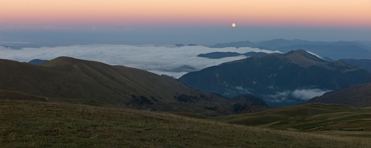
The hiking season in Georgia tentatively starts in May in the lower elevations and goes through October. These start and end dates for hiking should very much be taken into consideration as Georgia’s wild nature and spring snowmelt season will undoubtedly make some trails not only more challenging, but at times impossible. Spring and early summer snowmelt dictate access to a number of hiking regions and should be watched carefully. The height of the hiking season in Georgia goes from late June to early September. While many locations are accessible in early May and June, you should still expect a certain amount of remaining snow on some trails, which can be both a blessing and a curse at times.
Hardy trekkers have indeed hiked or cross country skied through parts of Georgia during the winter season, however, it is not advisable for novices to try this until they understand the ins and outs of Georgia’s various landscapes as avalanches are a risk here. If you are going to try your hand at winter hiking then it is advisable to stay in the lower elevation areas such as the Borjomi-Kharagauli National Park. For example, Georgia’s famous Tusheti region, home to nomadic tribes that travels up and down the mountainous landscape with the seasons, is famously impassable throughout the winter, spring and late fall months. The road to Tusheti is one of the most precarious in the world and is often snowed in or flooded out. This allows the nature of the Tusheti region to remain unspoiled and remote.
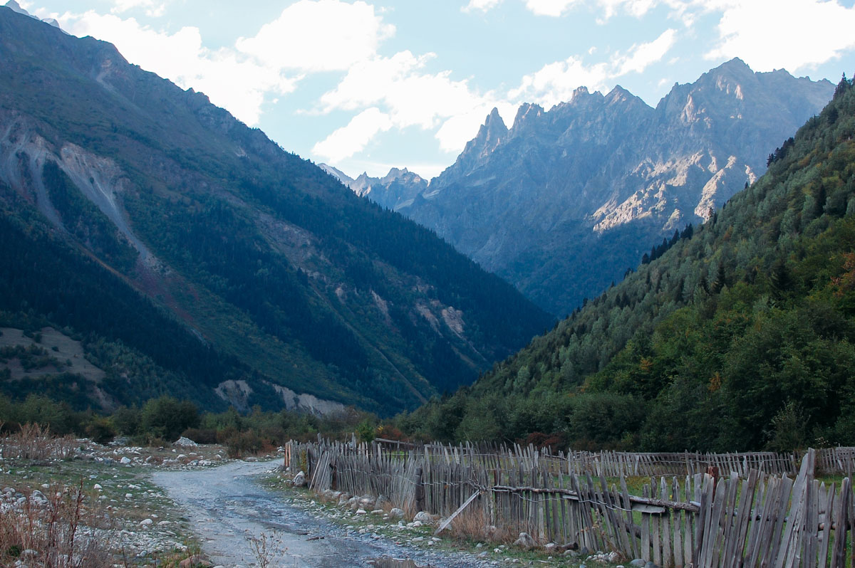
Similarly, the higher glacial mountain passes in the Svaneti region are inaccessible outside of the hiking season. Hikers traveling through the higher elevation areas should keep their wits about them as avalanches, though not inordinately common, are a risk. Additionally, in the glacial regions of Georgia, of which there are many, hikers should refrain from standing at the base of glacial drifts as there is a risk of falling rocks.
Navigation
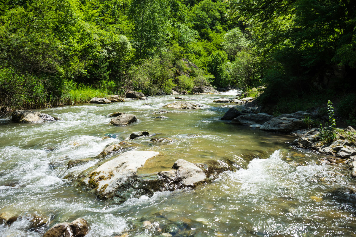
Many of the original hiking trails in Georgia were originally created by shepherd’s and hunter’s traces, or simply follow snowmelt river beds up mountain valleys. River bed hikes are a bit more demanding and technical. The difficulty of some of these trails is notable, especially in the spring months when the snowmelt makes water crossing precariously high and very cold. Hikers have had hiking boots wash away in mountain streams and have had to hike barefoot along mountain stream trails as a result of hiking a couple months too early in the season and wearing the wrong kind of footwear.
The adept hiker should be sure to carry both a compass and a GPS system of some sort and be sure to do their research before going for multi-day hikes in Georgia as the quality and type of hiking trails varies dramatically from place to place. GPS, in Georgia especially, are a good tool but should not be relied upon exclusively. Many trails in the better developed parks are well marked, however, this is inconsistent throughout the country and carrying a compass is a good idea at all times. A good rule for hiking in Georgia is that if all else fails, head “up”.
Some trails in Georgia are easy, but are little more than dirt roads and could more accurately be called nature walks rather than hikes. However, these are great for novice hikers or families. For example, hikes in the less develop Tbilisi National Park are not the most beautiful hikes in the world as they are often covered in litter (Georgia still has a huge issue with litter on highways and some trails), but offer great views of the city and lower, southern Sololaki range and parts of the Saguramo-Ialno Ranges and their branches to the north. Another, considerably more beautiful, example would be the Truso Gorge hike, which follows a jeep trail that is frequented by both foot and auto traffic.
However, other more established trails are well marked, offer stunning natural landscapes, and are well known by local and international hikers alike, such as the Mestia to Ushguli trail and the Lagodekhi Black Lake trail. Moreover, there are also a number of extremely demanding hikes that are harder to navigate and physically taxing, as many locations in Georgia have not implemented the switchback trail cutting system, which as a result has hikers heading straight up. Many trails in Georgia transition abruptly between gentle walks through meadows and valley to steep climbs straight up ridgelines.
Many of the more developed trail areas such as Lagodekhi, Borjomi and Svaneti will have trekking shelters. Additionally, the more famous Mestia to Ushguli trail has a variety of guest house options so that trekkers can do the entire thing with just a day pack, get a shower every night and a hot meal in the morning as they enjoy trekking through Svaneti. However, if you are keen to explore the newer or more off the beaten path trails expect to have to do a fair amount of navigation on your own. If you are unsure or wary about hiking in Georgia for the first time, tour guides in the country are a great and affordable resource and can help you get your bearings early on. Additionally, blazes for trails are still inconsistent and sometimes no existent, though many trails are clear and easy to follow most of the time. If there are blazes on a trail you are most likely to see red blazes or the three layered white, red, white striped blaze. There are also often yellow signs at trailheads and junctions indicating the terminus of each trail, distance, and the estimated time of arrival.
Dogs
While much of Eastern Europe is known for having an issue with dogs both feral and shepherds dogs, it is the size of Georgia’s Caucasian sheep dogs that is notable. These dogs are huge! They will also be most likely the biggest nuisance to your hiking or trekking, however, they are fairly easy to handle. A good rule for hikers is to not walk through flocks of sheep, but rather wait for them to pass or walk around them. The dogs hikers will run across on a trek will almost always be working sheep dogs and are there to protect the flock, so don’t give them any reason to see you as a threat. Dogs have a tendency to be more of a nuisance in the more remote Tusheti region as opposed to the Svaneti or Kazbegi regions where tourism is more developed. Concurrently, sheep dogs in the more popular hiking areas of Georgia, such as the Truso Gorge, have gotten very used to hikers and are often quite friendly. If hikers walk by homes they are also likely to see dogs chained up in the yard. These dogs will invariably bark at passers by. One of the more charming and entertaining aspects of Georgia however, is that in villages and towns if a street dog, or a pack of street dogs, decides they like you they will escort you to wherever you are headed and ‘protect’ you from any threat they perceive, most of which are passing cars. Do these dogs a favor and by them a little treat as a thank you.
Notable Day Hikes
Georgia has so many amazing trails that it is hard to pin down which ones to highlight. Luckily, there are a ton of resources both online and through published books that can guide hikers looking to explore the country. Here are just a few highlights to get you started.
- Lagodekhi
- The Lagodekhi Nature Reserve is the oldest in the country and was started when Georgia was under the Russian Empire. The entire area of the park is 24,451 hectares and borders Azerbaijan and Dagestan in Russia. The park is especially notable for its diverse flora and fauna, especially along the Black Rock Lake Trek (see multi day treks below).
- Ninoskhevi Waterfall (or High Waterfall)
- Do not let this relatively short hike fool you. It can be intense, and even impossible during parts of the year. If attempted too early in the season you will have to contend with difficult water crossings due to snow melt that makes the Ninoskhevi River high and very cold, especially as you approach the waterfall.
- The waterfall is 40m high at the terminus of the trail. The High Waterfall Hike is an approximately 10km total, in and out of the valley, and has a steady upward climb of about 400-500m.
- The majority of the hike is done through the riverbed, making the hike considerably more technical in some places. There are occasionally impromptu river crossing bridges, however these are invariably washed away every year during periods of high snow melt. Therefore, the hike changes slightly each year.
- There are some trail groups that are looking into recutting this trail along the valley ridge and building a high swing bridge across the river to make the trail accessible throughout more of the year, but as of 2019 that is still in the development stages.
- The blazes for this hike are red and easy to find. If all else fails, follow the river bed.
- The entry to this hike is found just past the village of Gurgeniani, west of Lagodekhi, which can be reached by taxi or the helpful local which will take you to the trailhead for a fee, usually around 30gel. There is a ranger cabin at the entrance of the hike, but it is recommended that hikers grab a park brochure at the Lagodekhi Park Office in the city of Lagodekhi ahead of time and get information about the hike there as the ranger is not likely to speak English and is mostly there for security.
- Kakheti
- David Gareja
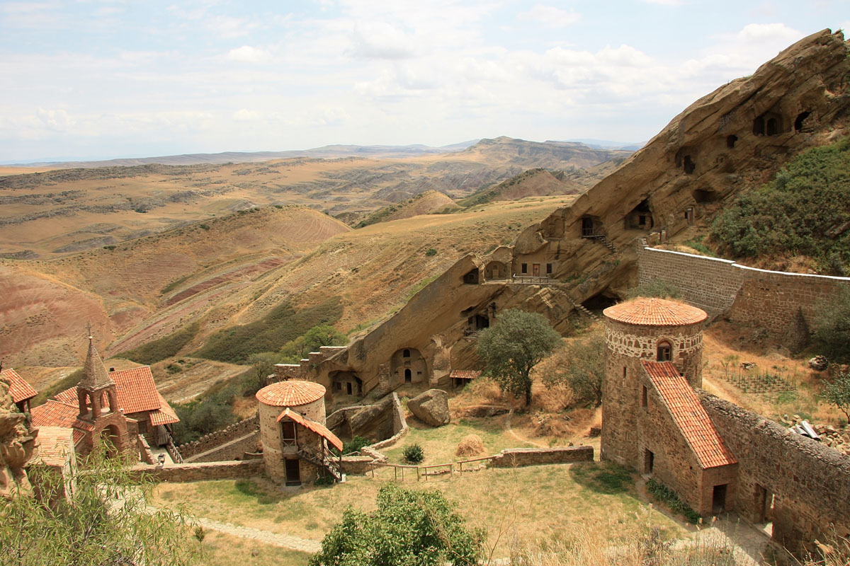
- The David Gareja Monastery is located east of the town of Rustavi directly on the Azerbaijan border and is an easy marshrutka ride from Isani station to the Sagarejo, from there you can catch a taxi to the complex for 60gel, or take a shuttle with the Gareji Line for 30gel, which will drop you off and pick you up two and a half hours later from the complex, which is more than enough time to explore.
- It was built into the caves of this semi-desert region of Georgia in the 6th century by its namesake, a man who left civilization to start the monastery and who was followed by generations of monks for centuries after. Though most of the complex is abandoned now the David Gareja monastery complex is a hotspot for hikers and tourists alike and is the largest monastic environment in the Caucasus.
- This hike is very short though is rather steep in places as you scale the ridge to get to the top of the complex. You can easily start you hike from the car park and explore as you like.
- Borjomi-Kharagauli
- The Borjomi-Kharagauli National Park is the largest and most developed formal national park in Georgia (taking up 76,000 hectares, or 1%, of Georgia’s landmass) and since it is part of the Lesser Caucasus it is accessible for more of the year than places like Svaneti or Tusheti. The trails of the park are designed for casual and advanced hikers and trekkers alike, having well marked trails, mountain shelters, an official guide structure and a visitor’s center complete with informational pamphlets.
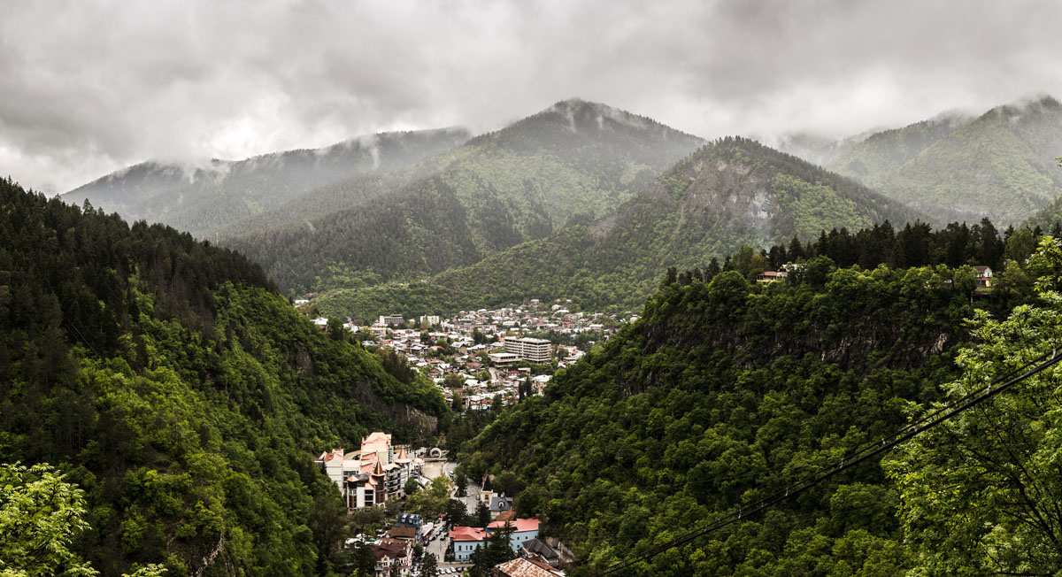
- The World Wildlife Fund and the German Government funded the development of this park as a pilot project for the development of Georgia’s other national parks. However, the start of the Borjomi-Kharagauli National Park becoming protected land actually started 1862, while Georgia was under the Russian Empire, with the brother of Russian Emperor Mikhail Romanoff being appointed the Viceroy of the Russian Empire to the Trans-Caucasus. He was so impressed by the Borjomi Gorge that he decided to build a residence in the valley, which still stands to this day and is known as the Romanov’s (or Likani) Palace. In 1871, King Alexander II presented Mikhail Romanoff the whole of the Borjomi Gorge, which he fenced off large portions off, effectively setting the stage for its continued preservation. Borjomi is now also a tourist hotspot and is famous for its water which is sold all over the region.
- In total, the Borjomi-Kharagauli National Park has 11 trails including day hikes and multi day treks that go through Alpine, Subalpine, Mixed, Coniferous, and Beech forests, and Alpine and Subalpine Meadows. The Borjomi-Kharagauli National Park is more conducive to activities like bird watching, botany, entomology and the like, as the lesser Caucasus of this region are full of old growth forest and therefore offer less expansive vistas and more rich, dense ecology for visitors.
- It is important to note that when you go to the Borjomi-Kharagauli National Forest you will have to register with the National Visitor’s Center and let them know how many days you intend to be in the park, as well as where you intend to hike, which will also give the park officials a chance to explain the difficulty levels of some of the trails in the area. This is a free and easy procedure. Once you have done this you can enter the park at any time and show your form to the Ranger at any of the stations located entering the park. The Visitor’s Center is located on 23 Meskheti St, Borzhomi 1200 in Borjomi.
- Footprint Trail
- The Footprint Trail is a rather schizophrenic trail that you will both love at hate from time to time. A couple important things to note are that there is a great deal of climbing for this and the three other trails that start at the Likani Ranger Station. Until you hit the ridge you will be going up, which will be a grind. For the Footprint Trail however, as you are heading down the ridge the path is very poorly cut and downright treacherous at times. The downward grade on the Footprint Trail has essentially dictated that this is a one-way trail from Likani to the Kvabiskhevi valley, where the trail terminates. It also means that anytime it rains the downhill path of the trail is impossible to traverse. It looks like much of the trail just follows water drainage paths and if there are switchbacks (there are very few) they are short and still very steep. Hikers often have to employ the sit and slide technique of getting down the mountain, which does not make this a good option for novice hikers who are not comfortable with technical downhill hiking, or families.
- Also known as the #6 trail and is blazed in white, yellow, white horizontal stripes. There are 2 water points, a handful of panoramic views when you reach the ridgeline (which is a fairly short section of the trail) and 2 official campsites along the trail, as well as numerous picnic areas at and around the completion point of the trail.
- The Footprint trail starts at the head of the Likani River Valley near the Likani guard station and there is a large campsite at the trailhead for this and three other trails. You will follow three blazes up the ridge, red, yellow (the Footprint Trail), blue and black, all with additional white stripes above and below each blaze color. You’ll know you are in the right place by the 800-1000 years-old yew trees in the area. Follow the wide path up. The first part of the part is wide and easy to follow until you reach another campsite and water access point where the trail narrows and moves into deeper forest.
- About 2km in you will come across a park map outlining the trails in the area. You will want to follow the trail going up along the ridgeline, which you will climb for about 5-7km or 3 hours along the Nikoloz Romanov trail. This is a fairly tiring climb, but is well cut. The Likani Gorge Trail, or #12 Trail, will separate from the Footprint Trail about an hour to an hour and a half into your accent, you will continue up with the St. Andrews, or #2, and the Nikoloz Romanov, or #1, Trails. Just when you think you will never stop climbing you will hit the halfway point for the Footprint Trail and break off from the St. Andrews and the Nikoloz Romanov trail and go along the opposite direction of the ridge to the left. The trail will open into a large field and level out.
- While there is some elevation gain on the ridgeline portion of the trail it is well balanced with light descents and straight hiking. It is very important to note that the trail gets considerably more narrow at this part and cuts close to steep downward descents so take care when hiking as one poor step can send you down the mountain. The panoramas of this portion of the hike look onto the lesser Caucasus and show just how diverse this region of the country is.
- While you are hiking along the ridge you will see; Mounts Orta Tavi (2500m), K’odiana (2690m), Shavi Kide (2856m), Oshara (2605m), Gumbat’i (2965m), Sakvelmosmta (2787m), Tavk’vetili (2583m), Sametskhvario (2645m), Megruki (2486m), Arjevani (2757m), Jamjama (2379m), and Didi Karta (2315m), among others.
- The trail then hits the Kvabiskhevi valley where the downhill becomes extremely treacherous and dangerous. This section is short but you will be moving through it so slowly. Stick to areas with lots of tree roots and rocks along the treeline. The soil on this part of the trail is slick whether or not is it dry or wet.
- The trail will level out beautifully after you get into the valley and the end of the hike through the Kvabiskhevi valley is full of subalpine meadows and interesting rock formations. There are also numerous camping and picnic areas. You can catch a cab back to Borjomi for 25gel.
- The Info Trail
- This is a short trail with one water point at the beginning/completion point of the trail and 2 camping locations.
- The Info Trail starts at the Borjomi-Kharagauli administrative building just outside of the town of Borjomi and starts with a hard 600m climb before leveling out along the ridge to overlook Borjomi and pass St. Nino’s Church.
- Hikers should get used to passing frequent churches to St. Nino, who was the woman credited with bringing Christianity to Iberia in the 4th century and rivals Queen Tamar as the most popular historical figure in Georgia.
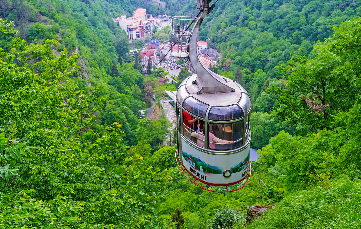
- Borjomi Sulphur Springs Hike
- This is an absolute novice hike that is frequently done by families and goes about 2.5km from the back end of the Borjomi Central Park (which is 2gel to enter) and follows the river up to the Sulphur Springs baths that have been built into the hillside.
- There are a few other hiking trails in this area as well that can be explored about 2km into the trail.
- The Sulphur Springs cost 5gel to enter and are extremely crowded during the summer, the best time to visit is during the winter or in the morning.
- This hike is a good alternative for people wanting to get outside, but not commit to the rigor of a hike in the National Park.
- Kazbegi
- Given Mount Kazbek’s accessibility year round and proximity to Tbilisi, this is one of the most, if not the most, visited peaks in the country. The village of Stepantsminda is the base of operations for both serious trekker and day-trippers alike and sits at the base of the mountain overlooked by the Gergeti Trinity Church. Stepantsminda is also known by its older name, Kazbegi, and the two names are used frequently interchangeable for the town, mountain and general region. The trails in the Kazbegi region are rarely or infrequently marked with blazes, however, they are so easy to find and highly trafficked that blazes are often unnecessary. If there are blazes for trails in this area they are typically painted with white, red, white horizontal stripes.
- Stepantsminda to Gergeti Glacier via Tsminda Sameba (Gergeti Trinity Church)
- This is the most popular and most accessible hike in the area and there are a few variations of the hike that you can take depending on how strenuous you want your day to be.
- You can start your hike either in the village of Stepantsminda or take a taxi and start at Gergeti Trinity Church and go all the way to the glacier. You can also end your hike at the Gergeti Trinity Church if you choose to only hike from Stepantsminda, which many novice hikers and families do. The Gergeti Trinity Church is a very popular attraction so be prepared for a lot of people on the trail during the mid-day.
- If you start your hike in Stepantsminda, you will walk through the downtown area towards the Terek Bridge over the Terek River. Cross the bridge and take the next left along the road to the neighboring village of Gergeti. You will walk up the hill along that road until you hit a T in the road. If you turn right you will have a couple of options to stay along the road all the way to Gergeti Trinity Church. This is not a great walk as it is mostly along the road, has little tree cover and you will have to contend with the many taxis and marshrutkas going up to the church.
- If you turn left you can take the trail through the rest of the village and continue up past an old watchtower and through a beautiful meadowed area that loops along the back of the hill that the Gergeti Trinity Church sits on and approaches from behind the church. This trail is preferable because it is so much more beautiful than going along the road, but the climb is steep and narrow in parts.
- The first part of the hike, starting from Stepantsminda going up to the church is about 4km with 400m of elevation gain. The church sits at 2210m.
- The trailhead towards the Gergeti Glacier is easy to see from Gergeti Trinity church. There is a parking lot situated at its base. It starts at around 2210m and continues with an elevation gain of 1400m with the base of the glacier sitting at about 3300m. The distance between the gergeti Trinity Church and the base of the glacier is about 8km.
- This trail continues past the base of the glacier all the way up Mount Kazbek. There is a camping site at the base of the mountaineering trail just before you have the option to cross the glacier. If you want to make an overnight trip of it you can stay at the hostel that is just a little further after you cross the glacier heading up the mountain.
- There are two routes up between the trailhead at the Gergeti Trinity Church and the Betlemi Gora landmark. The southernmost trail is considered the climber’s trail and has fewer views of Mount Kazbek, but also has less wind (Mount Kazbek can be very windy), the northernmost trail is windier, but has great views of Mount Kazbek.
- One important thing for hikers to note about this trail is that because it is on the base of Mount Kazbek, the weather can change very rapidly, so keep an eye on the forecast. The local geology does not make this hike a safe place to be during a thunderstorm as lighting striking the ground can be common and storms roll in and out very quickly. A light rain can quickly turn into a torrential downpour so come prepared.
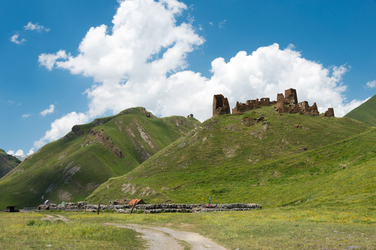
- Truso Gorge to Zakagori Fortress
- This is a great day hike as it has a small amount of elevation gain. This is a perfect family or novice hiker route and has a ton of cool stuff to see both in the landscape and the remaining ruins of the Truso Gorge. You could even call this hike a nature walk as the entire hike is done on a dirt road. Cars, ATV’s and motorcycles drive this road daily, but do not create much of an issue for hikers as this road has a higher percentage of foot traffic.
- You can either hire a taxi to get to the trail head, which will cost between 100 and 130gel, or you can sign up for a shuttle with the Mountain Freaks company for 30gel per person. If you sign up for the shuttle be sure to get on the list a couple days in advance as it fills up very quickly during the high season. You can set up your pickup time for taxis, it is recommended that you plan for at least 6 hours depending on how fast you plan to hike and how long you plan to rest. If the weather is good, in general, you should ask to stay a bit longer and enjoy the scenery and give yourself time to explore the ruins and geological highlights along the way.
- The Truso Gorge hike is about 22km long from the trailhead to Zakagori Fortress with about 220m of elevation gain, so while it is an easy walk, it is very long and there is absolutely no tree coverage so be sure to bring sunblock.
- The hike starts at Agatkau in the Kvemo Okrokana village, at the confluence of the Mnaisistskali and Terek River, at a partially abandoned industrial area, and follows the Terek River all the way to its terminus at Zakagori Fortress.
- There are other continuations of the trails in the area, but they are currently off limits.
- The first part of the hike has the most elevation gain and loss as you make your way towards the Truso Gorge through the Kasari canyon.
- After about 7km you will cross a bridge over the Terek River and begin entering the Truso Gorge, the valley opens up in about 1km to a number of natural mineral deposits coming out of the mountains and leading into the Terek River. On the opposing side of the river is the Truso Camping and Cafe site, which also holds the trailhead to a very short side hike to the Abano Mineral Pool along the river.
- As you continue you will pass through an expansive meadow that is home to a handful of people still living in the area. There is extensive sheep and cow grazing in the meadow and you will see sheep not only in the valley, but also climbing up along the steep mountain sides and speckling the landscape. If you are very quiet you can hear the otherworldly bleats of the sheep as they call out to each other on the mountainside and echo through the gorge.
- As this trail goes through grazing meadows keep a swift foot and an eye out for sheep and cow poop along the trail.
- While you should be careful of sheep dogs in general in Georgia, the dogs living in this valley were very laid back and downright friendly.
- After about 3km you will pass through the ruins of Ketrisi, which is mostly populated by old donkeys and horses put out to pasture. There are however a handful of people still living there and if you like you can stop by a family cafe and purchase a coffee, tea or khachapuri (see Georgian food below).
- After Ketrisi you can either split to try and find the Keterisi Mineral Vaucluse, which is off trail and difficult to locate, or you can continue on to Abano and the Zakagori Fortress.
- If you cross the bridge to Abano you will have to walk another 2km. Abano is in the process of developing and it looks like it may have a number of lodging options in the coming years for tourists. As you pass through Abano you can continue on until you reach the Zakagori Fortress at the head of the Gorge.
- From there you can follow the trail back to Kvemo Okrokana village.
- Juta and the Chaukhi massif
- The Juta day hike to the Chaukhi massif is an absolute must see if you are going to the Kazbegi area. The Chaukhi massif, also known as the Georgian Dolomites is a seven spiked massif that opens up to a beautiful valley cut with mountain snow melt rivers and a variety of interesting rock formations.
- There is no public transport to the village of Juta so you will have to get a taxi (90-120gel) or sign up for a shuttle service with Mountain Freaks in Stepantsminda (30gel per person). The village is on a hillside so the initial climb up to the high alpine valley is incredibly steep and easily the most cumbersome part of your entire hike.
- The day hike to the Chaukhi Massif is about 8km total with 400m of elevation gain. You will end your hike at an alpine lake (one of four in the area, the other three being on the opposing side of the pass) with a sign next to it indicating that you have reached 2500m.
- The village is being built up very rapidly so while there are still a few old residents there you will see a number of hotels, outdoors adventure companies, and restaurants being built as well.
- This hike does not have any tree coverage and the high altitude makes the sun very intense so be sure to cover up. Just 30 minutes of exposed skin will get you a sunburn here.
- One great thing about this hike is you can drink the water straight from the stream as this area is not used for grazing and the water (fed by snow melt) flows through a nature moraine base filtering system. It also comes out incredibly cold.
- This day hike is very short and is very easy most of the time, however, there are a couple spots of steep elevation gain, the first being through the village of Juta and the second being near the end of the trail.
- Once you are dropped off at the village you will see a large boulder sitting above the Jutistskali River with a stone cross on top of if. You will cross the road here and head left along the steep uphill path. Follow the path until you come to an abrupt right hand turn up an even steeper path. When all else fails, choose the path that goes up the steepest route past the village.
- You will continue up the hill and pass the Zeta Camping guest house and campsite (if you choose to stay here you will be provided with a tent, sleeping bag, and mat) on your right. You will know it is the Zeta Camp site because of the rockwall on the side of the building. Continue on and you will see the 5th Season Cafe and guest house on your right as well. Before you even see these locations however, as you scale the hill you will see the seven spiked Chaukhi Massif in the distance which will let you know that you are undeniably headed in the right direction. The distance from the village of Juta to the Fifth Season Cafe and guest house is only about 1km, but is incredibly steep.
- This trail is well trodden and easy to follow. It is also frequented by hikers, climbers, mountaineers, horseback riders, etc. so you can easily see where the route leads through the mountain.
- For most of the hike you will walk with the Chaukhistskali River on your right side. As you approach the massif however you will have to cross the river. There are a couple routes to do this. In early June there is still a small amount of mountain snow on the trail, which comes in handy as you can use it to cross the river, which will be slightly higher early in the hiking season. As you approach the river crossing, if it is too high for your liking you can take the left hand trail and cross the river over an area that is more likely to still be covered in a small amount of snow. However, from there you will have to go off trail for a few minutes to cut back over to the main trail. Do not worry though, the trail is always in eyesight and it very easy to walk back towards.
- You can end the trail at the beautiful alpine lake at 2500m at the base of the massif or continue to the top of the pass, which is an intense, but short hike up.
- The lake is a popular resting spot for trekkers continuing over the Chaukhi Pass and day hikers terminating their hike at the lake. There is also a campsite located here. From this vantage point you will also see some hikers who are starting 1 of 2 potential continuations of the trail; the 9-hour Chaukhi Pass day hike, with an additional 1000m of elevation gain over a few hundred meters, and the Chaukhi to Roshka Trek going fully through the pass and ending in the village of Roshka and taking about a day or two.
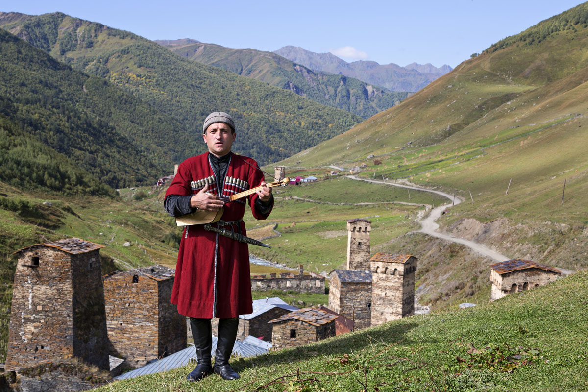
- Svaneti
- Svaneti is criss crossed with trails both long and short and is an absolutely hikers paradise. With the region’s dramatic landscape, Sven towers, and vibrant culture, any hiker would be hard pressed to find a more ideal hiking location anywhere in the world. Svaneti is not only considered the jewel of the country, but also the most authentically Georgian. Hikers could easily spend an entire season just exploring the mountains of Svaneti. One easy option for hikers is to base out of Mestia and explore the numerous days hikes that go in and out of the village.
- Guli Pass
- Point to point, the Guli pass is a strenuous day hike. However, if you are planning to hike from Mestia to Mazeri through the Guli pass and back, be sure to pack a tent because you probably will not be completing it in a day. The favorite spot for this are the Koruldi lakes above Mestia just off the trail. However, if you want to do this in a day start early.
- The views of Ushba and other mountains are amazing on this hike.
- The Guli Pass hike is 24km long with about 1600m of gain and decent.
- The best period for this hike is from the beginning of July until the end of September as the rest of the year has the Guli Pass covered in snow. The passability of this hike really depends on the proficiency of the hiker.
- If you start in Mazeri you will have a net vertical loss of 200m, making the trail a bit easier, however there is no public transport to Mazeri so you will have to take a taxi there.
- The hike starting from Mazeri starts at a tourist pointer south of the village and the trail is blazed with white and red blazes. The trail heads southeast, towards Bagvdanari village and then turns east and enters the Gulichala valley.
- Towards the end of the trail there is a shelter on top of Tshakazagari hill (2200m) over Mestia after that it is downhill towards Mestia. At 1850m you’ll turn right from the large road onto the smaller trail going between the wooden fences. There is also a tourist pointer here sending you towards Mestia.
- Chukhuti Ridge
- If you take the route from Mestia all the way to its endpoint just above Zhamushi you will hike about 11.25km with about 1910m of elevation gain, the majority of which is found towards the end of the trail.
- In common Georgian trail fashion, most of the trail is relatively flat with abrupt upward climbs in parts. About two thirds of this trail is flat-ish, with the remaining being steep climbs.
- As opposed to going through grazing land, the majority of this trail is through native meadows, making it much more pleasant.
- You can start the route in the main square in Mestia and head south through the eastern gate. There is no formal entrance point, instead the road just kind of turns into the path. Follow the trail down the river and after you cross the bridge turn left
- There are no balzes on this trail, instead it is just very clearly cut until the last part, which is much harder to follow and hike as it is the part the gets incredibly steep.
- The last part of the trail is what goes to the Chukhuti Ridge and it is more narrow, keep alert. As you scale this part of the trail you will see Tetnuldi mountain first, eventually coming to see Mount Ushba and Chatyn-Tau, to the right the pyramids of Tetnuldi and Gistola; you will be hiking towards the Gvalda range at this point. Chkhuti ridge heads towards its second highest point, Ahalgazrdoba (3702m) or Peak Komsomol. Left of Peak Komsomol is Banguariani (3804m) and the mountains Gvalda and Latraldashi.
Notable Multi Day Treks
Multi day treks are incredibly popular with Georgians and tourists alike. Throughout the entire country you will find many options for well established treks that can go as long or short as you desire. Many foreign hikers will notice that many of the distances per day for Georgia long distance hikes are relatively small by American and some European standards, this is due to how many trails are cut, having a large amount of elevation gain in a small period, creating more rigorous hikes for backpackers and therefore shorter days.
- Lagodekhi
- Black Rock Lake Trek
- You should budget about 3 to 4-days for this trek. While it is a relatively short, as far as treks go, the pathway up is a bit technical and steep in parts, slowing down many trekkers as the trail follow straight up the ridgeline.
- Trail development organizations are currently bidding to update both the Black Rock Lake and the High Waterfall day hike so that they are more accessible for longer parts of the year and to a wider array of hikers. This includes maintaining current hiking paths and cutting more switchbacks along the Black Rock Lake trail to make it more feasible to hikers, as well as building a swing bridge across the High Waterfall trail’s Ninoskhevi River so that hikers can hike along the ridgeline, making it more accessible in the spring.
- The Black Rock Lake Trail runs along the border with Azerbaijan and is distinguished as one of the most interesting treks in Georgia due to its views of the Alazani valley and the Caucasus mountains where they meet Azerbaijan and Russia.
- Day 1 - The route starts at the Lagodekhi visitor’s center and starts pleasantly enough through virgin forest, but be prepared to ascend endlessly at the 1.5km mark until you hit the Meteo tourist shelter, which is a great place to end Day 1 of your hike. The shelter can house 16 people, or you can comfortably camp outside, and has a water supply from a nearby spring.
- Day 2 - You will start walking along the alpine valley on Day 2 and will have plenty of opportunities to stop and observe Lagodekhi’s wildlife along designated observation areas. You can observe everything from deer, chamois and wild goat, to birds like grouse, Caucasian snowcocks, bearded and various eagles.
- You can end your hike along the border guards post where you will need to register with the border guards as visitors (a common practice on trails that go along the border), there is a new tourist shelter there as well, or you could push through the remaining distance, about an hour, to Black Rock Lake.
- Black Rock Lake serves as the natural border between Georgia and Daghestan in the Russian Federation at 2780m.
- It is possible to hike to the lake between late May and early October, but it is most ideal to trek it between the months of June and September, when the weather is warmer and the colors more vibrant, especially on sunny days on top of the mountain. There are a number of other smaller alpine lakes on the mountain, however, visiting them is not currently permitted.
- Day 3 - After you have taken in the waters of Black Rock Lake you can head down the ridge. As descending is considerably easier than ascending it will be up to you whether or not you want to make the second half of your trip a 1 or 2 day affair. You can easily go down the mountain in a day however along the same path you took up.
- Borjomi-Kharagauli
- Nikoloz Romanov's Trail
- The Nikoloz Romanov’s Trail is a great introduction to the Borjomi-Kharagauli National Park because it spans the length of the park from Likani (Borjomi district) to Marelisi (Kharagauli district) over the course of an approximate 3 to 4-day trek. You will also get highlights of the coniferous and mixed forest (part of the Colchic sub-tropical forest ecology of Georgia), Lomi Mountain, Lomi St. Giorgi Church, and numerous scenic viewpoints of the Lesser Caucasus.
- The trail has 6 water stations, 4 campsites, 2 tourist shelters, and 3 designated scenic viewpoints as you walk from the Linkani Ranger station to the Marelisi Ranger station approximately 43km along the trail.
- You start at the Linkani Ranger station, a common starting point for most of the trails in the park and which is located 5 km from the National Park Visitor Center. The first 3 hours of this hike from the second campsite after you pass the ranger station is all elevation gain, so be prepared.
- The tourist shelter of Lomismta, the first on the trail, is located 15km out, after this shelter you will climb approximately 1300m along Lomismta mountain, where Saint Giorgi church is located. On a clear day you can see the highest peak of the Great Caucasus and Europe, Mount Elbrus, to the Northwest.
- The trek descends along the Sakhvlari tourist shelter (1025m) and the trail follows the Arjola River valley and ends at Marelisi Ranger station. From there you turn around and follow the trail back to the Linkani Ranger Station.
- Saint Andrew Trail
- The Saint Andrew’s Trail is a 54km trail that is probably the most popular trek in the park as it gives hikers the opportunity to climb Mount Sametskhvario, the highest mountain in the park.
- This is an approximately 4-day trek that has 4 water stations, 4 campsites, 3 tourist shelters, and 3 designated scenic viewpoints.
- The trail starts at the Atskuri Ranger Station, which is further away from Borjomi than the Linkani Ranger Station, 27km away from the National Park Visitor’s Center. Early in the trail goes along the river and you will pass a bezoar Ibex enclosure before ascending along the range where you will get panoramic views of the Lesser Caucasus. The first tourist shelter is the Amarati tourist shelter about 16km in.
- After you pass the Amarati tourist shelter you will begin your ascent up Mount Sametskhvario (2642m), where there is another tourist shelter, the Sakhvlari tourist shelter at the 25km mark.
- The last tourist shelter is the Sakhvlari tourist shelter about 44km in and the remaining route follows the river valley and gives you a reprieve from the previous 2-days mountain climbs.
- The Saint Andrew’s Trail completes at the Marelisi Ranger Station and you can either follow the trail back to Atskuri, or loop back to Linkani via the Nikoloz Romanov's Trail connector trails. Be sure to grab a map from the visitor’s center so you can see all of your options for return trips.
- Svaneti
- Mestia to Ushguli
- This trek is easily the most popular trek in Georgia. It is one of the older trails in the country and there are a few different routes that you can take between Mestia and Ushguli going either high or low through the Svaneti region.
- One cool option for the trail is to take a plane to Mestia from Tbilisi, however, if you are going to go this option your trip will very much depend on the weather as the flight only runs on specific days and will only take off if the weather is clear due to the increased risk associated with landing at the mountain air strip and flying through the mountain range at close proximity. Flights often get canceled. However, if you do choose to take this route into Mestia, it is an absolutely awesome way to kick off your trek.
- It is also important to note that even though the Mestia to Ushguli trek is one of the better established treks in the country, parts of it still need development. The 15km section between Khalde and Ushguli is currently along a highly trafficked road and can be precarious for hikers. Current trail development groups are working to cut a new trail along this route away from the highway. Currently, hikers can bypass this section by climbing up through the Karreta pass, which will add time to your trek, but will keep you away from the road.
- The blazes for this trek are red and white and the trail is a great favorite among trekkers for a few reasons; it is easy to follow due to its effective blaze markings, the Svaneti region is very tourist friendly and the locals are pretty accustomed to hikers moving through the area, and similarly it is possible to sleep every night in village guest houses so you don't necessarily need to bring a tent and can pack very light, making this trek downright luxurious by most trekking standards.
- It is advisable to get very familiar with the various routes you can take in the area to make for the best trek for your tastes. Regardless of whether you prefer to trek through more civilization, historic markers, or natural environments, there is a route or detour for you and there are a variety of resources that can help you find the route you want.
- The Mestia to Adishi section has 2 major climbs, starts at 1393m and peaks at 2480m, with an accumulated climb of 1969m and an accumulated descent of 1269m going about 28km and taking 1-2 days.
- To start the trek, from the park in the center of Mestia, head down the road southeast, cross the bridge just past the restaurant Dror, immediately turning left after the river.
- The Adishi to Ushguli section starts around 2100m with one major climb peaking at 2723m with an accumulated climb of 1424m and an accumulated descent of 1448m, with the trail ending in a steady climb and going about 29km total.
- You will cross the Adishchala River early in this part of the trail and it is a good idea to cross it in the morning when the water is at its lowest. However, early in the season (June), this crossing is challenging to impassable due to higher snowmelt. Later in the season you may find locals waiting at the river to offer you a 10 gel crossing by horseback.
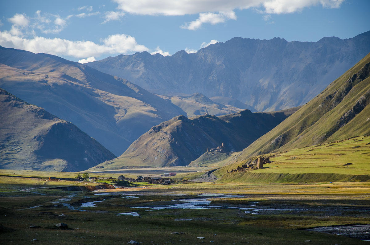
- Tusheti
- The hiking season in Tusheti is fairly short, even by Georgian standards due to Tusheti’s high altitude and remoteness. There is only one famously treacherous road to Tusheti and it is subject to being washed out by high snow melt, which shortens the hiking season even more. Tusheti is less frequented than Svaneti so hiking here will have you much more secluded and the nature more untouched. The local tribal communities in Tusheti are semi-nomadic and move up and down the mountains each year with the seasons.
- Omalo to Shatili
- The Omalo to Shatili trek connects the Tusheti region to the Khevsureti region over the course of 4-5 days.
- This trail was first created by shepherd’s paths in the region, much like many of Georgia’s trail systems.
- One of the major draws for this hike is that it is relatively unspoiled due to poor roads going into the region reducing accessibility. Another draw are the medieval villages and fortresses along the trail and the region's natural beauty.
- The Omalo to Shatili trek is about 75km long from end to end, starting at around 2100m, peaking at 3500m at the 50km mark and terminating at around 1450m in Shatili. You have a total climb of almost 3000m and descent of almost 3600m.
- To get to Omalo you will have to first take a marshrutka to Kvemo Alvani village from the Ortachala Station in Tbilisi at 9am (cost 7gel). From Kvemo Alvani you will need to hire a jeep to Omalo as there is no public transport. The trip takes about 4-5hours and costs 50gel per person.
- Day 1 of the trek has you going from Omalo to Dartlo, which is about 11km with an approximately 400m accent and 670m descent. To leave Omalo you will take the serpentine road heading north until it turns into a dirt footpath headed towards Dartlo
- In Dartlo there are guest houses, restaurants and places to resupply on food, even though the village is very small. There are also various places to camp along the Pirikita Alazani River just below the village.
- On day 2 you can go from Dartlo to Girevi, a 14km day with an approximately 400m accent and an approximately 200m decent, depending on your route. You can either follow the Alazani river through Parsma to Girevi, or take an alternate route up to the Dano Village before connecting back to the lower trail. In Grievi you will have to register with the border guards.
- Day 3 goes from Girevi to the Kvakhidi meadows, about 14km with approximately 1000m of ascent and approximately 600m of descent. You will cross two border guard checkpoints; one at the halfway point and one towards the end of your day. You will know you are reaching the end of your day when you pass a shepherd's shelter selling snacks at a bridge crossing the Kvakhidistskali River. Just past that is a meadow that is perfect for camping.
- Day 4 you will go about 17km to Khidotani ridge with about 1400km of accent and almost 1200m of descent. You will have to cross the Kvakhidistskali River twice, once by bridge and the second time you will have to ford the river. Follow the stone signs with the “Exit Shatili” markings towards the right most valley of three that you will come upon and hike up. The path turns right and climbs heap of shale through the Astunta Pass. From there do not descent all the way down to the river, but instead follow along the left side of the valley, which will eventually lead you to the Khidotanis range where you will get a great view of Tebulo mountain. There is a border guards camp just above the treeline.
- Day 5 you will end in Shatili and hike about 20km with 300m of accent and about 1500m of descent, there are two routes down the mountain, both of which are steep and muddy. One route goes through Ardoti village and the other goes north through Khonischala village at the confluence with Andaki river. You will pass below Musto Fortress, which you can take a side hike up to if you like. The trek then leads to the road, which is not that interesting but is 30 minutes to an hour from Shatili fortress where you will end your trek.
- Kazbegi
- Juta to Roshka over the Chaukhi Pass
- The Juta to Roshka trek is an easy at times, difficult at others, but a relatively short trail, which requires hikers to scale the 3431m high pass with about 1200m of elevation gain over an approximately 9.5km area (if you’re coming from Juta towards Roshka) at the beginning of the hike.
- It is recommended to start the day early so you are not crossing the pass when the sun is highest. The high altitude sun is more intense than you realize and even though the pass is cool, you can easily get fried in less than an hour.
- The trek is a little over 24km long, starting at about 2150m in Juta, peaking at 3431m and terminating at about 1350m in Roshka. Overall the trail is well trodden and popular among hikers so most of it is pleasant to walk. The most difficult part of the hike is going over the Chaukhi Pass.
- You can either do the hike in one day or break it into two. If you choose to break the hike into 2-days you can camp at the Abudelauri White, Blue or Green Lake, all along the trail, on the Roshka side of the pass. These are the 3 of the 4 alpine lakes you will see on the trail, the first of which being a blue green lake at the foot of the massif on the Juta side. The Abudelauri White Lake is harder to find as it is off trail, however it is the largest. You can see all three lakes from the head of the pass.
- The trail is harder to follow after you cross over the pass. It follows a small depression, then sharply turns to the right towards the lakes. You will also pass by the Roshka stones, which are large wondering boulders brought to the descending valley from the mountain glaciers. You will continue on until you see the road being built in the direction of the Arkhoti valley leading to Roshka, which you can follow into the village where you end your hike.
Geopolitical Disputes
Abkhazia
Abkhazia covers 8660km and has a population of around 240,000 people. Its capital is Sukhumi. Abkhazia is largely considered to be the most beautiful part of Georgia and historically was a center point for Georgian tourism until the short but violent 2008 Abkhazian War, which was one of the bloodiest in the post-Soviet period.
The Georgian–Abkhaz conflict is part of a larger, historical geopolitical conflict in the Caucasus region, which intensified at the end of the 20th century with the dissolution of the Soviet Union in 1991. As of 1989, Georgians were the single largest ethnic group in pre-war Abkhazia, with 45.7% of the population, but as of 2014 most Georgians left in Abkhazia to live in Georgia. This was likely exacerbated by the ethnic cleansing of Georgians from Abkhazia during the war by separatists, which resulted in the expulsion of up to 250,000 ethnic Georgians and in the killing of more than 15,000. International displaced persons settlements can still be found along the Georgia/Abkhazia border, with many displaced persons living in squatter settlements.
Abkhazia was annexed by Russia after the Russo-Georgian/Abkhazian war in 2008. While Abkhazia’s status is a matter of international dispute, Russia, as well as four other UN member states, Venezuela, Nicaragua, Nauru and Syria, formally recognizes both territories as sovereign independent states, however the Georgian government and most other United Nations member states consider Abkhazia legally part of Georgia, whose constitution designates the area as the Autonomous Republic of Abkhazia.
Travel in Abkhazia is possible, but the ins and outs of it can be a bit of a headache. If foriegn nationals hope to ever enter Georgia again you will have to enter Abkhazia through Georgia’s one entry point along the Enguri River near Zugdidi along the Tbilisi Senaki Leselidze Highway. However, Commonwealth of Independent States nationals can only enter Abkhazia from Russia at Psou. They cannot enter from Georgia. If foreign nationals enter Abkhazia from Russia and then try to enter Georgia they will likely be turned away as Georgia still considers Abkhazia to be part of it’s federation so for all intents and purposes, Georgia believes you have entered their country illegally. The Georgian border with Abkhazia opens at 8am and closes at 7pm and travelers should allow for about 5 hours to cross the border each way.
Travelers in Abkhazia should stay alert as this region is still technically in conflict, though it is at a stalemate at the moment. Many stories of officials trying to solicit bribes from travelers and threatening violence in turn have made visitors wary.
South Ossetia
The South Ossetia border has slowly expanded as Russian troops still occasionally move slowly south little by little. There have been historical instances of locals going to sleep in Georgia and waking up in Russia, as the border has been randomly pushed south, since 1992 with the Georgian-Ossetian conflict.
Much like Abkhazia, most members of the United Nations consider the territory part of Georgia, which has designated the area as "the former autonomous district of South Ossetia," while only Russia, Venezuela, Nicaragua, Nauru, and Syria recognise South Ossetia as a formal state. Shortly after the fall of the Soviet Union in 1990, South Ossetia declared its independence from Georgia, kicking off the 1991-1992 South Ossetia War, a conflict that peaked twice more in 2004, and 2008 with the Russo–Georgian War, and remains unsolved to this day.
Comparatively to Abkhazia, hikers should be a bit more wary of the South Ossetia region as arrests and kidnappings still occasionally occur in the area depending on regional tensions. Though largely peaceful the adept hiker should be aware of the political situation at any time between Georgia and South Ossetia before traversing near that border.
Pankisi Gorge
Though largely peaceful and inactive, many countries have put the Pankisi Gorge on their safety watch lists due to the remnants of the 2002 Pankisi Gorge crisis and the later Lopota Gorge hostage crisis of 2012. The gorge is believed to possibly still be a base for Chechen rebels and Al-Qaeda fighters currently moving between Chechnya and Syria.
History Highlights
Georgia has an incredibly long and complex history and has passed through a myriad of empires. This can be seen throughout many hikes in Georgia as hikers pass ruins of long gone people and nobility.
The oldest human remains outside of Africa have been found in Georgia, dating back 1.8 million years ago, from the excavations of Dmanisi in the south-eastern part of the country. The earliest agricultural Neolithic occupation is dated from 6000 to 5000 BC.
The first tribal kingdoms of Georgia were the Colchis Kingdom, along the Black Sea, and Iberia Kingdom, throughout the middle portion of modern day Georgia, which encompassed the smaller Argveti Kingdom during antiquity, and date as far back as the 13th century BC. The Ancient Greeks knew of Colchis and highlighted the region in the “Argonautica”. The Kartvelian tribes of the Svan and Zan people, who still exist today in mountainous Georgian villages, started around 2000 BC in the upper Colchis region.
Georgia, as in the historic Colchis and Iberia regions of antiquity, has a long history of invasion and conquest surviving repeatedly invasions by the Iranian Median Empire from 653 to 333 BC; invasion by Alexander the Great in the 4th century BC in southern Iberia, which established part of the Greco-Macedonian empire extending south of the Caucasus; and were subject to long and devastating conflicts between Rome, Armenia and the short-lived Kingdom of Pontus during the 2nd century BC and the late 2nd century AD to name a few during that time.
Mithras and Zoroastrianism were widely practiced in the region from the 1st century BC before the introduction of and conversion to Christianity in 327 when it was made the official state religion by the King of Iberia, Mirian III. According to the Georgian Chronicles, the principal compendium of medieval Georgian historical texts, natively known as Kartlis Tskhovreba, St. Nino of Cappadocia converted Georgia to Christianity in 330 during the time of Constantine the Great. St. Nino is still incredibly popular in the country, with many churches erected in honor of her, and Orthodox Catholicism is the majority religion today.
Fast forward to 1089 when King David IV the Builder, one of Georgia’s most popular historical figures, inherited the throne at 16 years old after the abdication of his father, George II Bagrationi. King David IV the Builder is famous for his military might and his expansion of the Kingdom of Georgia.
Queen Tamar the Great, often referred to as “mepe”, or King, Tamar, ruled from 1184 to 1213 and represented the peak of Georgia's might in the whole history of the nation and was marked by political and military achievements, as well as by the development of Georgian culture, including architecture, literature, philosophy and sciences. Queen Tamar not only crushed Turkish invasions, she also expanded Georgia’s reign into the Armenian Kingdom. She was referred to as “The Queen of Abkhazians, Kartvels, Rans, Kakhs and Armenians, Shirvan-Shakhine and Shakh-in-Shakhine, The Sovereign of the East and West”. Many of the modern day statues erected for Queen Tamar depict her holding a sword in one hand and a cup of wine in the other. Queen Tamar is easily Georgia’s most famous and beloved historical figure.
The Mongol invasion of Georgia and Asia minor marked the decline of the Georgian Kingdom starting in 1220. Georgia was highly fractured and changed by Ottoman and Iranian domination during the 15th century and boundaries and ethnic distinctions shifted dramatically over the course of 3-4 centuries. By the 18th and 19th centuries, Georgia shifted from a mainly Iranian-centred theatre to Russian annexation.
Georgia’s modern history is largely marked by its control under the Russian Empire starting at the beginning of the 19th century. Starting in the early 20th Century, the Marxist Social Democratic Party became the dominant political movement in Georgia. Josef Vissarionovich Djugashvili (Joseph Stalin) was born in Gori, north of Tbilisi, became a Georgian Bolshevik, and lead the revolutionary (and anti-Menshevik) movement in Georgia. He went on to control the Soviet Union.
Georgia was known as the Democratic Republic of Georgia from 1918 to 1921 after the Russian revolution sparked Georgia to claim its independence, proclaiming the establishment of the independent Democratic Republic of Georgia (DRG) on May 26, 1918. The newly independent Georgia was recognized by western powers in 1921.
The Georgian–Armenian War was a border war fought in 1918 between the Democratic Republic of Georgia and the Democratic Republic of Armenia over Lori, Javakheti, which had been largely populated by Armenians in the 19th century.
In February 1921, the Red Army invaded Georgia and after a short war occupied the country. In 1922 Georgia was forcibly incorporated into the Transcaucasian Socialist Federative Soviet Republic. Under Soviet rule, approximately 50,000 people were executed and killed from 1921 to 1924, more than 150,000 were purged deported to the eastern Soviet states from 1935 to 1938, 1942 and 1945–1951. In 1936, the Transcaucasian Socialist Federative Soviet Republic was dissolved and Georgia became the Georgian Soviet Socialist Republic.
Georgia gained independence after the fall of the Soviet Union in 1990, though shortly after both Abkhazia and South Ossetia seceded from the union with the help of Russian forces and remain under Russian occupation. Active conflicts over these regions date as recently as 2008, however more recently the conflicts have remained at a relatively neutral stalemate.
Culture
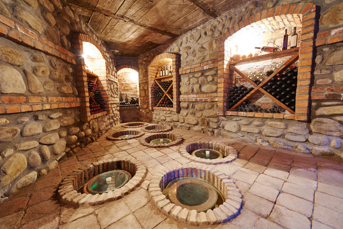
Wine and Chacha
Georgia the birthplace of wine and which some areas still make in the traditional Qvevri fashion in large buried clay pots. Georgia’s pride in their wine will become crystal clear to any hiker as they make their way through mountainous villages and towns and are greeted by the friendly locals offering their homemade “house wine,” chacha or vodka.
Favorite red wine varieties include; Saperavi (the most popular variety of red wine in Georgia), Tavkveri, Mujuretuli, Usakhelouri, Chkhaveri, Ojaleshi, and Shavkapito. Favorite white wine varieties include; Rkhatsiteli, Mtsvane Kakhuri, Kisi, and Tsolikouri. Georgia is also famous for its “amber wines,” a type of heavy white wine that is aged with the wineskins giving it that darker amber color and taste.
Chacha, a Georgian pomace brandy ranging between 40% to 65% alcohol, should be treated with caution and awe. It is otherworldly in its strength and potency and nights have disappeared for many an unseasoned traveler. While women often drink in Georgia, the expectations around this vary from location to location. For instance, it is less advisable for women to drink with villager men alone in the more secluded, and therefore conservative, Tusheti region as it is taken as a sign of romantic interest. However, in many areas of Georgia this is not an issue.
Food
Georgian are incredibly proud of their food and each Georgian dish differs slightly from region to region. There is an even wider variety of regional specific Georgian dishes far exceeding this list.
Some Georgian food staples to try include:
- Khachapuri, is perhaps Georgia’s most famous culinary dish and is a cheese-filled bread with several distinct varieties;
- Imeretian, a circular popover type, which is the most common.
- Adjarian, where the dough is formed into an open boat shape, with the cheese filling being soupier and boat being topped with a raw egg and a pat of butter before serving.
- Mingrelian, similar to Imeritian, but with more cheese added on top.
- Achma, which is more like a sauceless lasagna.
- Gurian, which has boiled eggs inside the dough and looks like a calzone. Gurians make this mostly around for Christmas and call them simply 'Christmas pie'.
- Ossetian, which has potato, as well as cheese in its filling.
- Svanuri Lemzira
- Rachuli khachapuri
- Penovani khachapuri, which is made with puff pastry dough.
- Lobiani is a khachapuri style Georgian dish that is filled with mashed beans instead of cheese. Similarly, it comes in a variety of styles.
- Khinkali, a large Georgian dumpling, which originated in the Georgian mountain regions of Pshavi, Mtiuleti and Khevsureti. Varieties of Khinkali range from meat “mountain style” khinkali to potato, cheese and veggie. The top knots of the khinkali, can be, but are not typically eaten (Georgian’s associate eating the top knot with being a child as that is typically who eats it) and when eating a meat khinkali it is common to take a small bite and suck the juices out of the khinkali before eating the rest of the dumpling.
- Georgian bread, called “puri” is some of the most delicious bread out there and is made in the Tonis Puri, Shotis Puri, Mesxuri Puri, and Mchadi (Fried bread made from corn flour) style. The shotis puri is made in a pit oven, as well as shotis lobiani, and comes in a distinct boat or flying saucer shape.
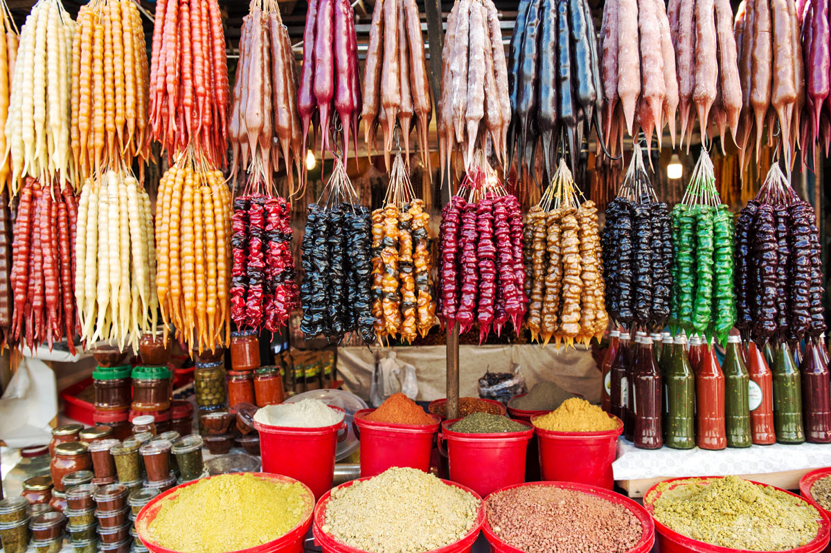
- Churchkhela is a traditional Georgian desert, also jokingly referred to as “Georgian Snickers,” though not an apt comparison (it is more analogous to a kind of trail mix), that is a candle-shaped candy made by stringing together nuts and/or dried fruit and dipping them in a thickened grape juice (though it can be made with other fruits), that has a bit of flour and sugar added to it, and hung up to dry.
Monasteries
Georgians are famous for building monasteries on top of their mountains and many trails, especially day hikes, define their midpoints by what monastery hikers are pursuing. While many Georgians claim that they built their churches there as a strategic way to protect them from foreign invaders, there is no historical evidence for this. Many churches are devoted to Saint Nino, Saint George and David the Builder. Popular day hikes to churches include; Gergeti Trinity Church on Mount Kazbek, Jvari Monastery in Mtskheta, and David Gareja Monastery on Mount Gareja.
Song and Dance
Georgian has undeniably distinct traditions of song and dance. Georgian dance is characterized by the impressive feat of strength and dexterity on the part of dancers and four regional styles of Georgian dance have been placed on the UNESCO Intangible Cultural Heritage List. Similarly, Georgian polyphonic singing has also been placed on the UNESCO Intangible Cultural Heritage List and its roots predate the introduction of Christianity in Georgia in the 4th century AD.
Language
The predominant language in Georgia is Georgian, the most pervasive of the Kartvelian languages with its own writing system, the Georgian script, that finds roots in Aramaic. The remaining Kartveli languages are also found in Georgia and are spoken by the Svans, Mingrelians and the Laz, all in the mountainous villages of Georgia. It is very common for younger populations in Tbilisi to also speak English, however, the older populations are less likely to speak any English, but may speak Russian, which was carried over from their time as a Soviet state. Due to geopolitics, Russian is not a favored language in Georgia, especially among the young populations, few of which will know how, or care to, speak it.
Georgia Ski Resorts
For skiing and snowboarding enthusiasts, there are more than 5 ski resorts in Georgia, which are located throughout the country, but mainly in its northern parts, where you will find most of the resorts, including also the largest of them. It is also one of the main areas for skiing in the Caucasus.
- The largest ski resort in Georgia is Gudauri in Mtskheta-Mtianeti region with more than 35 km (22 mi) of slopes and more than 15 ski lifts.
- Another major area for skiing in Georgia is Bakuriani in Samtskhe-Javakheti region west of Tbilisi with more than 30 km (19 mi) of slopes and more than 20 ski lifts.
- There are also smaller Tetnuldi-Mestia and Hatsvali-Mestia near Mestia, the capital of Upper Svaneti region in the northwest of the country with more than 13 and 5 km (8 and 3 mi) of slope and more than 3 ski lifts each.
- In the Adjara region further west of Tbilisi, there is Goderdzi Resort with more than 9 km (6 mi) of slopes and 3 ski lifts.
- Finally, there is Betania Ski Resort with just less than 1 km (0.6 mi) of slopes and 1 ski lift—the main ski resort near Tbilisi, the capital of the state.
Check the Georgia ski resorts map in the World Mountain Lifts section of the site. It includes information about open ski lifts / slopes in Georgia in real-time with opening dates and hours. There are also year-round cable cars, funiculars, cog railways, aerial tramways, and all other types of mountain lifts.
Major Cities
Tbilisi (pop. 1.2 million)
Tbilisi is the “half-European, half-Asian” capital of Georgia and the largest city in the country and is the ideal place to start any trip in Georgia and is a great base when figuring out your Georgia trip. However, the smog of Tbilisi, especially during its very hot summer months from June to August, will definitely remind any hiker why they love the mountains. ‘Tbili’ means warm in Georgian and during the summer months the city lives up to its name and it is incredibly common for Georgians and tourist alike to retreat to the mountains on the weekends and holidays for respite from the heat. As the largest city it is easy to find hiking and tour guides in any language, as well as a myriad of outdoor retailers, hired cars, accommodations, etc.
Located on the banks of the Kura River, Tbilisi was formerly known as Tiflis, pre-1936 and was founded in the 5th century AD by Vakhtang I of Iberia. The city, much like the entire country of Georgia, is full of historic sites and is famous for its sulphur baths and its historic old town. Tbilisi is also the culinary center of Georgia and is a great place to get acquainted with Georgia’s subtle and regionally specific specialty dishes such as khachapuri, lobiani and khinkali.
The Tbilisi International Airport is located 17km southeast of the city center. Grabbing a cab or the number 37 bus to the airport makes for easy access. If taking the bus, allow for at least an hour to get between the city center and the airport (allot more time for rush hour). The Tbilisi bus system works on a metrocard system exclusively so be sure that you purchase one at the airport, or have a credit card with a contactless payment system, which can also be used. If you want to rely on taxi services while in Tbilisi, it is advisable to download the Taxify or Bolt app to call cabs as taxi drivers are famous for overcharging foreigners in the city.
The marshrutka, or mini-bus system in Tbilisi is expansive, but poorly documented, so most travelers will often have to ask marshrutka times at the Tbilisi’s two major marshrutka stations. Unfortunately, most markshutka and taxi drivers do not speak English and some will overcharge foreigners so hikers should be comfortable with haggling or ask for help from English speaking locals. Tbilisi’s two major marshrutka stations are Didube, which is the hub for north, west and northwest travel in Georgia; and Isani, which is the hub for south, east and southeast travel in Georgia. Georgia also has a developing train system, the quality of which is hit or miss based on the destination. The train to Kobuleti and Batumi is fully developed and the best in the country, however, trains to other locations are more analogous to the old soviet rail trains and are slower and less comfortable. The train station in Tbilisi is called Station Square and the platforms are located in a multi-storied shopping mall. Didube, Isani and Station Square are all accessible by Tbilisi’s metro system, which is broken into two lines; the Saburtalo Line, and Line One, which connects the three stations. The Tbilisi metro operates in both Georgian and English and runs on an approximate 3-minute schedule from 6am to 12am.
Tbilisi City Hikes and Walks
While you are planning your trip throughout Georgia, there are a few city walks and nearby hikes in Tbilisi and the surrounding area that can quell your hiking hunger in the meantime:
- Narikala Fortress and the Botanical Gardens
- Though you are in the city, be prepared for some serious elevation gain as you make your way up the Sololaki hill from Old Town to the Narikala Fortress and the Statue of Queen Tamar.
- You can start the hike in Tbilisi’s historic old town near the Sulphur baths complex at Old Town’s center on Kote Afkhazi Street across from the Metekhi Bridge, which leads to the Meteki Church of the Assumption and the Statue of King Vakhtang Gorgasali that overlooks Old Town. Head up (literally) Orbiri Street towards the Narikala Fortress overlooking Old Town opposite the Statue of King Vakhtang Gorgasali and next to the statue of Queen Tamar overlooking the entirety of Tbilisi. The road will eventually turn into one long series of stairs, once you have climbed to the top there are numerous entries down the opposing side of the hill to the Botanical Gardens, which are open 9am-8pm, Tuesday, Thursday, Saturday, and Sunday, and 9am-12am Monday, Wednesday and Friday. Price for admission is 2gel.
- Vake Park and Nightingale’s Lowland Forest Trails
- If you happen to be in the Vake Park area, you can still reach the top of Mtatsminda through Vake Park in the Vake neighborhood, located off of Ilia Chavchavadze Ave. This is an especially lovely series of hikes etching up the main ridgeline that Tbilisi sits at the base of.
- Go to Vake Park and climb the steps to the World War II memorial. You can’t miss it. It is a large statue of a woman holding an olive branch in one hand and an unfurling cloth in the other overlooking the entire park. Just behind her the Vake Park Trails start and go all the way up to Turtle Lake, a family friendly lake that provides the entrance to the Nightingale’s Lowlands Forest, which is etched with beautiful trails all over the ridgeline and provides a great escape from the city.
- Immediately as you work your way through the Vake Park Trails you will notice the smell of smog recede and be replaced with the smell of the local plantlife. The entire Vake Park area along the hill is cut with thin trails that are less well maintained than it’s higher up sibling of the Nightingale’s Lowland Forest. There is also a great deal of erosion along the trail so take care around nature, and unnatural, drainage points and where shoes with good grip.
- The Nightingale’s Lowland Forest trails are phenomenal and it is hard to believe that such nature, and trails that well maintained at that close to the Tbilisi City center. You can even get a quick break from the city noise of Tbilisi. The trails are wide and can accommodate hikers, horseback riding, cycling and ATV riding. The Nightingale’s Lowland Forest Trails are also incredibly well marked, much better than the Vake Park Trails. At each intersection there are yellow signs indicating the nearby attractions, as well as the estimated time it will take to hike to them. The trail is blazed with a three striped white, yellow, white blaze. The Nightingale’s trail connects the Tbilisi Ethnographic Park and the Svan Tower, with Turtle Lake, with Vake Park and finally with Mtatsminda Park.
Kutaisi (pop. 190,000)
Depending on who you ask, Kutaisi is the second or third largest city in Georgia and the second most important city when it comes to politics and travel. Kutaisi is 221km west of Tbilisi, on the Rioni River and is the capital of Imereti. It was historically the capital of the Kingdom of Georgia in the middle ages and between October 2012 to December 2018, Kutaisi was the seat of the Parliament of Georgia in an effort to decentralise the Georgian government and suppress political unrest.
Kutaisi was historically the capital of the ancient Kingdom of Colchis from the sixth to fifth centuries BC and is believed to be the final destination of Jason and the Argonauts in the epic Greek poem, “Argonautica”. Historic Colchis was also believed to be the home to Medea, in addition to the “Argonautica” Greek myth of the Golden fleece. The Golden fleece myth can actually be traced to traditional gold collection methods in the Svaneti area where sheep’s wool was placed in mountain streams to catch gold flakes. Stories of wool saturated with gold flakes from the mountainous region helped solidify this myth and attest to the rich natural resources of the region.
Kutaisi’s David the Builder Kutaisi International Airport, which is located 14 km west of Kutaisi, is a popular budget friendly alternative airport for European flyer looking to save a few bucks. If hikers from Europe are planning to hike exclusively in the western half of the country, it is advisable that they skip Tbilisi and use Kutaisi as their transportation hub.
Like Tbilisi, Kutaisi relies on a marshrutka and bus system as its main transportation form and Kutaisi is connected to Tbilisi through daily marshrutkas and a Georgian railway train line. Taxift and Bolt are also used in the city.
Batumi (pop. 160,000)
Batumi is known as the Las Vegas of Georgia for good reason. It has the highest per capita of casinos in the country and has built its economy strongly around the gambling tourism industry. Building for Batumi’s tourism industry boomed in 2010 due to a great deal of strategic investment and the downtown marries a variety of different architectural styles that give Batumi it’s incredibly unique look. Batumi is the capital of the Autonomous Adjara region and is the closest major Georgian city to the Turkish border, which is reflected most in its culinary scene with a great many Turkish and muslim-oriented restaurants.
Batumi also has the country’s third, though less used international airport, the Batumi International Airport, and is Georgia’s second largest port city next to Poti to the north, which transports the majority of freight in the country. While many Black Sea ferries travel through both Poti and Batumi, Batumi is largely considered to be the more entertaining of the two ports due to its focus on tourism.
Overall, Batumi is a good hub for hikers interested in exploring the Adjara region or going south to Turkey. The Kintrishi Nature Reserve and Mtirala National Park are incredibly close to Batumi to the East and are the wettest national parks and reserves in Georgia, with the highest percentage of rainfall in the country, creating Georgia’s unique temperate rainforest. There is also a great deal of relaxed beach camping between Batumi and Poti in the Kobuleti area north of Batumi.
Poti
Poti is Georgia’s largest port city, transporting mostly freight, located in the Samegrelo-Zemo Svaneti district. Poti is also a port stop for some Black Sea ferry services, in addition to Batumi. Poti is considerably more industrial than Batumi and not considered to be a tourist hotspot. However, Poti is a good connection point to much of the Svaneti region via local marshrutkas and abuts the Kolkheti National Park, which encompasses the east coast line of Black Sea and Lake Paliastomi basin. The park was created to protect and maintain the Kolkheti wetland ecosystems.