
Scan the QR code and open PeakVisor on your phone
Autonomous Republic of Abkhazia is home to 248 named mountains. The highest is Dombai-ulgen Glavnaya at 4,046 m.
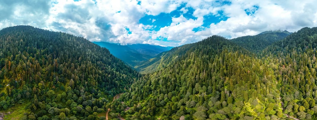
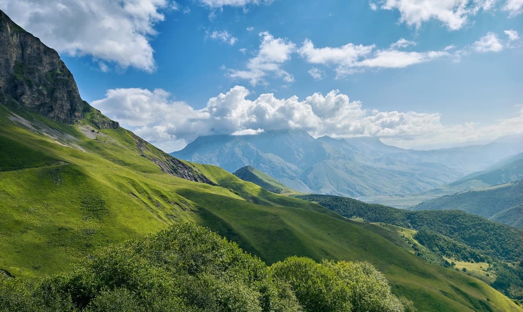
The Republic of Abkhazia is an amazing mountainous country on the shores of the Black Sea. The locals call it Apsny, or the Land of the Soul. Soul or no soul, but it is surely the name of the beautiful mountains, lakes, canyons and waterfalls, the sea and luxurious beaches. Almost 75% of the territory is covered with mountains. In total, there are 248 named mountains.
Abkhazia has plenty of sunny days, it is paradise for long vacations. The country has many landmarks, fertile lands bearing many fruits and the climate is very curative. Mountain air itogether with fresh sea breeze is very rich in oxygen. Isn't that the main reason for the longevity of the Caucasians? In addition, there are a large number of sanatoriums and unique health resorts that cure and heal the body of a large number of ailments.
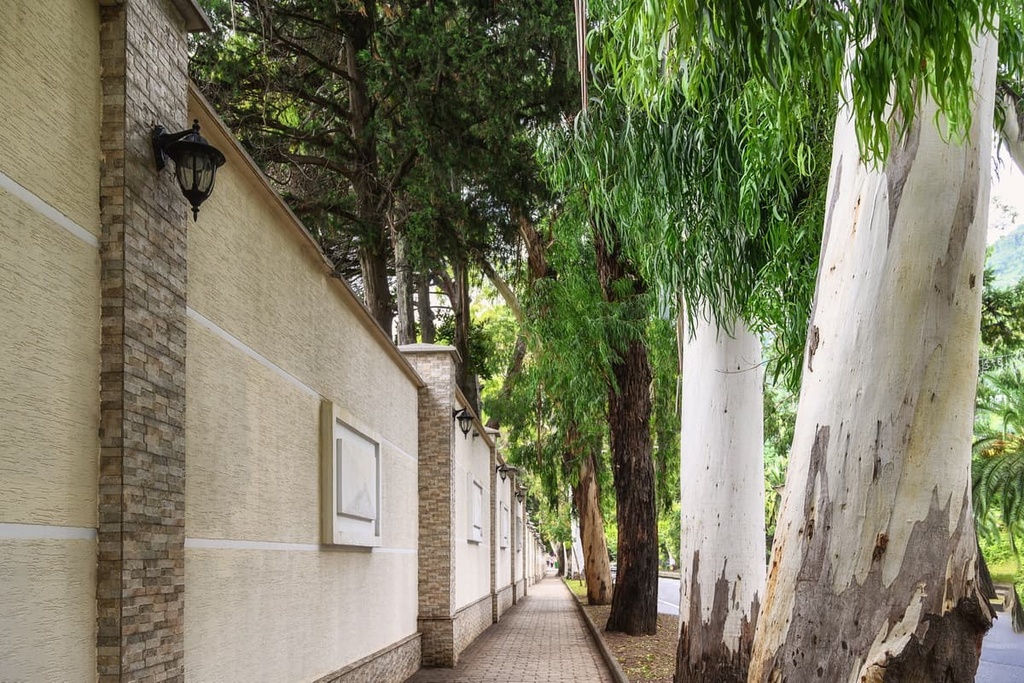
The Republic of Abkhazia used to be a part of Georgia. After the 1992-1993 war, Abkhazia declared its independence. Now its territory is 8650 sq. km, the population is almost 250,000 people. It is recognized as a separate state by some countries, although in the Constitution of Georgia this territory is listed as the Autonomous Republic of Abkhazia. In Abkhazia, there are 8 cities in Abkhazia, 4 urban-type villages and 105 rural administrations, which are actually villages. The capital is now called Sukhum, but better known as Sukhumi as it used to be called during the Soviet times.
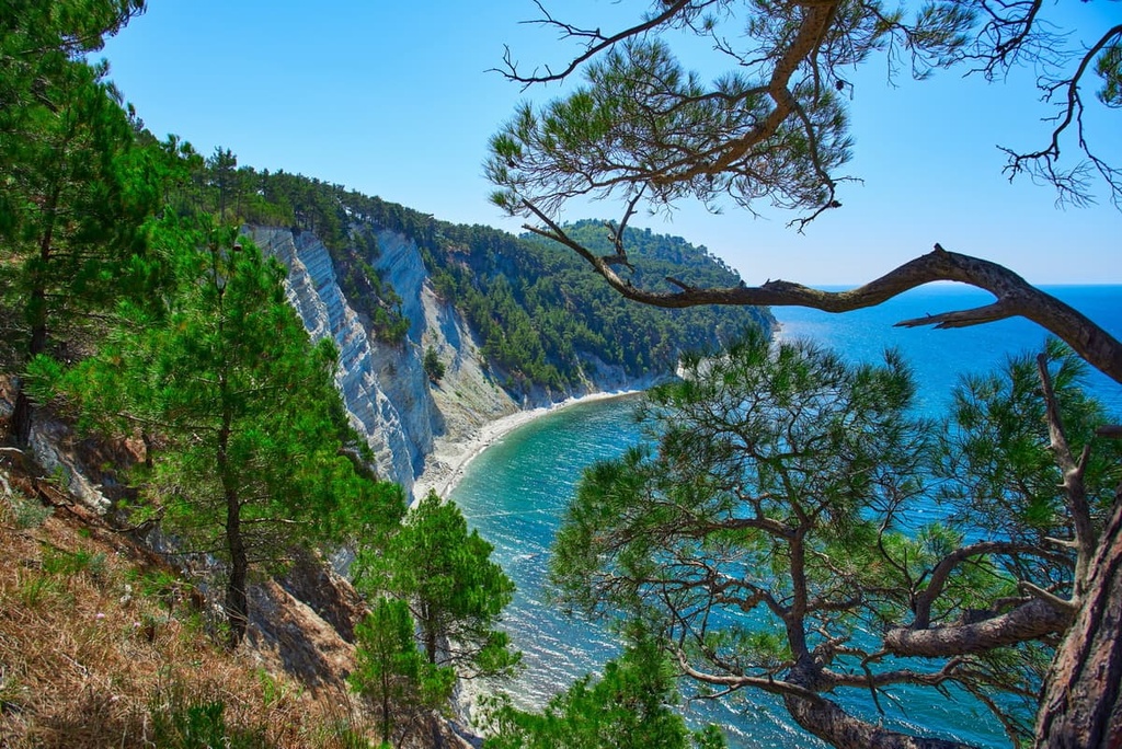
The Republic of Abkhazia is nestled in the foothills of the Caucasus Mountains covered with eternal snow. According to an ancient legend, it was to these mountains that the supreme trickster, Titan Prometheus was chained. He allegedly stole fire from the gods and brought it to the people. Up north, the region borders on the Russian Federation, in the south it neighbours with Georgia, and in the west, the 210-km long Abkhazian coast is washed by the Black Sea.
Almost 75% of the territory is covered by mountains. In total, there are 245 named mounts.
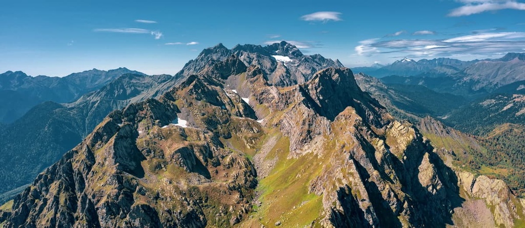
The main ranges of Abkhazia are the spurs of the Greater Caucasus or, as it is also called, the Main or the Watershed Caucasus Range, which limits the republic from the north. Abkhazia has the Ghagra Range, the Bzybsky Range, the Abkhaz Ridge, the Kodorsky Range. The highest point of Abkhazia is Dombai-Ulgen (4,048m). The famous passes here are the Klukhorsky Pass, the Marukh and others. It should be noted that at present the roads through the passes from Abkhazia to Georgia are mined and are constantly monitored by armed patrols, therefore the movement by them is not possible.
From the southeast, the Colchian Depression enters Abkhazia in a narrow strip of the coastline to the northwest of the Kodor River. Between the lowlands and the mountains is a belt of small foothills, with a gentle hilly terrain. Abkhazia can boast of well-developed karst phenomena such as caves, wells, and karst lakes.
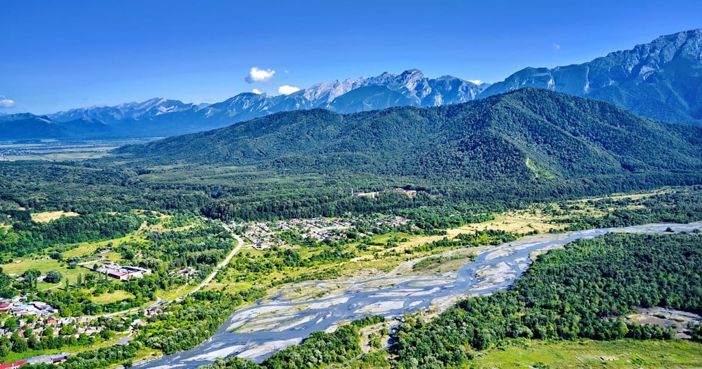
All the rivers in Abkhazia belong to the Black Sea basin and are quite short. The most significant and most abundant ones are the Kodor (or Kudry), Kyalasur, Bzyb, and the Gumista. And the shortest river is the Reprua, which is only 18 m long. The local rivers are mainly fed by rain and snow. Spring and summer floods are quite frequent.
Abkhazia can boast of more than 180 mountain lakes and innumerable waterfalls. Just like in other Caucasian regions, there are many hot springs with a variety of chemical compositions. Each landmark here is unique in its natural characteristics. The amazing scenery attracts lots of travellers here.
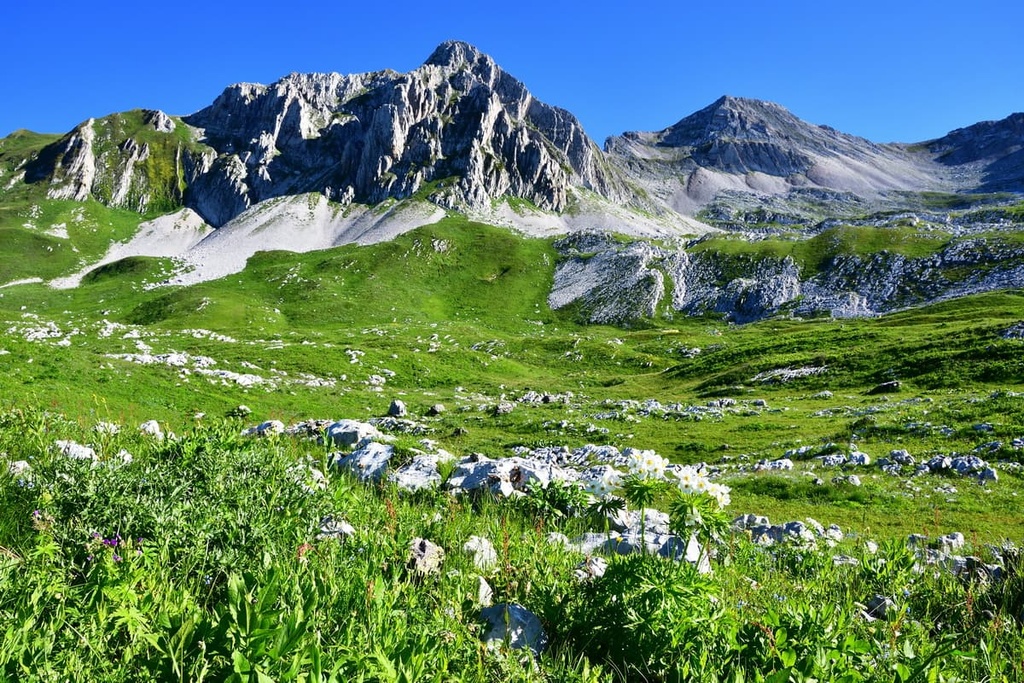
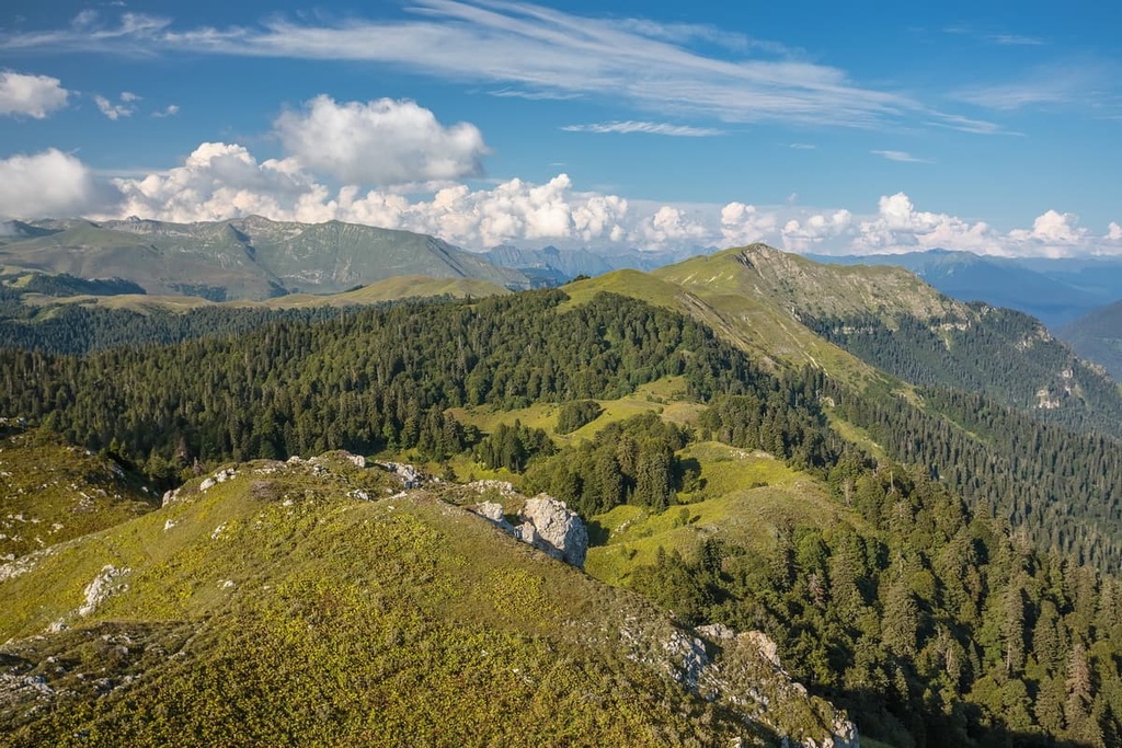
Abkhazia is home to more than 3500 plant species 180 of which are shrub and tree forms, all the rest are herbaceous. About 400 species are endemic growing only in the Caucasus, while over 100 of them can be found only in Abkhazia. A bit more than half the area of the region (55%) is covered by forests. The mountains are covered primarily with beech and boxwood, the upper parts of the slopes are occupied by fir trees and spruces. At higher altitudes (above 2,000m) there are subalpine woodlands, alpine meadows, as well as vegetation typically growing on the rocks and rubble.
The Black Sea coast is most of all developed in terms of cultivated vegetation. On the coast and in the nearby gorges, there are small areas of broadleaved forests with hornbeam (aka witch elm), oak, chestnut, Oriental hornbeam and others. There are also many alder groves. The famous alpine meadows please the eye with marvellous flowers: edelweiss, saffron, pink clovers, goldenrod, delphiniums, yellow telekas and other plants of different colours. There are many fruit grown in the region: juicy Abkhazian tangerines, persimmons, figs, etc.

Abkazia’s largest city and capital - Sukhum - deserves a special mention in relation to flora. It is virtually smothered in flowers and greenery. You can feel its fairy-tale vibe, enjoy bright colours and great diversity of plants. Nowadays, not every big city can boast such an abundance of natural treasures within the city limits. Here grow palms, Himalayan cedars, white cedars, tangerines, feijoa (pineapple guava), cypresses and many more. Raccoons, wild cats, squirrels, deer and fallow deer (Cervus dama) inhabit Sukhum's forests.
Eucalyptus has a special role in the history of Abkhazia. In the past, the local climate was unfavourable for human habitation. There used to be feverish swamps everywhere, thus people had to settle in the foothills. On the plain, the swamps had to be drained. In ancient times, clay pipes were used for this purpose. But this method proved to be ineffective. In the 19th century, people began to use plants in order to manage the drainage. The eucalyptus tree, which is native to Australia, proved to be working best. It can absorb up to 200 litres of water a day! Since the 1920s, the Soviet epidemiologists have actively planted these plants in Abkhazia. You can see them all along the Black Sea coast, especially on the flat areas of the sea resorts. In addition to its high draining properties, eucalyptus emits beneficial chemicals that help disinfect and sanitise the surrounding air. That is why the eucalyptus is sometimes called the "green pharmacy".
Years of hard work led to the disappearance of swamps. But it was not only for the trees alone. An aquatic plant called bladderwort (Utricularia) helped to eliminate the large numbers of malarial mosquitoes. Its bubbles are able to capture mosquito larvae. Another helper in the fight against mosquitoes was the Italian Gambusia fish (aka mosquito fish), which were regularly released into rivers and reservoirs of Abkhazia just to eat the larvae of malarial mosquitoes. It is due to the united efforts of trees, flowers, fish and humans that it became possible to reduce the population of the dangerous malaria mosquitoes (Anopheles) to small sizes.
The Abkhazia animal world is also rich. The forests are inhabited by bear, lynx, red deer, roe deer, wild boar, and high in the mountains live Caucasian black grouse, chamois, the lowlands are fancied by jackals as well.
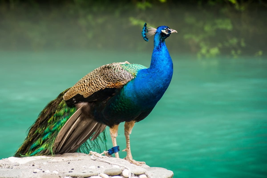
The small island of Blue Lake is home to peacocks who never fail to show off their gorgeous tails.
As for fish stocks, the local rivers and lakes are inhabited by trout, pike-perch, salmon, carp and other fish species.
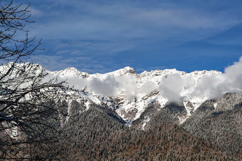
Naturally, one of the first questions tourists ask is what weather will be waiting for them here. In Abkhazia, apart from the calendar time of the year you should also take into account the so-called altitude factor, namely, whether you will be holidaying in the mountains or at the seaside. This is because the temperature can vary dramatically. The climate of Abkhazia is humid subtropical. It is primarily due to its favourable geographical location. The Caucasus Mountains protect it from the cold winds, and the warm waters of the Black Sea provide good weather and humidity. At the same time, the local climate is warmer than in Sochi. Even in winter, the temperature rarely drops below 0°C (32F), which cannot be said about the mountains - frosts there are quite frequent. Gagry is considered to be the warmest place on the coast of the entire Caucasus. The subtropical climate in the mountains, where the division in altitude belts is clearly marked, extends up to a mark of about 400m a.s.l., and at an altitude of 2700m and above there are eternal snows and glaciers, the total number of which is approximately 170.
Summers are warm and winters are quite mild. The average temperature of the coldest month (January) is from +4 to +7°C (39.2-44.6 F) in the valleys and from -2 to +2°C (28.4-35.6 F) in the mountains.
The temperatures in July, the hottest month of the year, vary from +22 to +24°C (71.6-75.2 F) in the valleys and from to +16 to +18°C (60.8-64.4 F) in the mountains.
When travelling, you should take into account some weather peculiarities. The air temperature in summer almost does not change regardless of sunny or cloudy weather. However, this rule does not hold true in the winter. In December, despite pleasant, almost windiless weather, there may be massive avalanches because of the large amounts of snow in the mountains. Yet, you will not see any snow at the Black Sea coast. In January, the weather changes unpredictably and dramatically: the winter sun can be suddenly replaced by cold rain and strong winds. The weather in February can be described in one word - dank (which means chilling to the bone and unpleasantly damp). This last month of winter is the rainiest and the windiest. The weather is quite unfit for recreation because of the high humidity. The cold and dampness is especially felt on the sea coast, where you can be caught in serious storms.
The best season in Abkhazia, also called locally the velvet season, is from September to October. It is sunny, not too hot, the sea is still warm, and the beaches are half-empty.
Abkhazia’s hospitality is renowned. Tourists come here at any time of the year. Each season offers great recreational opportunities for holidaymakers of all shapes and sizes.
With so many mountains in the region, it is impossible to imagine a winter vacation without checking in ski resorts! The impregnable mountain peaks beckon the conquerors-to-be. Beautiful landscapes and mountain air call for good long hiking. You can also visit the thermal springs and mud baths, thereby strengthening the immune system and overall health. Naturally, there are more options to take some quality rest in warmer seasons. You can go on guided tours, go trekking, have multi-day hikes, enjoy paraglider flights, or simply flop out on a beach. Alternatively, you are welcome to visit the famous caves - a paradise for speleologists. But even in winter, there is plenty of entertainment. There are many monuments, museums, and fruit markets. Street cafes are open all year round.
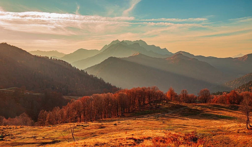
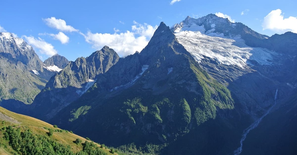
Abkhazia lies in the Western Caucasus, or better say the western part of the Greater Caucasus, a massive mountain chain stretching its beautiful uplands for more than 1,100 km from northwest to southeast. The Caucasus Range extends from the Black Sea near Anapa to the Caspian Sea near Mount Ilkhydag (northwest of Baku). It divides the Caucasus into the Pre-Caucasus (North Caucasus) and Trans-Caucasus (South Caucasus). It is part of the mountain system called the Greater Caucasus (or Greater Caucasus Range).
The highest Caucasian mountain in Abkhazia is Mount Dombai-Ulgen (4,046m).
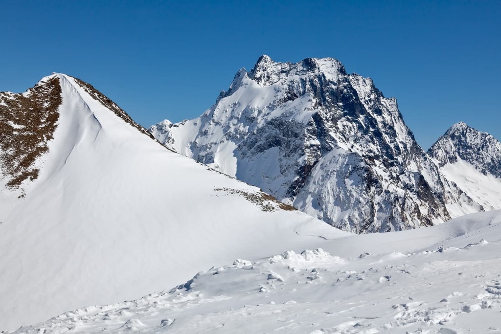
Some sources cite Dombai-Ulgen as the highest peak of Abkhazia, yet technically speaking, it belongs to the Russian Federation (the coordinates are 43.243075, 41.727298). Dombai-Ulgen is the highest peak of the Dombai Territory, which belongs to Karachaevo-Cherkessia (Russia), located east of Dombai village and has three peaks: Western (4,036 m), Main or Central (4,046 m) and Eastern (3,950 m). The name Dombai-Ulgen translates from Karachaevo-Balkar and Kabardino-Cherkessk languages as ‘the river where the bison was killed’. The silhouette of the rocky mount really reminds of an extinct animal that used to live in these parts. You can either climb it from the Russian territory or from Abkhazia.
Geographically, the border runs between Russia and Abkhazia on the Central Dombai-Ulgen. In practice, this means that the northern slopes of the mountain are on Russian territory, while the southern slopes belong to Abkhazia. But the border guards are friendly and do not prevent mountain climbers from ascending the southern face. The climbers' official requests for permits are always satisfied. Another thing to remember, the mountain is part of the Teberda aka Teberdinsky Reserve, which includes the highland area and Dombai village and belongs to the jurisdiction of Karachaevo-Cherkessia, Russia.
The climbing routes to Dombai-Ulgen are considered to be among the most difficult and dangerous ones and are accessible mainly to experienced and prepared climbers. Categories of difficulty range from 2A to 5B, depending on the chosen summit and the route of ascent. The Eastern summit is considered the most difficult to climb.
The classical route to the Central Peak (4,046m) starts from the Dombai Saddle, the difficulty category is 3B, you can also start from Ptyshsky bivouac. The hike requires thorough preparation and skill, as well as appropriate equipment. You should allow at least one day for the ascent. Vladimir Shataev, a Soviet and Russian mountaineer, wrote in his book "The Difficulty Category": According to Vladimir Shataev, a Soviet and Russian mountaineer, there is no exhausting height in the Caucasus, yet instead you get the ascents with mindblowing rock-climbing difficulties. By the time you reach the summit you will leave half of yourself on negative rocks, chimneys, inner corners, cornices, and slabs smooth as glass.
Should you wish for a simpler hiking route, go along the picturesque gorges along the banks of the river Dombai-Ulgen. On the way up, there are interesting natural monuments - a green Russian Glade, the Chuchkhursky Waterfalls, the Ptyshskoye Gorge, etc. You can see many different mountains too. So, in the Russian Glade, take your time to enjoy a wonderful view of the slope of Mount Mussa-Achitar (3,012 m) on the left and Ineh Peak (3,455 m), Mount Dzhuguturlyuchat (3,921 m). Belalakaya (3,861m) and Teatralny Peak on the right. If you look back, you can see Mount Sulakhat (3,439 m), which covers the gorge, and the top of Mount Semenov-Bashi (3,602 m).
One of the most popular peaks which offers great views over Dombai-Ulgen is Mussa Achitara (3,012m). Anyone can climb Mussa-Achitara because there is a cable car to the top.
Dombai-Ulgen is located near the confluence of the mountain rivers Dombai-Ulgen and Alibek into the Amanauz. The mountain has glaciers on its slopes, which feed large mountain rivers. To the north of the mountain there is a pass called Dombai Saddle, popular among mountain climbers.
The Dombai Glade is a perfect viewing platform to see the majestic Dombai-Ulgen. There is a resort village of the same name, it has become the centre of tourism and mountain climbing in the North Caucasus.
Nestled between the rivers Bzyb and Psou is the Ghagra Range. It is located on the southern slopes of the Greater Caucasus and almost dives into the Black Sea near the town called Ghagra. It looks as if a giant has come to pay his respects to sea waters. Rivers flowing down from the Ghagra Range form deep valleys and canyons. The Range is famous for its multiple karst phenomena. The highway to Ritza Lake runs along the valleys of the rivers Yupshara, Bzyb and Ghega.
The highest point of the Ghagra Range is Mount Agepsta (3,259m), pronounced with hard ‘g’ as in ‘golf’. Actually, different sources give different estimates ranging from 3,256 to 3,263m. Located on the border of the Krasnodar Territory (Russia) and the Republic of Abkhazia, the beautiful mountain is a favourite place for climbers and experienced tourists. The rocky cliffs at the top are telling travellers to be thoroughly prepared if they want to conquer this naughty peak. Bear in mind that you should climb only when the weather is good.
On the southern slope of the mountain, there is a wonderful karst lake, stunning views of which can be seen from any point of the trails. Next to the lake is the Ghegsky waterfall near which you can have a snack in a cafe and have a rest.
The northern slope is much steeper. It is home to several karst glaciers that feed the Dolgaya and Tikhaya Rivers - the tributaries of the Mzymta River. Scientists believe that at the beginning of the last century there was one big glacier on Mount Agepsta - the famous Hims-Aneke. However, climate change led to its division into several parts. From the outside, the glacier looks like a huge white mass over 1.5 km long, its lower part descends down to 2,400m a.s.l. In recent years, the glacier has increased, becoming more and more impregnable.
The combination of dazzling white snow sparkling in the sun and lush green grass on the slopes of the mountain seems amazing. It's as if winter and summer live in perfect harmony here.
The name of Mount Arabika (2,661m) may remind you of coffee, yet it has nothing to do with the famous drink. Arabika is located near Ghagra town. The mountain is bounded in the north and east by the canyons of the Ghega, Kutu-Shara and Bzyb rivers, in the southwest by the Black Sea coast, and in the west by the Sandripsh and Khashuapse river valleys. There are a lot of mysterious caves here, hiding in the depths of Mount Arabika, including the deepest cave in the world - the Krubera-Voronya Cave.
Mamdzishkha Mountain (1,878m), aka Mamzishkha, Mamzishka, is just six kilometres from Ghagra town. Its name means ‘a mountain of the Mamdzaa tribe’ in Abkhazian language.
Mamdzishkha Mountain is followed by the Mamdzishkha Ridge, along which you can get to the amazing Blue Lake. There is a winding 30-km long serpentine to the top of the mountain. In Soviet times, it was almost all covered with asphalt. At that time it was planned to create a ski resort with hotels on the mountain. Despite the fact that the ski complex was never opened, this place still attracts travellers. Along the road, there are several viewing platforms at different heights, they allow you to enjoy the gorgeous views of the sea, mountains, the Russian city of Sochi and the nearby towns of Abkhazia - Ghagra and Pitsunda. Along Mamdzishkha Mountain also run the main roads that connect Abkhazia with Russia.
Diprish Mountain (919m) is located near village Achandara. It is considered sacred and is the most significant of the seven sanctuaries of the Republic, which are revered by the traditional religion of the Abkhazians. Mount Didripsh is the site where prayers are held.
The development of skiing in Abkhazia is on the rise. The main thing is that the region has everything necessary for it to become one of the best ski resorts in the Caucasus, namely mountains with snow-covered peaks. The best ski resort towns in the region are as follows:
Abkhazia is paradise for freeriders and experienced skiers who prefer natural elevations. Fans of extreme sports should go to Arabika, Mamdzishkha and Auadkhara mountains.
You can combine skiing at ski resorts with ski touring. Such tours are in increasing demand every year. Skiing season begins in mid-November and lasts until mid-April. From Abkhazia, you can easily reach the Russian ski resorts of Krasnaya Polyana, Arkhyz and Dombai.
The mountains and highlands of Abkhazia keep many secrets among which are many caves hidden from a prying eye. Abkhazia is home to the deepest caves in the world - the Kruber-Voronya, Verevkina, Snezhnaya, and Sarma. The Krubera-Voronya used to be called the deepest karst cave in the world, its depth is 2,080 m. It is located in the Ghagra Range close to the border with Russia. It had the title of the deepest cave on the globe until it was surpassed in its explored size by the Verevkina Cave. Scientists have found that the latter is 2,197 m deep. The Verevkina Cave is located on the plateau of Mount Arabika, also belonging to the Ghagra Range.
Unfortunately, regular tourists are unlikely to see the above-mentioned caves because they are closed for ordinary visits. Recently, only participants of scientific expeditions, as well as groups of speleologists are allowed access to the caves. However, if you have a great desire to get there, you can become a member of any caving team. Guided tours take place every year. If you cannot join them, visit other caves of Abkhazia, open to the public and specially equipped for this: the New Athos Cave, the Abrskill Cave, the Mchishta, St. Ipatius’s Cave, Otapa's Head Cave. The New Athos Cave is the most visited cave in Abkhazia.
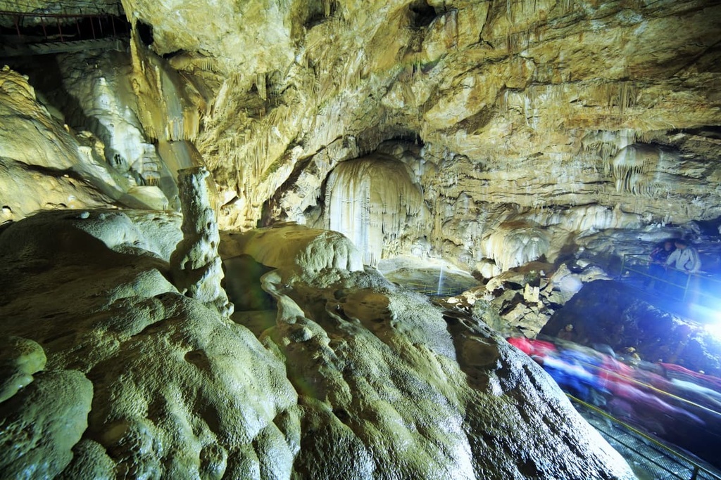
At its entrance, there plays some melodious music which immerses tourists in the atmosphere of a fairy-tale underground kingdom. Interesting mineral formations and the shores of underground lakes are equipped with colourful illumination. Even in the summertime, take some warm clothes because even on the hottest days the air temperature in the cave does not rise above 14°C (57.2F).
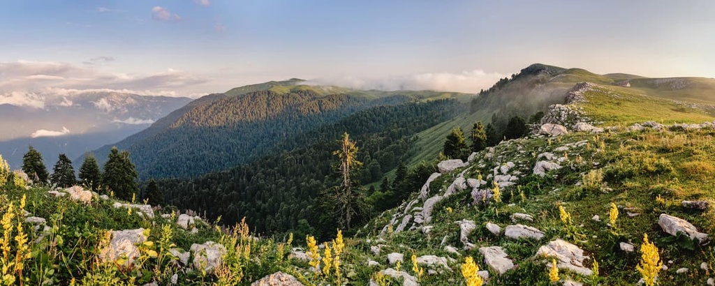
The specially protected natural territories of Abkhazia occupy about 10% of the country’s land. They are designed to preserve the ancient pre-glacial flora.
The state protected areas include:

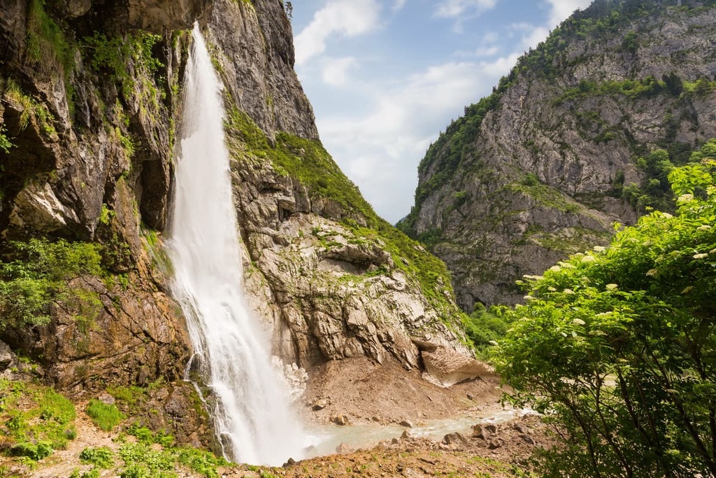
Those who have been to Abkhazia talk about the amazing beauty of numerous waterfalls. Most well-known are the Bird's Waterfall, the Maidens’ and Men's Tears Falls, and the Milk Waterfall. But besides those there are others in Abkhazia, which are not so easy to get to.
These waterfalls include the Ghegsky Waterfall. It is a fountain which comes out in the middle of the rock. The road to it winds along the river Ghega. It takes travellers to the northern spurs of the Ghagra Range to an altitude of 530m a.s.l. The waterfall is located 6 km from the confluence of the river Ghega with the river Yupshara. By the way, the waterfall was the background for one of the scenes in the Soviet film "The Adventures of Sherlock Holmes and Dr. Watson", the film was highly appreciated by the British Queen Elisabeth II, who awarded the actor with the Most Excellent Order of the British Empire in 2006 for his role of Sherlock Holmes.
In eastern Abkhazia near the town of Tkuarchal, there are beautiful waterfalls called the Akarmarsky, Irina, and the Velikan, which are also accessible to visitors.
Another attraction, the Olginsky Waterfalls, is located 20 km from Sukhum, in the Tsebelda Gorge. The place is truly magical, you get into a lost world with abundantly growing ferns and lianas. There is a park with waterfalls, bridges, equipped paths, and an observation deck for comfortable walks here.
The lakes of Abkhazia are beautiful, most of them are of glacial origin and are located in the mountains at high altitudes. Due to their unique location on the slopes of the high mountains, the lakes have many endemic plants.
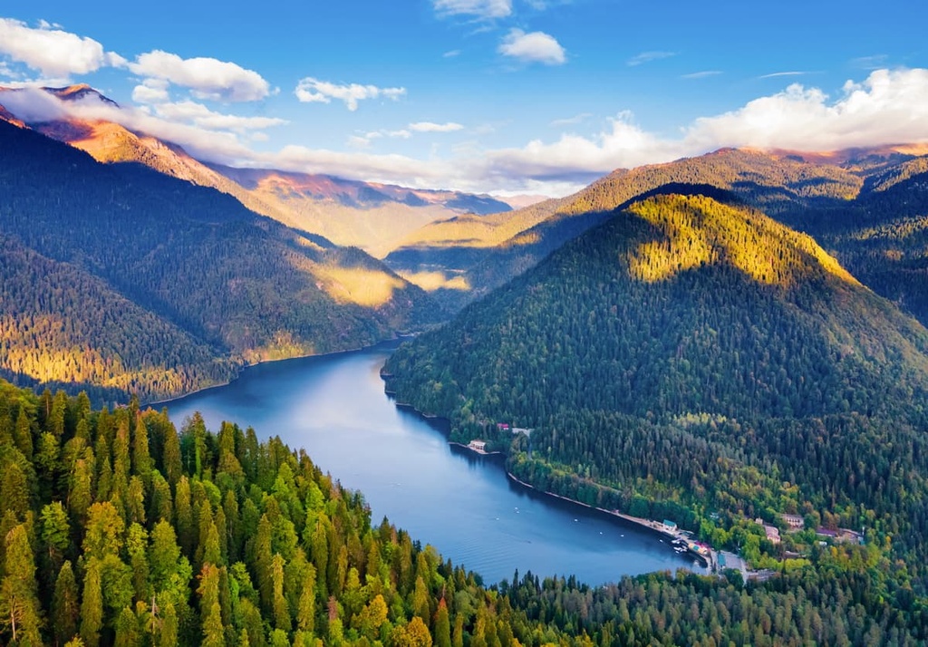
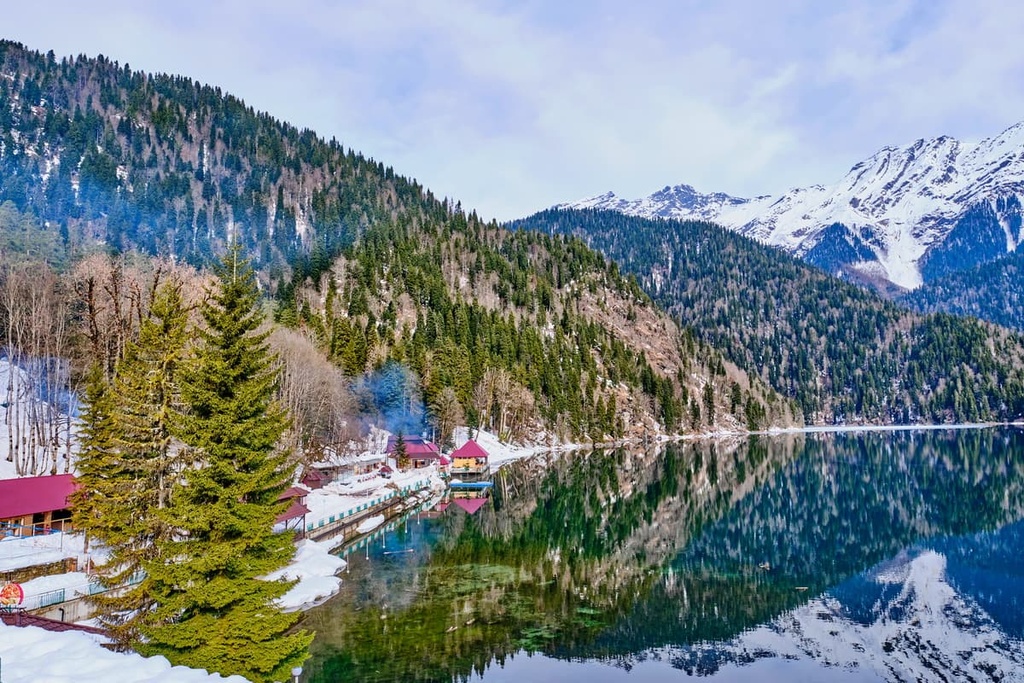
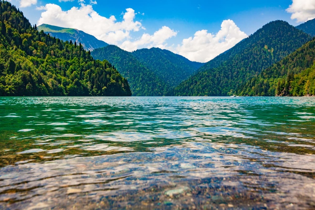
Lake Ritza is a must-have stopover when you are travelling in Abkhazia. It is rightfully called one of the main attractions of this country. Lake Ritza is located at an altitude of approximately 1,000m a.s.l.. There is a sad old legend about three brothers turning into three mountains - Agepsta, Atsetuk and Pshegishkha - when they heard about the poor fate of their sister Ritza. Anyway, those mountains serve a perfect backdrop for the charming beauty of the lake.
Other popular lakes include Lake Mzy, Blue Lake and the picturesque Gali Reservoir.
The Valley of Seven Lakes probably offers the most staggering sight in Abkhazia. It is sometimes called a mountain fairy tale of the Caucasus. Actually, there are twice as many water bodies as the name suggests. But all 14 lakes appear only during the active snow melting and rainy season, in summer some lakes can not show themselves to a casual traveller. The Seven Lakes Valley is located at an altitude of 2,450m, so it is always cooler here than on the plain or the Black Sea coast. The Abkhaz people call this place Agura Adziakua.

All the lakes are of different sizes and depths. The most impressive of all is Lake Sultan Idzia, which is the largest in the Valley. According to a legend, the lake was named after a man who lost his leg in war. He made a bet with his friends that no matter what it would cost him, he would swim across the lake, and he successfully did so. Table Lake (or Astoldza) is also worth mentioning. If you look at it from the side, you will see a small island in the shape of a rounded table, hence the name Table Lake.
The guide to the Valley of Seven Lakes will tell you an interesting legend about the dwarfs who once lived on the territory of Abkhazia and left behind dolmens or atsanguars - constructions that look like stone fences.
The route to the Valley of Seven Lakes is 4-6 km on the well-trodden path. If you do not want to go on foot, you can ride a horse or take a jeep for some part of the way. The route goes through the whole Ritza Reserve, that is why you can capture great sights of Goluboe Lake, Malaya and Bolshaya Ritza, the Chkha Pass, the stone bag of the Yupshar Gate, as well as mineral springs of the Audkhara resort.
Abkhazia is famous for its mineral water springs, which are typical for the Caucasus Mountains. There are about 30 hot springs with various healing powers. The most famous of them are the thermal springs in villages Kandyg, Besletka, Merkhiaul, the mineral springs and muds in Ghagra, Tkuarchal, Tskuara (springs near Gudauta and New Athos), Babushera, the hot spring in Esher.
You can get to the Republic of Abkhazia by plane, train and car. Abkhazia's own airport currently does not operate foreign flights, so you can take a plane to Sochi international airport and fly from there. There is only 10 km to Abkhazia from Sochi, and a very easy bus transfer.
Sukhum takes trains coming from many Russian cities: Moscow, St. Petersburg, Rostov-on-Don, Armavir, Lipetsk, Ryazan, Voronezh, Krasnodar, Tver, and Tula.
Alternatively, you can also get to Adler, whose railway station operates about 30 daily trains, and then take a shuttle bus to the border with Abkhazia. This option is often considered by tourists in the off-season when the number of trains to Abkhazia significantly decreases. By the way, the train makes stops at all popular Abkhazian resorts: Ghagra, Novy Afon and Gudauta.
Since August 2010, there was resumed the sea connection between Russian city Tuapse and Abkhazian Ghagra.
Russian citizens do not need a visa to enter Abkhazia.
There are some things to bear in mind when you are planning your stay in Abkhazia.
It is highly recommended to negotiate all prices in advance, no matter what it concerns: a cab ride, excursions, accommodation in the private sector, etc. And don’t be shy to haggle in the market!
You should avoid walking in swimming wear (suits, trunks, bikinis) on the street and in public places. You will hardly see the local men even in shorts in public places. They only wear shorts or trunks when swimming in the sea. Preferably, the main parts of the body should be covered and the clothes should be below the knees.
It is also not welcomed to openly express their emotions and feelings in public, try to do all your hugging and kissing not in the public eye.
The traffic rules are not always followed. So be careful when crossing the road. It is also better not to leave your car unattended for a long time. If possible, use the hotel or paid parking for the night.
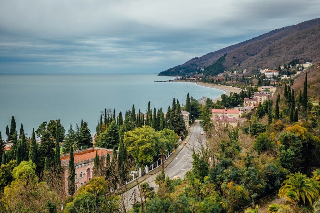
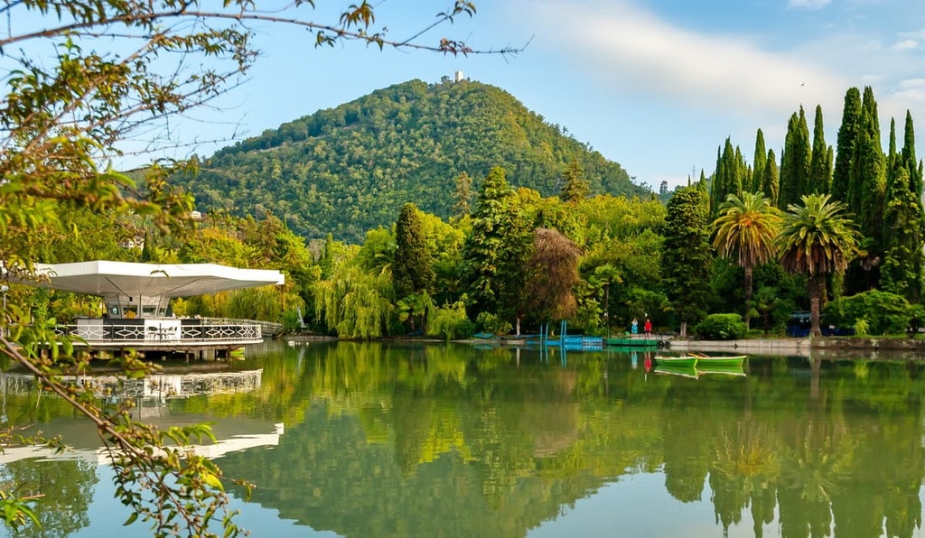
The snow-white Sukhum, or Sukhumi - a more usual name for people living on the post-USSR territory - lies against the backdrop of magnificent mountain ranges. The city is located on the shore of the Sukhumi Bay, and is surrounded by two rivers - the Kelasur and the Gumista. In the north, there are mountain peaks.
The panorama of Sukhum

The city was founded in the 6th century BC, thus it is one of the oldest urban settlements in the world. In the old part of the city, there are many historical monuments that attract tourists: the Sukhum Fortress, the castle of the great Bagrat III, watchtowers of the sultan’s personal bodyguards (janissaries), the Bzybsky Temple and many others.

Leon Avenue is one of the most beautiful streets. It links Mount Trapezia and the sea. It's not just a street, but a real open-air museum! The sights found here are many: the Philharmonic, the Botanical Gardens, the world famous monkey nursery and a monument to the monkey installed on the nursery’s territory.
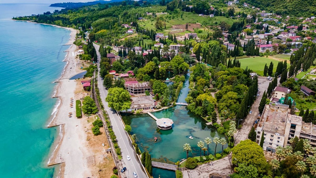
A stroll along the Makhajirs Embankment and the Dioscuros Embankment will make you feel the ancient atmosphere of the city. The embankments are lined with old houses and monuments. The sandy sea beaches stretch for 10km within the city limits. In the centre of the city, they are well maintained but once you set your foot out of the city premises, beaches become ‘wild’ - there are no facilities, but also there are no people, the nature is pristine and it is much quieter than in the city.
You can be offered to admire the underwater world and even see the ancient city Dioscuria. This city was swallowed by the sea a long time ago - more than 2000 years ago, but its remnants have survived over the centuries well.
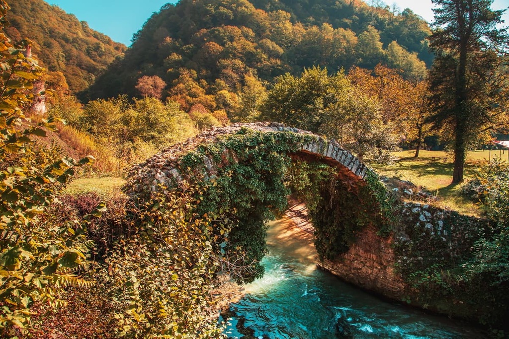
A large number of interesting natural monuments are located in the picturesque surroundings of the capital: the Bagrat Castle, Beslet Bridge over the river Baslu, the Sukhum lighthouse, the latter was made in France.
You can see the panorama of the city and the beautiful views of the surrounding ranges by going up into the mountains - either on horseback or on foot. Mount Sukhumskaya (Samata) is modest in comparison to the other peaks, just 201m high, but it towers over the city and from its summit you can have a marvellous view over Sukhum Bay, Sukhum itself and the surrounding ranges. There is another mountain near the town - Trapezia (Hathua) - it also has a good viewpoint.
The most popular way to travel around the city is by bicycle. You can ride a bike here all year round!
As for entertainment and shopping options, there is a theatre, billiard clubs, fitness centres, and mineral spring spas. Sorry if you are an avid party- or club-goer, clubs are virtually nonexistent here. There are also no shopping malls, boutiques and supermarkets. But there are private farmsteads and a very nice market in Sukhum.
To begin with, Ghagra follows the same fashion as Sukhum about its name. Which is correct: Ghagra or Ghagry? The name Ghagry became common a long time ago and was widely used in the Soviet times, the same as Sukhumi and Batumi. But in the Abkhaz language the form is singular - Ghagra. That is why, since the country gained independence in 1994, the official name has been Ghagra.
The city is located 70 km from the capital of Abkhazia. A relative of the Russian Tsar Nicholas II, the Russian General Prince Oldenburgsky is considered to be the founder of the city. The prince built a castle on the seashore and then a balneary clinic.
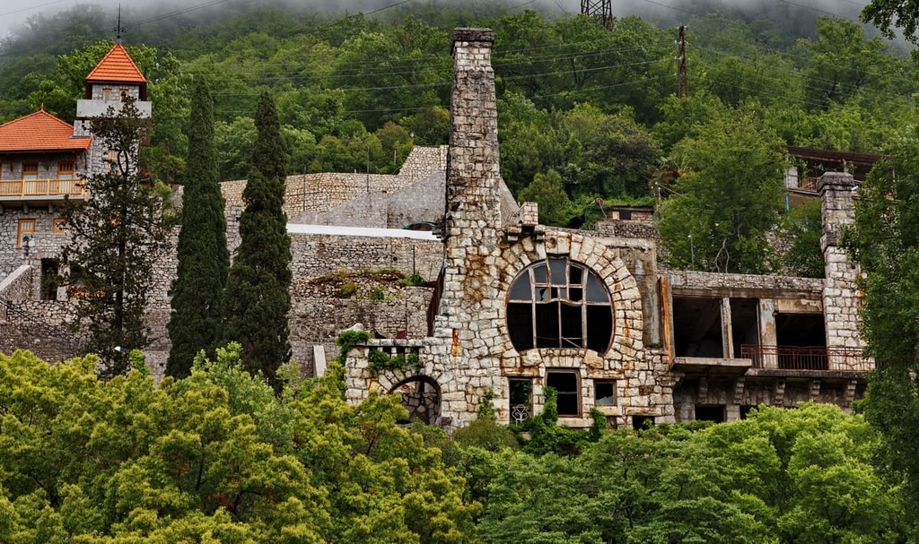
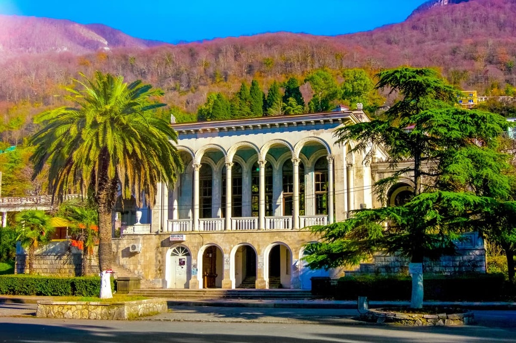
In the old days, the Russian aristocracy used to come to Ghagra for vacations and spa treatment. Villas, gambling houses and mansions began to appear along the seashore. After Tsar Nicholas II visited the Russian resort, a seaside park was laid out. Nowadays, Ghagra is a resort area of Abkhazia. There are guided tours to the old part of the city where many historical monuments are preserved. It is worth visiting the Abbott Castle, not far away from the Prince’s Castle. Among the architectural sights are an abandoned Sanatorium Gagripish (former name Georgia), the Colonnade, and an abandoned theatre of Ghagra (the Winter Theatre). If you are a fan of steampunk photoshoots, there are the spots to visit.
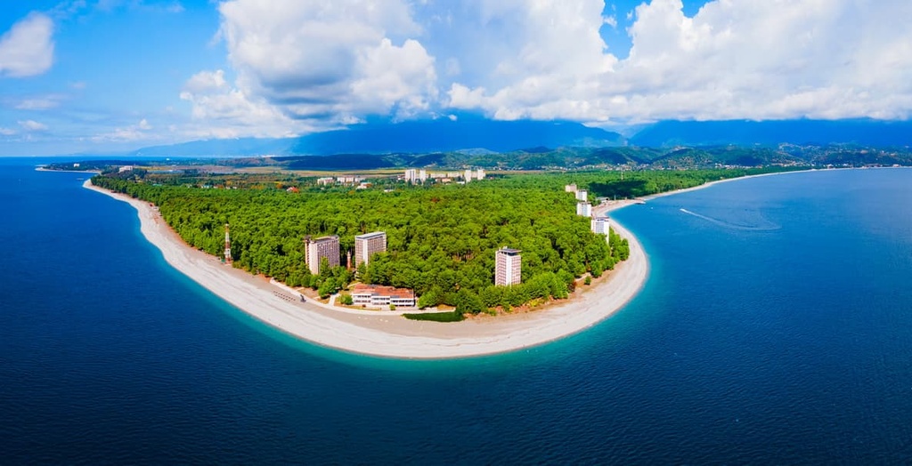
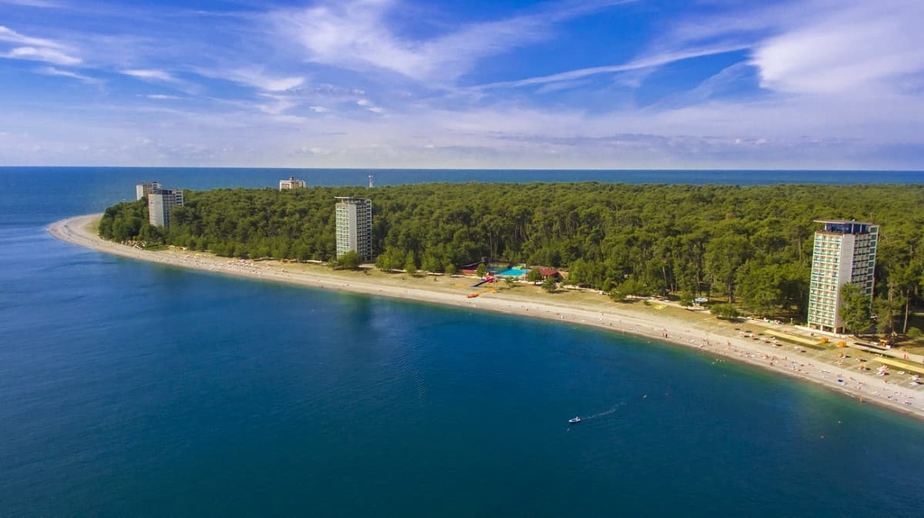
Another amazing town in Abkhazia is Pitsunda. It is located 25km from Ghagra and is famous as the city with the cleanest sea water on the entire Black Sea coast.
In the heart of the city, there is a historical and architectural reserve called the Great Pitiunt. It represents a part of the ancient city which was built by the Greeks and the Romans around 200 AD. Pitiunt is the ancient Greek word for the modern name of Pitsunda, it means pine. In ancient times, the entire cape was covered with pine forests, due to which the town got its name. Holidaymakers can see the preserved stone walls that surrounded the mediaeval settlement, temples, watchtowers, and many other attractions of the town.
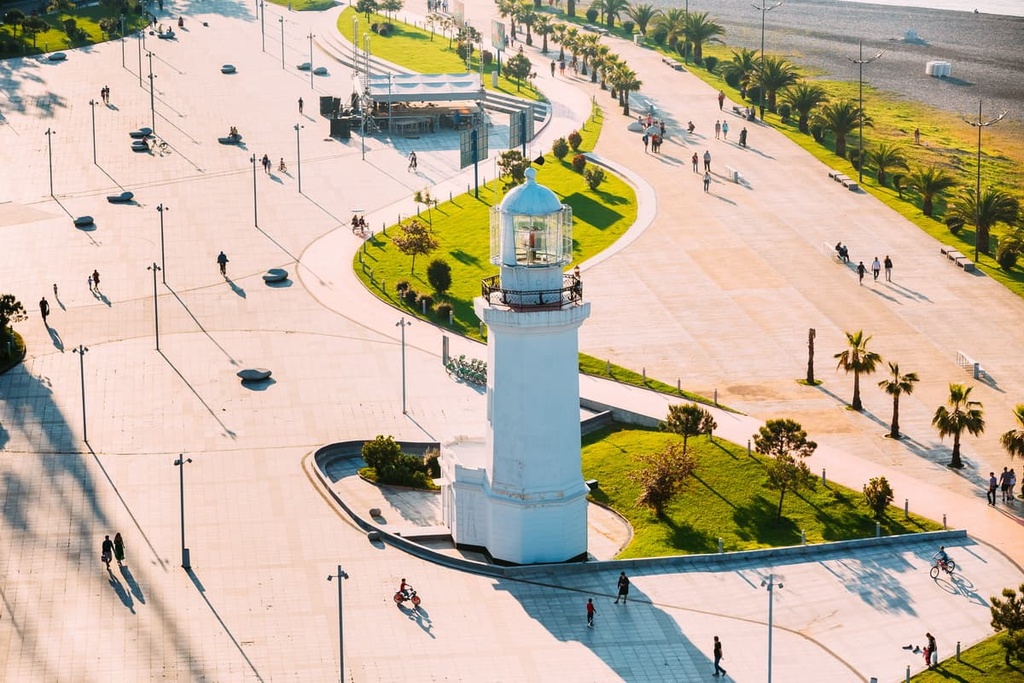
The old lighthouse is now out of service, but it is a charming landmark of Pitsunda.
The Lighthouse in the Wonderland Park in Pitsunda
Pitsunda is also home to many modern monuments and a dolphinarium.
In the vicinity of Pitsunda, you can visit the Pitsundo-Musser Reserve, on the territory of which grow relict pines listed in the Red Book. You can enjoy a walk through a bamboo grove as well.
Novy Afon aka New Athos is not just a town, but a real collection of Abkhazian attractions! It is located at the foot of two hills: Mount Iverskaya (365m) in the west and Mount Afon or Athos (or Mount Akoui) in the east, please do not confuse Abkhazian Athos with the sacred mountain of the same name in Greece (2,033m).
Iverskaya Mountain hosts a natural treasure - the New Athos Cave. And if you climb to its top, you can see the remains of Anakopia Fortress. The ancient city Anakopia used to be the capital of the Abkhazian kingdom back in the 770s. You can see a well-preserved temple inside Anakopia Fortress.
>
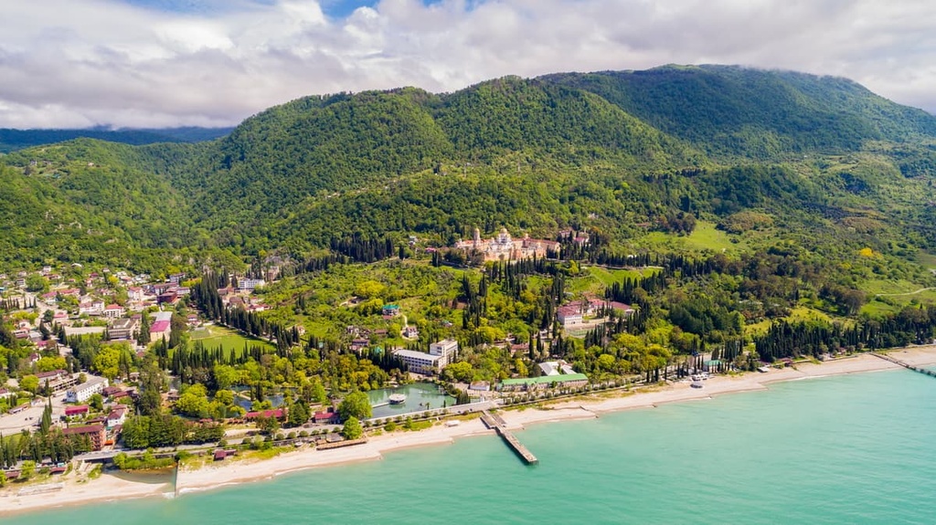
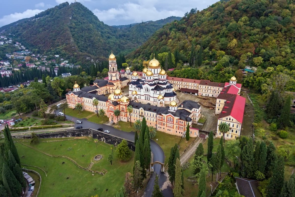
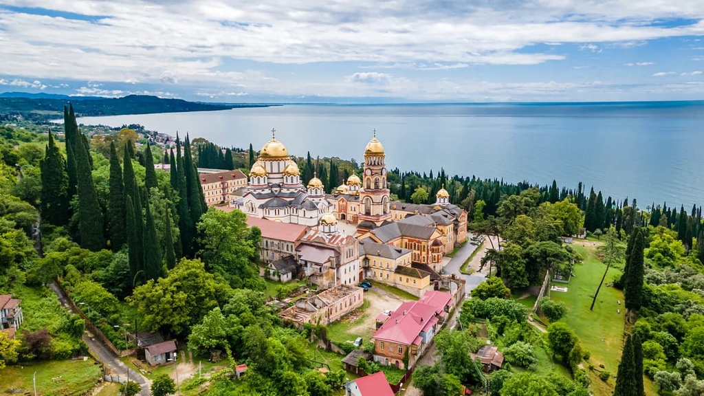
On the slope of the neighbouring mountain Akuyi rises the New Athos Monastery. Behind it, there is Stalin's dacha (country house).
The Psyrtskha River flowing between the two mountains is also adorned with numerous sights. On the bank of the river, there is a museum of the Abkhaz kingdom, the church of St. Simon the Zealot (Simon Kananaios, one of the 12 apostles), a picturesque gorge with the grotto of St. Simon, as well as a fragment of the railroad with a station.
Fans of calm and measured rest will like the park stretching along the Black Sea coast.
Overall, Abkhazia leaves a good impression for a long time and there is a high likelihood you would like to visit sunny Abkhazia again.


Yes. Autonomous Republic of Abkhazia has 248 named mountains. The highest is Dombai-ulgen Glavnaya at 4,046 m.
The highest mountain in Autonomous Republic of Abkhazia is Dombai-ulgen Glavnaya, at 4,046 m.
Autonomous Republic of Abkhazia has 248 named mountains.


