
Scan the QR code and open PeakVisor on your phone
Kakheti is home to 346 named mountains. The highest is Tebulosmta at 4,492 m.
Tusheti is one of the most remote and untouched parts of Georgia with its own unique culture, traditions, and food. If you are looking for a less crowded and more culturally unique option for hiking in Georgia, Tusheti is the perfect place to go. Especially throughout the month of August there are a variety of unique and fascinating Tushetian celebrations throughout every village in the region that will give hikers a glimpse into a little seen culture that have retained much of its ancient pagan traditions and even pictorial writing system.
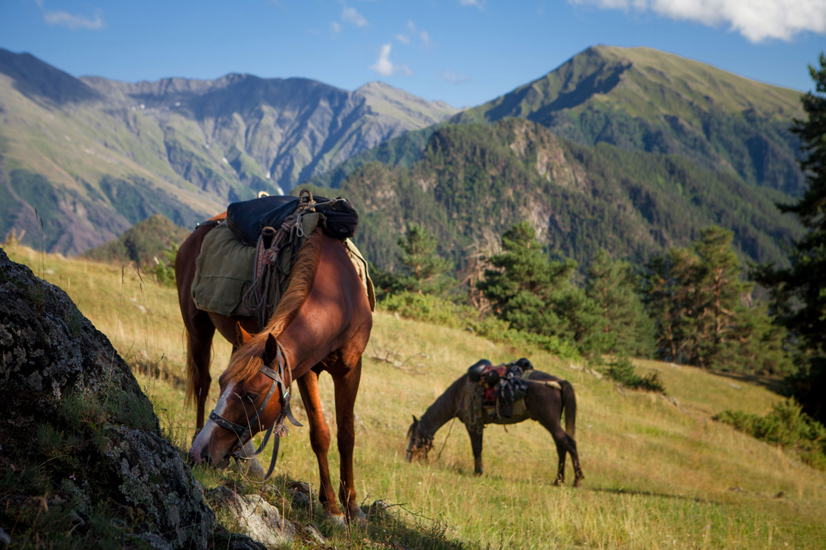
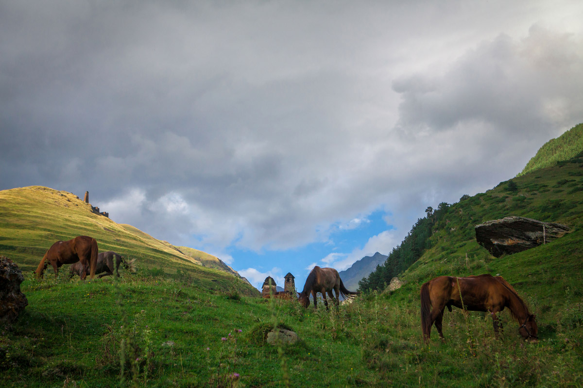
The region covers only 969 square kilometers and is home to approximately 48 very small, unique Tush villages that range in size from less than a handful of people to no more than 40 yearly residents. The population of Tusheti has declined significantly over the past 100 years. In 1897 the Georgian census found 4074 permanent inhabitants in Tusheti, but by 1989 that number had dwindled to 101. Not only is it the country’s most isolated region, it is also inaccessible by car for much of the year when the mountain passes get completely snowed in. Even after the snow has melted many parts of the road are damaged and require maintenance, therefore the road typically opens around mid May. The Tusheti region is home to the Tush, or Tushetian, people, a semi-nomadic group of Georgians who live in Tusheti during the summer months and travel back down the mountain passes in the fall, typically around mid October, to live in the lower regions of Kakheti. For the summer months, local Tush bring their flocks of sheep and cattle up the mountain passes to graze with their Tush horses, a breed of horse that is small, but incredibly fast and strong and is unique to the area. Many Tush cultural activities and legends involve horses and there are a variety of horse-packing tours and routes available to visitors in the summer.
During the winter months upwards of 15-20 people live in the entire Tusheti region total, mostly men, but a few women as well, and occasional government helicopters are flown in to deliver supplies. For Tushetians, the helicopter transports are free and provided by the government, who is very supportive of the unique Tushetian culture and want to support those who choose to stay throughout the isolating winter months. For example, one of Georgia’s highest permanent settlements located in Tusheti, Bochorna (2345m), is considered by Tushetians to be Europe’s highest permanent settlement (rivaling the other highest settlement in Georgia, Ushguli) purely because it is inhabited year round by one doctor. While it is possible to get to Tusheti in the winter via helicopter for foreigners or Georgian non-Tushetians, you will likely have to find a local Georgian who can help you set up the trip and knows the area well. You will also have to pay for the trip, which can be quite expensive.
An interesting aspect to the Tusheti region is that only native and ethnically Tush people can own land there, meaning that the villages have been inhabited by the same families for hundreds of years. If a non-native Georgian, for example, wants to have property in Tusheti they have to lease the land and they must have support from the whole community as to its use. It is nearly (if not completely) impossible for an outsider to own a summer vacation home in Tusheti, rather the property must be used for the betterment of the region either culturally or economically. This is typically done by having a local advocate to help in the development of any given project.
Male and female groups are also more separate in Tush culture than in the rest of Tusheti, even compared to the more conservative parts of the Svaneti region, so certain village locations and parts of traditional celebrations are separated between the genders. In some of the most conservative parts of the region even local women cannot own property and women are typically not allowed to step foot on sacred spaces in the region. Trekkers will see many signs in Georgian, Russian, and English stating that women may not step foot in certain religious sites.
Another interesting aspect of Tusheti is that due in part to its remoteness, the region is more dependent on sustainable practices than most places in the world. Back in the Soviet era there was an attempt to power the entire region through traditional powerlines, however, the ruggedness of the region made maintaining the power lines far too costly and now the entire region is speckled with the remnants of long dormant Soviet power lines. Now, the region relies on solar power, which has been well funded by the Czech Development Agency. This, of course, means that the power at local guest houses is all dependent on the weather. Similarly, a few places rely on solar energy to heat water, but many places still use old systems of building fires below water tanks to heat water for showers and cleaning.
The road to Tusheti is considered to be one of the most dangerous roads in the world. Not only are all roads in Tusheti dirt, Jeep tracks, so they take a long time to drive through and are extremely bumpy, the road leading up to and through Tusheti traverses high mountain passes with steep, unforgiving drop offs. Almost every year, unfortunately, a car, and lives, are lost to the roads. If you are prone to car sickness ask to sit in or near the front of the car as the back of the car is the roughest part to ride in.
Getting to Tusheti via car or with a tour group from Tbilisi is the most common way to enter the region. The cost of a car from Tbilisi cost 70-75 Gel and can be found at the Isani bus and metro station (look for the large Delicas). These will leave when they fill up and do not work on a fixed schedule. You can also get a car from Telavi for 60 Gel and Alvani for 50 Gel.
While you are in Tusheti, all you need to do is ask for help finding a car out of the area from a local guest house owner. The communities of this region are very tight nit so they are sure to know who is leaving on any given day.
Few people to to Tusheti via helicopter. Typically helicopters are used by the government to transport supplies to the various border guard stations, in the winter to transport locals and supplies in and out of the area, or, in the worst case, are used for medical evacuation.
(1 USD = approximately 2-3 Gel depending on the exchange rates, which have varied recently. 1 Euro = approximately 3 Gel)
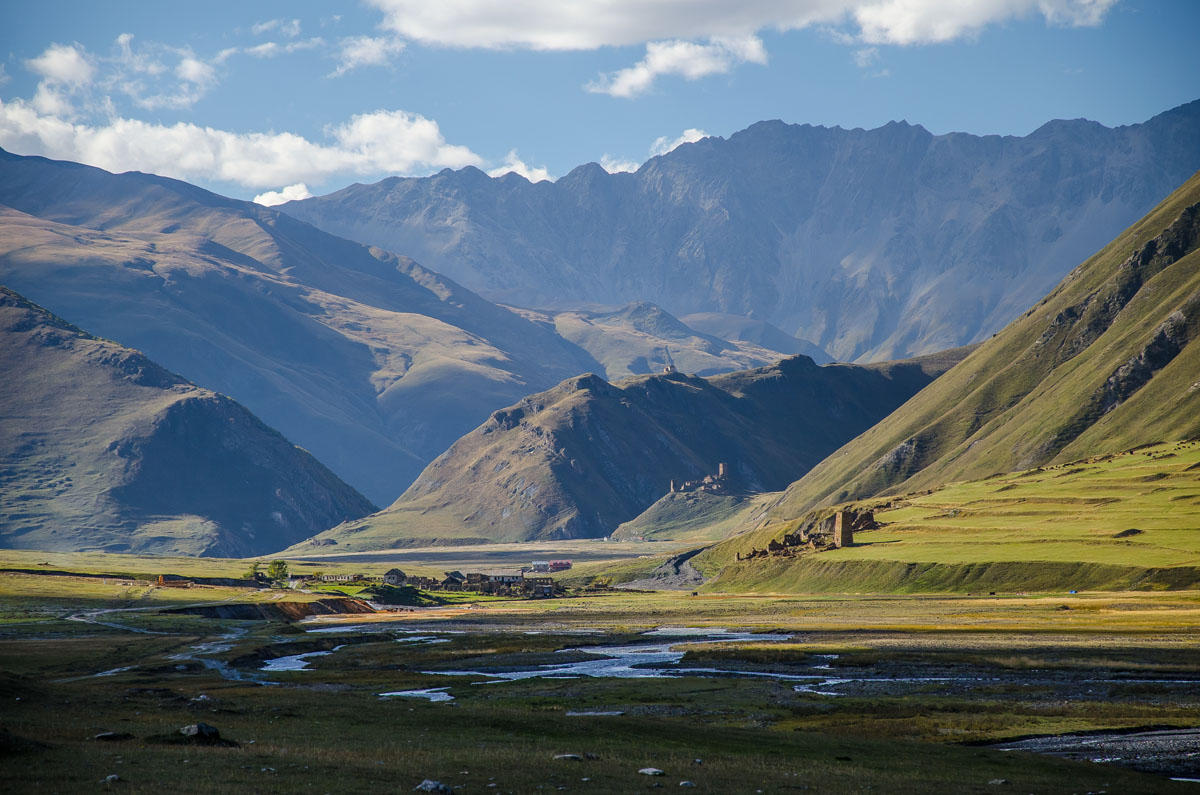
Omalo is the largest village in the region and the base for many tours and trekkers. The village is broken up into Upper and Lower Omalo. As the name suggests, Upper Omalo is at a high altitude that Lower Omalo and is a bit more tourist oriented and beautiful than lower Omalo. Upper Omalo is situated in a crater like formation at the top of a hill and is distinguishable by the Omalo fortress, Keselo, overlooking the plateau and valleys below, which is characterized by its group of Tush towers jutting up over the peak of the hill and is a perfect example of historic Tush defense systems. Lower Omalo is situated uniquely below on a plateau surrounded by deep river valleys, the Khoshantkhevi, Andis Koisu, Gometsris Alazani Rivers, among others, that give way to high mountain ridges separating Omalo from neighboring villages such as Shenako, Tsokalta and Kumelaurta, among others.
For the artistically inclined there is the Aq Tushetii artist residency program. The program is not open to the general public, rather you have to apply for a residency through their website where you will be able to work on your individual art projects for your preferred time of stay. The residency is perfect especially for nature photographers or videographers who need a home base while they explore the region and the Aq Tushetii Residency is easily the best value in the area.
Additionally, throughout the entire season there are a variety of festivals held at the residency including Full Moon Festivals every month, music festivals and artist workshops that range around a week to 10-days long.
The program prefers that artists stay for at least a month, though somewhat shorter programs are available (2-weeks being the minimum). The program costs €550 per month and includes transportation between Tusheti and Tbilisi, room, board, and access to art studios and resources. The residency is active from July 1 to October 15 typically and the application period is open through the end of May. Accepted artists are notified during the month of June.
This guest house is right in the middle of lower Omalo and doubles as a shop and simple restaurant. It is a popular center point for the entire village so it is hard to miss. The owner, Eto, also speaks very good English and is incredibly accommodating. Like most guest houses, the cost for accommodations runs about 25 Gel per night and meals depend on guest’s preferences.
Trekkers can feel more or less free to camp just about anywhere in Tusheti. In Omalo especially there is a lovely, small pine forest near the national park office that is a popular spot for camping - especially with trekking tours. The region is wide open, much of the land operates on a collective ownership basis, and safe camping sites can be set up without much hassle. If, however, you are more comfortable camping in someone’s yard between treks, many guest houses across Tusheti have outdoor spaces where trekkers can pitch their tent.
There are not currently any hotels in the Tusheti region, however, the Hilton is currently building a hotel in Omalo.
Shenako is a popular and beautiful rest point between Omalo and Diklo and has a variety of guest house and nearby camping options available to trekkers. Shenako can be a welcome alternative to Diklo as a place for trekkers to spend the night.
The guest house Old Tusheti is one of a handful of guest houses in the village and is a simple guest house that runs about 25 Gel per night. Like with just about every guest house in Georgia, you can include a meal with your stay. Meals typically cost between 15 and 30 Gel depending on which meal it is and the guest house. The biggest draw for the guest house is that the food in the family restaurant is absolutely amazing and well worth a try even if you are not staying at the guest house and are just passing through.
Diklo is an absolutely gorgeous and well preserved village on the border between Georgia and Russia. Both Diklo and Dartlo especially are characterized by their slate homes, which is collected from the slate rich Tushetian mountains.
While Diklo is a popular through village for many trekkers, as well as a cultural draw as a result of its well preserved architecture, there are a surprisingly small amount of guest houses. Many families instead have small shops where they sell food and souvenir items (wool clothes and crafts are very popular). The stay at Guest House Diklo, you can reach them at their website (attached above) to get a quote.
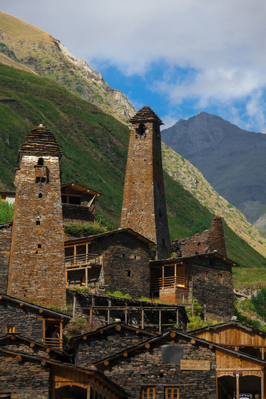
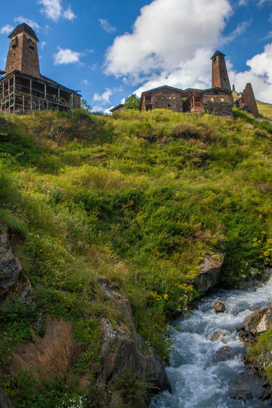
Next to Omalo, Dartlo is the next most popular center point for those visiting and trekking through Tusheti. While Omalo has a newer, more utilitarian feel, the architecture of Dartlo is characterized by the traditional Tush slate building and towers. The village itself is tightly packed together and sits below the village of Kvavlo, overlooked by the Kvavlo fortress.
There are numerable guest houses in Dartlo, but the guest house Makratela is beautiful and easy to find as it is in a central location across from the Dartlo Church and next to the confluence of the Didi Khevi and Pirikita Alazani Rivers.
If you want a higher view of the Alazani valley that Dartlo sits in you can climb up the mountain to Kvavlo to stay at the Kvavlo Guest House, which has a beautiful porch attached to the cafe overlooking the valley through traditional Tush woodwork.
Much of the diet in Tusheti is dependent on what locals can bring in from the lowlands and what they can raise, grow or forage on their own. As such, the diet is more heavily vegetarian though you may occasionally eat sheep or goat meat.
Tusheti is typical of the rest of Georgia in that supras are the main source of group socializing. You may in fact run into more supras in Tusheti than you would in other places in Georgia since the local Tush go up to Tusheti in the summer and treat their time there almost as a kind of vacation (in some cases). The summer period is also full of local celebrations, which increases the amount of supras that will inevitably be held.
Tush, especially in the higher regions, consider eating pork meat to be impure. However, the lower villages of Alvani and Laliskuri will occasionally eat pork.
Tusheti is filled with edible mushrooms and wild berries such as raspberries and currants, which are a popular addition to the Tush diet.
Guda is a sheep cheese that is aged in sheep skin and is very dry and salty.
Kotori is the Tushetian style Khachapuri, a famous Georgian bread and cheese dish served all over the country, but which has its particular styles from region to region.
Khavitsi is a cheese and butter dish that is very popular in Tusheti and it eaten by dipping bread in the mixture.
Khmeli Kalti is sun dried cottage cheese filled dumplings.
Kaghi is a kind of Tushetian meat jerky.
Mstvadi is a kind of kabab that shepherds eat.
Kaurma is shepherd mutton stew.
The hiking season in Tusheti is fairly short, even by Georgian standards due to Tusheti’s high altitude and remoteness. There is only one famously treacherous road to Tusheti from the south and it is subject to being washed out by high snow melt, which shortens the hiking season even more. Tusheti is less frequented than Svaneti so hiking here will have you much more secluded and the nature more untouched. The local tribal communities in Tusheti are semi-nomadic and move up and down the mountains each year with the seasons.
A very popular and relatively easy hike is the hike between Omalo and Old Diklo. It should be noted however, that most of this hike is along the dirt Jeep roads, which may deter some hikers. It is not until you reach Diklo that you break off to a small trail headed to the fortress. You have the option as well to hire a car (or hitch hike) to take you to either Shenako, so you can avoid the step climb valley climb between Omalo and Shenako, or all the way to Diklo so you can avoid the jeep road all together. However, regardless, the hike is extremely pleasant and offers plenty of opportunities to explore the surrounding region and villages at your own pace and can easily be completed in a day round trip. The total distance for the hike is about 11pm point to point, 22km round trip.
If you start from the center of Lower Omalo and walk east with the cell towers to your left you will pass by the Aq Tusheti Art Residency space on your right. You will go just a few more meters before you pass by the remnants of the failed Tusheti Aerial Tramway station on your left and you will quickly turn left and head down into the valley for a little over 1km. Keep an eye out for the overlook at the first turn from left to right. If you stop there and look into the valley you can see one of the many hidden, historic Tush towers that is often overlooked. This fortress is the ‘Love fortress’ (there as another ‘Love fortress’ in Svaneti actually). If you want to turn off to see this fortress the trail branches off from the main road just after the bridge. As you continue to head down you will then come the Pirikitis Alazani River with a large bridge going over it.
If you want a detour from this route you can turn right just before the bridge and follow a rough trail to the abandoned village of Ageurta. Once you get to Ageurta you will find the dirt jeep road that connects back with the main road to Shenako.
However, if you choose to stay on the main path you will cross the bridge you start heading up for about 3-4km up the ridge. This is probably the hardest part of the hike. While there is another very steep climb right after Shenako, the climb up this ridge is longer, though it does level off a time or two before you reach the lookout point just before you walk into the plateau that is home to Shenako.
Once you are past the ridge climb the road will level off for a bit as you head into Shenako. You can take one of two routes at this point. You can either go through Shenako and break for a meal and see the local sites, or you can talk the jeep road that goes around Shenako and see a little more of the surrounding countryside.
If you choose to go through Shenako you can visit the Holy Trinity church at the top of the village. As is normal in Tusheti, women are not allowed in the Church. There is also an ancient and incredibly clear and tasty well that uses an old form of cleaning, which has small local fish clean the walls of the well. Ask for directions. It is to the left of the main village in the abandoned part of Shenako slightly further down in a small valley. The road to Diklo passes directly through Shenako and heads steeply down into the valley before rising just as steeply over the hill towards Diklo. There are yellow signs indicating where to go and the km distance.
If you choose not to go through Shenako you can turn right at the jeep road that goes around the village. You will continue to see Shenako on your left and you will pass down through the valley with the forest to your right before you come to a fork in the road. To the right is the road leading to the village of Ageurta and to the left the road loops back around to connect with the road to Diklo.
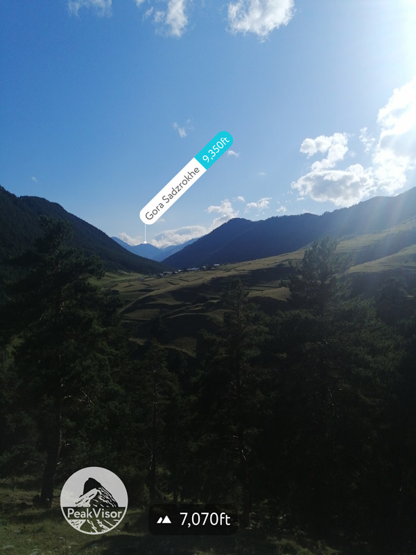
As you cross over the last of the steep hills you will ascend comfortably for a few km’s towards Diklo through open fields with forests on either side. You will see a double peaked rocky mountain, which is unnamed, rise beyond the horizon before you see Mounts Diklosmta (4285m, 1289m prominence) and Shungalavani (3033m, 44m prominence) rise up as you get closer to Diklo.

As you approach Diklo, any women in your group may be asked to pass to the leftmost entry point of the town. This is because the locals are trying to keep the women away from a sacred church near the entrance of the town. Both the left and the right routes through the entrance of town meet within a few meters. If you continue to follow the road towards the edge of town towards the mountains you will see a small trail going through cattle and sheep pastures after a small fence that has a crossed-beamed latch that is easy to walk over or under. Here there is a small trail that goes around the remaining valley to Old Diklo. The blazes for this trail are white, yellow, white. Old Diklo is an ancient fortress that you can still climb into to explore. There are various petroglyphs on the building and it has amazing views of the valley between Diklo and Dagestan.
The Oreti Lake hike is an absolutely beautiful and pleasant day hike that can be taken from Omalo. This is a popular equine hike as well so expect to see a number of horse riding groups as you walk this trail. If you choose to walk from Omalo to the lake and back, the entire trip will cover about 30km. During the hottest part of the season in August the sun is extremely strong so be sure to bring sunscreen and extra water. The road between Omalo and the trailhead at Tsokalta is incredibly dusty and very boring. Luckily, this section of the road is easy and common to hitchhike on so you should not have a problem finding a ride between the two villages.
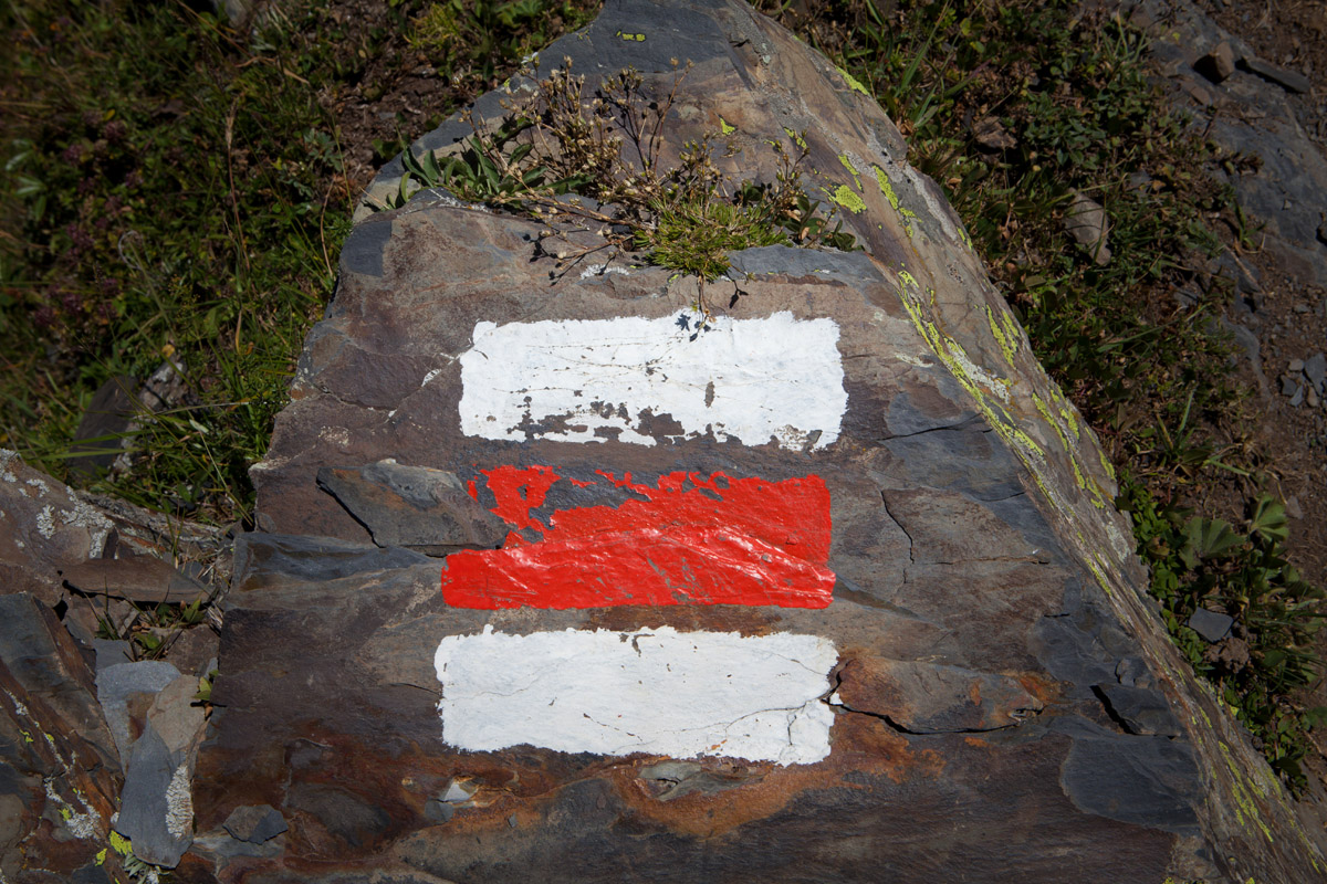
From the main road at the base of the valley as you cross the bridge over the Tushetis Alazani River you will turn left towards the very small village of Tsokalta. On the right hand side you will see a trail marker, white and red up towards the village. As you head up towards the village you can stop by a water source near the edge of the village. This is a good place to grab water as there is not a water source on the trail unless you want to ask nearby shepherds on the ridge for water. They are very friendly and may offer water or coffee anyway.

It should also be noted that there is also a makeshift cafe up near the lake that may or may not be there from year to year. Another important thing to note about this hike is that this section of the mountains is a popular grazing location for local shepherds and their sheep, which means there are a number of Tush sheep dogs as well. You need to be very careful of these dogs as there are very aggressive and territorial. It is also common for there to be dogs with cattle herds in the valley near the villages.
As you leave to follow the trail from the water source in Tsokalta you may want to head up through the village. Do not do this! Instead, vear left along the outskirts of the village and slightly down through the valley to the jeep road. The road will veer left around the neighboring valley towards the village of Kumelaurta and next to a meadow on your right. Take note, the trail starts in this meadow.
You will walk up through the meadow to the edge of the forest where you will see a trail heading straight up the mountain toward the ridgeline that heads towards the lakes. This is the hardest part of the hike. You can expect to hike anywhere between 1-2.5 hours for about 3.5km, depending on your speed, to climb this mountain until you hit the ridge line. However, once you walk along the ridge the hike, even though it still climbs upwards, is considerably easier.
As you hike up the mountain you will pass through high altitude barrier sub-alpine forests that quick transition to alpine forest full of pine and beech trees. Once you reach the ridge the landscape will transition in and out of the last of the subalpine forest to full alpine forests and alpine meadows, eventually leading to full alpine meadows populated with rhododendron fields as you get closer to the lake.
You will turn left once you hit the ridge and will quickly come upon a shepherd’s hut a couple km’s into the hike on your right. You will continue to climb up the ridge and as the scenery clears you will have amazing views of; Mounts Gora Shaikhkort (3922m, 293m prominence), Komito (4261m, 681m prominence), Danosmta (4174m, 515m prominence), Shavi Kvisha (3209m, 25m prominence), and Diklosmta (4285m, 1289m prominence) to the north, and Gora Skhamoana (3321m, 354m prominence), Mt’a P’irs’ristsveri (3012m), and M’ta Samquristsveri (3257m) to the southwest, and Mount Vestmovake (3047m, 96m prominence) directly in front of you as you head to the lake.

Once you begin approaching the Rhododendron fields with their Yellow Azalea accents you will know you are getting close to the lake. The rhododendron cover about 13,000 hectares of the Tusheti protected landscape and mainly grow between 2400m and 2800m. These fields are the perfect environment for the endemic Caucasus Black Grouse, which, if you’re lucky, you may catch a glimpse of during your hike.
The level of the lake depends on the time of year. The best time to hike to the is in June when the weather is wetter and the lake is higher, by the late season, August and beyond, the lake is considerably lower and less impressive. From the lake, to return you follow the same path as you took up.
The most important thing to remember about Tusheti is that every village is accessible by foot in one way or another. The region is so small that trekking through it for even short periods of time allows you to see a great deal. Thus, building multi-day treks to various villages through either smaller trails (during the warmest part of summer when they are not snowed in) or even just through the jeep trails will insure that you see some of the most beautiful landscapes and culture that Georgia has to offer.

Day 1 of the trek has you going from Omalo to Parsma via Dartlo. You can also take detours to the surrounding villages based on your preference.
From Lower Omalo you will head up the road to Upper Omalo and past the village over the hill and then heading back down the serpentine road. The road will branch off into two directions. Ultimately, you will end up traversing both of these roads, however for this route you will want to follow the signs headed to the right towards Dartlo. The road will climb up again and pause at a hilly field where you can forage for berries or mushrooms if you have the aptitude and are interested, before heading back down into the valley towards Dartlo which will be on your right on the opposing side of the river.
You will continue on past Dartlo until you hit Parsma. The Pirikiti Alazani River will be on your left as you walk along the jeep road. Parsma is hidden from the road, but you will know you have reached the village because there will be Parsma’s iconic Tush tower looking out over the valley on your right and a couple small shops along the road. From the road you will follow the small trail up the hill, which will curve left behind the hill and you will come upon Parsma. You can either stay at a guest house in the village or camp along the hillside or in the valley below.
Day 2 of the trek is more rugged and gets off the main jeep road relatively quickly. From Parsma you will cross the river and hike along the opposing side of the bank from the day before. There is sometimes a bridge that crosses the Pirikiti Alazani River, however some years it is washed out and it is not always replaced quickly so take care. Shepherds also keep their flocks on this side of the river so watch out for dogs.
After about 2km the path will turn sharply upwards southeast towards the Nakle-Kholi Pass, which you will eventually cross after a few hours of climbing.
You will find the Nakle Pass to be pretty flat and wide and you will get a good view of the surrounding region. There will be signs pointing to Verkhovani southwest, which you will want to follow. The route will then become a bit harder to follow, but you will descend sharply downward towards the west. You will want to keep in mind were the river to the south is as it will eventually lead you to your destination.

The route, as mentioned with turn south and become more visible as you approach the river. You will lead out onto the abandoned village of Dadikurta. The road will continue on to the river through the valley. The trail then follows along the river, crossing it a few times (about 3) before finally ending at the Verkhovani village. You can either stay at a guest house here or try to find a place to camp. The village is on a steep and relatively rocky slope so it can be difficult to find a comfortable place to set up camp, though not impossible.
Day 3 you will make your way to Omalo. You can also choose to stay in Verkhovani for an extra day and explore the surrounding abandoned villages and forests if you like. Unlike day 2, much of the route to Omalo is done along the jeep road, which is not as busy as the jeep road between Omalo and Dartlo.
From Verkhovani you will follow the path that ascends up and through the village southeast parallel to the river rather than down towards it. After about 2km you will hit the main road and the navigation from here will be very easy. You will want to turn right along with the signs headed for Omalo through Bochorna, one of the highest permanent settlements in Georgia.
First you will pass through Beghela and ascend up the road. You will pass a shepherd’s camp on the left and then see the village of Dochu below you along the river shortly after, which is a great side trip if you are interested. Then you will continue on through Bochorna on your left and you will descend for about 7-8km before you hit the climb up to Upper Omalo, which is not too long, but fairly steep (it is by no means the most steep ascent you will ever encounter in Georgia, but if you are tired by this point you could hitchhike up to Upper or Lower Omalo depending on where you are planning to stay).
The Omalo to Shatili trek is a very popular trek and connects the Tusheti region to the Khevsureti region over the course of 4-5 days. The blazes from Omalo to Girevi are white, red, white and from Girevi to Shatili are white, yellow, white.
This trail was first created by shepherd’s paths in the region, much like many of Georgia’s trail systems.
One of the major draws for this hike is that it is relatively unspoiled due to poor roads going into the region reducing accessibility. Another draw are the medieval villages and fortresses along the trail and the region's natural beauty.
The Omalo to Shatili trek is about 75km long from end to end, starting at around 2100m, peaking at 3500m at the 50km mark and terminating at around 1450m in Shatili. You have a total climb of almost 3000m and descent of almost 3600m.

Day 1 of the trek has you going from Omalo to Dartlo, which is about 11km with an approximately 400m accent and 670m descent. To leave Omalo you will take the serpentine dirt, jeep road heading north until it turns into a dirt footpath headed towards Dartlo.
In Dartlo, you can either stay at a guest house or there are also various places to camp along the Pirikita Alazani River as well just below the village.
Day 2 you can go from Dartlo to Girevi, a 14km day with an approximately 400m accent and an approximately 200m decent, depending on your route. You can either follow the Alazani river through Parsma to Girevi, or take an alternate route up to the Dano Village before connecting back to the lower trail. In Grievi you will have to register with the border guards.
Day 3 goes from Girevi to the Kvakhidi meadows, about 14km with approximately 1000m of ascent and approximately 600m of descent. You will cross two border guard checkpoints; one at the halfway point and one towards the end of your day. You will know you are reaching the end of your day when you pass a shepherd's shelter selling snacks at a bridge crossing the Kvakhidistskali River. Just past that is a meadow that is perfect for camping.
Day 4 you will go about 17km to Khidotani ridge with about 1400km of accent and almost 1200m of descent. You will have to cross the Kvakhidistskali River twice, once by bridge and the second time you will have to ford the river. Follow the stone signs with the “Exit Shatili” markings towards the right most valley of three that you will come upon and hike up. The path turns right and climbs heap of shale through the Astunta Pass. From there do not descent all the way down to the river, but instead follow along the left side of the valley, which will eventually lead you to the Khidotanis range where you will get a great view of Tebulo mountain. There is a border guards camp just above the treeline.
Day 5 you will end in Shatili and hike about 20km with 300m of accent and about 1500m of descent, there are two routes down the mountain, both of which are steep and muddy. One route goes through Ardoti village and the other goes north through Khonischala village at the confluence with Andaki river. You will pass below Musto Fortress, which you can take a side hike up to if you like. The trek then leads to the road, which is not that interesting but is 30 minutes to an hour from Shatili fortress where you will end your trek.
Parsma is a small village at the edge of Tusheti located between Cheso and Girevi and a popular draw for many trekkers. The Parsma Tush tower is considered to be one of the strongest and best preserved towers in the region and is linked to the legend of Tino who defended the region from the raids of Murtaza Khan in the mid-1800’s.
Girevi is the first and last place to be inhabited in Tusheti during the summer months due to its proximity to the entrance/exit of Tusheti on the Atsuna Pass side bordering Khevsureti. It also has a well preserved Khevsureti style defense tower.
Bochorna is notable as one of the two highest permanent European settlements and is located along the Dochu road. Local groups are currently working to develop a trail race starting from Bochorna and ending in Omalo starting in 2020.
While Border Control themselves are not dangerous, and are in fact typically quite friendly, it is important for trekkers to remember to bring their passports while hiking in this area as you may have to register with the border control guards on a few hikes. Given the entire region’s proximity to Chechnya and Dagestan in the Russian Federation, registering with border control is considerably more prevalent than it is in the western part of the country.
Some trekkers will want to be aware that one of the main roads going into Tusheti from Tbilisi goes through the Pankisi Gorge, which is on many country’s safety watch lists due to the remnants of the 2002 Pankisi Gorge crisis and the later Lopota Gorge hostage crisis of 2012. The gorge is believed to possibly still be a base for Chechen rebels and Al-Qaeda fighters currently moving between Chechnya and Syria and historically has been alleged to be a base for transit, training and shipments of arms and financing by Chechen rebels and Islamic militants. Trekkers are not likely to have trouble when traveling through the gorge, as the highway is a highly trafficked one during the high season in Tusheti, and the area is more similar to the rest of Georgia than most media reports would imply.
While dogs in the rest of Georgia can be a nuisance, they are by and large not going to cause too many problems, however, in Tusheti, many of the dogs are unequivocally work dogs and can be extremely aggressive and territorial. The situation with the dogs in Tusheti is split into two situations, first, dogs that want to join you on the trail as “trail dogs” (typically hoping for scraps). While these dogs can be pleasant to have around they pose an often unforeseen problem - if you are overnight trekking and these dogs stick around, they can draw other animals to your campsite that can be dangerous and wouldn’t otherwise bother campers. While it won’t feel great to do, your best bet if you are doing the longer treks is to do everything in your power to keep the trail dogs away, especially if you plan to camp in secluded areas.
The second type of dog you will run into are shephard’s dogs. These are the aggressive dogs who are tasked with protecting flocks of sheep or herds of cattle. The aggressiveness of these dogs can scare most hikers, but there are a number of steps you can take to keep yourself safe. The most important thing to remember is not to run away from these dogs. That is the best way to insure you get bitten. Whenever possible, do not walk through flocks or herds. If a dog (or most likely a pack of dogs) does run toward you, go to pick up a rock. This is the first indicator to the dog that they should leave you along. Make a lot of noise as well. If the dog(s) are still aggressive, it is time to start throwing the rocks you have found or swinging the sticks you have picked up. This is a deterrent to the dogs as well. If you are carrying a pack you can also take it off in case they do actually try to bite, which is unlikely. As you create distance between you and the dogs with deterrent measures, get low (as counter intuitive as that may sound), and wait for the shepherd to come call them off. They will show up eventually and most likely apologize and call their dogs off. Your chances of getting bitten are not too high if you take the proper care and do not let sheep dogs come up too close behind you, which is when they are more likely to bite.
Horse tours are incredibly popular in Tusheti, but inexperienced riders should take care when choosing a tour. Many tours are unregulated and conducted by locals with their personal horses. As such, these tours do not typically offer helmets and the guides have little to no knowledge of proper medical treatment in the case of an emergency. Also, given Tusheti’s remoteness, if you get injured on a tour it is incredibly difficult to transport you safely to a hospital both because ambulances cannot get to trail heads easily, the medical knowledge of most EMTs in the region is not well developed, and medical helicopters will not medivac you out if it is night and you will have to wait until morning.
Hogweed can be a problem throughout all of Georgia, however, in the eastern part of the Georgia Caucasus it tends to be more prevalent. It is not a massive problem in Tusheti, but trekkers should keep an eye out for it. When the sap of Hogweed comes into contact with human skin and is exposed to sunlight it creates a burn, sometimes very severe. Most of the time you are ok as you brush past the leaves, but it is a plant you need to be aware of and try to avoid contact with as much as possible. Hogweed is not native to Georgia, but rather was brought in as a decorative plant and has been a nuisance ever since.
Tusheti’s proximity and incorporation into the Kakheti region insures that there is red and white wine available in the region, which is often quite good (some of the best in the entire country, honestly).
However, the local preference is chacha. The chacha in Tusheti is especially potent, ranging anywhere from 30% to as high as an unbelievable 70% alcohol volume. The elevation also plays a role in how hard the alcohol hits you (it hits you much faster and harder despite the fact that locals will say the opposite) and trekkers should take care when taking shots with locals during a dinner or celebration. Often you are not required to finish your shot after a toast, but can sip it bit by bit. It is also acceptable to say you do not drink chacha, which is often a good idea. Female hikers should be especially vigilant when it comes to drinking in the region. Tusheti is a more conservative region so often when a woman drinks with men it is often considered to be a sign that she is romantically interested in him. Women can easily travel in Tusheti alone if they want, but they should be sure to let their positions be very clearly known.
Tusheti also is known for making its own beer, which is typically very light and has a taste surprisingly close to wine.
Tushetian climate is indicative of mountainous climates with short summers and long, snow-covered winters. Not surprisingly, the coldest months in Tusheti are January and February with the temperatures hovering around freezing, and the hottest months are July and August with the temperatures hovering around the mid 20°s C. The wettest time of year in Tusheti is in the late spring, early summer months of May and June with the driest months being December, January and February. Tusheti has a drier climate than its cousin, Svaneti.
Documentation of geology in Georgia is spotty at best for any given region. While the entire country is known for having many mineral deposits and interesting geological particularities, the documentation of those particularities can be hard to find. Tusheti, like the rest of the country, has a number of mineral springs and its mountains are characterized by shale, which creates scree fields in the higher altitudes. The region is also full of quartz rocks, which locals put at the entrances and windows of their homes to ward off bad spirits. The quartz may also be an indicator of gold deposits in the mountains.
To the south, Tusheti is encompassed by the Kakheti region and itself is part of the Akhmeta raioni. To enter Tusheti from Tbilisi you will drive over the famous Abano Pass (also known sometimes as the Tusheti Pass). The road tops out at 2926m and overlooks both Tusheti and the rest of Kakheti. The pass neighbors the Ortskali (2926m) and Samkinvrostsveri (3167m) Passes to the west and Mounts Bulanchostsveri (3255m) and Zetavi (3099m, 162m prominence) to the southeast.
Tusheti’s eastern most border with Russia, from south to north, is defined by Mounts Shaviklde (3578m, 758m prominence), and Encho (3304m, 332m prominence), followed by the Verbo Range, which encompasses Mount Vestmovake (3047m), and the Sarmaghele Pass (2596m), which creates its boundary with the Butsibatsi Range, which ends with Mount Diklosmta (4285m, 1289m prominence), which sits at the eastern most point of Tusheti and starts the region’s border with Dagestan.
Tusheti’s border Chechnya and Dagestan in Russia to the north and the east, is separated from by the massive Tusheti ridge and is home to the highest peaks in the region starting with Diklosmta, and followed east to west by Mounts Danosmta (4174m, 515m prominence), and Komito (4261m, 681m prominence), then followed by the Kachu (3552m), Kerigo (3120m), Ukerecho (3023m), Tebulo (3342m) Passes, and ending at Mount Tebulosmta (4492m, 2129m prominence).
Finally, the (north-ish) western most part of the region borders Khevsureti (which will eventually take you to the Kazbegi region through Khevsureti), leading into the remaining south western most part of the Tusheti region, which encompasses again the Kakheti region. Starting from Mount Tebulosmta the western most part of Tusheti is home to the Atsunta Range, which holds the Atsunta Pass (3431m), Mount Amugo (3709m, 331m prominence), and ends near Mount Barbalo (3135m).
Other mountain ranges that can be found in Tusheti (from north to south) include; the Larovani Range, which holds the Larovani Pass (3317m); the Makratela Range, which encompasses the Nartsapi (2981m), Kodorisghele (3145m), and Nakle-Kholi (3552m) Passes; and the Caucasus Range, which is home to the Sakorno Pass (3089m) and Mount Gvelis mta (3089m, 267m prominence).
Tusheti is one of the most biodiverse regions in Georgia, as well as one of the best preserved, which makes it one of the most important protected regions in the country. While neighboring alpine regions in Georgia, such as the Kazbegi, Racha, Svaneti or Samegrelo regions are wetter, Tusheti adopts some of the dryer characteristics of the Kakheti region that is it part of.
The Tushetian landscape is dominated by coniferous pine forests, some less common deciduous forests (only about 1400ha, compared to 15000ha of pine forests between 1700m and 2000m), and montane meadow habitats, including subalpine scrub, forests and grasslands, as well as alpine forests, meadows, scree fields and rocky peaks. The Tushetian environment exists between the 1500m and mid 4000m ranges, peaking at 4492m. Pine forests can be found along Tusheti’s various river valleys including the Alazani Rivers reaching up to 2000-2200m. Above 2000m you will find the Pine forests replaced by Birch (mainly of Betula pendula [particularly in the northern regions of Tusheti], but also including crooked Birch and Litvinov Birch) forests. The alpine regions of Tusheti are beautifully accented by Caucasian Rhododendron (Rhododendron caucasicum) and Yellow Azalea (Rhododendron luteum), which is a favorite habitat for the Caucasian Black Grouse. You can find alpine grasslands and meadows all the way up to 3000m where they then drop off to scree fields, moraines, and rocky peaks. Tusheti is also a hotspot for medicinal plants, which contributes significantly to local lore and traditions.
The Kakheti side of the region before the Abano Pass is characterized largely by its broadleaf forests which include; Caucasian Hornbeam (Carpinus caucasicus) and Oriental Beech (Fagus orientalis). The Tushetian Pine forest region is most common in the eastern part of Tusheti near Shenako and Diklo along the massifs of Vebu, Ighone, and Oreti. Coniferous forests are more rare in Tusheti, but can be found Chanchakhovani Range including the Gometsari and Pirikita Alazani River basins.
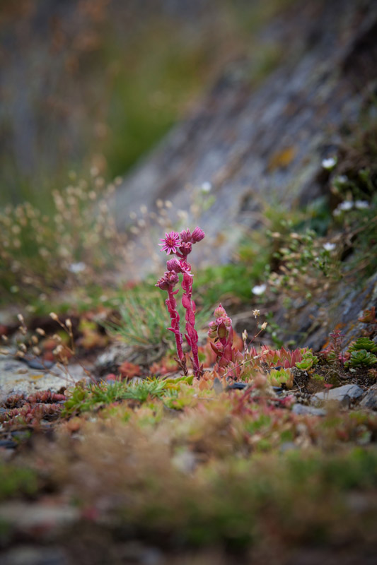
A wide list of endemic Tushetian flora includes; Yellow Primrose (Primula luteola), Bayer’s Primrose (Primula bayjernii), Purple Primrose (Primula juliae), Tushetian Skull-cap (Scuttelaria raddeana), Tushetian Foxtail (Alopecuris tusheticus), Tushetian Dog Rose (Rosa tuschetica), Tushetian Wolfsbane (Aconitum Tuscheticum), Caucasian Lily (Lilium monadelphum), Caucasian Rhododendron (Rhododendron caucasicum), Caucasian Comfrey (Symphytum caucasicum), Aromatic Symphiola (Symphyoloma graveolens), Iris (Iris sibirica), Viper’s Grass (Echium russicom), Bug Orchid (Orchis coriophora), Daphne (Daphne glomerata), Pasquflower (Pulsatilla albana), Fragrant Orchid (Gymnadenia conopsea), Burnt Orchid (Orchis ustulata), Gentian (Gentiana djimilensis), Stonecrop (Sedum caucasicum), St. John’s Wort (Hypericum perforatum), Valerian (Valeriana officinalis), Catton Grass (Eriophorum vaginatum), Trefoil (Trifolium), Gentian (Gentiana caucasica), Rock Bellflower (Campanula petrophila), Scabious (Scabiosa caucasica), Purple Marshlock (Comarum palustre), Tebulo’s Buttercup (Ranunculus tebulosicum), Fritillary (Fritillaria caucasica), Black or Radde’s Birch (Betula raddeana), which is redlisted, Litvinov Birch (Betula litminowii), Caucasian Pine (Pinus kochiana), Wych Elm (Ulmus glabra), which is redlisted, Tree Wormwood (Artemisia splendens), Blueberry (Vaccinium myrtillus), Raspberry (Rubus), Mountain Crowberry (Empetrum hermaphroditum), Rowan (Sorbus caucasigena), Greater Plantian (Plantago major), False Hellebores (Veratrum lobeliauim), Stinging Nettle (Urtica dioica), Thyme (Thymus caucasicum), Moonwort (Botrychium lunaria), Mint (Mentha), Greater Plantain (Plantago major), Pot Marjoram (Origanum vulgare), and Twinflower (Linnaea borealis) in the lower forest regions, among others.
Tusheti is home to an amazing array of birds who have made a home in its diverse forests and meadows along the various elevations. There are at least 60 mammal species, 120 bird species, four reptile species, six amphibian species, and one species of fish that have been categorized in Tusheti. Invertebrate species are less studied and encompassing surveys of the different types are currently insufficient.
Rare bird species that are endemic to Tusheti include; the Caucasus Black Grouse (Tetrao mlokosiewiczi) and the Caucasian Snowcock (Tetraogallus caucasicus).
Notable birds of prey of Tusheti include; the Golden Eagle (Aquila chrysaetos), Bearded Vulture (Gypaetus barbatus), and Griffon Vulture (Gyps fulvus) at the highest altitudes, as well as the Tawny Owl (Strix aluco), Kestrel (Falco tinnunculus), Peregrine Falcon (Falco peregrinus), Common Buzzard (Buteo buteo), and Cinereous Vulture (Aegypius monachus) among others.
Other birds that can be found in Tusheti include; Caucasian Chiffchaff (Phylloscopus lorenzii), Dipper (Cinclus cinclus), Chukar (Alectoris chukar), Common Crossbill (Loxia curvirosta), Great Spotted Woodpecker (Dendrocopus major), Green Woodpecker (Picus viridis), Red-fronted serins (Serinus pusillus), Common Rosefinch (Carpodacus erythrinus), Water Pipit (Anthus spinoletta), and Hoopoe (Upupidae), among others.
One notable mammal that is indicative of the Tushetian landscape is the Bezoar Goat, which is an incredibly shy animal that is capable of seeing movement from several kilometers distance, and makes its home along the steep forest slopes. The Bezoar Goat is the symbol of Tusheti National Park. Though less common, Tusheti is also home to the East Caucasus Tur (Capra cylindricornis), which can be found in the higher alpine elevations. You can also find Wild Boar (Sus scrofa), Roe Deer (Capreolus capreolus), Red Deer (Cervus elaphus), Caucasian Squirrel (Sciurus anomalus), Marten (Martes foina), Chamois (Rubicapra rubicapra).
The carnivorous animals that can be found include; the Gray Wolf (Canis lupis), Brown Bear (Ursus arctos), Red Fox (Vulpes vulpes), and the Eurasian Lynx (Lynx lynx). It is extremely rare to see these animals however. Leopards (Panthera pardus saxicolor) are extremely rare if not altogether extinct from the region, but have historically inhabited Tusheti.
There are four species of snakes in Tusheti; the Smooth Snake (Coronella austriaca), Grass Snake (Natrix natrix), Water Grass Snake (Natrix Tesselata), and the Trans-Caucasian Rat Snake (Elaphe hohenackeri).
There are two species of toad and four species of frog including; the Green Toad (Bufo viridis), and Caucasian Toad (Bufo verrucosissimus), as well as Asia Minor Frog (Rana macronemis), Common Tree Frog (Hyla arborea), Caucasian Parsley Frog (Pelodytes caucasicus), and Marsh Frog (Pelodytes caucasicus).
River Trout (Salma Truta Fario) can be found in the oxygen rich snowmelt fed rivers of Tusheti and are characterized by their colorful scales, which change as trout move in and out of different river conditions and as they age. River Trout prefer river temperature between 8-16° and during the warmer months they swim upstream to the most uninhabited parts of the river.
The trout feed on soft-bodied aquatic invertebrates including; snails, insects, worms and crayfish. They reach adulthood in 3-4 years and prefer to spawn on rocks or sandy river beds.
Currently, River Trout are listed in the Red Data Book of Georgia.
The origin of the Tush people and the Tushetian civilization is unclear and indeed, as you drive through the rough roads leading up to the remote region you will invariably think, ‘Who in the world found this place?!’ There is a legend about the origin of the Tush (and surrounding) people that states that a pregnant woman appeared at the top of the Borbalo Pass entering Tusheti after being banished from her home village, where she gave birth to three sons. Each of her sons rolled down a different section of the mountain, Pshavi, Khevsureti, and Tusheti, and each created their own village in the places where they landed.
Tusheti has long been a place of hiding a refuge for people throughout history including Chechens, Dagastani, and those fleeing early Christianization, and later Islamitization, crime, taxes, and blood feuds. The Tush have also been linked to the Vainakh (Nakh) tribes who came to Georgia around the same time Christianity did. There are also the Tsova Tush, or Bat people, who still retain their own language, Bat. Additionally, the name ‘Tusheti’ is believed to come from the Ingush name for the goddess of the sun and fertility, Tusholi. Tusheti has historically been a mixing pot of different groups coming together in this remote region and eventually the process of welcoming new people into the community became a rite that was conducted over the course of a year in traditional Tush culture.
The first settlement in Tusheti have been dated back to as late as the Bronze age and early Iron Age from the 12th to the 9th century BC, but some scientists believe that the region had been inhabited even a thousand years prior to that time. Lower Omalo, given its plateau structure was most likely one of the first places the first Tush ever lived. Greek Geography Ptolemy writes about Tusheti as well and there is documentation linking Tusheti to the Kingdom of Kartli (Iberia) in the 3rd century.
While Tush towers were built before this time, most Tush clan towers, which still speckle the region, were built in the 16th and 17th centuries BC when raids from Dagestan and Chechnya were prevalent. The history of these battles however is spotty and inconsistent, though it does still contribute a great deal to local lore. In the 16th century BC as well many Christians fleeing nearby Islamization found their homes in Tusheti. The Georgian Chronicles Kartli also mentions how at the height of Christian persecution in the region, the only safe place to worship as a Christian was in Tusheti, Pshavi and Khevsureti. Starting in the 16th century BC Tush began their semi-nomadic travels up and down the mountain ranges, which they still continue to this day. This semi-nomadic behavior was started for shepherding reasons as Tush would bring their flocks up and down the mountain passes each year. This, in the beginning, was much at the expense of their Kakheti neighbors who they domineered over and stoll from as their flocks and powers grew. Later, King Erekli decreed that Tush restrict their flocks to the Lopoti Valley, Alvani and Pankisi as a means to quell discord in the region. He also required the Tush to keep the size of their flocks below 2 herds (400) at any given time over the space of two grazing areas. This gives you an idea of just how important sheep and cattle grazing have been to Tush historically.
One notable aspect of Tusheti is that the Tush people sided with the Russian Empire during the Great Caucasian War for 1834-1859, while also working to promote healthy ties to their Islamic neighbors with whom they still conducted a great deal of trade. By the end of 1846 many of the famous battles and legends had been waged across Tusheti including the Battle of Parsma Tower. Both Diklo and Shenako had been burnt to the ground during various battles. Further battles were waged in the Pirikiti Valley and in Chagma Tusheti. Overall the Great Caucasian War was very devastating to many villages in Tusheti, however the Russian Government was known to send deputies to come to the aid of local villages. At the conclusion of the Great Caucasian the area was overseen by the Russian Empire. Further military events were seen in the region with the Russo-Turkish War, which Tusheti was literally caught right in the middle of. It was during this time, due to political disruption, the difficulty of living in such a harsh climate, and plague that migration between the higher and lower altitude of Tusheti became more common, with many families beginning to choose to stay at the lower altitudes.
The fall of the Soviet Union was still hard on the Tush as many of their government subsidies were taken away, as well as standardized economic trade systems for Tush wool, and the region had to start again from scratch. Not only were many schools and hospitals closed, many shepherds lost grazing lands to Dagestan and Azerbaijan. These issues were further aggravated by the war with Chechnya.
In 2006, the village council of Omalo was cancelled in an effort to centralize the Georgian government. This council had been sporadically self-governing since the fall of the Soviet Union and had maintained relations with neighboring Dagestan. Powers were then transferred to the Municipality of Akhmeta, where the Tush were poorly represented. There are also records of Tush men fighting in the South Ossetian War in 2008. It was not until later that Tusheti started prioritizing tourism and has developed into the tourist draw that it is today.
The most interesting and important thing to know about Tusheti is that a great deal of its history, traditions and culture are based in paganism, as well as having some ties to Islam due to its historic proximity to Chechnya and Azerbaijan (Tusheti has always been a hideout location and crossroads of culture). While the region converted to Christianity with the rest of Georgia under Saint Nino, Tusheti incorporated their previous pagan traditions into many of the Christian religious ceremonies they adopted. This can still be seen with the various activities at local celebrations, as well as the sacrificing of goats and even the occasional pictographic writing on a skull that you might find on a hike. These pagan routes also tie to the region’s sense of communal ownership over the land and the use of medicinal herbs and rituals to treat disease. Similarly, many of the old gods of the region are still spread down through Tush legends and stories.
Many, if not all, of the treks you will follow in Tusheti will be tied to local legends, mythology, celebrations and history and knowing a bit of these stories makes your travels through the region much more interesting and dynamic.
Tusheti is home to Georgia’s only pictographic language system and incorporates images that depict men riding horses, the sun and stars, fish, aspects of shepherding and much more.
You will also find petroglyphs on various ancient historic sites, as well as homes, across Tusheti. These mostly depict mythological characters and their epic stories. Many of the stories of the petroglyphs show the duality of life and the attempt to balance chaos and order. Saint George is often depicted as well.
Two steep cliffs overlooking Diklo Khaa have sparked the legend of the love cliff. The story goes that a young man and woman from Diklo, named Bero and Tsum, fell in love. Bero became very ill with a high fever. The local villagers covered him in ice but the ice kept melting. Bero, to cool his fever left the village and climbed to the glaciers above where he turned to a man of ice and snow. When Tsum heard this she went to find him. When she found him she sat by his side and turned to ice and snow herself. As the glaciers slowly retreated they gave way to two stone cliffs believed to be the loving couple overlooking their home of Diklo.
The story goes that a cruel stepmother hid the cows of her stepdaughter, a shepherdess named Inan, and forced her to go look for them in the night through Dorai’s Gorge. Inan looked the entire night with no luck and, exhausted, drank water from the steam running through the gorge. As she did this the entire gorge lit up and Inan saw a man in a black cloak with a silver moon on his forehead and golden teeth. Inan, afraid, ran and hid in a nearby flour mill. The next morning as she arrived back home she realized she was pregnant. Her stepmother, infuriated, chased her from her home and baid her never to return. Distraught Inan returned to Dorai Gorge and cried by the river cursing the rocks and landscape that she felt had damned her so. Suddenly, a nearby bolder broke in two and Doraiskhevian, a god, emerged and took her in his arms and cared for her. Inan soon gave birth to a baby boy that heralded the time when the local Tush stopped being afraid of the local gods and began living in peace and harmony with them.
Khakha is an abandoned tabernacle in the village of Vedziskhevi and Afora is another abandoned tabernacle in the village of Koklati. Traditionally, celebrations for both tabernacles were celebrated together until a local shepherd’s son had a fatal accident during one of the celebrations. It is important to note that the Tushetian communities are so tightly connected that a death is cause to stop all music and celebrations in a village of an entire month. This occasionally happens if a local dies on the road (for example) to Tusheti, which can occasionally happen. According to local legend, the shepherd’s son died by falling into the Giant’s Spring a wetland between the two villages, during a horse race and in reverence for the deceased all following celebrations were canceled.
One of the major draws for trekkers to Tusheti is that the region will give you a glimpse of ancient festivals, games and traditions that you will see nowhere else in Georgia, let alone the world. Therefore, many trekkers consider the timing and location of many festivals and plan their treks based on the Tush religious calendar.
Alaverdoba is a significant holiday in Tusheti held in September in Alaverdi.
Amaghleba is the Day of Ascension and is held 40 days after Easter.
Atnigenoba is the most important Tushetian holiday, as well as the most visible. Traditionally it is celebrated before the beginning of Autumn work, about 100 days after Easter, and takes about 2-weeks over the course of different days.
Didmarkhva means ‘great fasting’ and is the fasting period before Easter.
Tushetians, like all Georgians put a great deal of merit in Easter and follow the othodox calendar when celebrating it.
Giorgoba is the holiday of Saint George, an important holiday across Georgia, and is celebrated in both spring and autumn (typically on November 23rd in the Autumn). These two festivals in particular mark the beginning and end of harvest and shepherding seasons.
Mariamoba is the holy day of the Virgin Mary celebrated at the end of August (typically on August 28th).
Mzebudoba is tied to the winter solstice. In pagan Tusheti the sun was worshipped as a goddess and the ancient Tush believed that around December 6th the goddess crept into her nest and found a baby lamb there, staying for three days and emerging on the 9th of December.
Otsoba (or Khargae) is a festival celebrated on Marsh 25th and signifies the beginning of the agricultural season.
New Years in Tusheti is called Tseltsdobebi and is preceded by 2 weeks of fasting and spiritual reflection.
Tskhvarmoe is the period of celebration commemorating the return of sheep to the Tusheti region for the summer.
Tushetoba is a festival that started in the 90s and has been named Day of the Shepherd (metskhvaris dghe).
Zezvaoba is a festival held on the last Saturday in May in Upper and Kvemo Alvani commemorating the battle of Bakhtriono in 1659.
Visitors are likely to run across a common Tushetian game similar in some ways to Tic Tac Toe that involve two players competing to make a row of three with their given three rocks across a square board that is crisscrossed with an X and a +. The board are typically drawn with chalk across a slate slat and decorated with Tush pictographs.
The legend of the Parsma tower is indicative of the Tush rebellious spirit and outlines how a Tush woman, Tino, and her daughter Kakho, lead the local battle against the army of Murtaza Khan, ally of Imam Shamil, who sought to punish the Tush people for their alliance with Russia. This historical battle started at the Parsma tower.
At the beginning of the 14th century an infamous battle at Old Diklo saw 16 men fighting off an invading army of 10000, all perishing. Many locals can quickly recount the legend and how their ancestors would mercy kill family members to save them from the ravages of the incoming invaders.
In Dartlo specifically, behind the old Trinity church you will see a semi-circle of rocks resembling seats. Here is where a council of twelve judges would deliberate and judge on local issues, as well as dole out sentences for the convicted.


top50
ultra
russia-ultras
georgia-ultras
top50
ultra
russia-ultras
georgia-ultras
Yes. Kakheti has 346 named mountains. The highest is Tebulosmta at 4,492 m.
The highest mountain in Kakheti is Tebulosmta, at 4,492 m.
Kakheti has 346 named mountains.


