
Scan the QR code and open PeakVisor on your phone
Tbilisi is home to 16 named mountains. The highest is Udzo at 1,416 m.
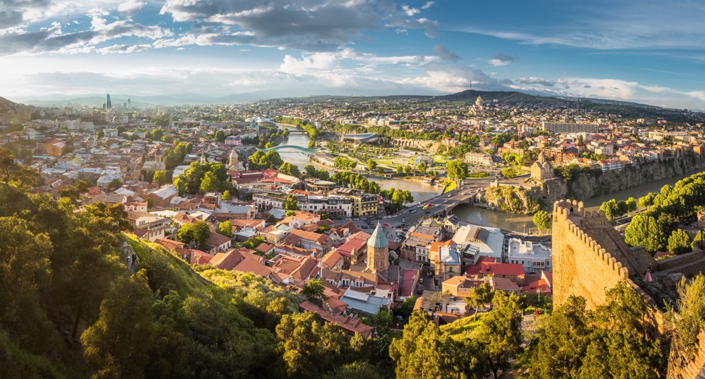
Tbilisi is one of 10 major regions of Georgia and the country's capital of the same name in the Caucasus region between Europe and Asia. The main feature of Tbilisi mountains is Mount Mtatsminda (747 m / 2450 ft), a part of the namesake Caucasus system, which rises above the city and is an integral part of its landscape. But Udzo (1416 m / 4646 ft) is the highest point. The most prominent is Gora Kashvetis-Gora (1097 m / 3599 ft). In total there are 16 named mountains in Tbilisi.
The name of the city, municipality, and region founded in the fifth century, Tbilisi (თბილისს), means "warm spring" and refers to the numerous sulfur springs and baths organized on their basis.
You can also try them while in the Georgian capital at Chreli-Abano (Orbeliani Baths)—a luxury option, or at regular and budget ones: Gulo's Thermal Spa, Bohema Sulfur Bath (Mirzoyev Bath), and others. In general, this is a feature of all the Caucasus Mountains, so there are many sulfur spas throughout the country.
It should also be noted that from 1801 to 1936 the city was called Tiflis, when Georgia was part of the Russian Empire and then the Soviet Union, in case you see it somewhere.
Tbilisi is located practically in the geographical center of Georgia, a relatively small country in the Caucasus.
The municipality borders the regions of Kvemo (Lower) Kartli in the south, Kakheti in the east, Shida (Inner) Kartli in the west, and Mtskheta-Mtianeti in the north.
The city of Tbilisi itself consists of 10 districts: Mtatsminda, Vake, Saburtalo, Krtsanisi, Isani, Samgori, Chughureti, Didube, Nadzaladevi, and Gldani.

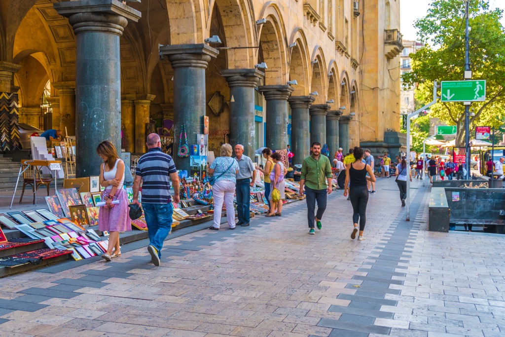
However, from my point of view, not all of them are pleasant for traveling, not speaking about living. The areas outside the old center during the Soviet era were built up with quite ugly tall single-type panel houses, which will be torn down to build new ones for centuries to come. But the old center also needs significant modernization. So my recommendation is Vake, perhaps the only pleasant area, where I spent three weeks in June 2018. It is located between the old town and the districts in the north of the city. Vake is a popular place for living among local intellectuals, creative people and the like. It’s also one of the greenest because of the large park of the same name.
The municipality includes two large settlements in the south—Kojori and Tskneti. It is also firmly associated with Mtskheta in the north, although it belongs to a neighboring region.
It is relatively easy and quick to get to Tbilisi from Armenia, Turkey, and Azerbaijan in the south and Russia in the north by land by car or bus, or by plane, but I recommend the overland route because Georgia is an incredibly picturesque country, where almost every kilometer (mile) is worth of attention. For example, if you drive from Azerbaijan, you can go through the Gareja Desert with its Martian landscapes in Kakheti, although it is also the main wine region of the country.
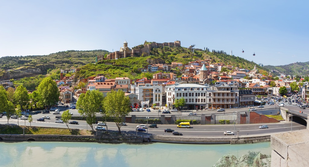
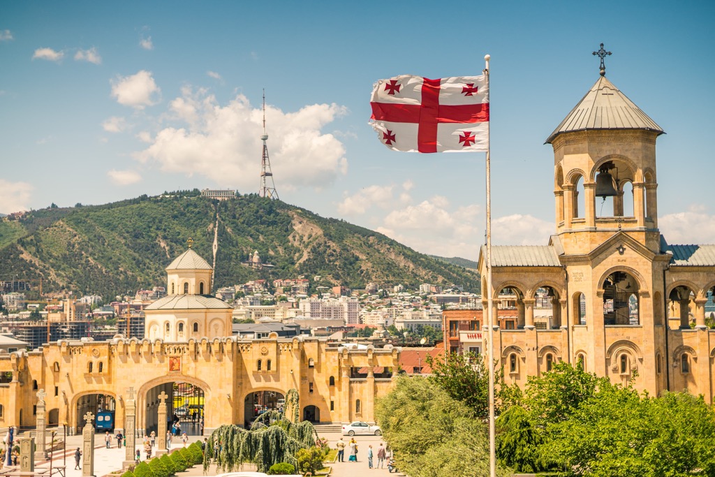
The main natural feature of Tbilisi’s landscape is its mountainous terrain: wherever you go, you will see mountains all around you. The municipality is also characterized by an abundance of free viewing platforms, the main one being the same Mtatsminda with the TV tower. No less famous is the neighboring Gora Kargakala (656 m / 2152 ft). You can go to it by the funicular from the embankment of the Kura River.
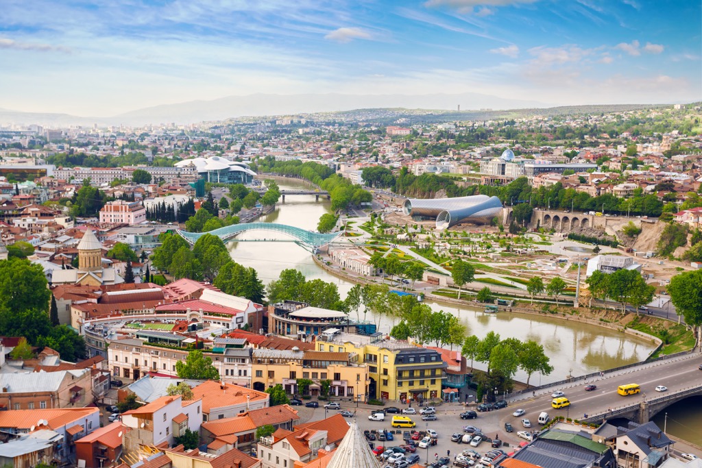
So the second main feature is Kura, flowing through the city, its main waterway. However, it is a borrowed name, Georgian is Mtkvari (მტკვარი).
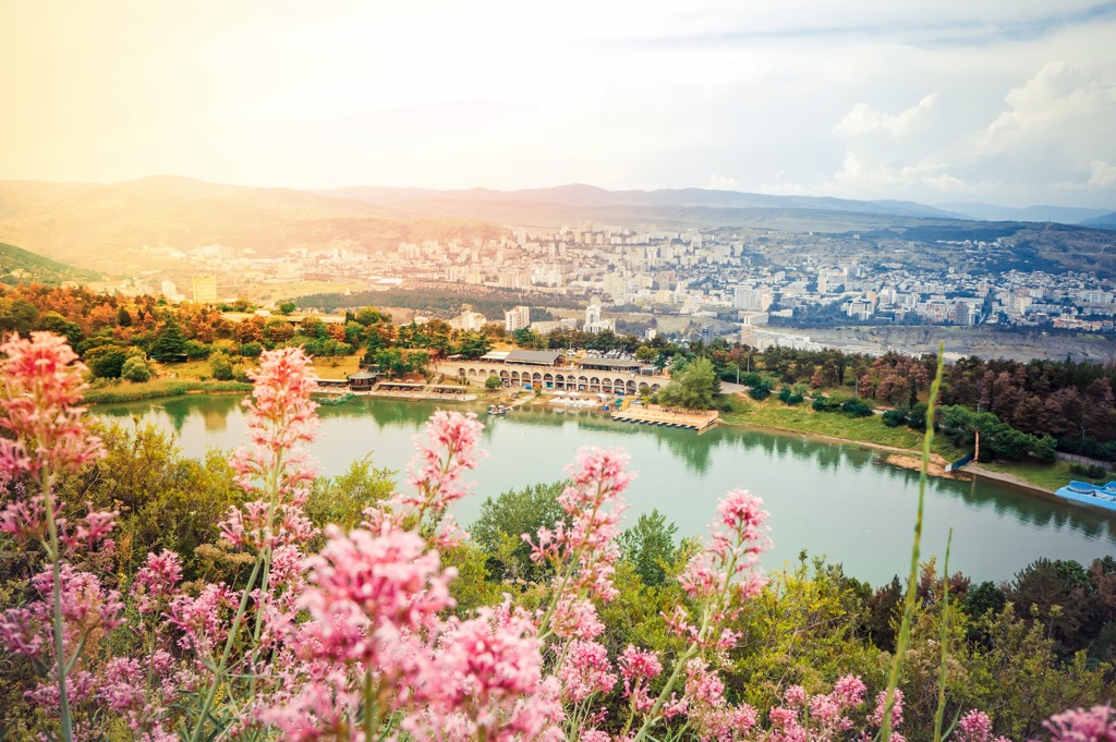
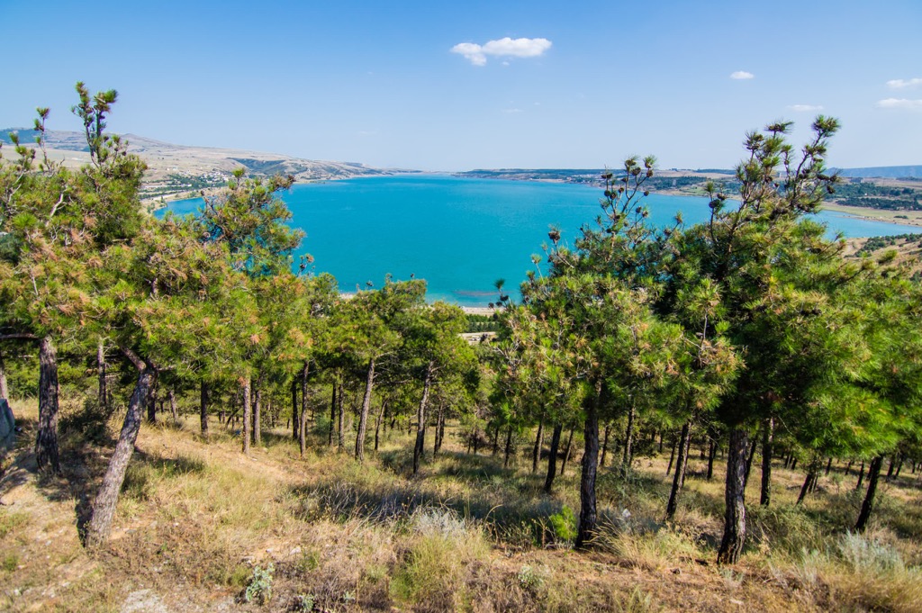
There are also three lakes in the municipality: Tbilisi Sea, the city’s largest reservoir, named so for a reason, Turtle Lake on top of Mtatsminda, and Lisi Lake. Together they form a peculiar triangle.
The greenest parts of the municipality, besides Vake Park, are the entire north slope of Mtatsminda Ridge, as well as Tbilisi National Park on the region's northern borders.
Of course, being one of the oldest cities in the Caucasus, the landscape of Tbilisi also has many man-made landmarks, which I will name at the end of the guide.
The mountains of Tbilisi are unique in that they are located between two main parts—Lesser Caucasus and Greater Caucasus—of the Caucasus mountain system in its north-south division. So we can say that it contains the mountains of both parts (it is difficult to draw a line between them).
Within the municipality, there are also smaller mountain ridges. For example, Mount Mtatsminda (747 m / 2450 ft) is the main one for Tbilisi city center, but not the highest for the ridge of the same name, Mtatsminda Ridge. Most of it, which stretches far to the southwest to the borders of the municipality, is hidden from the peakbagger's eyes unless you intend to travel or hike it.
The opposite, western end of the ridge, crowns Udzo (1416 m / 4646 ft)—the highest point of the entire municipality of Tbilisi.
The Mtatsminda Ridge as a whole is part of the larger Trialeti Range, 144 km (89 mi) long and 30 km (19 mi) wide, which stretches from Tbilisi to Borjomi, the famous Georgian spa, where the mineral water of the same name is produced.
The most prominent mountain of the region, Gora Kashvetis-Gora (1097 m / 3599 ft), is located to the northeast of Tbilisi Lake, so you can see it from its shores.
If you hike every day, you have enough hiking trails in the municipality of Tbilisi for at least a whole week. Next I will briefly tell you about the main ones:
There are also three Georgian national parks near Tbilisi: Tbilisi National Park in the north, and Trialeti Planned National Park, and Algeti National Park, in the west.
The former is located on the slopes of the Saguramo Range, but features a gentle forested landscape; the latter two, which are adjacent to each other, are located on the same Trialeti Range. They are more mountainous and diverse in terms of landscape with many canyons, plateaus, and unusual cliffs and rocks.
The first park is only an hour's drive from Tbilisi, the other two are two hours away, which also makes them ideal options for a day trip out of the city to hike a couple dozen km (mi).
There is a small Betania Ski Resort to the south of Tbilisi with 0.6 km (0.3 mi) of slopes and 1 ski lift.
Two major resorts are located to the west and to the north of the city. These are Bakuriani Ski Resort with 29 km (18 mi) of slopes and 20 ski lifts and Gudauri Ski Resort with 34.8 km (21.6 mi) of slopes and 15 ski lifts, respectively.
For skiing and snowboarding enthusiasts, there are also two small ski resorts near Mestia, the capital of the Upper Svaneti region: Tetnuldi with more than 13 km (8 mi) of slopes and more than 5 ski lifts, and Hatsvali with more than 5 km (3 mi) of slopes and more than 3 ski lifts in total.
Learn more about ski resorts in Georgia in the World Mountain Lifts section of the site, including open and closed ski slopes and cable cars, and lifts.
While traveling in Tbilisi, visit its official tourist center of the Georgian National Tourism Administration:
Tbilisi Tourist Information Center
Pushkin Park, Freedom Square, Tbilisi, Georgia
+995322158697
Georgia.travel/en_US/shida-kartli/tbilisi
The main options for overnight stays in Tbilisi are rooms and apartments; guesthouses, which are extremely popular in the country as a whole; and campsites in the more mountainous and wilderness areas.
For example, I stayed at Jina's Art Room for my first 10 days in the city, and very much recommend meeting the host as a local guide, even if you are not going to rent the room. It is located in the so-called "Italian Сourts" in the Old Town of Tbilisi, where several houses are enclosed in a circle with a common courtyard and form a single communal space with shared kitchens and bathrooms, which also implies closer communication between the inhabitants.
The name, probably, refers to their similarity to the way Italians in the south also live closely, spending a lot of time outside, hanging laundry to dry, interacting a lot with their neighbors, and so on.
Speaking about shared kitchens and bathrooms, this was, however, the case in the Soviet Union, of which Georgia was a part. Today, most of these apartments have long since been converted into separate and more modern ones, but the houses themselves have not disappeared and their communal spirit has partially survived.
The advantage of this particular apartment is that it is close to the main street of the city, Rustaveli Avenue (but at the same time in a quiet yard), and also close to the subway and bus stop, where it was convenient to go to Vake Park or the city center. Both locations can also be reached on foot in half an hour.
Another good place for staying in Tbilisi for a few days is Hostelfabrika.com—part of a large creative and cultural cluster Fabrikatbilisi.com. In addition to the hostel itself with shared rooms from 3 to 12 people, it also has double private rooms and suites (apartments) completed with beautiful walk-out terraces, kitchenettes and private bathrooms.
So both places are great to stay for a few days to explore the city and its people, but for a longer stay, it's better to find something more spacious.
Tbilisi is the main city of the country, which has almost 1.5 million inhabitants out of a population of more than 3.5 million in Georgia in total, which is almost the half.
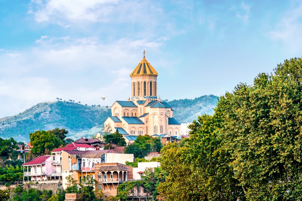
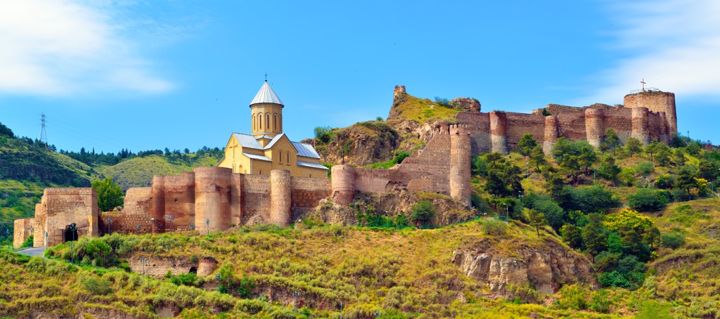
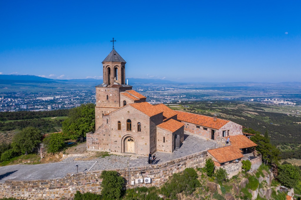
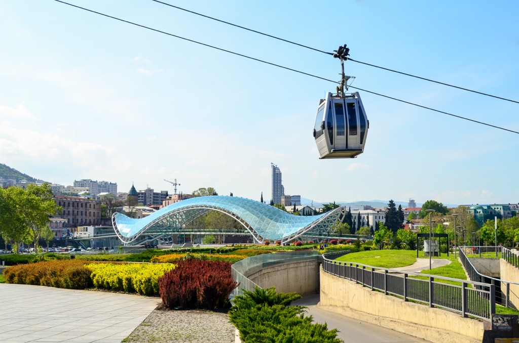
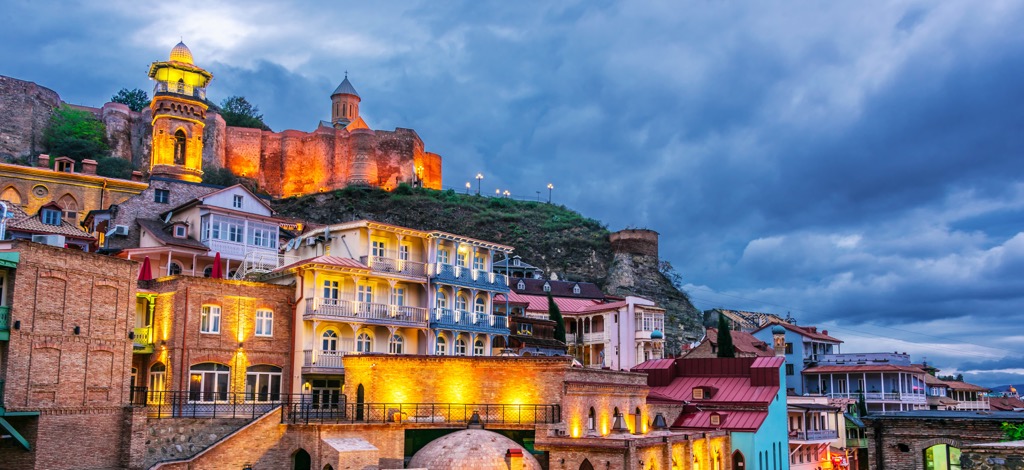
The main architectural and cultural attractions of this unique city cannot be named in three such guides, so here are just a few of the main ones not to be missed: Tbilisi Funicular Railway to the top of Mtatsminda and Aerial Cable Car to Narikala Fortress above the Old Town, Mother of Georgia Statue behind it, beautiful glass Peace Bridge over the Kura River leading to the Rike Park or vice-versa, Georgian National Museum with various findings, futuristic Public Service Hall, Metekhi Church and Tsminda Sameba Cathedral on the eastern side of the city, and others.
In general, over the past decade, the city has undergone major changes and has become more Western with a developed system of public transport and various social services, modern stores and cafes, and clean streets in the center.
Tbilisi is also one of safest (on my personal inner impressions) cities I've been to, even though it has unsightly neighborhoods and terrible traffic. In daily life, when they are not on strike on various occasions, the locals are almost very calm. They are also very friendly and kind to travelers, always ready to help.
Tbilisi is also home to a large community of expats from all over the world, including many English speakers, so you won't be lost without knowing the complicated local language both to the ear and to the eye.


Yes. Tbilisi has 16 named mountains. The highest is Udzo at 1,416 m.
The highest mountain in Tbilisi is Udzo, at 1,416 m.
Tbilisi has 16 named mountains.


