
Scan the QR code and open PeakVisor on your phone
The Lesser Caucasus include 3,027 named peaks. The highest is Mount Aragats at 4,090 m. Other notable peaks include North false peak, Aragats Western Peak and Kaputjugh.
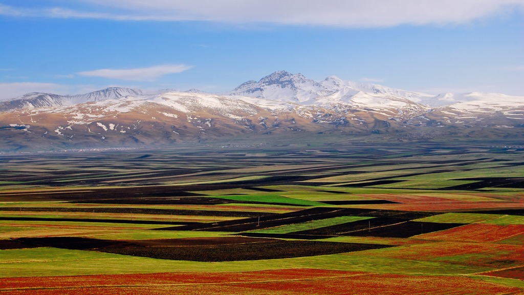
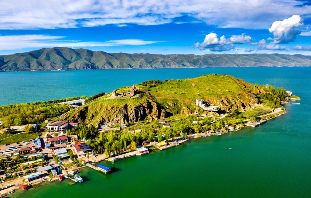
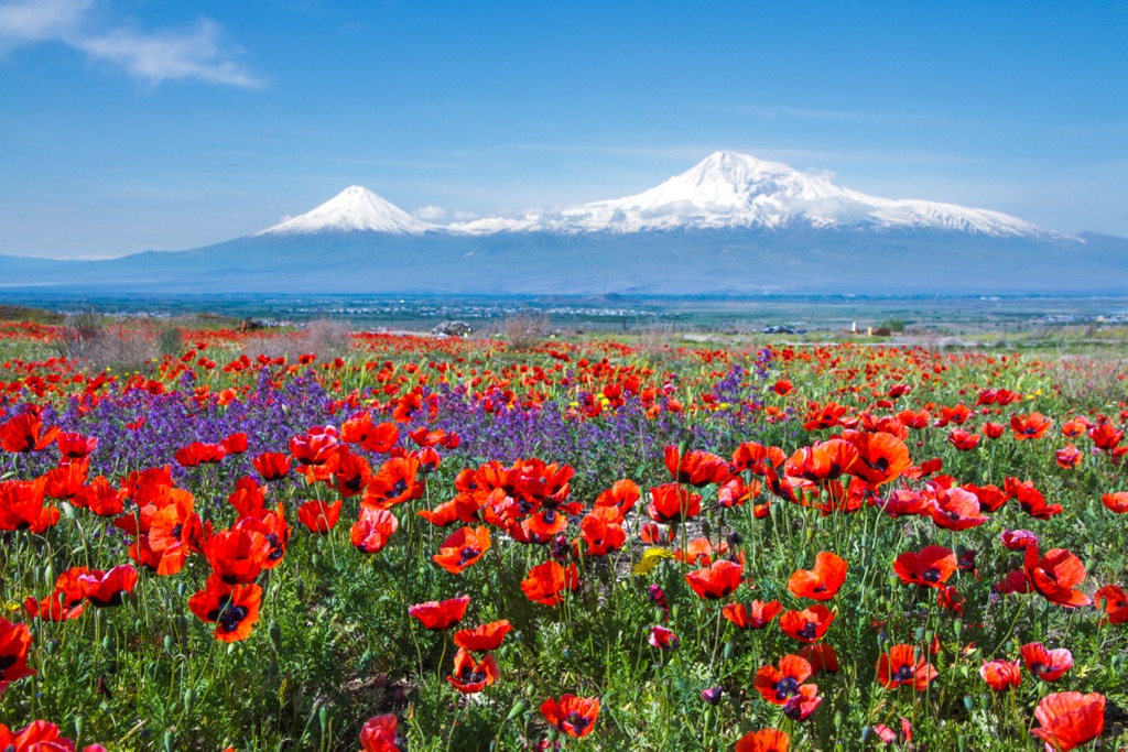
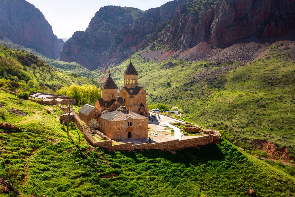
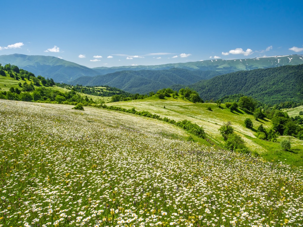
The Lesser Caucasus is one of two major parts of the Caucasus mountain system in its north-south classification, located mainly in Armenia (the second part is the Greater Caucasus). The main features of the range, which is essentially a set of separate chains without a single backbone, is its highest and the most prominent mountain, Mount Aragats (4,090 m / 13,418 ft), and the only large lake in Armenia, extremely beautiful Sevan Lake with the national park around it. You can also hike the entire range and country on the marked, 861-km 535 (mi) long Тranscaucasian Trail or its individual sections. In total there are 3027 named mountains in the Lesser Caucasus.
The first word in the name of the mountain system, Lesser, means that it is the minor part of the Caucasus, both in size and length, and in height in relation to the Greater Caucasus, which is located to the north of it.
The second word, the Caucasus proper, comes from the Greek Καύκασος, which most likely came to them from the Caucasus itself, not the other way around. There is still no consensus as to what exactly this word means, but it is most likely nothing unanticipated: "mountain" or "high mountain," as well as "mountains covered with ice/snow that glisten in the sun."
The Lesser Caucasus in the languages of peoples of this mountain system are Малый Кавказ (Russian), მცირე კავკასიონი (Georgian), Փոքր Կովկաս (Armenian), Kiçik Qafqaz (Azerbaijani), Küçük Kafkasya (Turkish), القوقاز الصغرى (Arabic). In other European languages: Μικρός Καύκασος (Greek), Kleiner Kaukasus (German), Petit Caucase (French), Caucaso Minore (Italian), Cáucaso Menor (Spanish).
The range was also historically called Anticaucasus or Anti-Caucasus but the current usage tends towards using the modern name, Lesser Caucasus.
The Lesser Caucasus is a relatively extensive mountain range or a small mountain system, which is essentially a collection of individual chains, volcanic highlands, and high mountain plateaus, as well as individual peaks without a single ridge, stretching about 600 km (370 mi) from northwest to southeast.
This mountain arc is located mainly in Armenia and covers almost the entire country, but also a little in Georgia in the north, Azerbaijan in the east, Turkey in the west, and Iran in the south — that is, in all the countries surrounding it, because mountains do not know administrative borders, on the contrary, people are guided by mountains.
On the physical map of the world, the exact borders of the Lesser Caucasus are as follows:
Speaking of the geography of the two main natural landmarks within the mountain system: Mount Aragats (4,090 m / 13,420 ft) is located in the northeast of the Lesser Caucasus in the Shirak province north of Yerevan, and Sevan Lake is roughly in the middle of the eastern part of Armenia, which again more or less coincides with the center of Armenia.
Looking at the Sevan Lake even on the map, not to mention the fact that I managed to visit it myself and then drive all over the Martian-looking country, I am amazed at the luck of Armenians. It is a uniquely huge lake for a country squeezed in the middle of the mountains and highlands, where in fact there are no other major bodies of water, although historically Armenia in its (I should say primarily military) heyday had access to both the Black Sea and the Caspian Sea, and even the Mediterranean Sea.
Three other nearest large lakes are Val Lake in Turkey, Urmia Lake in Iran, and Mingachevir Reservoir in Azerbaijan.
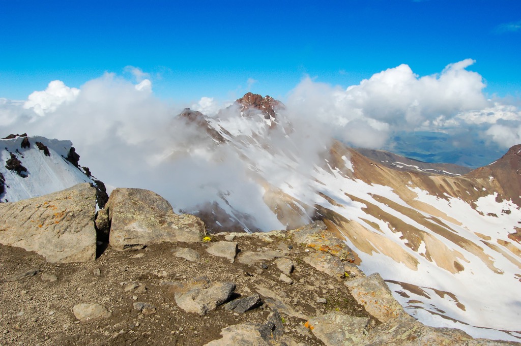
The Lesser Caucasus are folded mountains, which were formed as a result of the collision of tectonic plates at about the same time as the Alps (28–25 million years ago). They have various compositions, consisting of granite, dolomite, limestone, and other rocks, also inherent in the Caucasus as a whole.
However, its highest mountain, Mount Aragats (4,090 m / 13,418 ft), has a volcanic origin. It is a stratovolcano, that is, a volcano with a strict conical shape, composed of multiple layers of solidified lava and volcanic ash.
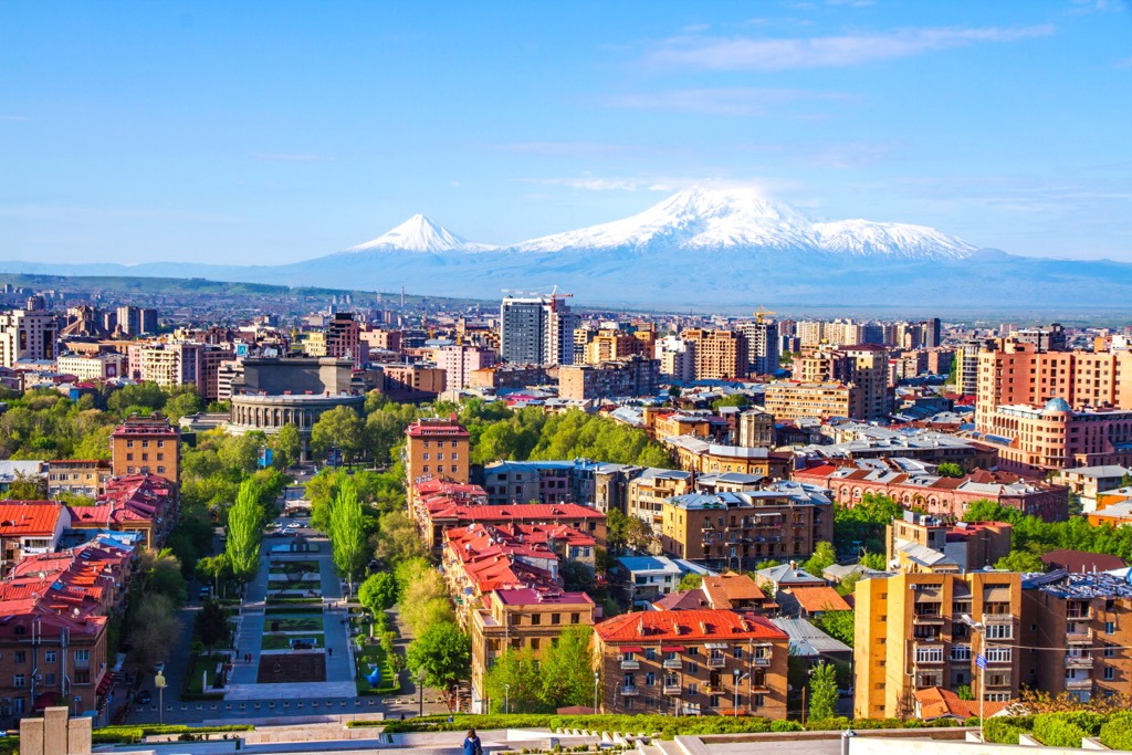
The same can be said about Ararat (5,137 m / 16,853 ft), which is located in the territory of Turkey but used to be also in Armenia during the long and troubled conflict history of the region on the border between Europe and Asia. Therefore, Armenians consider both of these mountains, especially the last one, sacred. The reason is that Armenia was the first country in the world to officially adopt Christianity according to the Byzantine model, i.e. Orthodoxy. In other words, its official Christian traditions are even older than in the rest of Europe. Ararat is perfectly visible from the center of Yerevan, the capital of Armenia. In particular, you can see it at the entrance of the factory where their main national product, cognac with the same name Ararat, is produced. It is also known as Armenian brandy.
There is also Mount Little Ararat (3,896 m / 12,782 ft)—a neighboring lower volcano near Ararat, the existence of which most people simply can not guess.
(Completing the picture, the highest mountain in the Caucasus, as well as all of Europe, Mount Elbrus (West Summit) of 5,642 m (18,510 ft) is also a volcano.)
Both of these volcanoes are not the only ones in the Lesser Caucasus, there are many others. Volcanic activity is one of the differences of this mountain system.
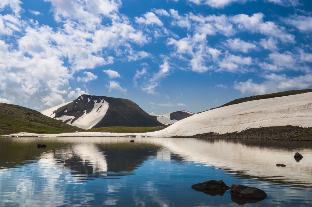
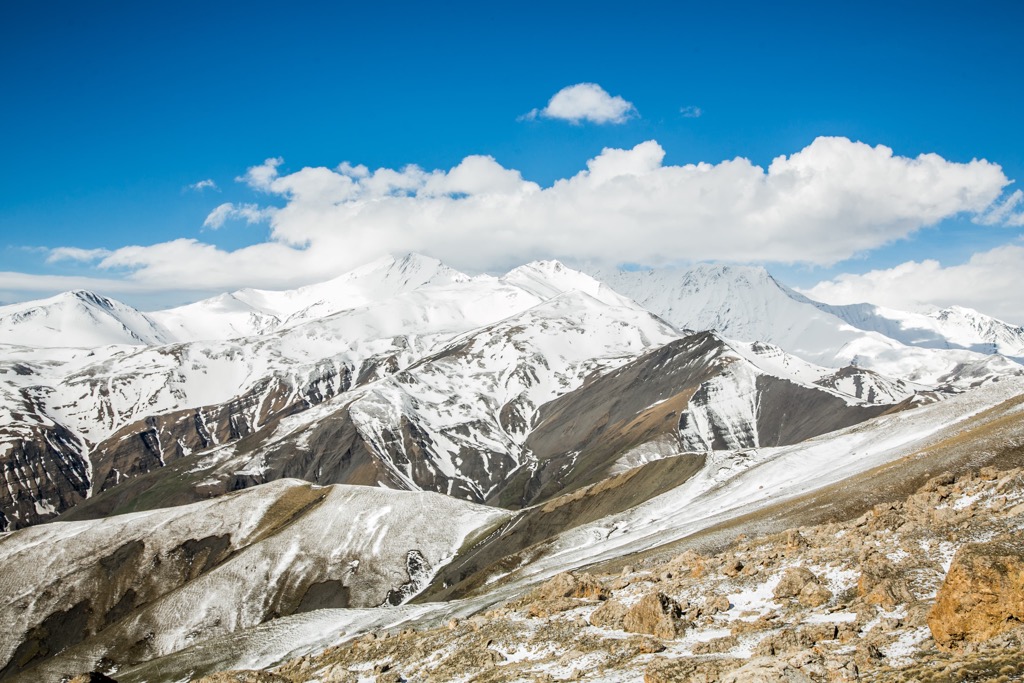
But given the lower elevation and size of the Lesser Caucasus mountains compared to the northern Greater Caucasus (Aragats is also the only peak above 4,000 m (13,123 ft), while there are several dozen in the northern Caucasus), it also has no large glaciers.
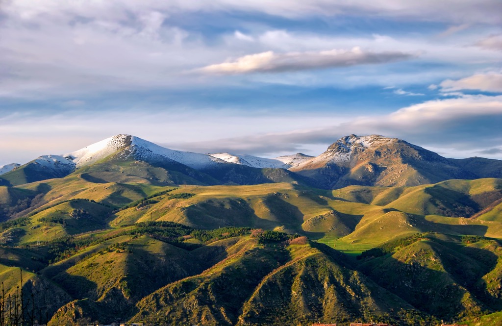
The Lesser Caucasus system consists of a dozen separate unconnected ranges, which are nevertheless close to each other and therefore visually (on the map) resemble a single mountain range, similar to the Greater Caucasus.
In addition to the Likhi Range with the highest peak of Ribisa (2,470 m / 8,100 ft), a part of the larger Meskheti Range with the highest peak Mount Mepistskharo (2,850 m / 9,350 ft), which connects the two parts of the mountain system, in the Lesser Caucasus you can distinguish at least nine more major ranges—from northeast to southwest in accordance with their natural arc-shaped location with the following corresponding highest peaks:
Note: Given that the local alphabets are radically different from the Latin and even Cyrillic in Russia, some mountain range names may be spelled differently. More: They may have second local names and even third names. Check with locals for the correct name of a particular range.
An examples of other important peaks in the aforementioned ranges are the following:
It is also important to note that the Lesser Caucasus system coincides with a large historical and cultural region, called the South Caucasus. Correspondingly, the mountains of the Greater Caucasus are also called North Caucasus. It is also a large distinctive region in present-day Russia.
As in other parts of the world, the main hiking trails in the Lesser Caucasus lie within the national parks, nature parks, nature reserves, natural monuments, and other natural protected areas. Given the sheer number of the areas, to help you navigate, I counted all national parks (16) as the most popular type. Here they are in each of the four countries:
Another way to explore the Caucasus Mountains on foot is long thru-hiking trails similar to the Appalachian Trail in the United States.
The main such trail in the Lesser Caucasus is the Transcaucasian Trail of 861 km (535 mi) long. This is a relatively new trail that was built by Peace Corps volunteers in 2015–2020. It runs through the entire system and all of eastern Armenia through its main natural and architectural landmarks, including Sevan Lake and the national park of the same name around it.
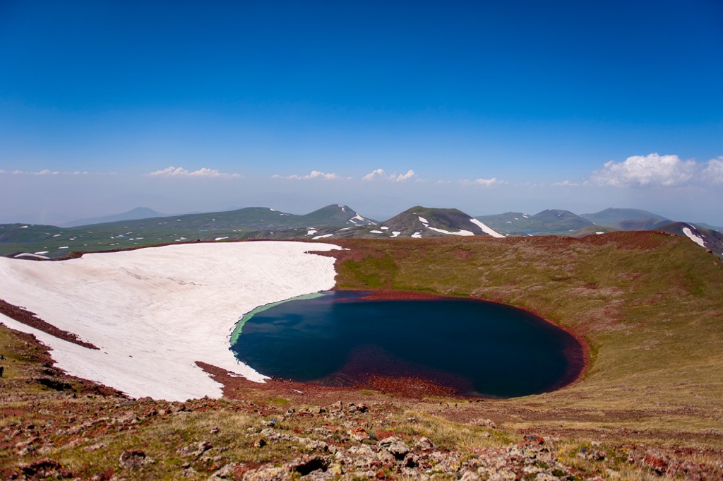
Like other similar trails, it is divided into sections, so you may take shorter routes, such as the in the abovementioned Gegham Range of 114 km (71 mi) long west of Sevan Lake and climb up its highest peak, Azhdahak volcano (3,597 m / 11,801 ft) to see another picturesque lake at its caldera. Or, it can be the Dilijan National Park route of 80 km (50 mi) long. Another option is hiking the Vayots Dzor province in southern Armenia by a route of 181 km (112 mi) long.
Remember also that the Transcaucasian Trail is a generic name for a longer, two-part trail. In addition to its Armenian part, volunteers are building a trail along the entire Greater Caucasus Range, where four sections of 100 km (62 mi) each in the western and eastern part of the ridge are now ready. More: the trails will intersect and eventually connect the Black Sea and the Caspian Sea in the near future.
It does not apply to hiking, but I also recommend driving from Yerevan to Gyumri in the west of the country on the border with Turkey, the country's second-largest city across the Armenian Highland with its Martian-like scenery. Believe me, even from the bus or car window this trip will be remembered for the rest of your life as a road movie with you as the main character. But even better of course is to get out on the road to enjoy the scenery. I couldn't do that, because I was taking an airline shuttle bus to fly from Gyumri to my native St. Petersburg. So I recommend renting a cab in Yerevan, considering also that they are very inexpensive because of the low exchange rate in Armenia compared to Europe and other Western countries if you go there from this part of the world.
Another equally scenic and much greener route is all the way from Yerevan to Tbilisi, the capital of Georgia, via Sevan Lake. I highly recommend taking it, too. By no means take a plane between these two neighboring countries, which you are likely to visit one after the other, as well as possibly neighboring Turkey or even Iran.
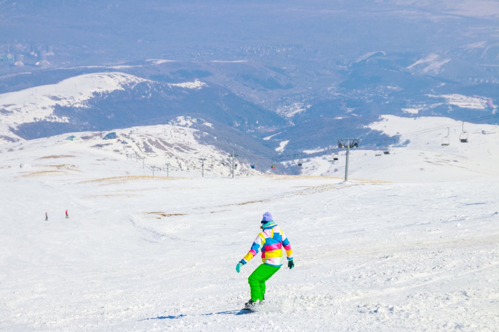
The Lesser Caucasus is not the main place in Europe (and Asia) for skiing and other winter sports but there are a few relatively large ski resorts here.
In Amenia, there is Tsaghkadzor Ski Resort in Kotayk province, the only large one in the country with more than 30 km (19 mi) of slopes, most of which are for easy and intermediate skiing, and more than 5 ski lifts. It is also the highest ski resort in Armenia located between 1,966 and 2,819 m (6,450 and 9,248 ft), and the main ski resort near Yerevan, the capital of the state. The ski season at the resort is from early December to late April in general.
In Georgia, the largest ski resort in the Lesser Caucasus is Bakuriani in Samtskhe-Javakheti region west of Tbilisi with more than 30 km (19 mi) of slopes and more than 20 ski lifts.
In Azerbaijan, Turkey and Iran, there are no large ski resorts similar to these in Armenia and Georgia in the Lesser Caucasus.
Check the Lesser Caucasus ski resorts map on the larger Armenia and Georgia ski maps in the World Mountain Lifts section of the site. It includes information about open ski lifts / slopes in the Lesser Caucasus in real-time with opening dates and hours. There are also year-round cable cars, funiculars, cog railways, aerial tramways, and all other types of mountain lifts.
Before or after hiking in the Caucasus mountains, visit one of the region's official tourist centers:
Vladikavkaz Tourist Information Center
Prospekt Mira, 9, Vladikavkaz, Russia
+78672772878
Visit Sochi Tourist Center
Ul. Vinogradnaya, 20A/1, Sochi, Russia
+78001000382
Krasnodar Tourist Information Center
Ul. Gogolya, 76, Krasnodar, Russia
+78612189777
Tbilisi Tourism Information Center
Pushkin Park, Freedom Square, Tbilisi, Georgia
+995322158697
Yerevan Tourist Information Center
2/1 Nalbandyan Street or 2/5 Baghramyan Avenue
+37411514230
Baku Tourism Information Center
Bulbul Avenue, 14, Baku, Azerbaijan
About overnight stays in the mountains during hiking in both the Greater and the Lesser Caucasus, first, you should know that compared to the Alps, the system of mountain huts here is dozens of times smaller or, I could say, weaker. But they still exist in large numbers, especially near the most popular attractions of the mountain system.
Hence, in the Caucasus, hiking is more often meant backpacking or thru-hiking—as an autonomous hike with a tent for several days and longer, because even if you find a mountain hut at the start and finish of your route, in the middle of it there usually will not be any of places to stay except under the starry sky. This also means that, of course, you should not set up a multi-day camp and vice versa use the campsites that already existed before you came.
But at the same time, in the mountains of the Caucasus, you can find permanent large organized campsites from various companies and private entrepreneurs, which is another frequent type of accommodation in this region. For example, there are many of them in the area of Kazbegi and the surrounding mountains: Zeta Camping, Kazbek Camp, Sabertse Campsite, and others.
The situation in the mountain towns and villages is better: There you can find many different types of accommodation, the most popular of which is a guest house—a small hotel with basic services for a relatively low cost. For example, in the eco-settlement Ažek in Sochi National Park, you will find a small guest house from locals, which I highly recommend.
If you have read this guide to the end, you already know the main cities and resorts of the Greater Caucasus. Let's summarize the information and add a few new ones as well.


The highest peak in the Lesser Caucasus is Mount Aragats, at 4,090 m.
The Lesser Caucasus have 3,027 named peaks.


