
Scan the QR code and open PeakVisor on your phone
Tbilisi National Park has 13 named peaks. The highest is Mt. Nakokhari at 1,735 m. Other notable peaks include Mt. Kuchna, Mt. Satibis-Mta and Kuchna.
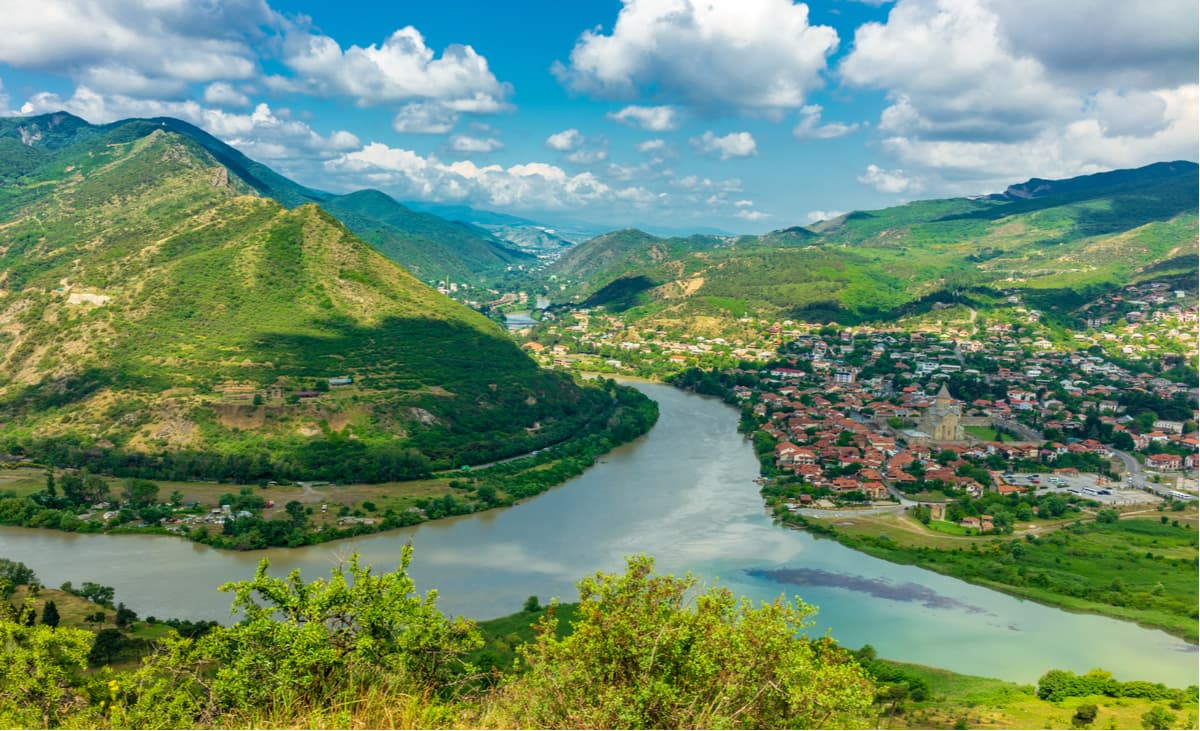
The Tbilisi National Park is the first national park in Georgia. It was established in 1973 with the purpose of saving rare plants from extinction and protecting various animals, reptiles, and birds. It is located only 20-25 km from the Georgian capital Tbilisi in the foothills of the Greater Caucasus on the Saguramo - Ialnossky Ridge of the southern saddle of the Main Caucasian Ridge near the city of Mtskheta. The park lies at an altitude of 600-1800 m above sea level from the Mtkvari River to the Iori River on the slopes of the Ialnoi (1,874 m), Saguramo (1,385 m), Sabadur and Ikvliwa mountain ranges. The main part of the park belongs to the Mtskheta-Mtianeti region, and part to the Kvemo-Kartli region. The park covers an area of 23,218 hectares, 90% of which are forests, and consists of five sections: Saguramo, Gldani, Martkopi, Gulelebi, and Gardabani. The national park borders the historic provinces of Kakheti, Shida Kartli, and Erzo-Tianeti.
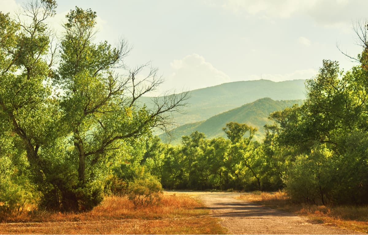
Climatic, soil and vegetation conditions vary greatly from one height zone to another. Up to the elevation of 600m, there are the so-called ‘light’ forests, which are transitional from semi-desert vegetation to forest vegetation and represent the forest-steppe of the subtropical climate.
At altitudes of 500-600 m to 1000-1100 m there is a belt of Georgian oak forests, the climate here is relatively dry, continental. The warm period starts in May and lasts until the end of October.
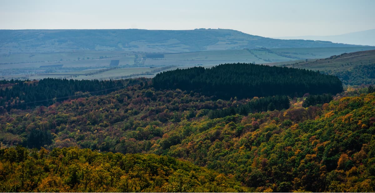
East beech forests are the common sight within the limits of heights from 1000-1100 to 1500 m. The climate of this zone is moderately humid with cool summers, droughts happen very rarely. The warmest and most comfortable months are July and August. Snow cover lies from November to mid-March.
The following rivers flow through the park: the Gldanula, the Tedzami, the Lochini, the Alihevi, the Norio (they are all part of the Kura River Basin) and many small rivers. In spring, as a result of snow melting and heavy rainfall, the river flow increases greatly. There are also many lakes in the park, the largest of which are the Nakerala and the Mamkodi, and springs with drinking water.
The diversity of geographical and climatic conditions in the region where the park is located has led to the richness, originality and diversity of vegetation. The flora of the national park and the surroundings of Tbilisi can boast of 1,643 plant species belonging to 629 genera and 107 families of flora. Among rare and endangered species one can see Pontine oak, walnut, Colchis boxwood, yew, wych-elm. The vegetation of the light forest belt is very similar to that of the savannah.
There are a lot of fruit and berry plants in the park, such as oriental and black hawthorn, willow-leaf pears, Georgian and wild pear, Caucasian blackberry, European dogwood, cornelian cherry, Russian olive, plum, wild cherry, common rosehip, common blueberry, medlar and a wild apple tree, some of which are included in the Red Book like sea buckthorn, Georgian bream and Georgian barberry. There are Tertiary period plants, such as Colchis ivy, Colchis holly, Caucasian rhododendron and Pastukhov’s ivy.
The fauna around Tbilisi used to be quite rich in the past. In the national park, you can still spot a roe deer, hare, squirrel, mole, forest mouse, etc. Oak and beech forests are inhabited by boars. Among the animals of prey, there are forest and stone martens, foxes, lynxes, wolves, brown bears, wild cats, jackals, and badgers. Not so long ago, one of the representatives of the semi-desert, a goitred gazelle, lived in these places and in recent years it has completely disappeared. Of the red-booked representatives of the fauna, special attention is drawn to the inhabitant of subalpine and alpine meadows – the noble deer, the number of which is only about 700-800 in the whole of Georgia. The Red Book includes a Caucasian hamster, which is in danger of complete extinction in Georgia, dwarf and lesser white-toothed shrew, otter and Caucasian lynx. The number of Caucasian lynx in Georgia is estimated at 750 individuals only.
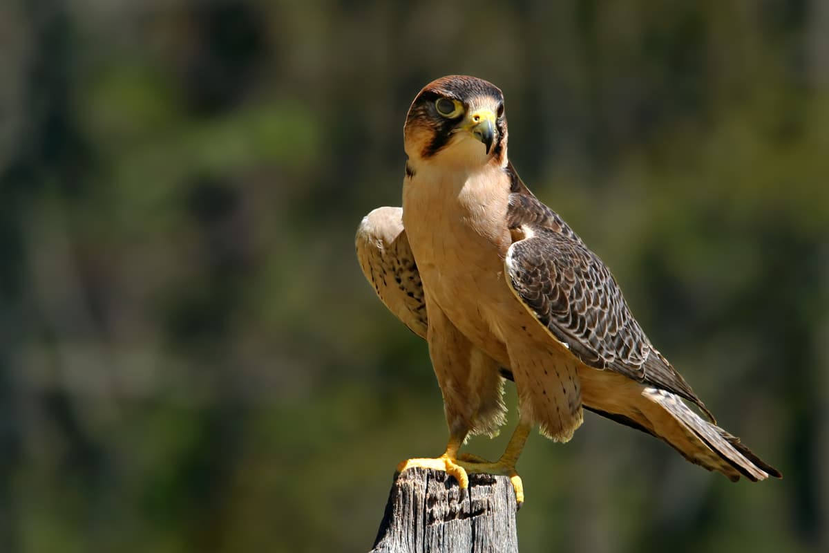
Of particular interest is the common falcon, or peregrine falcon, which lives mostly in open spaces near forests. The peregrine falcon is listed in the Red Book. In recent years, the number of pheasants, bustards and other birds has decreased dramatically.
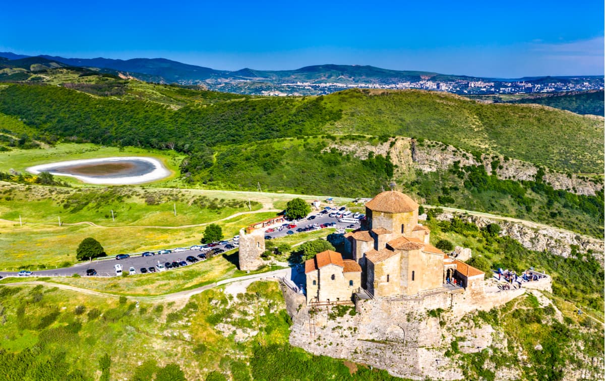
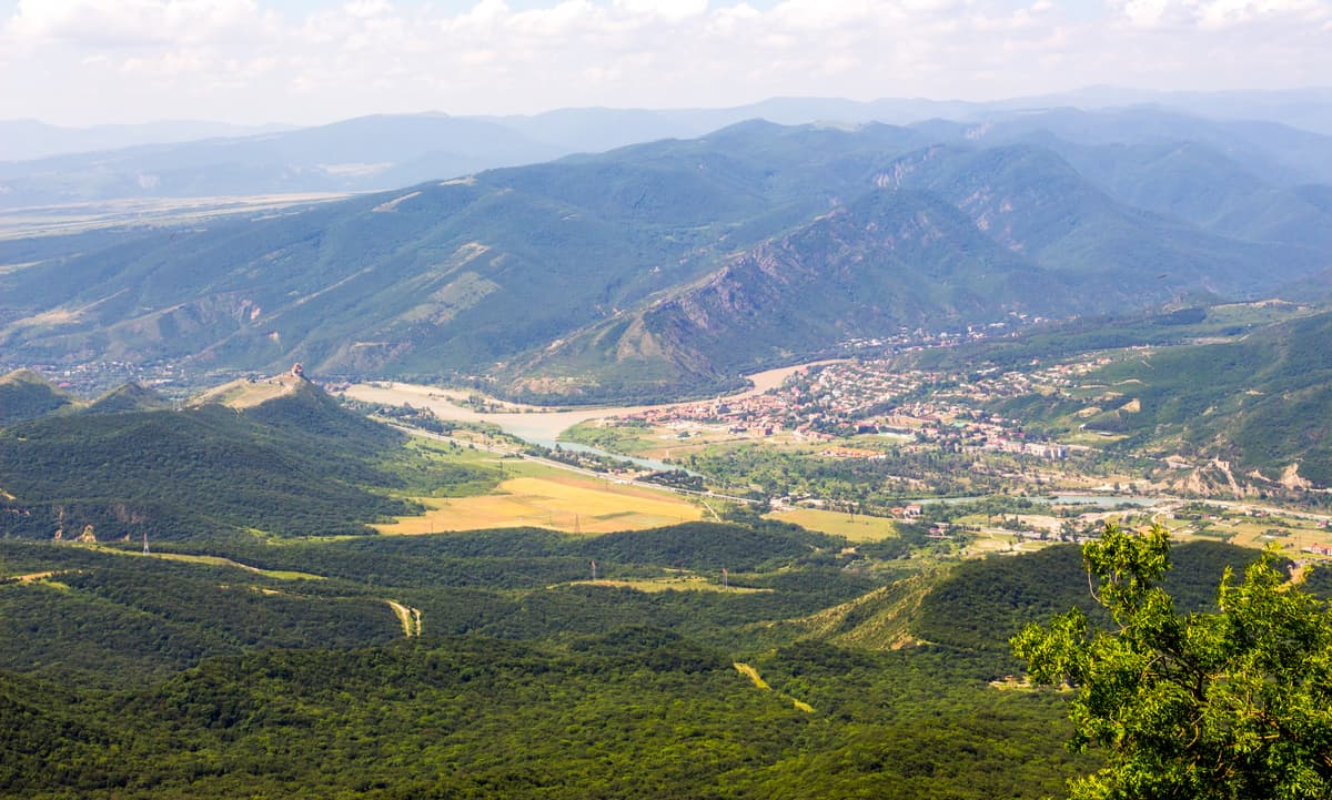
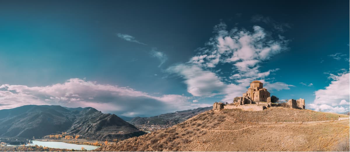
There are 25 cultural, historical and ethnographic monuments of the 6th-18th centuries on the territory of the Tbilisi National Park. The park is located near the ancient Georgian capital Mtskheta and near its western border, you can see a monument of Christian culture – the monastery and temple Jvari of the first half of the 7th century. It is located on the top of a mountain at the confluence of the rivers Kura and Aragvi where, according to legends and historical sources, St. Nina erected a cross. It is the first World Heritage monument in Georgia, and since 1984 it has been under UNESCO protection.
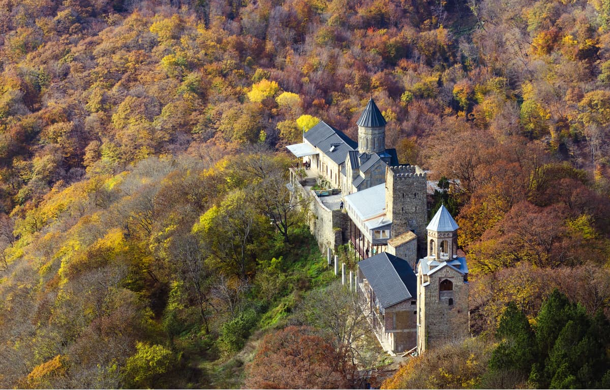
The Martkopi Monastery Khvtaeba (Saviour) can be found 35 km from Tbilisi, near the village Martkopi on the forest slopes of the Ialnoi Range at an altitude of 1,350 m. The monastery was founded in the 6th century by one of the 13 Assyrian fathers named Anthony who arrived in Kartli, which was called in those ancient times Akriani, and settled alone, away from the hustle and bustle of the world. That is why he was nicknamed "Martomkopeli" (living in solitude) and soon the area was named after this elder, Martkopi.
Among the attractions located in the park are: the Zedazeni Monastery, the Church of St. Grigola, the ruins of the church of Asur Sakdari, the ruined Palace of Vegini, as well as the House Museum of Ilya Chavchavadze in the village of Saguramo. Among other important monuments, we should mention the Archila Church in Gulelebi village, Peter the Mediator Church in Zion, historical monuments – the fortresses of Akton and Giorgi Mamkoda. Mamkoda Monastery, which is 22 km north-east of Tbilisi, is a monument of Georgian architecture of the 18th-19th centuries and is especially popular among holidaymakers.
The Tbilisi National Park offers visitors various types of routes including those for cycling, hiking and horseback riding of medium difficulty, they are marked and equipped with picnic areas, hangars and places where you can light a fire or put up tents for the night. In 2013, the first bicycle paths were marked in cooperation with the World Tourism Organization. In total, three bicycle routes were planned and arranged.
The easy walking track has a length of only 10 kilometres. It is an observation trail and is designed for leisured strolling along asphalt roads and forest paths. The route runs from the village of Gldani towards Didveli over a bridge across the river of the same name, offering panoramic views of the Lesser Caucasus and Mount Amarati. On the way, there are some remarkable places: a spring with the purest drinking water, an iron cross Rkinis Jvari on the top of the mountain with a panoramic view of the national park and the monastery. You can also visit the Monastery of St. George of Mamkoda located near the starting point.
The route of medium difficulty starts from the village of Mamkoda, passes through Lelubani, Martkopi, and Norio. The 38-kilometre-long route passes by springs, the ruins of the Lelubani church, the ancient monasteries of Mamkoda and Martkopi. The road is mostly paved and only eight kilometres of the Tianeti highway is asphalted. There is a pass between the village of Lelubani and Martkopi Monastery, 1,460 meters above sea level, from where you can enjoy the view of Tbilisi.
The route also starts from the village of Mamkoda and runs entirely through dirt roads. The total length of the route is 44 kilometres. There will be a lot of elevation gains, so the route can be recommended to experienced tourists. The route starts from the old administration building and passes through the church of Mamkoda, the village of Lelubani, the ruins of the temple of St. Giornia and a spring, a pass with a height of 1,460 meters. Descending from the highest point of the pass, the trail goes to the meadows of Shvindadzeebi, where you can see the Ialno Ridge and the monastery of Martkopi, the ascent to which is of medium difficulty ascent. There are picnic tables and a spring. From the road of Norisi village, one can enjoy breathtaking views towards Tbilisi.
It is the busiest route despite its length of 25 kilometres. It starts from the village of Saguramo and includes a museum, the ruins of the temple and a palace, a monastery and a church. It reaches a height of 1,440 meters above sea level. On this route you can visit the house-museum of Ilya Chavchavadze, the ruins of the Asur Sakdari church, the Zedazeni monastery, the remains of the Vedzhini palace, St. Grigola church and enjoy wonderful panoramic views. There are at least 3 springs along the way.
Park address: Mtskheta Town Municipality, the village of Saguramo The road from Tbilisi to the centre of the national park takes about one hour along the Tbilisi-Tianeti highway. Saguramo can be reached by shuttle bus from the Tbilisi Didube bus station to the village of Saguramo. They are rare, so it is better to check the ticket offices in advance. The travel time is about 30-40 minutes.
There is a small Betania Ski Resort to the south of Tbilisi with 0.6 km (0.3 mi) of slopes and 1 ski lift.
Two major resorts are located to the west and to the north of the city. These are Bakuriani Ski Resort in Samtskhe-Javakheti region with 29 km (18 mi) of slopes and 20 ski lifts and Gudauri Ski Resort in Mtskheta-Mtianeti region with 34.8 km (21.6 mi) of slopes and 15 ski lifts, respectively.
There are also two small ski resorts near Mestia, the capital of the famous Svaneti region in the northwest of the country: Tetnuldi and Hatsvali with more than 20 km (12.4 mi) of slopes and more than 10 ski lifts in total.
Check the Tbilisi ski map on the larger Georgia ski resorts map in the World Mountain Lifts section of the site. It includes information about open ski lifts / slopes in Tbilisi and Georgia in real-time with opening dates and hours. There are also year-round cable cars, funiculars, cog railways, aerial tramways, and all other types of mountain lifts.
Tbilisi is the capital and the largest city of Georgia, located on the banks of the Kura River with a population of about 1.1 million people. The name of the city founded in the fifth century by the Iberian king Vakhtang I, nicknamed Gorgasal, came from the Georgian word "Tbilisi" translated as "warm", which is associated with the presence of hot sulfur springs in the city.
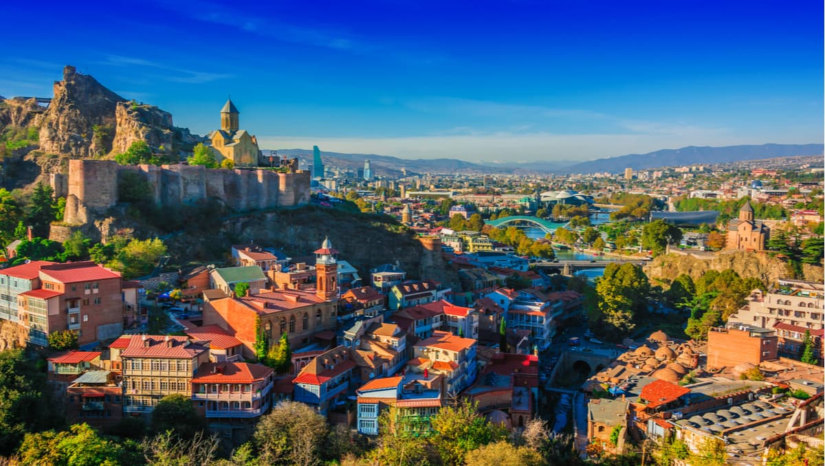
It is an incredibly picturesque city, impressive with its unusual panoramas, the abundance of greenery and staggering sights. Equally enjoyable is the wonderful cuisine, cosy hotels and surprisingly cordial atmosphere: the people in Tbilisi treat tourists as dear guests, trying to make the most pleasant impression in the best traditions of Caucasian hospitality. Standing on hills and rocks, Tbilisi has an unusual relief and breathtaking views: there are ancient temples, picturesque ruins of ancient fortresses, churches and monasteries, old houses with carved wooden balconies and inner courtyards, those are often restored but never lose their charm. Modern buildings oftentimes feature unusual architecture and the narrow streets are connected by steep staircases. The city is blessed with some waterfalls and beautiful parks.


The highest peak in Tbilisi National Park is Mt. Nakokhari, at 1,735 m.
Notable peaks in Tbilisi National Park include Mt. Nakokhari, Mt. Kuchna, Mt. Satibis-Mta, Kuchna and Mt. Sabaduri.


