
Scan the QR code and open PeakVisor on your phone
Borjomi-Kharagauli National Park has 44 named peaks. The highest is Sametskhvario at 2,646 m. Other notable peaks include Didimaghala, Samets’khvario and Megruki.
There are 14 named mountains in Borjomi-Kharagauli National Park. The highest and the most prominent mountain is Sametskhvario.
Borjomi’s history as a protected area goes all the way back to the feudal ages when the forests of these lower Caucasus mountains were protected for hunting by feudal lords. The region has long been considered one of the most beautiful and prestinely preserved forest landscapes in all of Georgia and has been valued by Georgians, monarchs of the Russian Empire, and international environmental organizations alike.
Borjomi is also one of the most effectively developed environmental tourism regions in Georgia and offers a great number of activities including hiking, horseback riding, cross country skiing (in the national park) and traditional skiing (in neighboring Bakuriani), spa retreats, and many bird and wildlife watching opportunities in the national forest. The Borjomi-Kharagauli National Forest is one of the most ecologically diverse forests in the entire country and is a huge draw to botanists, ornithologists, and zoologists both within Georgia and internationally. Another draw Borjomi has is that it is famous for its water (you can see Borjomi bottled mineral and still water all across Eastern Europe and Russia), and has historically been a very popular vacation spot for Russians who still flock to the village every year to enjoy the benefits of the sulphur baths and Borjomi’s restorative mountain spring water. Addition the neighboring villages of Likani and Bakuriani claim benefits to their local springs as well.
Marshrutka
The most popular way to get to Borjomi is via Marshrutka from Tbilisi. You can catch a marshrutka from the Didube Bus Station on the M1 metro line. The marshrutka will cost 7 Gel and will typically leave once it is full. Your best bet is to try and catch a ride in the morning. The ride is about 2.5 to 3 hours and it will drop you off at the Borjomi Bus Station just slightly southwest of the center of town inside the town limits and within a very short walking distance of the downtown area.
Train
Another option for going to Borjomi is to take the train. The trail is an old Soviet train and there are no bathrooms. This option is more interesting, but takes considerably longer at 5 hours between Tbilisi and Borjomi, stopping in numerous villages, as well as the city of Gori. The train moves relatively fast between Tbilisi and Gori, but once the train approaches the mountains and the famous Surami Pass (949m), which connects the Lesser and Greater Caucasus mountain ranges, going through the Likhi Mountain Range is slows to a crawl.
The first train leaves Tbilisi from the Tbilisi Train Station near the Station Square Metro Line at 06:45 and arrives in Borjomi at 10:55, and the second train leaves at 16:35 arriving in Borjomi at 20:45. The return Borjomi to Tbilisi trains leave first at 07:05 arriving at 11:55, and the second at 16:45 arriving at 21:15. The tickets are very cheap, costing only 2 Gel each way. For the most part, the train is not very crowded, however, when heading back to Tbilisi the train gets very full for the last hour. You can either buy a ticket at the domestic train ticket desk or you can pay on the train at one of the machines near the entrance of the car.
Marshrutka
Many trekkers come to Georgia through Kutaisi as it offers a budget airline option for entering the country. As such, traveling from Kutaisi to various parts of Georgia via marshrutka is very common. You can catch a marshrutka from the Kutaisi Bus Station, next to the railroad station in southwest part of town. The Marshutka will cost between 5 Gel to 10 Gel and will leave in the morning. Marshrutkas returning to Kutaisi from Borjomi are less common so be sure to ask when the best time to go to the bud station to catch a Kutaisi marshrutka would be.
Bakuriani is a popular addition to a Borjomi trip, especially for those interested in skiing, and can be reached in a number of ways from Borjomi, Tbilisi and Kutaisi.
Train
The train to Bakuriani, called Kukushka, is very slow, but is a phenomenally beautiful option especially during the winter months because it cuts through remote parts of the forest. Scheduled to coincide with the Tbilisi to Borjomi trains the first train leaves at 07:15 arriving at 09:35, and the second leaves at 10:55 arriving at 13:15 and costs 1 Gel each way. To return you can take the first train back at 10:00 arriving in Borjomi at 12:20, or the second train, which leaves at 14:15 arriving in Borjomi at 16:35.

Marhsrutka
You can take a marshrutka from the Borjomi Bus station as well, which will cost you around 5 Gel. If you want to go straight to Bakuriani from Kutaisi there is a direct route leaving at 10:00 and arriving at 13:00 in Bakuriani, with a return marshrutka leaving at 14:00 and arriving in Kutaisi at 17:00.
Ski Pass Prices
As of 2017-2018, the price of ski passes were; 1 Day: Adult 15 Euro, Child 9 Euro; 5 Days a week: Adult 68 Euro, Child 44; EuroNight Skiing: Adult 4 Euro, Child 4 Euro; 7 Days a Season: 90 Euro, Child 65 Euro (includes all ski resorts); Full Season: Adult 110 Euro, Child 65 Euro (only Bakuriani); Family (2 Adult, 2 Child): 40 Euro, (2 Adult, 3 Child) – 45 Euro.

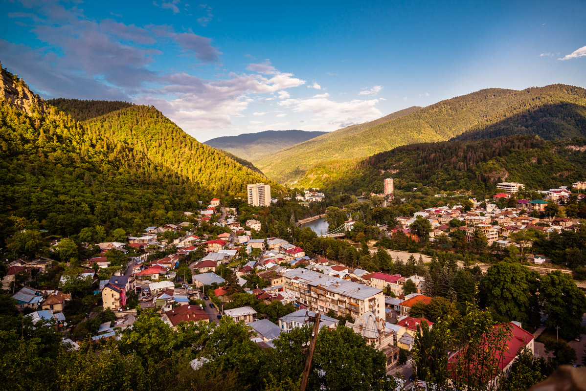
Borjomi is the town center and the most popular place to stay when visiting the Borjomi National Park as well as for additional day trips. It has access to the Borjomi Mineral Springs Park, as well as a number of restaurants and tour guides for the area. While in Borjomi you can also see the Blue Palace “Firuza” (which doubles as a hostel), built in 1892 by the consul of Iran near the entrance of the Mineral Park; the Borjomi Museum of Local Lore, which was opened in 1926 and offers a number of permanent exhibits about Borjomi’s local environment and the famously medicinal properties of Borjomi water; or Gogia Fortress, situated on a hill overlooking Borjomi, which dates back to the 14th century.
[firuza.jpg]Day trips around Borjomi include; Kvabiskhevi Church of the Assumption, in the village of Kvabiskhevi and which was built in the 8th and 9th centuries; Timotesubani Monastery and the Cathedral of the Holy Virgin; located in Timotesubani and constructed in the 12th and 13th centuries; and the Chitakhevi Monastery of St. George (the Green Monastery), located 13 kilometers from the town of Borjomi and which was built in the 9th and 10th centuries.

Hotels
Crowne Plaza Borjomi
By far the largest and fanciest hotel in the area, the Crowne Plaza hotel is located in downtown Borjomi near the Borjomi Mineral Spring Park along the popular pedestrian street leading up to the park. The hotel is a good option if you are open to spending a little extra money for comfort and extra amenities. The hotel will cost you between 90 and 500 euros a night depending on what type of room you book and the time of year or week. The hotel offers multiple dining rooms, a spa, pool, and a gym, a lovely view of the Borjomi valley, and much more.
Guest Houses
Guest houses are incredibly common in Borjomi and are typically centered in two different parts of town, on the north side of town on the north side of the Mtkvari River, or on the southern hill of town on the southern side of the Mtkvari River. The north option is close to the Museum of Local Lore and has easier access to the downtown area, but the southern side of town is built on a mountainside and has amazing views of the village and surrounding mountains. Any number of guest houses can be found on booking.com.
Hostel
Hostels are also a popular option for European travelers and easily available in Borjomi. If you are interested you can stay at the Hostel Firuza, which is located in the historic Firuza Blue Placa building in downtown Borjomi (mentioned above).
Bakuriani is one of Georgia’s three most popular ski retreats during the winter season. While the activities are typically oriented towards skiing, there are still a couple hiking trails available in the area and Bakuriani makes for a lovely day trip, especially if you take the train in the winter months when you will see beautiful snow-covered landscapes.

Likani is a considerably smaller alternative to Borjomi and is located just 5km from Borjomi. The draw of Likani is that it sits directly at the National Park entrance and is close to a couple of regional attractions including; Peter’s Castle, and the Romanovs’ Palace, built between 1892 and 1895. There are also a number of campsites and guest houses to stay at, but Likani does not have access to the restaurants and street shopping that Borjomi does. To reach Likani you will either need to walk along the road or you can easily take a taxi from the town center in Borjomi.
Guest Houses
Guest houses are available in Likani, but are less common than in Borjomi. These guest houses vary and while some may offer food options for additional cost, others may not. Some guest houses are located on the road leading into the Borjomi-Kharagauli National forest and also offer camping options in the yard if you prefer.
Camping
There are a number of campsites near the entrance to the Borjomi-Kharagauli national forest. You will want to check with the Borjomi-Kharagauli National Park office to see what the rules and regulations for these campsites are, as well as which sites require you to pay a fee to stay there as it can differ from site to site.
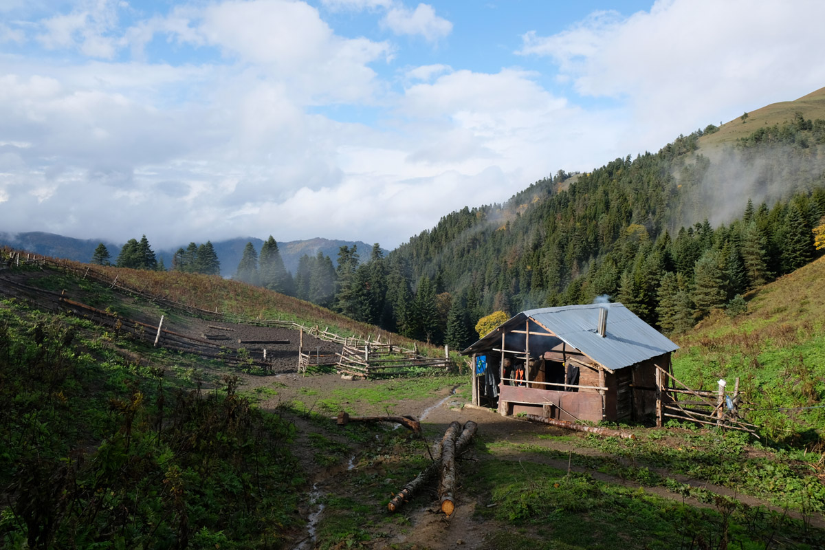
There are also a number of tourist shelters and regulated campsites (including the Lomismta Shelter, Sakhviari Shelter, and the Shepherd’s Shelter, and the Amarati Shelter), deep within the park on some of the parks multi-days treks. Reserving a spot at these shelters can be competitive during the high hiking seasons so bring a tent if you plan to do some of the longer treks to insure you will always have a place to sleep. These shelters are extremely popular among local Georgian and you may find yourself in the middle of a party on the weekends. The cost of a bunk is 20 Gel, though you will have to pay an extra 3 Gel for a mattress, otherwise you will be sleeping on wooden boards. You can get a full list of these sites and their requirements from the national park office.

The Borjomi-Kharagauli National Park is the largest and most developed formal national park in Georgia (taking up 76,000 hectares, or 1%, of Georgia’s entire landmass) and since it is part of the Lesser Caucasus it is accessible year round, as opposed to places like Svaneti or Tusheti. The trails of the park are designed for casual and advanced hikers and trekkers alike, having well marked trails, mountain shelters, an official guide structure and a visitor’s center complete with informational pamphlets and maps.
The World Wildlife Fund and the German Government funded the development of this park as a pilot project for the development of Georgia’s other national parks. However, the start of the Borjomi-Kharagauli National Park becoming protected land actually started 1862, while Georgia was under the Russian Empire, with the brother of Russian Emperor Mikhail Romanoff being appointed the Viceroy of the Russian Empire to the Trans-Caucasus. He was so impressed by the Borjomi Gorge that he decided to build a residence in the valley, which still stands to this day and is known as the Romanov’s (or Likani) Palace located near the village of Likani near the national park’s entrance. In 1871, King Alexander II presented Mikhail Romanoff the whole of the Borjomi Gorge, which he fenced off large portions off, effectively setting the stage for its continued preservation. Borjomi is now also a tourist hotspot and is famous for its water which is sold all over the region.

In total, the Borjomi-Kharagauli National Park has 11 trails (more are under construction) including day hikes and multi day treks that go through Alpine, Subalpine, Mixed, Coniferous, and Beech forests, and Alpine and Subalpine Meadows. The Borjomi-Kharagauli National Park is more conducive to activities like bird watching, botany, entomology and the like, as the lesser Caucasus of this region are full of old growth forest and therefore offer less expansive vistas and more rich, dense ecology for visitors.
It is important to note that when you go to the Borjomi-Kharagauli National Forest you will have to register with the National Park’s Visitor’s Center and let them know how many days you intend to be in the park, as well as where you intend to hike, which will also give the park officials a chance to explain the difficulty levels of some of the trails in the area. This is a free and easy procedure. Once you have done this you can enter the park at any time and show your form to the Ranger at any of the stations located entering the park. The Visitor’s Center is located on 23 Meskheti St, Borzhomi 1200 in Borjomi.
The Footprint Trail, also known as Trail #6, is a rather schizophrenic trail that you will both love at hate from time to time. The entry point for this trail is at the Likani Ranger Station and is the entry point for three other trails; the Snowshoe, Nikoloz Romanov, and Likani Gorge Trails.
You’ll know you are in the right place by the 800-1000 years-old yew trees in the area. Follow the jeep wide path up. The first part of the part has a low grade and is easy to follow until you reach another campsite after about 2km with a park map outlining the trails in the area and water access point where the trail narrows and moves into deeper forest.
You will want to follow the trail going up the ridgeline, which you will climb for about 5-7km or 2 to 3 hours along the Nikoloz Romanov trail. This is a fairly tiring climb, but is well cut and very beautiful. The Likani Gorge Trail, or #12 Trail, will separate from the Footprint Trail about an hour to an hour and a half into your accent, you will continue up with the Snowshoe, or #10, and the Nikoloz Romanov, or #1, Trails. Just when you think you will never stop climbing you will hit the halfway point for the Footprint Trail and break off from the St. Andrews and the Nikoloz Romanov trail and go along the opposite direction of the ridge to the left. The trail will open into a large field and level out.
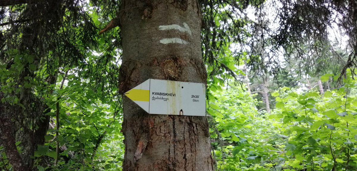
The Footprint Train in particular can only be hiked from Likani to Kvabiskhevi due to its unreasonably steep descent towards the Kvabiskhevi River and is blazed as such. This also means that you will not be able to complete this trail if it is raining or has rained recently. It looks like much of the trail just follows water drainage paths and if there are switchbacks (there are very few) they are short and still very steep. Hikers often have to employ the sit and slide technique of getting down the mountain, which does not make this a good option for novice hikers who are not comfortable with technical downhill hiking, or families. If you have trek poles they will come in handy on this hike.
There are 2 water points (one at the beginning and one at the end), a handful of panoramic views when you reach the ridgeline (which is a fairly short section of the trail) and 2 official campsites along the trail (one where the trail branches off from it’s sister trail and numberous areas in the Kvabiskhevi Valley), as well as numerous picnic areas at and around the completion point of the trail. It is a great idea to stop at one of the panorama points for a break as the views are breathtaking.
While there is some elevation gain on the ridgeline portion of the trail it is well balanced with light descents and straight hiking. It is very important to note that the trail gets considerably more narrow at this part and cuts close to steep downward descents so take care when hiking as one poor step can send you down the mountain. The panoramas of this portion of the hike look onto the lesser Caucasus and show just how diverse this region of the country is.
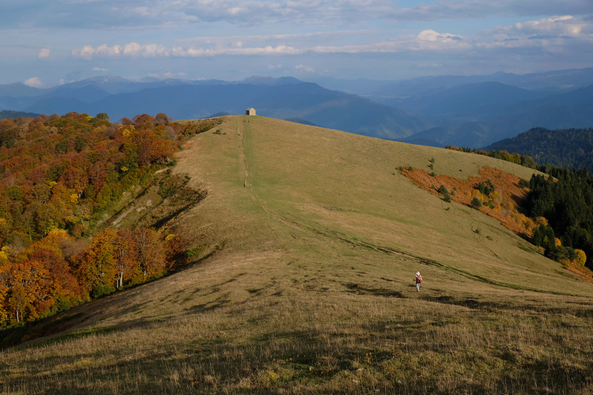
While you are hiking along the ridge you will see; Mounts Orta Tavi (2500m), K’odiana (2690m), Mount Shavi Kide (2850m), Oshara (2605m), Gumbat’i (2965m), Sakvelmosmta (2787m), Tavk’vetili (2583m), Sametskhvario (2645m), Megruki (2486m), Arjevani (2757m), Jamjama (2379m), and Didi Karta (2315m), among others.
The trail then hits the Kvabiskhevi valley where the downhill becomes extremely treacherous and dangerous. This section is short but you will be moving through it so slowly. Stick to areas with lots of tree roots and rocks along the treeline. The soil on this part of the trail is slick whether or not is it dry or wet.
The trail will level out beautifully after you get into the valley and the end of the hike through the Kvabiskhevi valley is full of subalpine meadows and interesting rock formations. There are also numerous camping and picnic areas. You can catch a cab back to Borjomi for 25gel.
The Likani Gorge Trail, also known as the #12 Trail, is a surprisingly challenging trail despite its relatively short distance. It starts in exactly the same way that the Footprint and the Snowshoe trails start at the Likani Range Station headed into the valley, then climbing up the ridge, however the Likani Gorge Trail branches off far earlier than its sister trails. If you thought you were going to get a break from climbing, think again.
The Likani Gorge Trail is beautiful because of its panoramic views of the Likani Valley, but you have to climb steeply up Mount Chitakhevi (1446m). Once you reach the top of the peak you will see craggly rock formations and you will then steeply descend down the subalpine meadows to the forest line again.
Unfortunately, the rest of the hike is a steep descent down into the valley. The descent can take a pretty long time, about 1 to 2 hours, due to how steep it is and your knees will be very tired afterward. Unlike the other trails the Likani Gorge Trail lets out in the village of Likani near the mouth of the valley and the trailhead is not easy to see from the road. For these reasons it is a better idea to start the hike along with its sister hikes at the Likani Ranger Station at the head of the Likani village valley at the entrance to the park.
This is a very short trail with one water point at the beginning/completion point of the trail and 2 camping locations.
The Info Trail starts at the Borjomi-Kharagauli administrative building just outside of the town of Borjomi and starts with a hard 600m climb before leveling out along the ridge to overlook Borjomi and pass St. Nino’s Church. From there you loop back around and head down towards the administrative building again.
Hikers should get used to passing frequent churches to St. Nino, who was the woman credited with bringing Christianity to Iberia in the 4th century and rivals Queen Tamar as the most popular historical figure in Georgia.
The Borjomi Sulphur Baths trail is located outside of the national park and starts instead inside of the Borjomi town limits. It is a popular and very simple trail that can easily be hiked by families and ends at the Borjomi Hydrogen-Sulphide Springs about a kilometer or two from the trail head in the famous Borjomi Park. This is a good option for an easy day in Borjomi as the route is in no way difficult and can quickly and easily be reached from the center of town. The distance from the entrance to Borjomi Park to the Sulphur Spring is 3km, making the round trip 6km long.
To get to the trailhead you have to first go through the Borjomi Mineral Water Park, which costs 2 Gel to enter. From the entrance of the park you will walk a little less than a kilometer before you reach the dirt path to the springs.
At this entrance there is an optional shuttle service during the high season in the summer that will take you to the springs for 10 Gel each way. The entire route follows the Borjomula River and criss crosses the river safely with a series of bridges that make for a beautiful walk.
Once you get the the springs you have the option to go for a dip if you prefer, which will cost you around 5 Gel. During the afternoons of the summer months the spring is unbelievably crowded, but if you go early in the morning or in the winter months the baths are much quieter and more pleasant. Once you have taken the waters you simply turn back along the path you came to head back to Borjomi. Another nice thing to note about this trail is that it connects with a hand full of other simple, short trails that go to nearby villages in the area.
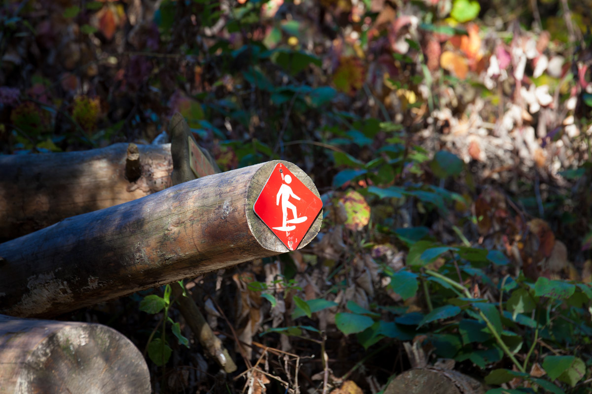
The Snowshoe trail doubles as both an equine trail year round (all the trails in Borjomi double as equine trails) and a cross country ski route during the winter months. This trail can be done in a day if you prefer, but if you want to have a couple of light trek days there is the Chitakhevi Shelter around the halfway point.
The entire route is a loop so you have two options to start. Taking the route that continues straight through the valley from the trail map is a bit easier, through both routes involve a great deal of climbing. If you take the rightmost route you are more likely to not run into other hikers as this is only the Snowshoe trail and does not follow along with the accompanying Likani Gorge, Nikoloz Romanov, and Footprint Trails for the first few kilometers. This section of the trail also has more breaks from the ascent, which the leftmost trail does not. Lastly, this section of the trail follows a jeep path so it is wider than the leftmost part.
If you follow straight along the rightmost part of the trail you will walk about 8km up to the shelter with about 870m of elevation gain. There are numerous places to stop and rest and look out over the park. Once you hit the ridge the path will level out considerably more and you will soon come to a left hand turn to the shelter. The shelter overlooks the town of Borjomi and you can even see the ferris wheel in the park.
While you are here you can take the option to do day trips around the park, such as along the Nikoloz Romanov Trail to Saint George’s Church.
On the second day you will walk along the path away from the shelter and turn left along the jeep track until you come up (very quickly) to a sign turning left again along a narrow hiking trail. You will leave the jeep trail and follow this route until you come up on a fork in the trail. The right turn goes along the Footprint Trail and the left turn descends into Likani to the Rangers Station.
The descent for the rest of the trail is very easy and absolutely breathtaking. Another reason to take the east to west route for this trail is so that you can appreciate how amazingly beautiful the descent section of the trail is, which can be hard to do as you are huffing and puffing up a ridge. This section of the trail is better preserved and more narrow than the eastern most route.
You will continue down until you hit another fork in the trail which goes along the Likani Gorge trail, which is blazed white and black, or continues along down the ridge into Likani.
The great thing about this trail and this section of the park is that there are many various you can take for the trails, which gives you a ton of variety with regard to what you see and what your energy or skill level is.
The Nikoloz Romanov’s Trail is a great introduction to the Borjomi-Kharagauli National Park because it cuts in half the length of the park from Likani (south in the Borjomi district) to Marelisi (north in the Kharagauli district) over the course of an approximate 3 to 4-day trek. You will also get highlights of the coniferous and mixed forest (part of the Colchic sub-tropical forest ecology of Georgia), Lomismta Mountain, Lomi St. Giorgi Church, and numerous scenic viewpoints of the Lesser Caucasus.
The trail has 6 water stations, 4 campsites, 2 tourist shelters, and 3 designated scenic viewpoints as you walk from the Linkani Ranger station to the Marelisi Ranger station approximately 43km along the trail. On day one you start at the Linkani Ranger station, a common starting point for most of the trails in the park and which is located 5 km from the National Park Visitor Center. The first 3 to 4 hours of this hike to the second campsite after you pass the ranger station is all ascent.
The tourist shelter of Lomismta, the first on the trail, is located 15km out and a good place to stop for your first day. If this shelter is full you can also detour to the Chitakhevi Shellter along the Snowshoe Trail.
On day 2, immediately after the shelter you will climb approximately 1300m along Lomismta Mountain, where Saint George church is located. Saint George church is a great place to take a break as the views are amazingly beautiful. On a clear day you can see the highest peak of the Great Caucasus and Europe, Mount Elbrus, to the Northwest.
You will follow back along the trail towards a shepherd’s hut on the northern side of the Lomismta Mountain and then the trek follows the ridge of the mountain, providing beautiful views, before descending towards the Sakhvlari tourist shelter (1025m), which is a good place to stop for day 2.
On day 3 the trail then follows the Arjola River valley along with the Saint Andrew’s Trail and ends at the Marelisi Ranger station.
The Saint Andrew’s Trail is a 54km trail that is the longest and probably the most popular trek in the park as it gives hikers the opportunity to climb Mount Sametskhvario, the highest mountain in the park.
This is an approximately 4-day trek that has 4 water stations, 4 campsites, 3 tourist shelters, and 3 designated scenic viewpoints. You can either start the trek in Atskuri or Likani.
Day 1 starting at the Atskuri Ranger Station, which is further away from Borjomi than the Linkani Ranger Station (27km away from the National Park Visitor’s Center) you will see that early in the trail goes along the river and you will pass a bezoar Ibex enclosure before ascending along the range where you will get panoramic views of the Lesser Caucasus. As you climb you will see Mount Didi Ochora (1543m) on your left at the start of the hike and Mount Sinachkhoro (1770m) on your left as you climb up over the ridge. The first tourist shelter is the Amarati tourist shelter, which is 16km in and sits at the base of Mount Amarati. This is a good place to stop for day 1.
On day 2, after the Amarati tourist shelter you will begin your ascent up Mount Amarati along the highest ridge of the park towards Mount Sametskhvario (2642m) to the Sametskhvario Shelter about 10km away. As you walk from Mount Amarati to Mount Sametskhvario you will see Mount Pikala (2422m) on your right, and climb over Mount Megruki (2475m) as well as a number of other unnamed mountains in the area. The views on this section of the hike are the best in the park. One you reach the Sametskhvario Shelter you will have finished day 2.
Day 3 is a long day where you will continue to cross over the highest ridge of the park towards the last Shelter, the Kvazvinhevi Shelter, 19km away. You will walk along the eastern side of Mount Sametskhvario along the ridge passing a number of unnamed peaks until you come up upon Mount Rkinis Jvari (2439m) on your left, which you will be walking just below the peak of. You will then continue along the ridge, passing a waterfall as you begin to descend towards the Sakhviari Shelter, which connects with the Nikoloz Romanov's Trail. This is where day 3 ends.
If you want to extend your trekking by a day, there is a nice day trail from the shelter called the Megruki, or #8, Trail and is blazed white and black. The route is 11km in and out. This trial will give you a reprieve from the hot weather in the summer months in the cool Megruki microclimate and also provides lovely views of the Megruki Gorge.
Your last day of trekking follows from the Sakhviari Shelter down through the Sheviskala River valley 10km to the Marelisi Ranger Station and gives you a reprieve from the previous 2-days mountain climbs. As you descend you will walk along the south esatern side of Mount Didi Sakhviari (1116m). There are about 8 bridge/water crossings on this section of the trail.
The Saint Andrew’s Trail completes at the Marelisi Ranger Station and you can either follow the trail back to Atskuri, or loop back to Linkani via the Nikoloz Romanov's Trail connector trails. Be sure to grab a map from the visitor’s center so you can see all of your options for return trips. For example, if you prefer to end in Likani you can return along the Nikoloz Romanov's Trail, or if you prefer a shorter version of the Saint Andrews Trail you can take a detour along the Shepherd’s, or #9 Trail.
Weather in Borjomi is mild and pleasant. Due to its location in the center of Georgia between the wetter western region and the dry eastern region, Borjomi gets the best of both worlds. Additionally, while Borjomi is in the mountains, its location in the Lesser Caucasus prevents its weather from getting too cold. The coldest months are January and February, when the temperatures hover between -4° and -1° C. The hottest months are July and August when the weather stays around 18° and 19° C. Borjomi gets a fair amount of rainfall mostly in the late spring early summer months of May and June with average monthly precipitation between 80mm and 90mm. Comparatively, the driest months are in January, February and March (with February being the driest), with average monthly rainfalls between 38mm and 43mm.
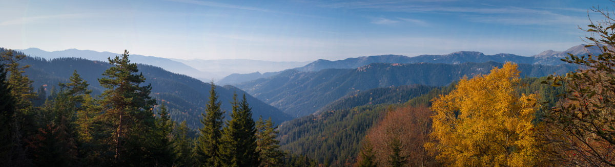
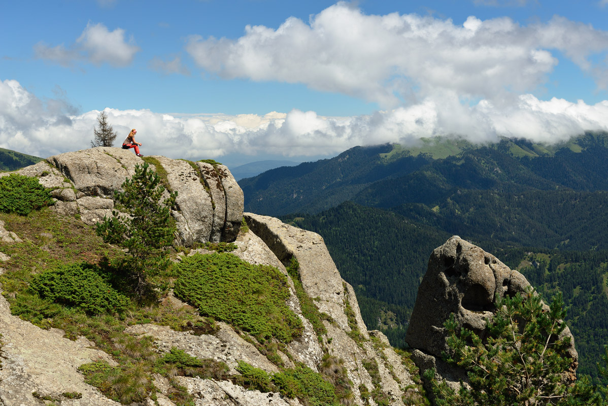
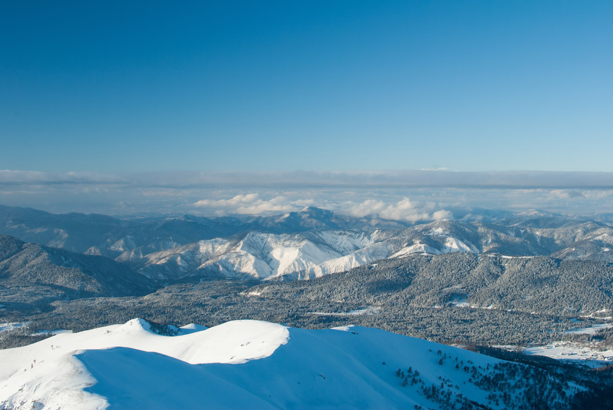
While hiking in Borjomi you will walk across a large variety of ranges in the park and will have amazing views of Lesser Caucasus Mountains, with a few views of the Greater Caucasus if the weather permits. Borjomi is home to many mountain ranges and notable peaks.
To the east of Borjomi (northeast of the Gujuretis Tskali River, and southeast of the Mtkvari River) there is the Kvibisis Seri Range, with Mounts Tortza (1996m), and Meskhismta (1938m); and the Keribis Seri Range, with Mount Kekiasmta (1651m).
South of Borjomi (south of the Mtkvari River and southwest of the Gujuretis Tskali River) includes; the Pikalasser Range, with Mounts Libani (1885m), and Misaktsevi (1586m); the Skhirmo Range; and additional Mounts include; Kodiani (2689m), Dviristavi (1437m), Datvis Tavi (2178m), Kibia (2285m), and Chkhiria (1263m), among others.
Northwest of Borjomi (northwest of the Mtkvari River), which incompasses most of the Borjomi-Kharagauli National Park is home to the Sabughrao Range, with Mounts Dedabera (1839m), Likhi (1433m), and Virigverde (1644m); the Vakhani Range, and the Tsrutsunis Seri sub-Range, including Mount Zvenidauta (1164m); the Kvabiskheviseri Range, including Mounts Khergianismta (1835m), Tsiteliklde (1414m), and Kiriebis Kilde (1993m), among others; the Ochivari Range, which includes Mounts Pikala (2422m), Meghruki (2475m), Sakekela (2236m), Amarati (1528m), and Ochora (2107m), among others; the Sakikeles Seri Range, including Mounts Didi Ochora (1543m), Bodzala (1516m), Sinachkboro (1770m), Amarat (2354m), and Tsokhtevi (1505m), among others; additional mountain peaks include; Tsipora (1795m), Datvismta (2434m), Shavi Mta (2362m), and Tskaltsiteli (2496m), among many, many more.
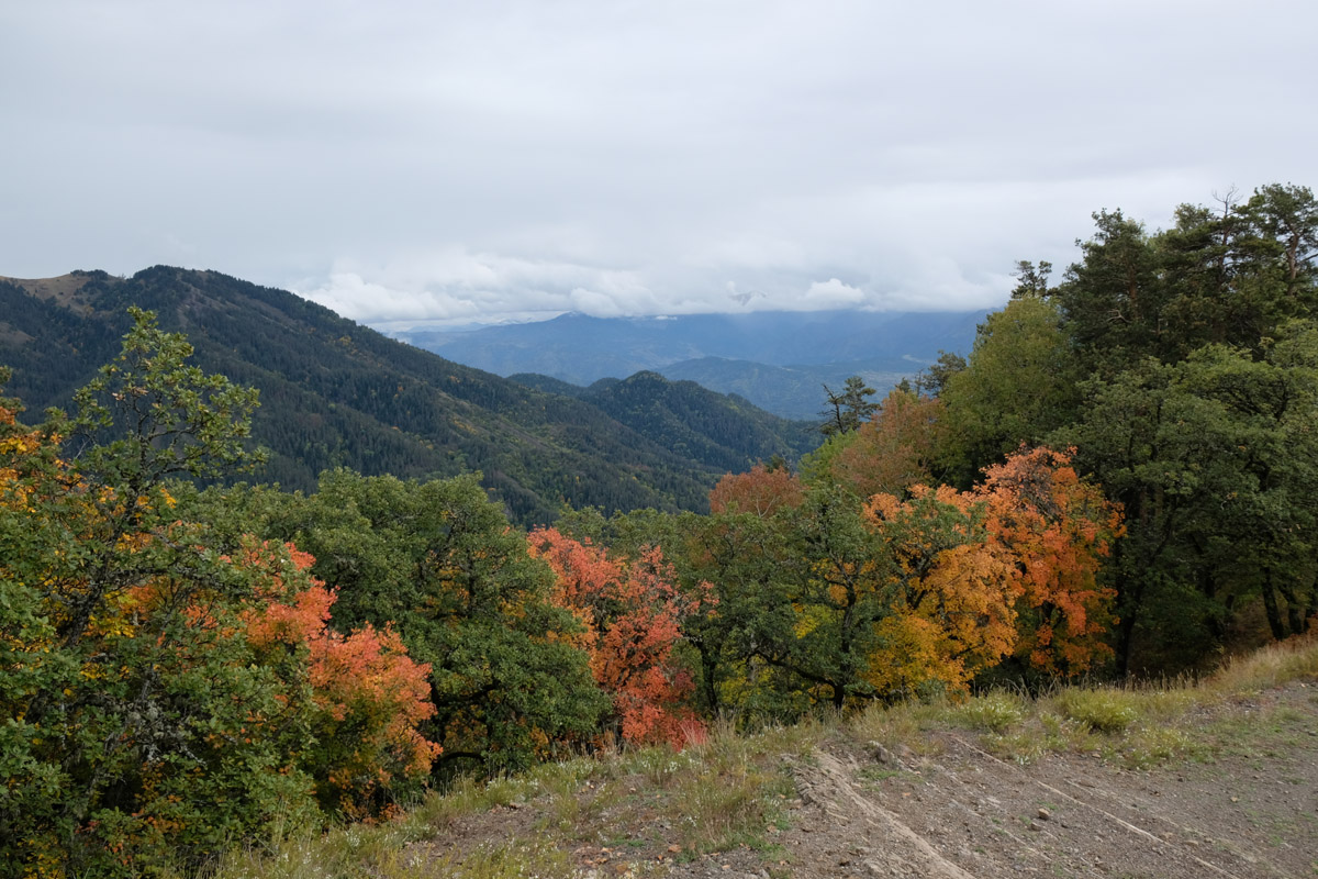
The southwestern most portion of the Borjomi Region is defined by the Trialeti Range, which is mainly covered by deciduous forests, though the western parts, as well as by coniferous and mixed forests. The Trialeti Range is 144km in area with maximum width is 30km. It’s highest mountain is Mount Shaviklde (2850m) (also known as Qaraqaia). The eastern edge runs along the western border of Tbilisi while the western edge runs along River Mtkvari to the southwest of Borjomi and it as built up by volcanic activity during the Paleogene Era.
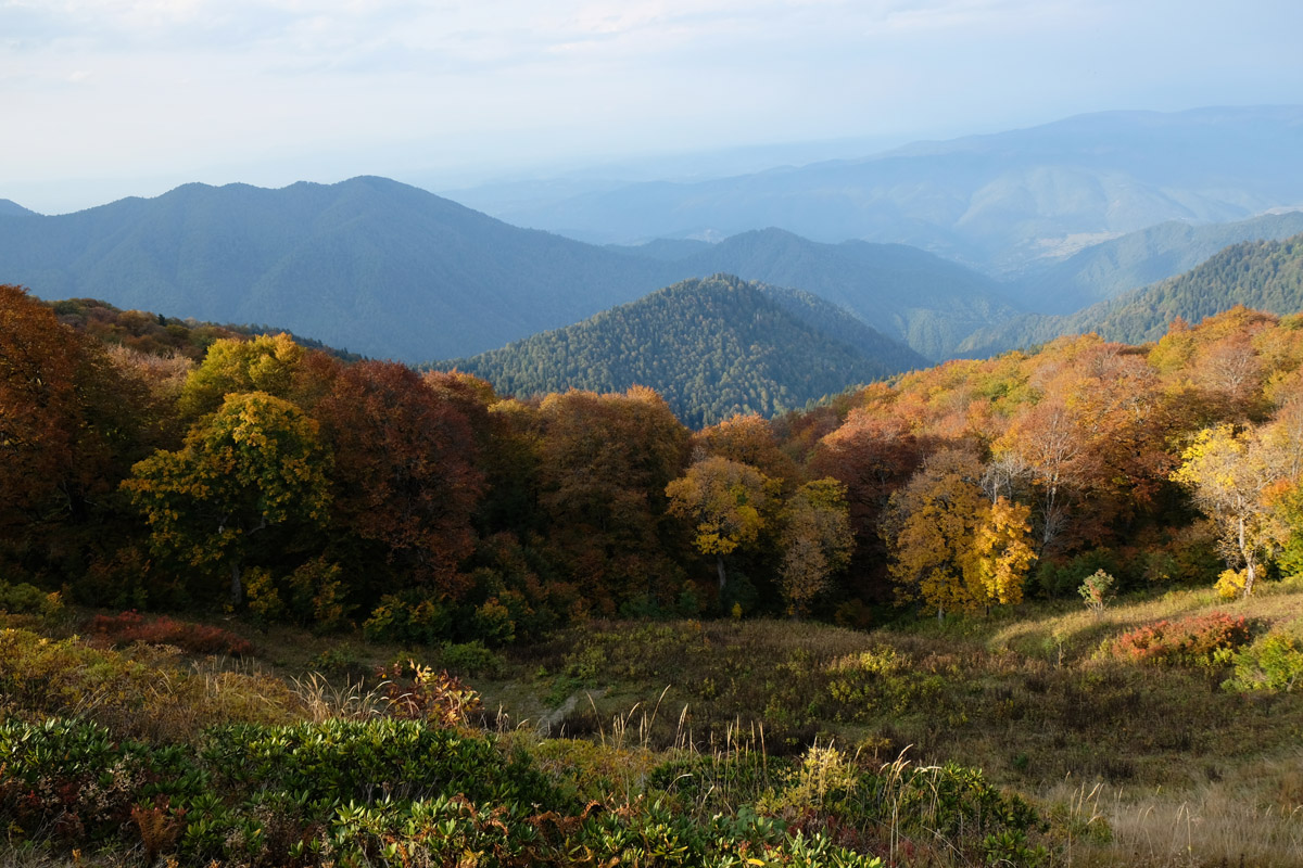
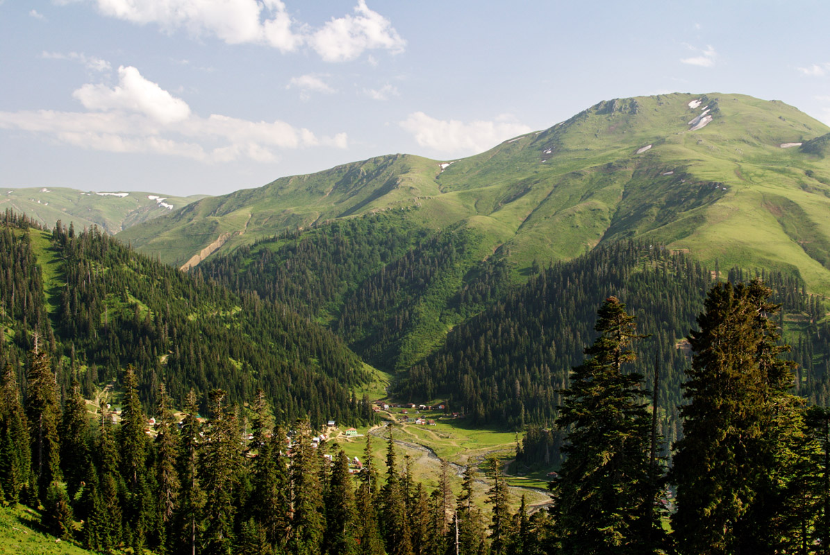
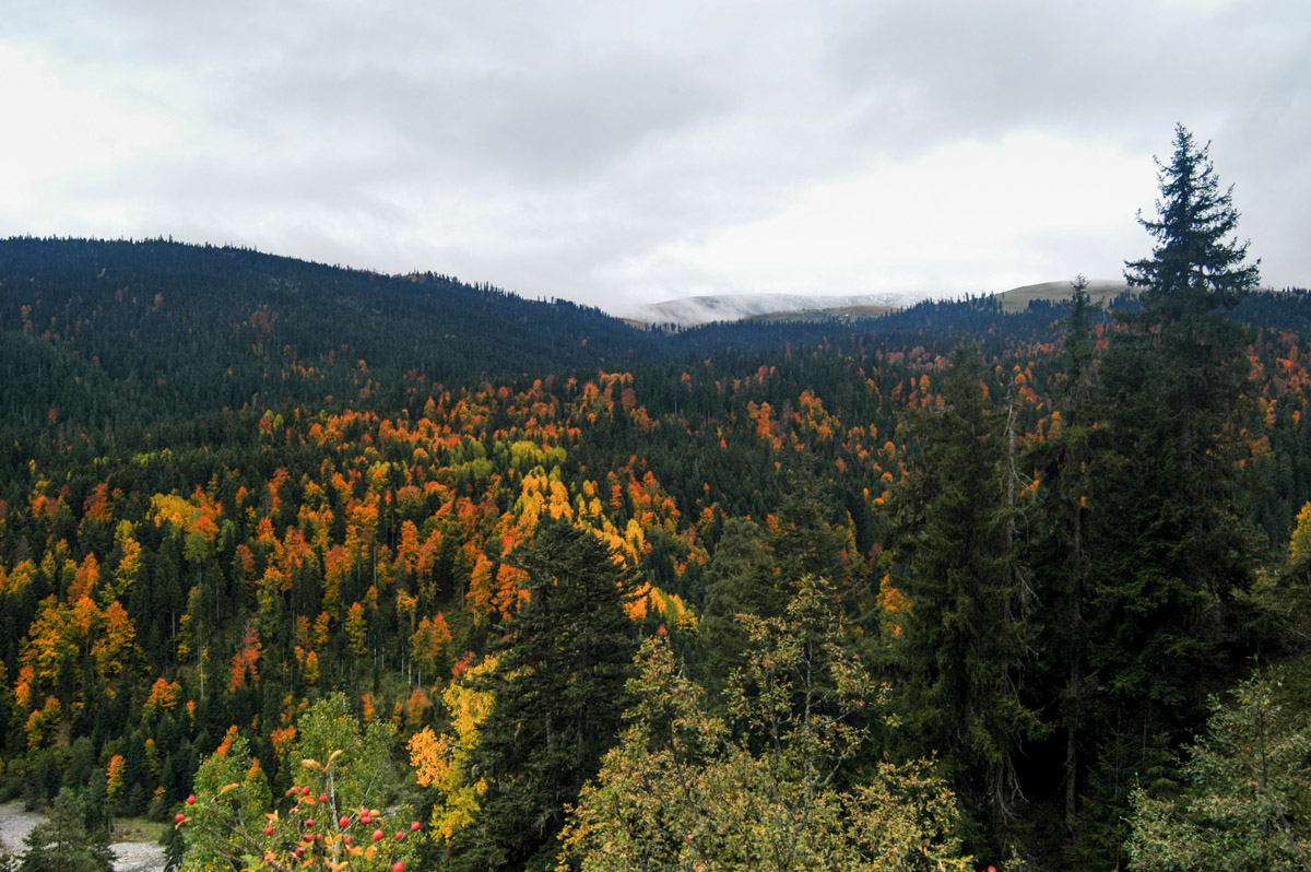
The Borjomi-Kharagauli National Park’s main draw is its wealth of flora and fauna. Situated in a number of different climate and biogeographical zones, the park is home to an especially diverse array of plant and wildlife in a relatively fixed space. The Borjomi-Kharagauli National Park holds within it the Kolkhic, lesser Assian and Asian biogeographical zones and has a number of different types of forest through the forest belt between 400m and 1800m, the subalpine belt between 1800m and 2450m, and the alpine belt above 2500m. Unlike the Greater Caucasus Range to the north, Borjomi does not have rocky peaks or scree fields and is fully covered with vegetation.
Forests and Meadows
Within the forest belt region, 400m to 1800m, of Borjomi-Kharagauli National Park there are Oak Forests (Quercus iberica), which include; Yew, Beeches (Fagus orientalis), Firs (Abies nordmanniana), Pines (Pinus sosnovskyi), Hornbeams (Carpinus caucasica), and Chestnut (Castanea savita). Additionally, there are mixed forests including coniferous mixed forests with; Spruce, Fir, and Pine, as well as braodleaf mixed forests with; Beech and Hornbeam, both of which include; Ash (Fraxinus excelsior), Pits (Sorbus torminalis), Maples (Acer laetum, A. campestre), Crab-trees (Pyrus caucasica), Plums (Prunus divaricata), Mountain Oaks (Quercus macranthera), Mountain Maples (Acer trautvetteri), Birches (Betula litvinovii), Holly (Ilex), Cherry Laurel (Prunus laurocerasus), Mountain Laurel (Kalmia latifolia), Colchis Plush, and Butterwort (Pinguicula), among others, as well as Male Fern (Dryopteris filix mas).
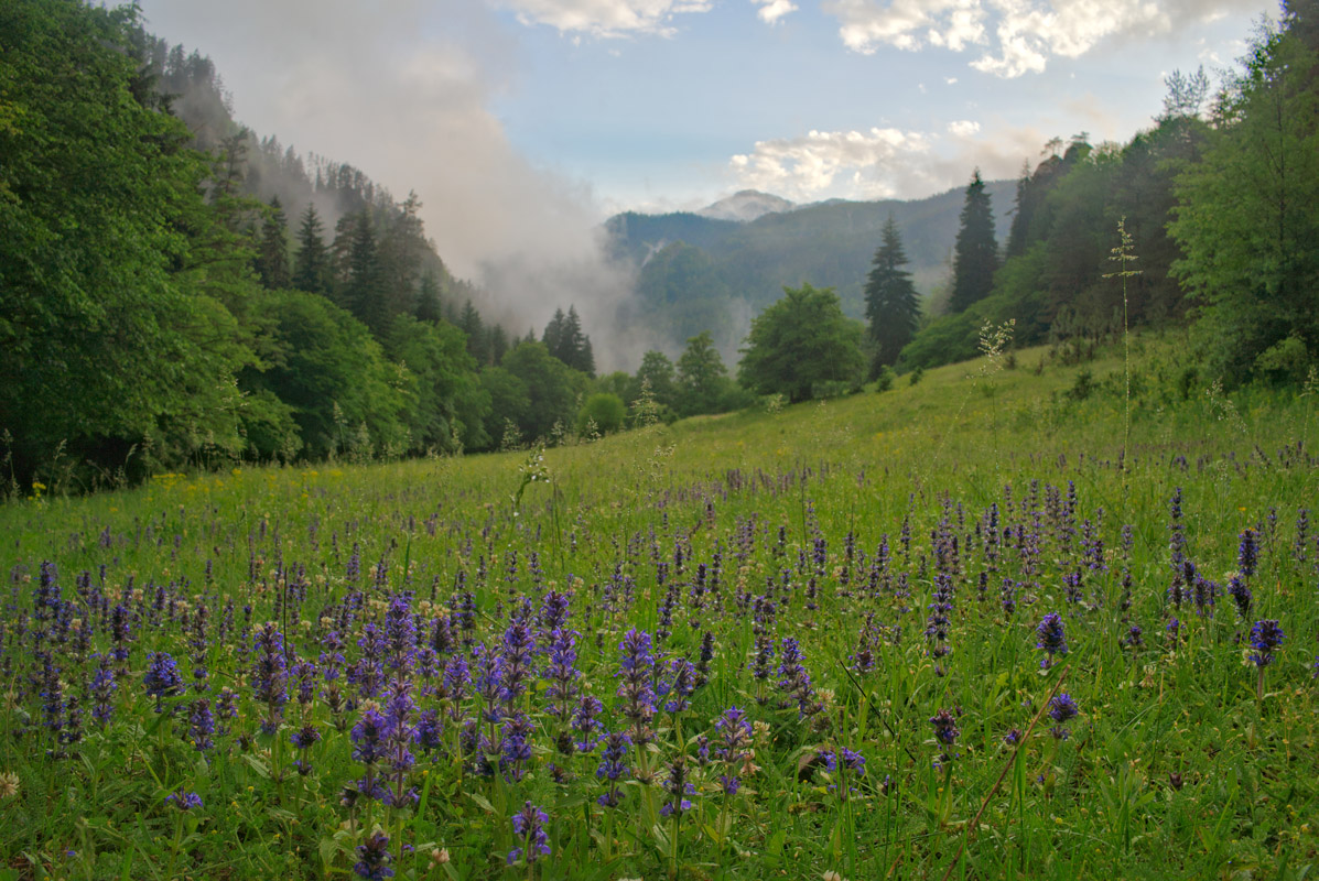
In the subalpine belt between 1800m and 2450m there are subalpine forests and meadows. In the subalpine forests you can find Beeches, Mountain Maples, Birches, Mountain Oaks, and Pines, among others. In the subalpine forests you can find a variety of tall grass species, including Prickly Comfrey (Simphythum asperum), Ragworth (Senecio rhombifolius), and Beinwell (Symphythum caucasicum), among others, as well as bushes and Rhododendron (Rhododendron caucasica).
In the alpine region above 2500m there are a variety or grasses in the meadow regions including; Forest Meadow Grass (poa alpine), Grass Matta (Nardus stricta), Clover (Trifolium), and Bird’s Foot (Lotus caucasicus), Pink Cow Parsley (chaerophyllym macnlatum), Juniper (Juni perus depressa), Separ Grass (Agrostis kappilaris), Reed Grass (Kalamagrostis arumdinacea), Sheep’s Vascue (Festuca ovina), Boehmer’s Cat-tail (Phleum phleoides), Cow Clover (Trifolium ambiguum), Bird’s Foot (Lotus caucasius), Caucasian Bitter-cup (Ranunculis caucasius), Avens (Geum speciozum), Trollflower (Trollius patulus), Greater Butterfly Orchid (Platanthera Chlorantha), Variegated Brome (Bromopsis variegata), Wayfaring Tree (Viburnum lantana), among others.
The flora in the area is representative of Colchi, Hyrcanian, Iberian, Iranian Caucasian and Asian flora.
Medicinal Plants
There are a variety of medicinal plants in Borjomi-Kharagauli National Park and the tradition of using medicinal herbs in Georgia is very strong across the country. Some of the traditional herbs and plants you can find include; Coltsfoot (Tussilago farfara), Oregano (Origanum vulgare), Licorice (Glycyrrhiza glabra), Orchid (Orchis masculata), Alder Buckthorn (Frangula aluns), Chicory (Cichorium intubus), Stinging Nettle (Urtica dioica), Horse-heal (Inula helenium), Common Hop (Humulus lupulus), Three-lobe Beggarticks (Bidens tripartita), Alder Buckthorn (Frangula alnus), and Hellebores (Helleborus caucasicus), among others.
Fruits and Berries
Borjomi-Kharagauli National Park’s Deciduous Forests have a variety of fruits and berries including; Cornel (Cornus mas), Wild Apple (Malus orientalus), Blackthorn (Prunus spinosa), Barberries (Barbaris Vulgaris), Medlar (Mepilus germanica), Blackberries (Rubus sp.), Wild Plum (Prunus divaricata), Black Hawthorn (Crateagus pengyna), Wild Pear, Sweetbrier (Rosa rubiginosa), Bird Cherries (Prunus padus), Raspberries (Rubus), Caucasian Blueberries, Black Currant (Ribes nigrum), Stone Gooseberries, and Bilberry (Vaccinium).
Fungi
There are a wide variety of both edible and poisonous fungi present in Borjomi-Kharagauli National Park including; the Chicken Mushroom, Horse Mushroom, Fly agaric, Ink Cap, Caesaris Mushroom, Peppery Milkcap, and Golden Chanterelle, among others.
Mammals
There are a wide variety of mammals in the Borjomi-Kharagauli National Park, many of which are decreasing in population throughout the rest of Georgia, making the the Borjomi-Kharagauli National Park a safe haven for these animals.
Some of the mammals in The Borjomi-Kharagauli National Park include Marten (Matres matres) such as; Pine Marten (Matres matres), Beech Marten (Martes Foina); Otters (Lutra lutra), which can be found on the banks of the Baniskhevi, Qvabiskhevi, and Zoreti; Fox (Vulpes vulpes); Wolves (Canis Lupus); Brown Bear (Usrsus arctos), which are included in the Red List of Georgian mammals and include subspecies such as, u.a. Meridionalis and u.a. Siriacus; lynx (Lynx lynx), among others.
Rodents that can be found in The Borjomi-Kharagauli National Park include; Caucasian Squirrel (Sciurus anomalus); Hare (Lepus europaeus), Hedgehogs, Moles, Mice, Voles, and Shrews, among others.
There are four main species of Ungulates in Borjomi-Kharagauli National Park, many of which are on the Georgian Red List for mammals, including; Wild Boar (Sus Scrofa), Roe Beer (Capreolus capreolus), Caucasian Red Deer (Cervus elephus), Chamois (Rupicapra rupicapra), Bezoar Goat (Capra aegagrus).
Birds
There are 217 different species of birds in Borjomi-Kharagauli National Park, which is about 60% of Georgia’s bird varieties. There are 107 permanent species of nesting birds, 58 species of which can be found year round, and 49 of which are migratory; 53 species of summer breeding birds; 2 species of winter hibernators; and 21 species of migratory birds that travel through the park.
The most common birds that can be found in Borjomi-Kharagauli National Park are; Peregrine Falcons (Falco peregrinus caucasicus), Caucasian Snowcock (Tetragalus caspius tauricus), Caucasian Black Grouse (Lyrurus mlokosiewiczi), Saker Falcon (Falko cherrug), Golden Eagle (Aquila chrysaetos fulva), Bearded Vulture (Gypaetus barbatus aureus), Falcon (Neophron percnopterus), Goshawk (Accipter gentiles), Raven (Corvus corax), Balck kite (Milvus korschun), Eagle Owl (Bubo bubo), Twany Owl (Strix aluko).
Reptiles and Amphibians
The Borjomi-Kharagauli National Park is home to one of Georgia’s larger communities of amphibians and reptiles, which live largely in the lower elevations near the Borjomi gorge. These include; the Caucasian Salamander (Mertensiella caucasica), Eastern Spadefoot Toad (Pelobates syriacus), Branded Newt (Triturus vittatus), Smooth Newt (Triturus vulgaris), Crested Newt (Triturus karelinii), Caucasian Parsley Frog (Pelodytes caucasicus), Caucasian Toad (Bufoverrucosissimus), Green Toad (Bufo Viridis), European Tree-Frog (Hyla arborea), Marsh Frog (Rana ridibunda), Caucasian Brown Frog (Rana macrocnemis), Slow Worm (Ngulis Fragilis), European Glass Lizard (Ophysaurus apdus), Sand Lizard (Lacerta agalis), Three-lined Emerald Lizard (Lacerta trilineata media), Artvin Lizard (Certa derjugin), Spiny-tailed Lizard (Lacerta rudis), Ajarian Lizard (Lacerta mixta), Red-bellied Lizard (Lacerta parvala), Caucasia Agama (Agama caucasica), Ring Snake (Natrix nartrix), Water Snake (Natrix tessellata), Cat Snake (Telescopus fallax), Aesculapian Snake (Elaphe longissima), Smooth Snake (Cornella austriaca), Sand Viper (Vipera amodites), and Caucasian Viper (Vipera kaznakowi), among others.
Fish
The Borjomi-Kharagauli National Park is also home to a number of fish species endemic to the Caucasus region, specifically in the Qvabiskhevi, Baniskhevi, Nedzura, Tsinubani, and Baratkhevi Rivers, including; Trout (Salmo fario) which is on the Georigan Red List; Common Barbel (Barbus barbus), which can be found additionally in the Sakraula, Bjoliskhevi, and Lashuri Rivers; Common Roach (Rutilus rutilus), which spawn in the region in March and April and can also be found additionally in the Sakraula, Bjoliskhevi, and Lashuri Rivers; among others.
Insects
While the information is still not complete, there has been a number of insect studies that have been conducted at Borjomi-Kharagauli National Park. Some of the insects that can be found at the park include; Creeks (Scarabidae); Tiger Beetles (Caranidae); Darkling Beetles (Tenebrionidae); Snout Beetles (Curculionidae), which is a parasite of local tree species; Dark-boring Beetles (Ipidae), which is a parasite of local tree species; Longhorn Beetle (Cerambicidae), which is a parasite of local tree species.
There are also a variety of butterflies (Lepidoptera) including; Diurnal Butterflies: swallowtails, whites, yellows, fritillaries, satyrs, gossamer-winged butterflies, and roadside skippers. Moth varieties include: Ghost moths, Goat moths, Peacock Butterflies (Eudia pavonia), Giant silk moth (Perismomena coecigena), Death head sphinx (Manduca atrops), Oleadr sphinx (Deilephia nerri), Apollo (Parnassius apolo), and Tiger moth lady (Callimorpha dominula), among others.
There are also 5 species of wasps (Hymenoptera), a number of different types of flies and midges (Diptera).
Borjomi was part of the Tori Province during the Middle Ages and was a strategic location for travel between Western and Eastern Caucasia between the Colchis and the Imereti Kingdoms. From the 16th to the 19th centuries Borjomi belonged to the noble family of Avalishvili but found itself largely depopulated when the Ottoman regime took over the region.
Borjomi was revitalized under the Russian Empire in the 19th century. In the early 1800s Russian military forces occupied Borjomi and built a number of baths in response to the belief of Borjomi’s water’s restorative effects, and military bases. Viceroy Mikhail Vorontsov, fell in love with the local landscape and was enticed by the region’s mineral waters. In response he made Borjomi his summer residence and built a number of parks and restored many of the buildings in the region. Viceroy Mikhail Vorontsov’s, as well as a number of other aristocrats’ love of the Borjomi region is the primary reason that Borjomi-Kharagauli National Park is the largest park in all of Georgia. The Russian aristocracy solidified early on that the forest of the region were protected and available for their use. Borjomi’s pristine landscape contributed to its title as ‘Pearl of the Caucasus’. In the early 20th Century, as the Soviet regime took over Georgia, the aristocratic palaces were confiscated and were turned into sanatoria for use by the Soviet Communisty Party Leaders. Under the Soviet Union, Borjomi became a center for Russian tourism and remains so to this day.


The highest peak in Borjomi-Kharagauli National Park is Sametskhvario, at 2,646 m.
Notable peaks in Borjomi-Kharagauli National Park include Sametskhvario, Didimaghala, Samets’khvario, Megruki and Tskaltsitela.


