
Scan the QR code and open PeakVisor on your phone
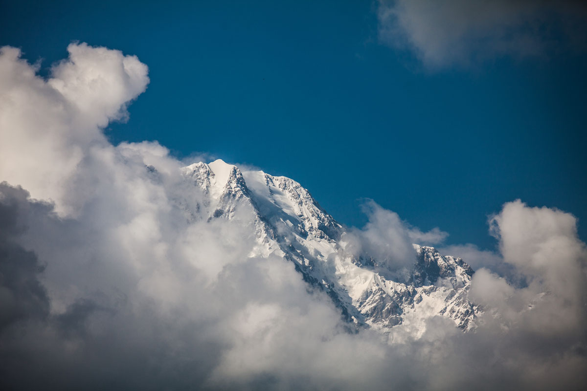
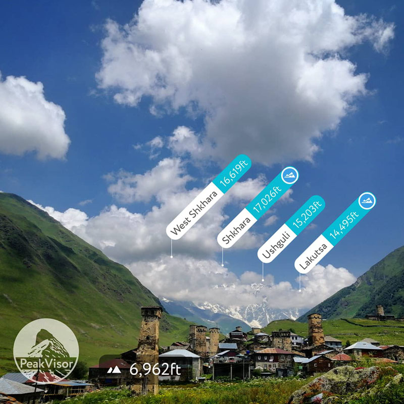
Upper Svaneti is home to 229 named mountains. The highest is Shkhara at 5,193 m.
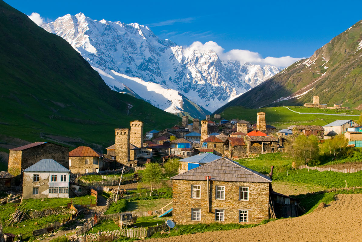
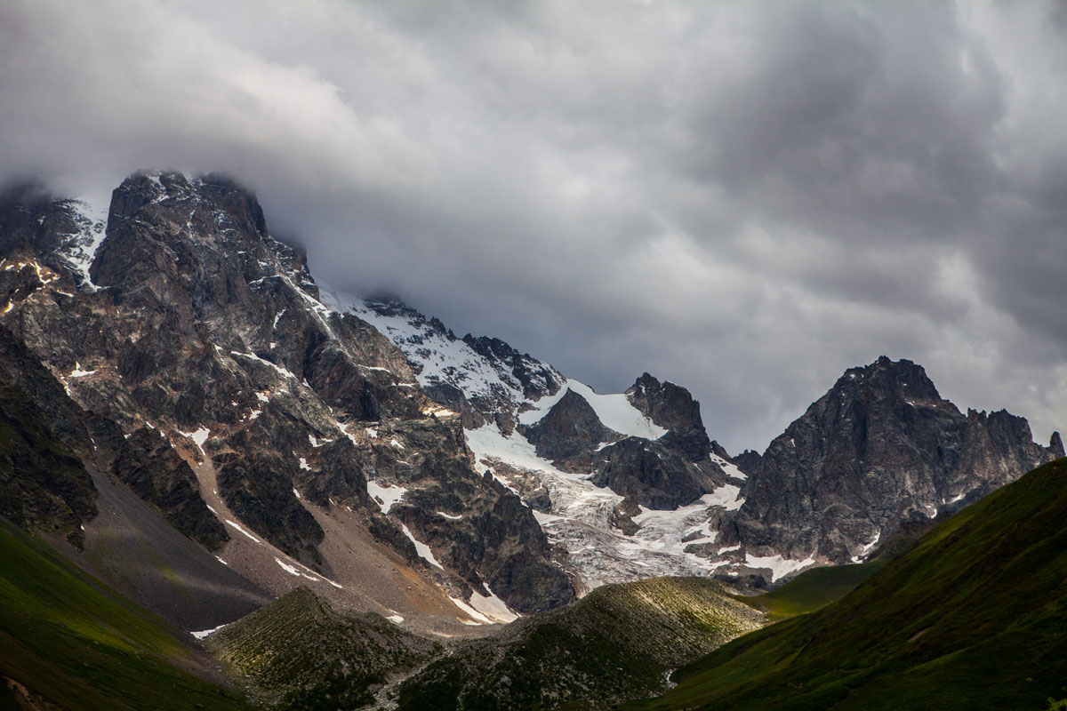
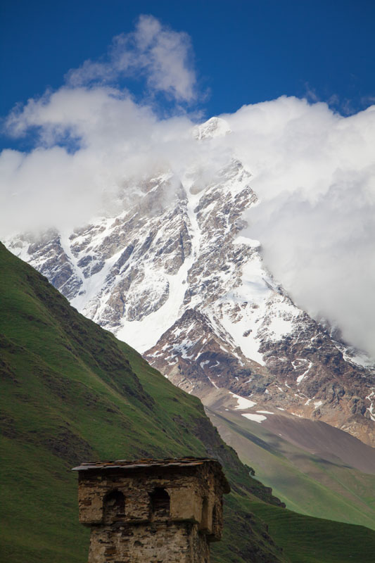
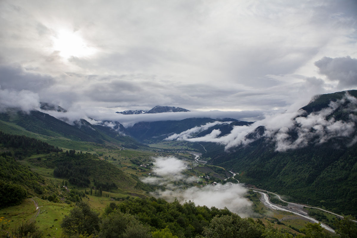
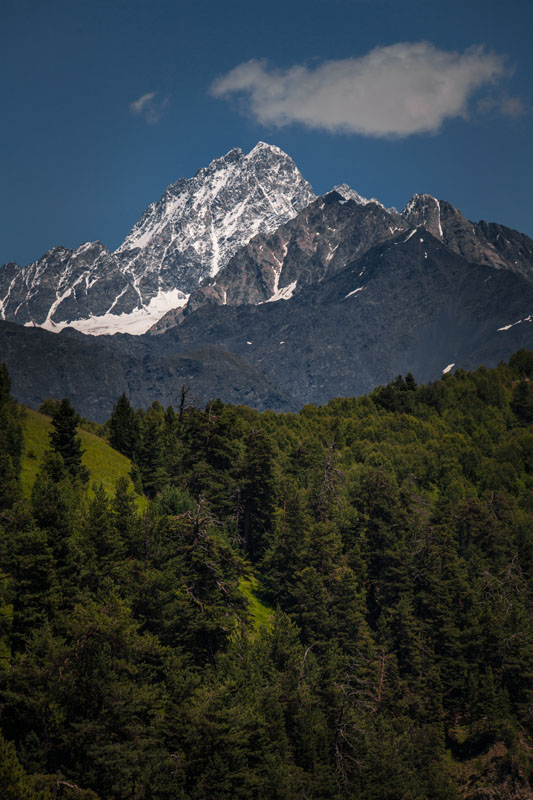
Svaneti is arguably the most beautiful part of Georgia, making it the country’s primary location for hikers and adventurers. Located in the northwestern part of Georgia, Svaneti sits at around 1.800m on the southern slopes of the Central portion of the Greater Caucasus Mountain Range and is home to 4 of 10 of the Greater Caucasus highest mountains, as well as Georgia’s highest mountain, Mount Shkhara, which overlooks, in part, the highest permanent settlement in Europe, Ushguli.
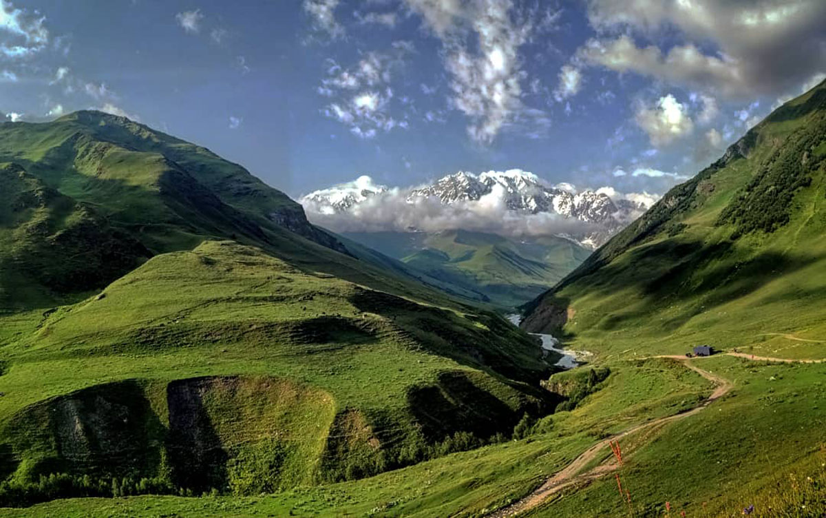
Svaneti is broken into 2-parts, upper and lower Svaneti, which are determined by the two inhabited valleys in which they sit. Upper Svaneti follows the Enguri River Valley and is part of the Samegrelo-Zemo Svaneti administrative division, with the township seat being Mestia. Lower Svaneti follows the Tskhenistsqali River Valley and is part of the Racha-Lechkhumi and Kvemo Svaneti administrative division with its township seat being Lentekhi. The two sections are divided by the Svaneti Range, which creates the headwaters for both the Enguri and Tskhenistsqali Rivers and is an 85 km long at an elevation of around 4000m. The Svaneti Range is almost as high as the Caucasus Range and is composed of mainly of sedimentary and some metamorphic rocks including; mica and schist, which are sedimentary, and quartzite, slate which are metamorphic. These geological characteristics contribute to the vast scree fields at the higher elevations.
Svaneti is the historic home of the Svan people, a subgroup of Georgians that speak their own sub-Kartvelian language of Svan, as well as Georgian. Historically, the Kodori Valley (or Kodori Gorge) was also part of Svaneti and was inhabited by Svans. After the Abkhazian-Georgian conflict, post-1993, the Kodori Valley was the only portion of the region that was under direct control of the Georgian government. However post 2006, solidified with the 2008 Georgian-Russian conflict, the region has been under Abkhazian and Russian control.
You can reach Svaneti in a variety of ways; by marshrutka, train, and/or flying. The easiest way to get to Svaneti is to fly to Mestia from Tbilisi or Kutaisi. The airline Vanilla Sky operates a direct flight between Tbilisi and Mestia twice a day from Monday to Friday, and one flight on Sunday (there are no flights Saturday) during the summer tourist season for 90 Gel per person each way on a LET-410 UVP aircraft (registration UR-LSA), which seats only 19 passengers. You can fly from Kutaisi to Mestia for 50 Gel per person each way. The Kutaisi to Mestia option is a good alternative for European travelers taking cheaper budget airline flights into Kutaisi, rather than Tbilisi. An important thing to note is that the flights are highly dependent on the weather in Svaneti. These planes are incredibly tiny and considering the fact that the mountains of Svaneti are very high, the Mestia airport and runway is very small, and the weather is very unpredictable and changeable, the flights will not leave unless it is a perfect flying day.
There is also the option to take a marshrutka into Mestia. You can take these from Tbilisi (8 to 10-hours at around 30 Gel per person each way), or Kutaisi, Batumi, and Zugdidi (at around 30-40 Gel per person each way). As with most marshrutkas in Georgia these leave when they are full.
A very common method for going to Mestia is to take the night train to Zugdidi from Tbilisi and a Marshrutka to Mestia. The train from Tbilisi to Zugdidi leaves at 21:45 and arrives at Zugdidi at 6:05. First class tickets cost 35 Gel per person each way, second class tickets cost 21 Gel per person each way, and third class tickets cost 8.5 Gel per person each way. The Zugdidi marshrutkas wait at the train station and during the high season fill up immediately with tourists headed to Mestia so you won’t have to wait that long. If you leave from Zugdidi later in the day you are more likely to wait a few hours to depart.
A popular day trip in the area is from Mestia to Ushguli. You can take a marshrutka to Ushguli one way for 20 (if you are lucky) to 35 Gel per person one way. A same day round trip marshrutka to Ushguli costs 40 Gel per person.
You can also take private taxis around the area depending on where you are going, however these will be considerably more expensive (100-200 Gel per car). Hitchhiking is also a popular option for trekkers in the area and if you are traveling alone or with one other person it is very easy to find a ride along the main Mestia to Zugdidi road or along the village side roads that do not have access to public transportation.
The exchange rate for Gel to USD averages about 2.5-3 Gel to 1 USD and the exchange rate for Gel to Euro averages a little over 3 Gel to 1 Euro.
Mestia is the center of tourism for the Svaneti region. During the high season tourist easily outnumber locals and number of Georgian move to Svaneti during the high season to work. As such, there are a number of places to stay in town. While in Mestia you can camp; stay at a hotel, which is the most expensive option; stay at a guest house, which varies in price and often has a breakfast and dinner option; or stay at a local hostel, which is the easiest to find in case the local guest houses are full (typically on the weekends) and often offers a breakfast option as well. Many hotels and guest houses also offer storage space for ski equipment during the winter as Svaneti is a popular winter destination as well for extreme winter sports enthusiasts.
Camping can be done in a couple of different ways, either you can camp at local guest houses with open camp sites, or you can hike up to the many trails in the area. A popular area to camp is along the Tebdiashi Range and Shagatkhumari Plateau, where the Guli Pass and Koruldi Lakes hikes are located.
Popular hotels in Mestia include the Hotel Banguriani, which sits near a popular entrance for the Mestia to Ushguli trek and costs between 220-370 Gel depending on how many people are booking and includes breakfast. The hotel Posta is located 700m from the Svan History and Ethnography Museum and costs 324-441 Gel per room and includes breakfast.
The guest houses in Mestia are incredibly numerous (as they are all over the region), and typically very affordable and easy to book. You can either book online (though this can be a dubious option as booking.com seems to have a consistent issue with false booking options in this area), or you can stop by and ask if there is a free room. Guest house prices typically range from 20-45 Gel per person depending on the room. The cheapest rooms often have a shared bathroom option. You can also add breakfast and/or dinner to your room cost. Many guest houses are flexible so if you want to have breakfast and/or dinner some days and not others they will work with you. Breakfast typically costs between 10-15 Gel and dinner typically cost between 15-25 Gel. Depending on your appetite, this can be a very good option. There are a ton of places to eat around Mestia, but they can be very expensive.
The main hostel in the center of town is Seti Hostel and is located across from the park next to the police station in the downtown area. It cost between 25-30 Gel per person and you can add breakfast for another 10 Gel. There is also a cafe attached to the hostel.
Ushguli, like Mestia, is a popular center for hikers, primarily due to the fact that it is located at the preferred terminus for the Mestia to Ushguli trek. Unlike Mestia, however, Ushguli has guest houses, but no real hotels. There are a few larger hotel-like guest houses in Mestia that are open for the winter season for winter sportsmen, but for the most part, the town is full of Svan homes that locals have converted into guest houses for the tourist population. You will also see a family cafe and souvenir shop attached to just about every single guest house in the village. The guest houses in Ushguli are largely shared room and shared bathroom, though it is possible to get a single room as well. The rooms are largely more modest than what you would find in Mestia, but very cozy and the families running them are typically extremely accommodating. The price for a guest house in Ushguli can run anywhere from 25-40 Gel per person per night and the meals typically run 10-15 Gel for breakfast and 15-25 Gel for dinner.
Mazeri (as well as many of the small villages on the Transcaucasian Trail) is very similar to Ushguli in that the town is full of primarily guest houses (though fewer than Ushguli) run by local families during the tourist season, with the option of breakfast and/or dinner included. Mazeri however, due to its small size and the number and types of hikes that are in the area is typically a little more expensive than Ushguli, with beds ranging closer to 20-30 Gel per person per night and meals ranging closer to 15-20 Gel for breakfast and 25 Gel for dinner.
The trails in Svaneti are by and large well marked and cut and easy to follow. There are regular hiker’s guide posts that give the kilometer distance and approximate time to both favored hiking destinations, as well as nearby villages and passes. Blazes in the area are typically read and white.
Since Mestia is one of the most popular (if not the most popular) destination for hikers in Georgia, during the high season the routes can get very crowded. However, if you start your hike very early in the day you can bypass three things; the crowds, the sun, and lost time. Crowds start getting big along the routes around 10am so if you start your hike at at least 5am you will not only catch some amazing sunrises, you will also get to enjoy the route more or less alone for a few hours. Additionally, the sun in Svaneti can get unbelievably intense so starting early in the day helps prevent sun burns and also helps you beat the heat as the mornings are very cool. This is especially true if you are doing a lot of climbing early in the hike. The beginning of the hike will be cool and you will reach the higher elevations just in time for the clouds to burn off so you can see the surrounding mountain peaks. Leaving early also allows you to either end your hikes once the day starts getting warm or even extend your hikes if you want to explore side trails or attempt a few modest summits.
This is a very popular hike for the Mestia area and doubles as the entry point to the Guli Pass trail. One key thing to note is that the lakes are more of a means to an end when it comes to this hike. They are rather small and less impressive than other lake hikes in Svaneti, however, the hike has great views of the surrounding mountain ranges.
From this hike (as well as the Guli Pass hike) you can see a huge variety of mountain peaks including; Dalrakora (3430m, 249m Prominence), Bashkara (4162m, 356m Prominence), Gumachi (3797m, 86m Prominence), Chegetau-Chana (4091m, 355m Prominence), Ullutau-Chana (4274m), Sarikolbashi (4074m), Latraldashi (3370m, 142m Prominence), Asmashi (4057m, 438m Prominence), Banguriani (a very popular peak at 3838m, 255m Prominence), Dykhtau (5201m), Marinnazha (3584m, 298m Prominence), Latraldashi (3370m, 142m Prominence), Komsomoletsi (3702m, 198m Prominence), Glavni Salinan (4504m), Gora Gistola (4586m, 18m Prominence), Chkhunderi (3036m, 332m Prominence), Dadash (3424m, 35m Prominence), Gvadarashi (3749m), Chkeeru (3584m), Lailchala (another very popular peak at 3991m, 82m Prominence), Rozhana (3798m), Guri (3146m), Totani (3050m, 138m Prominence), Carci (3531m), and Guli (2923m), among many other possible peaks depending on visibility and how high you choose to climb.
The best way to understand this hike is to break it up into 2 sections, the subalpine section and the alpine section. You can do the subalpine route in 3-ways.
The easiest thing you can do is hire a care to take you up to the lakes, which sit in the Shagatkhumari Plateau. Albeit that this is not actually a hike, but it is a popular way to get up to the lakes and a kinder option on your knees if you want to extend the hike up to just below the peak (though if you are confident in your mountaineering ability you can reach the actual peak) of un-named mountain overlooking the lakes, which is quite steep and very tiring if you tack it onto hiking up the subalpine region to the plateau as you will be contending with about 1500m of elevation gain from Mestia to the end of the road near the summit. You can also drive up to the hiking marker for the Guli Pass trail if you want to bypass a bit of vertical gain for that trail as well. There are also a ton of smaller trails and places to walk around the Shagatkhumari Plateau so you can still do a bit of exploring. You could also walk up the road to the plateau if you do not want to contend with the two hiking routes up the mountain, which are very steep.
As far as hiking up to the Shagatkhumari Plateau goes, there are currently 2-trails that connect the plateau with Mestia. For whatever reason, the Mestia tourism maps seem to favor the more difficult of these 2-trails.
The first and most difficult option for reaching the plateau is the route that leaves from the town centre and connects mid way with the jeep road going to the plateau. If you walk eastward through downtown you will turn left up the road at the Credo Bank and pass through an area of Mestia with a number of Svan towers headed up a steep hill towards an unassuming white concrete building with a no trespassing sign that sits at the trailhead, which is marked. The trail continues to go straight up the hill and at times feels like you are just walking through natural drainage ditches. In short, it is unreasonably steep. This portion of the trail is also cut with a number of side loops that don’t really go anywhere, or head to the Laghami Church. The trail will eventually connect with the jeep road for a couple kilometers before reaching the overlook and cross, which is your first landmark for this trail. Since the trail connects with the road early and the views are not that impressive, there is no real draw to taking this route unless you are looking for a physical challenge.
The second route, while also very steep is considerably easier to navigate, and less steep than its sibling. It also hits the road later and has better views of the valley it follows up. While the first route employs absolutely no switchbacks, this route has a few, making it a bit more manageable. This route starts more towards the entrance of the village and there are a few signs for it. You will have to walk through some of the neighborhoods of Mestia as well. If you walk westward you will turn right onto Erekle Parjiani I Alley. The road will follow a small built up stream and eventually end at the mouth of a valley. Continue to walk up the stream path (you will at times have to cross in the stream, but it is not deep at all), until you see a messy trail head on your right heading up the mountain. You can follow that all the way up to the plateau. The terminus of this trail ends just behind the cross and overlook so if you want to look over into Mestia and the Zuruldi Ridge you will have to backtrack a few meters.

Once you are at the cross and overlook you will see a variety of jeep trails heading up the plateau, which are both steep and flat at times. As you head up you will pass a shepard's cabin where the route narrows a bit before connecting with the jeep road again. You will walk along the route until you hit a trail marker directing you either along the Guli Pass or to the lakes. The Guli Pas and the Koruldi Lakes head in generally the same direction for a bit, however, the Guli Pass hike circles around the mouth of the leftmost valley at the base of Guli Peak which you can easily spot as you walk to the lakes. Guli has a rounded craggly peak that is not terribly talk and it extends out towards the valley Mestia sits in while the back end circles around and connects with the un-named mountain overlooking the lakes. If the weather is clear you might also get lucky and catch a glimpse of Mount Ushba, which sits behind the plateau you are walking on.
After the trail marker you will continue to head up the jeep trails (again these will jump between being very steep and relatively flat) and you will eventually climb over a bit of a hill before you reach the lakes.
If you want to extend you hike even more you can continue up the jeep road until it ends near the top of the mountain. The views here are great and the feeling of accomplishment is even better.
If you hike from Mestia to the Koruldi Lakes you will climb about 1500m over the course of about 11km depending on where you start. The accent to the lakes should take 3-4 hours and the descent will be around 2-3 hours.

If you want to extend your hike up the road towards the summit of the mountain you will add about 600m of elevation gain to your hike and around 2-3km. Adding this section will take around an hour to ascend.
This is an incredibly easy, popular, and enjoyable day hike with great views of Mounts Tetnuldi, Laila, and Ushba, as well as the entire Svaneti Mountain range area.
The best way to get to this hike is to take the Hatsvali cable car. However, the lift only operates if the weather is nice, so it will not run if it is raining. There are two sections to the lift. Sometimes only the lower of the two sections will be running due to weather. These lifts also require a great deal of maintenance and sometimes do not run for that reason, even during the high season. There are additional trails going up the ridge if you want to add some mileage to your hike, or you could take a taxi up if the lifts are not running. The Hatsvali Cable Car cost 15 gel round trip.
To get to the Hatsvali cable car you will walk along the road to Ushguli heading east out of town. You will take a right turn as you approach the town limits just before the Hotel Shgedi Mestia.

The trail is about 6km round trip. For the most part it is rolling hills with only a few steep climbs.
However, the steepest climb comes at the accent to the radio and cell towers that marks the halfway point of the hike. It is a very steep climb up, but not unmanageable. From there you can see great views of the Svaneti Mountain range and relax. The trail returns along the same route you came and ends at the ski lift.
If you take the route from Mestia all the way to its endpoint just above Zhamushi you will hike about 11.25km with about 1910m of elevation gain, the majority of which is found towards the end of the trail.
In common Georgian trail fashion, most of the trail is relatively flat with abrupt upward climbs in parts. About two thirds of this trail is flat-ish, with the remaining being steep climbs.
As opposed to going through grazing land, the majority of this trail is through native meadows, making it much more pleasant. However, you will have to climb the initial ridge that is part of the Mestia-Ushugli trek to get out of grazing lands, as well as Mestia city limits. This part of the trail is rather boring and take a while, but once you get up on the ridge the views and nature vastly improve.
You can start the route in the main square in Mestia and head south through the eastern gate. There is no formal entrance point, instead the road just kind of turns into the path. Follow the trail down the river and after you cross the bridge turn left.

There are no balzes on this trail, instead it is just very clearly cut until the last part, which is much harder to follow and hike as it is the part the gets incredibly steep.
One important thing to note about this trail is that the portion that actually climbs Chukhuti Ridge branches off the main trail, but is not obvious. Once you reach the valley leading up to Banguriani, you will know to turn off the trail. The Chukhuti Ridge actually follows up the climb to the summit of Banguriani
You will have to go off trail for a little while through an alpine valley meadow climbing towards Banguriani. Head towards you right. The continued trail will start along the treeline.
The last part of the trail is what goes to the Chukhuti Ridge and it is more narrow, keep alert. As you scale this part of the trail you will see Tetnuldi mountain first to your right, eventually coming to see Mount Ushba and Chatyn-Tau to your left. To the right the pyramids of Tetnuldi and Gistola; you will be hiking towards the Gvalda range at this point. Chkhuti ridge heads towards its second highest point, Ahalgazrdoba (3702m) or Komsomol Peak (3330m). Left of Komsomol Peak is Banguariani (3804m) and the mountains Gvalda and https://peakvisor.com/peak/pik-komsomolets.html Latraldashi (3370m, 142m Prominence).

Point to point, the Guli pass is a challenging, but incredibly rewarding day hike. You can do this hike in a day over the course of about 10 hours depending on how fast you hike. Or, if you want to take your time and explore the area more, you can pack a tent and camp in the mouth of the Guli Pass. A fun variation of the Guli Pass hike is to tack on a trip to the summit of Guli Peak (2926m, 129m prominence), which you can find a route for at the top of the pass, turning left instead of right, which goes towards Mount Ushba (the most challengin accent in Georgia at, 4710m, 1235m Prominence) and down to Mazeri.
The views of Ushba and other mountains are amazing on this hike.
The Guli Pass hike is 24km long with about 1600m of gain and decent.
The best period for this hike is from the beginning of July until the end of September as the rest of the year has the Guli Pass covered in snow. The passability of this hike really depends on the proficiency of the hiker.
If you start in Mazeri you will have a net vertical loss of 200m, making the trail a bit easier, however there is no public transport to Mazeri so you will have to take a taxi there.
The hike starting from Mazeri starts at a tourist pointer south of the village and the trail is blazed with white and red blazes. The trail heads southeast, towards Bagvdanari village and then turns east and enters the Gulichala valley.
Towards the end of the trail there is a shelter on top of Tshakazagari hill (2200m) over Mestia after that it is downhill towards Mestia. At 1850m you’ll turn right from the large road onto the smaller trail going between the wooden fences. There is also a tourist pointer here sending you towards Mestia.
If you start from Mestia you will mostly likely be hiking alone and the start of the hike is the same as the start of the Koruldi Lakes hike with the 3 options for ascending the subalpine region out of Mestia. Instead of going up towards the lakes however, you will go down through the mouth of the pass and around the exposed valley towards the Guli Pass.
The Mazeri to Shdgura Waterfall hike is a popular day hike for casual day hikers and families. If you like, and if you are fit enough, you can extend this hike to Ushba Glacier, which is a bit over 1000m higher in elevation than the waterfall. Many people turn the Ushba Glacier hike into an overnight camping trip, but if you leave early and have the energy, you can do it in a day. This hike and it’s extension are similar in elevation gain (in the 2nd part) to the Chaukhi massif hike in the Kazbegi area.
To the waterfall the hike is an easy hike with only a couple areas of steep, but not altogether too difficult or long stretches, elevation gain along the jeep road further into the valley.
To start the hike you will leave Mazeri heading towards the valley. You can either take the main paved road following the east bank of the Dolra River, which is hot and not that interesting, but easy to follow, and cut through the river crossing a few meters along the route following the trail markers on your left, or you can exit Mazeri and take the dirt path on the west bank of the river, which heads straight to the waterfall. It is important to note that the paved road still occasionally gets washed out by flash floods so check that the road is in good order. The blazes for this hike are red and white.

If you want to take the dirt path on the west side of the bank you will cross through the center of town heading to the western side of the valley toward neighboring small villages through meadows and farmland. You will pass through a couple small fenced in areas, most likely with cattle or sheep, as you leave the village. Feel free to open the gate and pass through, but be sure to close it after you. You will then walk through an open field for a short while and reach a blocked off fence that you cannot open closer to the river. You will have to climb this gate and you will cross a bridge immediately after. Once you are on the other side of the river you will head north into the valley.
A few meters down the trail there is a bubbling mineral wetland with a platform that allows you to take water if you like.
As you continue down the trail you will pass by the Hiker’s Cafe on the left, which you can both grab a bite or a beer at, and doubles as a hostel/guest house. There is a second cafe further into the forest on the left as well as the trail bends right and you approach the second river crossing.
Once you cross the river to the east side of the bank you will come upon a third, more populated cafe area, as well as a border guard post. The guards typically do not check your passport as you move through the area, but it doesn’t hurt to bring it just in case.
Once you pass through this last meeting area the route will climb up steeply toward the waterfall. At this point you should start noticing how popular this route is. The trail gets considerably more crowded and there are a number of people at the waterfall site. There are also horses on the trail as it is a popular equine route as well.
If you like, you can end the route here and head back. However, if you want to see Ushba Glacier the route continues on between the Dolra River and a rocky drainage depression.
You will eventually make a left turn onto the steepest section of the entire hike. It should be noted that the trail is in rather poor condition here as it is very slippery and you cover about 150m of elevation over a very short distance.
Once you get to about 2200m elevation the trail with turn right and go through a bit of young forest along the ridge before you reach another river crossing. Hopefully there will be a few stones or tree trunk to help you cross, but be sure to scout the best route across as the river crossing can be quite hectic.
After you cross the river you walk through a thicket and rocky moraine before you catch sight of the glacier and Mount Ushba. You will also be able to see Mount Shelda (4368m) at the Georgian-Russian border to the north, as well as Mount Mazeri (4010m, 375m Prominence) to the south.
The best time to see the peaks of Ushba is in August when the weather is much drier. In June and July the peak is often obscured and even pulls in the surrounding moisture to keep clouds circling its peak constantly.
As is the rule with all rocky and craggly glaciers in Georgia, do not stand too near the base of the glacier and the falling rock hazard is very high. Many people get injured and even killed at the base of these glaciers by not taking simple precautions.
Currently, you can not camp at the base of the glacier due to its proximity to Russia so you will have to head back towards the border guard station where you can stay and perhaps even enjoy a party.
This is another very popular hike that offers views of Mount Chatyn-Tau, which composes the head of the Chalaadi Glacier, as well as Mount Vulleya (4055m, 192m Prominence).
Your best bet for the Chalaadi Glacier hike is to get a marshrutka, taxi or hitchhike to the trail head. Otherwise, you will be walking along a hot and very boring road. This should be very easy to find as it is a highly trafficked trail.
Once you reach the trailhead you will walk for about 15-30 minutes, depending on your speed, through beautiful, rugged subalpine to low alpine coniferous forests, the trail then heads along the river to the glacier, which will take another 15-30 minutes.
Georgia are incredibly craggy and have a high risk of falling rock injuries. Every year a number of tourists get injured, or even killed, at the glacier by standing too near to its base and becoming the victim of falling rock or by falling on black ice. Do not be that tourist. The glacier is just as amazing at a safe distance as it is up close, if not more so.
The Shkhara Glacier is incredible, easy and the most popular day hike in Ushguli. You can either hike this route, which will take about 5 easy hours and covers 16km with only about 540m of steady elevation gain (not strenuous at all), or you can hire a car or horse to take you. A marshrutka to the glacier will cost about 100 gel and is best done with a group of people, which will not be hard to come by.
Getting to Ushguli will cost anywhere from 20 to 40 gel. Typically, you can get a round trip ride to and from Ushguli for 40 gel.
For the vast majority of the hike you will be walking along the jeep road that carves through the glacial valley along the Inguri River, which is fed by the Shkhara Glacier.
The route is impossible to miss. You just take any road leading towards the massive wall of mountains behind Ushguli and you will find the one road that leads to the glacier passing by the Lamaria Church. The Lamaria Church is a relic of the old pagan traditions of the region and how they were co opted by othodox catholicism. Saint Mary, the patron saint of the church was originally a pagan goddess of the area.
Once you reach the cafe, which sits across the opposing side of Inguri River you will need to look for a small trail heading up towards the glacier. The road continues up to a short trail following the valley and providing good upper views of the glacier, as well as the entire valley and is a good side hike if you want to see more of the valley.
Towards the glacier the trail narrows considerably and follows more closely along the Inguri River, finally coming up to the mouth of the glacier. You will be able to see directly where the glacier ends. It is an absolutely beautiful scene.
This trek is easily the most popular trek in Georgia. It is one of the older trails in the country and there are a few different routes that you can take between Mestia and Ushguli going either high or low through the Svaneti region. Typically, most people hike the Mestia to Ushguli section over the course of 3-4 days, but you can easily extend this hike and start further east in Chuberi. If you do this, you will also incorporate the Guli Pass hike, outlined above.
If you want to do the entire Transcaucasian trail, the route is typically broken into 5 stages; Chuberi to Nakra, Nakra to Becho, Becho to Mestia, Mestia to Adashi, and Adashi to Ushguli.
It is also important to note that even though the Transcaucasian/Mestia to Ushguli trek is one of the better established treks in the country, parts of it still need development. The 15km section between Khalde and Ushguli is currently along a highly trafficked road and can be precarious for hikers. Current trail development groups are working to cut a new trail along this route away from the highway. Currently, hikers can bypass this section by climbing up through the Karreta pass, which will add time and elevation to your trek, but will keep you away from the road and is very beautiful.
The blazes for this trek are red and white and the trail is a great favorite among trekkers for a few reasons; it is easy to follow due to its effective blaze markings, the Svaneti region is very tourist friendly and the locals are pretty accustomed to hikers moving through the area, and similarly, it is possible to sleep every night in village guest houses so you don't necessarily need to bring a tent and can pack very light (even packing as light as just a day pack if you are more minimalist), making this trek downright luxurious by most trekking standards.
It is advisable to get very familiar with the various routes you can take in the area to make for the best trek for your tastes. Regardless of whether you prefer to trek through more civilization, historic markers, or natural environments, there is a route or detour for you and there are a variety of resources that can help you find the route you want.
The Chuberi to Nakra section covers 27km and climbs 2296m with 1861m of decent, starting at 844m elevation, peaking at about 2707m, and ending at about 1200m elevation and take about 10 hours to complete.
The route is a steady climb up and over the Utviri Pass, ending in Nakra valley. While the climb is not as steep as other climbs on the trek, the distance between the beginning and end is what makes this hike so long. The following directions are based on those provided by the Transcaucasian Trail Development Group. The full explanation of the trail can be found here;
“The route starts in the center of Kvemo Marghi on the east side of the river. Follow the yellow signs to Utviri Pass and Nakra, taking the road north along the east side of the river. Turn to the right before you cross over the Gvashkhara River, which follows into the Nenskra.
Follow the path, which turns to the left leads to a small log bridge as it leads over several streams, over which are large fallen logs as makeshift bridges. After 600 meters, the wide path you are on bends right toward a stream, but there is a thin footpath on the left, going uphill. Turn left here.
Soon you will reach the outskirts of Zemo Marghi, and the trail follows a fence. At the top of the hill, turn right and continue along the fence away from the cell tower. Pass straight through the meadow to the end. Continue north along the ridge, steadily climbing upwards.
From this point you are mainly following the course of the Marghi River northward before bending east toward the Utviri Pass. After a series of shephard’s huts, the trail turns sharply to the left and goes uphill. The trail climbs steadily upward on the south side of this valley.
From the pass, follow the blazes, which take you to the left of the small lake and across a small stream before joining the jeep track then to Nakra.
As you come around the mountainside you will see more shepherd huts. Keep going downhill and follow the blazes past the cell towers to the north end of the village.”
The Nakra to Becho section covers 35 km with 2 major climbs and and number of small climbs interspersed with the first decent. The accumulated accent is 2411m with an accumulated descent of 2422m, starting at 1175m elevation, peaking at about 2456m, and ending at about 1600m elevation. This section of the trek should take 2-days.
The following directions are based on those provided by the Transcaucasian Trail Development Group. The full explanation of the trail can be found here;
“From the mineral spring or school in Nakra, follow the road downriver. The trail crosses over the next bridge and ascends gently upwards toward the hamlet of Latsumba. Go through a gate on the right to the top of the meadow and turn right into the forest. An hour or two beyond is the forested pass at 1866m. Descending from the pass, the trail enters the Enguri valley. Turn right at the jeep track. Before you reach the cell towers make a sharp left. In the village of Tsaleri there is a sign with a map on it. Continue on the jeep track for another 50m, then follow the yellow sign into the forest. The trail descends steeply to a bridge crossing the small river. The trail then ascends steeply across several landslips to Kichkhuldashi.
The route from Kichkhuldashi follows the jeep track uphill after the village then enters the forest before descending to the ruins of the abandoned hamlet of Paledi and across the Ladlina River (there is a bridge) and up to the village of Gheshderi. After an hour or so you will reach the larger village of Pari.
Continue along the main road through Pari until you reach a T-junction with a road. Take the road that bears left uphill. Then, follow the trail that splits off to the right. You will reach a stream where there is a bridge nearby. It is best to cross the bridge than by foot, but you may have to look around to locate it.
Make a sharp left after the bridge at the meadow to the gate, then turn right and follow alongside the outer fence until you reach a path which turns sharply left up into the forest. Turn right and go up to the village of Pkhutreri. Turn left onto the main village road. Follow this road for about 600 meters downhill. After crossing a small stream, turn left up the road to the center.
After 3km the path connects with the alternate route coming from Pari. Continue straight going north to the end of the valley.
Before long you’ll go up the rocky incline to the Bak pass. Take the trail to the right as you reach the signs for the local villages. The trail crosses a thin ridge before skirting around the east side of Mt. Detsili. Do not descend into the forest until you have passed the church and the small lake. A slow descent leads to Mezuris Angelosi Church. After the lake, the trail enters the forest and descends on a well-maintained trail to Becho valley.”
This portion of the route goes over the Guli Pass. Outlined above is the section of the Guli Pass if you choose to go from Mestia to Mazeri, however, this section of the trail goes in the opposite direction, which is the more popular option because Mazeri is about 200m higher than Mestia.
The route covers 21km with 1627m of elevation gain and 1806m of decent, starting at about 1600m, peaking at 2928m, and ending at about 1400m in Mestia. The entire route is a steady climb up the pass and down through the mouth of the pass, passing by the Koruldi Lakes hike and into the city of Mestia.
This can be done in 10 hours, but many people like to camp in the mouth of the Guli Pass, which is very beautiful.
The following directions are based on those provided by the Transcaucasian Trail Development Group. The full explanation of the trail can be found here;
“From Mazeri village, go south on the main road 200m and look for a white sign on the left. Turn here and walk up the road to Bagvdanari. Then turn right in the center of the village, crossing over the Gulichala River. 100m beyond the river, turn left onto a footpath. Follow the path as it ascends alongside the river toward the ancient ruins of Guli.
Follow the path as it winds up toward Guli pass. Early in the season (before July), you are likely to run into patches of snow near the pass, as it is quite high at 2954m. Be careful as you cross over and down the pass, which is steep and rocky, and if there is still snow here it can be dangerous. Upon reaching the first white sign on the ridge, continue south along the ridge for about a kilometer until you reach a saddle and another white sign.
Follow the red and white blazes down the mountainside until the grade levels out a bit and you find yourself on the clearly trodden path. Where the trail meets the headwater of the Pushkueri River which is steep and powerful should be crossed with great care.
Where the path meets the dirt road, turn right. After 500m you reach a wooden lookout platform with views over Mestia. From here, [you can take one of the three routes to descend to Mestia, mentioned above in the Koruldi Lakes Hike].”
The Mestia to Adishi section has 2 major climbs, starts at 1393m and peaks at 2480m, with an accumulated climb of 1969m and an accumulated descent of 1269m going about 28km and taking 1-2 days.
This is the start of the traditional Mestia to Ushguli trek and you will start running into a higher number of trekkers at this point.
The route follows the same route at the beginning of the Chukhuti Ridge hike, but instead of branching off at the base of Mount Banguriani, you will continue along the path the follows the lower ridge towards the villages of Murshkeli, Zhamushi, and Artskeli.
The following directions are based on those provided by the Transcaucasian Trail Development Group. The full explanation of the trail can be found here (note: There is a second option for this route that starts at the Zuruldi Ridge hike and the details of which can be found here);
“From the park in Mestia town center, head down the road southeast which leads towards the museum. Cross the bridge just past the restaurant Dror, immediately turning left after the river.
At the first fork, go right in the direction of Hotel Tetnuldi, which is above on your right. Continue on the road, bearing right at a fork about 500m on toward the Hotel Banguriani. Follow the road straight for another two kilometers as it turns to dirt.
Near the end of the road a white sign points to a footpath steeply up to the right as the trail bends up the ridge. Before you reach the top of the ridge you will pass a huge open meadow on your left.
Continue on the path as it goes up and over the ridge. As you enter the valley, a white sign appears left of the trail and points vaguely east. There are two ways here, a dirt road going down to the first village, and a path forking left and going above the villages. The trail marked on the map takes the route through the villages on the jeep track. If you take the trail to the left to stay high, you will pass above the first few villages and through the village of Lakhiri.
Beyond Cholashi and its “Beer Bar,” the blazes continue north of the Mulkhura to Zhabeshi at the end of the valley. As of fall 2017, the only way to cross the river in Zhabeshi was via a zip-line (Tyrolean traverse) set up by a local mountain guide, who was charging hikers to use it. An easier, [but less interesting] and more certain way to get to Zhabeshi is to cross the car bridge after Cholashi. Turn left after the bridge and continue on the car road on the south side of the Mulkhura.
From Zhabeshi, the trail is marked with red and white blazes following the road south from Zhabeshi, which soon becomes a path. Bear left next to an iron-rich mineral water spring. Turn left at the first intersection of paths. Continue through the forest into a meadow at the end of which is another water source.
Here the trail exits the forest next to the Tetnuldi ski resort. Cross the wide and dusty road to follow a smaller road with a white sign on it. Follow this as it loops south and then east and connects back with the main road you just crossed. Turn at the white sign onto a path on the right.
From the road the path heads south along a small creek. At the first fork bear right and continue following the blazes along the path. Continue as the path bends around the ridge and soon the village of Adishi will appear below.
You will pass through the north side of Adishi across a bridge, and then straight east. The trail leads vaguely down to the Adishchala River, as there is no bridge and there are different places where people attempt to cross it.”
The Adishi to Ushguli section starts around 2100m with one major climb peaking at 2723m with an accumulated climb of 1424m and an accumulated descent of 1448m, with the trail ending in a steady climb and going about 29km total.
There are 2-options for finishing this hike, you will either end along to road going to Ushguli, in which case you are better off hitchhiking the remained of the way, or you can climb up over the Khalde-Ushguli alternate pass, which, if you are feeling up to it, is a challenging climb, but a more beautiful way to end the hike.
The following directions are based on those provided by the Transcaucasian Trail Development Group. The full explanation of the trail can be found here;
“Whether on foot or by horse [Most years it is advisable to cross the river by horse as it is quite high.], it is a good idea to cross the Adishchala River early in the morning when the water is at its lowest. Early in the season (before late July) it is challenging or impossible to cross by foot.
In peak trekking season there are usually some local men hanging around the river on their horses, and they will carry you and your things across on horseback for about 10 Gel per person.
Across the river is the trail that leads up to the Chkhunderi Pass. From here it is quite steep and can be rather muddy if there has been a lot of rain. It should take around two hours to reach the pass.
Descend to the valley below where you will meet a jeep track that follows Khaldeschala River, following the north side as it follows down toward the village of Khalde. Continue three kilometers further to reach Iprari.
The road is none too exciting, but of course easy to follow. It meanders alongside the Enguri River before leading to Ushguli."
If you choose to instead cross the pass above Khalde you will have to keep a look out for markers and perhaps ask for directions. The pass is still under development, but has been improved since 2018. Luckily, the region approaching Ushguli is mostly alpine meadows so it is easier to get your bearings than in other parts of the route.
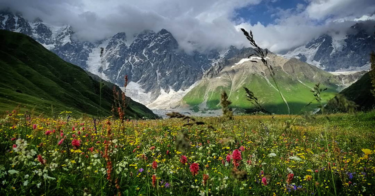
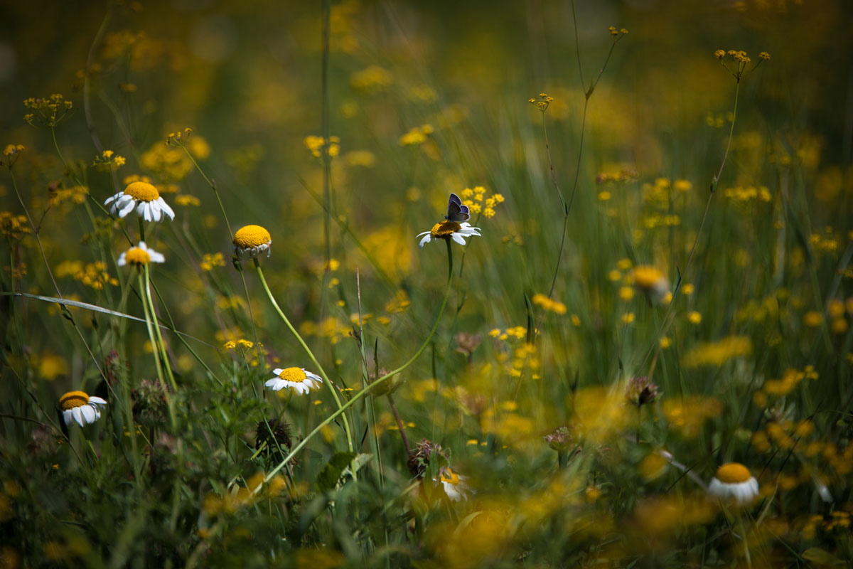
Svaneti has a surprisingly humid and rainy climate (getting anywhere from 1000mm to 3200mm of rain annually), as a result of warm air masses being pulled into the mountain ranges from the Black Sea. Svaneti’s proximity to the Black Sea also relieves much of the region from the extremely cold winters that are found in most mountainous regions. Many of the mountains in Svaneti are high enough that they create their own weather systems and are often obscured by clouds near daily during the wettest part of the season. However, Svaneti’s wet climate also inform the immense biodiversity of the region and alpine meadows are often covered with countless flowers and plants.
The wettest month of the year is July, with an average of 149mm of rainfall, followed by June (137mm) and August (119mm). Ironically enough, the high season in Svaneti is the wettest time of year. Ironically, the number of days of rainfall is highest in May with 18 days of rainfall on average, followed by June (16 days) and April (15 days). An astute traveler will instead consider hiking in Svaneti in early September when the leaves begin to change, the average days of rainfall is at it lowest (only 9 days), before the mountain passes get snowed in, and when the amount of tourists in the area is considerably lower.
During the winter months Svaneti gets a heavy amount of snowfall, making many parts of the region impassable. This also make Svaneti a draw for extreme winter sports enthusiasts. In the higher regions snow cover can reach five meters (16.4 feet). In general, the 800–1200m regions of Svaneti are characterized by long, warm summers and relatively cold and snowy winters. The 1200–1800m ranges have relatively warm summers and cold winters. Areas above 2000m have short, cool summers (less than three months) and long and cold winters. Large parts of Svaneti are above 3000m and do not have any real summer, instead being covered in snow, glaciers and ice sheets year round.
While Svaneti can get rather warm in the lower regions during the summer, it is characterized by cool pleasant summers and cold winters. In the alpine regions, the weather stays pleasantly cool in the summer. The two warmest months are June and July with an average high of 19°C and lows of 6-7°C. The coldest month is January with highs of -7°C and lows of -16°C.
Svaneti is home to an unbelievably vast array of plant and wide life, both alpine and subalpine with the lower forests being composed of mixed, deciduous, and coniferous forest at around 1800m, where much of Svaneti is situated, which also includes spruce, fir, beech, oak, and hornbeam. Less common trees include; chestnut, birch, maple, pine and box.
The alpine region between 1800m and 3000m is composed of alpine meadows and grasslands frequently covered in an unimaginable variety of alpine flowers and medicinal herbs. These herbs are used in the region’s famous Svan salt, which is an herb infused salt and which every family seems to have their own special recipe for. Svaneti is further emphasized as a natural medicine haven as a result of its numerous mineral springs, which are often used in conjunction with medicinal herb treatments in the area.
The region’s herbs are also the source of ancient Greek legends with Medea’s garden being believed to have been located there. It was said that Medea’s sorcery and herb concoctions were was Jason (of Jason and the Argonauts) strong and powerful and hypnotized the dragon guarding the Golden Fleece, and helped the Argonauts to take it away from Colchis. Such mixtures as Patchkoria, Dolidze, Burdiladze; and balsams such as, Kolkhuri, Turmanidze, Karchauli, Gochitashvili, as well as remedies like, Askurava, Khabazi, Loladze and etc. originated in the area.
Above around 3000m flora drops off and is replaced by snow-covered rocky peaks and scree fields. There are also a number of notable glaciers in the Svaneti region including the; Chalaadi, Ushba, Ushguli, Laila, Lekhziri and Tsaneri Glaciers, among others.
Some notable platlife in Svaneti includes; the Fragrant Orchid (Gymnadenia conopsea), Hound’s tongue (Cynoglossum officinale), Hogweed or Cow Parsnip (Heracleum) - hikers should watch out for this plant because if the sap touches human skin and is then exposed to sunlight it causes, at times, very severe burns - Black Henbane (Hyoscyamus niger), Red Clover (Trifolium pratense), Common Selfheal or Heal all (Prunella vulgaris), Fendler’s Meadow Rue (Thalictrum fendleri), Red Currants - these are edible - the Greater Butterfly Orchid (Platanthera chlorantha), the Norway Maple (Acer platanoides), European hornbeam (Carpinus betulus), Guelder-rose (Viburnum opulus), Oxeye Daisies (Leucanthemum vulgare), among many others.
Svaneti is home to the Svan population, which has their own language (Svan, within the Georgian Language family) and a long cultural history. The Svan population is typically associated historically with the Soanes, which were described by the Greek geographer Strabo. Throughout history the Svan population has been ruled by the Georgian Colchis dynasty, the Byzantine Lazica empire, the Abkhazian Shavliani dynasty, and finally the Georgian and, periodically, the Russian Empires, finally ending up as the north western most part of modern day Georgia.
The region in general has been renowned for its independent spirit and throughout history has been difficult for foreign empires to keep in check the Svans have been known as fierce warriors for centuries, often flying their war banner called Lemi (meaning Lion) into various battles. This could be due to the strong development of its culture as a result of its secluded position in the high reaches of the Greater Caucasus Mountains. For example, when the Russian empire had control over Georgia, Svaneti was characteristically rebellious. There was an unsuccessful anti-Soviet Svanetian Uprising in 1921 and in 1875 Russia had to contend with contentious and violent protests that came about as a result of an increase in taxes, battles which the Svans ultimately lost, but not before inflicting considerable losses on the Russian side.
The region is also well known for two particular traditions regarding marriage, both that stretched into as late as the 1990’s, but little exist today. For example, if a man wanted to marry a woman all he had to do was announce that they were to be married (this even happened within days of a previous husband’s death), and the woman had to leave her family and go live with her new husband’s family. This even, at times, included a woman being forced to leave her children from her first marriage. The second tradition was the tradition of ‘wife kidnapping’ where a man would kidnap the woman he intended to marry. Oftentimes, these women were forced to marry the men to prevent bloodshed between families, or to preserve her reputation as an unsullied woman. There is a popular movie called ‘Dede’ that explores this history (as well as a short film called ‘Dinola’, and typically plays daily in both Mestia and Ushguli.


top10
glacier
europe-4500ers
caucasus-4500ers
top10
glacier
europe-4500ers
caucasus-4500ers
top10
glacier
europe-4500ers
caucasus-4500ers
top10
glacier
europe-4500ers
caucasus-4500ers
Yes. Upper Svaneti has 229 named mountains. The highest is Shkhara at 5,193 m.
The highest mountain in Upper Svaneti is Shkhara, at 5,193 m.
Upper Svaneti has 229 named mountains.


