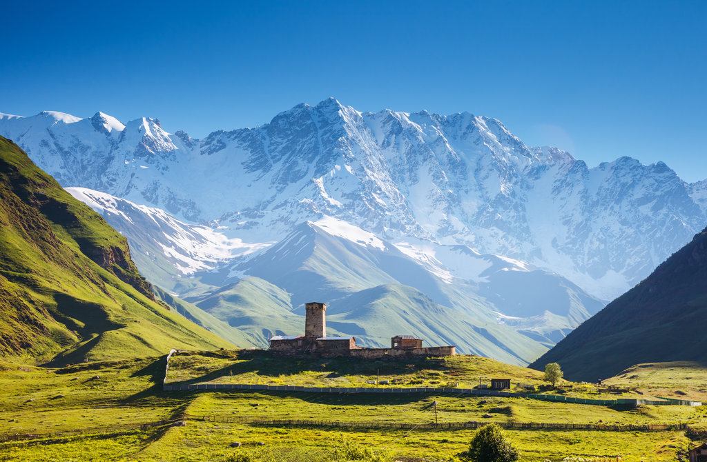
Shkhara (Georgian: შხარა) is the highest point in the country of Georgia. It is located near the Russian-Georgian border, in Russia's Kabardino-Balkaria region on the northern side, and the Svaneti region of Georgia in the south. Shkhara lies 88 kilometres (55 mi) north of the city of Kutaisi, Georgia's second-largest city, and closer to the townlet of Mestia in Svaneti. The summit lies in the central part of the Greater Caucasus Mountain Range, to the south-east of Mount Elbrus, Europe's highest mountain. Shkhara is the third-highest peak in the Caucasus, just behind Dykh-Tau.
By elevation Shkhara is
# 2 out of 199 in Cherek District # 4 out of 475 in Kabardino-Balkaria # 1 out of 277 in Samegrelo-Upper Svaneti # 1 out of 224 in Mestia Municipality # 1 out of 1724 in Georgia # 4 out of 24823 in Russia # 2 out of 171 in Kabardino-Balkarski Nature Reserve # 4 out of 4326 in the Greater Caucasus # 4 out of 7939 in the Caucasus
By prominence Shkhara is
# 2 out of 199 in Cherek District # 3 out of 475 in Kabardino-Balkaria # 2 out of 277 in Samegrelo-Upper Svaneti # 2 out of 224 in Mestia Municipality # 5 out of 1724 in Georgia # 87 out of 24823 in Russia # 2 out of 171 in Kabardino-Balkarski Nature Reserve # 12 out of 4326 in the Greater Caucasus # 15 out of 7939 in the Caucasus
We use GPS information embedded into the photo when it is available.
3D mountains overlay
Adjust mountain panorama to perfectly match your photos because recorded by camera photo position might be imprecise.
Move tool
Rotate tool
Zoom
More customization
Choose which peak labels should make into the final photo and what photo title should be.
Next
Photo Location
Satellitte
Flat map
Relief map
Latitude
Longitude
Altitude
OR
Latitude
°'''
Longitude
°'''
Apply
Register Peak
Peak Name
Latitude
Longitude
Altitude
Register
Teleport
PeakVisor
This 3D model of Sagarmatha National Park in Nepal was made using the PeakVisor app topographic data. The mobile app features higher precision models worldwide, more topographic details, and works offline. Download PeakVisor maps today.
Download OBJ model
PeakVisor
The download should start shortly. If you find it useful please consider supporting the PeakVisor app.
PeakVisor for iOS and Android
Be a superhero of outdoor navigation with state-of-the-art 3D maps and mountain identification in the palm of your hand!


.jpg)


