
Scan the QR code and open PeakVisor on your phone
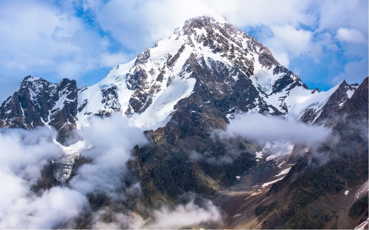
The Kabardino-Balkarian Highland State Reserve is the only highland reserve in Europe. It hosts the main peaks of the Northern Caucasus, the average height of which is 3910m. All five-thousanders of the Northern Caucasus except Elbrus and Kazbek are located here. The highest point of the Reserve is Dychtau Mountain (5,204 m), then comes Koshtantau (5,152 m), Pushkin Peak (5,068m), Shkhara (5,193 m), Dzhanghitau (5,085), Mizhirgi (5,047 m). The lowest point is located at 1800 m above sea level, so the reserve is mountainous.
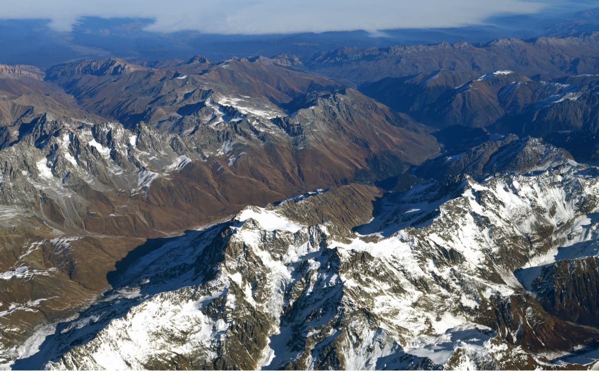
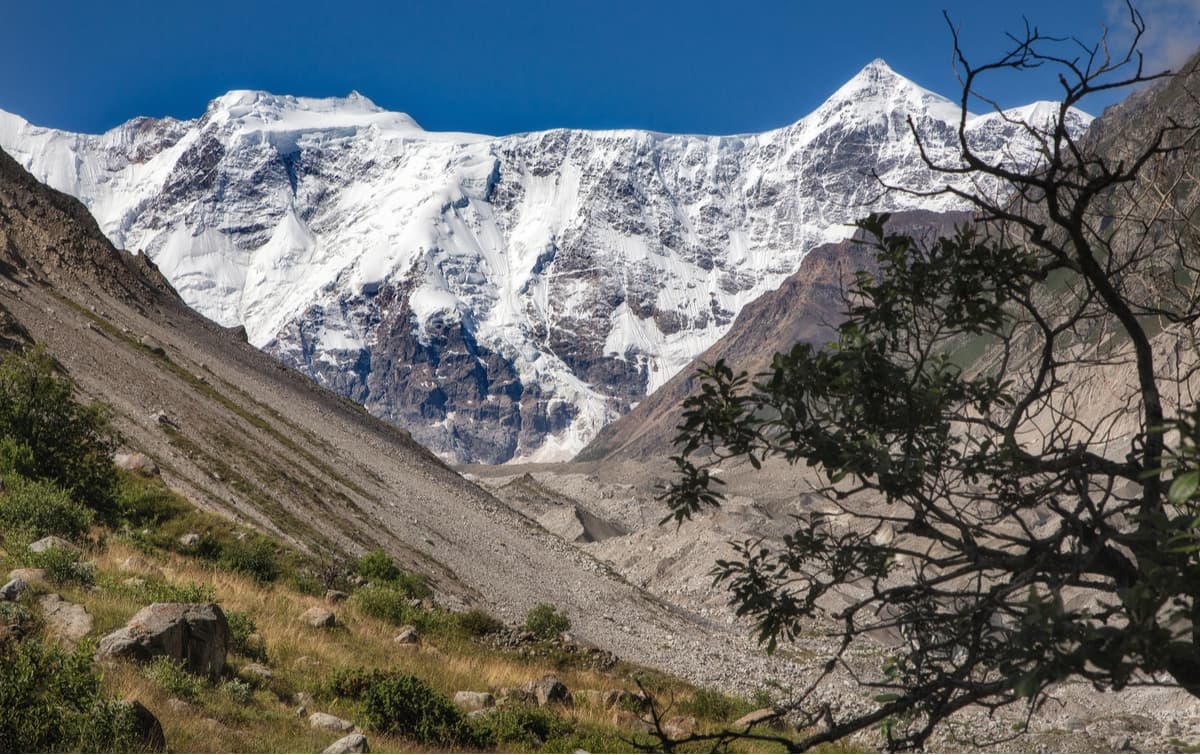
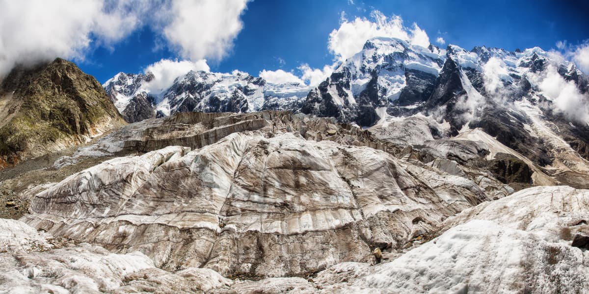
Half of all glaciers in the Caucasus are concentrated here, all of them are the largest in the region. Their total area is 152 sq.km. The biggest glaciers of the Caucasus and Europe are Bezengi, Dychtau, Tsanner, Shaurtu, Kysh-Kara. The middle cross-section of these glaciers can be up to 300-350 m thick. The Bezengi glacier is the largest in the Caucasus and Europe, its length is 17.6 km, the area is 36.2 sq.km. It is dubbed the Ice King of the Caucasus.
The Reserve is located on the territory of the Republic of Kabardino-Balkaria, along the Greater Caucasus Range and the Lateral Ridge in the upper reaches of the rivers Chereka Balkarskogo, Chereka Bizenghiyskogo and Cheghem.
The green world of the Reserve is very diverse due to differences in altitude, the complexity of relief and geographical isolation.
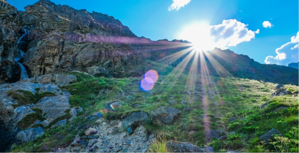
From 3600 m and above, there is no terrestrial vegetation. The belt below resembles a rocky tundra where there is no solid vegetation cover. In the Alpine belt (approx. 2100-3000m), there are alpine low grass meadows with alpine meadow rues, anemones, double buttercups, dandelions, primroses, etc.
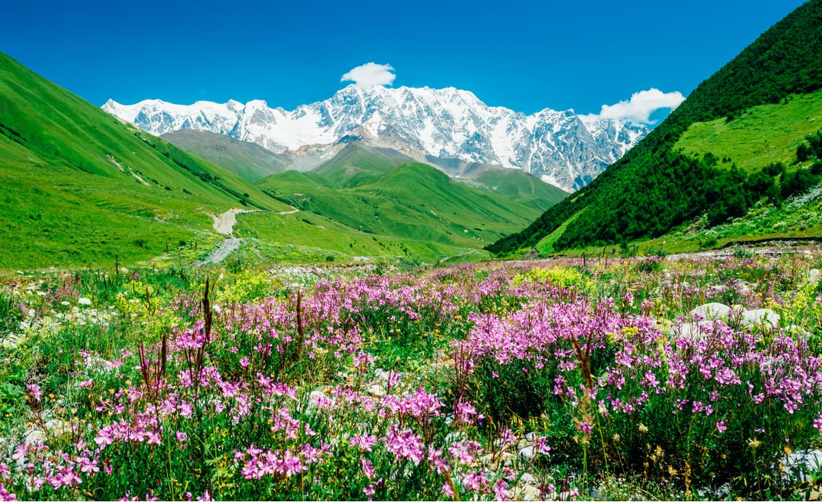
Farther down the slopes you will see subalpine high grass meadows with elfin or better say crooked birches, hazelnut clumps, sticky alder, Caucasian rhododendron and its companions – blueberries, cowberries, wild germander (in Russian this type of flower is called Veronica or angel’s eyes) etc. Then comes the belt of forests and forest glades. Here you will wander in broad-leaved (and middle-leaved) woods and coniferous forests which rise to 2400m. Some rock pines can even sometimes be found at the altitude of up to 3000m.
There are many valuable plants, endemic, rare species including congeners of cultivated plants such as Bieberstein’s currant, mountain raspberry, rosehip, hawthorn, meadow strawberries, Caucasian mountain ash and others. In total, over 1000 species of vascular plants are known to grow on the territory of the Reserve, among them are 74 Caucasian endemics and 27 relict plants.
There have been detected 32 mammal species, 5 amphibian, 6 reptile, and 127 bird species, 91 or those bird species permanently inhabit the Reserve. The animal population is typical for the Greater Caucasus: Caucasian turs, snow cocks, grouse, great rosefinch, wall creepers and others. A considerable number of animals and birds listed in the Red Book of Russia are Caucasian grouse, golden eagle, bearded vulture, imperial eagle, black vulture, griffon vulture and others.
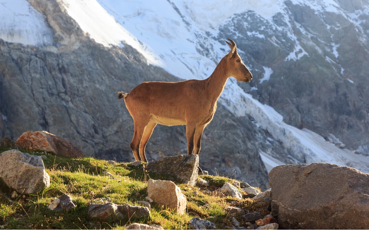
The Caucasian tur is a typical resident of the highlands. The gorges of Cheghem and Bezengi are the meeting point of two subspecies – the Western Caucasian and the Dagestani species of turs. Tur is not the only owner of these lavish lands. You can frequently spot a boar and a brown bear. The latter is virtually everywhere, its number is quite high, and there are cases of it attacking domestic animals. Lynx feels quite comfortable in the reserve as well, so does the wolf. The permanent inhabitants of the reserve are the common fox, jackal, European wild cat, stone and forest marten, ermine and weasel, Altai squirrel, brown hare, several species of mouse-like rodents, common dormouse, shrew, bat etc. There is evidence of Caucasian leopard encounters.
The most characteristic species of birds are the Caucasian snowcock and Caucasian grouse. Gallinaceous birds (basically those that belong to ‘chicken’ type) include several types of partridges and quail. Less numerous though are large birds of prey – bearded vulture, imperial eagle, black vulture, and griffon vulture others.
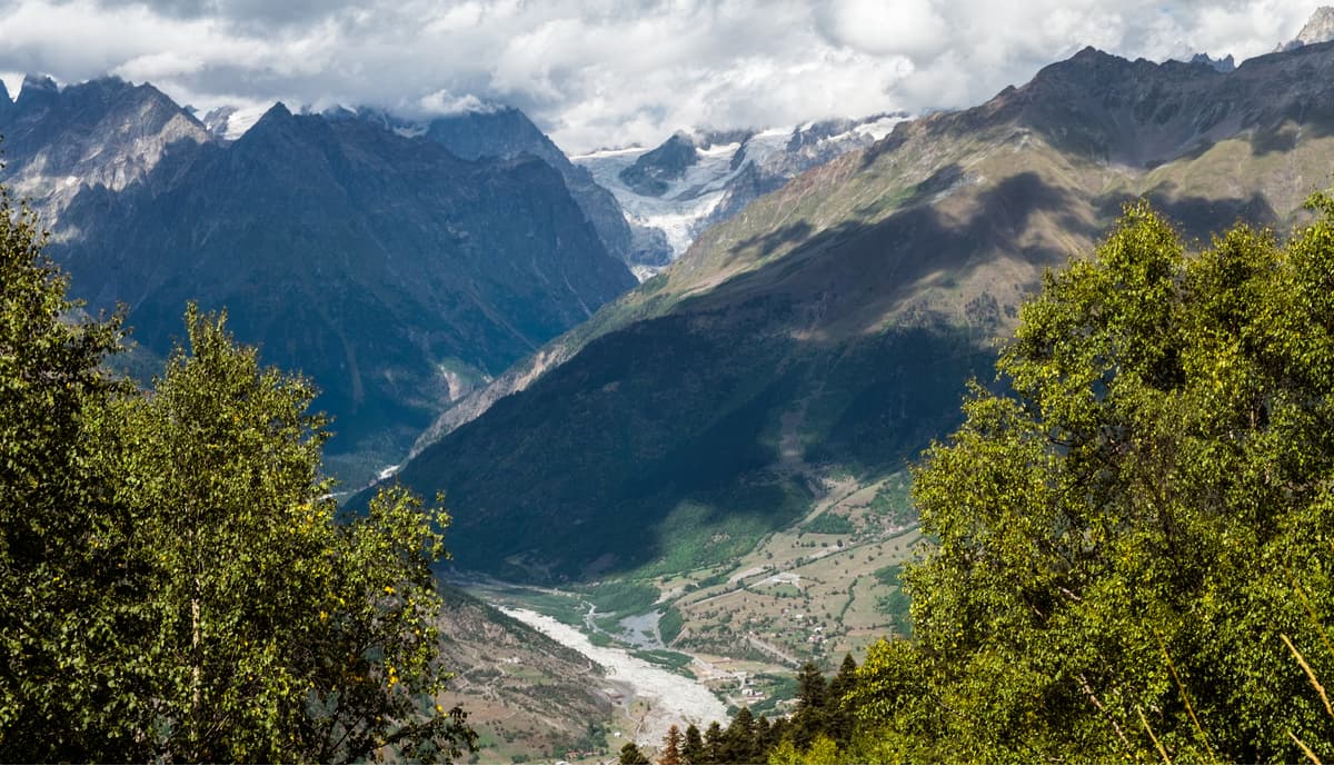
The territory of the reserve is covered by a network of rivers originating from numerous glaciers. The largest are the Cheghem, Cherek-Bezengiysky, Cherek-Balkarsky, Sukan-Su and Hasnidon. The glacial origin makes river flow uneven, the water is very high from June to September and can subside to a weak rivulet from January to March.
There are several known mineral springs in the Reserve:
The temperature on the territory of the Kabardino-Balkarian Reserve, as well as on the entire northern slope of the Greater Caucasus, is determined by the peculiarities of the atmospheric circulation and a wide range of altitudes. The average annual air temperatures in the high altitude zone are low. Thus, the altitudes of about 2000 m usually enjoy positive (+2.9°) figures, whereas the altitudes of 2500m and higher rarely exhibit the same trend. The air temperatures there are negative. The high altitude zone in the cold period is characterized by steadily negative temperatures, there is no even temporary warming in the daytime part of the day.
Dychtau, or Dych-Tau / Dykhtau, also dabbed as a Steep mountain or Teethed mountain, is 5,204m a.s.l. It is the second-highest, after Elbrus, peak of Russia and of Europe respectively.
Dychtau is basically the pyramidal array of crystalline rocks with pronounced 2 peaks of the Main (5,204.7 m) and Eastern (5,180 m). The mountaineers also separately distinguish a 50-meter gendarme – Pushkin Peak located in the Dychtau massif.
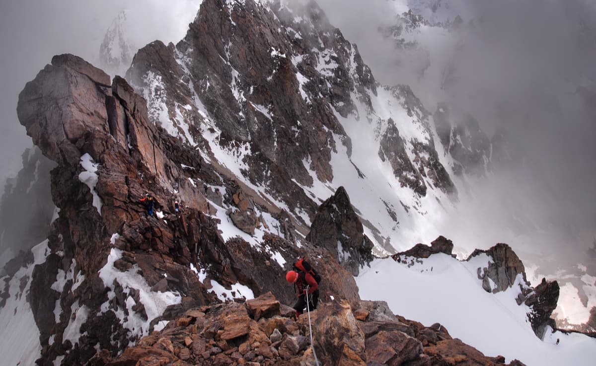
There are more than 10 mountaineering routes on Dychtau. The minimal complexity of these routes is 4A according to the Russian classification, which makes this mountain accessible for a few, really strong climbers. Dyсhtau has a rather vicious character, there are frequent rockfalls, complemented by no less frequent avalanches, so climbing it requires a carefully balanced tactical approach. The mountain is covered with centuries-old snow and hanging glaciers. When the sky is covered with clouds, the top of the massif can hardly be seen. Temperatures in the mountains are quite comfortable both in winter and summer, yet winter temperatures might drop extremely low.
Climbers usually prefer the winter months as the snow is much denser and therefore the probability of snow melting decreases. Specialists, on the contrary, recommend the end of summer or beginning of autumn for hiking.
The most popular and safest way of climbing to the top of the Dychtau Mountain is via on the North Ridge, the climb is ranked 4B according to the Mountaineering Federation of Russia classification. This is the route undertaken in 1888 by a team of Austrian climbers led by J.G. Cockin, the most famous climber of the time, who gave his name to the classical routes to other legendary mountains of the Caucasus, Ushba and Shkhara. Dychtau still attracts tourists and mountaineers because of its nasty character, haughtiness and wilderness.
Koshtantau, aka Koshtan or ‘a mountain similar to a remote dwelling’ (5,152 m) closes the top league of the three high-altitude summits in Russia. Its peak resembles a tent from afar. It is one of the most inaccessible peaks in the Caucasus. Koshtantau is located on the border of the Bezengi and Balkaria regions. The first attempt to conquer the peak in 1888 ended in tragedy – two British climbers and their Swiss guides died.
Since then, there have been laid several routes to the summit of Koshtantau, all of them are of increased difficulty ranging from 4B to 6A. What’s more, it is extremely rare to have good weather on this mountain. The impregnable beauty is shrouded in ice and clouds, seldom do the conquerors make their ascent in clear weather.
Pushkin Peak (5,068 m) is the fourth five-thousander of Russia. The name was changed in honour of the 100th anniversary of Alexander Pushkin’s death. It is part of the Dychtau mountain massif. The peak is quite famous among mountaineers who jokingly call it a gendarme.
For a long time, the peak remained unconquered. The peak succumbed to human endeavours in 1937 (a hundred years before Pushkin was killed in a duel). The team lead was a famous climber Victor Zimin. It took another 70 years for the second successful ascent (in 2007). The complexity category of the route to the summit is classified as 4B. "This is a summit worth visiting at least once in a lifetime", say climbers admiring the panorama of Tuzuak glacier opening from the peak.
Dzhangitau aka ‘a new mountain’ (5,058 m) is the central part of a unique 13-kilometer mountain massif known as the Bezengi Wall.
It is a popular place for mountaineering despite it belonging to the most difficult and dangerous peaks for climbing in Russia. To the top there lead routes of 4B-5A category of complexity. This mountain is also in the middle of a traverse of the Bezengi Wall (5B), a winter route to Dzhangitau is classified as 6A.
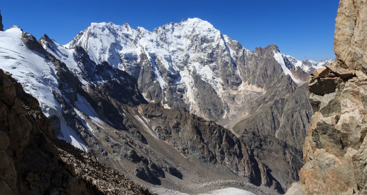
Shkhara (5,193 m) is another five-thousander shared by two regions. The southern part is located in the Georgian Svaneti, whereas the northern is in Kabardino-Balkaria. In translation from Georgian, the name means "nine". Indeed, the mountain has nine distinct high points. The first ascent to the top was made in 1888 from Svaneti via the North East Ridge route by the British/Swiss team of U. Almer, J.G. Cockin and C. Roth. This route is still one of the easier and more popular routes on the mountain. Soviet mountaineers first climbed Shkhara only in 1933.
The easiest and most popular route to the summit from the northern (Russian) side is classified as 5A. This climb is designed only for trained climbers who have experience of such ascents.
Shkhara has three large glaciers sparkling in the sun and is notable for its spectacular views that attract the attention of thousands of adrenalin-thirsty climbers.
Visits to the territories of the Reserve are strictly regulated. It is necessary to obtain a permit in advance at the Directorate of the Reserve in the village of Kashkatau.
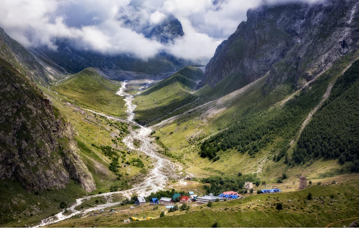
There are three official walking routes on the territory: To Bezengi glacier, Mizhirgi and Narzan spring.
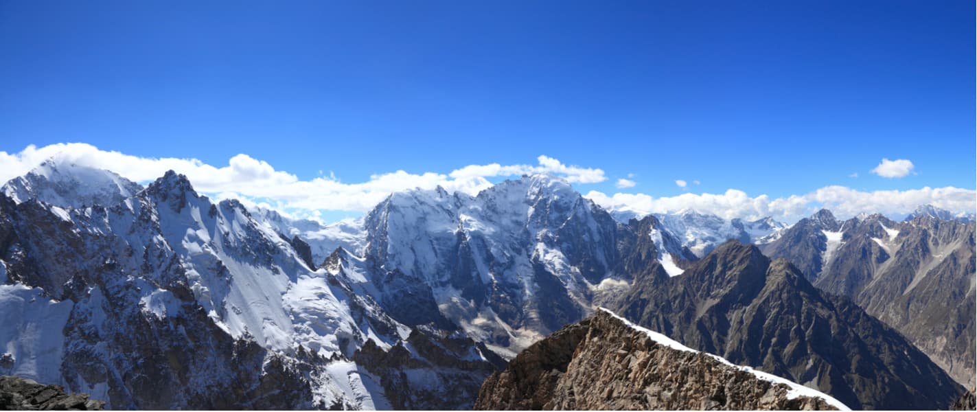
The Bezengi Wall is the highest section of the Greater Caucasus Range. It is 17 km long and forms a vertical wall more than 2000 m high above the Bezengi glacier. In the Bezengi area, there are five five-thousanders out of seven (except Elbrus and Kazbek): Shkhara Main (5,193 m), Shkhara West (5,069 m), Dzhangitau East (5,038 m), Dzhangitau Main (5,085 m), Dzhangitau West (5,058 m), Koshtantau (5,152 m), Mizhirgi West (5,025 m), Pushkin Peak (5,068 m), Dychtau East (5,180 m), Dychtau Main (5,204 m).
In translation from the Balkar language, Bezengi means ‘the place from which the glacier came down’. It is an amazingly beautiful and grandiose region of the Caucasus with majestic snow-white peaks ripping the skyline and grand blue glaciers covering the slopes.
Russian climbers call this region the Little Himalayas for its severity and eternal glaciers stretching over vast mountain valleys. All you see is rocks, ice, snow, cracks, avalanches, rockfalls, frost, and the scorching sun. This is where most ice and snow routes in the Caucasus are laid.
The first climbing in the area of the Bezengi Wall was made in 1888 by four British climbers, they summited Gestola. More avid exploration started at the end of the 19th century, and the climbers were mostly foreign. They climbed one peak after another reaping their virginity and making all the first ascents during this period.
Dych-Suu Gorge is picturesque but quite inaccessible. It has absolutely untouched nature and a unique landscape in the upper reaches of which is one of the largest glaciers Dych Kotyu-Bugoisu also known as Dychsu.
Bashil Gorge is another protected area of the reserve with a unique pine forest.
Mizhirgi route passes along the mountain trail. You can see a lake where turs gather and much of the highland nature along the way. The trail stretches to the foot of the Mizhirgi glacier.
Narzan Spring route starts from the checkpoint of Chegemsky cordon and goes via a forest road along a mountain-and-forest belt, then on mountain meadows, the end point is the Narzan spring. The route has plenty of natural gems and at the end you can drink some highly salubrious mineral water from the Narzan spring.
Bezengi Glacier route starts from a research station, goes along a mountain trail leading to the Ullu-Chiran (aka Bezengi) glacier, which is considered one of the largest glaciers in the Caucasus. The route is 18 km long and ends up in the place where one of the largest mountain rivers in the northern part of the Central Caucasus – Cherek Bezengiysky – breaks out of the Bezengi glacier grotto. The information boards describing the natural and biological features of the area have been installed along the trail, there are two equipped stops and an observation tower on the route as well.
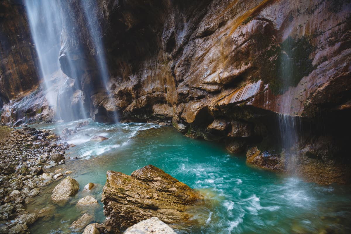
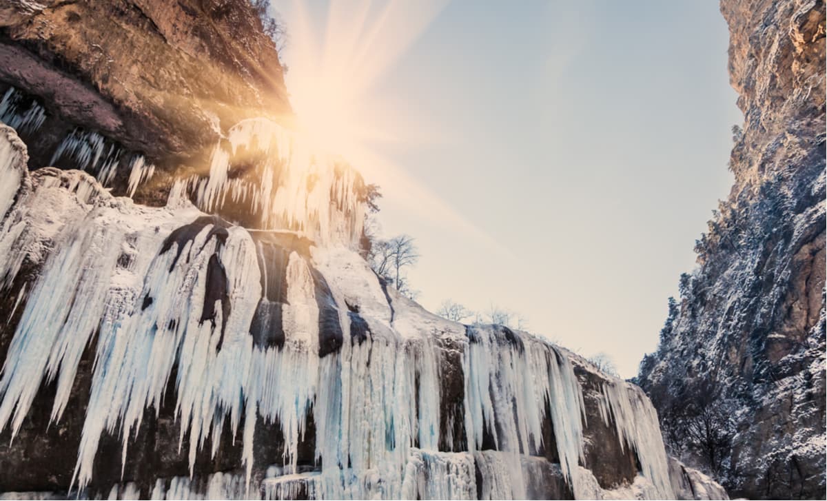
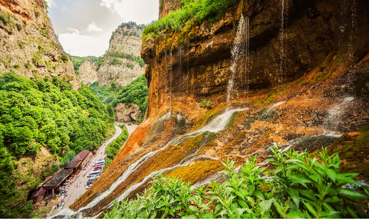
Should you wish to see some waterfalls, take the part of the trail towards the Bezengi Glacier that goes from the beginning of the trail in a northwest direction up the slope along the left and right banks of the Sueme-Suu brook. The length of the trail is 380m, the height difference is 110m. The trail ends at the Sueme Chuchkhur Waterfall which is over 30m high. Next to the waterfall, you will see rhododendron and lingonberry thickets growing on the slope. The Sueme-Suu brook made itself a deep channel in the mountain. Its banks are formed from the remnants of old mudflows and moraine deposits. The upper part of the trail at the waterfall overlooks the terrace of the moraine left by the retreating Bezengi glacier. You can enjoy a magnificent view of the Bezengi and Mizhirgi glaciers, as well as the Bezengi Gorge from there. You can also see the famous five-thousanders of the Caucasus, take in the diverse landscape, and enjoy the endemic flora and fauna of the highlands.
Take a plane or train to Nalchik, the capital of Kabardino-Balkaria.
The Administration of the Reserve is located in the village of Kashkatau, Cherek district, 78 Kezima Mechiyev Street. Here you can obtain the permit to the territory of the Kabardino-Balkarian Highland State Reserve.
Telephone: +7 (866) 364 1718 or +7 (866) 364 1907
Факс: +7 (866) 272-0601
Email: kb_zapovednik@rambler.ru
www.zapovednik-kbr.ru
Nalchik is the capital of Kabardino-Balkaria. It is a resort town and a perfect hub on the way to such mountain attractions as Elbrus, Kabardino-Balkarian Highland Reserve.
Nalchik is famous for its numerous spas, balneological resorts, mud baths and mineral springs located near the mountains.


top10
ultra
europe-4500ers
caucasus-4500ers
russia-ultras
top10
glacier
europe-4500ers
caucasus-4500ers
top10
glacier
europe-4500ers
caucasus-4500ers
top10
glacier
europe-4500ers
caucasus-4500ers
top10
ultra
europe-4500ers
caucasus-4500ers
russia-ultras
top10
glacier
europe-4500ers
caucasus-4500ers
top50
glacier
europe-4500ers
caucasus-4500ers
top10
glacier
europe-4500ers
caucasus-4500ers


