
Scan the QR code and open PeakVisor on your phone
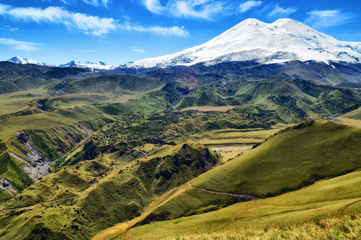
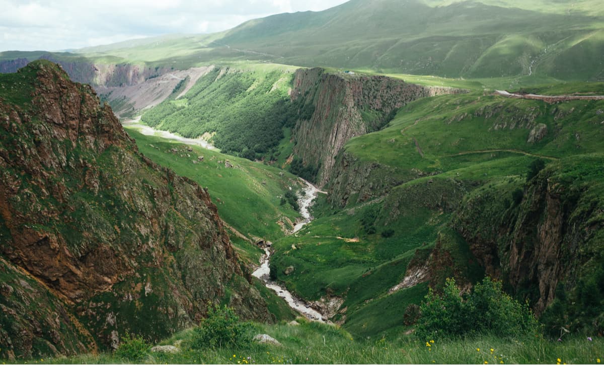
The territory of the national park is located in the Central Caucasus, in the middle and high mountain zone (1,400-5,642m above sea level). It covers over 101 thousand hectares and features the highest peak in Europe - the two-headed Elbrus. It also includes a part of the Greater Caucasus and the Lateral (Bokovoy) Eastern Caucuses and the Baksan Valley, snuggly tucked at the foot of Elbrus.
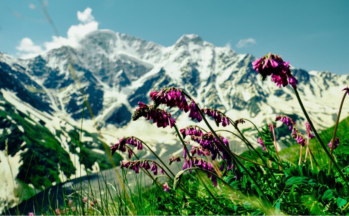
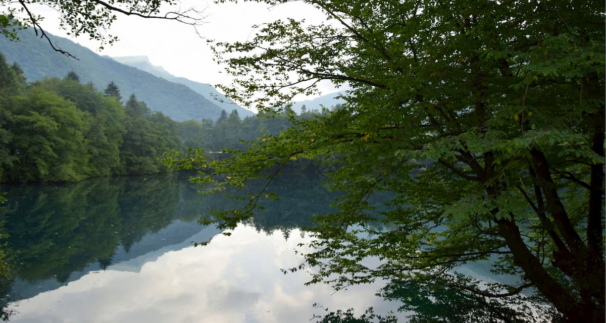
In addition to the majestic mountains, the park has picturesque gorges, powerful waterfalls, alpine lakes and mineral springs used to treat various maladies. The park is predominantly occupied by forests consisting mainly of coniferous trees and birches. Various plants grow on the territory, some of them are rare and listed in the Red Book of Russia. As to the mammals inhabiting the park, eight species are listed in the Red Book of Russia, including a leopard, a Caucasian forest cat, a lesser-mouse-eared bat and a giant noctule (this is Europe’s largest carnivorous bat that weighs approximately 80 grams, but the wingspan is almost 0.5 metres).
Glaciers and snow cover about 15% of the territory and ensure there are magnificent sights to behold. There is a high-altitude glacier, medium-altitude mountain relief, lava streams, lakes and troughs, over 100 mineral water springs and many picturesque lakes. One of the most interesting is Syltran-Kel, located in the upper part of the Syltran River. The rivers of the Elbrus region are famous for their waterfalls. These are The Maiden’s Braids, a waterfall listed in the book 100 Most Beautiful Waterfalls in the World, the Sultan and others.
There are 23 recreational facilities on the territory of the national park, they extend hospitality and catering to about 5 thousand people in the high seasons. Among the activities that the park can offer are climbing mountain peaks, hiking, horse riding, equestrian and combined routes, ski resorts, and spas. The main ski pistes and ski lifts of Kabardino-Balkaria are located on the slopes of Elbrus and Mount Cheget (3,700 m).
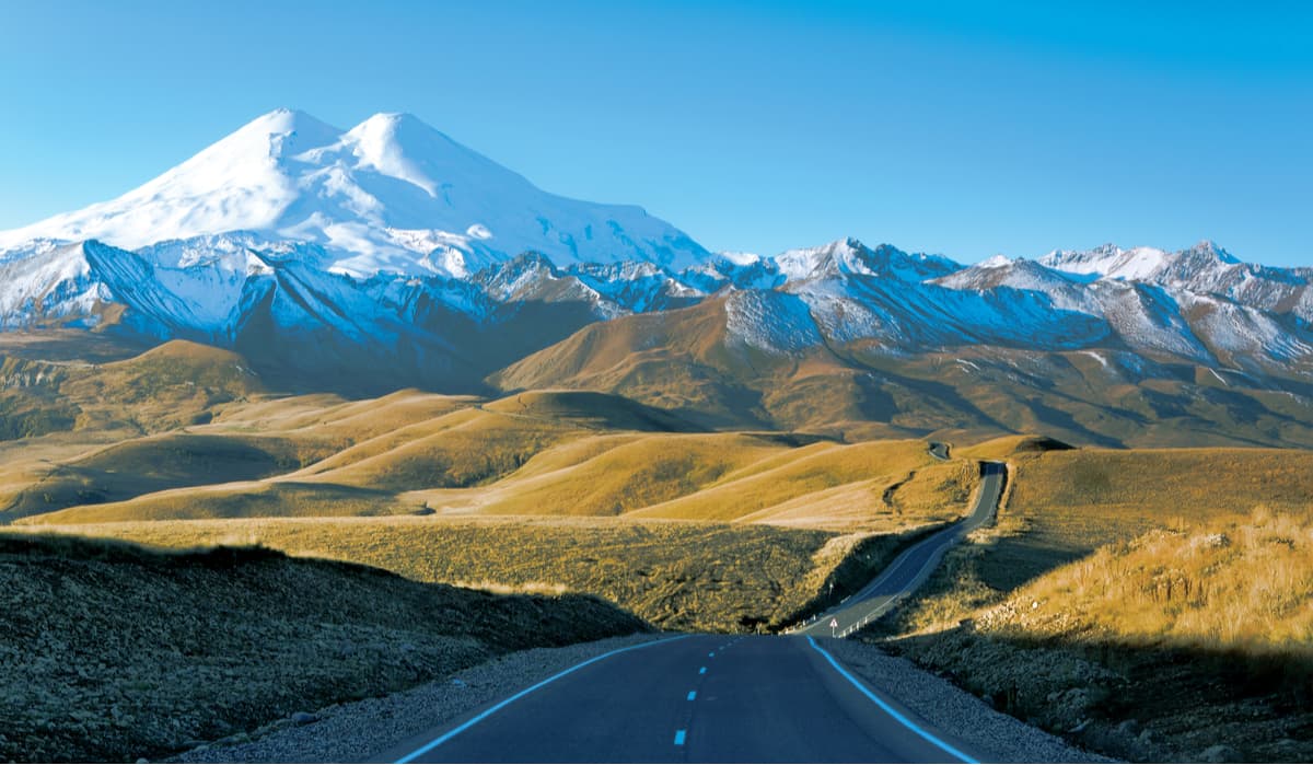
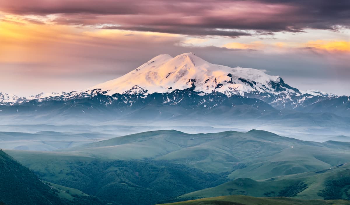
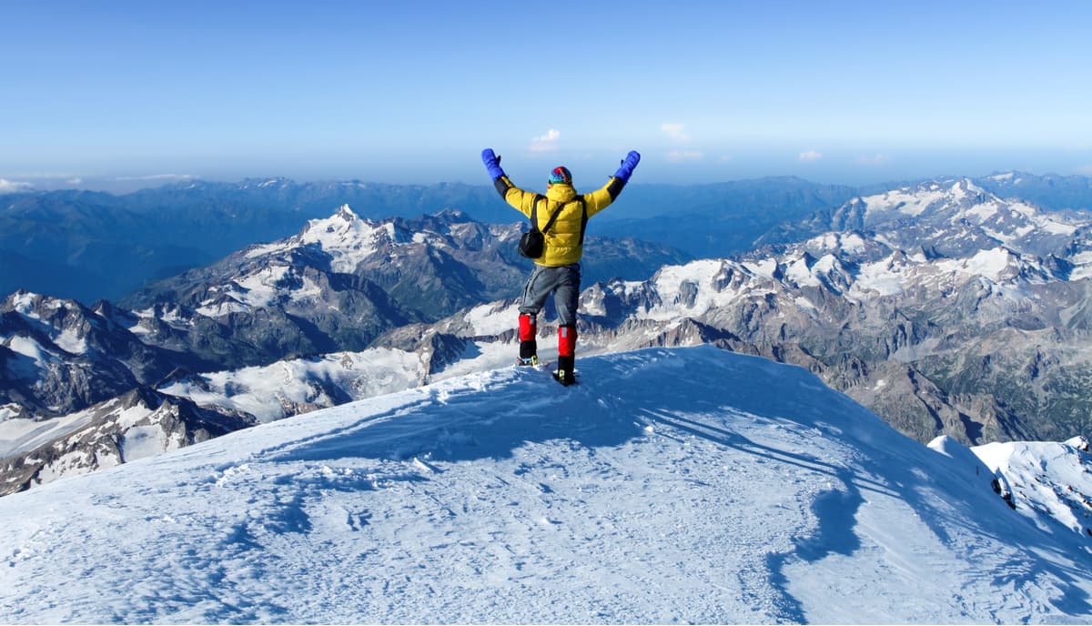
Elbrus is the highest mountain peak in Russia and Europe, it also features on the famous Seven Summits Challenge and in the list of The Seven Wonders of Russia (we have already written on Manpupuner and the Valley of Geysers). Elbrus is located in the North Caucasus, on the border between Kabardino-Balkaria and Karachay-Cherkessia. It is a mountain massif of volcanic origin with a base diameter of 15 km and pronounced Eastern (5,621 m) and Western peaks (5,642 m), separated by a long gently sloping saddle (Sedlovina Elbrus Pass, 5,416 m). Elbrus is one of the most gently sloped volcanoes in the mountains. Its slopes are covered with a thick layer of ice, which evens out the steepness and unevenness of the volcanic pyramid.
Once you conquer the top of Elbrus, you can see both the Black and the Caspian Seas. The closest major cities are Mineralnye Vody, Nalchik, and Pyatigorsk.
Since ancient times, Elbrus has been known to many peoples far beyond the Caucasus, which generated various names of the mountain. With every nation calling the mountain in its own way, the exact etymology of its name origin is unknown. One common version is the Persian origin of the name from Elburz, i.e. "high mountain". Among the names of indigenous people of the Caucasus, the most common are the Karachai-Balkar name Mingi-Tau and the Kabardin name Oshkhamakho. Mingi-Tau literally means "Eternal Mountain". The Kabardin name of Oshkhamakho is translated as "mountain of happiness" from the Persian word "elboros", meaning "shining" or "glittering".
The slopes of Elbrus are one big ice field. Permanent snow cover starts from an altitude of about 3,800 meters. There are 23 glaciers spreading off the firn cover of both Elbrus summits. The area of permafrost and snow is 135 square kilometres. In some places, the ice layer reaches 400 meters. Over the past 100 years, the total area of glaciers has decreased by 18%, and those flowing into the Kuban Valley by 33%.
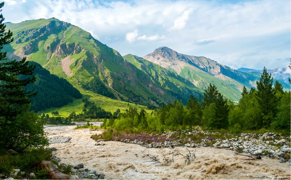
Meltwater from glaciers feeds some of the largest rivers in the North Caucasus: the Kuban, Malka, and Baksan. In the depths of Elbrus, there are great reserves of famous therapeutic sulphur waters that are extensively used in spas of the North Caucasian resort towns of Kislovodsk, Pyatigorsk, Essentuki and Zheleznovodsk.
The mountain is conditionally divided into two parts - a pedestal and a bulk cone. The pedestal consists of rocks, while the cone is made up of eruption materials. The height of the pedestal is 3.7 kilometres. The rest is about 2,000 metres of volcanic "growth". The eruptions of Elbrus resembled those of today's Vesuvius but were more powerful.
Gases and ashes are assumed to have been spat first miles upwards from the crater. Then underground explosions caused earthquakes and the air saturated with ashes and gases generated numerous bolts of lightning. Volcanic bombs were flying out of the crater, mudflows made of ashes, stones, boulders, and plants came down the slopes. Finally came the eruption of lava. Lava quickly cooled down and being mixed with the ash streams, increased the height of the volcano.
The power of the eruptions is evidenced by the ashes found in the town of Nalchik and on the slopes of Mount Mashuk. They are both about 90 kilometres away from Elbrus.
The eruptions ceased about 2000-25000 years ago. They were fickle, followed by periods of silence. During the quiet periods, there formed the glaciers and rivers which eroded the volcano cone to its base. As a result, volcanic rocks were covered by river sediments and moraines. The cycle of eruptions and erosions was repeated about ten times. According to some extensive research in the 2000s carried out by scientists from the Institute of Earth Physics of the Russian Academy of Sciences, the Geological Institute, the Geophysical Service of the Russian Academy of Sciences and others, we can conclude that the volcanic activity of Elbrus is currently on the rise.
Sulphur dioxide gases still come out of the cracks on the slopes. There have been found mazes at an altitude of 5,400 metres under four-metre cover of snow. They were formed due to evaporations of steam. Thanks to the air heated to 18 degrees Celsius, the rocky bottom has become covered with green mosses. This confirms that Elbrus is still not extinct, but it is clear that it is dormant.
Elbrus is characterized by cyclical periods of nasty and awesomely good weather. In summer, it is 5-7 days, and in the first half of summer, the weather is usually worse than in the second. Summers are humid and cool, the maximum temperature at an altitude of 2000 meters can reach +35 ° C, and at an altitude of 3000 m - +25 ° C.
The coldest month here is February. Autumn begins in late August or early September. Winter at 3000 meters a.s.l. and higher starts in October. The average thickness of the snow cover reaches 50-80 cm, increasing with the altitude. There is less snow on the southern slopes than on the northern ones. At 3000m, the average temperature in January is -12°C and the marked absolute minimum is -27°C. Spring on Elbrus begins in the first decade of May.
Precipitation comes mainly as snow and is two to three times higher than on the neighbouring plains. The warm humid air of the Atlantic Ocean reaches Elbrus and, once it hits the Caucasian Mountain range, it cools down to produce heavy snowfalls or even hailstorms.
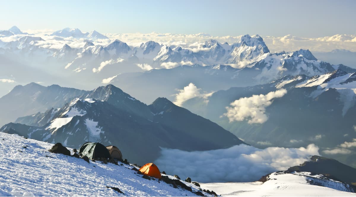
The snow at the 3000m point melts by the end of May and forms wet avalanches. At high altitudes, there can be permanent snowflakes and firn fields that feed the glaciers thus increasing their mass. At altitudes above 5000m, snow does not melt despite warm air temperatures and other weather conditions. The best month to climb Elbrus is August. During this time the snow melts, revealing cracks in the ice, which makes climbing easier. At other times, those precipitous traps remain invisible.
Currently, Elbrus and the nearby Pre-Elbrus area is one of the most popular centres for mountaineering, tourism, and skiing. The infrastructure is mainly located on the southern slopes of Elbrus. The third span of the modern gondola cable car will lift you to a height of 3,847 meters above sea level.
But back in the day, there were no technical gimmicks to help you climb the highest mountain of the range. The first documented conqueror of Elbrus (the Eastern Peak) was Kabardinian mountaineer called K. Khashirov who accompanied the Russian expedition organized by the Russian Academy of Sciences at the suggestion and under the general guidance of General G.A. Emmanuel in 1829. The other members of the expedition were able to climb only to the mark of 5,300 meters.
The western peak of Elbrus was conquered only in 1879 by the members of an English expedition led by climbers F. Grove and accompanied by a Kabardinian A. Sottaev. The latter became one of the most famous mountaineers of Elbrus. Being a hunter and mountain lover, he climbed Elbrus 9 times, and his last ascent was made at the age of 120.
In Soviet times, Elbrus became one of the most popular places for climbing. The so-called alpine mountaineering contests were held here several times. The most massive was the climb in 1967 - almost 2500 alpinists took part in it.
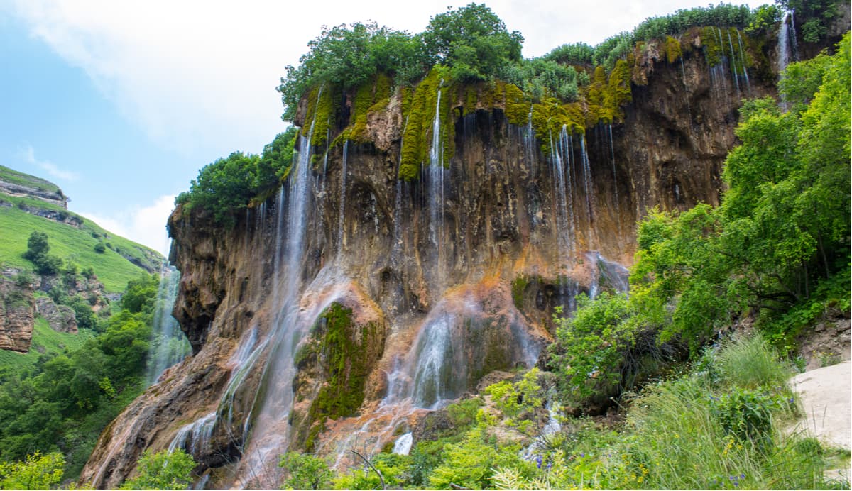
In the Chegem Gorge, a group of waterfalls of the same name forms three streams falling from the mountains. The Small Chegem and the Big Chegem Falls are several kilometres away from each other. It is most interesting to watch nature change during a walk down the Gorge. The gorge narrows gradually and the waterfalls become louder, almost deafening with the crescendo of falling water once you reach the final waterfall that falls from a height of 60 meters. The cascades of the Chegem Falls impress at any time of year. In summer, you can see the rainbow in the small droplets of water hanging in the air like a mist and sparkling in the sun. In winter, waterfalls freeze and turn the gorge into an icy kingdom.
The Narzan Valley features 20 mineral springs. You can get here and collect water for free. Located at an altitude of about 1000 m, in the zone of the Skalisty (Rock) Mountain Range, the picturesque valley has a warm climate and plenty of sunny days. In winter it is rarely lower - 2°C, and in summer the temperature does not exceed + 26°C.
Alongside with the mild climate, the healing waters of the valley mineral springs have a beneficial effect on the wellbeing of visitors. Mineral springs are acidulous and have sodium hydro-carbonate, chloride, sodium-calcium composition. The water is strongly gassed and its temperature is + 10.4 ° C. Due to its high iron content, the waters runoffs and the surrounding areas have an orange colour, closer to that of rust.
The Narzan Valley is surrounded by mountains covered with diverse vegetation: on the northern slopes, there grow pine, birch, maple, oak, the southern slopes are covered with lush grasses. Subalpine meadows of the mountain plateau rising above the valley delight the eye with bright colours of large flowers.
The heights that surround this area offer beautiful views of Elbrus. Not far from the Narzan Valley, there are beautiful waterfalls of mountain rivers the Malki, the Khasaut, and the Mushty.
Another natural wonder is the Blue Lakes located in the Cherek Gorge, in the valley of the Cherek-Balkarsky River. There are five lakes in total: the Lower and four Upper lakes - Western, Eastern, Secret, and Dry. In terms of genesis, the lakes belong to the karstic ones, i.e. they are depressions or sink-ins in the rock filled with water. At the same time, each of them has its own characteristic features and unique shape.
The most picturesque is the Lower Blue Lake Tzerik-Kel. Its area is a little more than 1.5 hectares, but in terms of depth (up to 368m) it is among the ten deepest lakes in Russia. The lake really has a mysterious colour changing depending on the weather - from sky blue to turquoise, and it also has constant water temperature (+ 9 °C). These amazing facts are explained by the fact that the karst water is fed by mineral springs whose waters are saturated with hydrogen sulphide. The water surface mesmerizes with its serenity, there are no ripples on the surface so that the lake seems frozen. There is a diving centre on the shore of the Tzerik-Kel.
The Upper Blue Lakes are interesting in their own way. The eastern and western lakes are 17-18 m deep and they are both rich in fish. You can fish white cupid (aka grass carp), carp, and trout. It is not easy to spot Secret Lake located in a deep hollow and surrounded by thick forests. The most difficult to access is Dry Lake (Kel-Ketchkhen), which is at the bottom of a huge deep canyon with steep walls that are 177 m high. The depth of the modern reservoir is only 5-7 m which depends on precipitation. It is known that years ago this rock depression was completely filled with water, but one day the "lake passed away" (this is how Kel- Ketchkhen translates from the Balkar language).
The Chyranbashi-Suu waterfall, which literally means the maiden’s braids in Karachai-Balkar language, is one of the most beautiful waterfalls in the Elbrus region.
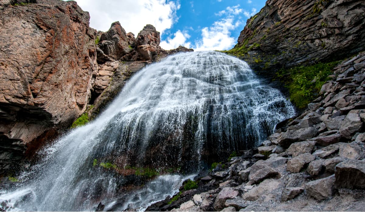
The waterfall located at an altitude of 2,800m is fed by a melting glacier Gara-Bashi. The water comes down the rocks smoothed and polished by the glacier to fall from a height of about 30 meters. The stream is beautifully scattered in its flight into long jets resembling the typical hair-do of a local girl. Such an unusual effect is due to the fact that the water flows here through particularly hard rocks - basalt, where it cannot erode even a small trench for itself. Another distinctive feature is the presence of a grotto behind the flowing stream. Here, at a high elevation, one can see a panorama of royal peaks which the Caucasus is famous for.
The International Astronomical Observatory, established in 1980, is located at the top of the peak, which is 3,100 m high. On the way to the Observatory, you can see the Maiden’s Braids. You can reach the natural attraction on foot from the village of Terskol. The road will take about two hours.
In terms of the number of glaciers and their size, the Main Caucasian Range is almost equal to the Alps. And the greatest number of significant glaciological objects is located in the Elbrus part of the ridge.
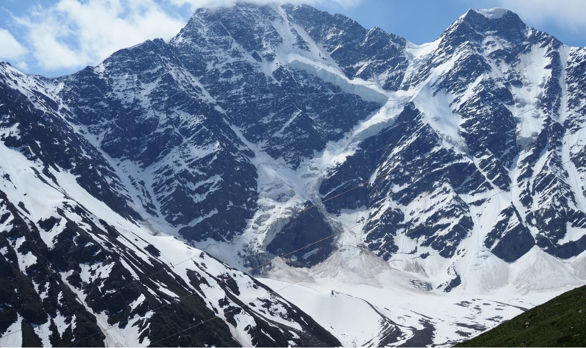
The glacier is part of the Elbrus National Park. The upper part of the glacier is located between the peaks of Mount Donguz-Orun (4,450m) and Nakra (4,450m). Donguz-Orun has three peaks, one of which is called the Eastern Peak. It is the most graceful (4,442 m) in all the photographs. If you are on Elbrus, the glacier will appear in front of you in all its glory! The glacier has a shape of the number seven. At the foot of the mountain flows the river Donguzorun, the first large right tributary of the Baksan River.
The depth of the cracks in the glacier exceeds 100m. In the crossbar area (in Russian number 7 has a crossbar, like that of a handwritten letter Z), small avalanches often go down in the summertime. Once you are close to the glacier, pay attention to the rumble and roar coming from frequent rockfalls and the glacier crackling. A closer look at the unique glaciological object is possible from the Intercosmos Peak (between the Intercosmos and Kotugay passes).
In the northern part of Mount Elbrus base, there is an interesting landmark called Dzhyly-Su, a unique and beautiful place in Kabardino-Balkaria.
To get to Dzhyly–Su, you can take a new asphalt road from Kislovodsk in the direction of Kichi-Balyk village. The road will take an hour and a half if you do not stop. The journey to Dzhyly-Su itself is fascinating in itself, the road is all about steep descends into the gorges and steep ascends to the high plateau. If you experience nausea on mountain roads, please take travel sickness pills.
Dzhyly-Su translates as "warm water" and is widely known for the therapeutic qualities of its mineral waters. More than fourteen springs are scattered along the track in the upper part of the Malka River at an altitude of 2,380 meters.
The waters here have a unique healing property as they are saturated with mineral and organic substances. The locals sometimes refer to this mineral water as "the drink of a hero". It used to be considered the main source of strength for the Nart tribes who lived here in ancient times. The uniqueness of Dzhyly-Su narzan springs lies in the water composition which features silica, iron, sodium, it can be low-mineralized or slightly acidic. When the carbon dioxide water moves to the upper ground levels, it forms many bubbles, which gives a boiling-water effect at the surface. The water temperature is quite high, i.e. plus 22-24 degrees Celsius.
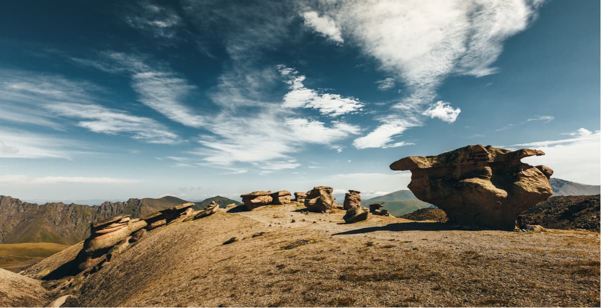
On the northern slope of Elbrus in Byrdzhal area, at an altitude of 3000 meters, on a relatively small, 250 by 100 meters, flat, slightly sloping site there are amazing rocks that you cannot see anywhere else in the Caucasus. The Mother Nature has sculpted more than two dozen sculptures nicknamed mushrooms. The material is slightly cemented flint tuff sandstone. The stone slabs topping the legs are of dense, layered rock and really resemble giant mushrooms.
Scientists are still arguing about their origins. Some believe that the rock has acquired this shape because of the strong winds blowing from Elbrus. Others argue that glaciers melting produced powerful streams flowing down from the mountain passes and grinding down the bases of the rock, resulting in a mushroom-shaped formation. Others tend to think of the man-made origin of the rocks and compare the plateau to the English Stonehenge.
Climbing Elbrus is not technically difficult. Alpine mountaineering classification is 1B when climbing Elbrus from the south and 2A for climbing from the north. Elbrus gentle slopes can be climbed by anyone with good physical preparation. The main difficulty is the altitude where thin air and reduced atmospheric pressure can cause mountain sickness. Therefore, the main key to a successful ascent to Elbrus is proper acclimatization. All routes need to be built with acclimatization time in mind when you have to go down for the night after a morning ascent. It is best to join organized groups with experienced guides who provide medical support, MES registration, communication facilities and GPS. Overall, a successful climbing of Elbrus will require stamina, good condition of the cardio-vascular system, proper lungs and muscles functioning needed for long-term work.
Most climbs take place in the summer period, from May to October, as it is the most favourable time with the most comfortable weather.
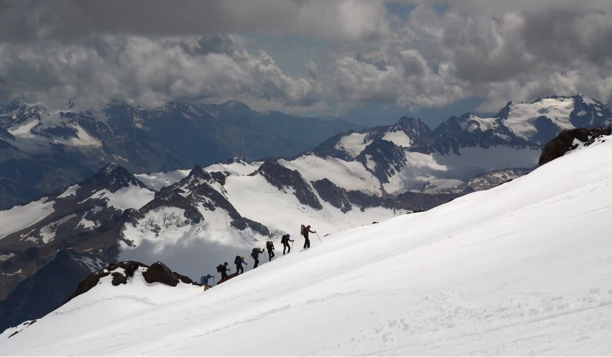
Every year, thousands of tourists from all over the world climb the western summit along this route, so you will meet many groups here. The standard ascent on the south side of the mountain starts at the foot of the Azau glade, from the height of 2,200 meters, there is a large tourist complex. Tourists usually use the cable car and then the chair lift to the station Gara Bashi (3,800m) where the shelter is located. This equipped shelter is the starting point for climbing, acclimatization and climbing to the western top of the mountain. The ascent, depending on the speed of the group, takes from 8 to 10 hours, the descent is 5-6 hours.
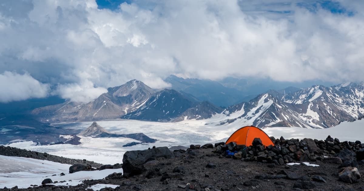
Climbing Elbrus from the north cannot be compared to the standard route from the south if we consider the beauty of the surrounding scenery. Here you can get unique impressions from the unforgettable nature of the Caucasus. The hot springs of Dzhyly-Su and amazing rock formations of Stone Mushrooms deserve special attention. The northern rise follows the traces of the first conquerors of the mountain (the first ascent was made in 1829). The climbing is not very difficult for people of average physical training. But, unlike the southern side, the tourist infrastructure is not that well- developed. You will have to deal without a cable car, but there are shelters. You have to cover the whole route - from the beginning to the end - by yourself, and because of such solitude climbing Elbrus from the north becomes more interesting and prestigious. It is also more difficult technically because the slope is cracked, and you will need equipment to pass.
The eastern rise is an extreme galore. The route is still in its original pristine condition, there is no intrusive service, no cable cars and no or almost no tourists. It runs along a lava flow, which has naturally been long frozen. You need experience in the mountains, the ability to carry a full backpack not only with personal but also with public equipment and to move in bundles on the glacier.
The route of the ascent to the Eastern peak of Elbrus begins in the village of Elbrus, through the Irik-Chat Valley with the trail leading to Irik Pass. Then there is a traverse of the Jainkau-Ginkez ice plateau that comes out to the lower part of the eastern crater (Horseshoe). From there, along gentle screes and snowy slopes, you can reach the Eastern peak of Mount Elbrus.
Nalchik International Airport is the closest airport to Elbrus, it is located 130 kilometres away. You can also hop on a brand train from Moscow to Nalchik (062Ch), the road takes 34 hours. Alternatively, you can get to Nalchik by coach. Terskol village is the closest to the slopes and the base camp for many expeditions and sightseeing groups. From Nalchik, you can get to the village by bus or taxi.
170 kilometres away from Elbrus there is another major transport hub - Mineralnye Vody, which also has a railway station and an airport. Despite the fact that the Minvody Airport is farther away, getting through it will be more convenient and comfortable as it was reconstructed for the Sochi games. There are more direct flights from Moscow as well. Many more trains pass through Mineralnye Vody railway station. There is a bus from Mineralnye Vody to Terskol once a day, the road takes about 3 hours.


top10
ultra
glacier
volcano
europe-4500ers
caucasus-4500ers
russia-ultras
top10
ultra
glacier
volcano
europe-4500ers
caucasus-4500ers
russia-ultras


