
Scan the QR code and open PeakVisor on your phone
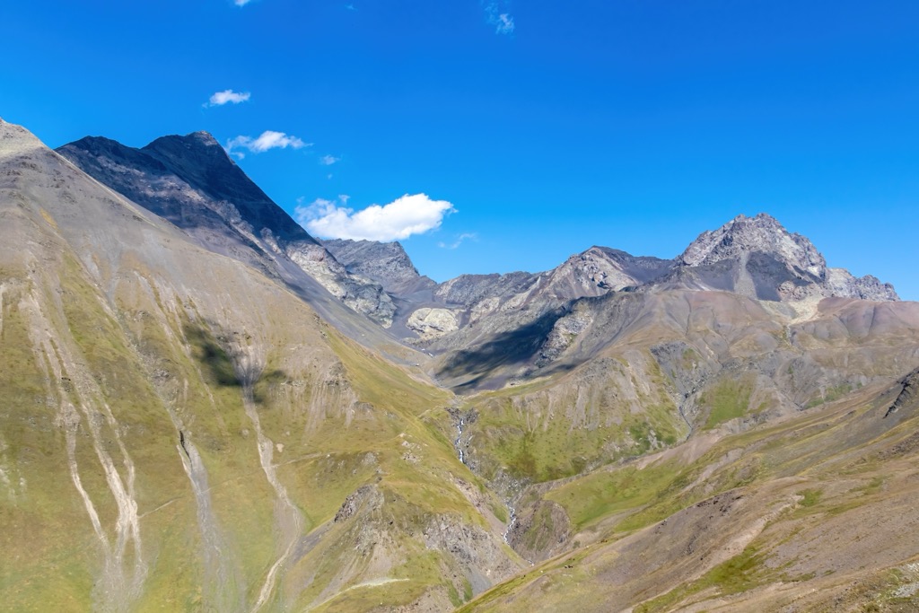
Kazbegi Municipality is home to 78 named mountains. The highest is Mount Mkinvartsveri (Kazbegi) at 5,054 m.
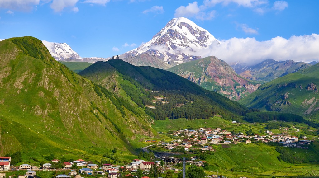
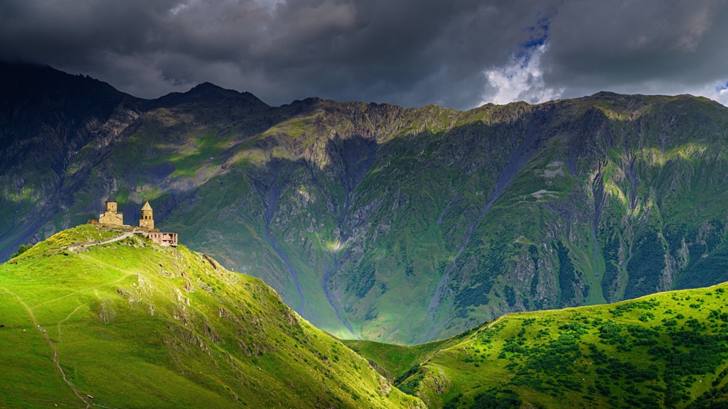
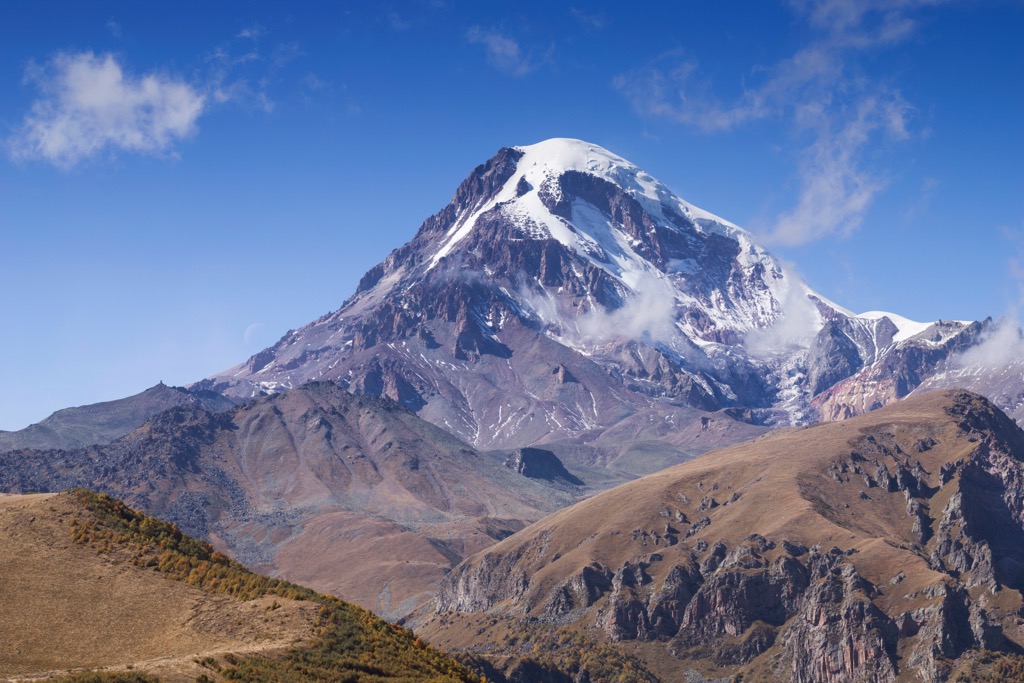
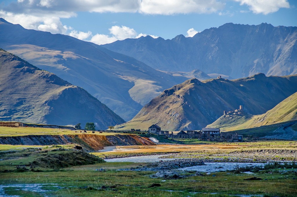
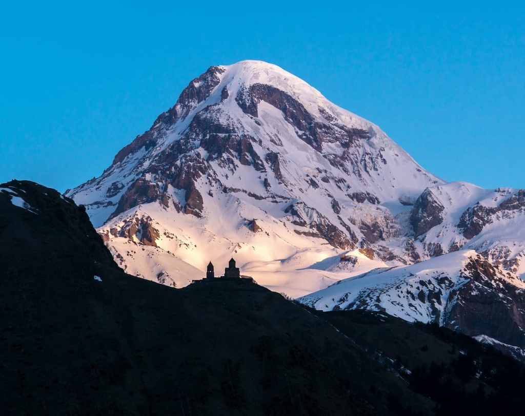
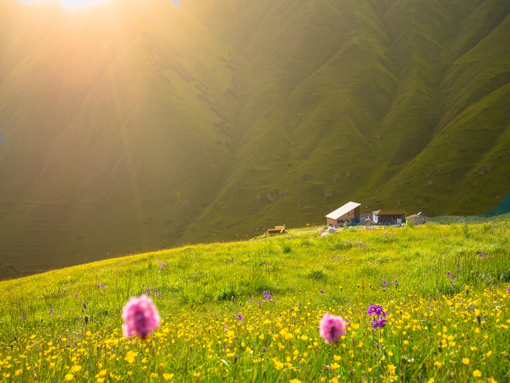
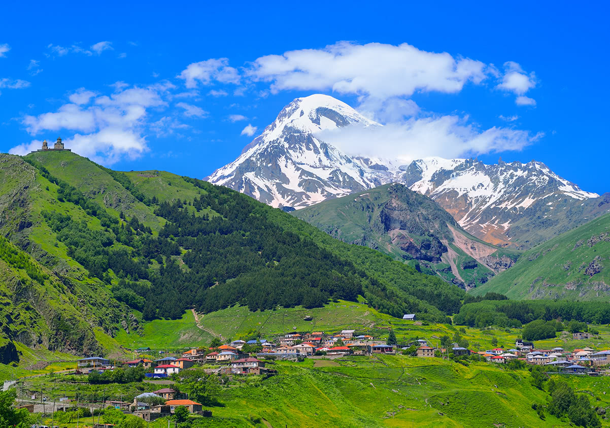
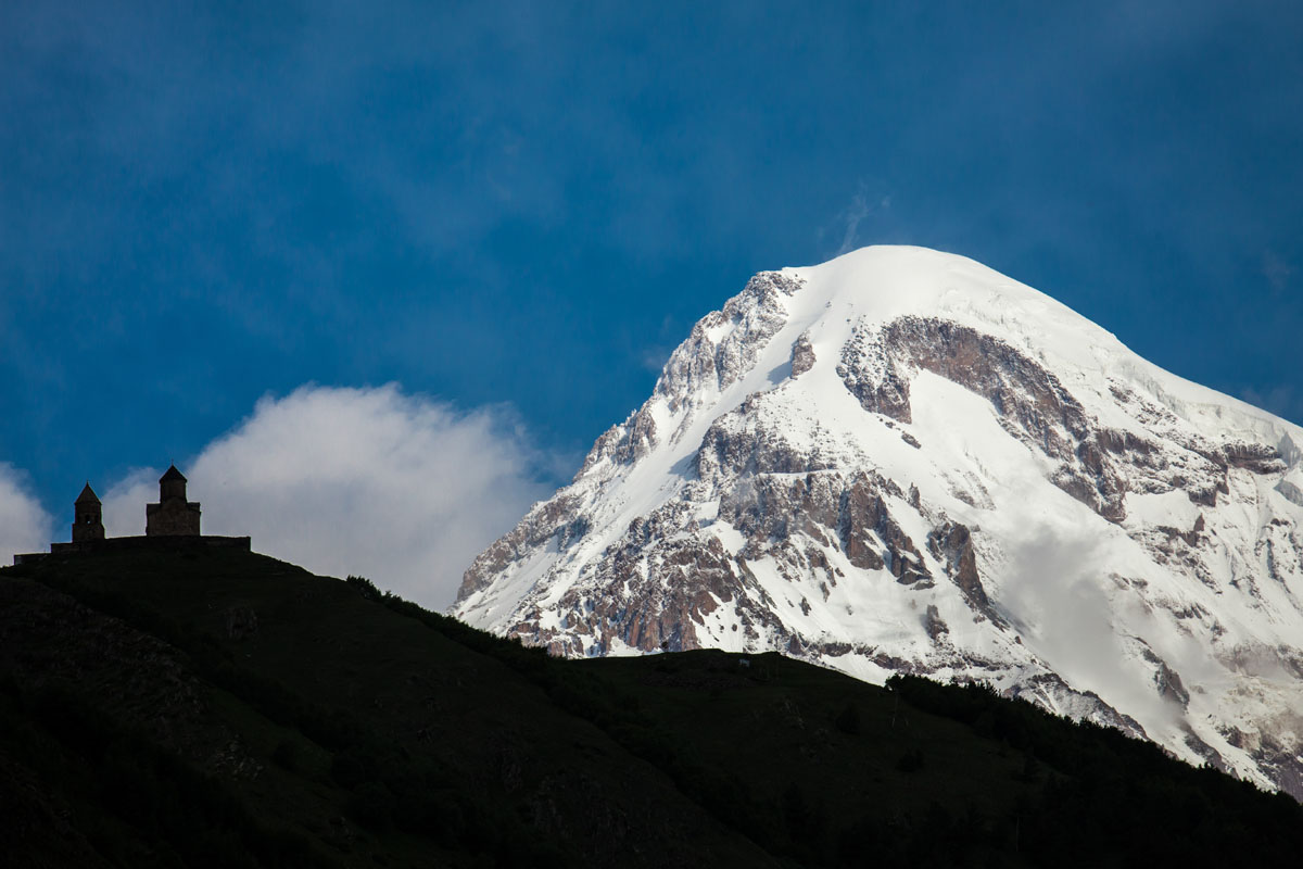
Kazbegi is one of five municipalities in the Mtskheta-Mtianeti region of north-eastern Georgia. The main feature of the area is the village of Stepantsminda, which sits at 1,740 m (5,708 ft) at the base of one of Georgia’s most famous mountains, Mount Kazbek or Mount Mkinvartsveri. At 5,033 m (16,512 ft) with a prominence of 2,353 m (7,719 ft), it is the most prominent mountain in Georgia. Having more than 1,500 (4,921 ft) of topographic prominence, it is an ultra-mountain, which makes it a draw to mountaineers internationally. In total, there are 78 named mountains in Kazbegi Municipality.
Stepantsminda is also often referred to as Kazbegi, which is a historical name for the village after an early 19-century local lord Gabriel Chopikashvili, son of Kazi-Beg, who during a local revolt against Russia remained loyal to the Russian empire and helped suppress the local population and was then promoted to an officer in the Russian Army. He then adopted the surname of “Kazbegi” and the village, which was under his control, was referred to by the same name.
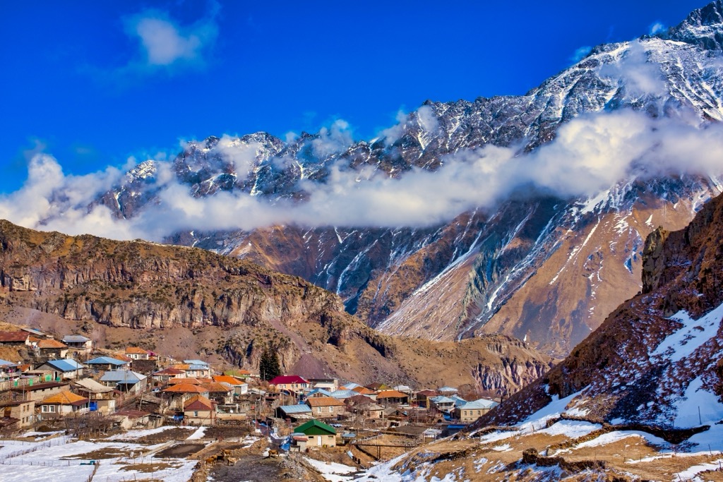
The Kazbegi Municipality is located in the north of the Mtskheta-Mtianeti region on the border with North Ossetia region in Russia. Its capital Stepantsminda is situated on the Terek River, which runs through many of the trails in the area. It is 157 km (98 mi) north of Tbilisi. Other smaller but important towns and villages in the area are Juta, Kobi, Gveleti, and Shevardeni.
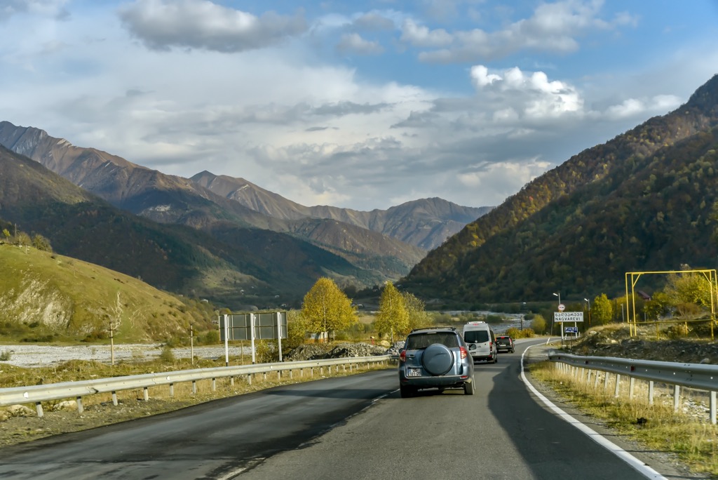
From Tbilisi, Kazbegi can be reached via an approximately 3-hour marshrutka (a name of small local buses) ride from Tbilisi’s Didube Station for about 10 Georgian lari (GEL), which is a local currency, which is about 0.33 US dollar or euro in 2022.
The marshrutkas for Kazbegi, like many in Georgia, do not run on a fixed schedule, rather they leave when they are full. Depending on the time of day and year you might leave within 5 minutes or as long as 3 hours. If you want a faster, more private option you can grab private care for around 100–120 GEL. The private taxis also frequently offer the option to stop at popular photography locations on the way, which can be a perk to some travelers.
The marshrutkas are located closer to the road, in the market at the Didube Station, while the private cars are located close to the exit of the metro at Didube, just before the market, in an attempt to try and catch tourists as they exit the metro.
Word of warning: these Georgian drivers work very hard to get every lari, so there's a lot of competition between them, and they could even occasionally give you false information, such as that the marshrutkas have stopped running. Be sure to check this out before believing them outright. The best time to catch a marshrutka is in the morning.
Also keep in mind that anyway, the road always also has to contend with mountain weather including landslides, snow drifts, avalanches, and rapid erosion due to extreme temperatures. These however are typically rapidly fixed as a result of Bakuriani and Stepantsminda’s tourism draws.
At the time this guide’s update (July 2022), air travel between Russia and Georgia is closed, so if you are traveling between these two countries, keep in mind that the only way to get from one to the other is to take the same Georgian Military Road.
Since 2008, for several years the border was closed as a result of tense Russian-Georgian relations, but it was opened again as a result of Armenian demands and has been used as an artillery transport, as well as civilian.
Still, crossing the border in both directions—from Georgia to Russia and from Russia to Georgia—can be quite a long time and difficult even for local Georgian and Russian travelers, not to mention foreigners.
To help you understand the specifics of crossing the border between the two countries, I asked outdoor writer Ivan Kuznetsov from the Dolomites, Italy, who is originally from Russia, to share his experience of traveling from Russia to Georgia by the Georgian Military Road. Before moving to Europe, he had lived in the Caucasus Mountains on the Russian side for over three years and traveled the road once.
"As the guide has already made clear, traveling through Georgia by bus is a bit of an adventure. It is the same if you go to the country from Russia.
To get from Vladikavkaz to Tbilisi by the Georgian Military Road there are several main ways: by minibus, by transfer or taxi, or by carsharing.
I will tell you briefly about all of them one by one:
Minibuses. These are essentially the same marshrutkas that allow you to get from Tbilisi to Kazbegi. You can find them at the main bus station in Vladikavkaz (Arkhonskoe Shosse, 1). The minibuses depart daily in the early morning and late evening and night, but, as in Georgia, it depends on bus occupancy. In addition, there may be various changes, so it is better to have a plan B for another kind of transportation. You can find the exact schedule at Avtovokzal15.ru/vladikavkaz-tbilisi, where you can also buy tickets. Here and hereafter, use some online translator from Russian. Don't be frightened: when you try to buy a ticket you will be redirected to Travel.yandex.ru—one of the main ticket booking services in the country, a kind of “Russian Google”.
Transfers and taxis. You can find an individual transfer or taxi for your trip to Georgia at the bus and train station in Vladikavkaz and at the airport in the neighboring city of Beslan. As with the buses, the more people, the cheaper the fare will be for everyone. As in Georgia, the drivers will seem overly talkative and insistent, with absolutely no concept of personal space as accepted in Europe (Georgia and Russia are similar to Asia in this respect). Tips: relax and take your time. First, go around a few people and ask for exact details of the trip and agree on the price. Then stand back and make a decision. Go back to the driver of your choice and hit the road. You can also order a taxi in advance at the most popular service in Russia, Yandex.Taxi, from the same company.
Carsharing. You can also travel to Georgia from Russia by hitchhiking and some of its modern online versions. Use the group “The Situation at the Upper Lars Checkpoint” on the social network Vkontakte (Russian Facebook). The group is full of ordinary travelers, who are going to Georgia themselves and don’t mind taking people to their cars for a small fee or even just for fun. You can also post an ad that you are looking for a driver. You can also find such people on the carsharing service BlaBlaCar. But be very careful: there are many offers from taxi drivers, which look like they are from normal travelers. The prices for the trip may also not correspond to reality.
The main advice for traveling on the road itself is to have patience and be careful. Local drivers, both Russians, and Georgians, are noted for their talents as failed car racers and entrepreneurs, so they usually drive very fast and in a hurry despite the poor quality of the mountain road. Alas, if you choose to travel by land or are forced to do so, there is nothing you can do about it.
However, if you see that the driver is driving too fast, politely and persistently ask him to go slower. As a last case, leave the car and try to get another one (but then you’ll have to find it on the spot) or book again through the internet, so it’s better to change the driver in one of the towns on the way and not in the middle of the mountains.
The pluses of a trip is that it takes about 4–5 hours to cover the distance of 200 km, and also that it will be one of the most beautiful mountain roads in your life, especially in the summer period starting in June, when the mountains turn green.
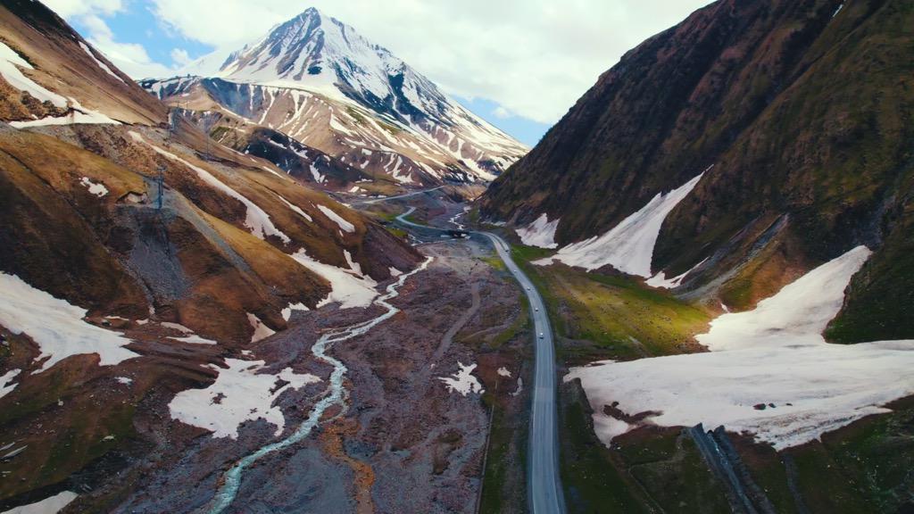
The most notable aspect of human history of Stepantsminda and the whole Kazbegi Municipality is that it resides on the Georgian Military Road, which is 212 km long, and is the primary historic highway connecting Georgia to Russia, and more specifically Tbilisi to Vladikavkaz in North Ossetia. It is still widely used as an ingress and egress point between Georgia and Russia.
The Georgian Military Road is one of three primary routes through northern Georgia to southern Russia, the other two being the Ossetian Military Road and the Transkam.
The road dates back to antiquity and has been mentioned by both Strabo and Pliny the Elder. It was originally a route for invaders into the Caucasus and it follows the Terek River through to the Darial Gorge in the north, and then southward through the region of Khevi to the Jvari Pass, peaking out at 2,379 m, then following the Tetri Aragvi River through to the town of Pasanauri, finally it passes by the historic town of Mtskheta and into Tbilisi.
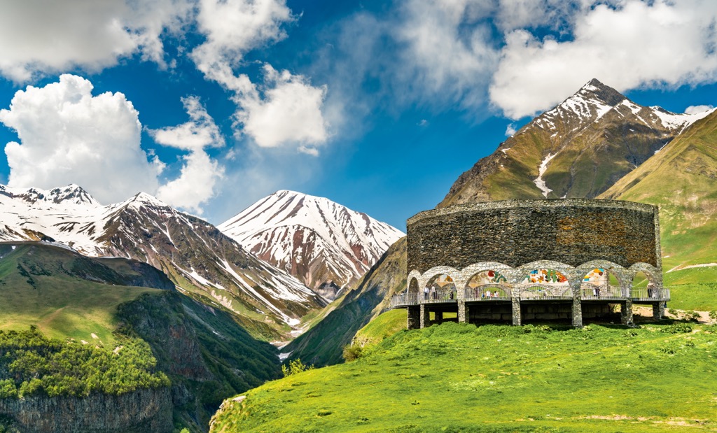
The road passes by many popular tourist destinations including the Russia–Georgia Friendship Monument, built in 1983 during the bicentennial of the Treaty of Georgievsk; Bakuriani, a very popular Georgian ski resort; a number of paragliding jump points; and the medieval fortress of Ananur, which was the seat of the eristavis (Dukes) of Aragvi, a feudal dynasty from the 13th century, among others.
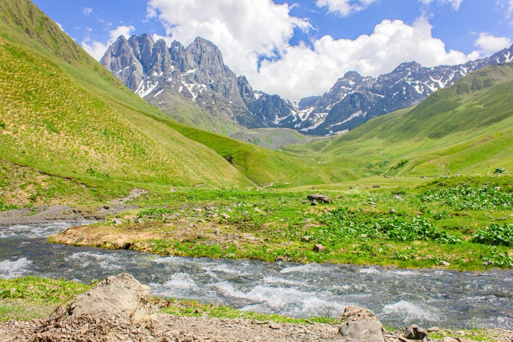
Much of the Kazbegi region is home to an amazingly diverse ecosystem, which it was possible to study and preserve in many respects thanks to the creation of a Kazbegi National Park.
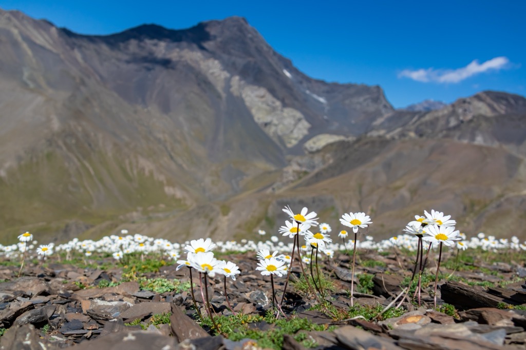
The flora of Kazbegi is largely characterized by Alpine and Subalpine meadows with a large number of of endemic plants and wild herbs including sage, cucasian rhododendron, sweetbrier, centifolia, tansies, dandelion, and many others.
However, there are also many forests with birch and pine forests of over 369 hectares, beech forests of over 49 hectares, asp forests of over 32 hectares, and willow forests of over 15 hectares.
Among the trees, there are at least three major "red listed" plants: high mountain oak, small elm and bare elm (Ulmusglabra) among others.
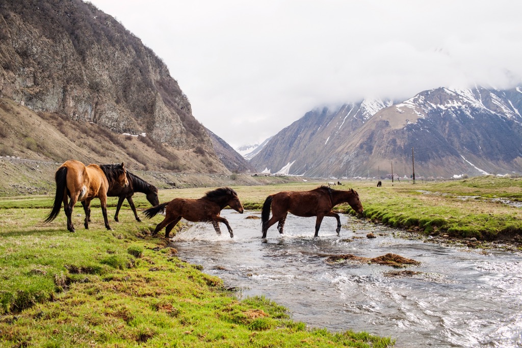
The fauna of Kazbegi is represented by such large animals as East Caucasian tur, chamois, and brown bear. Among the smaller ones, there are martens, wild cats, rabbits, squirrels, common shrew, Kazbeg birch mouse, bushes vole, and many others.
Among the birds, there are Golden eagle, vulture and bearded vulture, Caucasian black grouse and Caucasian snowcock, ring ouzel, red-billed chough, Alpine chough, great rosefinch, and others.
The mountain rivers and lakes are home to various species of reptiles such as newts and salamanders, as well as many species of fish.
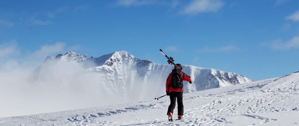
Given Mount Kazbek’s accessibility year round, as well as its proximity to Tbilisi, it is one of the most, if not the most, visited peaks in the country.
However, ironically enough, many of the popular hiking trails in the Kazbegi region are not located in the national park of the same name, which, rather than being in one central location, speckles the region intermittently.
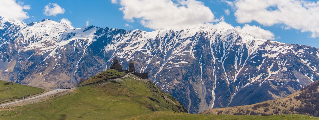
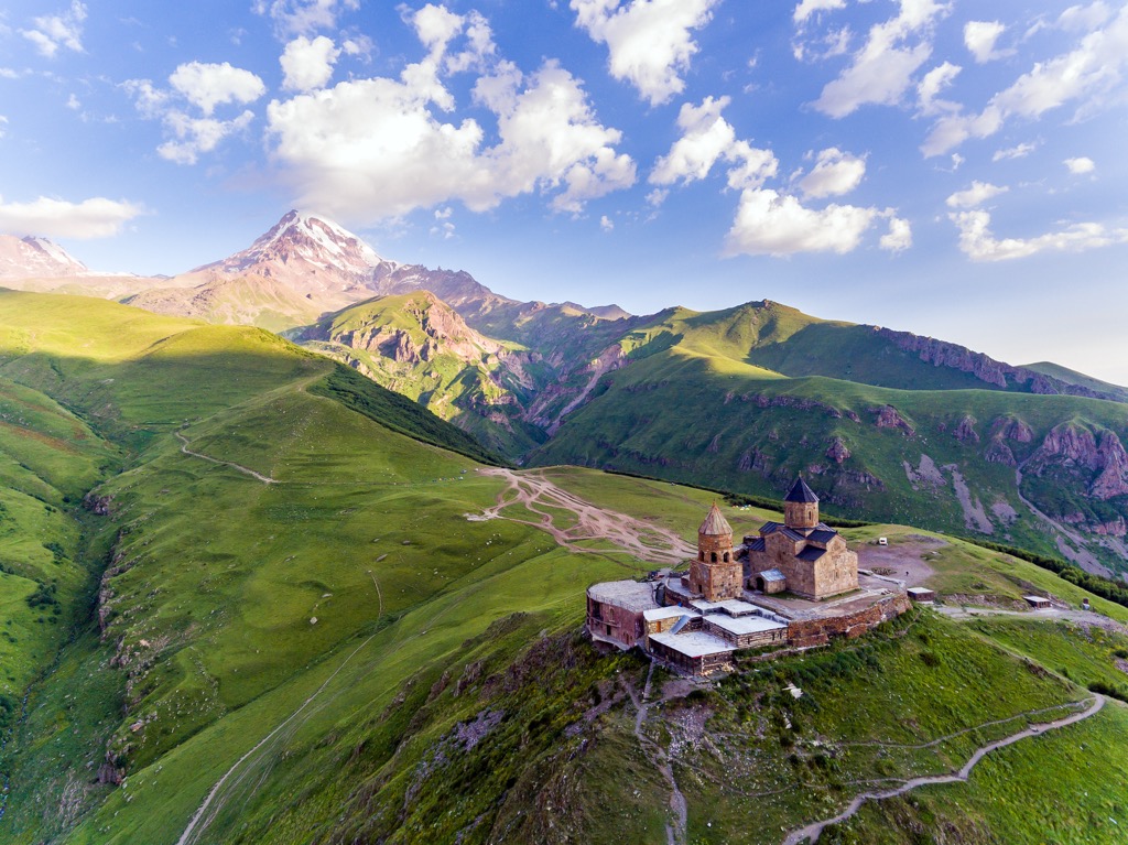
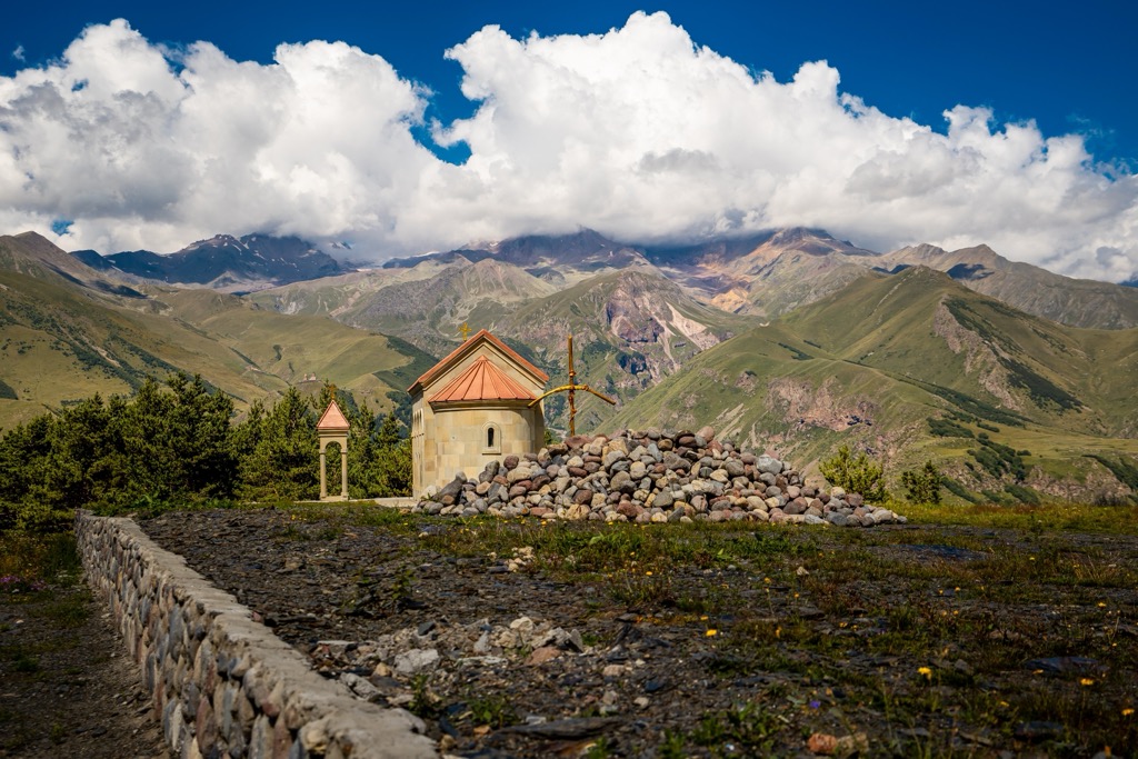
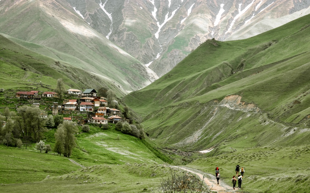
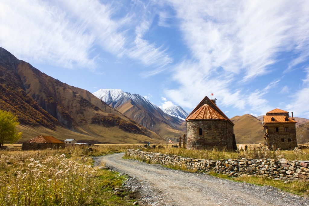
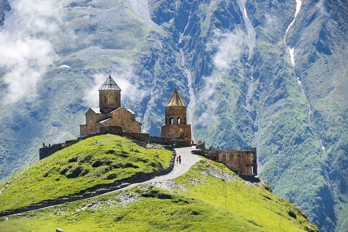
The village of Stepantsminda is the base of operations for both serious trekkers, climbers, mountaineers, and day-trippers alike and sits at the base of the mountain overlooked by the Gergeti Trinity Church.
Then, there are a number of options for both day and multi-day treks in the Kazbegi area. However, two things should be noted immediately:
Another important thing to know before hiking in Kazbegi is how to get around it. As most hikes in the municipality are located outside of Stepantsminda (in Juta, Kobi, Gveleti, Shevardeni villages, etc.), you will have to get a shuttle or a taxi to many hiking locations (or you could hitchhike).
There is no public transport in this area, so these are the only options and taxi drivers know this so the rates to get around are typically pretty high.
From my experience, Mountain Freaks company is a good option for day trips though they work on a fixed schedule and you need to be sure to sign up a couple days before your hike as their shuttles fill up quickly.
It is also advisable to try and find people to grab a taxi with as taxis typically charge per destination rather than per person.
So here’s a list of the main day and multi-day hiking routes in the municipality in its three main locations: Stepantsminda, Juta and Gudauri:
There are three main hikes in the Stepantsminda area. First is Gergeti Glacier via Tsminda Sameba (Gergeti Trinity Church). Second is Truso Gorge to Zakagori Fortress. Third is Gveleti Waterfalls Hike. Below I will tell you in detail about each route.
Gergeti Glacier via Tsminda Sameba (Gergeti Trinity Church)
This is the most popular and most accessible hike in the area and there are a few variations of the hike that you can take depending on how strenuous you want your day to be. It is very, very highly trafficked so if you want to beat the crowds then it is advisable to leave earlier in the day (this is a good strategy all over Georgia as Georgians tend to start their day much later than most, around 10 am).
You can start your hike either in the village of Stepantsminda or take a taxi and start at Gergeti Trinity Church and go all the way to the glacier. You can also end your hike at the Gergeti Trinity Church if you choose to only hike from Stepantsminda, which many novice hikers and families do. The Gergeti Trinity Church is a very popular attraction so be prepared for a lot of people on the trail during the mid-day.
If you start your hike in Stepantsminda, you will walk through the downtown area towards the Terek Bridge over the Terek River. Cross the bridge and take the next left along the road to the neighboring village of Gergeti. You will walk up the hill along that road until you hit a T in the road. If you turn right you will have a couple of options to stay along the road all the way to Gergeti Trinity Church. This is not a great walk as it is mostly along the road, has little tree cover and you will have to contend with the many taxis and marshrutkas going up to the church.
If you turn left you can take the trail through the rest of the village and continue up past an old watchtower and through a beautiful meadowed area that loops along the back of the hill that the Gergeti Trinity Church sits on and approaches from behind the church. This trail is preferable because it is so much more beautiful than going along the road, but the climb is steep and narrow in parts.
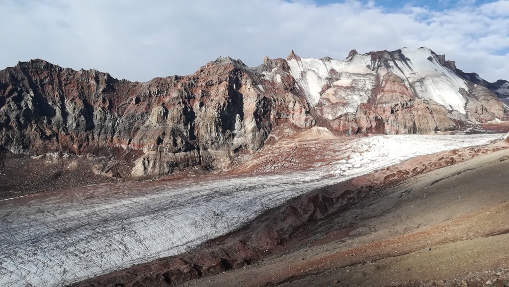
The first part of the hike, starting from Stepantsminda going up to the church is about 4 km with 400 m of elevation gain. The church sits at 2,210 m. The trailhead towards the Gergeti Glacier is easy to see from Gergeti Trinity church. There is a parking lot situated at its base. It starts at around 2,210 m and continues with an elevation gain of 1,400 m with the base of the glacier sitting at about 3,300 m. The distance between the Gergeti Trinity Church and the base of the glacier is about 8 km.
This trail continues past the base of the glacier all the way up Mount Kazbek. There is a camping site at the base of the mountaineering trail just before you have the option to cross the glacier. If you want to make an overnight trip of it you can stay at the hostel that is just a little further after you cross the glacier heading up the mountain. In this area you will see mountaineers taking their first night’s stop on their ascent up to the summit of Mount Kazbek.
There are two routes up between the trailhead at the Gergeti Trinity Church and the Betlemi Gora landmark. The southernmost trail is considered the climber’s trail and has fewer views of Mount Kazbek, but also has less wind (Mount Kazbek can be very windy), the northernmost trail is windier, but has great views of Mount Kazbek.
One important thing for hikers to note about this trail is that because it is on the base of Mount Kazbek, the weather can change very rapidly, so keep an eye on the forecast. The local geology does not make this hike a safe place to be during a thunderstorm as lightning striking the ground can be common and storms roll in and out very quickly. A light rain can quickly turn into a torrential downpour so come prepared.
This trail is also the start of a number of longer treks through the area that can potentially end in; Gveleti through the Dariali Gorge (the main route for mountaineers going over the summit of Mount Kazbek), Arsha, Pkhelshe, Kanobi, or Kobi — or will even connect to the Truso Gorge hike if you like.
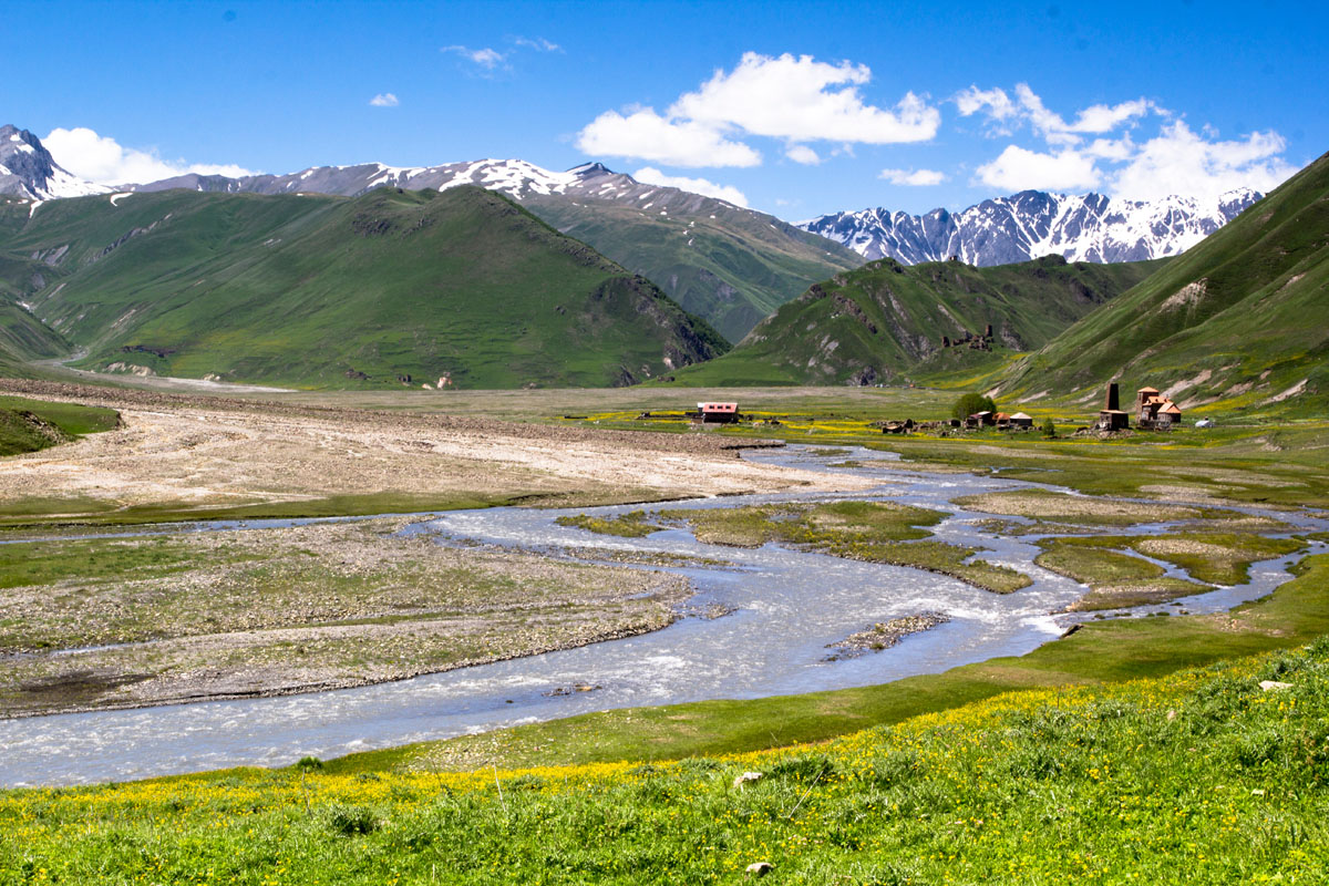
Truso Gorge to Zakagori Fortress
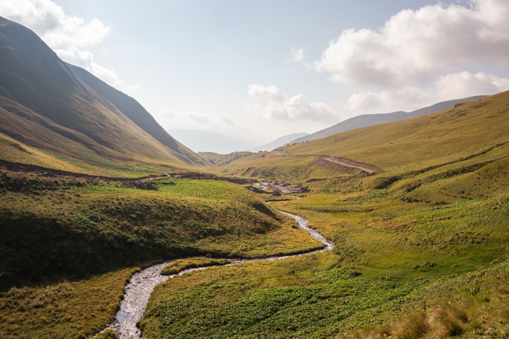
This is a great day hike as it has a small amount of elevation gain. This is a perfect family or novice hiker route and has a ton of interesting things to see both in the landscape and of the remaining ruins of the village of Ketrisi in the Truso Gorge. You could even call this hike a nature walk as the entire hike is done on a dirt road. Cars, ATV’s and motorcycles drive this road daily, but do not create much of an issue for hikers as this road has a higher percentage of foot traffic.
You can either hire a taxi to get to the trail head, which will cost 100–130 GEL, or you can sign up for a shuttle with the Mountain Freaks company for 30 GEL per person. If you sign up for the shuttle be sure to get on the list a couple days in advance as it fills up very quickly during the high season. You can set up your pickup time for taxis, it is recommended that you plan for at least 6 hours depending on how fast you plan to hike and how long you plan to rest. If the weather is good, in general, you should ask to stay a bit longer and enjoy the scenery and give yourself time to explore the ruins and geological highlights along the way.
The Truso Gorge hike is about 22km long from the trailhead to Zakagori Fortress with about 220 m of elevation gain, so while it is an easy walk, it is very long and there is absolutely no tree coverage so be sure to bring sunblock.
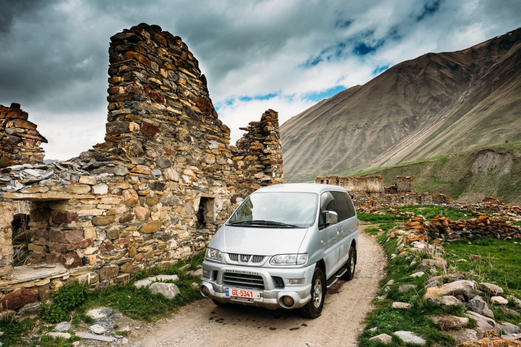
The hike starts at Agatkau in the Kvemo Okrokana village, at the confluence of the Mnaisistskali and Terek River, at a partially abandoned (though still a little active) industrial area, and follows the Terek River all the way to its terminus at Zakagori Fortress. There is a second longer trek that can be taken from this trail head that heads up towards the mountains, the South Ossetia border and Mount Kazbek.
There are other continuations of the trails in the area past the Fortress, but they may be off limits. This is possibly due to the route’s proximity to South Ossetia and may change in a few months, be sure to check availability before planning your trek through these passes. The first part of the hike has the most elevation gain and loss as you make your way towards the Truso Gorge through the Kasari canyon.
After about 7 km you will cross a bridge over the Terek River and begin entering the Truso Gorge, the valley opens up in about 1km to a number of natural mineral deposits coming out of the mountains and leading into the Terek River. On the opposing side of the river is the Truso Camping and Cafe campsite, which also holds the trailhead to a very short side hike to the Abano Mineral Pool along the river.
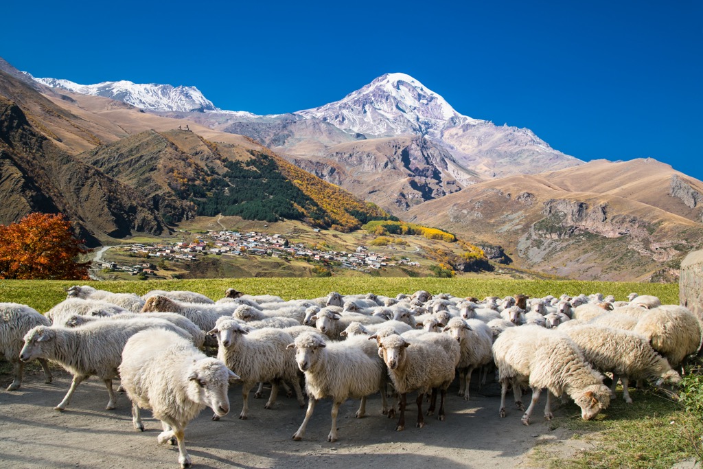
As you continue you will pass through an expansive meadow that is home to a handful of people still living in the area. There is extensive sheep and cattle grazing in the meadow and you will see sheep not only in the valley, but also climbing up along the steep mountain sides and speckling the landscape. If you are very quiet you can hear the otherworldly bleats of the sheep as they call out to each other on the mountainside and echo through the gorge.
As this trail goes through grazing meadows keep a swift foot and an eye out for sheep and cow scat along the trail.
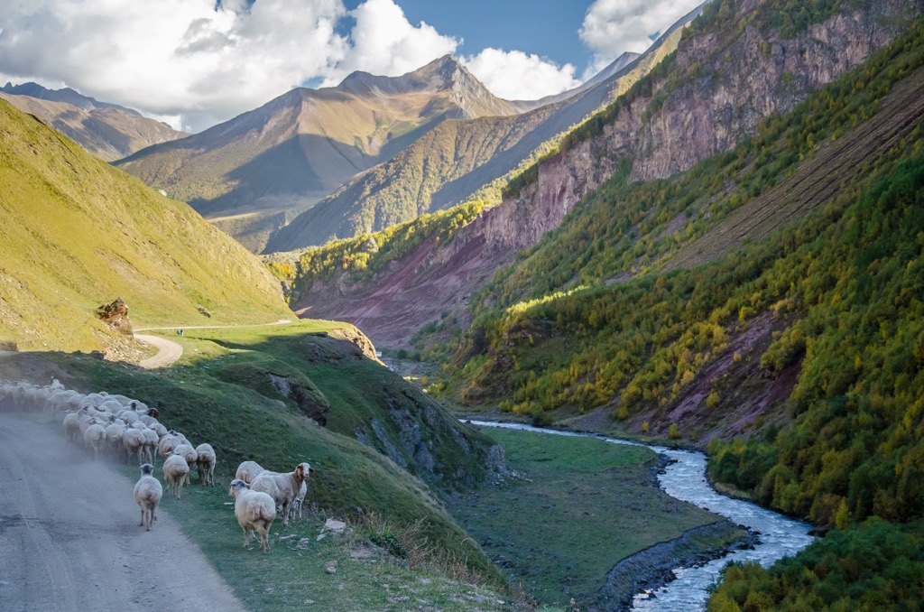
While you should be careful of sheep dogs in some parts of Georgia, such as Tusheti (which gets less tourism), the dogs living in this valley are very laid back and downright friendly. Dogs are of less concern in the high tourism parts of Georgia as they have become accustomed to hikers. If you are hiking out of a village, like Stepantsminda or Juta, for example, you may acquire a temporary trail dog (or even a pack of dogs) that will escort you along your route.
After about 3 km you will pass through the ruins of Ketrisi, which is mostly populated by old donkeys and horses put out to pasture. There are however a handful of people still living there and if you like you can stop by a family cafe and purchase a coffee, tea or khachapuri (a Georgian cheese bread dish).
After Ketrisi you can either split off to try and find the Keterisi Mineral Vaucluse, which is off trail and difficult to locate, or you can continue on to Abano and the Zakagori Fortress.
If you cross the bridge to Abano you will have to walk another 2 km. Abano is in the process of developing and it looks like it may have a number of lodging options in the coming years for tourists. As you pass through Abano you can continue on until you reach the Zakagori Fortress at the head of the Gorge.
From there you can follow the trail back to Kvemo Okrokana village.
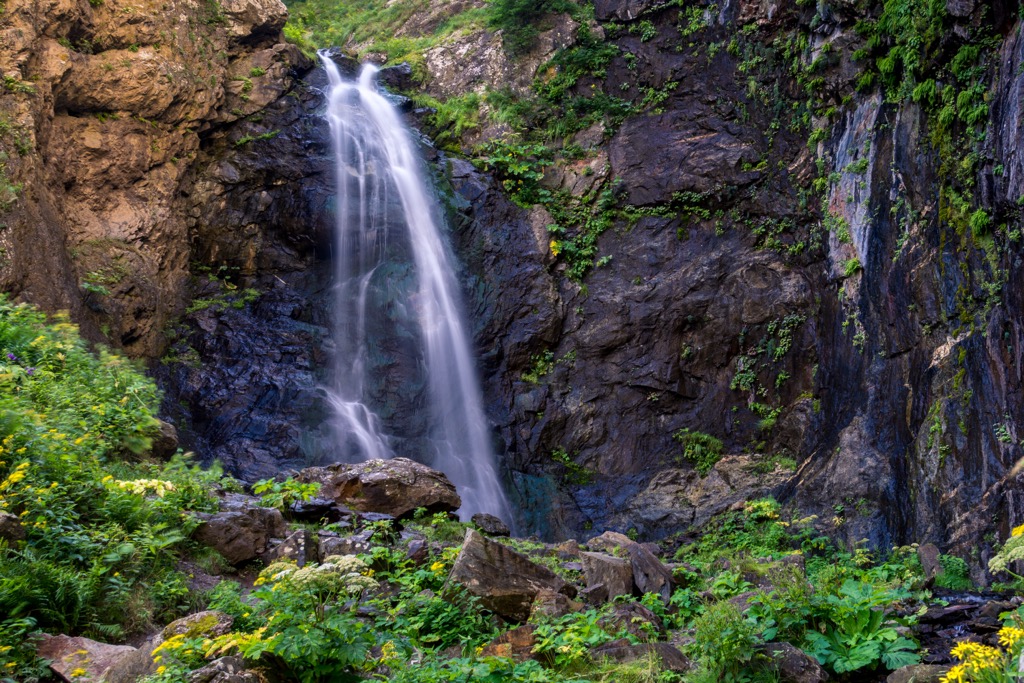
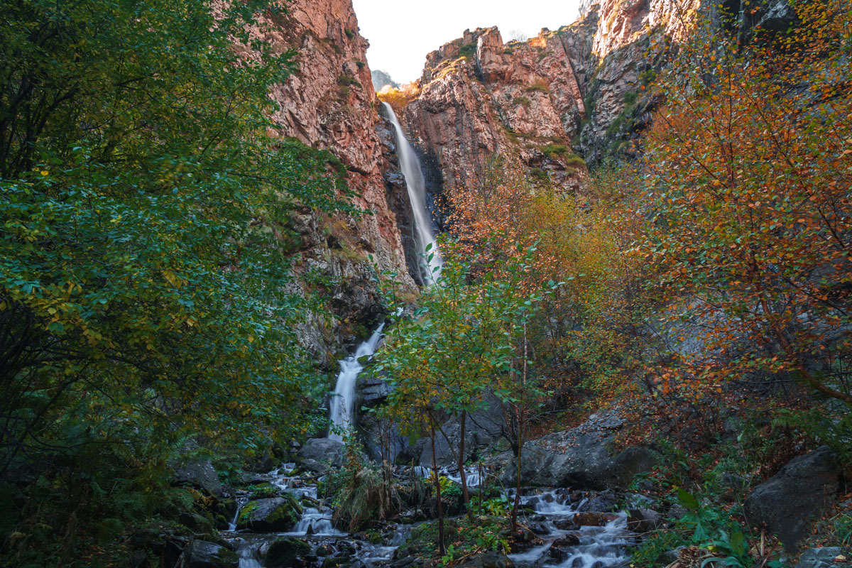
Gveleti Waterfalls Hike
First off, Gveleti means “Place of snakes” in Georgian, so keep an eye peeled if you are a bit squeamish around these reptiles.
However, take heart, the most common snake in Georgia is the “ring snake” which is gray with white rings around its neck and is not poisonous. Most poisonous snakes are not terribly prevalent in the Kazbegi region (the upper Caucasus are too chilly most of the time—though you will run into a ton of lizards on your hikes) and when they do they are very shy so you will probably not see them.
The only one you would need to keep an eye out for is the meadow viper, which is very small and (contrary to this hike), hangs out mostly in meadows as the name suggests. There are also a ton of raspberry bushes on this trail (a favorite food for snakes), which is great if they are in season because you will get a snack, but also a bit of a pain (literally) as they can snag you as you hike if you don’t take care.
The Gveleti Waterfalls hike is a 7 km forked hike that takes about an hour to complete and is just north of Stepantsminda in the village of Gveleti. It is a nice, easy side hike if you have a little extra time in Stepantsminda or are hiking with novice hikers or children.
Gveleti is about 9 km north of Stepantsminda. You can either hitchhike to the trailhead (hitchhiking is very common in Georgia and the road is very busy so you will probably get a ride quickly), or you can get a taxi for 20–30 GEL.
The trail starts with an elevation of about 1,500 m and tops out at about 1,650 m, so there is very little incline making this hike extremely easy.
The trail starts in the Gveleti valley near the main road. Odds are that locals will know where you are going so ask for directions. There will be an abandoned camp with a few empty cabins on the left side of the trail. You will walk a short distance and come to a fork in the trail. The larger road will turn to the left and go to the smaller waterfall, which is less popular than the larger. The small trail will branch off to the right and go to the big waterfall. The larger waterfall is more popular for two reasons. The first, fairly obvious, reason is that it’s larger and therefore a bit more impressive, but the second reason this waterfall is more popular is that it gets great sunlight in the afternoon and evening, making it a nice way to end your day. You can also swim in the small pool beneath the waterfall if you like.
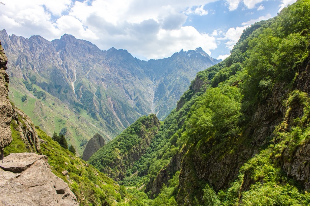
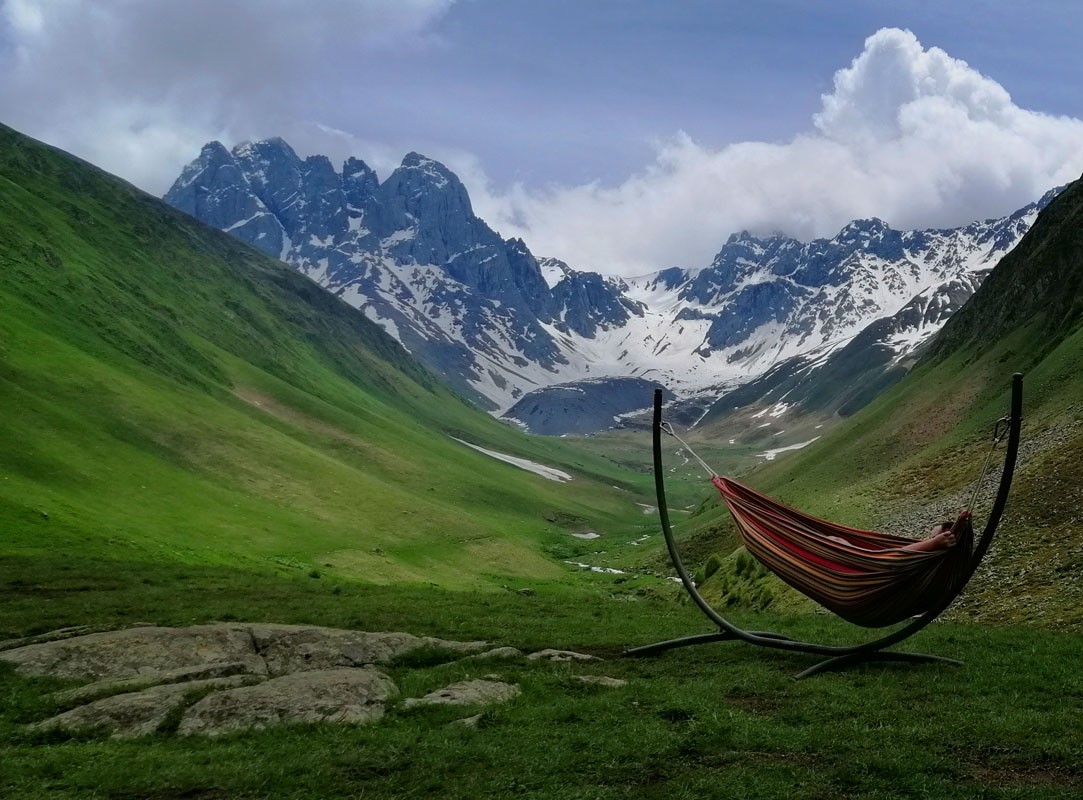
There are also three main hikes in Juta. First is a Juta day hike to the Chaukhi massif, which is an absolute must see if you are going to the Kazbegi area. Second is the Artkhmo Gorge, which is between the village of Sno and Juta, and which could be a great addition to any day hike or trek you do at the Chaukhi Massif. Third is the Juta to Roshka trek over the Chaukhi Pass.
The Chaukhi Massif
The Chaukhi Massif, also known as the Georgian Dolomites is a seven spiked massif that opens up to a beautiful valley cut with mountain snow melt rivers and a variety of interesting rock formations.
There is no public transport to the village of Juta so you will have to get a taxi (90–120 GEL) or sign up for a shuttle service with Mountain Freaks in Stepantsminda (30 GEL per person). The village is on a hillside so the initial climb up to the high alpine valley is incredibly steep and easily the most cumbersome part of your entire hike.
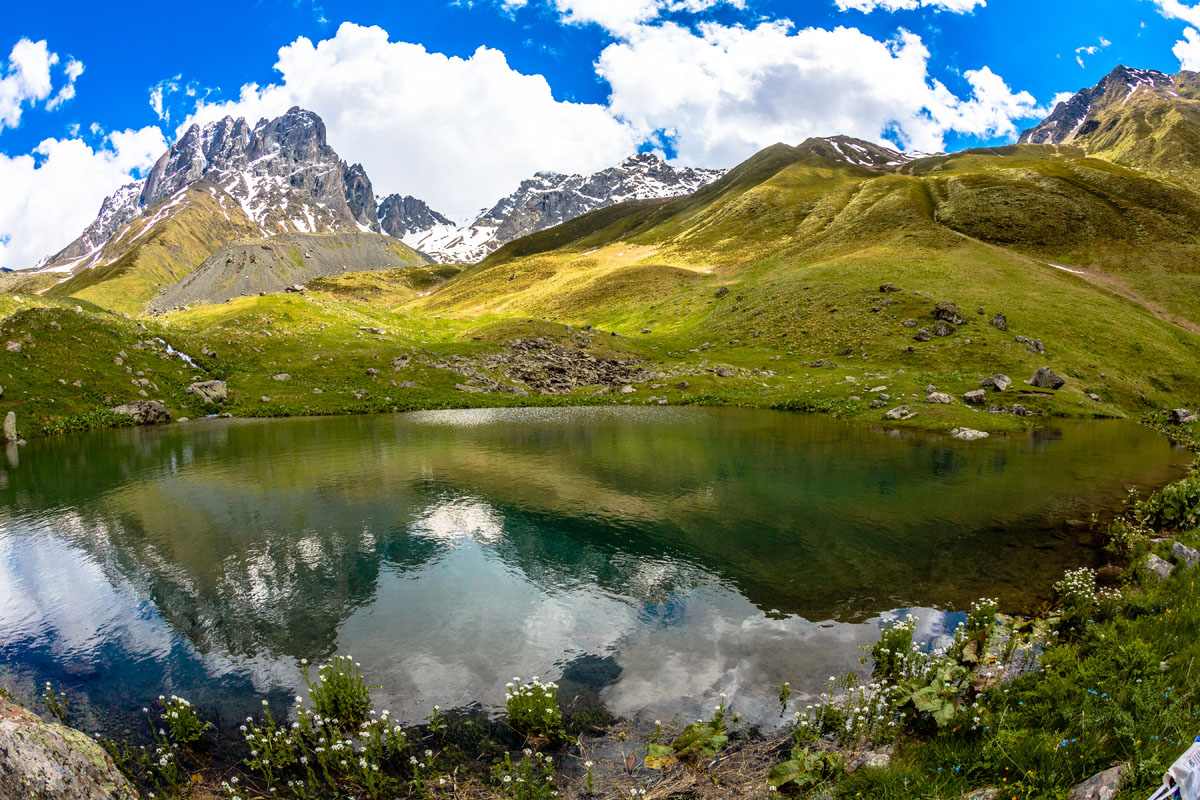
The day hike to the Chaukhi Massif is about 8 km total with 400 m of elevation gain. You will end your hike at an alpine lake (one of four in the area, the other three being on the opposing side of the pass) with a sign next to it indicating that you have reached 2,500 m.
The village is being built up very rapidly so while there are still a few old residents there you will see a number of hotels, outdoors adventure companies, and restaurants being built as well.
This hike does not have any tree coverage and the high altitude makes the sun very intense so be sure to cover up. Just 30 minutes of exposed skin will get you a sunburn here.
One great thing about this hike is you can drink the water straight from the stream as this area is not used for grazing and the water (fed by snow melt) flows through a natural moraine base filtering system. It also comes out incredibly cold.
This day hike is very short and is very easy most of the time, however, there are a couple spots of steep elevation gain, the first being through the village of Juta and the second being near the end of the trail.
Once you are dropped off at the village you will see a large boulder sitting above the Jutistskali River with a stone cross on top of if. You will cross the road here and head left along the steep uphill path. Follow the path until you come to an abrupt right hand turn up an even steeper path. When all else fails, choose the path that goes up the steepest route past the village. The Chaukhi Massif, for all intents and purposes, is directly behind the village, rather than off to the left or right.
You will continue up the hill and pass the Zeta Camping guest house and campsite (if you choose to stay here you will be provided with a tent, sleeping bag, and mat, or you can choose to stay in the guest house/hostel area inside) on your right. You will know it is the Zeta Camp site because of the rockwall on the side of the building. Continue on and you will see the 5th Season Cafe and guest house on your right as well. Before you even see these locations however, as you scale the hill you will see the seven spiked Chaukhi Massif in the distance which will let you know that you are undeniably headed in the right direction. The distance from the village of Juta to the Fifth Season Cafe and guest house is only about 1km, but is incredibly steep.
This trail is well trodden and easy to follow. It is also frequented by hikers, climbers, mountaineers, horseback riders, etc. so you can easily see where the route leads through the mountain.
For most of the hike you will walk with the Chaukhistskali River on your right side. As you approach the massif however you will have to cross the river. There are a couple routes to do this. In early June there is still a small amount of mountain snow on the trail, which comes in handy as you can use it to cross the river, which will be slightly higher early in the hiking season. As you approach the river crossing, if it is too high for your liking you can take the left hand trail and cross the river over an area that is more likely to still be covered in a small amount of snow. However, from there you will have to go off trail for a few minutes to cut back over to the main trail. Do not worry though, the trail is always in eyesight and it is very easy to walk back towards. This option also (obviously) changes from year to year based on snow melt patterns.
You can end the trail at the beautiful alpine lake at 2,500 m at the base of the massif or continue to the top of the pass, which is an incredibly steep and intense, but short, hike up.
The lake is a popular resting spot for trekkers continuing over the Chaukhi Pass and day hikers terminating their hike at the lake. There is also a campsite located here. From this vantage point you will also see some hikers who are starting one of two potential continuations of the trail; the 9-hour Chaukhi Pass day hike, with an additional 1,000 m of elevation gain over a few hundred meters, and the Chaukhi to Roshka Trek going fully through the pass and ending in the village of Roshka and taking about a day or two.
Artkhmo Gorge Hike
The Artkhmo Gorge branches off of the Sno Gorge heading to Juta.
You can get a taxi to Sno for 20–30 GEL from Stepantsminda and arrange a time for them to return and pick you up. This is a very common practice for most taxis.
Along this hike you will see the ancient abandoned villages of Miguda and Artkhmo. These villages were inhabited by Georgian tribes that were neither Christian nor Muslim and spoke both Georgia and their own Kartli language of Zoa.
The trail starts at around 1,830 m and tops out at around 2,000 m so there is no serious climbing over this approximately 12 km day-hike. The hike in total will take about 3 hours and is one of the lesser trafficked routes so you should have a quiet day to hike on your own!
The trail starts from the bridge in the Akhaltsikhe village and follows a dirt road for 2–3 km. Some taxi’s will take you further down this road until the trail narrows if you prefer and you can go until the trail splits into two branches, one following the road and another being a short detour to a waterfall about 50 m up from the bottom of the gorge.
Going back down to the right most trail you will go another 2–3 km until the trail narrows even more into a simple path and you will pass a shrine next to the river. Go a bit further and you will reach Artkhmo village. At this point you should feel free to explore as you like further down the gorge or on your return. There is a swinging bridge somewhere on the trail that is rather fun to play on.
Roshka Over the Chaukhi Pass
The Juta to Roshka trek is an easy at times, difficult at others, but a relatively short trail, which requires hikers to scale the 3,431 m high pass with about 1,200 m of elevation gain over an approximately 9.5 km area (if you’re coming from Juta towards Roshka) at the beginning of the hike. It is recommended to start the day early so you are not crossing the pass when the sun is highest. The high altitude sun is more intense than you realize and even though the pass is cool, you can easily get fried in less than an hour.
The trek is a little over 24 km long, starting at about 2,150 m in Juta, peaking at 3,431 m and terminating at about 1,350 m in Roshka. Overall the trail is well trodden and popular among hikers so most of it is pleasant to walk. The most difficult part of the hike is going over the Chaukhi Pass.
You can either do the hike in one day or break it into two. If you choose to break the hike into two-days you can camp at the Abudelauri White, Blue or Green Lake, all along the trail, on the Roshka side of the pass. These are the three of the four Alpine lakes you will see on the trail, the first of which being a blue green lake at the foot of the massif on the Juta side. The Abudelauri White Lake is harder to find as it is off trail, however it is the largest. You can see all three lakes from the head of the pass.
The trail is harder to follow after you cross over the pass. It follows a small depression, then sharply turns to the right towards the lakes. You will also pass by the Roshka stones, which are large wandering boulders brought to the descending valley from the mountain glaciers. You will continue on until you see the road being built in the direction of the Arkhoti valley leading to Roshka, which you can follow into the village where you end your hike.
While Gudauri is mainly utilized as a ski resort, just an hour from Stepantsminda, there is the Khada Gorge hike, which has a number of variations you can take, and is a good way to see the area in the off season. As such, it is also a bit less touristy than the rest of the region.
Khada Gorge
The Khada Gorge is also known as the valley of 60 towers due to its many historical towers and graves, as well as having what is purported to be the best tasting natural mountain water in the region. The many towers of the area were historically used to defend the southern Caucasus region from northern invaders. You will also get great views of the Caucasus Main Range.
While there are a number of ways you can take this hike, in general, if you are day hiking this trail you can expect to walk about 14 km over the course of 6 hours with about 800m of elevation gain and 400 m of descent.
This trail can be taken as an alternative to other day hikes in the area and you can take a marshrutka to Gudauri from Didube station for 5 GEL and ask to be let off at the Kvesheti village’s bridge, just short of Gudauri. From there walk to the village of Tskere along the jeep road, which is very small, but very beautiful. On this route you will pass a number of old fortresses and churches; the first being the Adgilis Deda Church in Kvesheti on your right, next to the river; followed by the Khada Gorge Fortress on your right after about 1 km of walking, and a man made cave and the Zakarkari Shrines on your left .5km’s down the road; the Sharmiana waterfall; Sviana-Rostaiani tower; and the Begotkari Church just before you reach the Tskere gorge and then the village of Tskere.
While you are in Tskere you can see the Church of All Saints and the Tskere tower before you continue north through the gorge. If the village of Tskere is your goal you can return to Kvesheti along the same route. Or, if you want to do a loop you can exit Tskere one of two ways, either continue north, eventually turning east to end in Gudauri, or take the east road on your right after the bridge to Tskere, which also ends in the exact same place in Gudauri.
If you choose to take the northernmost route your hike will be a little longer and go deeper into the Khada gorge looping around Mount Kudebi (3,006 m) and passing a number of ski routes through the Gudauri resort.
If you take the easternmost route you will pass Mount Chrdili (2,504 m). Both routes end at the Ivengo Hotel.
There are a number of variations that can be made to this route, so it is advisable to buy a map to see all of your options.
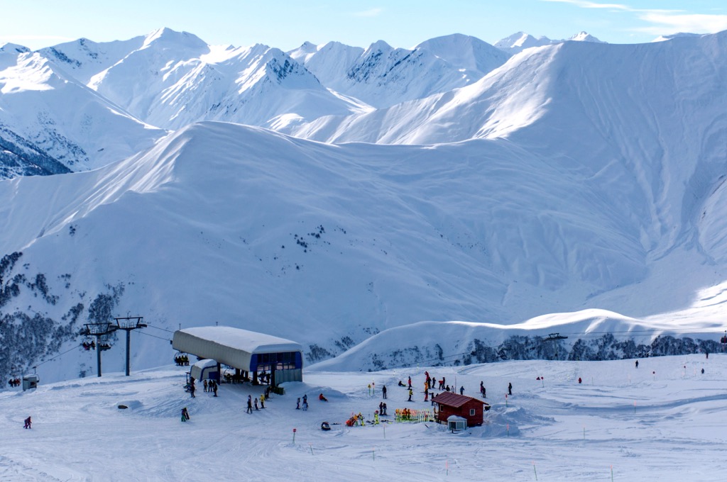
For skiing and snowboarding enthusiasts, there is a Gudauri Ski Resort in Kazbegi, the largest in the country with more than 35 km (22 mi) of slopes, most of which are for intermediate skiing (but there are also many advanced runs), and more than 15 ski lifts. It is also the highest ski resort in Georgia located between 1,993 and 3,276 m (6,538 and 10,748 ft), and the main ski resort near Tbilisi, the capital of the state. The ski season at the resort is from late December to late April in general.
Check the Kazbegi ski resorts map on the larger Georgia ski resorts map in the World Mountain Lifts section of the site. It includes information about open ski lifts / slopes in Kazbegi in real-time with opening dates and hours. There are also year-round cable cars, funiculars, cog railways, aerial tramways, and all other types of mountain lifts.
Georgia, especially in the more tourist-heavy mountainous regions, is very good about having a selection of guest houses in any village you may visit that has a major hiking trail running through it. You can either visit Booking.com, which is also a popular site in Georgia, for finding these places, or you can often just stop by and see if there is any availability, as there often is, if you are unsure about your travel dates. Read a bit more about a particular accommodation option right next.
There are three main cities and resorts in Kazbegi Municipality: Stepantsminda and Juta. You can also find some accommodation in Truso Gorge.
Stepantsminda has a variety of options for places to stay. Many of the campsites are located on trails as well rather than in the township of Stepantsminda. If you want to stay in Stepantsminda proper, there are a variety of hotels and guest houses to choose from.
However, if you want the best view of Mount Kazbek, then the Hotel Stancia Kazbegi is the place to be. It is a bit more expensive than other options, with rooms ranging from around 180 Gel for a budget double room to around 380 Gel for a deluxe family room with a balcony, but the hotel by far has the best vantage point for mountain gazing.
Along the Mount Kazbek trek there is the Sabertse campsite, about 6km from the Gergeti Trinity Church, and which sits at about 3,000 m. There is also the Betlemi Shelter, about 3.5 km from the Sabertse Campsite and 1.5 km out from the Gergeti glacier. The Betlemi hut, also called the Meteo Station, is at 3,650 m. These locations are frequented by mountaineers looking to summit Mount Kazbek.
There are a couple notable places to stay in Juta; Zeta Camping and the Fifth Season Guest House. Zeta camping provides both a camping and a guest house option based on your budget and preferences, ranging from 35 Gel per night for a tent (sleeping bag and mat provided) to 400 Gel per night for a family room in the guest house that can house up to 5 people. These prices include breakfast according to their Booking.com advertisement.
The second, more luxurious option is the Fifth Season Guest House, which also doubles as a bar and cafe. The cafe is a popular resting point for hikers going up to the alpine lake or over the Chaukhi Pass. The Fifth Season guest house ranges from 160 GEL for a budget twin room with a shared bathroom, to around 300 Gel for a larger room housing 2–4 people. Hikers will pass both of these options on their way to/through the Chaukhi Massif.
There is one campsite in particular at the midpoint of the Truso Gorge hike that is very popular; Truso Camping and Cafe site. While the hike can easily be done in a day, the campsite gives visitors the opportunity to relax and really take in the beauty of the Truso Gorge. The campsite, as well as the entire gorge can be reached by car if preferred. There are also a number of accommodations that seem to be in development in the Abano village for the coming years.


top10
ultra
glacier
volcano
europe-4500ers
caucasus-4500ers
russia-ultras
georgia-ultras
top50
ultra
russia-ultras
georgia-ultras
top10
ultra
glacier
volcano
europe-4500ers
caucasus-4500ers
russia-ultras
georgia-ultras
top50
ultra
russia-ultras
georgia-ultras
Yes. Kazbegi Municipality has 78 named mountains. The highest is Mount Mkinvartsveri (Kazbegi) at 5,054 m.
The highest mountain in Kazbegi Municipality is Mount Mkinvartsveri (Kazbegi), at 5,054 m.
Kazbegi Municipality has 78 named mountains.


