
Scan the QR code and open PeakVisor on your phone
Dagestan is home to 754 named mountains. The highest is Bazardyuzyu - Bazardüzü at 4,466 m.
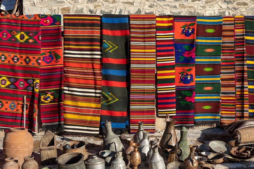
The Republic of Dagestan is one of the mountainous regions of the Russian North Caucasus, it has access to the Caspian Sea in the east. It is a place where history is honoured and folk crafts are practised even now in the digital era. The main treasures are nature with its majestic mountains and waterfalls, the villages that have remained almost intact since ancient times dating back to Noah’s notorious boat trip.
Since the 1600s, the Turkic-Persian word Daghestan, which means ‘Mountainous Country’, has been used to denote the region. Prior to that, in earlier historical sources, the territory had had several other names as it was part of different state formations. At the beginning of the 1800s the territory was annexed to Russia and in 1921 the Republic of Dagestan was established with Makhachkala as its capital. The name Dagestan reads with hard g, like in ‘game’ /dʌgə’stʌn/.
The area of Dagestan is 50,270 sq. km. The population is 3,132,268 as of the beginning of 2021, which is almost the same as in Albania or Panama. It borders on the Stavropol Territory of Russia, Kalmykia, the Chechen Republic, Georgia and Azerbaijan. To the east, the territory is washed by the Caspian Sea.
The middle and southern parts of the republic are occupied by the Greater Caucasus Mountains and foothills, while in the north lies the Caspian Depression. It is customary to divide the republic into Inner and Outer Dagestan. A 245-km-long strip of foothills is bordered by transverse ridges circling the Outer Dagestan in a huge arc. Inner Dagestan is divided into a middle mountainous (plateau-like) and alpine (high mountainous) regions. Mountains occupy 25,5K sq.km, i.e. about half of the total territory of the republic. The average altitude of the whole area is 960 m. The highest point is Mount Bazarduzu (4,466 m).

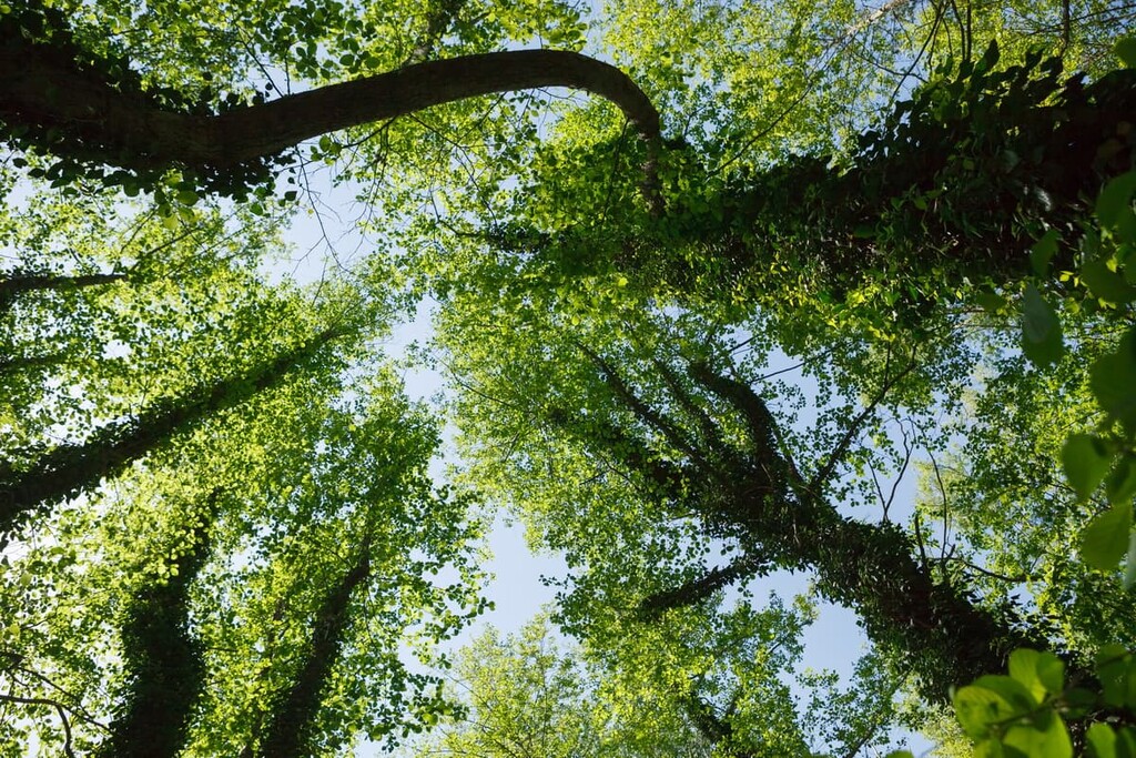
Dagestan is blessed with great diversity and richness of flora, which is determined by its relief: some plants cover the foothills, others grow in the mountains and highlands. The steppe and semi-desert areas of Dagestani plains are valuable forage grounds for keeping sheep in winter. The region is home to almost 5,000 (according to some sources around 4,500) species of higher plants of which 1,100 are unique endemics. The plain vegetation is mainly semidesert. In the foothill zone lying at an altitude of 500-600 m to 1500-1600 m meadows and forests prevail. The forests are mostly oak, beech, hornbeam, birch and pine. Forests and bushes occupy almost 9% of the territory of the country. In sub-alpine and alpine meadows, there are many herbs found, viz. fescue grass, clover, gipsy rose (Scabiosa), astragalus, gentian, etc. At higher altitudes (3200-3600 m), mosses, lichens and cold-resistant plants prevail.
The animal world is represented mainly by domestic animals: rams, turkeys, chickens and geese. But wild game is also plentiful. Wild animals are common and can be found in forests and mountainous areas. Here live leopards, aurochs (wild oxen), bearded goats and deer. It is not uncommon to see a bear and only occasionally a leopard. River valleys are home to otters and giant mole rats. Birds are also abundant in the region – there are over 300 species flying here. Lizards and snakes inhabit forests, foothills and river valleys. The most dangerous to humans is the viper. Lakes and rivers are inhabited by trout, sturgeon, beluga and many more fish.
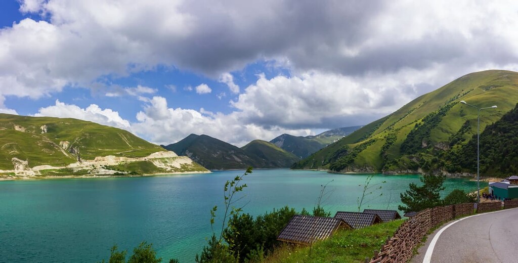
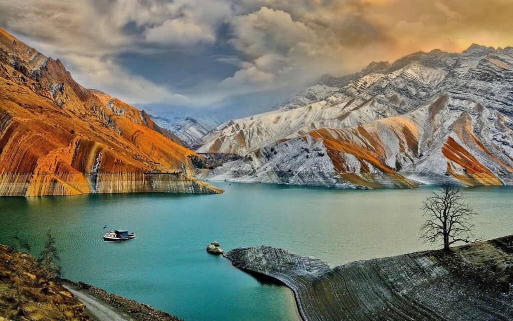
The Sulag, Terek and Samur rivers flow in Dagestan. They are the republic's major water resources, and there is also a network of smaller rivers. Here also lies one of the largest and deepest lakes in the Caucasus – Kezenoiam (Kezenoi Am) Lake – on the border between Chechnya and Dagestan. The lake appeared due to a landslide and rockfall that happened during an earthquake many centuries ago. Kezenoiam Village was once located near it. The turquoise water changes its shades depending on the weather. The scenery here is amazing, instantly immersing travellers in harmony with nature.
The city of Makhachkala is home to Ak-Gel Lake whose name means White Lake in Kumyk language. Unfortunately, it is gradually becoming smaller and less habitable for its inhabitants - the shores are being filled in for new urban developments.
The close vicinity of high mountains, plains, deserts and the sea, has created a variety of climatic conditions in Dagestan. There are five vegetation and climate belts: deserts and semi-deserts (the Caspian Lowland), subtropical forests (the Samur River delta), high mountain tundra and glaciers (the High Mountain Dagestan).
The climate in the north and central parts of Dagestan is moderately continental and arid. At the same time, there is a drop in temperature and an increase in humidity in the mountainous part depending on altitude. The climate in the southern and coastal zones of the region is transitional, from temperate to subtropical dry. Winter is short and lasts only three months, with little snow and no permanent snow cover. It drizzles rather frequently. Average January temperatures range from +4/5°C (+39/41F) in the lowlands to -7/11°C (+19/12F) in the mountains. Spring is warm and wet with frequent rainfall. Summers are hot and dry. The seaside areas enjoy clear, sunny weather almost all year round. The bathing season lasts from May to mid-September. July temperatures average up to +24 °C (+75F). Autumn is early and usually quite hot.
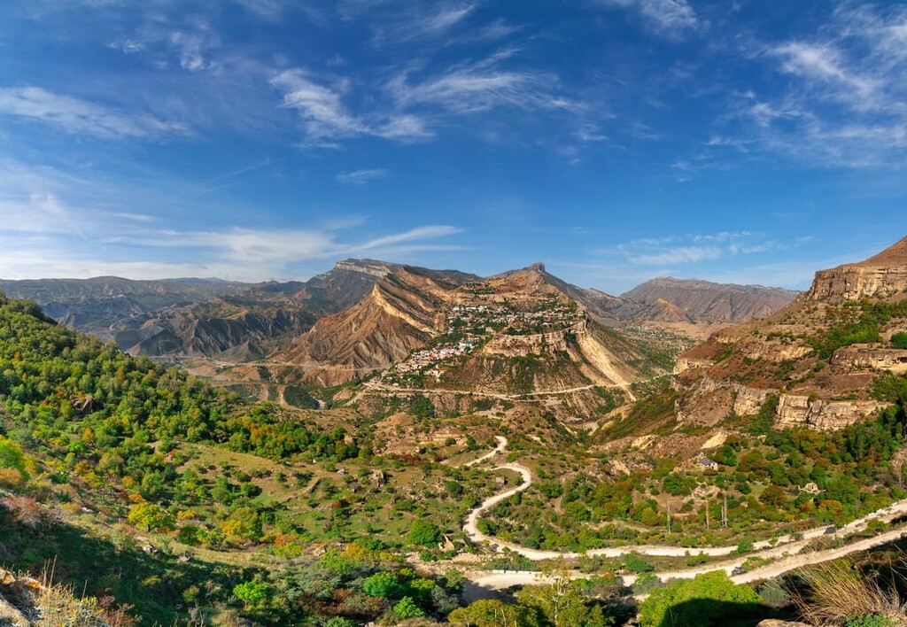
Half of Dagestan is occupied by mountains, the variety is great, you can see high mountains covered with alpine meadows, ice peaks in the south of the republic, and Inner Dagestan, with its gorges and sharp cliffs. The average height of Dagestan's mountains is 960 m, but there are about 30 peaks with heights of over 4,000 m on its territory.
The south and west of Dagestan are occupied by the Watershed Range of the Greater Caucasus. It is these mountain ranges that shape the weather in the republic: they trap humid air flows from the south, so the climate in Dagestan is predominantly dry.
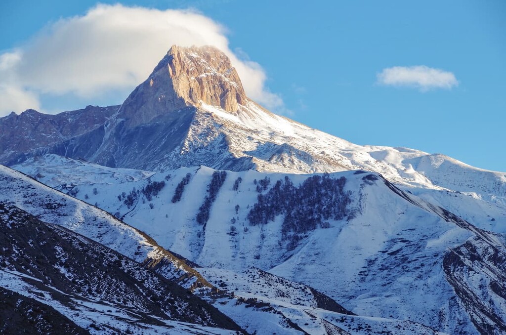
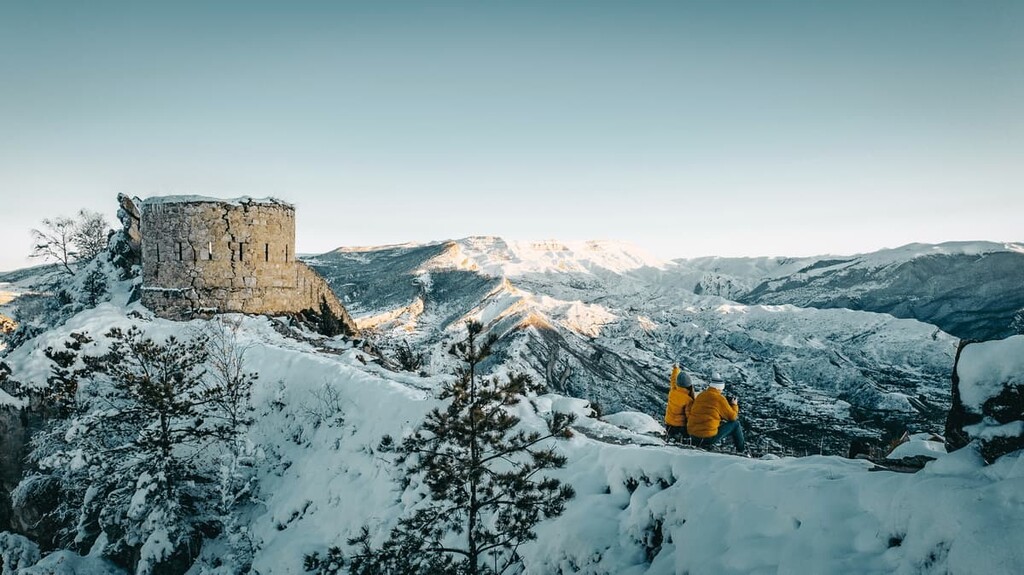
Among the natural treasures of the republic are Mount Bazarduzu (4,466 m), the Salati Caves, the Kuzhniki natural bridge (a 50 m high arch considered sacred) and many others. Dagestan is also known for its Diklosmta Ridge, Shalbuzdag peak and the poetic mountain Pushkin-tau. If one looks at it from a certain place and at the right angle, the profile of Alexander Sergeyevich Pushkin, a famous Russian poet, is clearly visible. The snow-capped mountains and their glaciers attract climbers from all over the world.
Bazarduzu or Bazardyuzyu (4,466m) is the highest mountain in Dagestan. Bazarduzu is the peak of the Watershed Range and is situated on the border between Russia and Azerbaijan. The relief of the range decreases from the peak to the east, thus it is the highest peak of Azerbaijan and a so-called ‘cold pole’ of Azerbaijan.
Bazarduzu is popular with climbers who are attracted to the area by the low complexity of the routes. 1B, 2A is the maximum that the biggest mountain in Dagestan is capable of. As a matter of fact, the peak was first conquered in 1849, and now athletes compete in exotic achievements. In 2014, a record was set by a group of athletes who climbed to the top in just 9 hours.
The glaciers of Bazarduzu are the easternmost group of glaciers of the entire Main Caucasus. On the northern slope of Bazarduzu there are two glaciers - the Tikhitsar and Murkar. There are five small tongues descending from them. It is easier to reach Tikhitsar. Its length is slightly less than a kilometer, width varies from 150 to 200 m. The peculiarity of Tikhitsar is its huge slope - the difference in elevation is 250 meters, so the glacier is moving down quickly - up to 9 cm per day.
The Murkar Glacier stretches to the northeast. It is much larger than its neighbor: the length of Murkar is about 1400 m, width varies from 300 to 450 m. The glaciers of Mount Bazardyuzyu are rapidly decreasing. In 1897, their area was 13.8 sq km, now it is almost four times less - only about 3.8 sq km.
Many rivers originate on Mount Bazarduzu. Here are the sources of the tributaries of the Samur River. Mountain slopes are covered with picturesque alpine and subalpine meadows. Plant and animal world is diverse and amazing. There are aurochs, chamois and roe deer found in sufficient numbers. High near the glaciers and hard-to-reach cliffs are inhabited by mountain turkeys and snow cocks.
Diklosmta is actually a mountain ridge lying on the border of Dagestan, Chechnya and Georgia, in the eastern part of the Greater Caucasus. If it were possible to see the mountain ridge from above, it would look like a star. It is part of the Snowy Range and has over a dozen high peaks covered with eternal snow, the highest of them are:
The massif is visible from afar. Translated from Chechen language, Diklosmta means "a Snowy Ridge". There are several large glaciers on the Diklosmta. The total area of nine permanent and most significant of them is more than 5 sq. km. These glaciers give life to the Khulandoy, Chero and Gakko rivers.
The mountain has a second name. In the local villages, the large ridge is called "the mountain that asks for rain." The origin of this version is unknown, but the old-timers secretly leave gifts in the foothills, praying for prosperity for their loved ones.
Being one of the highest mountains in Dagestan, Diklosmta is of primary interest to mountain climbers. On the steep cliffs and glaciers, students of mountaineering schools, including the Russian national team, practice their skills.
Shalbuzdag (4,142m) is the highest in Dagestan. Snow cover is partial and glaciers are found only above the 3,500m altitude mark. According to one version, the name Shalbuzdag is derived from a Turkish phrase that means "mountain covered with ice". Another version claims that the mountain was named after a man Shah-al-Burza who once lived in the area and helped local Muslims in their fight against the Khazars.
The red sandstone mountain has an interesting landscape. It is riddled with cracks and fractures. It is worth visiting not only for religious reasons, but also for aesthetic pleasure. The red rocks look more interesting in the photo than the crevasses of Colorado. There are also interesting views from above - the shrines and the human anthill of pilgrims.
If you believe that Shalbuzdag fulfills wishes, you have to go all the way. Start from the place where Suleiman is buried and follow the obligatory stages of this route: Suleiman's Feast, Golden Erenler Mosque, Zam Zam Lake and The Grahammer.
The cleft, through which one person can barely squeeze through, according to legend, atones for all sins. Passing through this difficult route is considered fully purified. And as a souvenir tourists bring water from the sacred lake. It tastes sweet and is crystal clear.
The mountain is considered sacred to the locals, there are many myths and legends associated with it, but one is dead certain – whenever you are on the mountain, respect its spirits/masters who can control avalanches and mudflows. Those phenomena are quite frequent due to the abundance of small rivers and springs that originate on its slopes.
The number of pilgrims here increases markedly from midsummer to late summer when the ground warms up considerably. One of the slopes of the mountain looks like an ant hill. The pilgrims believe that climbing to the top will grant them a wish. Some believe that the seven ascents are equivalent to a pilgrimage to Mecca.
In recent years in Dagestan much has been done to raise the rating of tourist sites. There appears nice infrastructure. On the routes of Mount Shalbuzdag there are free canteens and points where you can leave some things you don’t need on the mountain, but can leave them for safekeeping. Travellers who come down after visiting the holy places have a hot dinner in the canteen near the mosque.
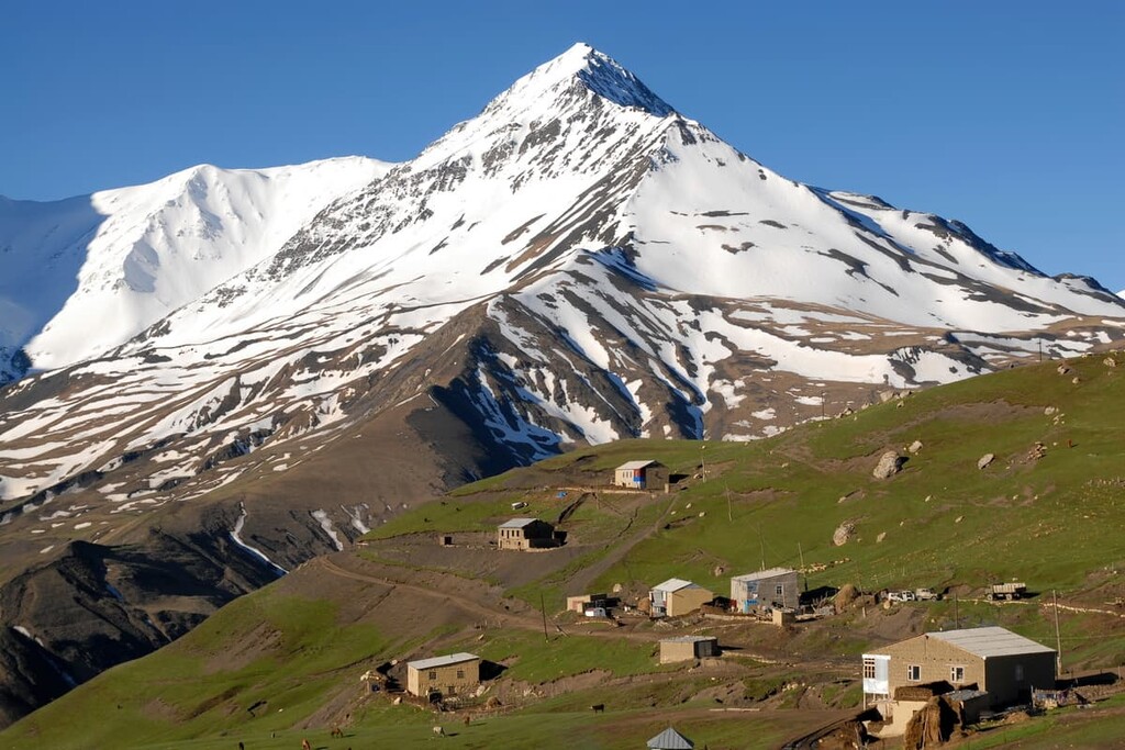
By the way, on one of the slopes of the mountain is the highest settlement in Europe - Kurush village, it rises to 2,560 meters above sea level.
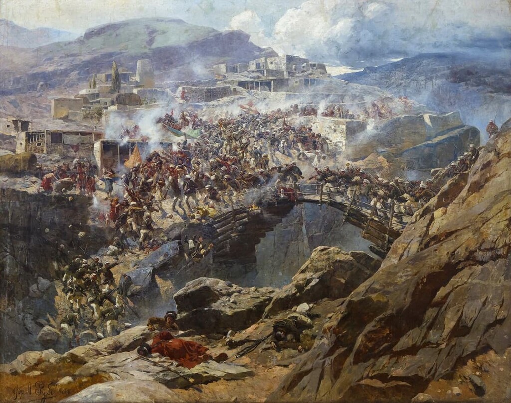
Akhulgo can be roughly translated from the Avar language as the calling mountain or the alarm-bell mountain. The peak is associated with a gory bloodshed back in summer 1839 when over a thousand locals and 600 Russian soldiers died during the siege of Imam Shamil’s fortress (the man and his family escaped unscathed and later caused much trouble to the Russian Empire, but that is a foregone history now). In 2017, the authorities opened the Akhulgo Memorial on the site of a former fortress which is the main feature of Franz Roubaud’s painting The Battle of Akhulgo.
Akhulgo is popular among the pious who do the ziarat – a pilgrimage to the sacred tombs, since many men died here fighting for their freedom. There are several mosques and a cemetery where Gazi-Magomed, the first imam of Dagestan and Chechnya, is buried.
In the north, the foot of the mountain is washed by the Andi Koysu River, forming a kind of peninsula cut in two by the river. Another site worth visiting here is a small suspended log bridge between the old and the new villages standing opposite each other on two giant cliffs. In the deep gorge between them flows the Ashilta River.
One more spot to appreciate the military prowess of the highlanders would be the rock called Shulatlulgo, which is translated from the Avar language as ‘a Fortress Mountain’. It slightly rises above the main mountain range, but it gives a good advantage in a battle. There is a flat area of about 100 square meters on top of Shulatlugo which proved to be enough for a small fort built by Surkhai, Shamil's assistant.
There is a small but very famous mountain in the vicinity of the town of Izberbash. It is called Izberg-tau or Izberbash (220m) - the mountain with a trace of a head, but is better known as Pushkin Mount, even though the famous Russian poet never set foot on it. The point why it is called Pushkin-Tau is that at an altitude of 150 meters the outlines of rocks overlap in such a way that at a certain angle you can see the aspiring profile of the poet. The best way to look at the mountain is from the road Rostov - Derbent. Pushkin-Tau is beloved by locals, tourists, and paragliders.
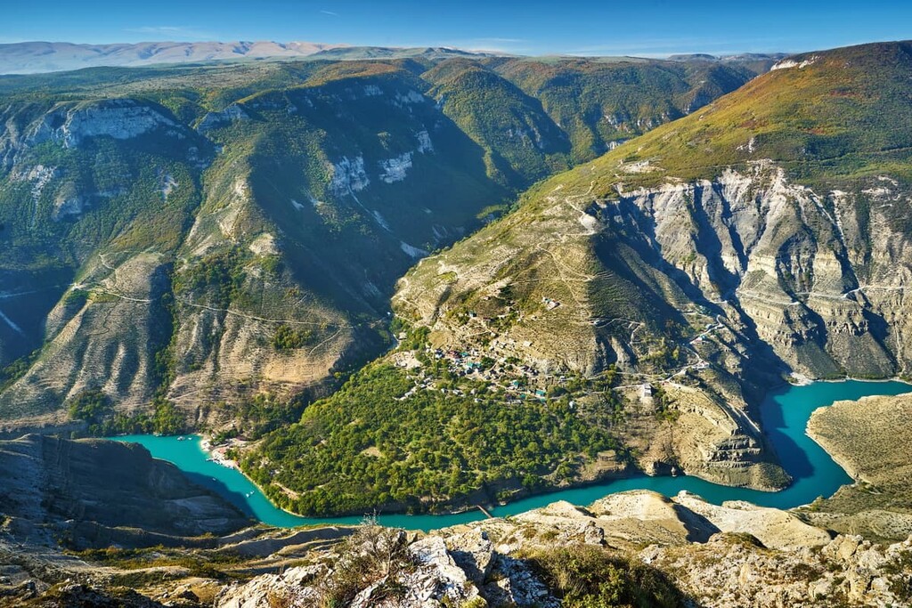
The Sulak or Sulaksky Canyon is situated in the valley of the Sulak River and extends a full 53 km. It is deeper than the famous Grand Canyon in Arizona. Being 1920m deep, the Sulak is the 6th deepest canyon in the world. The first five are the Gorge of the Jumping Tiger (China, 3000m), the Kolka (Peru, 3,400m), the Kotauasy with a 250-meter high waterfall Sipia (Peru, 3,535m), the Gandaki (Nepal, the depth is argued, but if you count it by the nearby mountains, it is at least 6,000m) and the Yarlung Tsangpo (Tibet, 6,009m).
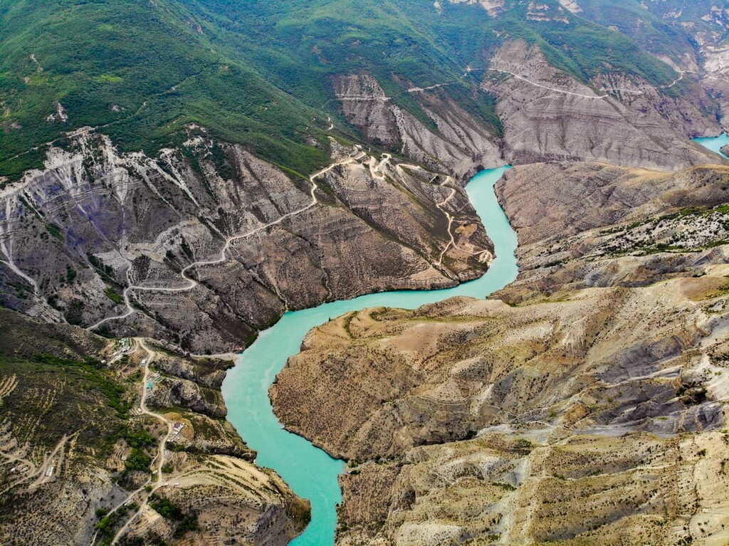
Climbers come to the Sulak Canyon with appropriate equipment and descend to its very bottom. By the way, there are no barriers on top of the canyon, so watch your step and be careful when taking mind-blowing selfies here. A safe way to admire the views of the canyon would be a boat trip up the Sulak River. Fishing enthusiasts may enjoy good fishing in the vicinity of the Chirkey Reservoir.
Barkhan Sary-Kum aka Sarykum is located 18 km from Makhachkala, it is an island of its own in the desert. The 252-metre sand mountain is probably the only one in Russia.
A sand mountain in the middle of green fields is a unique sight, prompting some kind of failure in the matrix. There are two versions of the origin of this anomaly - the weathering of rocks from the mountains and the typhoon that moved the sands many years ago. Anyway, it is a beautiful sight to behold, even more so that this Barkhan is second in size only to the one in the Sahara.
The sand mountain of Dagestan looks the most interesting in the photos. Its four tops are constantly in motion, while the base is stationary. For barchans that move in their entirety, this is a unique case. Try taking two photos a week apart, the terrain will be unrecognizable.
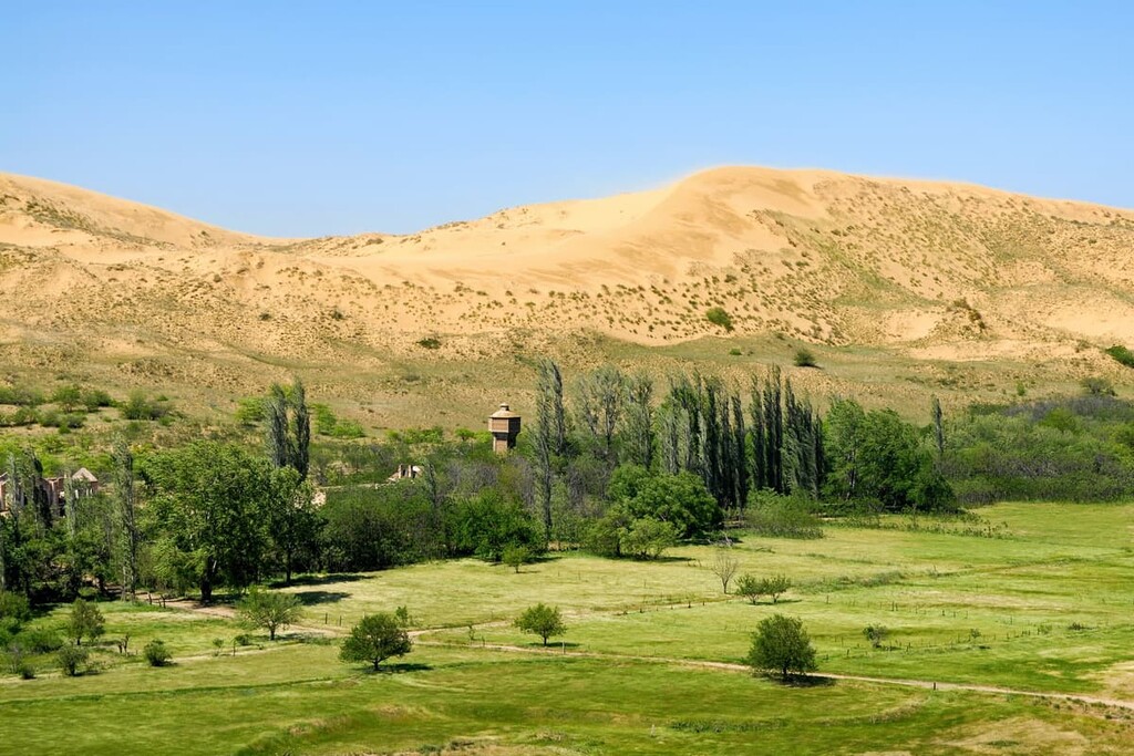
And the most amazing mystery of the Sarykum Mountain is the river that divides the barkhan in two. While flowing through the sands, it doesn't lose its fullness and essentially divides the sandy mountain of Dagestan into two, a large and a small one. The sight in the photos is amazing, although traveling to this part of Dagestan is not safe. As happens in deserts, not only turtles and snakes, but also scorpions are found in the sand.
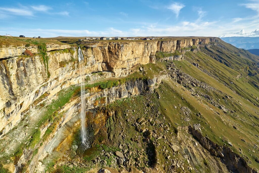
The Tobot waterfall is located near Arani village. A gentle stream of water falls from the top of the gorge, which is shaped like a Latin letter V. Researchers are still divided over the height of the fall, with figures varying between 50 and 100 metres. The water flows away rather quickly at the bottom, so no natural baths are formed there. On particularly sunny days, the rocks appear fairy-tale-like and multicoloured from the splashing and refraction of light in the thinly dispersed water droplets. There is another place of interest near the waterfall - the Hunzakh Fortress.
The Salta waterfall is in the vicinity of Salta village. It is the only underground waterfall in Dagestan. The Saltinka River goes underground not far from the village, then it falls from a height of 20 meters into a lower chasm. The water is coloured in different shades, the humidity is high here and the walls of the canyon are smooth. The flow of water is particularly powerful when it rains.
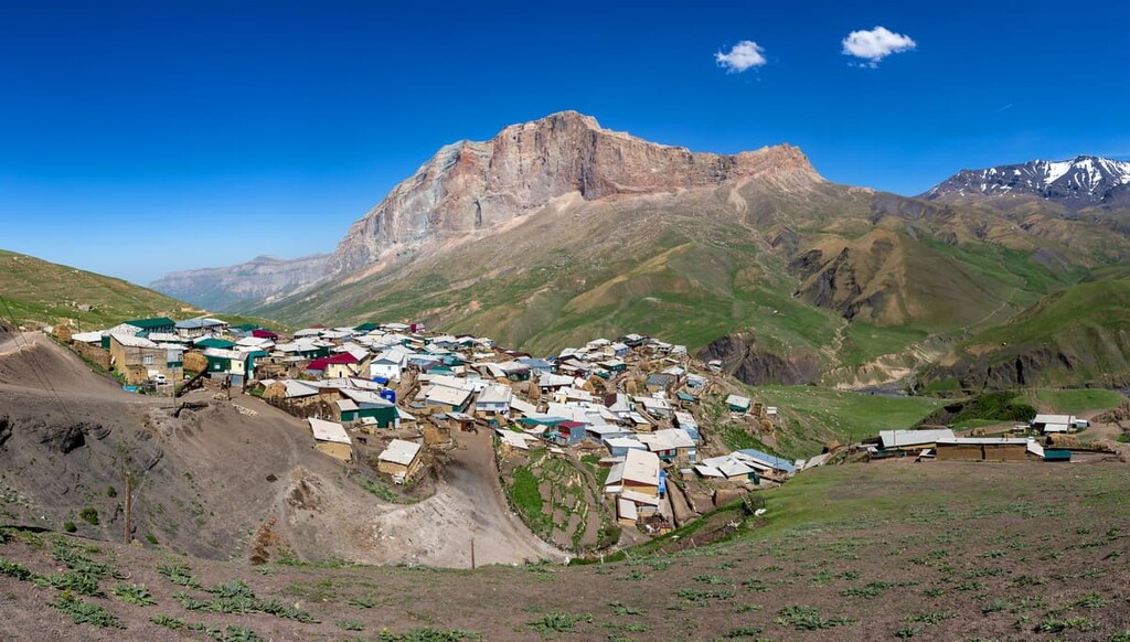
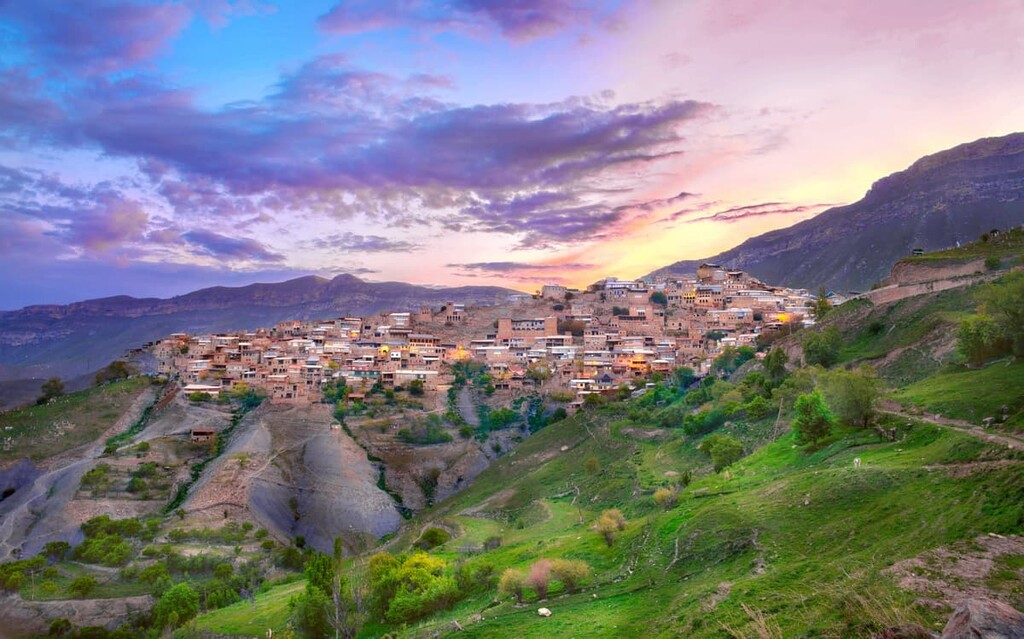
This is the name the locals give to an abandoned village in the Gunib district. The village is visually astounding due to the colour of the brickwork, which is very similar to that of the surrounding cliffs; all the buildings seem to be built into the mountain.
In the old days, there was a school, a hospital and other municipal facilities here. Now, however, the electricity poles stand dormant, the road ends about a kilometre before the houses, and most of the buildings are no longer livable.

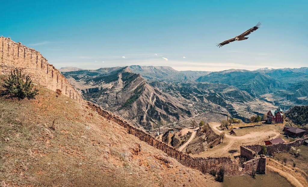
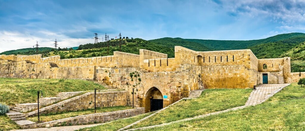
Naryn-Kala fortress was probably the longest-built edifice in the Republic. They laid the foundation stone in the 700s and finished in the 1500s. The fortress is located on a hill in the ancient town Derbent, very close to the Caspian Sea. Its purpose was to block the narrow coastal passage to the land of the Persians. Each new ruler added something of his own to the appearance of the fortress. Eventually, its area grew to 4.5 ha. Inside the fortress, many buildings have survived, including baths. The fortress is a UNESCO World Heritage Site.
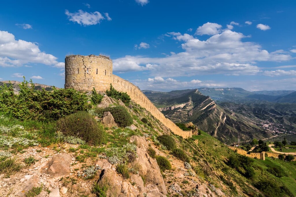
A unique fortress in the vicinity of Gunib village in the Gunib district has seen many battles. The history of its creation is directly linked to the events of the Caucasian War which lasted throughout almost the entire first half of the 19th century. External factors have had a detrimental effect on this object of cultural heritage: one of the walls is slowly deteriorating in several places. But still the fortress continues to look majestic.
Dagestan has a huge federal nature reserve – the Dagestan Nature Reserve, it covers two districts of the republic - the Tarumovsky and Buynaksky. It was established in 1987 to protect the migration routes of birds. The most protected and rare species are flamingos and pelicans (pink and curly ones). In 2009, the Dagestan Nature Reserve united three federal reserves: the Samursky (11,200 ha), Tlyaratinsky (83,500 ha) and Agrakhansky (39,000 ha). Near the Tlyaratinskiy Reserve, there are water reservoirs called the Plateau of Lakes Falling Asleep. The water in those lakes has a distinctive emerald tint.
You need to apply for a permit to visit the nature reserves in Dagestan. The official website of the Dagestan Nature Reserve gives more information on the rules of visit and how to get there. Sadly, it is in Russian only, at least for now.
The Tlyaratinsky State Nature Reserve is located on the steep northern slopes of the Greater Caucasus Range and south-western spurs of the Lateral Ridge, at altitudes ranging from 1500 to almost 4000 m above sea level. The highest point is Mount Butnushuyer, whereas the most popular is Mount Chodoridag. Almost the entire territory of the reserve belongs to the Jurmut River basin. Once this area had been assigned as a protected area, it became part of the bigger Dagestan Reserve.
These hard-to-reach places are protected by the state. Despite the fact that there are 11 settlements and plenty of grazing livestock, human presence is greatly limited and all those cultivated fields and vegetable gardens occupy a relatively small area. Small, densely built and very picturesque villages are usually located on steep southern slopes on the right bank of the Jurmut River.
The Samur Forest aka Samurdin Tam is the world-famous liana forest, a unique ecosystem located in the Samur River delta in Magaramkent district not far from Derbent. It is older than mankind because it is millions of years old. The Samur Forest is now part of the Samursky Nature Reserve. It extends over 11,200 hectares. The forest with its unique flora and fauna is the only subtropical complex of the Tertiary period in Russia. It features 14 relict species and 16 plant species that are in the Red Book of Russia.
This forest is attractive not only due to its natural wealth, but also because of it being the northernmost subtropical forest on the planet and the only subtropical liana forest in Russia. It is also the southernmost point of Russia.
It is a miracle of nature, a living natural complex: huge trees, tall green grass and evergreen lianas, which intricately twine all the greenery and trees. A great variety of trees in the Samur forest is a feast for the eye – here an oak grows next to a fancy alder, a huge poplar is next to a walnut, and a maple with beautiful leaves is comfortably placed next to a cornel tree and hazelnut. You can also find the common cultivated trees - apple and pear - who take a fancy to the bright areas of the forest.
Giant trees that are rarely met in Russia – corkwood, are also found in the Samur forest. The Samur River is very rich in fish, and the river banks have excellent places for tourists to rest, and the clear spring water perfectly cools tired travelers.
Streaming from the northern slopes of the Caucasus for more than 600 km, the Terek River flows into the Gulf of Agrakhan, thus forming a wide muddy delta. This place is a peculiar oasis among the dry Dagestan plains. Here, in the southern part of the Agrakhan Gulf of the Caspian Sea, there is a reserve with a total area of 390 sq. km, which has been under government protection since 1983.
The reserve was created in order to preserve rare species of birds and mammals, and to restore the population of valuable commercial animals. There are about 200 species of birds, 40 of which are included in the Red Book. The protected animals species include the Caucasian otter, red deer, reed cat, mongrel. Researchers count 63 subspecies of fish in the bay, including endangered ones. No humans live here but for a couple of farms.
Among the inhabitants of the bird kingdom are a variety of herons (Egyptian, yellow, gray, fritillary), bright glory ibises, and graceful spoonbills are the pride of the bird settlement. Large aggregations of Dalmatian pelicans appeared in the Agrakhan just a few years ago, at the moment the reserve has the largest wintering grounds of these birds in Russia. Colonies of small and large cormorants, globally endangered, have hundreds of nests in the reserve.
In the lakes formed by the delta, the Terek lime settles and the water becomes more transparent. The lush vegetation of the reservoirs creates ideal conditions for the growth and reproduction of fish.
The Agrakhansky Nature Reserve covers parts of the Kizlyarsky, Babayurtovsky and Kirovsky districts of the Republic of Dagestan.
The nearest settlements are Novaya Kosa, Orazgulaul, Glavniy Kut (Babayurtovsky district), Staroterechnoye (Kizlyarsky district). The distance to Makhachkala is about 100 km. You can get to the village of Starorechenskoye by bus from Makhachkala or Kizlyar. You can reach the village of Novaya Kosa by road R215 (Astrakhan-Makhachkala), then take the Kraynovka-Makhachkala road to get to the Agrakhan reserve.
The Chindirchero ski resort located in the Akushinsky district attracts fans of winter sports. The area has challenging slopes for professionals and easy ones for beginners and children. Family recreation has recently become popular here, as the service has improved and conforms to world standards. The season starts in November and finishes by April.
The resorts on the Caspian coast are mainly concentrated in and around Makhachkala, Kaspiysk and Izberbash. From May to mid-October, the Caspian Sea is warm and since it is not very deep, the water gets warm quickly in the sun and you can swim even in early spring and late autumn if the weather is favourable. The most popular beach holiday destination is the Buynak Bay, with a wide network of hotels with their own clean and well-maintained beaches.
The gateway to Dagestan is its main city, Makhachkala. Makhachkala can be reached by air. The international airport Uytash is situated 16 km from the centre of the city but it is not always easy to reach it by public transport. There are only 4-5 buses a day in both directions, so it is easier to get there by taxi or rent a car.
There are two bus terminals in Makhachkala – one at the entrance from the north, the other at the entrance from the south. You can get there to all cities, towns and district centers of Dagestan, as well as to Moscow, St. Petersburg, Baku, Stavropol, Vladikavkaz, Krasnodar, Rostov-on-Don, Elista, Volgograd and other Russian cities. There is also a sea port in Makhachkala.
When travelling around Dagestan one should consider in advance what to wear, because there is a rather strict dress code especially for women. Surely, Dagestan's dress code is not as strict as in the neighbouring Chechnya, and here one may come across a woman in jeans or a man in long shorts below the knee. But still, in order not to receive disapproving looks and avoid reprimands from the locals, one should refrain from excessive exposure of various parts of the body other than the head.
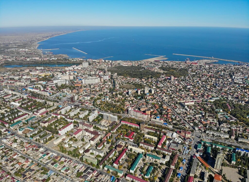
Makhachkala is nestled on the shores of the Caspian Sea, near the Andzhi-Aka mountain range. Among the cities of the North Caucasus Federal District, Makhachkala is considered the largest. It is the centre of tourism in Dagestan.
The history of the city begins in 1844. At that time the settlement Petrovskoe which served as a military fortification was established on the territory of future Makhachkala. In 1857, the settlement was given the status of a town. It was named Petrovskoe in honor of Tsar Peter I who, according to a legend, had established a military camp here during the Persian wars. The town was given its present name in 1921 and at the same time it became the capital of the Republic of Dagestan.
The beauty sights start already on the way from the airport to the city: look out for the fabulous arch of the airport bridge. Makhachkala has many beautiful places which every tourist should visit. You can move around on foot or rent a bicycle. They don't have a bike-rental mobile app yet like in Moscow, but you can make an appointment by phone and then you can ride peacefully through the parks of the city. And you can even get to the observation deck on Mount Tarki-Tau by riding past the many joggers.
You can swim in the Caspian Sea and bask in the sun on one of the city's beaches. Some of them are not free of charge, and there's even one beach where only women and children are allowed. The moderate winds here allow for some kitesurfing.
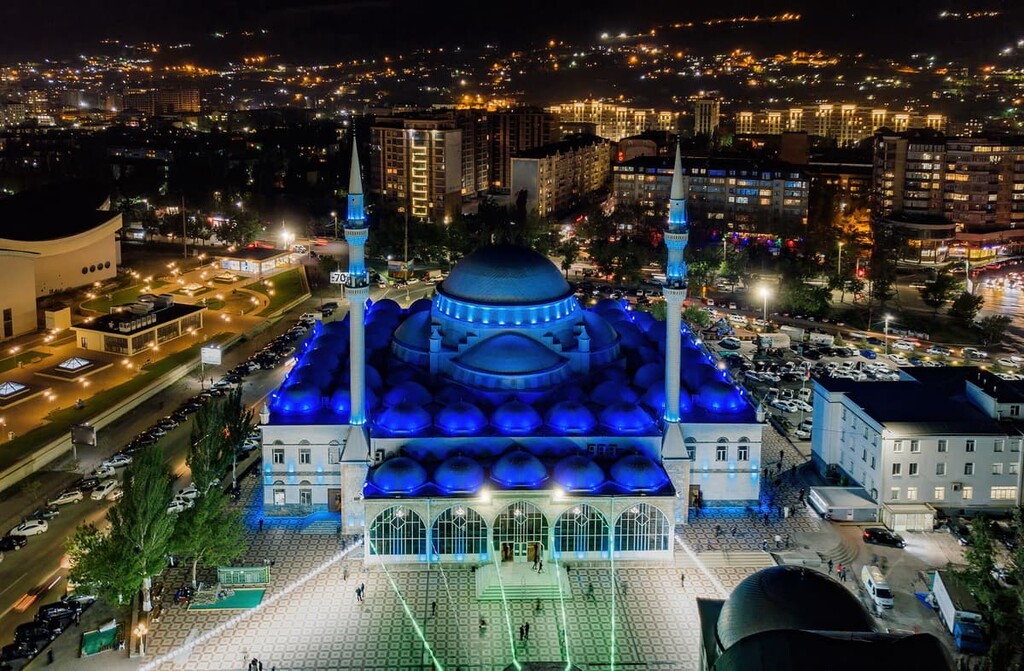
The Juma Mosque is considered the true gem of the city. The white-washed building with its elegant vaults is one of the largest mosques in Europe.
Tourists should see the Petrovsky lighthouse. It was built in 1866 and is not only one of the oldest buildings in the city, but is also considered the first lighthouse built in Makhachkala.
There are 18 museums and 10 theatres. Makhachkala has its own Philharmonic Hall. The unusually large number of theatres attracts visitors to the republic. Apart from traditional drama, opera and children's theatres, there are theatres representing the cultures of the region's various ethnic groups.
Numerous excursions are organised to the Albanian temple, the Juma Mosque, the Derbent Lighthouse, the house of Peter the Great, the medieval Kyrkhlar cemetery, the Carpet Museum, Orthodox cathedrals and many other memorable places.


top50
ultra
russia-ultras
azerbaijan-ultras
top50
ultra
russia-ultras
azerbaijan-ultras
Yes. Dagestan has 754 named mountains. The highest is Bazardyuzyu - Bazardüzü at 4,466 m.
The highest mountain in Dagestan is Bazardyuzyu - Bazardüzü, at 4,466 m.
Dagestan has 754 named mountains.


