
Scan the QR code and open PeakVisor on your phone
Tlyaratinsky State Nature Reserve (the Republic of Dagestan, Russia) is located on the steep northern slopes of the Greater Caucasus Range and south-western spurs of the Lateral Ridge, at altitudes ranging from 1500 to almost 4000 m above sea level. The highest point is Mount Butnushuyer, whereas the most popular is Mount Chodoridag. Almost the entire territory of the reserve belongs to the Jurmut River basin. Once this area had been assigned as a protected area, it became part of the bigger Dagestan Reserve.
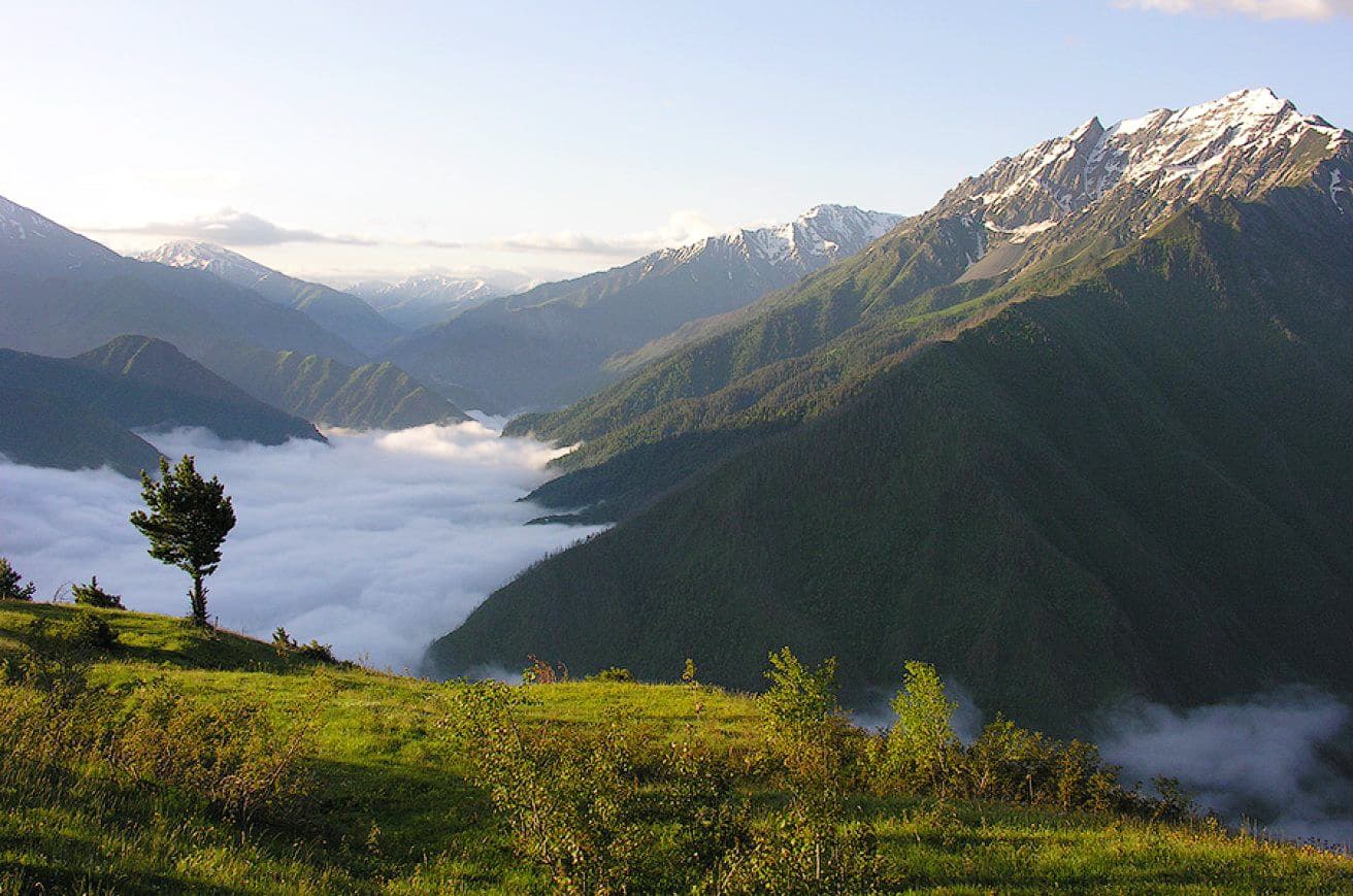
Photo from Dagestan Reserve official website
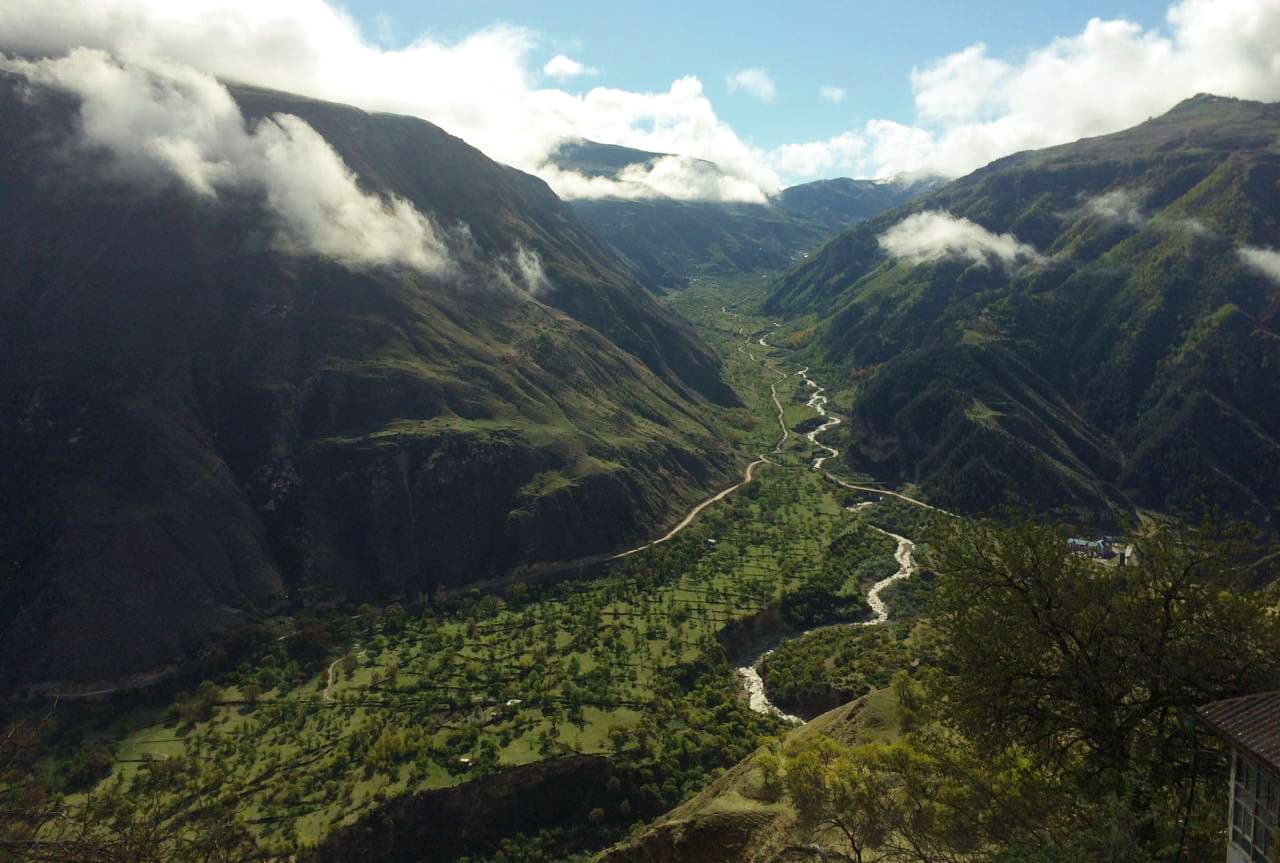
These hard-to-reach places are protected by the state. Despite the fact that there are 11 settlements and plenty of grazing livestock, human presence is greatly limited and all those cultivated fields and vegetable gardens occupy a relatively small area. Small, densely built and very picturesque villages are usually located on steep southern slopes on the right bank of the Jurmut River.
The relief here is typically mountainous, with steep slopes and deep gorges. The climate of the surrounding lands is continental and generally moderately warm. However, it is also influenced by the mountains. Thus, if in the valley of the Jurmut River the average annual rainfall is about 700 mm, it can reach up to 1000 mm on the slopes of the Greater Caucasus Range, and on the most elevated areas covered with perennial snow drifts precipitation decreases to meagre 500 mm or less. January is the coldest month and July is the warmest. The absolute maximum temperature is +35 °C, the minimum -33 °C.
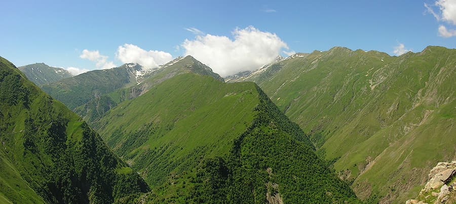
Photo from Dagestan Reserve official website
The area has come under the scrutiny of nature conservation organizations because of its unique fauna, which is rich in rare species of animals, many of them are listed in the Red Book. The Tlyaratinsky Reserve was established to preserve these species and habitats in the highlands. These are ungulates: a bezoar goat, a Caucasian red deer, an Eastern Caucasian tur. The latter species is often called Dagestani tur, it usually roams hard-to-reach rocky areas of the mountains above the forest border. What is utmostly astounding about this animal is its horns, they grow up to 1 meter and are very thick. These animals change the colour according to the season, they are brown or dark beige in winter and their colour pales significantly in summer time. Currently, there are about 10 000 turs who usually have herds consisting up to a hundred animals. Finally, you will see here cutely graceful chamois that live on the steepest rocky slopes in the highlands.
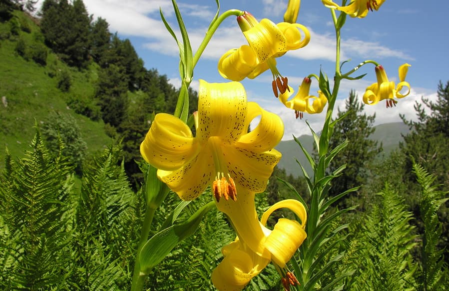
Photo from Dagestan Reserve official website
What is interesting about local chamois, they have a characteristic black stripe stretching from ear to eye. Curiously, both males and females have horns. In Russia, these ungulates live exclusively in the Caucasus. In summer, small herds of chamois graze in alpine meadows, and in winter they descend lower to escape from snow and wind. However, if animals are constantly disturbed by humans, they can climb high into the mountains, from where they make morning raids on mountain meadows. Young animals and females are united into small herds, from 10 to 30 animals. Links in this group, though not constant, are quite developed. For example, one of its members always acts as a guard and in case of danger warns the others with a kind of whistling. As a rule, the herd is led by an experienced female. The males are kept apart almost all the time. It feels almost like a lion pride.
Predators inhabiting the region are brown bear, lynx, stone marten and sometimes the rarest Persian leopard. As part of the programme to restore the population of leopards in the Caucasus, which is being implemented jointly by specialists from the Russian Academy of Science, the WWF Russia and the Ministry of Natural Resources of the Russian Federation, Dagestan and North Ossetia were recognized as the most suitable regions for releasing young leopards into the wild.

In 2018, the area of the Reserve was expanded to 383 thousand hectares, almost 5 times larger than it used to be, all done in order to be able to release leopards into the wild. Leopards prefer singular life; the individual area of a male can reach 50 thousand hectares.
In addition, among the main protected objects are rare species of birds: Caucasian snowcock, Caucasian grouse, peregrine falcon, golden eagle, griffon vulture, vulture and others.
The variety of natural zones and landscapes of the reserve allows for a unique symbiosis of snow-covered peaks and stony slopes and mounds, alpine meadows, mountain steppes on southern slopes, coniferous and mixed forests. Over 600 species of higher plants grow here, including 17 species listed in the Red Books of Russia and Dagestan. There are many relic forms and endemics among them. One of the rarest plants found in the sanctuary, with large yellow flowers, is named after the famous nature researcher of the Caucasus Ludwig Mlokosevich.
And another beautiful flower found only in the Eastern Caucasus is the bell of Colleenati. It looks very spectacular: on numerous erect stems, there are one or two, and sometimes up to five, large, up to 5 cm in diameter, purple flowers.
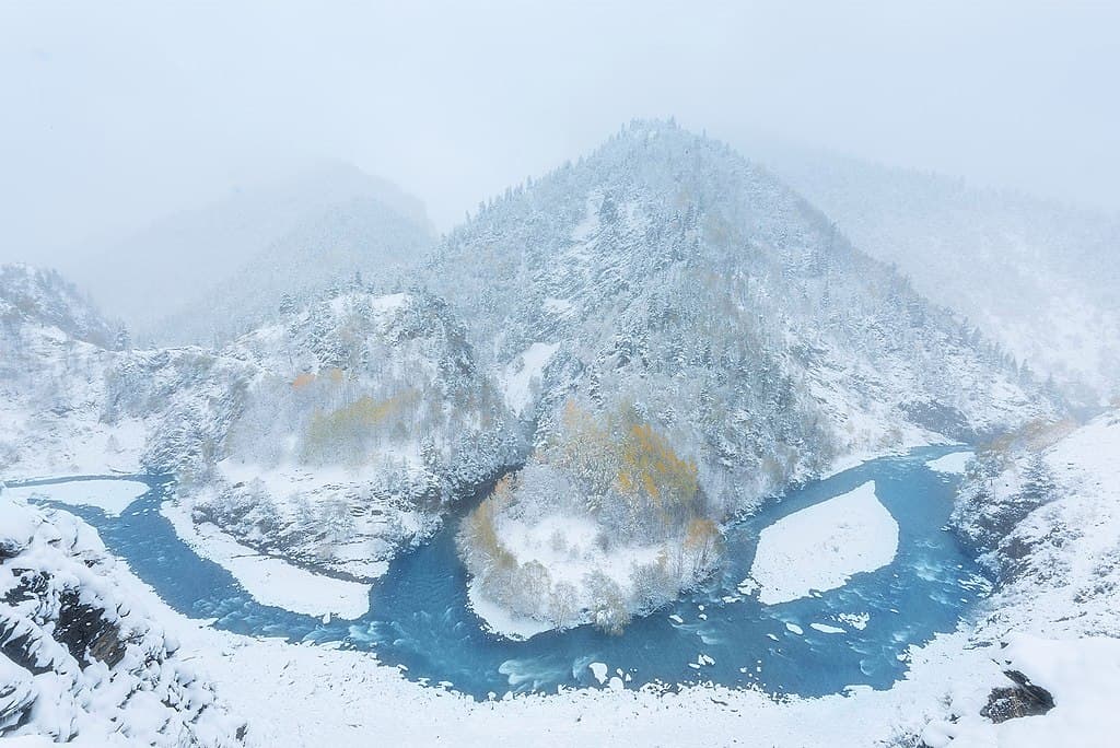
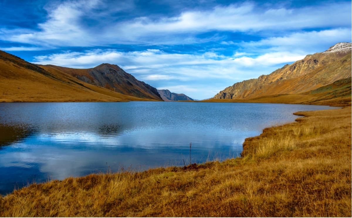
Numerous mountain rivers that rapidly carry their waters down the slopes deserve special attention. Along the south-western outskirts of the reserve, along the border with Georgia, among the ancient glaciers there are several dozens of beautiful mountain lakes. The Chodoridag Range – the highest among the spurs of the Greater Caucasus Range – has three beautiful lakes on the left bank of the Jurmut River.
The majority of lakes are found in the place called the Plateau of lakes that fall asleep named so in 1968 by G.I. Anokhin, the researcher of this area.
Lake Hala-Hyel is located on the very border with Georgia. Trekking goes through picturesque mountains, you can drop to small villages, called auls. Those mountain villages remind of the local chamois clinging to rocks. You will get acquainted with the life of mountaineers – their traditions, ancient crafts and hospitality.
Start from Tlyaraty village and go a few kilometers to Talsukh village. There is a picturesque hiking trail from there, you will go over numerous wooden and stone bridges across the river and over rocky cliffs. It's a pleasure to walk along such a trail. It is often a narrow man-made shelf at a height of about 10-15 m between vertical rocks. It is 12 km in a straight line from the starting point to Hala Hyel Lake. The height difference is between 1500 and 2800 m. The crossing takes 7-9 hours. Actually, there are a lot of lakes scattered along the path, the Hala-Hyel is the biggest. It is located at an altitude of 2,783 m. Around this alpine lake, in the hollow of the central part of the plateau, there are four more lakes. In summer the water in the lakes is warm and you can swim with pleasure.
The reserve is located in the south of the Republic of Dagestan. To get here, you need to get to the town of Tlyarata (200 km) that has shuttle bus service with Makhachkala. Then, take local shuttle buses from the district centre to other settlements. Optionally, you can hire a car from the staff of the Reserve or hire some locals to transport you to the destination point (but here good haggling skills and Russian language are a must) NB. Tlyarata lies almost on the border, so make sure you have your passport with you at all times.
The address of the Tlyaratinsky Reserve:
367010 Dagestan, Makhachkala, Gagarina Street 51
Tel: +7 872 262-4727, or +7 872 262-1401
But in case of emergency, it is better to contact the administration of the bigger Reserve - Dagenstansky, which is located on the same street, but at least has an official website and email.
367010 Dagestan, Makhachkala, Gagarina Street 120
Tel: +7 872 251 88 58
Email: zapoved@xtreem.ru
Makhachkala is the capital of Dagestan. Makhachkala has rail connections with Moscow, Rostov-on-Don, Volgograd, Astrakhan, Baku, and others. There is an international airport Uytash (on the outskirts of the city close to the Caspian Sea, half an hour drive from Makhachkala). You can fly from Moscow, St. Petersburg, Mineralnye Vody and other cities of Russia, the countries of near and far abroad. There are two bus stations, one in the northern part of the city, the other in the south, those two hubs service all cities, towns and district centers of Dagestan. You can also take a bust to Moscow, St. Petersburg and other cities.


.jpg)


