Scan the QR code and open PeakVisor on your phone
Ladakh is a mountainous region and union territory located in the northern stretches of India. The mountainous landscape is full of protected regions, trekking routes, and high altitude plateaus. The region contains 24 named mountains, the tallest of which is Saltoro Kangri at 7,742 m (25,400 ft) in elevation, and the most prominent of which is Saser Kangri I with 2,306 m (7,566 ft) of prominence.
The region of Ladakh is situated in northern India. The region is the largest by area in the entire country yet the second least populous, with a population of only around 275,000.
The region spans 59,146 sq km (22,836 sq mi) and is part of the larger Kashmir region, though it is administered as a distinct union territory. Elevations in the region range from 2,550 m (8,370 ft) along the Indus River, up to the summit of Saltoro Kangri at 7,742 m (25,400 ft).
Ladakh is bordered to the south by the state of Himachal Pradesh in India, to the west by the Gilgit-Baltistan of Pakistan and the union territory of Jammu and Kashmir, to the north by the autonomous region of Xinjiang in China, and to the east by the Tibet Autonomous Region (China). However, do note that many of the borders in this region are disputed.
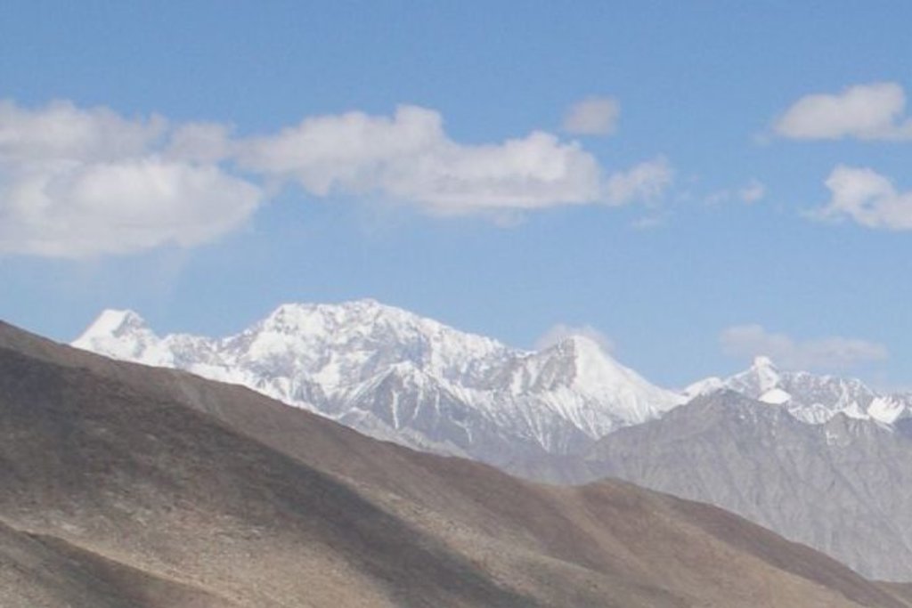
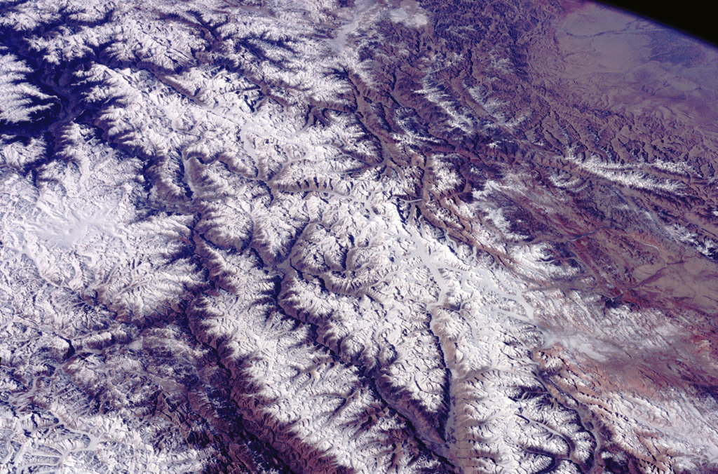
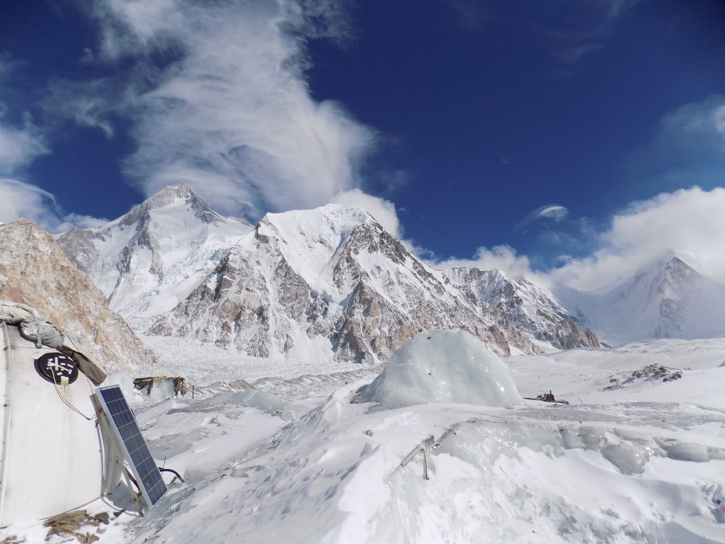
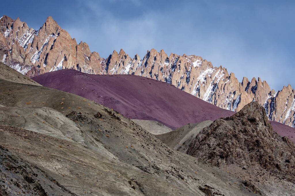
The entire region is known for containing the highest plateau in the country. Ladakh spans from the Himalaya to the Kunlun Mountains. The northern stretches of the region are marked by the Siachen Glacier in the Karakoram range with sections of the Himalaya lying to the south.
Tibet lies directly east of the region with the union territory of Jammu and Kashmir located to the west, and the southwestern corner of Xinjiang in the far north. The high plateaus of Ladakh are separated from the Tibetan Plateau by an intricate series of ridges which lie just east of Rudok.
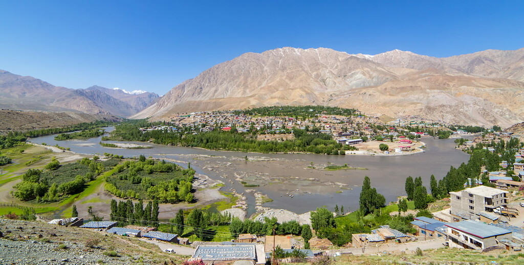
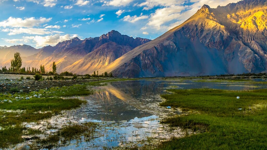
The Indus and Zanskar rivers run throughout the entire region and are one of its defining features as all major settlements in the area are located near them. The Siachen Glacier in the eastern stretches of the region is sometimes called the “Third Pole” due to its expansive size.
Siachen Glacier is currently about 76 km (47 miles) long, making it the longest glacier in the entire Karakoram range. At such an impressive length, the glacier is also the second-longest glacier in the world, excluding the polar regions.
The Himalaya create a rain shadow in this high altitude plateau. Because of this, much of the region does not receive monsoon-related precipitation, which are ubiquitous in other parts of the country. The northern reaches of the Himalaya also cut off travel to the Suru Valley from the rest of the Ladakh region during the winter months due to the typically high levels of snowfall in this area.
Additionally, Ladakh region is home to numerous protected outdoor recreation areas. These include the Changthang Wildlife Sanctuary, Karakoram (Nubra Shyok) Wildlife Sanctuary, and Hemis National Park
The Ladakh region was formed around 45 million years ago when the Indian Plate collided with the Eurasian Plate. The Indian Plate continues to move northward causing the Himalaya to rise around 5 mm (0.2 in) each year.
Nowadays, the Karakoram range is one of the most geologically active areas in both the entire country and the entire world. This range marks the boundary for the Indo-Australian plate and the Eurasian plate.
Today around 35 to 50 percent of the Karakoram range is glaciated, totaling around 15,000 sq. km (5,800 sq. mi). Because much of the glaciers are covered in a layer of sediment, they are melting at a slower rate than those glaciers found in the nearby Himalaya. While the Karakoram are often considered a subrange of the Himalaya, they are two distinct ranges each with their unique characteristics and cultural significance.
The rugged ranges that mark parts of the region are contrasted with the numerous high altitude valleys and plateaus throughout. The Suru and Zanskar valleys lie between the Himalaya and the Zanskar Range.
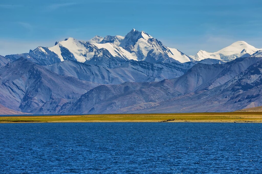
Major peaks within the region include Saltoro Kangri, Saser Kangri I, Saltoro Kangri II, Kangju Kangri, K12, Mamostong Kangri, and Gya.
Due to the lack of rainfall throughout much of the Ladakh region, vegetation is quite sparse. Most plant life can be found along the streambeds or in irrigated places. The unique Ladakiella klimesii plant was named after the region and has been found growing at elevations as high as 6,150 m (20,180 ft) above sea level.
Vegetation found in the wetlands of Ladakh often includes seabuckthorn, mint, stinging nettles, caraway, and various native grasses.
The bharal, also known as the blue sheep, is one of the most populous animal species in the region. Another common animal is the Asiatic ibex, which climbs the steep cliffs when threatened by predators. The Ladakhi Urial is a species of mountain sheep endemic to the region.
Both Tibetan argali and Tibetan antelope are found throughout the region, though their populations are slowly declining. Grasslands in the plateaus of the region are home Tibetan gazelles and kiangs (Tibetan wild asses).
Hemis National Park, which lies in the Ladakh region, is home to over 200 snow leopards. The population of leopards continues to thrive due to their protected nature and abundance of prey. Other predators found in Ladakh include the Eurasian lynx, Pallas’s cat, Tibetan wolf, brown bears, and the Tibetan sand fox.
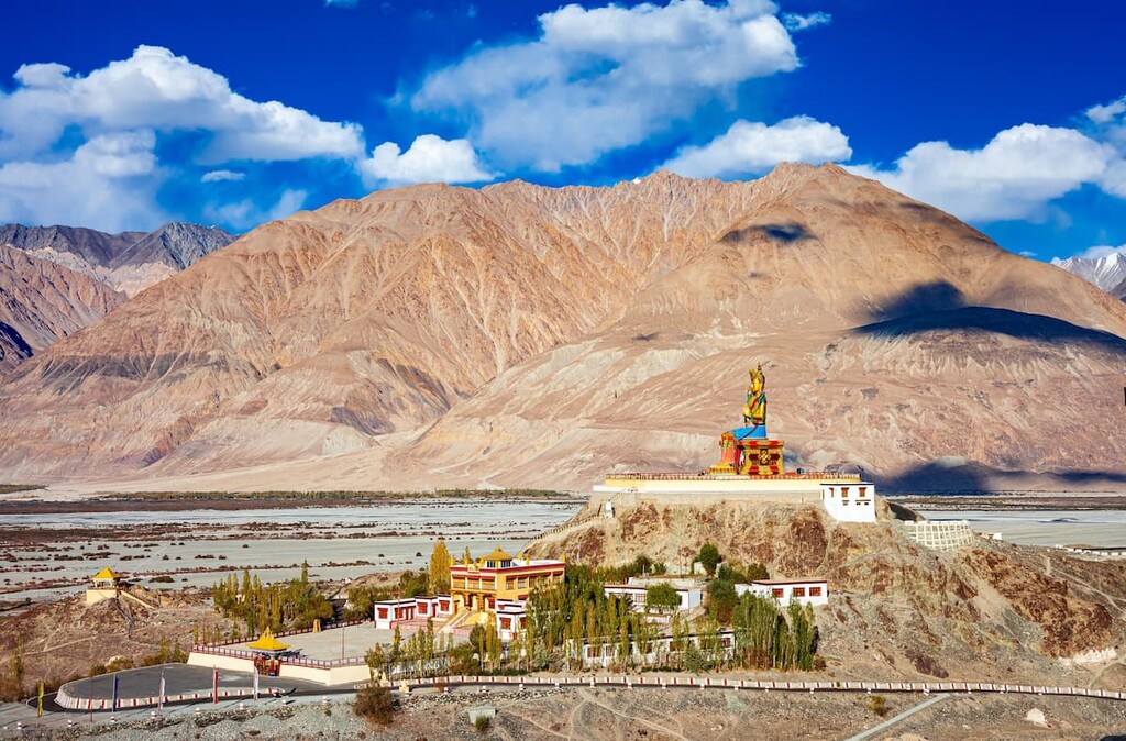
Thanks to rock carvings found in the region, archaeologists estimate that Ladakh has been inhabited since the Neolithic period, which dates back around 12,000 years. During the first century CE, the region was part of the Kushan Empire while Buddhism continued to spread into western Ladakh.
Throughout the first millennium CE, the Ladakh region is thought to have been ruled by the Zhangzhung kingdoms or by Kashmir. During the Medieval period, from around 1380 to 1510, many Islamic missionaries populated the region.

In 1934, Ladakh was claimed as part of Tibet by a Tibetan Communist leader. However, during the time of partition of India, in 1947, the region was signed over to India. The region was divided into the Kargil and Leh districts in 1979, and further divided into Kashmrii in the 1990s.
In 2019, Ladakh became its own Revenue and Administrative Division within Jammu and Kashmir. However, the people of Ladakh wanted the region to be declared as its own union territory. This led to a reorganization act that was passed by the Parliament of India to establish the region as a separate union territory, a status that it holds to this day.
Ladakh region is home to a few protected regions, each with their own trekking routes. Here are some of the top hiking areas to visit in the region:
Perhaps the most visited area in the Ladakh region is Hemis National Park. Besides the rugged peaks of the park, Hemis National Park is known for its high population of snow leopards. With over 200 inhabiting the area, it marks the largest protected population in the world.
The Markha Valley Trek is one of the most popular routes in Hemis National Park, covering much of the park and allowing visitors to stay in homestays throughout the journey. Other popular attractions include guided snow leopard treks. These trips can range from a day hike to a week long excursion in hopes of witnessing the elusive snow leopards.
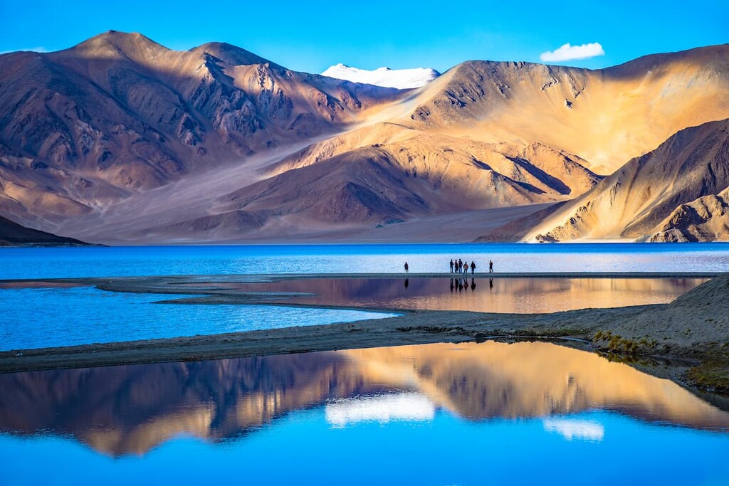
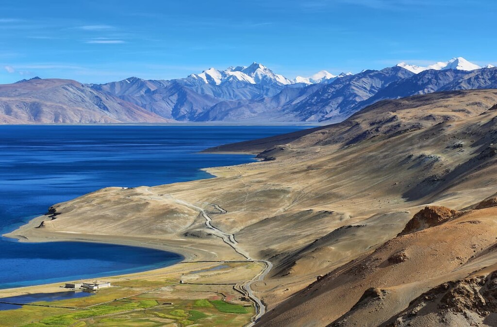
Located on the eastern edge of the region, the Changthang Wildlife Sanctuary shares a border with Tibet to the east. Many of the major hiking trails and multi-day treks can be found near the Himalayan lake Tso Moriri.
The lake sits at an elevation of 4,552 m (14,836 ft) making it one of the highest elevation lakes in the world. Popular routes include the trek to Tso Miori, Rumtse 2 Tso Kar, and Tso Kar 2 Karzok.
The Karakoram Wildlife Sanctuary is one of the most remote protected areas in all of India. Nearby protected areas are far more visited by non-locals and locals alike, so the sanctuary is a great place to visit if you’re looking to get off the beaten path.
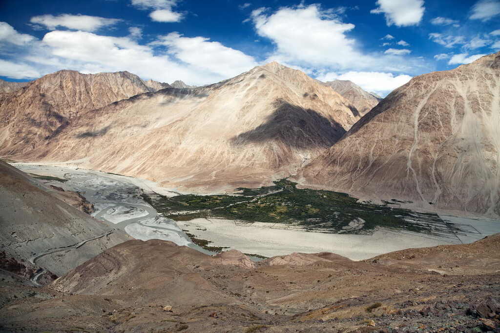
The rugged mountain peaks and remote location make trekking through the region difficult. If visitors do choose to trek in the sanctuary, it is highly recommended that they hire local guides for the journey. Many of the reks for this region start in Leh and the most popular trekking route in the sanctuary is through the Nubra Valley.
Looking for a place to stay in the Ladakh region? Here are some of the best cities and villages to check out in the region:
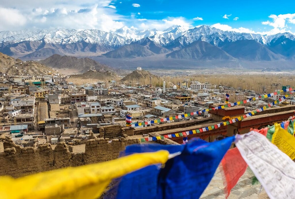
Located just north of Hemis National Park lies the city of Leh. With a population of over 30,000 people, Leh is the most populated town in the Ladakh region as well as the region’s joint capital. Leh is surrounded by a mountainous landscape, making access to it difficult during the winter months.
The town has a long and rich history due its location along the historic “Silk Road.” Inhabited since the eighth century, Leh holds cultural significance for both the Buddhist and Hindu populations of the region. Located along a major highway, Leh is a gateway to much of the protected regions in Ladakh, especially during the warmer months of the year.
In the western stretches of the Ladakh region lies the town of Kargil. Kargil is the second largest town in the region with a population of around 17,000 people. Kargil was the main town in the Indus (Suru) river basin in what was once the Purig Region.
Being located along the Indus River allows Kargil to have a temperate climate. Islam is most widely practed religion in the town followed by Hinduism. Plus, Deosai National Park lies to the northwest of the town while Karakoram Wildlife Sanctuary is situated to the east, so there are plenty of great places to check out if you’re staying in the region.