Scan the QR code and open PeakVisor on your phone
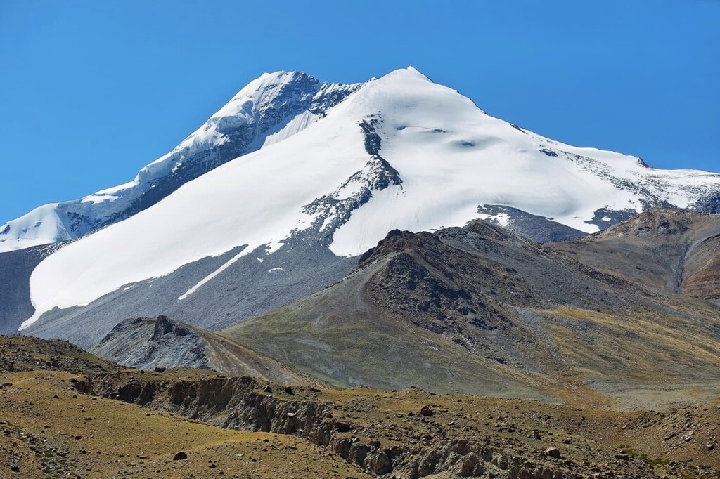
Hemis National Park (Hemis High Altitude National Park) is a stunning outdoor recreation destination known for its mountainous landscape that’s located in the Ladakh region of northern India. The park contains 29 named mountains, the tallest and most prominent peak of which is Kang Yaste I at 5,406 m (17,736 ft) in elevation with 1,450 m (4,610 ft) of prominence.
Hemis National Park is situated in northern India. Interestingly, it is the only national park in the country that is situated north of the Himalaya.
The park spans 4,400 sq km (1,700 sq mi) across the union territory of Ladakh. Hemis National Park is known for being the second largest continuous protected area in the entire country, and it is also one of the largest national parks in all of south-central Asia.
Hemis National Park is located in the Karakoram-West Tibetan Plateau alpine steppe ecoregion. The Ladakh region is home to the highest plateau in India. A majority of the plateau has elevations above 3,000 m (9,800 ft).
The Khuma, Rumbak, and Markha rivers run throughout the park along with the Ladakh Range, which is considered to be an extension of the Karakoram, which themselves are considered to be extensions of the Himalaya. The park's eastern and northern boundaries are marked by the Indus River while the western boundary is set by the Zanskar River.
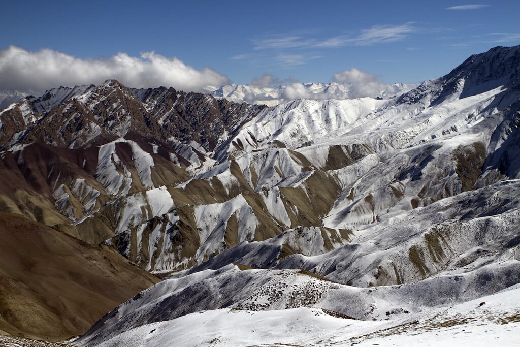
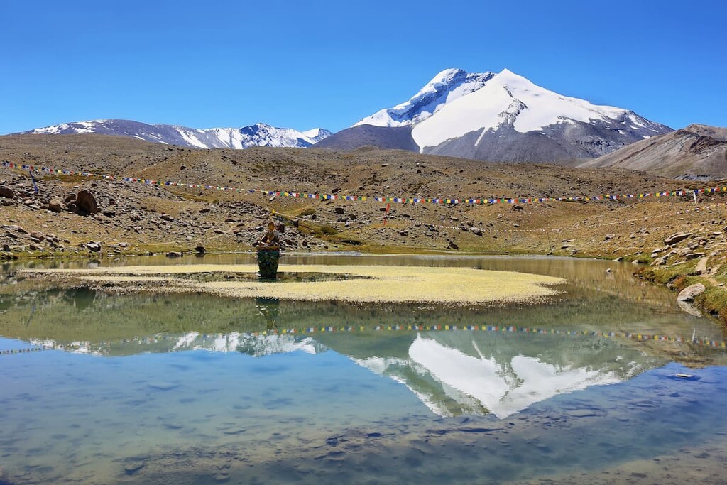
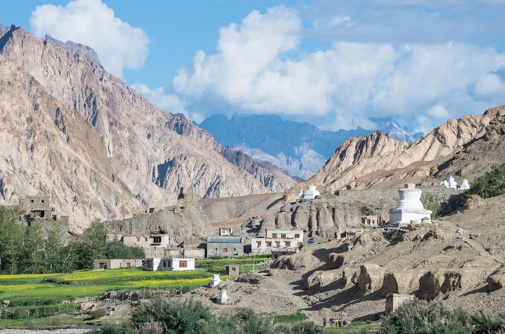
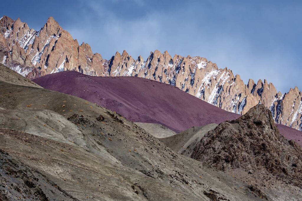
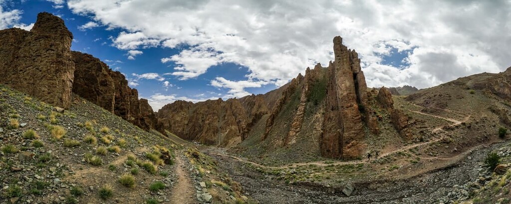
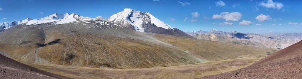
The tall and rugged peaks of the park dominate the landscape and are a sub-range of the Himalaya. Besides the many snow-capped mountains in the Hemis National Park, the region is also home to alpine meadows and alpine shrublands.
Additionally, Hemis National Park is surrounded by other popular outdoor recreation areas. The Karakoram (Nubra Shyok) Wildlife Sanctuary lies to the north, Changthang Wildlife Sanctuary to the east, Kishtwar National Park and Thajwas- Baltal Wildlife Sanctuary to the west and the Sech Tuan Nala Wildlife Sanctuary to the southwest.
The mountains in the Hemis National Park are part of the Himalaya proper. The Himalaya formed around 50 million years ago when the Eurasian plate and the Indian plate collided, giving rise to many of the tallest peaks in the world.
Common rocks found in the park include slate, schist, phyllite, quartzite, dolomit, and crystalline limestone. Since the mountains were formed by the collision of these two plates, there are numerous metamorphic structures as well as shear and suture zones.
Relatively speaking, the Himalaya, along with the sub-ranges located within the park, are a young mountain range. Today the Indian plate is still moving into the Tibetan Plateau, averaging 67 mm (2.6 in) per year. This results in the Himalayan mountains rising around 5 mm (0.2 in) each year.
Major peaks within the park include Kang Yaste I, Point 6300, Djena, KY III, Stok Kangri, Hemis, and Kang Yatse II.
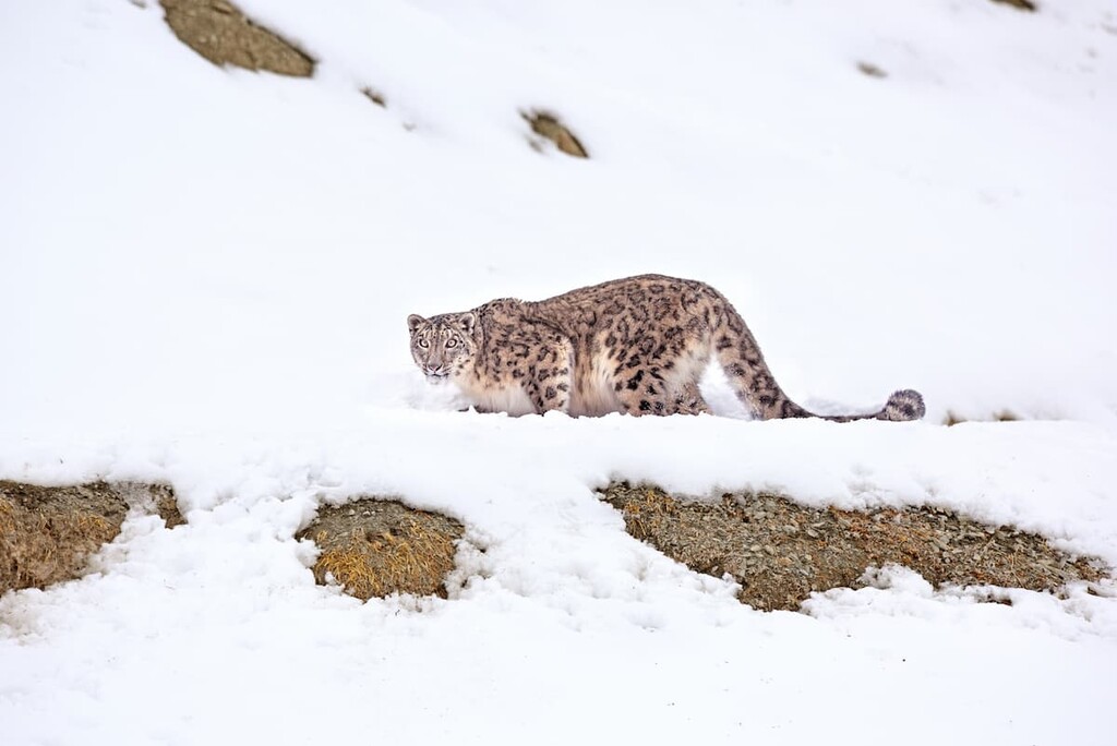
Besides its rugged snow-capped peaks, Hemis National Park is known for its thriving population of snow leopards. Approximately 200 snow leopards live within the park boundaries and surrounding hills, making them the largest protected population in the world.
Other notable animals in the park that allow the snow leopards to thrive are the great Tibean sheep, blue sheep, shapu, and livestock from the surrounding villages. Some of the other animals present in the park include the red fox, Tibetan wolf, Eurasian brown bear, marmot, and weasel.
Birds of prey dominate the skies in Hemis National Park. The Himalayn griffon vulture, golden eagle, and lammergeier vulture are common amongst other species.
Because the park is located north of the main crest of the Himalaya, it does not receive much rainfall. Dry forests can be found throughout the park consisting primarily of juniper, birch, and fir trees. Hemis National Park is also home to rare medicinal plants that are used by the local communities.
Humans have inhabited the region that is now part of Hemis National Park for thousands of years, with rock carvings dating back at least 12,000 years. During the first century, the Ladakh region was part of the Kushan Empire.
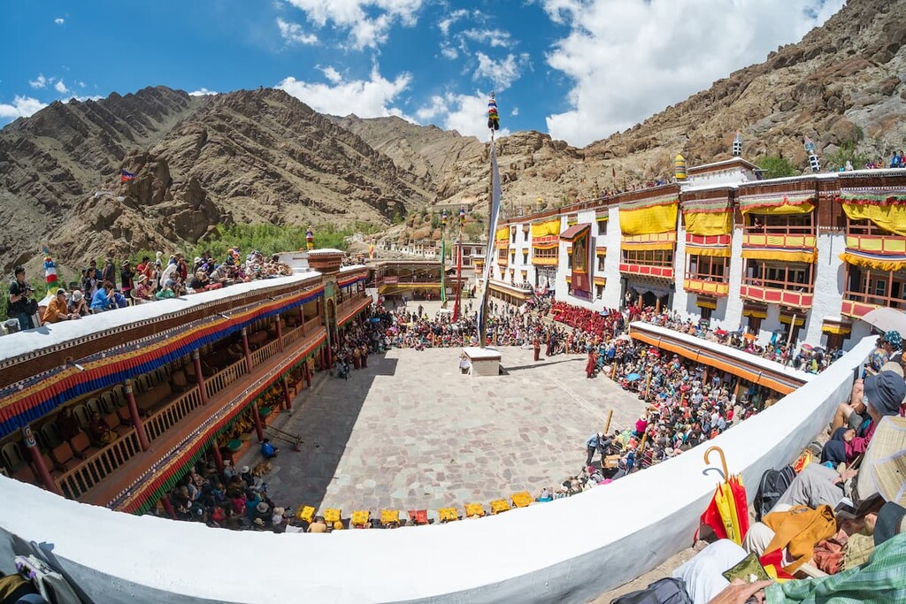
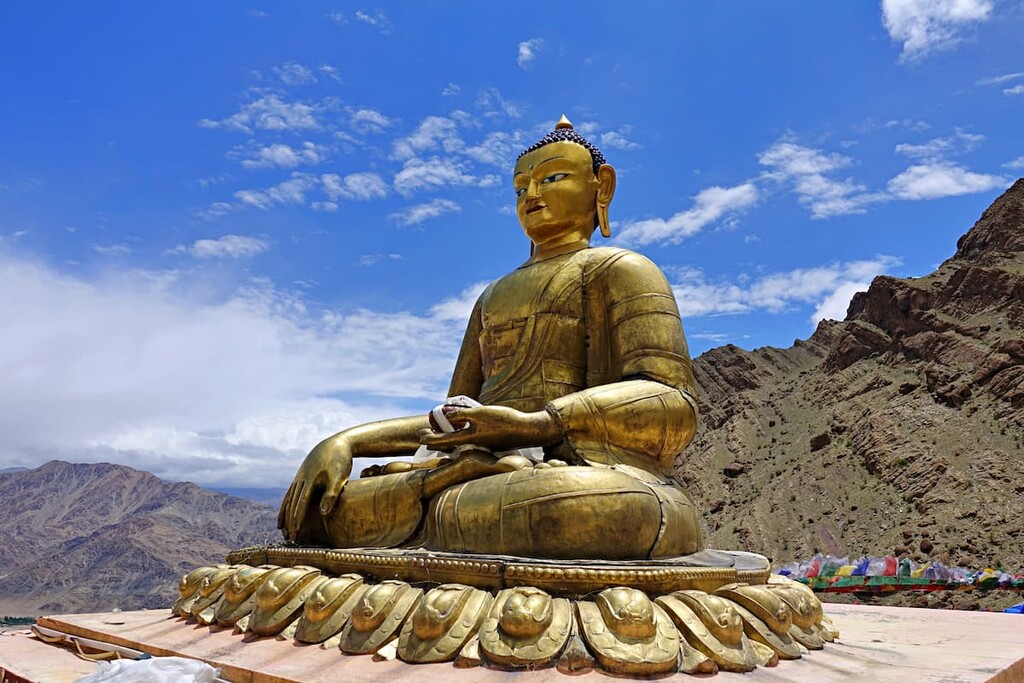
The Ladakh region was under rule from various empires and countries over the following centuries. Nearly 400 years ago, the Hemis Monastery, located on the northeastern boundary of the park, was established. The Himalayan Buddhist monastery is still in use today and parts of it can be visited by tourists.
During the partition of India back in 1947, the region was signed over to India. The park was later found in 1981 and it originally included some 600 sq km (230 sq mi) of land. The park was later expanded in 1988, and again in 1990, to its current size of 4,400 sq km (1,700 sq mi).
Today, over 1,600 people live within the park boundaries. Many of these communities raise sheep and chickens, whose populations are often threatened by the high density of snow leopards.
Hemis National Park is home to numerous trails. Here are some of the top hiking areas to visit in the park:
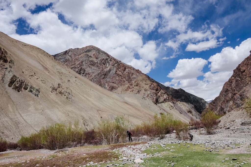
The Markha Valley trek is one of the most popular routes in the entire park. The multi-day trail is 111 km (69 miles) and goes over three high mountain passes.
This route is often completed over the course of 5 to 8 days. Homestays are very popular on this route as the trail leads through some of the villages and communities that live within the park’s boundaries.
Though it is 36 km (22 miles) in length, the Spituk to Stok Trek is one of the easier long distance treks in the park.
The trail follows along the contrasting landscape of the region while moving through the Zingchen valley. During the trek, snow capped mountains tower above, and the remote nature of the trail allows for an abundance of wildlife.
Because the Hemis National Park is so protected, there are many guided treks that hope to offer visitors views of the elusive snow leopards of the region. These treks can range from a one day hike to a multi-day adventure, so it’s best to discuss the type of trip you’re looking for with your guide service before you head to the park.
Looking for a place to stay near Hemis National Park? Here are some of the best cities and villages to check out in the region:
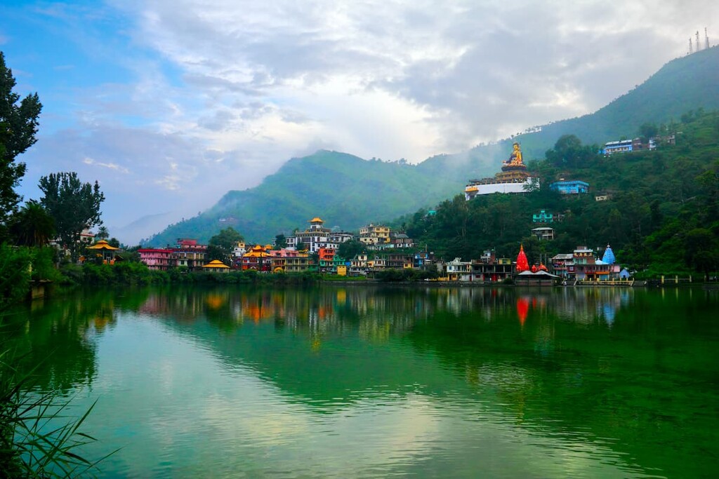
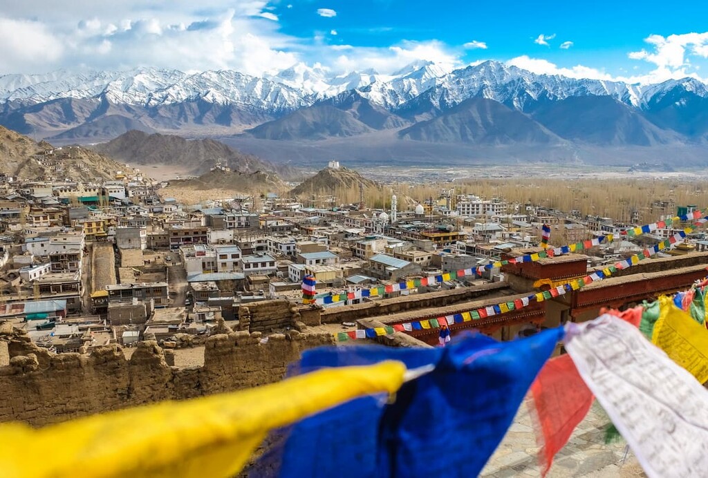
The nearest city to Hemis National Park is the city of Leh, located just 10 km (6.2 miles) to the north of the park. Leh is both the capital and the largest city in the union territory of Ladakh. The city has a population of around 31,000 residents.
Both Buddhism and Hinduism are prevalent within the city. Leh sits on the historical “Silk Road” and has been inhabited since the eighth century. The city's relatively large size for the region allows it to act as a transportation gateway to other nearby communities, parks, and wildlife sanctuaries.
The city of Srinagar lies a ten hour drive to the west of Hemis National Park. However, this major city has frequent flights into Leh in order to visit the park. Srinagar is the capital and most populous city of the union territory of Jammu and Kashmir.
Srinagar lies in the Kashmir valley along the bank of the Jhelum River. The city has a population of 1.3 million people. The city is sometimes called “Venice of the East” due to it being surrounded by lakes such as Dal Lake, Nigeen Lake, Wular Lake, and Manasbal Lake. Houseboats and Mughal gardens, along with the Sher Garhi Palace, make Srinagar a major tourist destination in the region.