Scan the QR code and open PeakVisor on your phone
Qinghai is a large, isolated province on the Tibetan Plateau in northwestern China, home to 152 named mountains. Bukadaban Feng is the highest point at 6,860 m (22,507 ft) and the most prominent peak is Mount Shulenan (5,808 m/19,055 ft).
Qinghai (青海, Qīnghǎi) occupies a massive, high-altitude area of northwest China (中国, Zhōngguó), covering vast plains, mountain ranges, and the largest lake in the country. The province’s name translates literally to “blue-green sea,” a reference to its namesake Qinghai Lake, the largest lake in China.
Qinghai is the fourth largest province in China by area and the second least densely populated, after Tibet ( Tibetan: བོད་, Böd; Chinese: 西藏, Xīzàng). It borders Xinjiang (新疆, Xīnjiāng) to the northwest, Gansu (甘肃, Gānsù) to the northeast, Sichuan (四川, Sìchuān) to the southeast, and Tibet to the southwest. The capital and largest city is Xining (西宁, Xīníng).
Most of Qinghai falls along the northeastern edge of the Tibetan Plateau, the highest region in the world. The average elevation in Qinghai is around 3,000 m (9,300 ft). Three of Asia’s most important rivers, the Mekong, the Yangtze, and the Yellow River all have their sources in Qinghai’s mountains.
This remote, vast region has long been home to many different ethnic groups, including Mongols, Tibetans, and Hui Muslim communities. Han Chinese, the dominant ethnic group in eastern China, make up just over half of the population in Qinghai. Today, there are 37 recognized ethnic minorities living in the province.
Qinghai has historically been a rural and remote area, with most of the population engaged in agriculture or nomadic herding. Today, it’s an important region for mining minerals, petroleum, and natural gas.
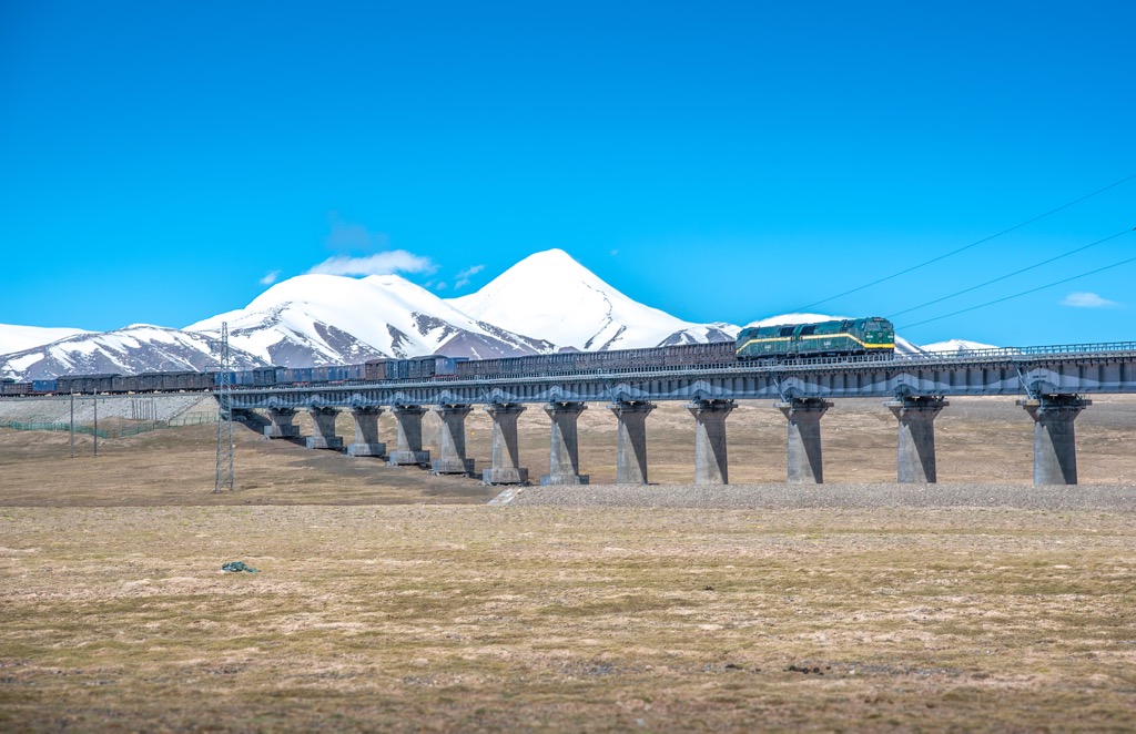
While Qinghai was deeply isolated from eastern China for most of its history, new railway lines and major highways opened in the last decade or so are starting to tie the province closer to the rest of China.
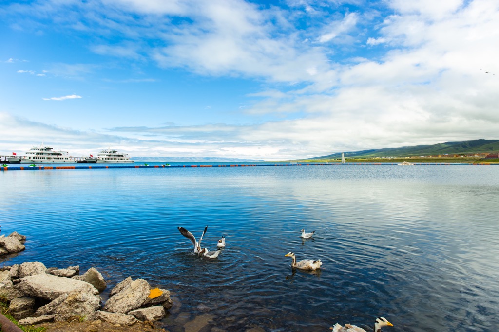
Qinghai isn’t well-known to foreigners, but it’s becoming a popular destination for Chinese tourists. The biggest draw is Qinghai Lake, which is a massive saltwater lake situated in the Qilian Mountains.
The most famous long-distance trek in the region is the Amnye Machen Kora, which circles the second holiest mountain in Tibetan Buddhism.
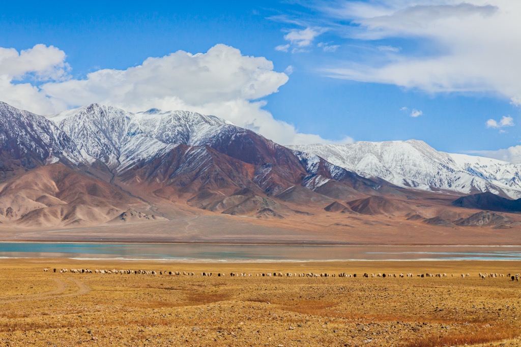
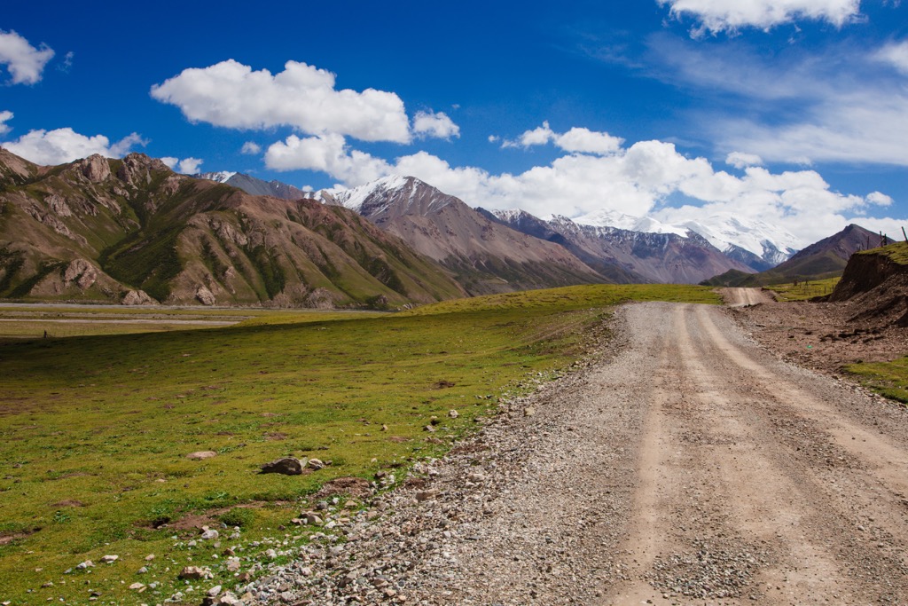
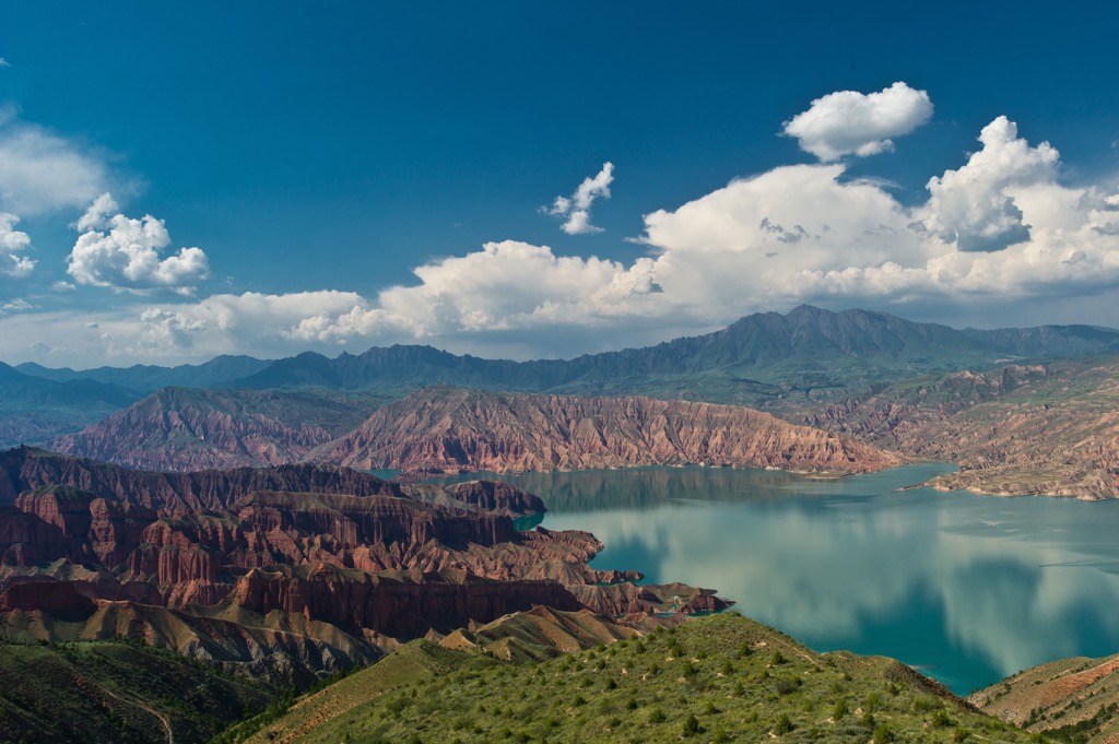
Qinghai’s geography and geology are dominated by the Tibetan Plateau, which is the highest-elevation region in the world. The major range in Qinghai is the Kunlun Mountains, which extend over 3,000 km (1,900 mi) through western China, making them one of the longest ranges in Asia.
The Kunlun Mountains cut across the center of Qinghai, framing the Tibetan Plateau’s northern edge. The Altun Shan and Qilian Mountains, which are a spur of the Kunluns, form Qinghai’s northern border with Gansu province.
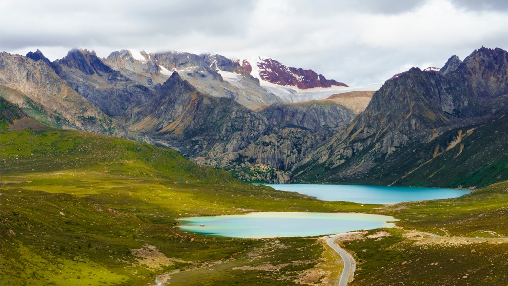
To the south, another spur of the Kunluns, the Bayan Har Mountains, separates the Yellow and Yangzte River watersheds. The headwaters of the Yellow River are found in the northern end of the Bayan Har Mountains, while the source of the Yangtze is further south in the Tanggula Mountains.
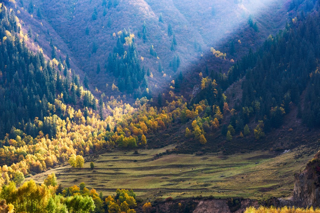
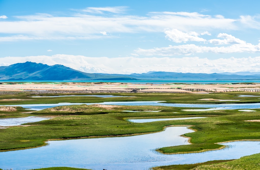
Between these mountain ranges, Qinghai’s landscape features wide plains, grasslands, and rolling hills. An 83,000 sq km (3,200 sq mi) region of northeastern Qinghai called Hoh Xil (Tibetan: ཧོ་ཧོ་ཞི་ལི ཨ་ཆེན་གངས་རྒྱལ; Mongolian: ᠬᠥᠬᠡ ᠰᠢᠯ; Chinese: 可可西里) is considered the largest and highest plateau in the world, and it was declared a World Heritage Site in 2017.
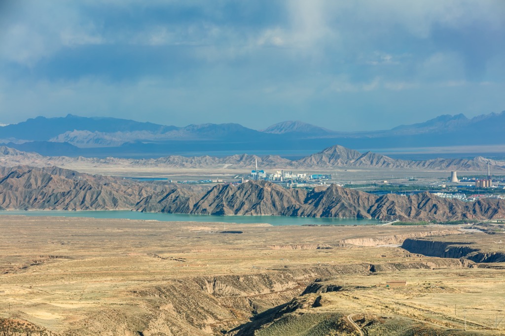
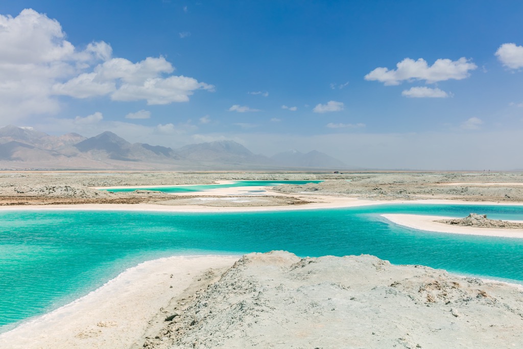
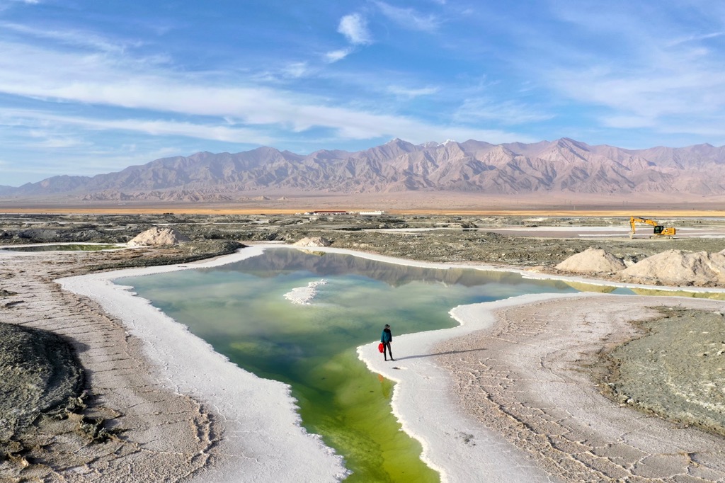
One of Qinghai’s unique geographical features is the Qaidam Basin, which is one of the most arid places in the world. The 120,000 sq km (46,000 sq mi) basin is endorheic, meaning none of its water flows out to sea.
About a quarter of the land area in the Qaidam Basin is covered by saline lakes and salt flats. Just one region, the Qarhan Playa, holds over 50 billion metric tons of salt. The basin is also home to China’s largest reserves of magnesium, potassium, and lithium, and one of the largest onshore oilfields in China.
As part of the Tibetan Plateau, Qinghai is connected to the seismically active region of the Himalaya and earthquakes can occur in the province. A major earthquake in 1927 killed about 200,000 people in Qinghai and a 6.9 Mw moment magnitude earthquake struck in 2010, killing several thousand people and destroying most of the buildings in the epicenter region.
The highest point in Qinghai is Bukadaban Feng (6,860 m/22,507 ft) located along the western border between Qinghai and Xinjiang. The second highest peak in the province is Geladaindong in southern Qinghai, which is the highest point in the Tanggula Mountains and was traditionally thought to be the source of the Yangtze (the actual source is nearby).
The third highest peak in the province is Dradullungshog, the highest point of the Amnye Machin massif, which is revered as one of the most sacred mountains in Tibetan Buddhism.
Qinghai is known for its high altitude and correspondingly harsh climate. Winters are long, cold, and dry with January temperatures averaging −18 to −7 °C (0 to 19 °F), while summers are warm but mild with July temperatures ranging from 15 to 21 °C (59 to 70 °F).
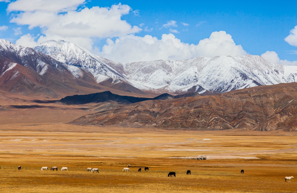
Temperatures can swing dramatically between day and night, even in the summer months, and most of the province is classified as arid or semiarid. Most of the land area in Qinghai is covered by grassland, with some areas of subalpine tundra and desert.
There are many unique plants and animals in Qinghai that have adapted to the harsh climate and high altitude. In particular, about one-third of the plant species and 60 percent of the mammal species on the Hoh Xil plateau in western Qinghai are endemic to the area.
Qinghai’s desolate, uninhabited areas are home to many species of large mammals, including Tibetan antelope, Tibetan gazelles, White Lipped deer, wild yaks, bears, wolves, and snow leopards.
Qinghai has been home to various groups of people for thousands of years. Some of the earliest residents are thought to be the ancient Qiang people, an ethnic group separate from the Han Chinese (the dominant ethnic group in China today). Some scholars believe the Qiang are the ancestors of modern-day Tibetans.
Much of Qinghai is traditionally part of Tibet, called Amdo province by Tibetans. Tibetans are still one of the largest ethnic groups in the province. In fact, the current Dalai Lama was born in Taktser, eastern Qinghai.
With its place at the edge of traditional Tibetan, Mongolian, and Chinese territory, Qinghai was long a contested zone between these major powers. The Han dynasty sought to keep Qinghai people out of the core of the empire, but by around 200 CE they had set up frontier settlements in the area.

Around 300 CE, a kingdom made up of local Xianbei nomadic peoples, called the Tuyuhun, took control of the area. They conquered territory from eastern Shaanxi province in China all the way to the borders of Afghanistan and Kashmir, unifying parts of central Asia for the first time.
In the mid-600s CE, the Tuyuhun fell to conflicts with the Tibetan Empire and the Chinese Tang Dynasty, and the Tibetan Empire took control of the area. By the mid-800s CE, the Tibetan Empire had collapsed and Qinghai was ruled by decentralized local kingdoms again.
The Tibetans brought Buddhism to the area, while at the same time Silk Road traders from the west brought Islamic influences. Several Muslim groups, including the Salar, migrated to Qinghai from farther west.
The Mongols took control of Qinghai in the mid-1200s, and for the next several hundred years the Mongol Yuan dynasty and then a Mongol successor state, the Khoshut Khanate, controlled Qinghai.
The Chinese Qing dynasty conquered Qinghai in 1724, but they had minimal control and the area was still fairly decentralized. Qinghai didn’t formally become a province until 1928. Even then, Qinghai wasn’t run by the central Chinese government but by a local Chinese Muslim warlord named Ma Bufang.
Ma began a program to modernize and industrialize Qinghai, but the Communists took control of the province during the Chinese revolution of 1949. Local Hui Muslim forces led an insurgency against the Communists for the next nine years.
Today, Qinghai’s diverse population stands as a testament to the many groups who have controlled the area over the past several thousand years. There are a total of 37 recognized ethnic groups in Qinghai, with Han, Tibetan, and Hui Muslims beings the largest groups.
If you’re looking to get off the beaten path in China, then head to Qinghai. Hiking in Qinghai is all about wide-open space and wild, remote destinations.
If you’re visiting Qinghai, you’ll almost certainly visit its namesake lake. Qinghai Lake (Chinese: 青海湖, Mongolian: ᠬᠥᠬᠡ ᠨᠠᠭᠤᠷ, Tibetan: མཚོ་སྔོན་པོ་) is the largest lake in China, covering 4,317 sq km (1,667 sq mi). It’s still sometimes known by its Mongolian name, Koko Nor.
The striking blue color of the lake and its surrounding salt ponds have made it the biggest tourist attraction in the province. Qinghai Lake is located in an endorheic basin, meaning the water here stays within a closed system and doesn’t flow out to sea or another large body of water. Evaporation has made it an alkaline saline (salt) lake.
Qinghai Lake is located just a few hours from the capital city Xining, so it’s easy to visit as a day trip. There are many tour agencies in town that send daily buses to the lake, or you can hire a private car.
As far as hiking at Qinghai Lake, most tourists opt to walk a short distance along the western shore of the lake. There’s also a Buddhist pilgrimage route that circles the entire lake, which takes 2-3 weeks to complete.
Sanjingyuan National Park is one of the newest preserved areas in China, part of the country’s effort to create a large network of modern national parks aimed at wildlife and land conservation.
The park covers a massive, noncontiguous area stretching across southern Qinghai, with its total land area roughly equal in size to England. The protected regions are divided into forest, wetland, or wildlife conservation areas.
Animals found in the park include wolves, bears, wild yak, Tibetan antelope, snow leopards, and argalis, which are the largest species of wild sheep in the world. Male argalis can weigh over 315 kg (700 lbs) and stand 1.3 m (4 ft) at the shoulder.
Sanjiangyuan translates to “source of three rivers, a reference to the Yangtze, the Yellow, and the Mekong Rivers, which all rise in protected areas of the park. The rivers supply water to over 1 billion people in Asia.
Given its size, there are dozens of places to visit in Sanjiangyuan for hiking and trekking. The easiest and most common way to visit the park is with an organized tour group.
There’s little to no public transportation in the region and distances between sites are far. It can be difficult to get around even with Mandarin language skills, given the high number of Tibetan speakers.
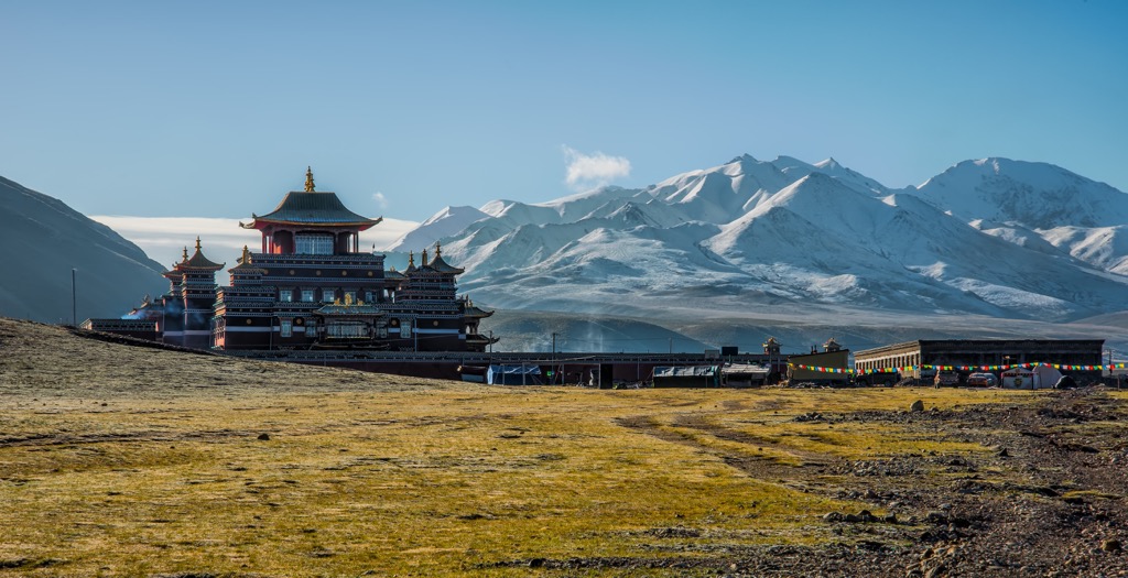
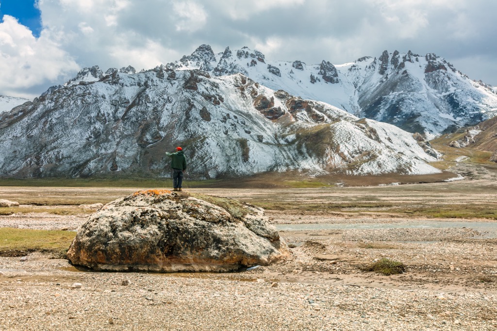
Amnye Machin ( Tibetan: ཨ་མྱིས་རྨ་ཆེན་) is the premier destination for trekking in Qinghai. It’s been a site of pilgrimage for hundreds of years, sacred to both Buddhists and practitioners of the Tibetan Bön faith. Amnye Machin is the highest peak in the Tibetan region of Amdo, and for a time in the early 1900s, the mountain was thought to be higher than Everest.
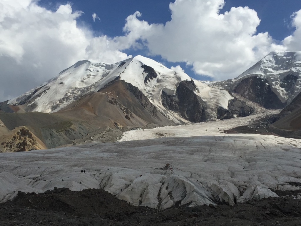
The name Amnye Machin refers to the entire range, which is 28 km (17 mi) long and contains a total of 13 peaks over 5,800 m (19,028 ft) . The highest point, called Dradullungshog, reaches 6,282 m (20, 610 ft). Glaciers cover a total of 125 sq km (48 sq mi) of the range.
Climbing Amnye Machin is a feat for serious mountaineers, but the pilgrimage route that circles the mountain, called a kora, is popular with Tibetan Buddhists. The traditional route takes 6 to 9 days and covers about 105 km (65 mi). There are also other, shorter routes that have been put together by local tour agencies.
This is a high-altitude trek, with most of the route lying above 4,150 m (13,600 ft). There are two mountain passes on the trek with elevations over 4,260 m (14,000 ft). The easiest way to get to Amnye Machin is with a tour group from Xining, but it’s also possible to catch a minibus to the trek starting point from Machen, the capital of Golok prefecture.
Hoh Xil (Tibetan: ཧོ་ཧོ་ཞི་ལི ཨ་ཆེན་གངས་རྒྱལ; Mongolian: ᠬᠥᠬᠡ ᠰᠢᠯ; Chinese: 可可西里) is one of the highest, harshest, and most remote places in the world, home year-round average temperatures below freezing and almost no people. The region occupies a plateau at an elevation of about 4,500 m (14,770 ft).
The 83,000 sq km (3,200 sq mi) plateau in northeastern Qinghai was declared a UNESCO World Heritage Site in 2017 to protect its sweeping landscapes and many species of large mammals, like snow leopards, wild yaks, and Tibetan antelope.
One of the distinguishing features of Hoh Xil is that it’s almost completely uninhabited. Most of the area has next to no signs of human impact. As such, it’s difficult to travel here and tour groups are forbidden in some places. The Qinghai-Tibet highway and railway pass along the eastern edge of the plateau, providing the only access to the area.
Kanbula National Forest Park is only about 100 km (62 mi) outside Xining, so it’s an easy stop for anyone visiting Qinghai. While the park has large forests and a huge dam-effect lake, the biggest draw are the unique danxia landforms.
In Kanbula National Forest, danxia (a soft, red sandstone) forms dramatic, pointed spires reaching up to the sky. The standard tour of the park will take you through a forest of pyramid-shaped towers of stone, and on a boat ride on the park’s reservoir. The red rocks are especially striking in contrast with the bright blue water of the Lijiaxia Reservior.
If you visit the park on the normal tourist ticket, you’ll take a bus ride and a boat ride, with minimal time for hiking. If you want to visit the park independently, you’ll need to hire a private taxi so you can drive through the park at your own pace.
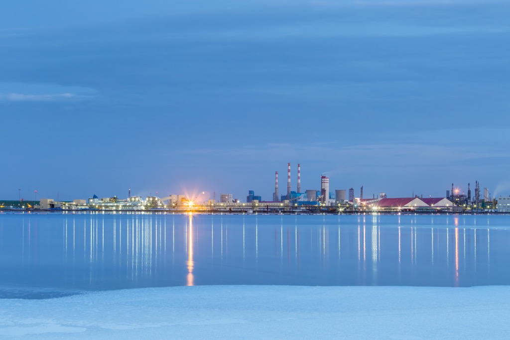
Golmud is Qinghai’s second-largest city, home to 200,000 people (a tiny population when compared with other county-level cities in eastern China with millions of residents).
Golmund is a frontier mining town and transportation hub. The Qarhan Playa north of the city is home to some of China’s largest reserves salt, magnesium, and potassium, and various other minerals and ores are mined in the area.
For foreign tourists, the main draw to Golmud is the Qinghai-Tibet Railway. The scenic 14-hour ride to Lhasa, which is the highest-elevation train journey in the world, starts in Golmud.
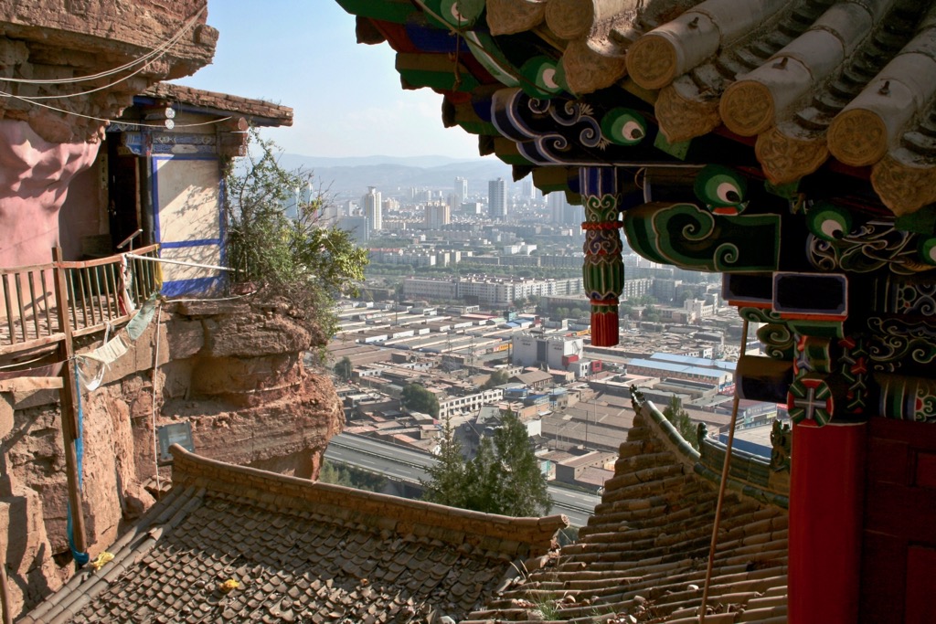
Xining is Qinghai’s capital, home to about 2.5 million people and about 40 percent of Qinghai’s total population. It’s the largest city on the Tibetan Plateau and the only real city in Qinghai.
Xining has long been home to diverse groups of people, particularly Muslims and Tibetan Buddhists. Two of the major attractions in the city are the Dongguan Mosque, the largest mosque in Qinghai, and the Kumbum Monastery, which is considered one of the most important monasteries outside of Lhasa.
If you’re visiting Qinghai, you’ll almost certainly visit Xining. It’s the easiest jumping-off point for visiting the Kanbula National Forest, Qinghai Lake, and Amnye Machin.