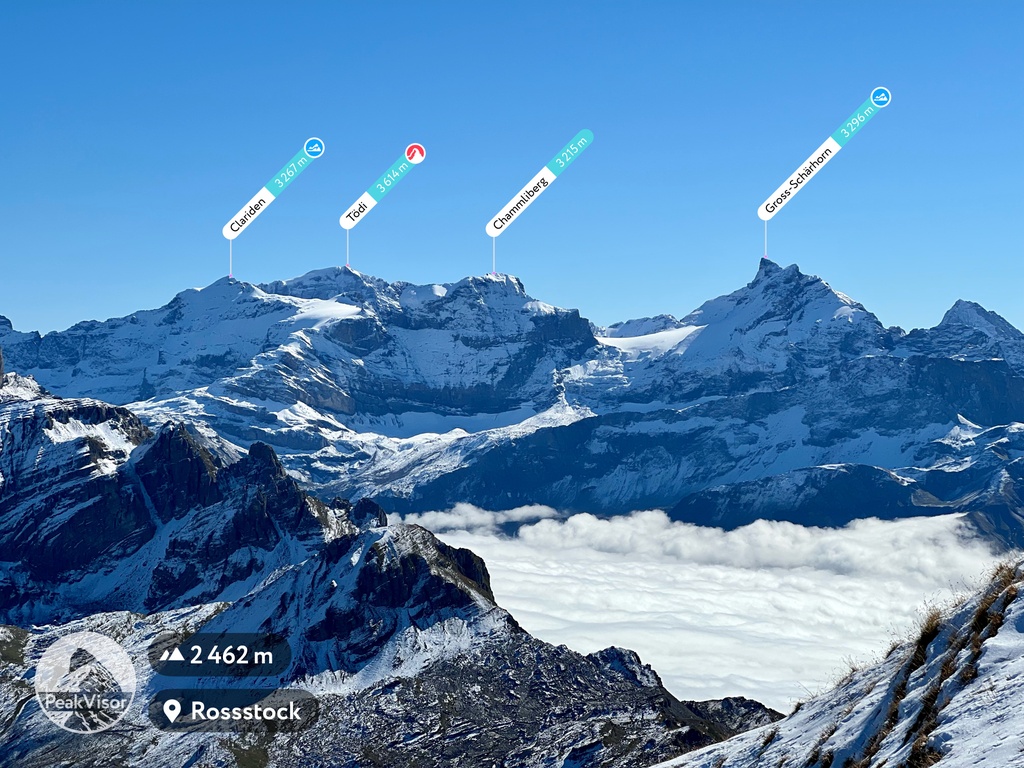
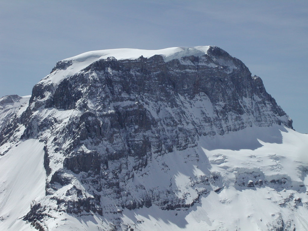
There are 440 named mountains in the Glarus Alps. At an elevation of 3,614m Tödi (Toedi), or Piz Russein, is the highest mountain in the mountain range and the highest summit in the canton of Glarus, Switzerland. With the prominence of 1,570m it is the only Ultra peak in the Glarus Alps.
Being a UNESCO World Heritage Site, Swiss Tectonic Arena Sardona is a major feature of the Glarus Alps. It presents an exceptional and dramatic display of mountain building through continental collision. If you are interested in the mountain formation then this is one of the best places to go.
Major Trails and Hiking Areas
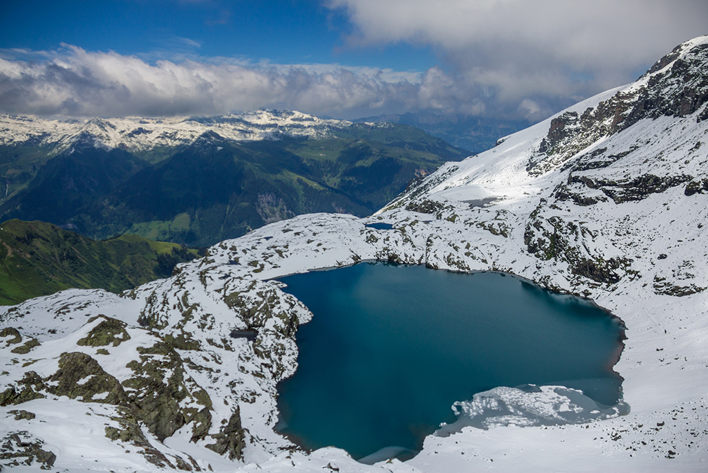
While reaching the summit of Pizol might be a challenging task which requires to cross a small glacier there’s a much easier spectacular circle hike going through five high altitude alpine lakes.
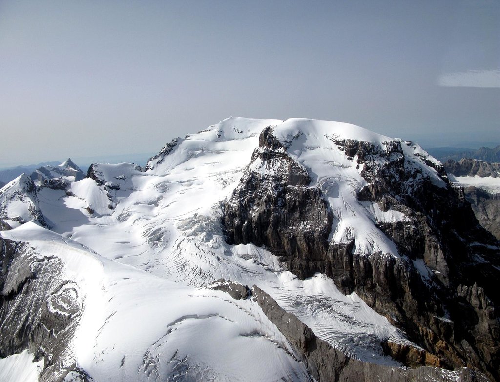
Piz Sardona is located within the Glarus thrust, a geologic UNESCO World Heritage Site. Easily reachable by a cable car, Fil de Cassons is a perfect place to see the tectonic line, as rocks turn from greenish hues to bright light grey on top of the ridge.
Tower-like Spitzmeilen was created by the Nature to provide the best panoramic view in Swiss Tectonic Arena Sardona.
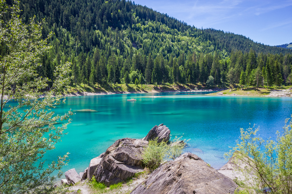
Caumasee is one of the most beautiful lakes in the Alps. Several hiking trails go from there. Among them is a short trail to Il Spir - a spectacular panoramic viewpoint over the Rhein canyon.
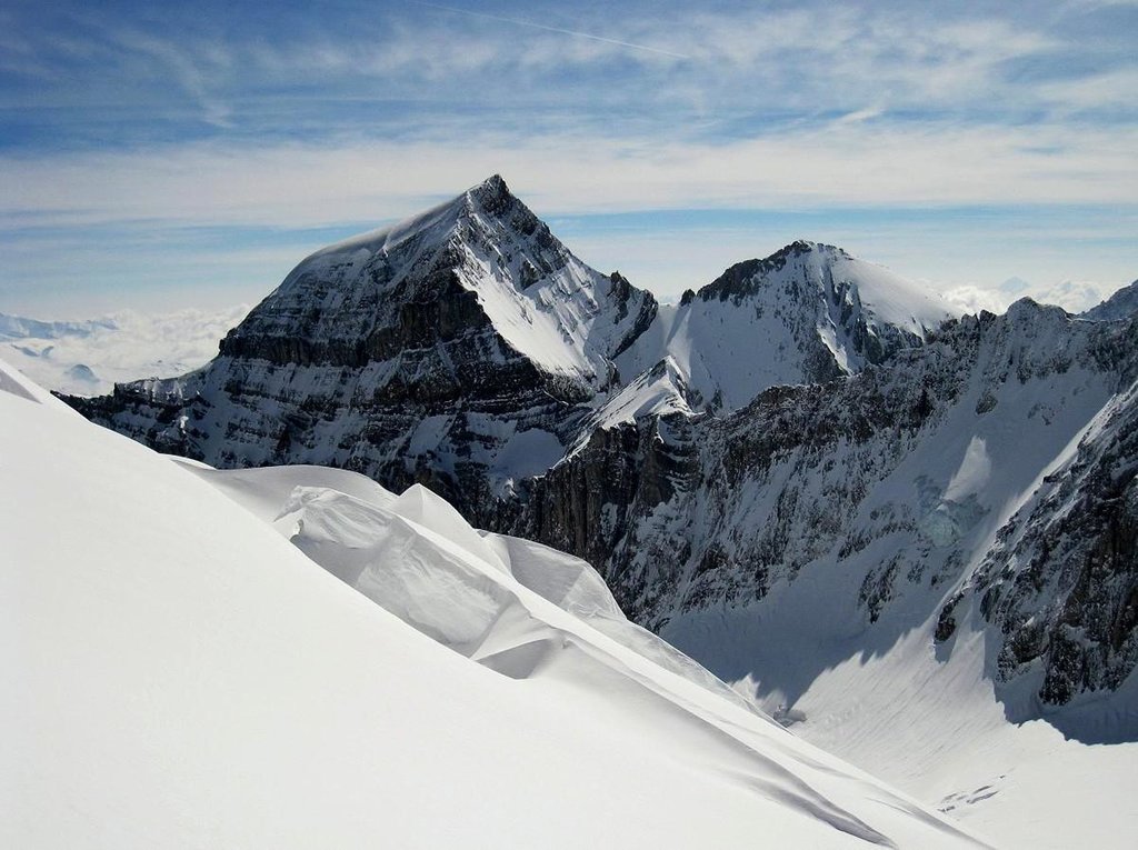
Klausen pass, the trail from the pass via Gratli to the summit of Gemsfairenstock, offers dramatic views of Tödi, hundreds of other peaks, and some glaciers.
Cable Cars and Cog Railways
Pizol cable cars in five modern gondola lifts and chairlifts transport the summer guests to 100 km of hiking trails, the Twärchamm climbing garden, launch sites for paragliders, mountain bike trails and idyllic mountain lakes for hikers and sports enthusiasts. The Heidi trail and the water forest are particularly suitable for families.
Braunwald cable car top station at the foot of Eggstock is the place of many trailheads. One of them lead to the middle summit of Eggstock.
Major Cities and Resorts
There are many touristic cities in the area, here are just several of them:
Glarus is the capital of the canton of Glarus
Chur is the oldest town in Switzerland, the capital of the canton of Grisons
Famous for the castle which dates from before the founding of the Swiss Confederation, the town of Sargans has strategic position on the intersection of main transport arteries.
The highest peak in the Glarus Alps is Tödi, at 3,614 m.
How many peaks are in the Glarus Alps?
The Glarus Alps have 812 named peaks.
Register Peak
Peak Name
Latitude
Longitude
Altitude
Register
Teleport
PeakVisor
This 3D model of Sagarmatha National Park in Nepal was made using the PeakVisor app topographic data. The mobile app features higher precision models worldwide, more topographic details, and works offline. Download PeakVisor maps today.
Download OBJ model
PeakVisor
The download should start shortly. If you find it useful please consider supporting the PeakVisor app.
PeakVisor for iOS and Android
Be a superhero of outdoor navigation with state-of-the-art 3D maps and mountain identification in the palm of your hand!