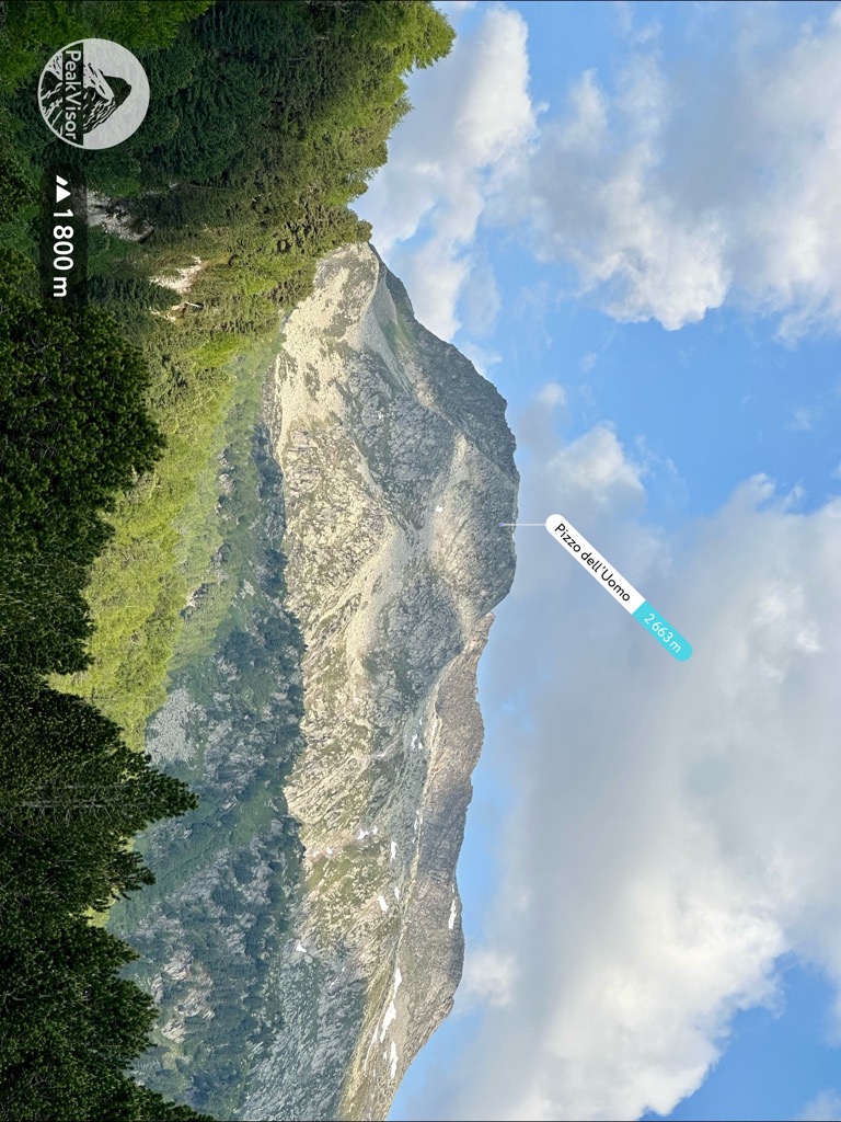
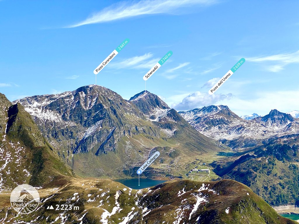
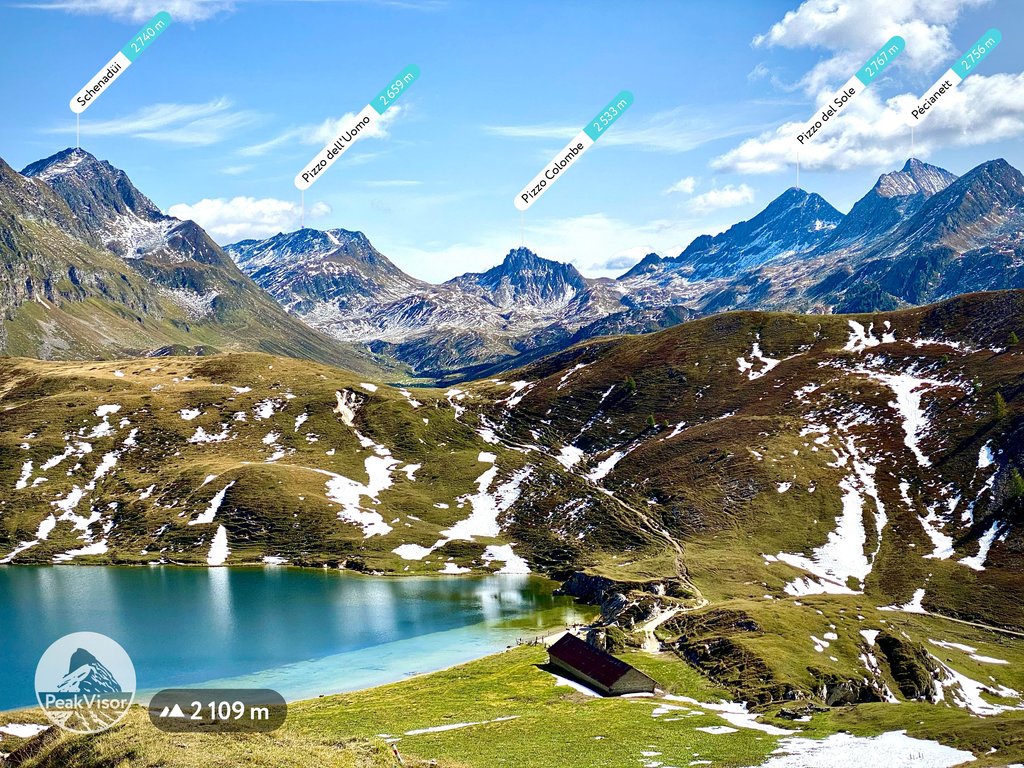
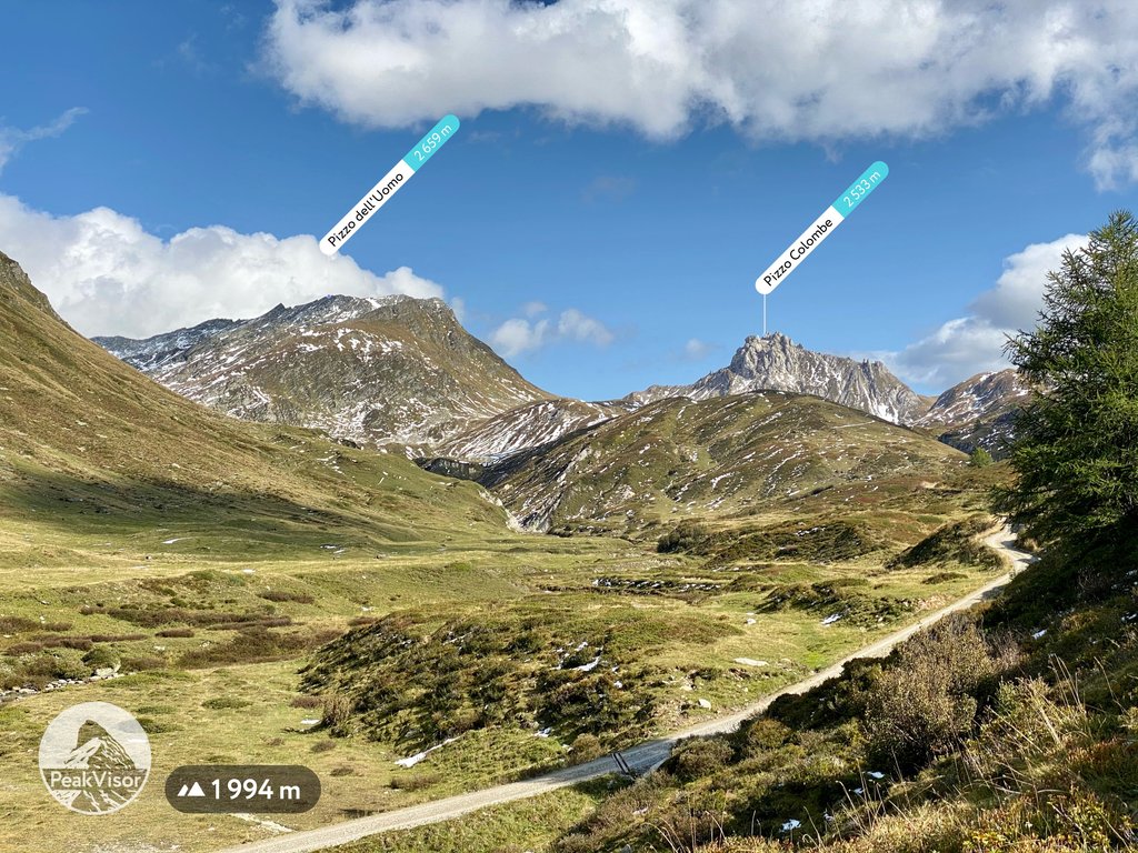
Pizzo dell'Uomo is a mountain of the Lepontine Alps and part of the extended Saint-Gotthard Massif, located between Lai da Sontga Maria and Pizzo del Sole, in the canton of Ticino, just southwest of the Passo del Lucomagno. The border with the canton of Graubünden runs on the northern foot of the mountain, although it lies on the main Alpine watershed, between the basin of the Rhine and that of the Ticino.
Pizzo dell'Uomo is, along with the Chrüzlistock and Piz Vatgira, one of the main peaks traversed by the Gotthard Base Tunnel. The tunnel runs below the summit of Pizzo dell'Uomo, or more precisely, just northeast of it.
By elevation Pizzo dell'Uomo is
# 60 out of 121 in Distretto di Blenio # 85 out of 227 in Distretto di Leventina
By prominence Pizzo dell'Uomo is
# 58 out of 824 in Ticino # 13 out of 121 in Distretto di Blenio # 19 out of 227 in Distretto di Leventina
We use GPS information embedded into the photo when it is available.
3D mountains overlay
Adjust mountain panorama to perfectly match your photos because recorded by camera photo position might be imprecise.
Move tool
Rotate tool
Zoom
More customization
Choose which peak labels should make into the final photo and what photo title should be.
Next
Photo Location
Satellitte
Flat map
Relief map
Latitude
Longitude
Altitude
OR
Latitude
°'''
Longitude
°'''
Apply
Register Peak
Peak Name
Latitude
Longitude
Altitude
Register
Teleport
PeakVisor
This 3D model of Sagarmatha National Park in Nepal was made using the PeakVisor app topographic data. The mobile app features higher precision models worldwide, more topographic details, and works offline. Download PeakVisor maps today.
Download OBJ model
PeakVisor
The download should start shortly. If you find it useful please consider supporting the PeakVisor app.
PeakVisor for iOS and Android
Be a superhero of outdoor navigation with state-of-the-art 3D maps and mountain identification in the palm of your hand!