
Scan the QR code and open PeakVisor on your phone
Ticino is the southernmost canton in Switzerland. The canton is the fifth largest in the country and lies almost entirely to the south of the main crest of the Alps. There are 826 named peaks in Ticino. Rheinwaldhorn is the highest peak in the canton at 3,402 m (11,161 ft) in elevation while Monte Tamaro is the most prominent peak in Ticino with 1,407 m (4,616 ft) of prominence.
Ticino lies in the south-central region of Switzerland. It is one of three main southern cantons in the country alongside Valais and Grisons.
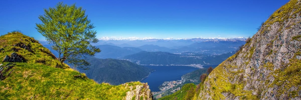
A majority of the canton lies to the south of the main crest of the Alps. Ticino encompasses 2,812 sq. km (1,086 sq. miles) of land and is divided into eight districts. With a few exceptions, most of the canton lies within the Ticino River basin. The Ticino River is the main river that flows to the northwest through the Leventina Valley.
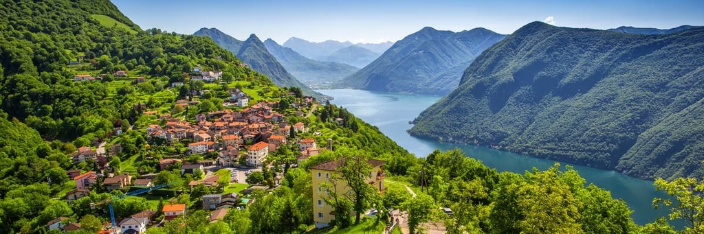
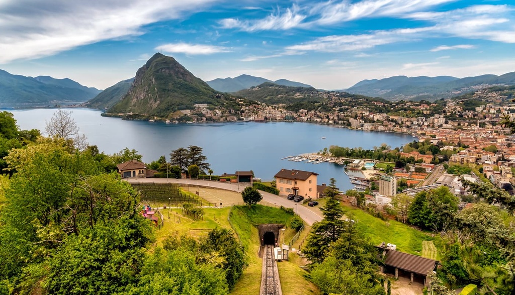
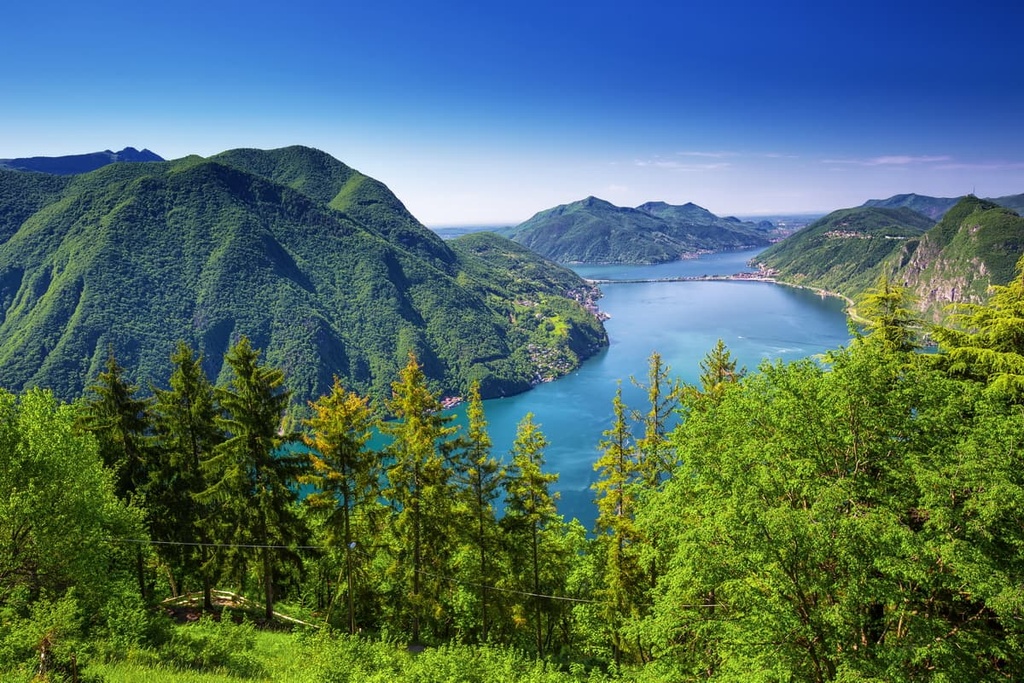
The canton is often broken into two main regions, which are known as Sopraceneri and the Sottoceneri. These regions are separated by the Monte Ceneri mountain pass. Sopraceneri is the northern region of the canton and it consists of the valleys surrounding Lake Maggiore. Sottoceneri marks the southern region of the canton and it includes the land around Lake Lugano.
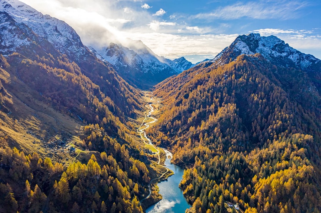
The main tributaries of the Ticino River include the Brenno and the Moesa. Much of the canton is shaped by the wide sweeping valleys of these rivers, which lead into the Alps. The land in the west of the canton is drained by the Maggia.
Ticino is home to Switzerland’s lowest point of elevation, which is found along the shores of Lake Maggiore. Despite being located primarily to the south of the Alps, Ticino features a rugged landscape and dramatic changes in elevation.
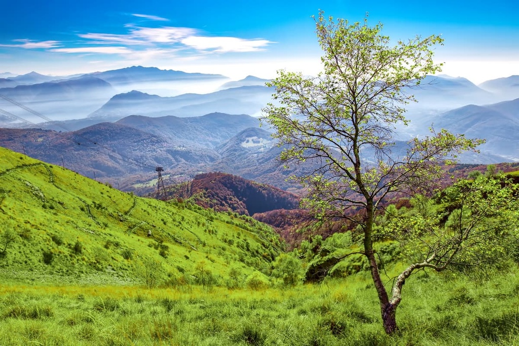
The northern stretches of Ticino are marked by the Lugano Prealps, Saint-Gotthard Massif, and the Lepontine Alps. Despite these rugged features, around 75 percent of the canton is considered to be agriculturally productive land.
Ticino shares its borders with three other cantons, including Valais to the northwest, Uri to the north, and Grisons to the northeast. The Italian regions of Piedmont and Lombardy also mark the borders of the canton.
That said, Ticino wholly surrounds the Italian exclave of Campione d’Italia, which is situated on the bank of Lake Lugano in the southern part of the canton.
The exclave is just 2.68 sq. km (1.03 sq. mi) in size and it is located less than 1 km (0.6 mi) as the crow flies from Italy. However, the ruggedness of the mountains surrounding the excalve mean that the road journey between Campione d’Italia and the next closest Italian town, Lanzo d’Intelvi, is more than 14 km (9 mi).
Often referred to as “Switzerland’s Sunny South,” Ticino offers a Mediterranean climate that just so happens to be situated in the foothills of the Alps. Nevertheless, the quaint lakes and sweeping valleys of the canton quickly give rise to the rugged peaks of the region.
Though there are numerous hiking trails within the canton, there aren’t many large protected areas in Ticino. That said, Ticino is located near other protected parks and regions for outdoor recreation, such as Beverin Nature Park and Parc Ela to the east and both Binntal Nature Park and Pfyn Finges Nature Park to the west.
The peaks within Ticino are part of the Alps and are home to unique geological features. The mountains in the canton are part of the Lepontine Alps, which dominate the northern portion of Ticino.
As a whole, the Alps are the highest mountain range that lies entirely within Europe. The peaks began forming around 65 million years ago during the Alpine orogeny. This major mountain building period also helped form the Pyrenees, Himalaya, Karakoram, Caucus, Atlas, Carpathians, and the Hindu Kush.
The Tethys Ocean once laid between the supercontinents of Laurasia and Gondwana, which roughly correspond to present-day Africa and Europe. As the two continental plates began drifting towards one another, the ocean began retreating.
Eventually, these two plates collided with one another. The immense pressure caused by their collision compacted and folded the sediments from the bottom of the ocean into the rugged mountain chain that exists today. The Alps are a part of the larger Alpide Belt, which spans from central Europe to south-central Asia.
Continual erosion further formed the jagged peaks of the Alps and Ticino, cutting away the limestone and sandstone peaks. During the last glacial maximum, much of the region was heavily glaciated. Glacial retreat left behind the sweeping river valleys of the canton that exist to this day.
The largest glacier in the canton is the Basòdino Glacier, which currently spans 2 sq. km (0.8 sq. mi). It is estimated that by 2030, only a few small remnants will be left of the glacier due to climate change.
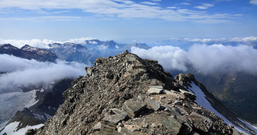
Major peaks within Ticino include Rheinwaldhorn, Monte Tamaro, Monte Generoso, Monte Limidario, Basodino, and Piz Medel.
The dramatic changes in elevation in the region allow for a variety of both flora and fauna to thrive within the canton of Ticino. The sunny and warm weather that’s typical of the canton has also allowed Ticino to flourish into one of the main wine producing regions of the country.
Common tree species found throughout the canton include European beech, Norway spruce, Scots pine, and silver fir. Various low-growing shrubs and plants thrive near the many waterways of the region. Common species in Ticino include the maidenhair spleenwort, common ivy, sweet chestnut, red clover and European holly.
The warmer weather of the canton also enables a wide range of flowers to thrive. Some of these flowers include the thick-leaved stonecrop, liverleaf, alpenrose, heather, germander speedwell, soapwort, primrose, and fire lily.
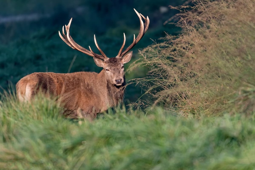
Many of the larger mammals found within the canton inhabit the northern region of Ticino, seeking solace in the forested and mountainous landscape. Large mammals include the western roe deer, red deer, northern chamois, Alpine ibex, and wild boar.
Small mammals such as the Eurasian otter, Eurasian pine marten, alpine marmot, European badger, and several species of bats are also common in Ticino. The rivers and lakes of the region are home to pumpkinseed, European bullhead, European carp, rainbow trout, and brown trout fish.
The region of Ticino was settled during the ancient times by the Celtic tribe known as Lepontii. During the rule of Augustus, the land became part of the Roman Empire. The settlements continued to grow after the fall of the empire.
Over the following centuries, Ticino was ruled by the Ostrogoths, Lombards, and the Franks. At the start of the twelfth century CE, the land was caught in the middle of a struggle between the communes of Milan and Como. Eventually the Dukes of Milan conquered the region in the fourteenth century.
During the fifteenth century, the Swiss Confederation began conquering land to the south of the Alps, including present day Ticino. The people of Uri would go on to conquer the Leventina Valley around 1440. The land was acquired by the Swiss over the course of three major conquests.
Throughout the sixteenth century, the region was mainly under the control of the people of Uri. The region of Ticino marks the last lands that were conquered by the Swiss Confederation. The people of the region revolted against the control of Uri in 1755 but were unsuccessful.
Throughout the rule of the Helvetic Republic, the area was divided into two cantons named Bellinzona and Lugano. After the fall of the republic in 1803, the two cantons were combined to form Ticino and join the Swiss Confederation.
The city of Bellinzona was declared the capital in 1878. Today, the city of Lugano is the country’s third largest financial center, after Geneva and Zuirch. The canton’s close proximity to Italy provides it with a mediterranean climate and culture that’s different from the rest of Switzerland.
The canton is home to three of the world’s largest gold refineries, and it is a hub for the high fashion industry. The completion of the Gotthard Railway in 1882 connected the canton to the rest of the country and led to its growing tourism industry. In fact, the Gotthard Road Tunnel is located in the canton, and it is one of the longest road tunnels in the world.
Ticino is home to numerous trails for hiking and outdoor recreation. Here are some of the most popular trails and regions in the canton:
The Monte Lema to Monte Tamaro trail is said to be one of the most beautiful hikes in the entire Prealps. The route follows a ridgeline that provides panoramic views throughout your trek. On a clear day, hikers have views of both Lake Lugano and Lake Maggiore along with the Maggia Valley, Verzasca Valley, and the nearby Alps.
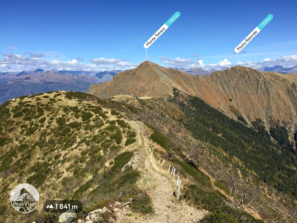
Hikers have the option of reaching the summit of both Monte Gradiccioli and Monte Tamaro or bypassing them and continuing along the ridgeline. The point to point trail is 13 km (8 miles) in length and it has 873 m (2,864 ft) of elevation gain. The trail is best completed from May to October.
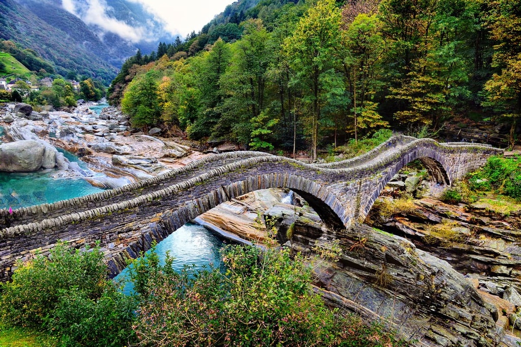
The Verzasca Valley features a long, rich history. Early settlers would migrate throughout the region, living in the lowlands during the winter and traveling up the valley during the summer months.
The remote and pristine valley features numerous trails, many of which follow the emerald-colored Verzasca River and its many waterfalls. A point-to-point trail runs along the length of much of the valley. It is 24 km (15 miles) in length, and it often takes around eight hours to complete.
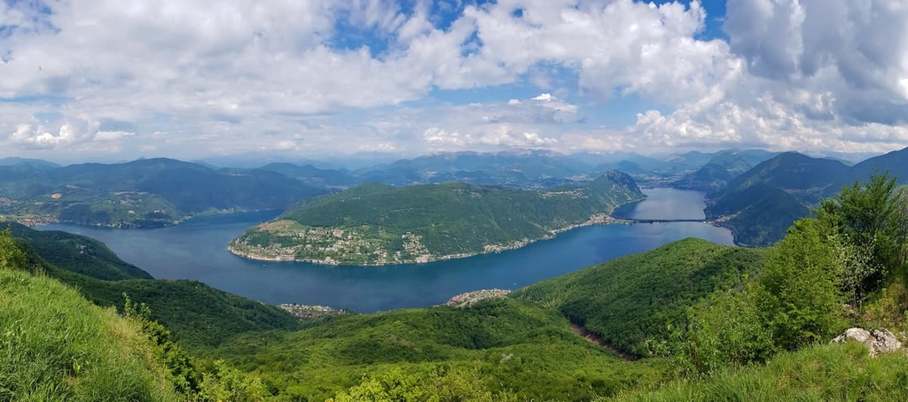
Monte San Giorgio is a mountain that towers above Lake Lugano. The mountain is known for being home to one of the best fossil records of the Triassic marine line, which dates back around 250 million years ago.
From the summit, hikers can enjoy sweeping views of Lake Lugano down below along with vistas of the surrounding mountains and valleys.
The trail to the summit of Monte San Salvatore is a shorter route, yet it still offers stunning views of the region.
Beginning in Ciona, the trail climbs steadily up to the summit. The route is 3.9 km (2.4 miles) in length and it has 274 m (898 ft) of elevation gain. A restaurant at the summit offers panoramic views of Lake Lugano, the plain of Lombardy, and the Alps.
Monte Generoso lies on the eastern side of Lake Lugano, along the canton’s international border with Italy. The route to the summit is 7.7 km (4.8 miles) round trip and it has 492 m (1,614 ft) of elevation gain.
The views from the summit of Monte Generoso are often regarded as some of the best panoramic views in the entire region. Hikers can see much of the entire lakes region, the Alps, the Po Valley, the Apennines, Monte Rosa, and even the Matterhorn.
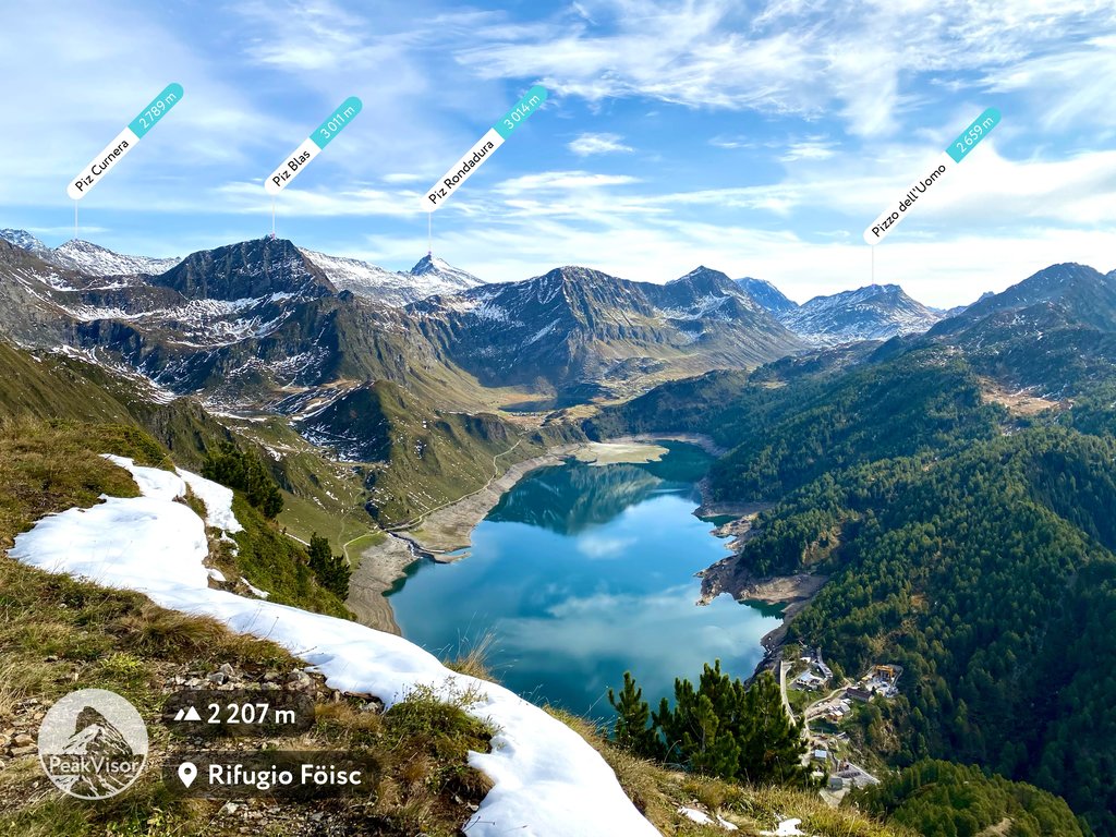
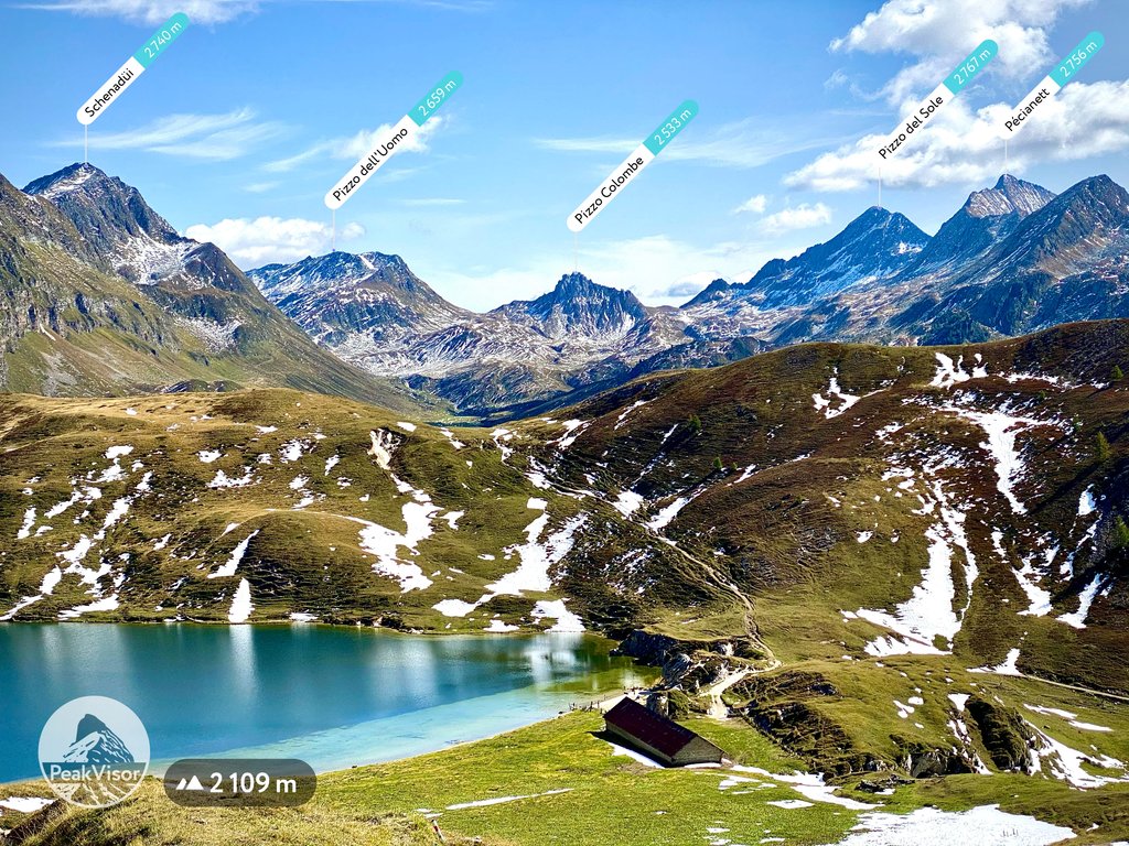
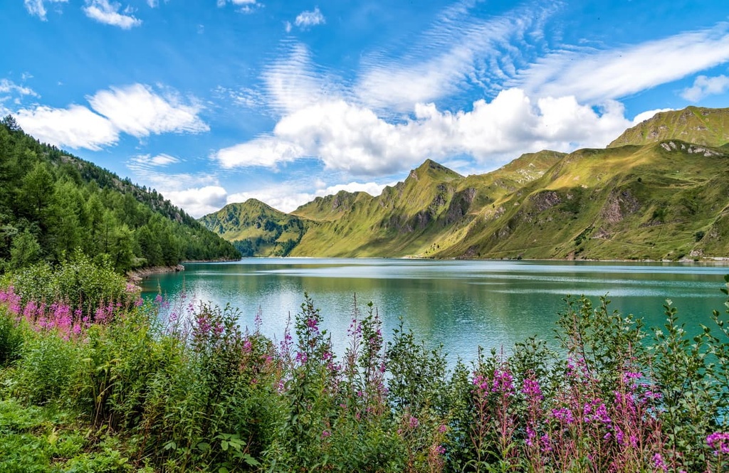
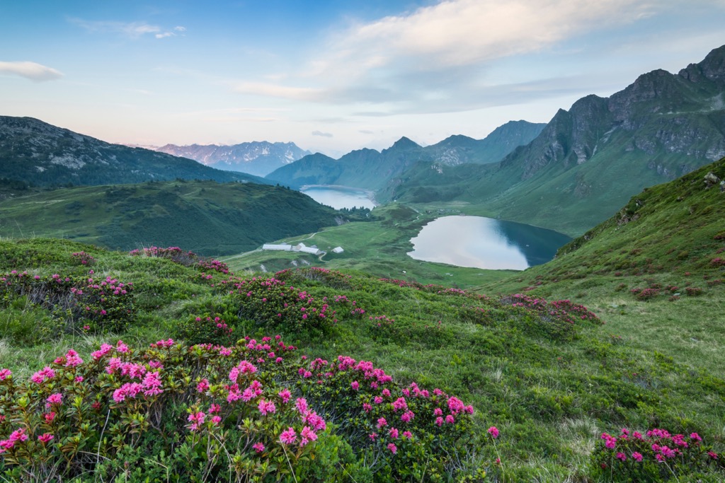
Lake Ritom lies in the northern portion of the canton, and the trail around it offers hikers a chance to explore the Alps of Ticino. This loop trail climbs steadily up to Lake Ritom and it offers the option to extend your hike to reach both Lake Tom and Lake Cadagno.
Any route in the region offers breathtaking views of the area’s pristine lakes, alpine hillsides, and snow-capped Alps.
For skiing and snowboarding enthusiasts, there are more than 10 ski resorts in Ticino, which are located throughout the canton, but mainly in its northern part, where you will find most of the resorts, including also the largest of them. It is also the main area for skiing in the Italian speaking part of the Swiss Alps.
The three largest ski resorts in Ticino of the same size are Nara–Leontica, Bosco Gurin–Grossalp, and Pesciüm–Airolo with more than 30 km (19 mi) of slopes and more than 5 ski lifts each. These are also the main ski resorts near Lugano, the capital of the canton.
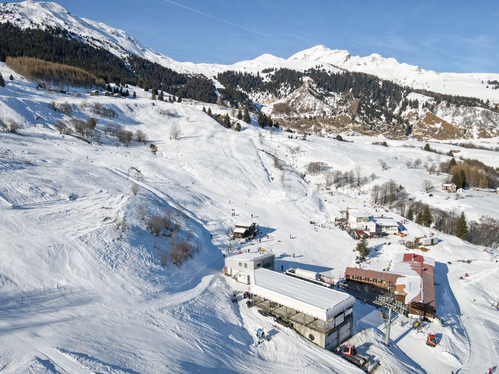
Check the Ticino ski resorts map as well as the larger Switzerland ski resorts map in the World Mountain Lifts section of the site. It includes information about open ski lifts / slopes in Ticino in real-time with opening dates and hours. There are also year-round cable cars, funiculars, cog railways, aerial tramways, and all other types of mountain lifts.
Looking for a place to stay in Ticino? Here are some of the best cities and villages to check out in the canton:
Lugano is the largest city in the canton with a population of around 62,000 people. Situated on the shores of Lake Lugano, the Lugano Prealps rise steeply nearby, leading into the Alps. The unique location of the city allows for Italian and Swiss cultures to merge together.
Nearby activities include the funicular to the summit of Monte Brè, a boat ride around the lake, and the Hermann Hesse Museum. Or, you can enjoy a nice stroll through the streets of the city’s main square. Though it is part of Switzerland, the local shops and restaurants in Lugano may appear more Italian upon first glance.
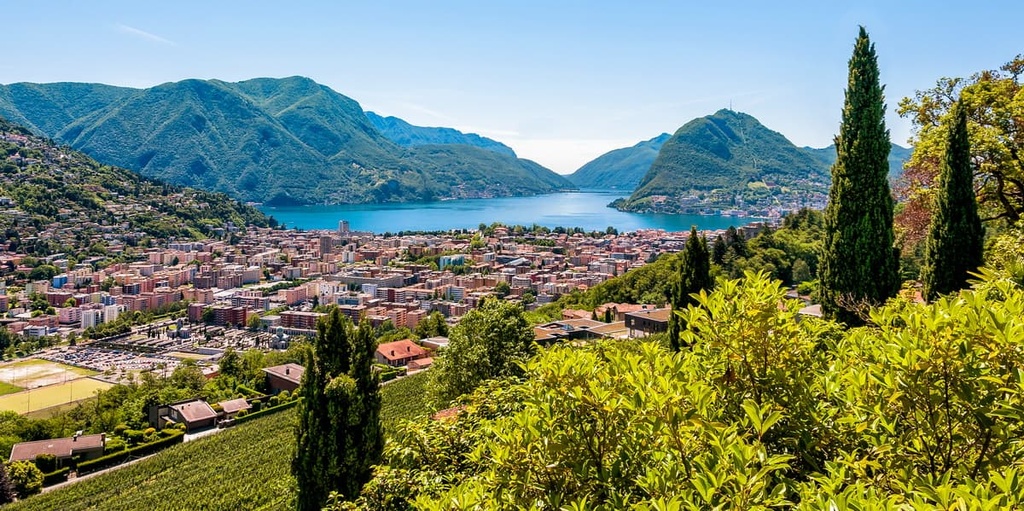
Another great place to visit in Lugano is Parco Civico-Ciani, which is a park situated along the shores of Lake Lugano that’s filled with artwork, trails, and flower beds. Visitors can also explore San Lorenzo Cathedral, which features frescoes that date back to the fourteenth century.
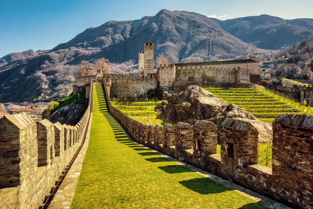
Bellinzona is the capital of the canton of Ticino, with a population of around 45,000 people. The town is best known for its three castles named Castelgrande, Montebello, and Sasso Corbaro. Together, the historic structures of the city have been a UNESCO World Heritage Site since 2000.
Situated along the Ticino river, the town spans across the valley floor with the Alps towering above to the north. Bellinzona’s unique position just to the south of the Alps makes it a gateway for those traveling between northern Italy and Switzerland.
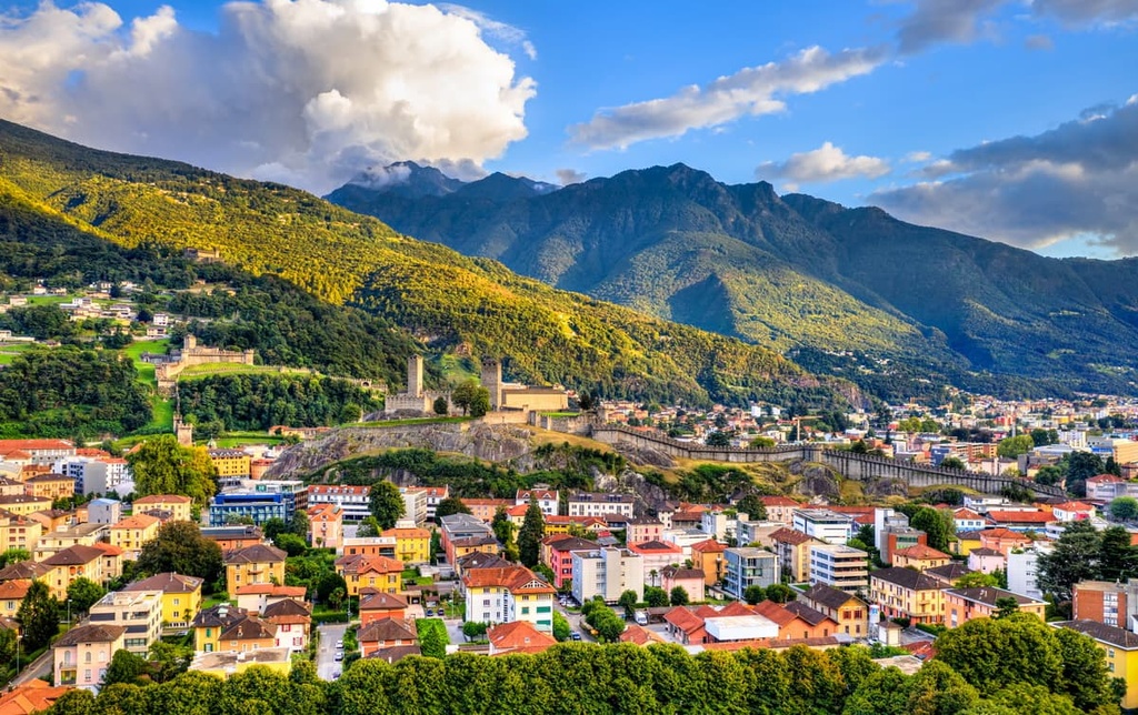
The Old Town of Bellinzona can be viewed from the Castelgrande, which features a museum that showcases the town's rich history. The narrow and quaint streets of the city are also lined with local shops while the dramatic mountainous landscape towers above.
The town of Locarno lies along the northern shores of Lake Maggiore, marking the northeastern tip of the canton. Home to around 16,000 residents, the town is nestled between the lake and the Prealps.
The small town of Locarno hosts the Locarno International Film Festival each August in the main square. Besides the natural beauty of the region, Locarno is also home to Madonna del Sasso sanctuary, Castello Visconteo, and the Astrovia Locarno, which is a 1:1,000,000,000 scale of our solar system.


