
Scan the QR code and open PeakVisor on your phone
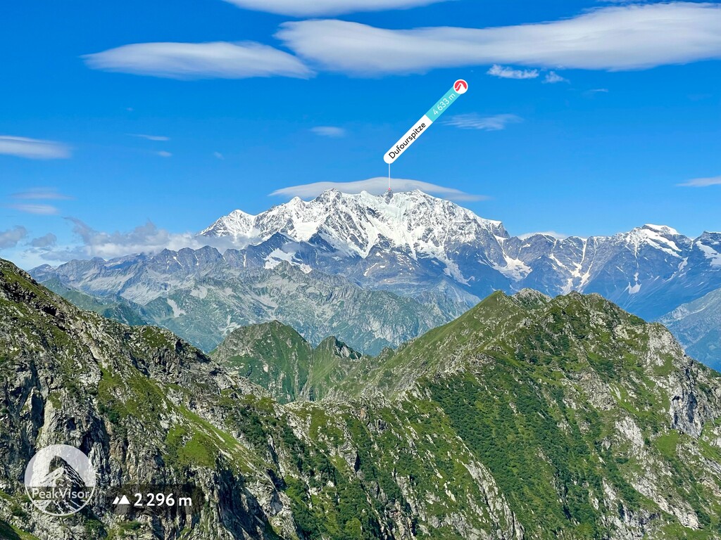
Valais (Wallis in German) is a canton located in southwestern Switzerland. The canton is the third largest in the country. One of the most prominent features in the canton is the Matterhorn, which straddles the border between Switzerland and Italy. There are 1795 named peaks in Valais. Monte Rosa - Dufourspitze is the highest peak in the canton at 4,633 m (15,200 ft) in elevation while the Finsteraarhorn is the most prominent peak with 2,280 m (7,480 ft) of prominence.
Valais is the third largest of the 26 cantons in Switzerland. Situated in the southwestern portion of the country, Valais borders the cantons of Uri and Ticino to the east and both Vaud and Bern to the north. It is also located to the east of France and to the north of Italy.
Valais encompasses 5,224 square kilometers (2,017 square miles) of land and is divided into 13 districts. A majority of the canton lies within the Rhône basin, particularly in the Alpine Rhône Valley.
Since Valais is such an expansive canton, it is often divided into three distinct regions known as Lower Valais, Central Valais, and Upper Valasis. Both the Lower and Central Valais regions are traditionally French-speaking areas, while Upper Valais is historically a German-speaking area.
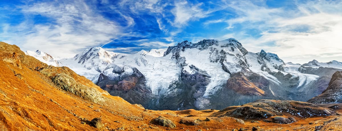
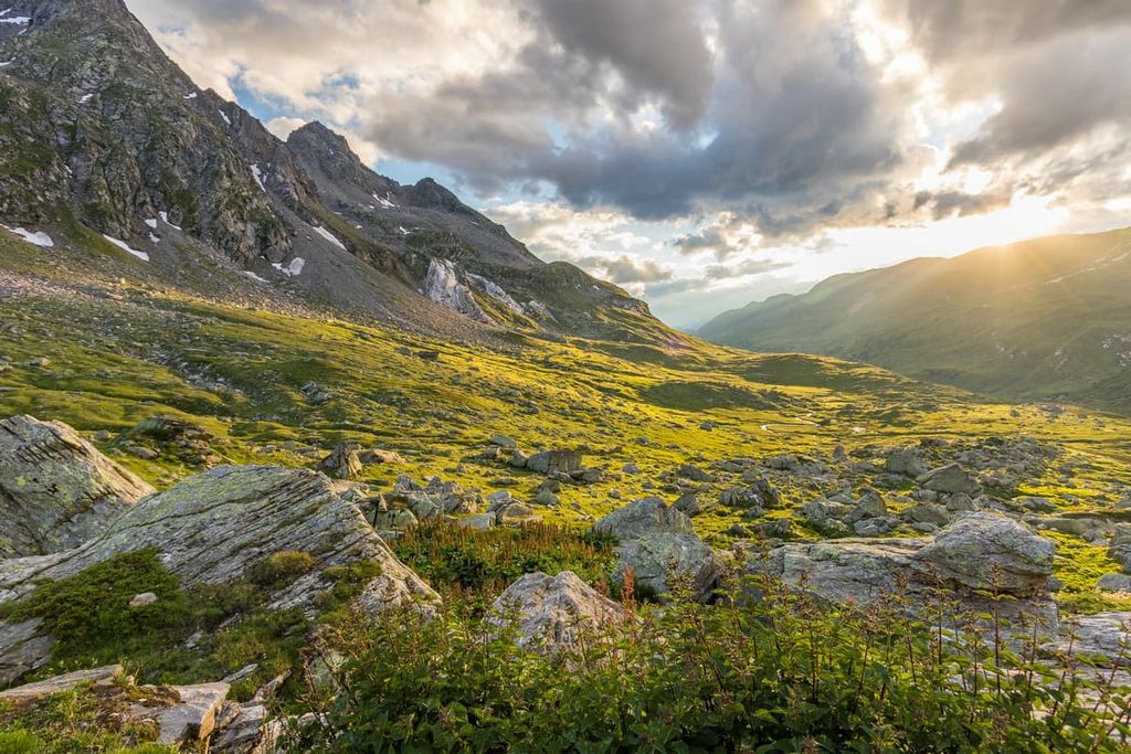
The canton’s Rhône Valley lies within the Alps, and it is surrounded by various subranges. The Bernese Alps mark the northern edge of the valley and the Valais Alps are situated to the south.
The canton of Valais has the highest relative elevation of any canton in the country. While the Rhône Valley dominates the landscape, the region is also home to various smaller valleys that branch off perpendicularly from the main valley.
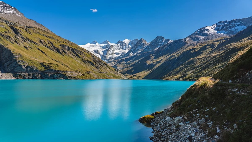
The Rhône Valley is named after the Rhône River, which is often referred to simply as the Rhône. The Rhône Glacier marks the headwaters of the river as it flows from east to west. Then, the river flows along the border between Valais and Vaud before entering Lake Geneva.
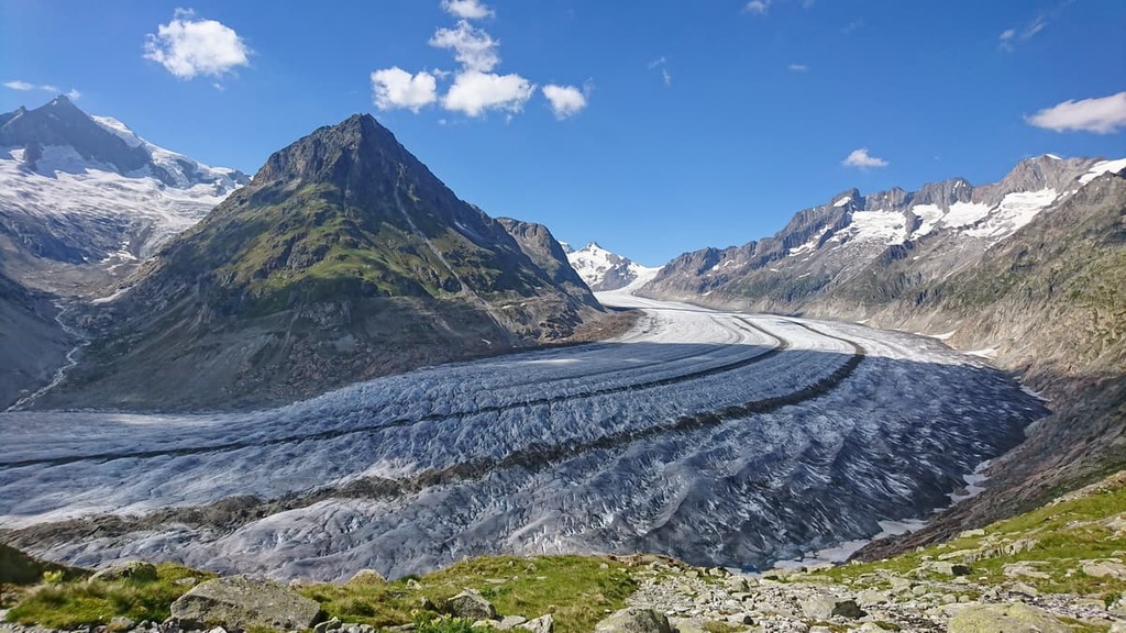
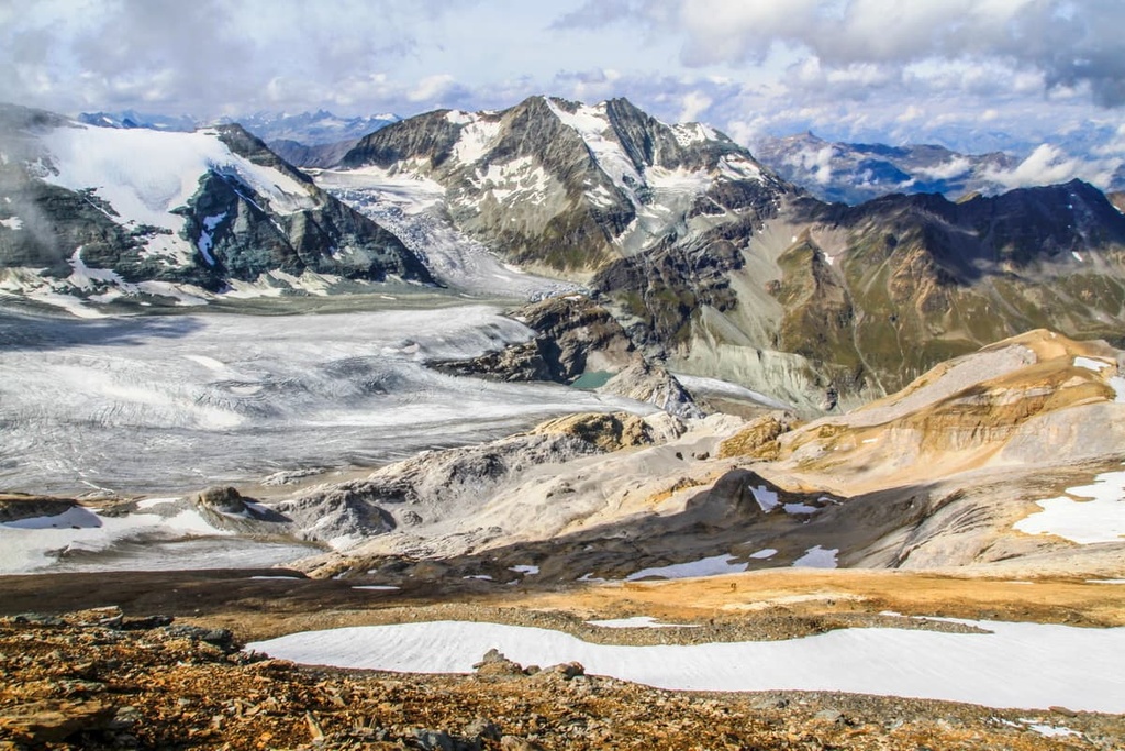
The rugged mountains of Valais are home to some of the largest glaciers in the country, including the Rhône Glacier, the largest glacier in the Urner Alps.
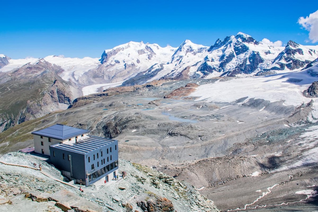
In particular, the Gorner Glacier lies along the slopes of Monte Rosa, the tallest peak in the country. The Aletsch Glacier is also located within the canton and is a UNESCO World Heritage Site. Major ranges in the canton include the Uri Alps, Chablais Alps, and Lepontine Alps.
A small section of Lake Geneva located in the canton, making it the largest body of water in Valais. The canton is semi-arid, with the lowlands receiving far less rainfall than the higher elevations. Meanwhile, the region’s vineyards are generally located on the south-facing slopes of the Bernese Alps.
Additionally, Valais is home to a number of parks and recreation areas. The two major parks in the canton are Binntal Nature Park and Pfyn Finges Nature Park.
Valais lies within the Alps and is home to unique geological features. The canton is dominated by both the Bernese Alps and the Valais Alps.
The Alps are the highest mountain range in Europe. Much of the range was formed by the Alpine orogeny, which occurred between 65 million and 2 million years ago.
This major mountain building event occurred as the Tethys Ocean, which once lay between Laurasia and Gondwana, got progressively smaller as the two continental plates began to drift toward one another.
As the two plates collided, the pressure of their collision created a massive chain of mountain ranges that’s now known as the Alpide Belt. The Alps are a part of the Alpide Belt, which extends throughout much of southern Europe and south-central Asia.
Metamorphism occurred throughout the region, forming the rugged ranges that exist within the canton to this day. Continual thrusting and recumbent folds compacted the marine sediment at the bottom of the Tethys Ocean, forming the distinct mountain ranges that are now found in the region.
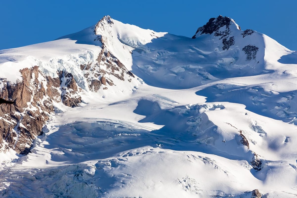
Additionally, massive glaciers formed during the Quaternary period carved the peaks within the canton. Glacial retreat and erosion further formed the jagged peaks of Valais.
Different types of rock can be found on either side of the Rhône Valley. Rocks on the northern side of the valley are made of limestone while the southern side of the valley primarily consists of slate.
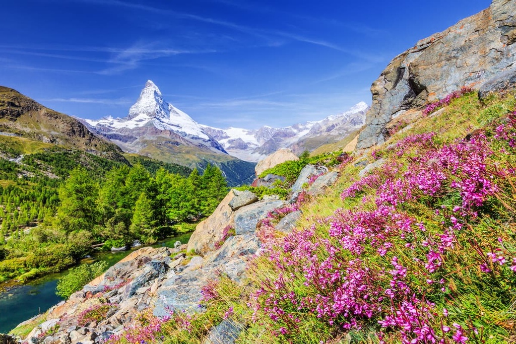
Major peaks within Valais include Rosa - Dufourspitze, Finsteraarhorn, Haute Cime, Combin de Grafeneire, Dammastock, Matterhorn and Weisshorn.
The vast Rhône Valley dominates marks much of the canton along with its forested hillsides and rugged peaks. Only around half of the canton is considered agriculturally productive and vineyards are only found on the south-facing slopes of the Bernese Alps.
The forests of Valais are home to birch, pine, alder, and larch trees. Lower elevations in the canton provide the ideal habitat for scrub oak, chestnut, and pine trees. At higher elevations a variety of alpine flowers flourish along side various mosses and lichen. However, above 1,800 m (5,900 ft) in elevation, trees become smaller and less frequent.
Commonly found flowers in the canton include primrose, lily, tulip, and astragalus. Wool grasses are frequently found near the many alpine lakes and streams. In Pfyn Finges Nature Park, hikers can also spot flowers such as spring snowflake, forget-me-not, primrose, and germander speedwell.
The remote wilderness within the canton is home to a variety of fauna. Commonly spotted animals include chamois, ibex, red deer, marmot, and fox. Though brown bears live in the country, they are not generally found within Valais.
Other common animals in the canton include the common redstart, crag martin, rock ptarmigan, and the green lizard, golden eagle, bearded vulture, and mountain hare.
The human history of the canton dates back to 6200 BCE. These early settlements were located along the Rhône River, where humans have lived for thousands of years.
Historians believe that Mediterranean farmers settled in the region from around 5800 BCE to 4500 BCE. Countless burial sites and ancient artifacts have been uncovered in the canton that date back to this time period.
Around the first century BCE, there were four major Gallic tribes that dwelled in present day Valais. The Seduni lived in present day Sion, near the Nantuates, Veragri, and Uberi tribes.
The Romans conquered the region following the Battle of Octodurus around 56 CE. By 888 CE, the land was part of the Kingdom of Upper Burgundy. Settlements in the region continued to steadily grow until the thirteenth century.
Around this time, the larger communities within the canton began gaining power and seeking independence. The upper part of the valley was settled by Germans from what is now Bern, resulting in the German speaking region present today.
During the fourteenth and fifteenth centuries, numerous disputes broke out between the large rebel communities, which were known as Zenden, and the noble houses. The rebels repeatedly won battles against the noble families while the Swiss Confederation took sides on who to support.
After the Raron affair (Raronhandel), the region was home to the Valais Witch Trials, which lasted from 1428 to 1447. The German-speaking part of the valley eventually won the ongoing battles with the French-speaking part of the region. By 1475, the bishop of the Zenden and Sion formed a treaty with Bern. In 1529, Valais became part of the Old Swiss Confederation.
During the seventeenth century, the districts of Valais formed the federal Republic of the Seven Tithings. In 1798, the French invaded the Swiss Confederacy, bringing the canton under Helvetic Republic rule until 1802 when it became part of the short-lived Rhodanic Republic.
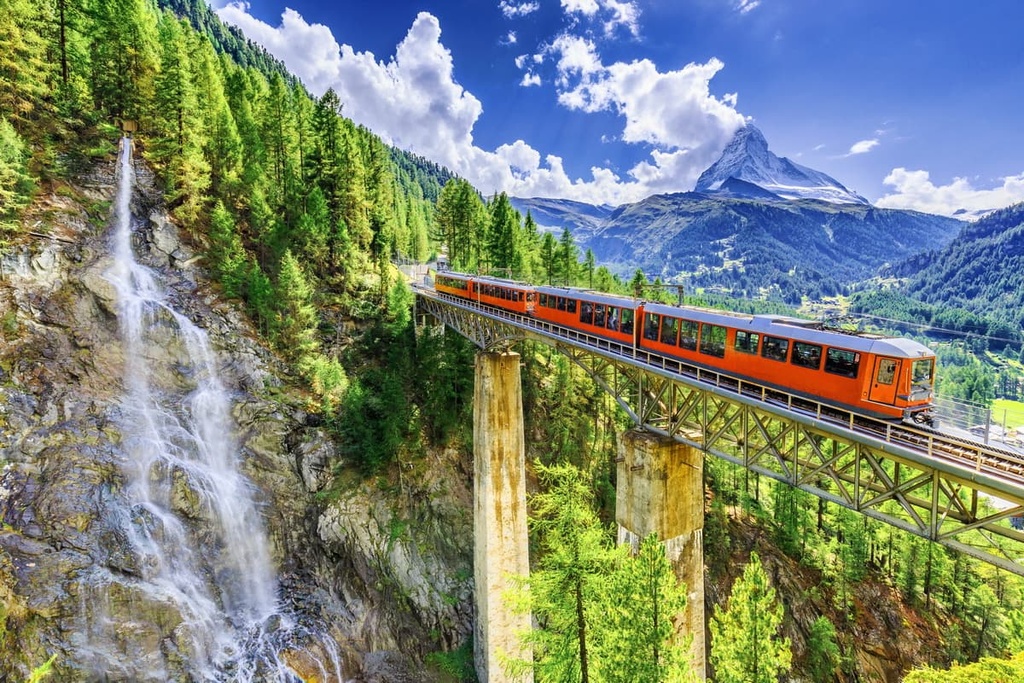
In 1815, Valais joined the contemporary Swiss Confederation as a canton. As the exploration of the High Alps began to rise, so did tourism throughout the canton. The Simplon Railway was completed in 1878, connecting Brig to the shores of Geneva.
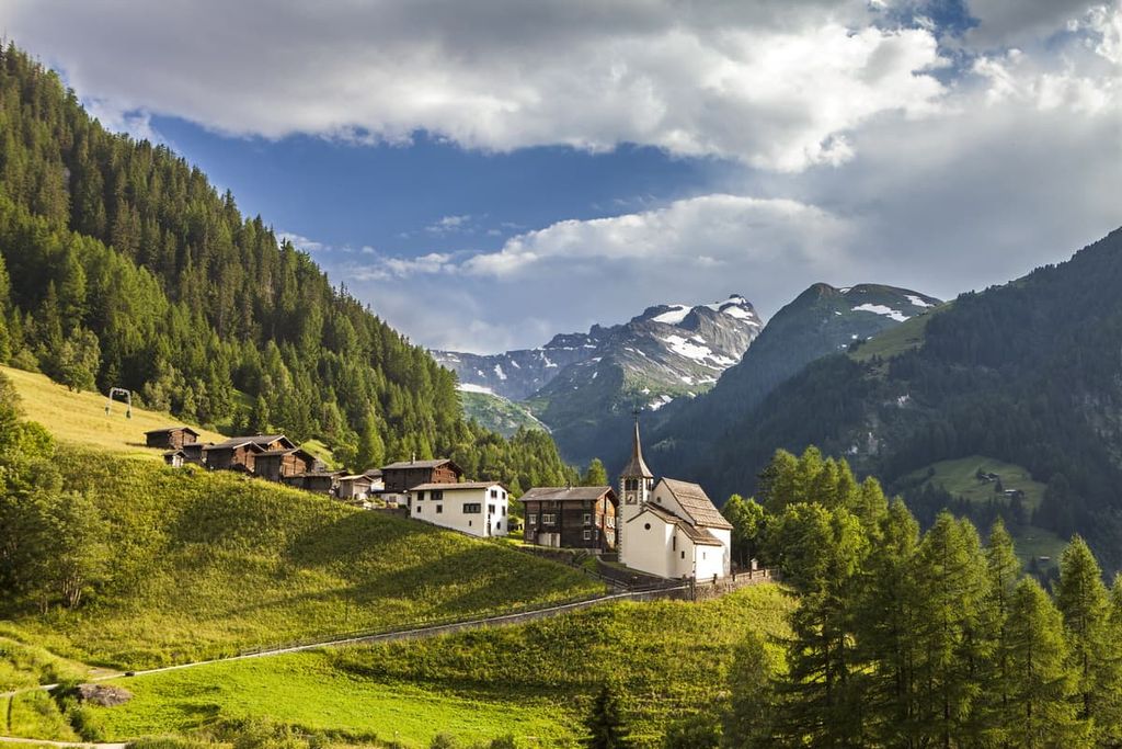
These days, Valais remains one of the most popular tourist destinations in Switzerland. The canton is home to some of Switzerland’s best skiing, hiking, and climbing destinations, including the historic town of Zermatt. There are also a number of popular Swiss Alpine Club huts in Valais that serve as the perfect basecamp for visits to this part of the Swiss Alps.
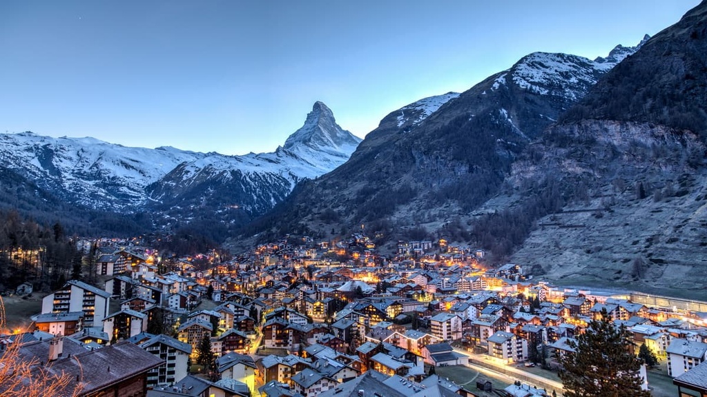
The city of Zermatt is also home to a rich mountaineering history. Up until the mid-nineteenth century, Zermatt was primarily an agricultural region. The Matterhorn, which lies just outside the city, was one of the final alpine mountains to be conquered.
Edward Whymper, and a team of other mountain climbers, completed the first ascent of the Matterhorn in 1865, though only three of the seven climbers survived the descent. This ascent brought a rush of mountaineers to the region and marked the end of the Golden Age of Mountaineering.
This feat transformed Zermatt into a tourist destination and helped give the Alps the mountaineering reputation they have today. Whymper wrote a book about his ascent of the Matterhorn, which arguably gave birth to contemporary mountain culture.
That said, many of the tourists who traveled to Switzerland during the early days of Swiss Alpine tourism were not mountaineers. Instead, these often wealthy Victorian visitors simply wanted to walk through the country’s pristine mountain valleys.
The first ascent of Monte Rosa was completed in 1855. Though it’s ascent was not as well-known as the Matterhorn, it too helped transform the region into the birthplace of modern mountaineering and hiking.
Valais is home to numerous trails for hiking and outdoor recreation. Here are some of the most popular trails and regions in the canton:
Zermatt is a municipality and resort within Valais that’s located near the country’s border with Italy. The region is surrounded by high mountains of the Pennine Alps, including Monte Rosa, the tallest mountain in the country.
Major hikes within the park include:
The Aletschhorn Glacier is the largest glacier in the Alps with a total length of about 23 km (14 miles). As it is situated in the Bernese Alps, many of the routes in the range take hikers along this massive glacier. The glacier is composed of four smaller glaciers that converge at Concordia Place.
Major hikes near the glacier include:
The trail to the summit of the Barrhorn marks the highest “hiking” trail in the Alps. Although there are routes that lead to taller peaks, these are considered mountaineering routes, not hiking trails.
Situated in Pfyn Finges Nature Park, the trail to the summit of the Barrhorn is 18.6 km (11.6 miles) long and has 1,748 m (5,734 ft) of elevation gain. From the summit, hikers can enjoy panoramic views of the Alps. The trail can be heavily trafficked during the summer months and those completing the route should exercise caution due to the rugged terrain.
Pfyn Finges Nature Park lies within the canton of Valais and is known for its diverse array of landscapes. The largest collection of Scots pine in the Alps lies within the park as do glaciated peaks and rocky hillsides.
The Alps tower above dense forests and thriving vineyards in the nature park. Additionally, the Rhône River runs through the park alongside various streams.
Major hikes within the park include:
Binntal Nature Park is home to two distinct landscapes. The northern section of the park contains rolling hillsides that lead into the Rhône River. The southern side is full of steep and rugged peaks that mark the country’s border with Italy.
Here are some of the major hikes within the park:
The Leukerbad region is home to both hiking trails and numerous thermal pools, making it perfect for a relaxing day in the alpine. The Leukerbad Therme is the largest thermal spa in the Alps. There are many short trails in the region, most of which take you to thermal pools and glistening lakes.
Here are some of the other top hikes to consider when visiting Valais:
Mountaineering is a risky activity, and one that should only be completed by experienced climbers. Those wishing to complete these routes should hire a guide who is well-versed and knows the mountain. Here are some of the top routes to consider when visiting Valais:
Matterhorn
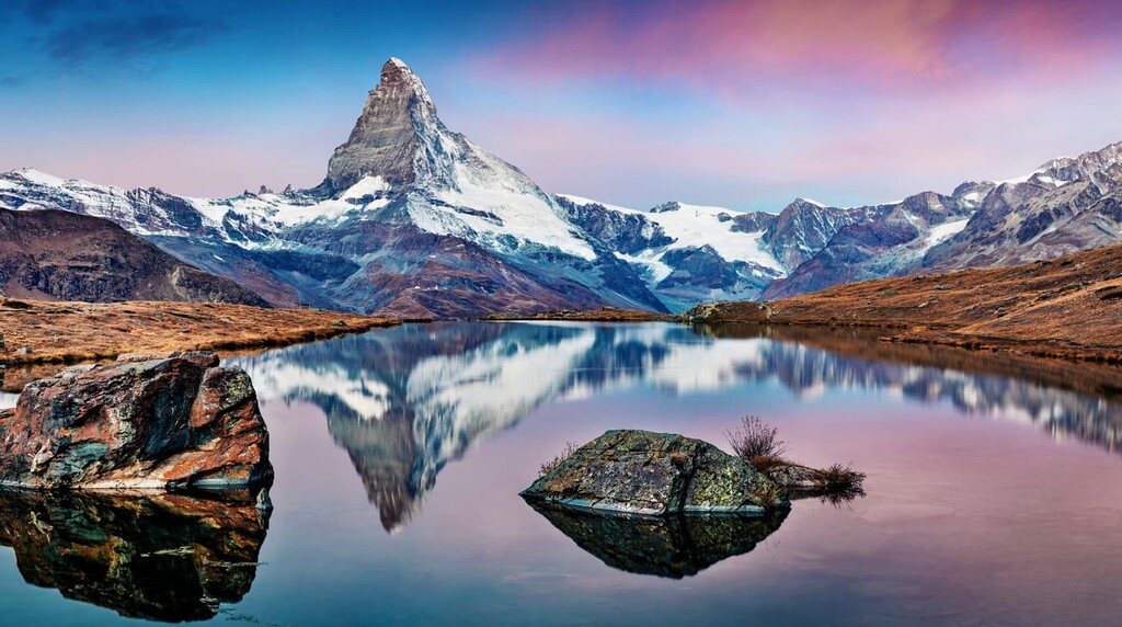
Though not the tallest peak in the canton, the Matterhorn is one of the most iconic mountains in the world. Situated along the border between Switzerland and Italy, the Matterhorn is also one of the highest peaks in the Alps.
The pyramid-like formation and steep slopes of the Matterhorn prevented the mountain from being summited until 1865. The west face of the mountain wasn’t fully climbed until 1962.
The route to the summit is demanding and technical. Many guides in the area require their clients to have prior mountaineering experience on other major peaks.
The most popular route is along the Hörnli Ridge from the Hörnli Hut on the Swiss side of the peak. The route often takes around 2 to 3 days to complete depending on the exact route taken and a climber’s skill level.
Monte Rosa
The Monte Rosa massif lies within the Pennine Alps between Switzerland and Italy. The massif is home to the second highest peak within the Alps, after Mont Blanc. There are four faces on the massif, three located on the Italian side and one on the Swiss side. The main summit on Monte Rosa is named Dufourspitze and it lies in Switzerland.
The glaciated peak is not a particularly difficult mountain to climb, but the high elevation and large crevasses on the mountain can be dangerous. As with many high peaks, Monte Rosa is subject to sudden changes in weather that add to the danger of the climb.
The main Monte Rosa tour is often completed by trekkers over the course of 3 days, along the West Ridge. After reaching the Monte Rosa Hut, mountaineering can then climb up to the Dufourspitze peak.
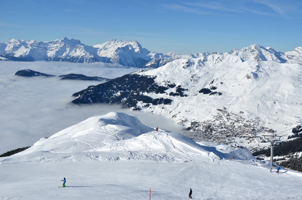
For skiing and snowboarding enthusiasts, there are more than 40 ski resorts in Valais (Wallis), which are located throughout the canton.
The largest ski resort in Valais (Wallis) is Les Portes du Soleil with more than 580 km (360 mi) of slopes and more than 165 ski lifts. However, it is partly located in France. It consists of Morzine, Avoriaz, Les Gets, Châtel, Morgins, and Champéry individual ski resorts. Yet it is the largest area for skiing in the Swiss Alps and the second largest in the Alps, Europe, and the world after Les 3 Vallées with more than 600 km (mi) of connected slopes and more than 150 ski lifts.
Other major areas for skiing in Valais (Wallis) with more than 100 km (62 mi) of slopes and more than 20 ski lifts each include the following in descending order of size:
The main ski resort near Geneva, the largest city west of the canton (due to the lack of cities in Valais/Wallis itself), is Les Portes du Soleil. But if we take its capital village, Sion, it is Anzère with more than 10 km (6 mi) of slopes and more than 10 ski lifts.
Check the Valais (Wallis) ski resorts map as well as the larger Switzerland ski resorts map in the World Mountain Lifts section of the site. It includes information about open ski lifts / slopes in Valais/Wallis in real-time with opening dates and hours. There are also year-round cable cars, funiculars, cog railways, aerial tramways, and all other types of mountain lifts.
Looking for a place to stay in Valais? Here are some of the best cities and villages to check out in the canton:
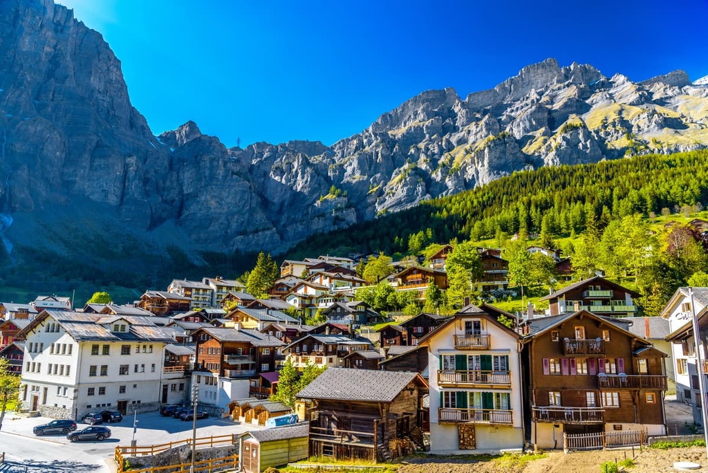
Zermatt lies at the upper end of the Matter Valley and is home to around 6,000 people. The city is located just 10 km (6 miles) from Theodul Pass, which connects Switzerland to Italy.
Zermatt is known around the world as a mecca for skiing and mountaineering. Many of the major peaks in the canton surround the small mountain village, which is normally full of tourists throughout the year. The Zermatt Ski Resort is also one of the most popular in the country.
Leukerbad is a small mountain village located in Valais that’s known for its thermal baths. Humans have inhabited and visited the region since Roman times to enjoy its natural occurring thermal waters. Today, there are 22 thermal pools in Leukerbad and most of them are surrounded by numerous hiking trails.
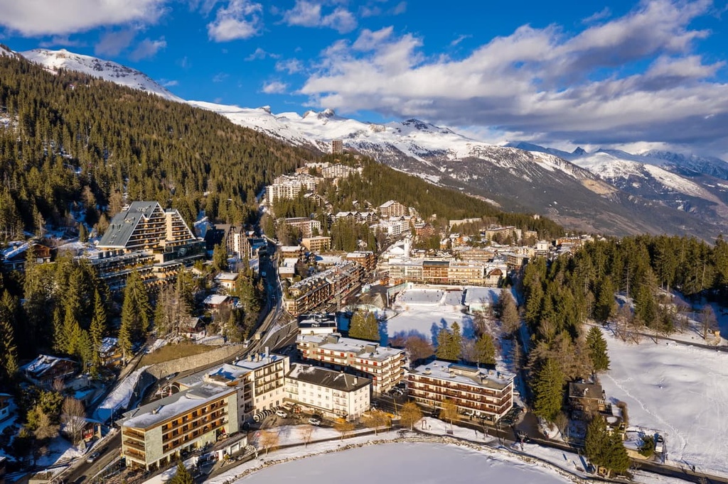
Crans-Montana is a municipality known for its ski resorts and alpine ski races. Situated in the heart of the Alps, the ski resort contains 140 km (87 miles) of marked runs for skiers to enjoy. Additionally, the village transforms into a popular hiking destination for tourists during the summer months.
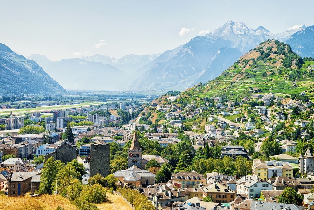
Sion (Sitten in German) is the most populous city in the canton, as well as the capital of the region. The city is home to around 35,000 residents and lies just to the west of Pfyn Finges Nature Park. Sion is the third largest wine producing region in the country.
The high towers in Sion are part of the Castle of Valère and the Castle of Tourbillon. Numerous historical buildings and sites can be found throughout the city. Sion’s central location makes it the ideal spot for exploring the canton.
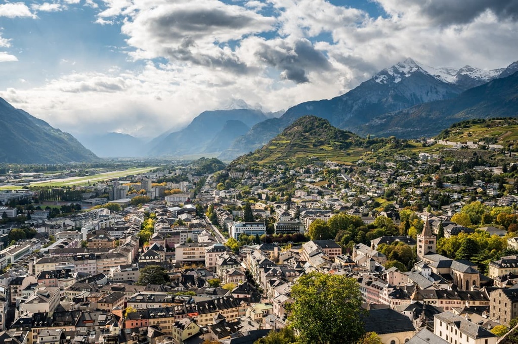
During the summer months, hikers can explore the vast network of trails in the surrounding mountains and Pfyn Finges Nature Park. Nearby thermal spa resorts attract tourists throughout the year. Sion’s close proximity to the ski resorts of Anzère, Crans-Montana, 4 Vallées and Val d'Hérens, make it an ideal destination during the winter months, too.
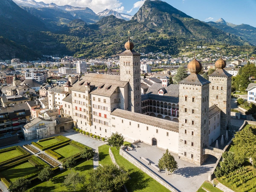
Brig, officially known as Brig-Gils, lies in the eastern portion of the canton, near Binntal Nature Park. Brig has around 14,000 residents and is also home to Stockalper Palace. The palace is one of the most important Baroque palaces in the country. Brig is also known for its thermal baths.
The city is located close to Simplon Pass, which has allowed its tourism to flourish. Direct routes now lead from the small mountain town to nearby Bern. The city is surrounded by hiking trails and ski resorts, allowing for year-long adventure. Though less popular than other mountain towns in the country, Brig provides visitors with a true experience of being tucked away in the Swiss Alps.


top10
ultra
glacier
europe-4500ers
alps-4000ers
italy-ultras
switzerland-ultras
top10
glacier
europe-4500ers
alps-4000ers
top10
glacier
europe-4500ers
alps-4000ers
top10
ultra
glacier
alps-4000ers
switzerland-ultras
top10
ultra
glacier
europe-4500ers
alps-4000ers
italy-ultras
switzerland-ultras
top10
ultra
glacier
alps-4000ers
switzerland-ultras
top10
glacier
europe-4500ers
alps-4000ers


