The Dunantspitze (German for "Peak Dunant", 4,632 m), formerly called Ostspitze ("Eastern Peak"), is a peak of the Monte Rosa Massif in the Pennine Alps in Switzerland. It is the second highest peak of the massif, after the Dufourspitze (4,634 m) and the second highest summit in Switzerland, but its prominence is only about 15 metres. At the time of its first ascent it was unclear which of the summits was the higher.
There's a difficult alpine trail (T6) leading to the summit.
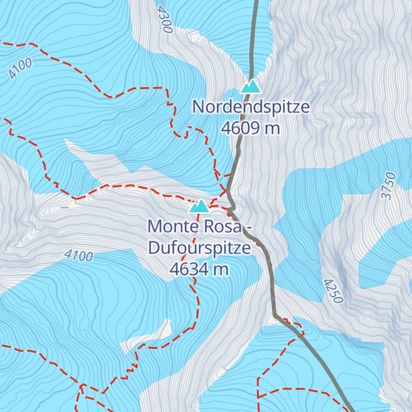
The nearest mountain hut is Rifugio Capanna Regina Margherita located 1 335m/4 381ft SE of the summit.
By elevation Dunantspitze is
# 6 out of 60693 in the Alps # 2 out of 1787 in Valais/Wallis # 2 out of 345 in Visp # 6 out of 42694 in Italy # 2 out of 4320 in Piemont # 2 out of 614 in Verbano-Cusio-Ossola # 2 out of 10817 in Switzerland # 2 out of 2009 in the Pennine Alps
We use GPS information embedded into the photo when it is available.
3D mountains overlay
Adjust mountain panorama to perfectly match your photos because recorded by camera photo position might be imprecise.
Move tool
Rotate tool
Zoom
More customization
Choose which peak labels should make into the final photo and what photo title should be.
Next
Photo Location
Satellitte
Flat map
Relief map
Latitude
Longitude
Altitude
OR
Latitude
°'''
Longitude
°'''
Apply
Register Peak
Peak Name
Latitude
Longitude
Altitude
Register
Teleport
PeakVisor
This 3D model of Sagarmatha National Park in Nepal was made using the PeakVisor app topographic data. The mobile app features higher precision models worldwide, more topographic details, and works offline. Download PeakVisor maps today.
Download OBJ model
PeakVisor
The download should start shortly. If you find it useful please consider supporting the PeakVisor app.
PeakVisor for iOS and Android
Be a superhero of outdoor navigation with state-of-the-art 3D maps and mountain identification in the palm of your hand!