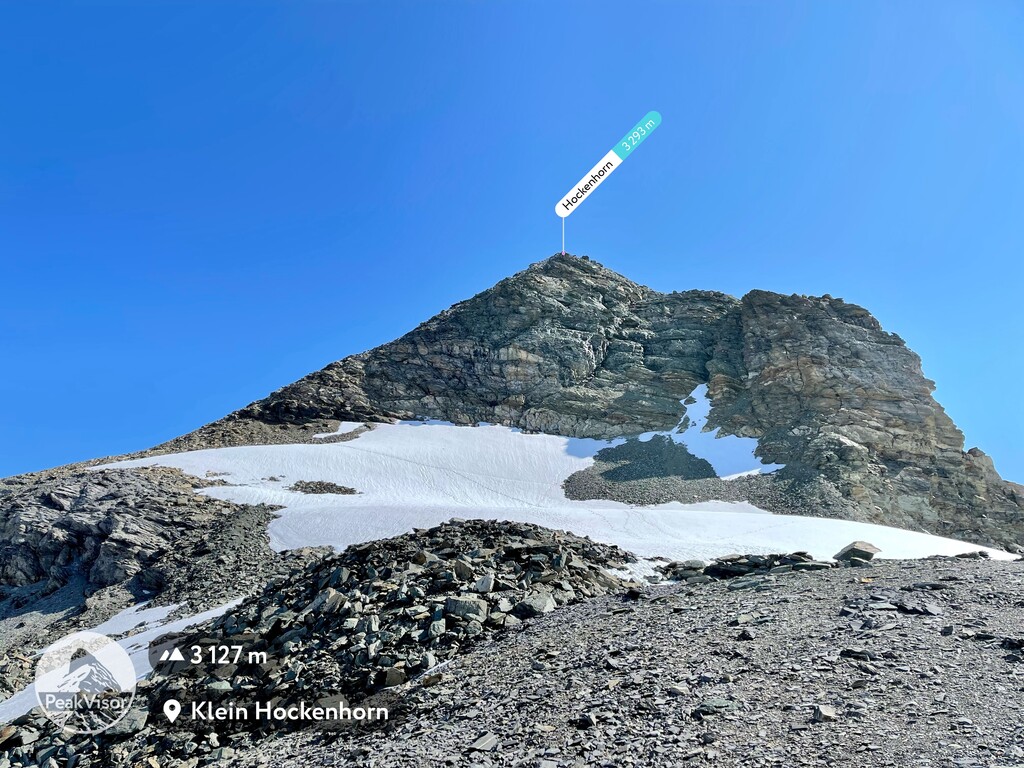
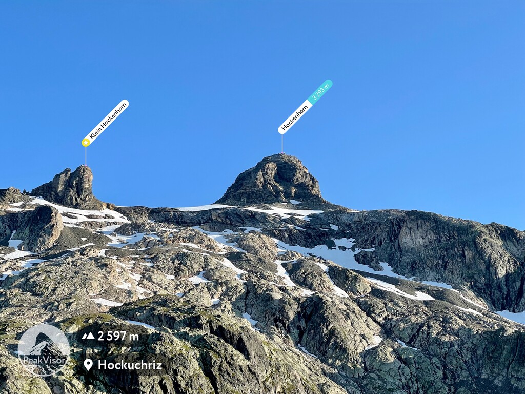
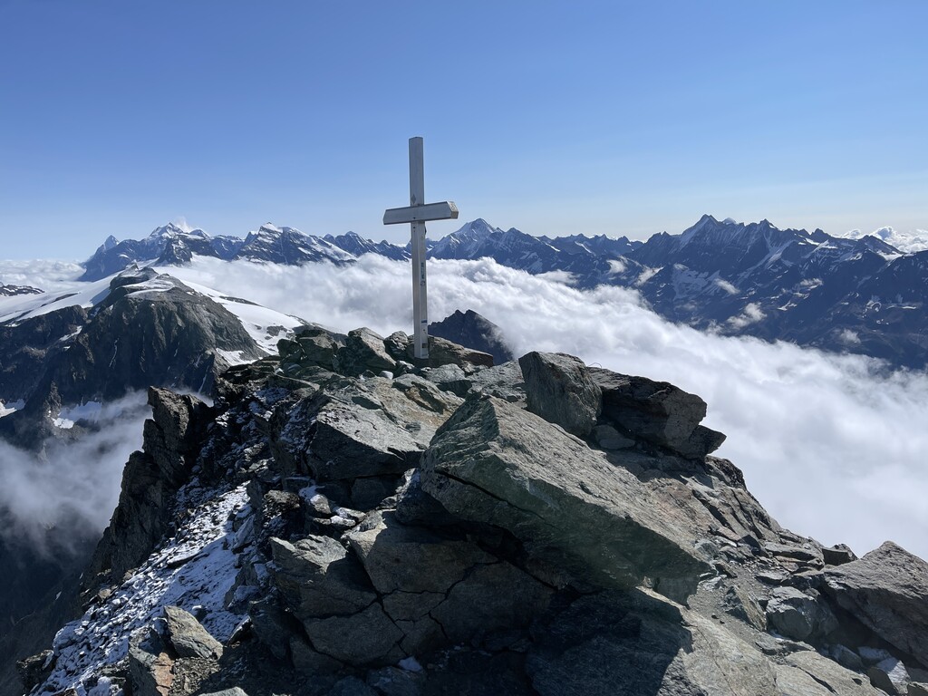
The Hockenhorn is a mountain of the Bernese Alps, located on the border between the Swiss cantons of Bern and Valais. Its summit is 3,293 metres high and lies between the upper Kandertal and the Lötschental. On its southern (Valais) side lies a glacier named Milibachgletscher.
The summit of the Hockenhorn is accessible by a trail starting at the Lötschen Pass. The southern side of the mountain is part of a ski area. The closest locality is Lauchernalp above Kippel.
There's a demading hiking trail (T3) leading to the summit.
The nearest mountain hut is Berggasthaus Heimritz located 1 931m/6 335ft NNW of the summit.
By elevation Hockenhorn is
# 13 out of 279 in Verwaltungskreis Frutigen-Niedersimmental # 78 out of 1615 in Bern # 20 out of 126 in Westlich Raron
By prominence Hockenhorn is
# 16 out of 279 in Verwaltungskreis Frutigen-Niedersimmental # 55 out of 1615 in Bern # 82 out of 1787 in Valais/Wallis # 5 out of 126 in Westlich Raron # 40 out of 1128 in the Bernese Alps
We use GPS information embedded into the photo when it is available.
3D mountains overlay
Adjust mountain panorama to perfectly match your photos because recorded by camera photo position might be imprecise.
Move tool
Rotate tool
Zoom
More customization
Choose which peak labels should make into the final photo and what photo title should be.
Next
Photo Location
Satellitte
Flat map
Relief map
Latitude
Longitude
Altitude
OR
Latitude
°'''
Longitude
°'''
Apply
Register Peak
Peak Name
Latitude
Longitude
Altitude
Register
Teleport
PeakVisor
This 3D model of Sagarmatha National Park in Nepal was made using the PeakVisor app topographic data. The mobile app features higher precision models worldwide, more topographic details, and works offline. Download PeakVisor maps today.
Download OBJ model
PeakVisor
The download should start shortly. If you find it useful please consider supporting the PeakVisor app.
PeakVisor for iOS and Android
Be a superhero of outdoor navigation with state-of-the-art 3D maps and mountain identification in the palm of your hand!


.jpg)
.jpg)
.jpg)
.jpg)
.jpg)
.jpg)
.jpg)


