
Scan the QR code and open PeakVisor on your phone
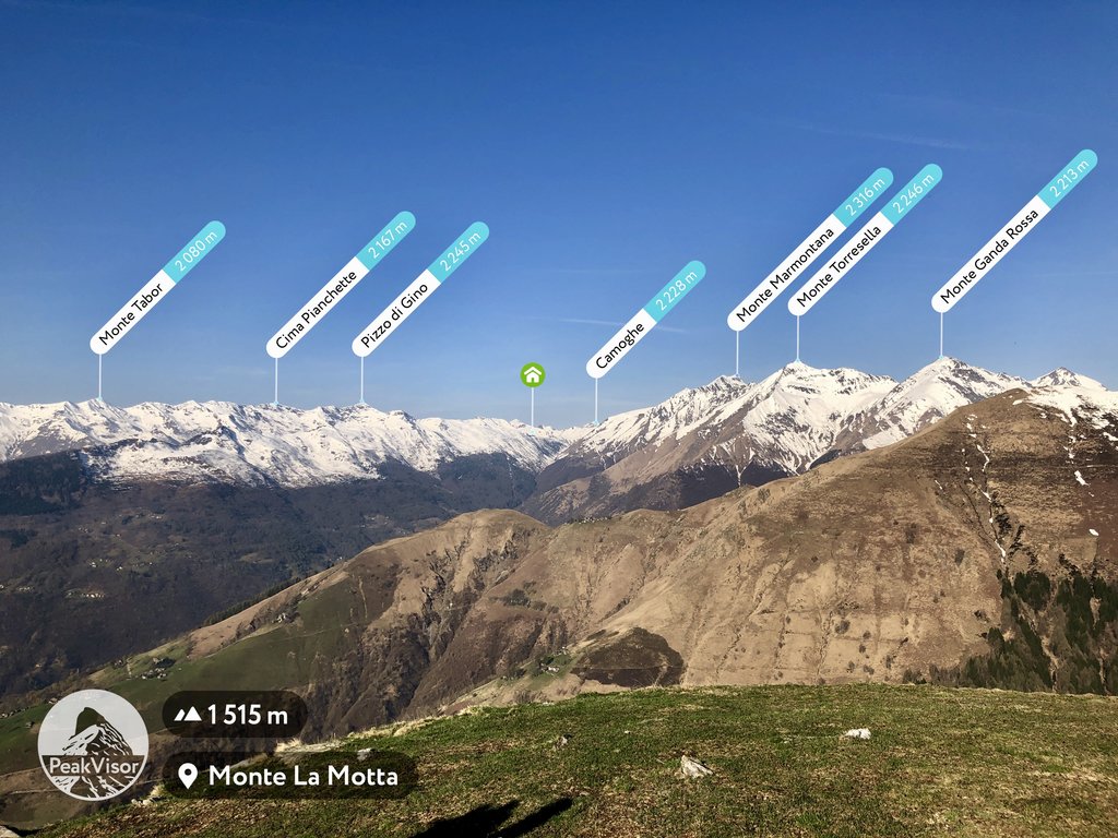
The Lugano Prealps include 448 named peaks. The highest is Pizzo di Gino at 2,245 m. Other notable peaks include Camoghè, Cima Pianchette and Cima del Vallone.
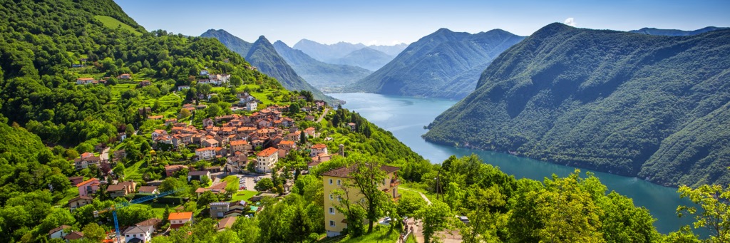
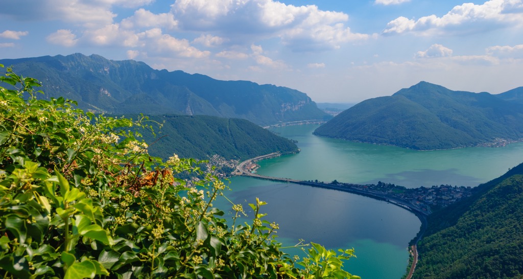
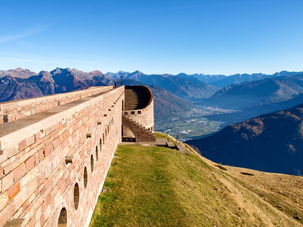
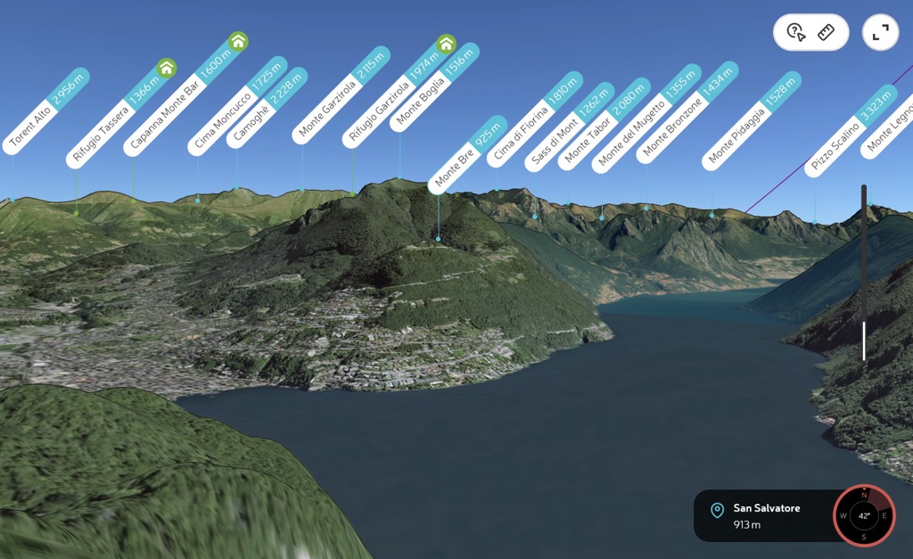
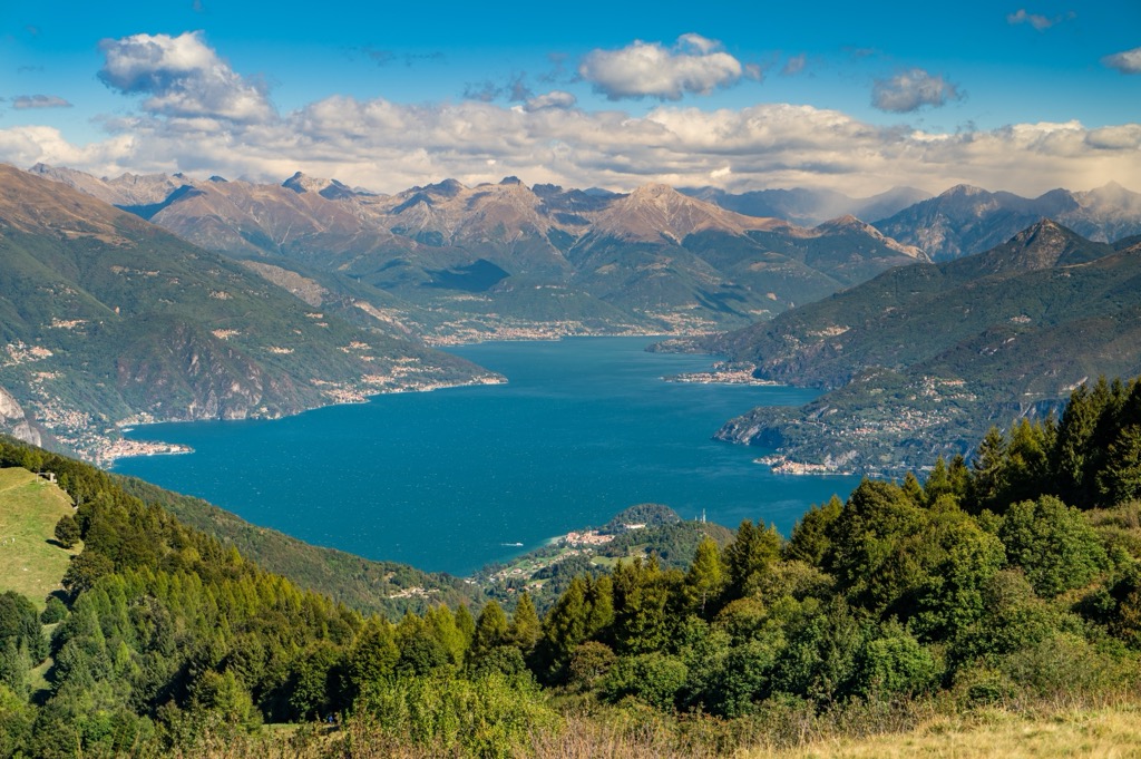
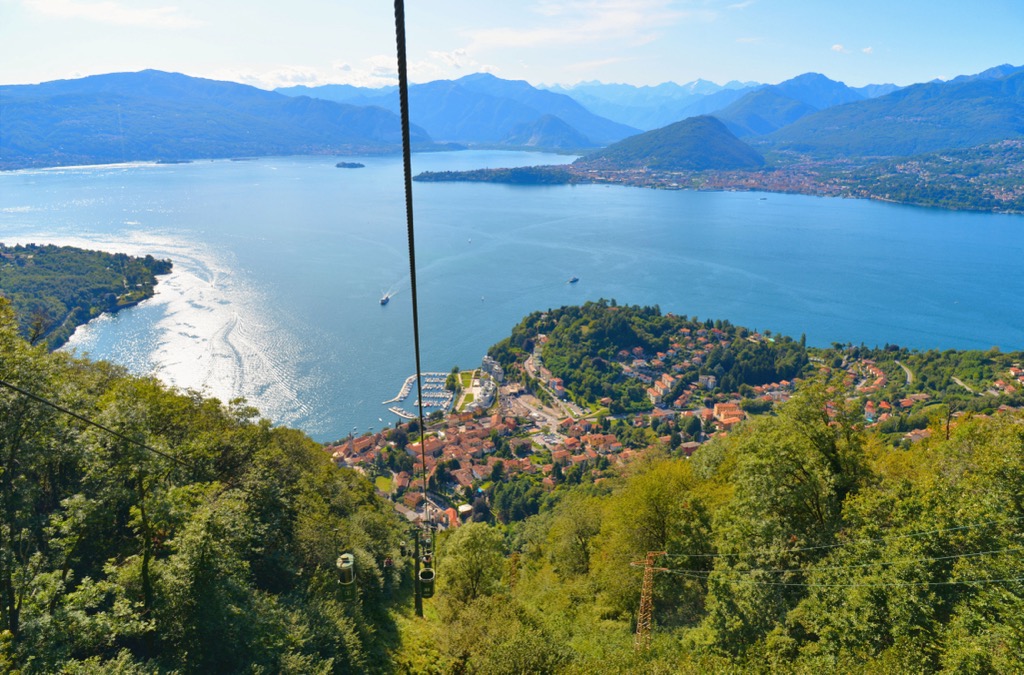
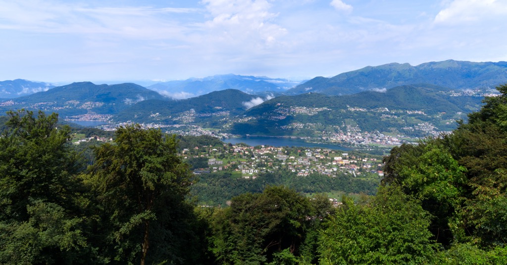
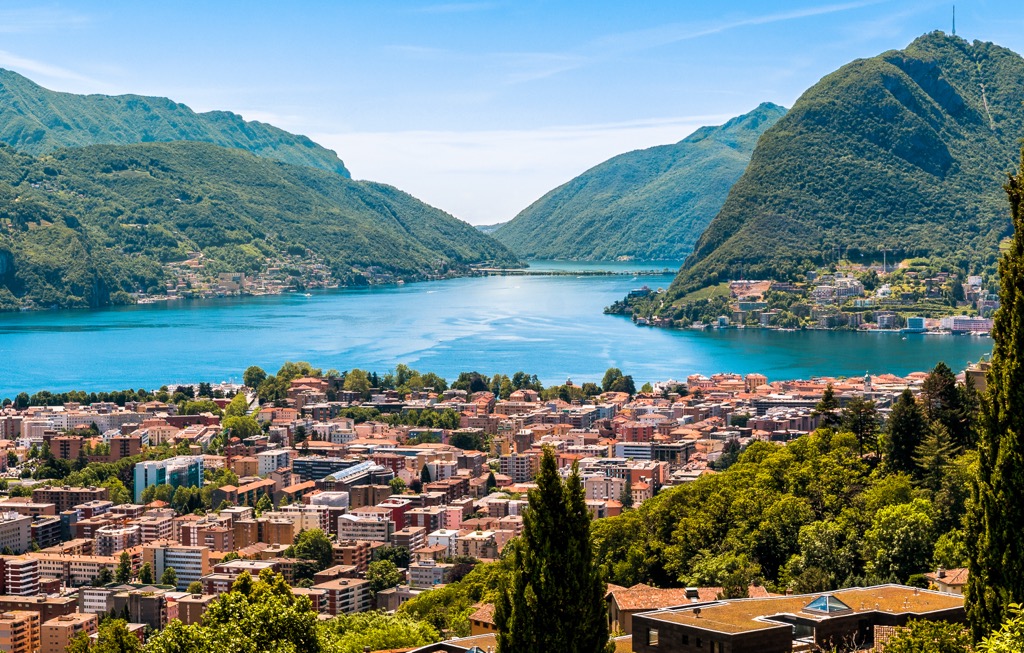
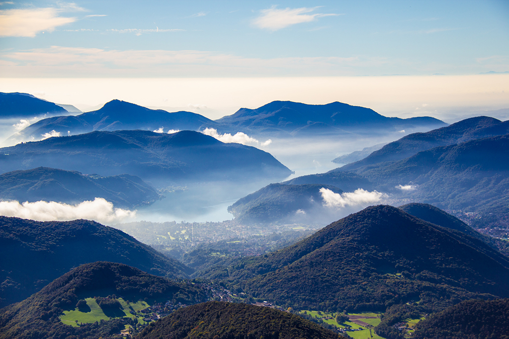
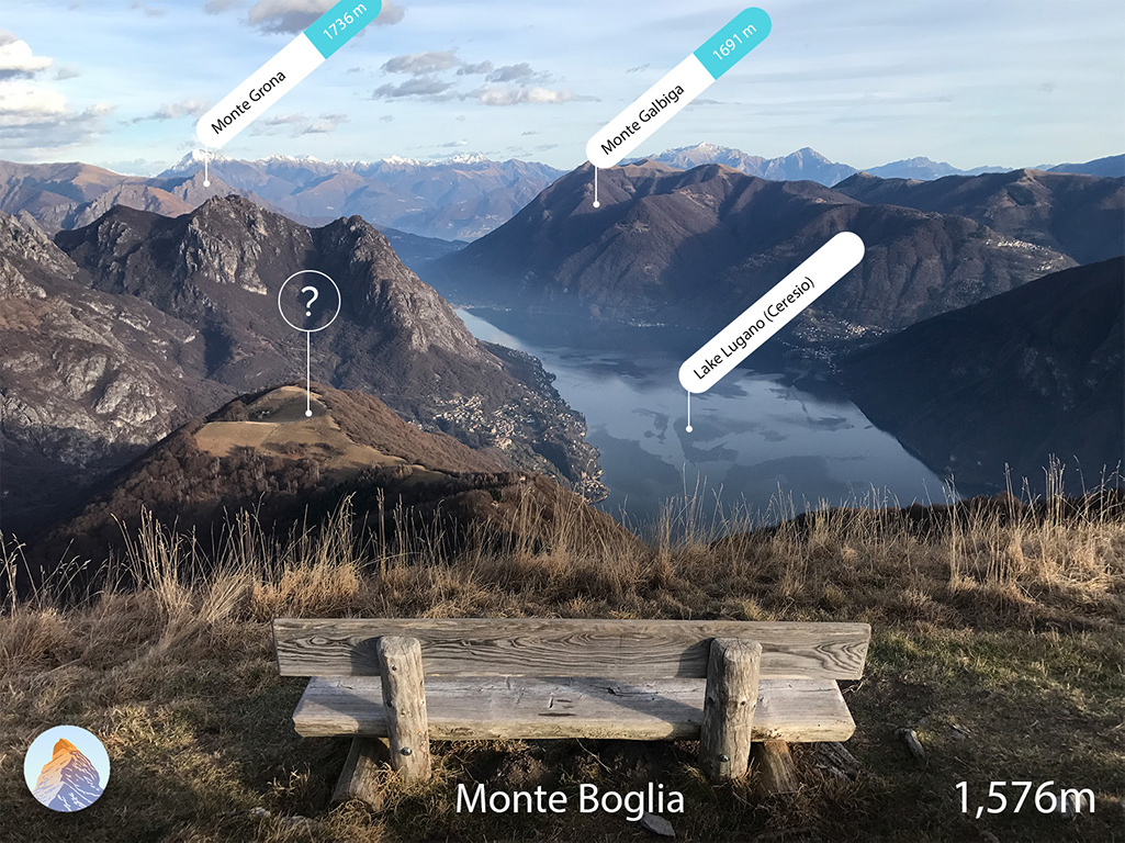
The Lugano Prealps is one of the major mountain ranges in the Western Alps in northern Italy and the very south of Switzerland. The main feature of the Lugano Prealps is their location on three of the five famous lakes in this part of the world: the Lugano of the same name, as well as Maggiore and Como. All three lakes are an integral part of the landscape of the range, without which it is simply impossible to imagine, and vice versa—lakes without mountains. The highest mountain in the Lugano Prealps is Pizzo di Gino (2,254 m / 7,395 ft). The most prominent mountain is Monte Tamaro (1,961 m / 6,433 ft), which is better known for its breathtaking funicular leading to a height of 1,530 m (5,019 ft), from where it is a short walk to the top. In total there are 448 named mountains in the Lugano Prealps.
As has just become clear, the name of the mountains comes from the name of the lake.
The word “Lugano,” in turn, most likely comes from the name of the ancient Celtic god Lugus, the patron saint of water. (The Celts were the largest tribe in what is now northern Italy before the arrival of the Romans.) From here also comes the Latin “lucus”—”sacred grove”, and “Lakvannus”—”lake dwellers”. By the way, the second little-known name of the lake, Ceresio, has Latin roots, too—from “Ceresius lacus”, which means about the same thing.
Unraveling the etymological tangle further: the Indo-European root “lug” comes from “leug”—“black”, “to break”, or “to take an oath”, or “leuk”—“to shine”.
The modern name of the lake also did not find its form at once, but went through a series of transformations: Luanasco—Luano—Lugano (Lugan in Lombard dialect of Italian).
The word Prealpes in the name of the range predictably means that it is the beginning of the Alps. To the south of them is the Padan Plain, which covers all of northern Italy.
The Lugano Prealps in Italian and German, two main languages of an area, are Prealpi Luganesi and Luganer Voralpen, respectively.
Despite being called one of the main ranges in the Western Alps, it is one of the smallest in terms of square footage, far behind the neighboring Pennine Alps to the west, the Lepontine Alps to the north, to which it is connected by the San Jorio Pass (2,010 m / 6,594 ft); the Western Rhaetian Alps to the northwest; and the Bergamasque Alps and Prealps to the east.
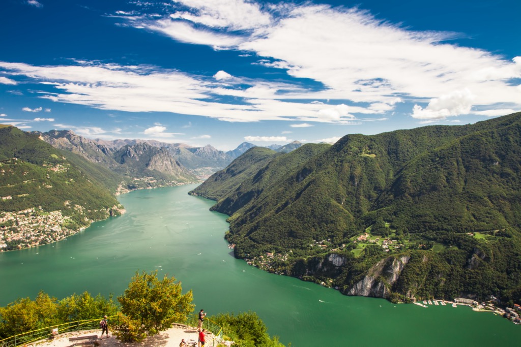
Remaining on the geographical map, the core of the range is three above-mentioned lakes, beyond whose borders it does not extend. Lugano Lake is in the center, Maggiore on the left, and Como on the right. The range border also runs along the major Ticino River between the towns of Locarno to Bellinzona.
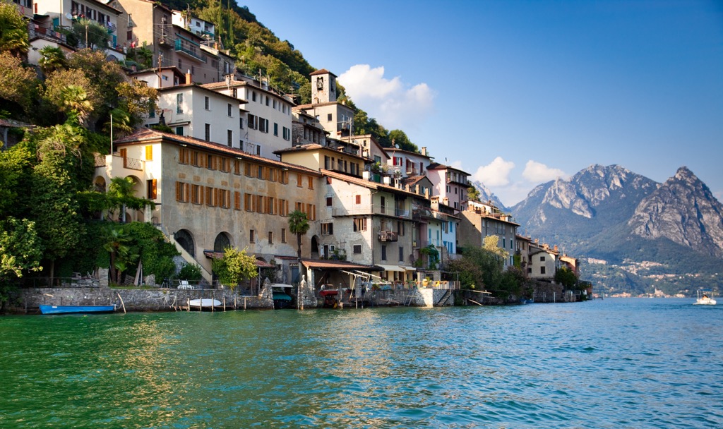
A separate line should be noted the so-called Triangolo lariano (Lario Triangle)—a peninsula of almost triangular shape, far into Como Lake (Lario is its Latin name), known primarily for the village of Bellagio at its northern tip, as well as Monte San Primo (1,681 m / 5,515 ft) mountain, which offers a magnificent view over the entire water body. Yes, the famous casino in Las Vegas seems to be named after it. Well, or you may have heard yourself that Hollywood actor George Clooney often lives in his villa here. Most likely he is not the only one, these mountains have long attracted celebrities, not just Italian ones.
On the administrative map, the range is not equally distributed country-wise, the major part stretches over the Italian region of Lombardy in the provinces of Varese, Como, and Lecco whilst the southernmost part of a Swiss canton of Ticino, including in the districts of Mendrisio, Lugano, Locarno, and Bellinzona, makes up a small tip in the center of it.
The city of Milan and Malpensa International Airport are just one hour away from the area, which makes the Lugano Prealps a perfect destination for a day trip and a weekend getaway.
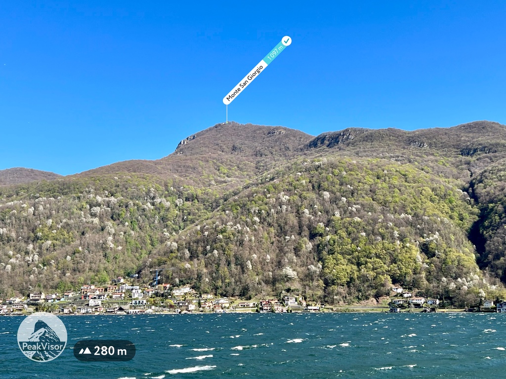
The most important fact about the geology of the Lugano Prealps is that the area south of Lugano Lake is rich in various fossils around 220 to 180 million years old (Triassic and Jurassic periods). In particular, the largest deposits have been found at Monte San Giorgio (1,097 m / 3,599 ft), a UNESCO World Heritage Site. You can see them in the Museum of Fossils from Monte San Giorgio (Museo Dei Fossili Del Monte San Giorgio, Via Bernardo Peyer 9, 6866, Meride, Switzerland), located on the site.
The Lugano Prealps are part of the Northwestern Alps (Alpi Nord-occidentali)—one of the two main parts of the Western Alps (Alpi Occidentali) in the Italian classification of Alps SOIUSA, where they are number 11, out of 14 in the western part of the Alps and 36 in total. At the same time, it is the southernmost of the four easternmost mountain ranges of the Western Alps on the border with the Eastern Alps, along with the Lepontine Prealps, the Glarus Alps, and the Swiss Prealps.
In Italy, they are also often called Western Lombard Prealps (Prealpi Lombarde Occidentali) or Ceresio Prealps (Prealpi del Ceresio). Here, this is one of the three large parts of the Lombard Prealps covering the Lombardy region on the administrative map of Italy, on par with the Bergamasque Alps and Prealps, and the Brescia and Garda Prealps. However, you will not find the Western Lombard Prealps in SOIUSA.
Internally, the mountain range is divided into two large subranges, or rather parts—eastern and western — named after the two Italian cities with the corresponding largest mountain groups within them:
PeakVisor founder: "The highest mountain in the Lugano Prealps is Pizzo di Gino (2,254 m / 7,395 ft) in Italy to the west of Como Lake. Monte Tamaro (1,961 m / 6,433 ft) in Switzerland is the most prominent mountain. With a prominence of 1,407 m (4,616 ft), this mountain is "almost" Ultra, lacking just 93 m (305 ft) to get the title."
In addition to the aforementioned Monte San Primo, other equally important and famous mountains are the following:

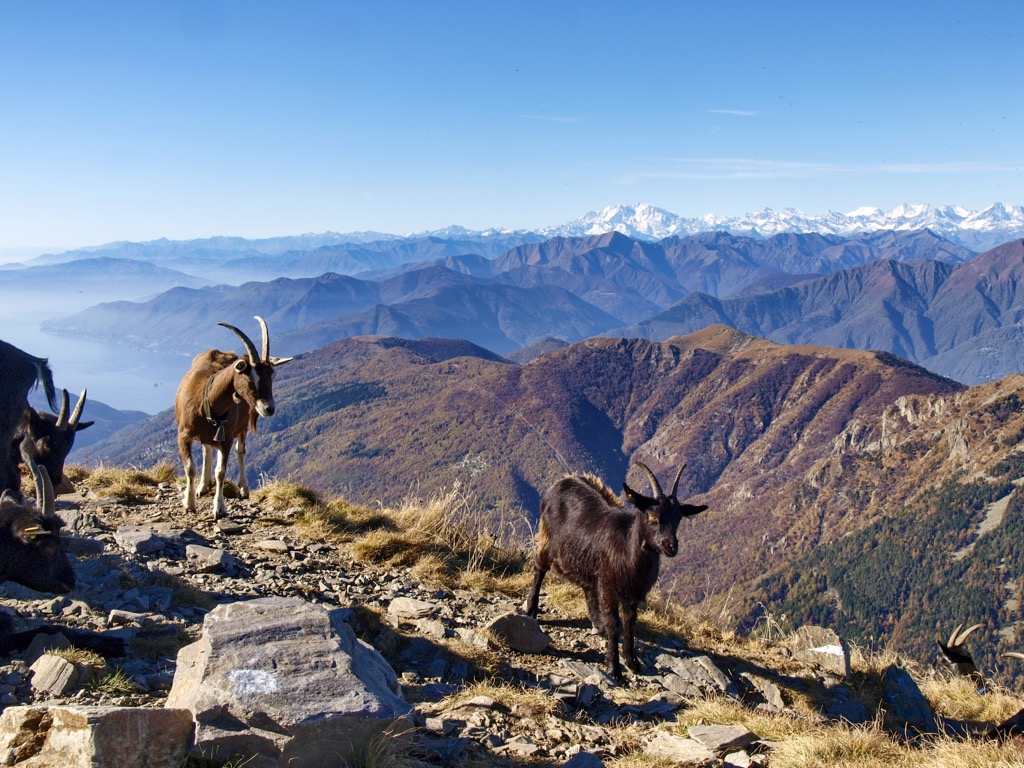
For this section, I asked PeakVisor founder as a local to help me in this guide: "The area is a real paradise for outdoor enthusiasts. A mix of sunny south Mediterranean flair, three marvelous lakes, and epic Alpine landscapes would drive any mountain aficionado crazy. There is a dense network of well-marked hiking and MTB trails with numerous panoramic points and benches.
Here are the main ones, including the above-mentioned mountains and peaks that you can reach by foot, bike, and cable cars:
I should also note that many of these mountains and peaks lie within various natural areas in which you will find even more trails and interesting places to hike. These include the following largest parks, which are easy to relate to the names above. They are located in Italy in the southern part of the range:
In addition to these, there are also many small nature reserves scattered throughout the range, dedicated to particular landscape features and natural attractions. Sasso Malascarpa Nature Reserve, for example, is another interesting area in Lombardy from a geological, geomorphological, and paleontological point of view.
And yet, just in case this is not enough for you, the two nearest larger ones are Val Grande National Park to the west and Parco delle Orobie Bergamasche to the east of the mountain range in the neighboring the Pennine Alps and the Bergamasque Alps and Prealps. Both parks are Italian. To the north of the range, it is Beverin Nature Park (Naturpark Beverin) in Switzerland.
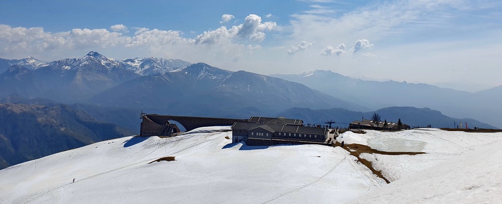
For skiing and snowboarding enthusiasts, there are no ski resorts in the Lugano Prealps, except the three very small ones with less than 1 km (mi) of slopes and several ski lifts.
However, this does not mean that you can't ski here at all. The nearest major resorts in the neighboring mountain ranges are nearby. These are at least Mottarone on the western side of the Maggiore Lake with more than 15 km (mi) of slopes and more than 5 ski lifts, and Piani di Bobbio on the eastern side of the Como Lake with more than 35 km (22 mi) of slopes and more than 15 ski lifts.
To the north of the Lugano Prealps, there are more resorts and they are also larger: Piana di Vigezzo, Bosco Gurin-Grossalp, Carì, Nara-Leontica, Valchiavenna, and others.
Check the nearest ski resort to the Lugano Prealps on the larger Ticino and Lombardy ski resorts maps in the World Mountain Lifts section of the site. It includes information about open ski lifts / slopes near the Lugano Prealps in real-time with opening dates and hours. There are also year-round cable cars, funiculars, cog railways, aerial tramways, and all other types of mountain lifts.
Before or after the hike, visit one of the official information points in the Lugano Prealps located throughout the mountain range. Here is the central one in Lugano:
Lugano Center Info Point
Piazza della Riforma, 1, Palazzo Civico, 6901, Lugano, Switzerland.
Monday to Friday: 9:00 am to 12:00 pm, 1:00 pm to 5:30 pm, Sunday and holidays: closed
+41582206506
The official tourist sites of Ticino and Lombardy: Ticino.ch, and In-lombardia.it.
I suppose you should have no problem finding lodging while hiking in the Lugano Prealps.
As in all other parts of the Alpine system, and in the mountains in general, the main type of temporary accommodation here is hut. It is only worth specifying that in Italian they are called "rifugio" and in German "hutte". Some of them we have already listed in the guide, the rest are easy to find on the 3D map in the application.
In the central part of the system in the Lugano area, you will also find all other kinds of accommodation: B&Bs, rooms, and apartments on Airbnb or Booking.com, campings, and others.
I also agree with the founder of PeakVisor and also recommend the incredibly well-developed, comfortable, and relatively inexpensive (true, in Italy, but not in Switzerland) accommodation. But also in the latter you can find good options of up to 100 euros per night for two people if you go hiking in the off-season or in less touristy places.
Anyway, spending a night or two in a classic rifugio/hutte or family-run B&B is not only about comfort and cost, but a great addition to the experience of hiking in nature, which will allow you to know the region better through the communication with locals.
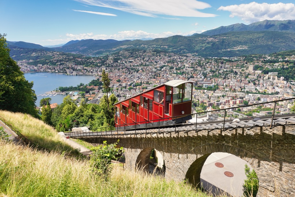
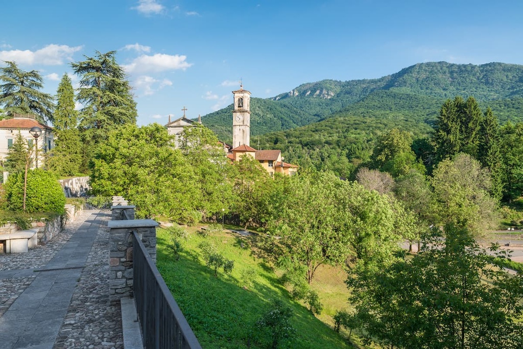
In the guide, you have already learned about the main cities and resorts in the Lugano Prealps. Let me tell you a little about their capital, Lugano.
It is not so much a large (75.93 sq km / 29.32 sq mi) as it is a busy, always moving city of over 67,000 people (2019), part of a larger urban agglomeration of over 150,000 inhabitants, much of which are Italians and Swiss who speak Italian. In other words, we could call it "Little Italy" within Switzerland, by analogy with "Little Austria" (Trentino and Tyrol) in Italy itself.
However, to name even the main architectural and cultural attractions of Lugano I would need a separate guide, the size of this one, no less. So I will just say that the municipality is home to 17 sites of different origin that are part of the Swiss Inventory of Cultural Property of National and Regional Significance — a very important thematic list for the country, as the name implies.
In particular, these are the whole city of Lugano and several districts and villages in the namesake municipality; two libraries; the Cathedral of San Lorenzo and two churches (Santa Maria degli Angioli, and San Rocco); three museums, including the Museo cantonale di storia naturale di Lugano; and many palaces: Palazzo civico, Palazzo e cinema Corso, three Palazzo Riva at different streets, and villas such a s Villa Favorita.
Some of them you come across on the way while walking, some you need to look for on purpose. But there are plenty of them for an interesting time in the city and its surroundings.


The Lugano Prealps are part of the Alps.
The highest peak in the Lugano Prealps is Pizzo di Gino, at 2,245 m.
The Lugano Prealps have 448 named peaks.


