Scan the QR code and open PeakVisor on your phone
There are 115 named mountains in the province of Varese. Monte Corbaro is the highest point. The most prominent mountain is Monte Nudo.
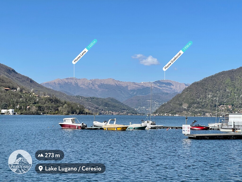
Varese is one of the 12 provinces in Lombardy, a region in Northern Italy. It extends until the border of Switzerland, with which it shares the Varese Prealps, its major mountain range. They make part of the Lugano Prealps and cover an area located between Lake Maggiore and Lake Lugano. The Varese Prealps can be divided into two minor ridges: the Tamaro-Gambarogno-Lema Ridge, which belongs mostly to the Swiss and the Piambello-Campo dei Fiori-Nudo Ridge, mostly located on the Italian side. Both of them take their names from the most prominent peaks of the respective groups.
One of the perks of this area is the coexistence of wilderness and urban landscapes. Despite Varese being a provincial town in many respects, major cities like Milan, Como and Lugano can be reached by train or by car in less than an hour. Also, the nearest hiking trails are just 10 minutes away from Varese city centre.
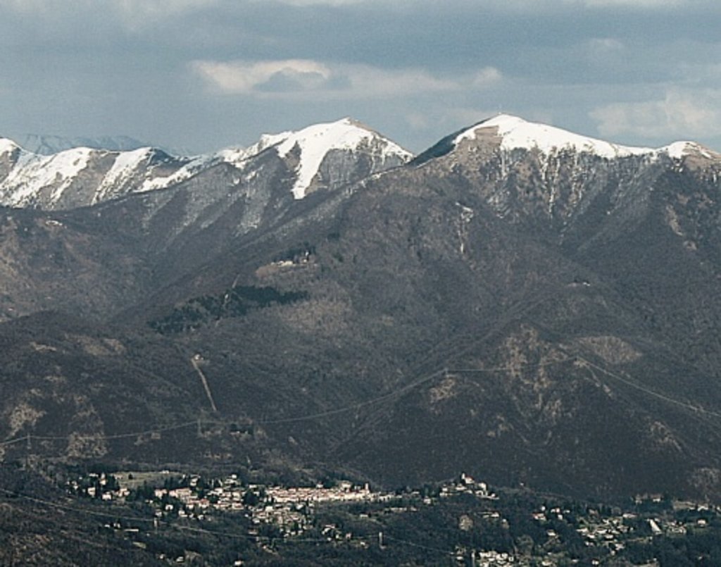
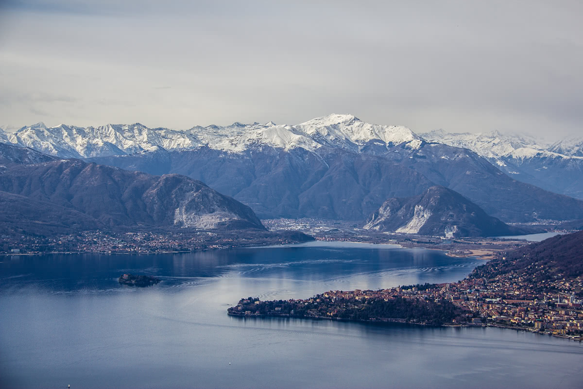
The Varese Prealps are a microcosm containing a huge variety of landscapes: there are four major big lakes and five minor lakes. Moreover, there are waterfalls, rivers and swamps, besides 10 major valleys, with great abundance of chapels, monasteries, castles, gardens, and many other treasures.
There are about 77 hiking trails in Varese, 7 of which are pilgrimage routes. No matter where you decide to go, you cannot just “hike” in Varese, because in every corner of every village on every mountain and in every valley, you will find at least one hiking trail passing through an archaeological site, a splendid church, or a colourfully painted borough etc. Trails on and around the Varese Prealps present a wide range of difficulty levels, but easy walking trails and medium level trails are the most popular and fascinating. Let’s discover some of these beautiful places.
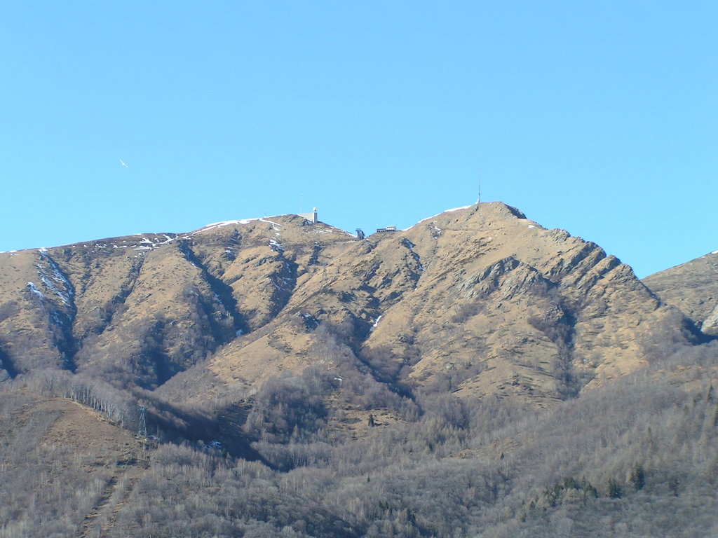
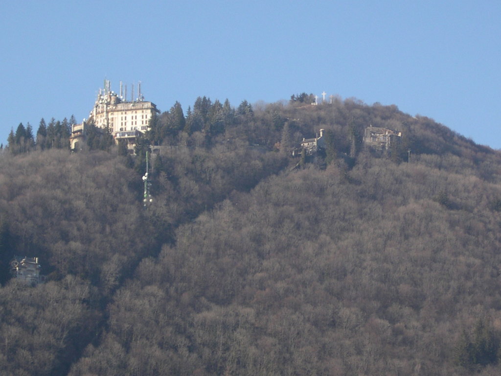
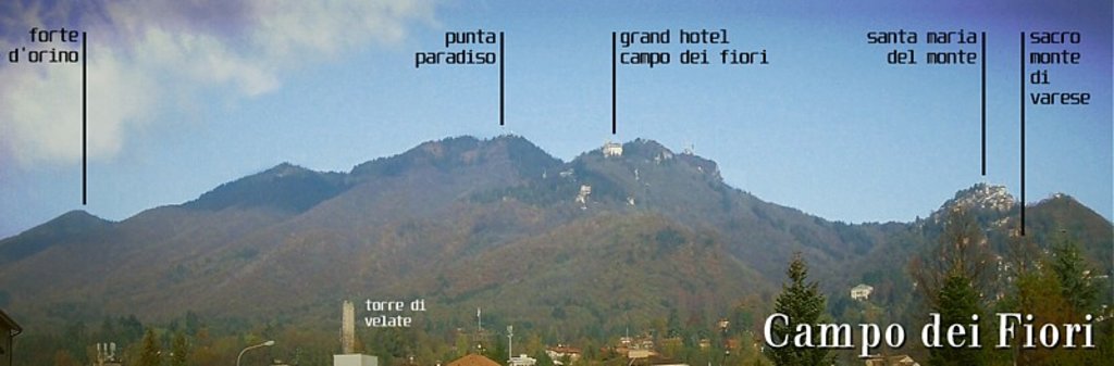
Sacro Monte and Campo dei Fiori are the most popular spots of Varese province. Sacro Monte (844m) was originally dedicated to the goddess Venus then, after the advent of Christianity, the Virgin Mary started to be worshipped there. The pilgrim trail ascending to Santa Maria del Monte Church located on the mountaintop is famous for its fourteen beautifully painted chapels scattered along the way. Proceeding from Sacro Monte by car or on foot, you get to Campo dei Fiori. There you will find trails reaching three major peaks: Tre Croci, Punta Paradiso and Punta di mezzo (1,227m), where the view of the Ceresio Valley, Varese, Brabbia Swamps and Monte Rosa (4,634m) is really stunning. There is also a famous astronomical observatory, from where you look at the starred night sky. Guided tours are available too.
Valganna is a rich green valley in the middle of Campo dei Fiori Regional Park. After parking your car at Badia di S. Gemolo, a small Benedictine monastery with a characteristic pentagonal cloister, you can choose between three trails, one going to the Valganna Mines, one leading to Monte Martica (1,026m) and one going to Brinzio village. Along the way to the mines, there is the possibility to stop at Valganna Lake and S.Gemolo Spring, a spring of pure water near which the Saint is believed to have become a martyr.
The Ceresio Valley is the valley surrounding Lugano Lake. Trails branching out of this area are mostly easy walking suitable for hikers of any level.
Via Verde Varesina is a trail created in 1980 to connect the area to the European trail E1 which ends in Porto Ceresio. The current trail is almost 200-km long and features ten historical stops. The most relevant stops are Arcumeggia, a small village famous for its colourfully painted walls and Dumenza. Another trail starting in Porto Ceresio is a 1h peaceful walk leading to the Brusimpiano – Trallo Waterfalls. If you are looking for a longer hike, there is a 7km trail feasible in 4h, starting in Viggiù and going to Monte Orsa (984m). This peak, together with Monte Marzio (878m) is the best place to discover the remains of the Cadorna line.
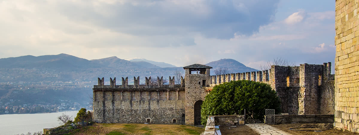
Anello di San Quirico is a 10 km trail feasible in 2.5h. This was the ancient path connecting the municipality of Ronco to Angera. It is an easy hike passing through the Ronco vineyards, where you can stop and enjoy a glass or two of wine, tasting the quality of this IGP product. Once the hike is completed, visiting the towering Rocca di Angera will pay back your fatigue.
Lake Varese Cycle Lane is a pedestrian-bike trail on Lake Varese, extending for 27km around the lake perimeter, in a really impressive countryside. The track is almost completely flat, but abundant in scenic spots and archaeological sites. The most convenient point to get on this trail is at Schiranna. In Azzate, visitors can see the Sanctuary of the Madonna del Lago, and then continue the hike in the green through to Cazzago Brabbia where it would be nice to see the historic ice houses built in the 18th century and recently restored. These buildings are a record of the fishermen's life on the lake. Near Biandronno, hikers can take a boat to Isolino Virginia, an important archaeological site mentioned on the UNESCO World Heritage List "Prehistoric pile-dwellings around the Alps". In this area, the lane connects Varese Lake to Comabbio Lake where you can admire the natural reserve of Brabbia Swamps (Palude Brabbia), one of the richest spots for animal and plant diversity in the province. From there, you can also easily reach the Voltorre Cloister (Chiostro di Voltorre), an impressive monastery of ancient Medieval origin.
Forte di Orino features a well-tracked path starting from Campo dei Fiori Observatory leading to a terrace that once used to be a military post. From there, a 360° view panorama allows admiring Varese Lake, Comabbio Lake, Monate Lake, Maggiore Lake and all the majestic mountains nearby. You can also reach Forte di Orino starting directly from Orino village. It usually takes 3h 45m to cover a distance of 3km.
Beautiful hiking trails branch off the numerous waterfalls of the area. Ferrera Waterfalls are probably the most popular spot, together with Froda Waterfalls. The best way to enjoy them is to leave the car somewhere in the villages around the area and ask locals how to get to the waterfalls. Usually, there is more than one option to reach them. In general, all the trails around the waterfalls in Varese do not present any particular difficulty, but it is always better to have at least a pair of trekking shoes since the trails may be slippery and more difficult in the proximity of the waterfalls.
There are three active mountain lifts in Varese.
Sacro Monte Cable Car is five minutes by car outside the city centre, on the slopes of Sacro Monte. It runs all year round and carries people who want neither to walk along the chapel trail nor to park the car on the top of the mountain to start their hike.
Monteviasco Ropeway is accessible from Ponte Piero, near Dumenza. It is the only access point to Monteviasco and it is open all year round. Another alternative is to take the 1400-step trails to the village. Monteviasco is located in the Tamaro-Gambarogno-Lema Ridge. From there you can reach Monte Pola (1,742m) planning a stop at Merigetta hut in about 3h.
Laveno Lake Gondola Lift, a peaceful nook of Varese province from where you can enjoy the combination of water and mountain landscapes while tasting delicious ice-cream at one of the numerous bars on the banks of the lake. The tiny gondola cableway (max 2 people in a single coach) comes in an open version and in a closed one. This is the only way to reach Sasso del Ferro (1,110m), but if you don’t like the idea of being in the open air in a tiny car you would better enjoy the view of the mountain from down there. If the sky is clear you can even see the spires of the Milan Cathedral (Duomo di Milano) using binoculars.
Mountains in Varese offer lots of panoramic spots, take Monte Nudo (1,235m) for example. A hiking trail starting near Laveno Lake and going to Monteggia - Monte Crocetta (1,117m), will take you there in 1h.
On Monte Marzio (878m) there is a panoramic spot called Belvedere. It is possible to get there in 1h of casual strolling. A piece of history still lies there: the trenches of the Cadorna line, a permanent system of defence used in 1899-1918 used to protect the Padania Plane from possible attacks from Northern countries. From this peak, you can continue with a 3h hike to Monte Piambello (1,122m).
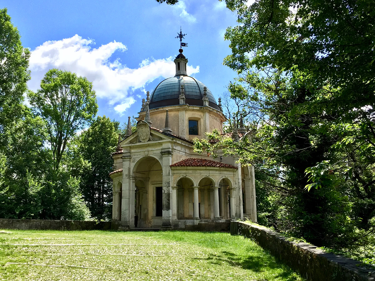
Sacro Monte, Varese.
Varese reached its peak period during the economic boom in the 1960s when small ski resorts flourished on these mountains, reducing drastically in the early 90s due to the scarcity of snow in the area. Nevertheless, on minor mountains like Monte Orsa snowboarding and skiing are still quite common in winter even if there aren’t any tracked ski runs. It is a local habit to bobsled on Sacro Monte slopes after the first heavy winter snow.
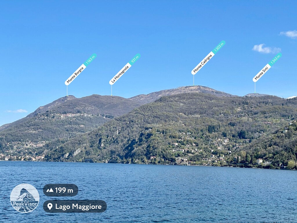
The only ski area of the province is located 50km from the city centre in the municipality of Maccagno. This is Forcora Pass (1,179m) provided with one ski run that connects Mount Cadrigna (1,304m) and two minor ski runs for alpine skiing and cross-country skiing. You can choose between amazing itineraries for snowshoes lovers as well, enjoying breathtaking views of Monte Rosa (4,634m) and Lake Maggiore. From Forcora Pass a 9km easy level trail leads to Monte Corbaro (1,545m).
Thanks to its closeness to Switzerland, big cities like Milan, airports like Malpensa and other important tourist destinations like Lake Garda, Varese is an especially appreciated area by Swiss and German tourists and people living in overpopulated cities who love to spend the weekends outdoors.
Varese is also called the “the garden-city” by locals, due to the numerous ancient villas surrounded by parks and gardens most of which belonged to rich families in the past and are now parks open to the public.
The presence of efficient tourist facilities is the natural consequence of the fact that the city has always been a favourite destination of noble families living in Milan who loved spending the summer season surrounded by healthy environment.
For any further details about Varese, you can visit the province official website or one of the numerous outdoor association's websites, like CAI Varese (Italian Alpine Club) or Varese Land of Tourism.
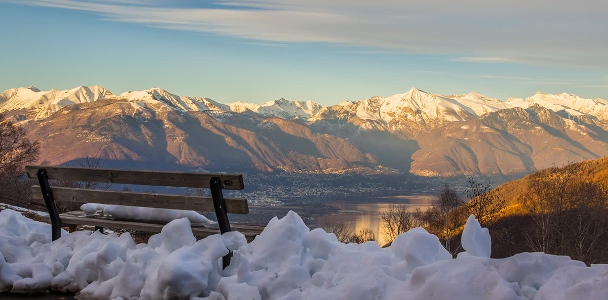
Viewpoint near Lago Delio