
Scan the QR code and open PeakVisor on your phone
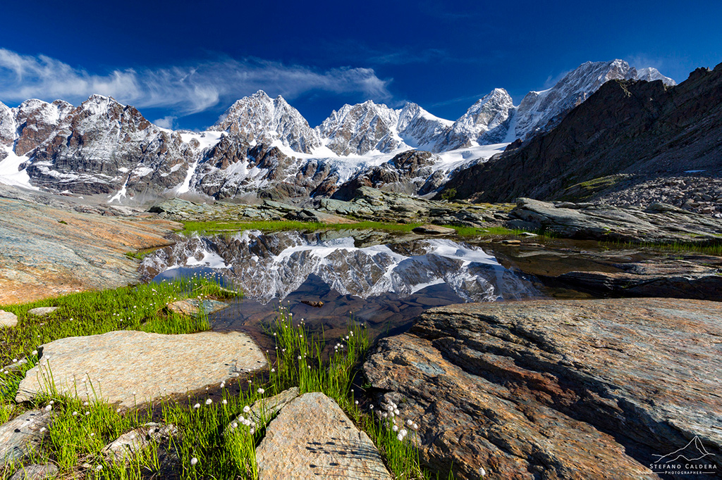
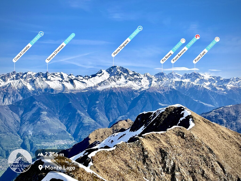
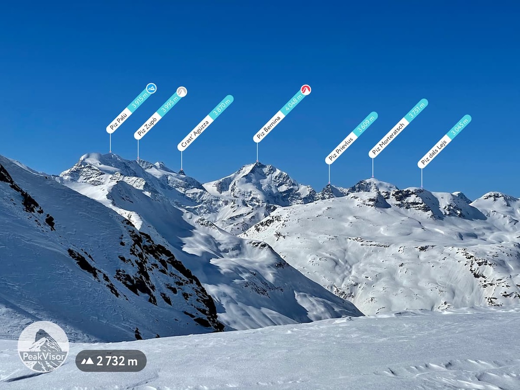
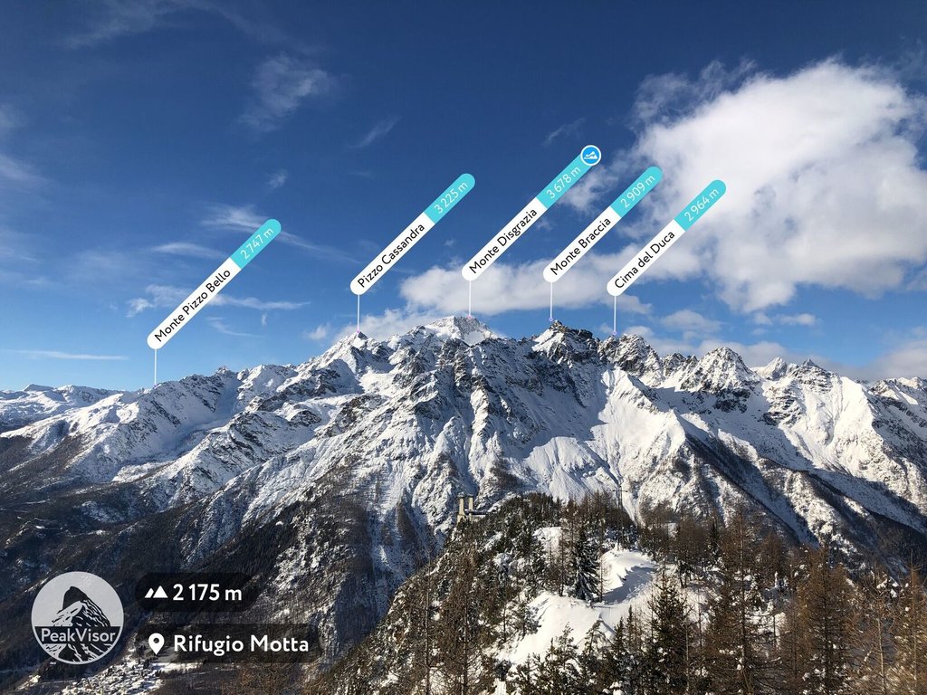
The Western Rhaetian Alps is one of the main mountain ranges in the Alps. Located in its geographical center, this part of the Alpine mountain system is particularly notable because it contains 11 subranges as well as the famous Bernina Express rail line, which crosses Bernina Pass (2,328 m / 7,637 ft). The range also contains 2817 named mountains, the highest and most prominent of which is Piz Bernina (4,049 m / 13,284 ft), which also happens to be the highest in the entire Eastern Alps.
The name of the Western Rhaetian Alps is likely a reference to the Rhaetian people, who were an Alpine tribe. Also known as the Rhaeti, Rhaetii, and Rheti, the Rhaetians are believed to have had a culture and language that was related to that of the Etruscans. They historically lived throughout what is now northeastern Italy.
Alongside their Celtic-speaking neighbors to the north, the Vindelici, the Rhaetians were conquered by the Imperial Roman army in 15 BCE. Their territory eventually became part of the province of Raetia et Vindelicia within the Roman Empire.
We know that the Rhaetians spoke a language that we now call Rhaetic, but it’s unclear where the name Raeti actually comes from. That said, we still see it in use today, such as in the Italian name for the range, Alpi Retiche occidentali and the German name for the range, Westliche Rätische Alpen.
The Western Rhaetian Alps are one of the three parts of the great geographical, historical and cultural area of the Rhaetian Alps, which are located in the very center of the Alps.
The Rhaetian Alps as a whole are located along the border of what we might call the western and eastern Alps. Alongside the Western Rhaetian Alps, we also have the Eastern and Southern Rhaetian Alps.
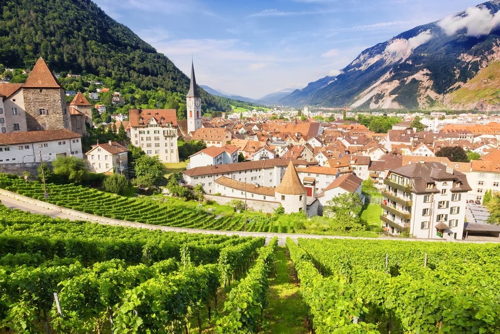
With respect to the region’s contemporary political borders, the Western Rhaetian Alps are almost completely located in Switzerland in the canton of Grisons (Graubündewith) as well as in parts of northern Italy in the province of Brescia in the Lombardy region and the province of South Tyrol in Trentino-Alto Adige / South Tyrol region. You can also find the range in parts of the Tyrol region of western Austria, as well as the country of Liechtenstein.
The mountain range is bordered by the Bergamasque Alps and Prealps in the south, the Brescia and Garda Prealps and the Southern Rhaetian Alps in the east, the Bavarian Alps and the North Tyrol Limestone Alps in the north; and the Lugano Prealps, the Lepontine Alps, the Glarus Alps and the Swiss Prealps to the west.
The largest cities and the most famous resorts in the Western Rhaetian Alps include:
It usually takes no more than half a day to reach any of these towns and resorts by car from the larger cities in the region that have international airports. However, travel in the region can take a little longer if you’re taking public transportation, such as trains and buses.
The main feature of the geology of the Rhaetian Alps is their location on the border between the Western and Eastern Alps.
Both parts of the Alps formed during the Alpine orogeny, a mountain-building event that took place between 65 million and 2 million years ago. This area is therefore often referred to as the ‘heart’ of the Alps in every sense, including geologically.
The mountains in the range consist primarily of sedimentary rocks such as limestone and dolomite. There are also outcroppings of mica slate, quartz phyllite, marble, and other rock types in the range.
Interestingly, the Rhaetian age (208.5 million to 201.3 million years ago), the most recent of the three ages of the Triassic Period, is named after this mountain range.
The rocks of this stage can be found worldwide. In particular, in Great Britain, you can find the same lagoonal deposits—limestones, shales, and marls, and bone beds that contain fragments of amphibians and reptiles—that you can find in the Western Rhaetian Alps.
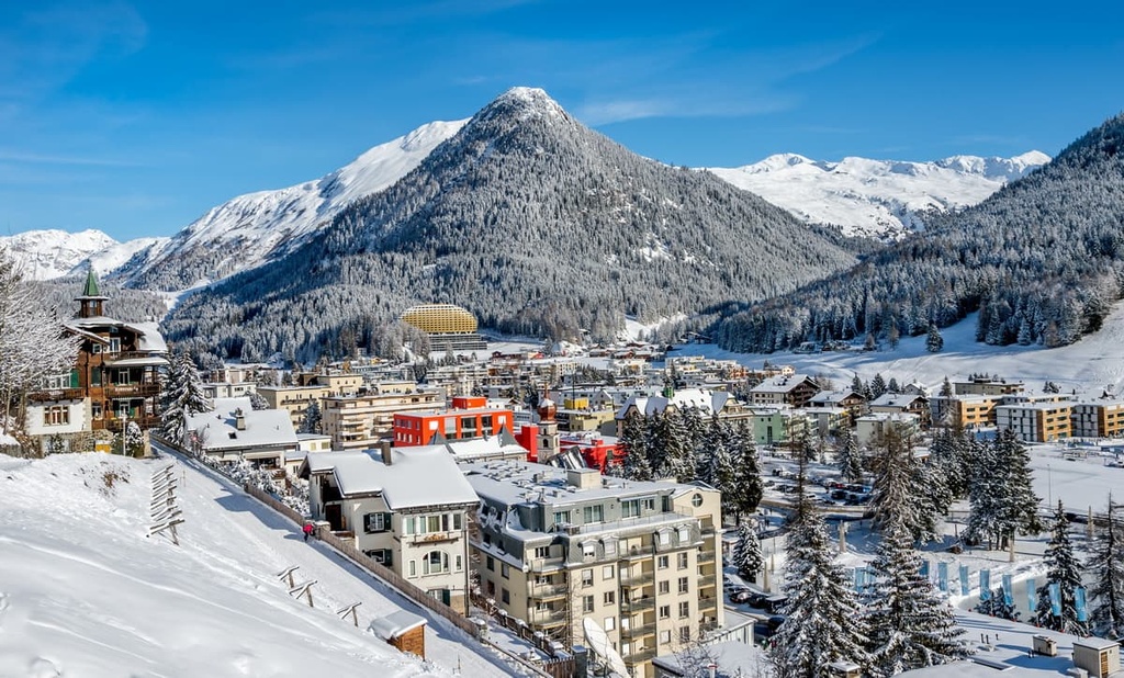
Despite the fact that it is home to world-famous ski resorts like Sankt Moritz and Davos, the region of the Western Rhaetian Alps lacks any major highways. As a result, the range features much more pristine wilderness than you might find elsewhere in the Alps.
Here’s a quick look at the most important landscape features in the Western Rhaetian Alps.
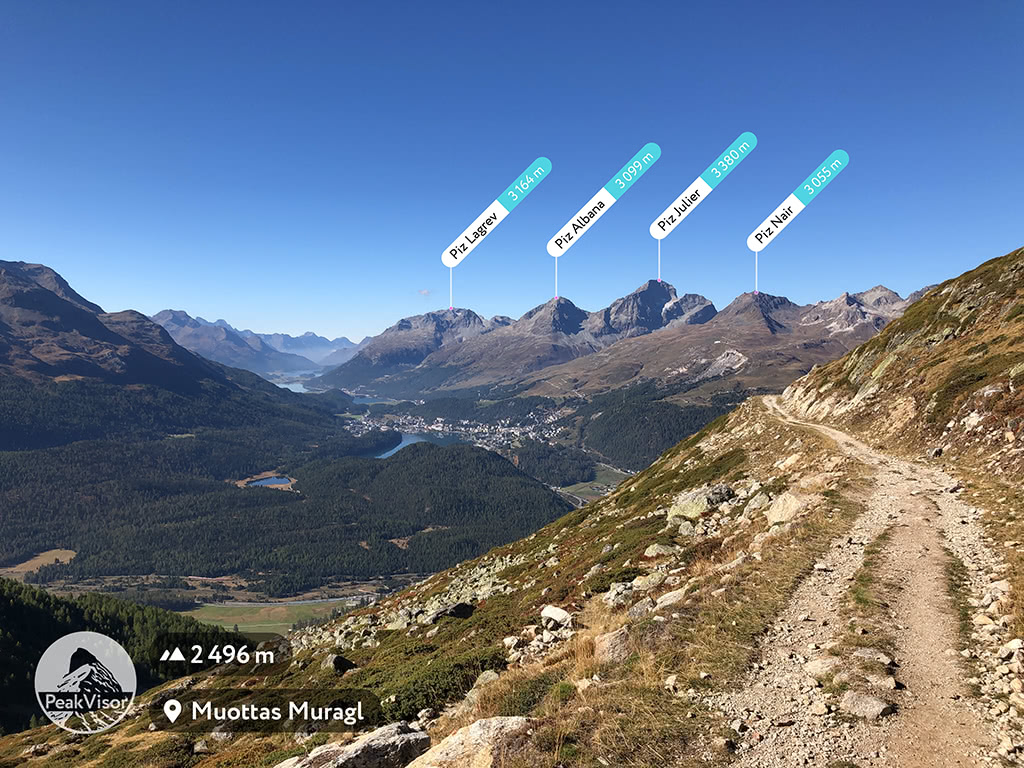
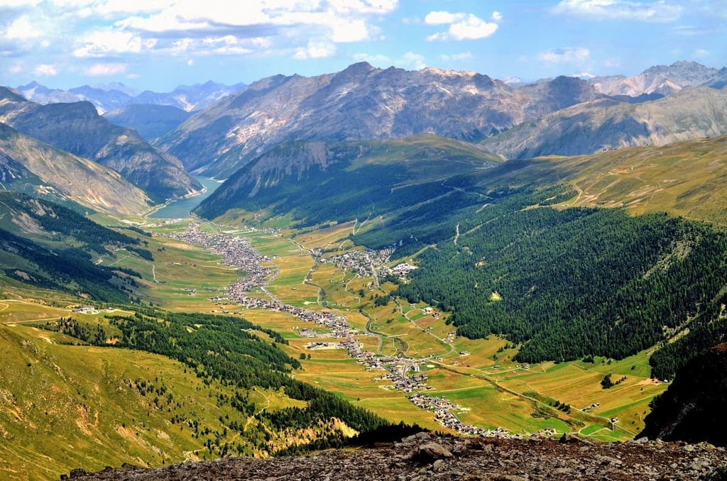
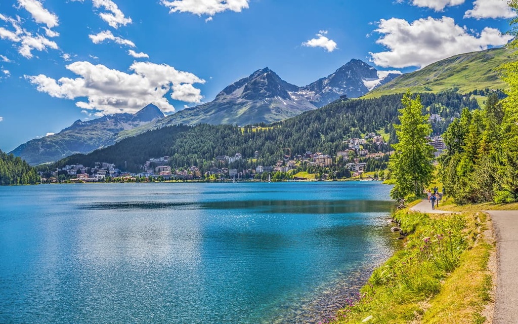
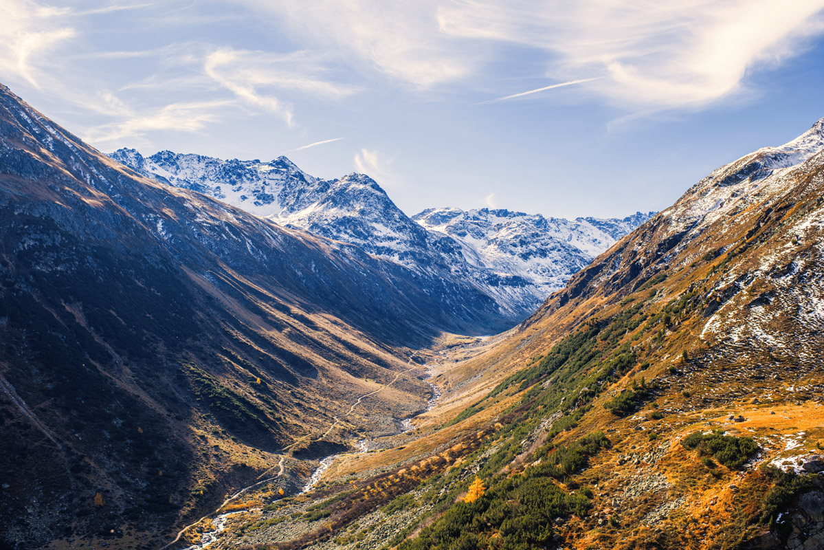
The Engadine is a long Alpine valley located at the core of the Western Rhaetian Alps. It runs roughly from southwest to northeast, and it follows the route of the Inn (En in Romansh) river from its headwaters at Maloja Pass until the Inn flows into Austria, 100 km (60 mi) downstream.
The Inn is the only major Swiss river to drain into the Black Sea as it is a tributary of the Danube, which also empties out into the Black Sea.
This valley is home to a particularly interesting place, namely, the point where three water basins meet at the Lunghin Pass. The northwest side of the valley gives birth to a stream ending in the Gelgia. This stream is a tributary of the Albula, which itself is a tributary of the Rhine. The Rhine runs into the North Sea.
From the southwest side of the valley, the water flows towards the Mera in Val Bregaglia, a tributary of the Po. The Po runs into the Adriatic Sea. Finally, the Inn originates from Lägh dal Lunghin below the peak of Piz Lunghin. From there, to the east to the pass, it flows into the Black Sea via the Danube.
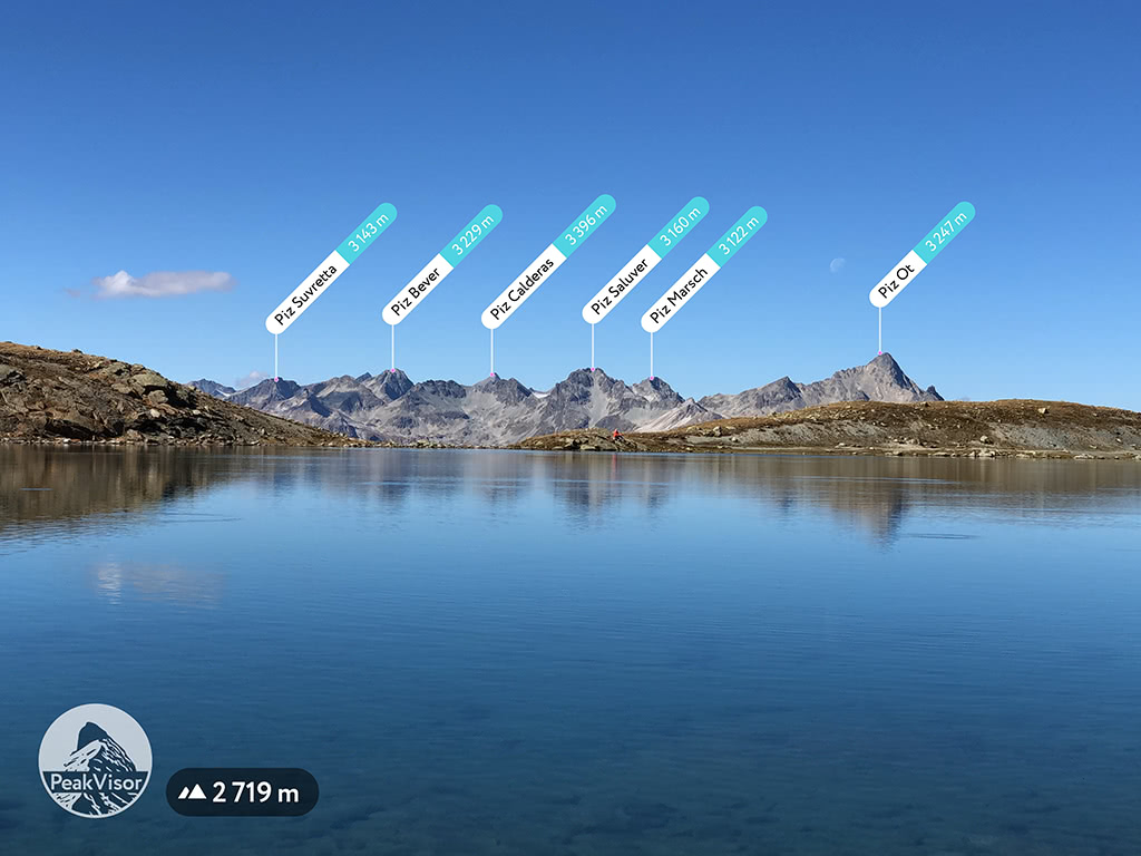
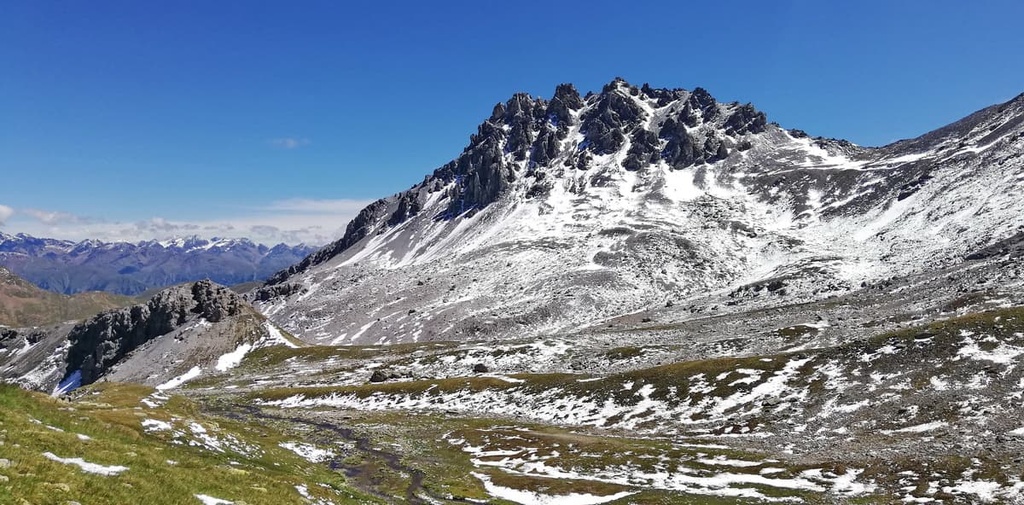
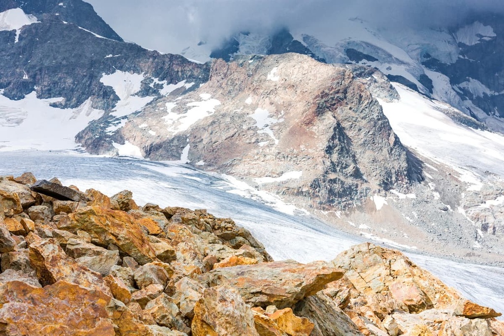
With 173 glaciers, Engadine is one of the most glaciated areas in the Eastern Alps. The most important glacier in the range is easily the Morteratsch glacier. As it is about 7 km (4.3 mi) long, it is among the longest glaciers in Engadine. In the area, you can find many walks that lead to glaciers and to spectacular viewpoints above them.
In addition to traditional Alpine activities such as skiing, hiking, and mountain biking, the region of the Western Rhaetian Alps is rich in thermal sources that feed mineral springs. The region’s thermal and therapeutic spas are fed by hot springs that have been known for many generations.
The iconic Sankt Moritz began as a spa town before it attained its status as a world-famous ski resort. The bathing culture of Sankt Moritz reaches back to 1400 BCE. The town’s mineral springs, with their ferrous and aerated waters, enjoyed great fame and appreciation during the Middle Ages under Pope Leo X and the naturopath Paracelsus.
Another example of such a spa town is Bad Alvaneu, where people have been bathing in these mineral waters since the sixteenth century. There’s also the Andeer bathhouse, which has been in use for 700 years. In Bogn Engiadina Scuol, the water was deemed medicinal by historic scientist Paracelsus himself.
The world-famous Bernina Pass (2,328 m / 7,638 ft) is the sixteenth highest pass in the Alps. It connects the resort of St. Moritz and Poschiavo Valley in Switzerland with the Italian town of Tirano in Valtellina. The pass is located just a few kilometers to the east of Piz Bernina.
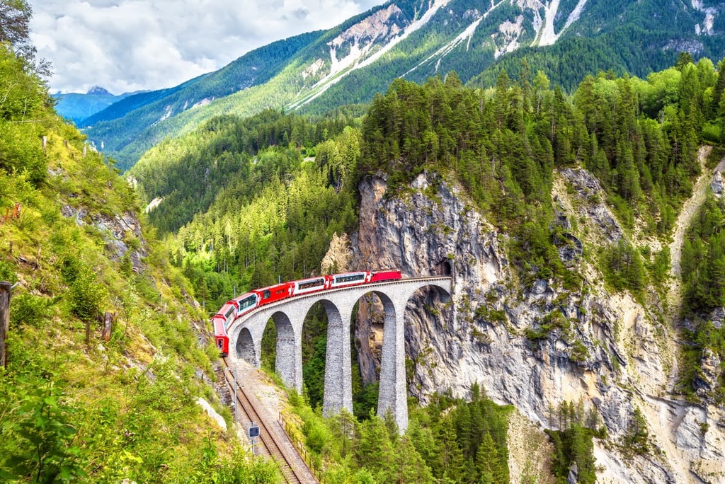
The Bernina Express railway route connects Tirano and Sankt Moritz and it is operated by the Rhaetian Railway. Additionally, the pass is listed as a UNESCO World Heritage Site in the Western Rhaetian Alps. If you want to take an Alpine postcard quality photo, then the Landwasser viaduct near the pass might be the best place to go.
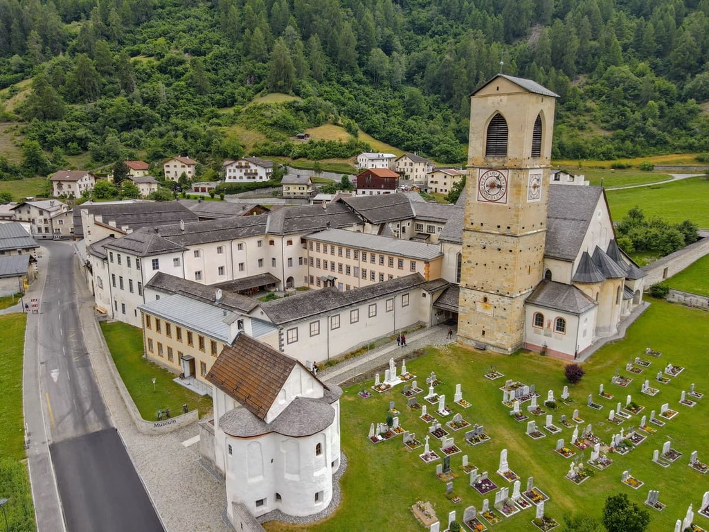
In order to close the topic, having mentioned two UNESCO World Heritage Sites in the Western Rhaetian Alps, we feel obligated to let you know about the third UNESCO World Heritage Site in the area—the Abbey of Saint John at Müstair. It is an old Benedictine monastery that, due to its exceptionally well-preserved collection of Carolingian art, has been recognized as a UNESCO World Heritage Site.
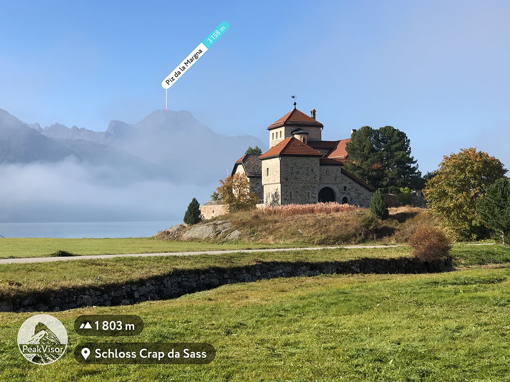
If everything that we’ve talked about so far isn’t enough to lure you into the region, be sure to check out the picturesque Swiss castles like Schloss Tarasp and Schloss Crap da Sass, both of which are true wonders to behold.
The Western Rhaetian Alps belong to the Eastern Alps according to both common classifications of the Alps, the Italian SOIUSA and the German-Austrian Alpine Club (AVE), the latter of which covers only the eastern part of the alps.
Internally, the Western Rhaetian Alps is divided into 11 subranges, making it much more diverse than the neighboring Eastern Rhaetian Alps (3 subranges) and Southern Rhaetian Alps (4 to 5 subranges depending on who you ask).
The subranges of the Western Rhaetian Alps differ depending on if you’re following the AVE or SOIUSA systems, but they’re very similar. Up next, we’ll list the different subranges that you’ll find in the Western Rhaetian Alps and their highest peaks.
In the SOUISA system, the Western Rhaetian Alps are part of the Central Eastern Alps region of the greater Eastern Alps. This system contains the following subranges:
In the AVE system, the Western Rhaetian Alps are part of the Western Limestone Alps and Central Eastern Alps regions of the greater Eastern Alps.
Within the Western Limestone Alps, this system lists the following subranges:
Within the Central Eastern Alps, this system features the following subranges:
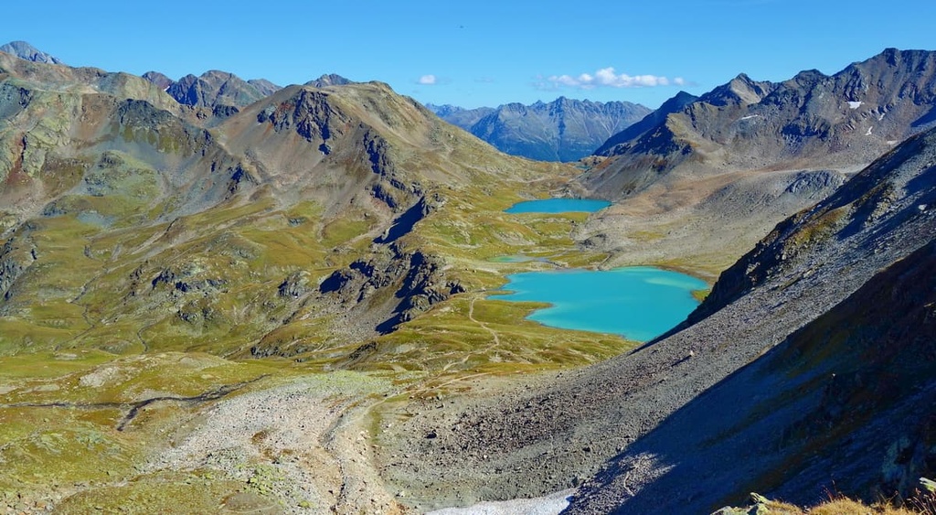
There are so many hiking areas and trails in the Western Rhaetian Alps that it is difficult to pick out just a few to highlight. To do so, we will focus on Switzerland, where the bulk of the range is located.
Everything is nature-oriented in the Swiss National Park. There are 80 km (49.7 mi) of hiking paths, nature trails, and excursion destinations for children and families.
Founded in 1914, it is the oldest national park in the Alps. To this day it also remains Switzerland’s only national park. It is also a part of the UNESCO biosphere reserve Biosfera Val Müstair.
Thanks to the strict conservation rules in place in the region, hikers in Swiss National Park are not allowed to leave marked paths, light a fire, or sleep outside the Chamanna Cluozza. It is also forbidden to disturb animals or plants or to take home anything found in the park. Dogs are not allowed, even on a leash.
Some of the most incredible hikes in the park include:
Other great adventures in Swiss National Park include peak ascents of Piz Quattervals, which is one of the few major mountains that’s located entirely within the park’s boundaries.
In addition to the Swiss National Park, the Western Rhaetian Alps is home to 2 of the 16 regional nature parks of Switzerland: Beverin Nature Park and Parc Ela. The latter is the largest in the country among regional parks. But they are located next to each other, so together they form an even larger protected area.
Some of the best hikes in these two parks include:
The Engadine Valley is a true hiker’s paradise. It is extremely popular among hikers due to its spectacular landscapes.
One of my favorite trails in the valley starts from the Muottas Muragl top station and first leads to the high-elevation lake Lej Muragl at the foot of Piz Vadret and Piz Muragl. But this is only the beginning of your adventures.
The next stage of the trail is the hike to Chamanna Segantini (a mountain hut) for a lunch with a view over the high peaks of the Bernina Group. The final part of the journey is the descent to the Alp Languard chairlift station which runs down to Pontresina. From there, you can take a bus to Punt Muragl if you happen to have left a car at the parking lot.
Some other great hikes in the Engadine Valley to check out include:
Bernina is known for its namesake railway route, but do not forget that it was named after the pass—not the other way around. There are many hiking trails in the pass area, including:
Klosters Davos, which is famous for being the host of the World Economic Forum, isn’t well-known for its hiking opportunities. Nevertheless, there are plenty of great hikes in the area for people of various interests and skill levels.

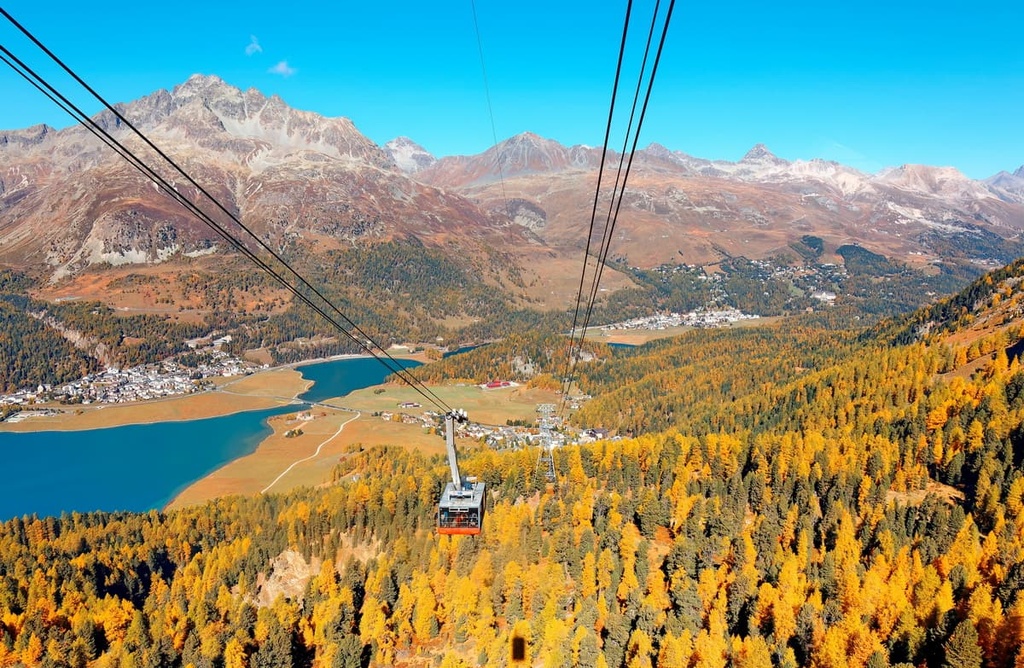
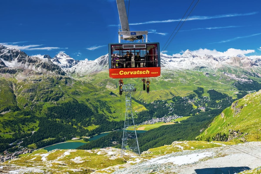
The Western Rhaetian Alps wouldn’t be the same without their various cable cars and cog railways, of which there are many. They are points of interest in their own right, but they offer even more to the adventurous visitor when you climb to the top station of each of them, as that’s where many hiking trails begin.
Here's a list of the main lifts in the Western Rhaetian Alps:
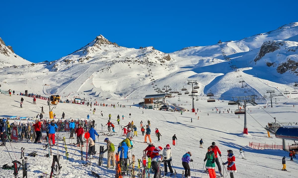
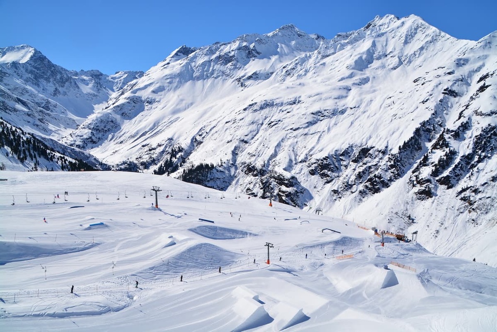
In the Western Rhaetian Alps, there are several dozen large ski resorts, alongside many smaller ski hills. The region is one of the best in the world for skiing, on par with what you find in the French, Austrian, and Italian Alps.
The top ten ski resorts in the Western Rhaetian Alps by the total length of all their slopes include:
The largest ski resort in the Italian part of the mountain range is Livigno, where you can find 115 km (71.4 mi) of pistes and 32 lifts.
If you’re traveling in the Austrian part of the range, you’ll likely make your way to one of the following resorts:
Finally, Liechtenstein also has at least one major ski resort—Malbun—which features 23 km (14.2 mi) of pistes and 7 ski lifts.
You can learn more about the ski resorts in the Western Rhaetian Alps in Switzerland (Grisons / Graubünden), Austria (Tyrol) and Italy (Lombardy) at the World Mountain Lifts page on the PeakVisor website. On these pages, you can get real-time lift information for most major ski resorts around the world.
When traveling in the Western Rhaetian Alps, be sure to visit one of the region’s many tourist centers. These tourist offices are useful because they provide paper maps and other information that you can’t necessarily get on the internet.
Here is the main tourist office in the canton of Grisons / Graubünden:
Graubünden Ferien
Alexanderstrasse, 24, 7000, Chur, Switzerland
+410812542424
Note that there are many more tourist offices that you can find throughout the towns in the Western Rhaetian Alps region.
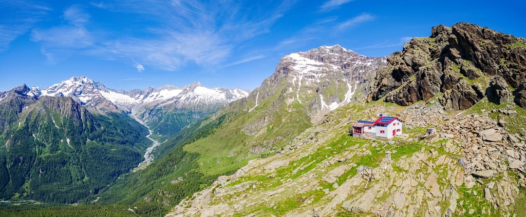
There are more than 150 mountain huts in the canton of Grisons / Graubünden in Switzerland, so there’s always somewhere to stay in the region.
In addition to the actual lodging, showers, and meals that these huts provide to guests, they offer many other benefits: meeting the owners and socializing with other guests and beautiful views right out the window.
For example, Forno Hut / Fornohütte (2,574 m / 8,444 ft) near the Monte del Forno (3,214 m / 10,544 ft) in the Val Bregaglia range has a spectacular view not only at the mountain itself but of the Forno Glacier right from its terrace.
There are also free accommodation options in the canton such as rifugio Pian Grand near the Pian San Giacomo village. This rifugio is actually two shelters that are equipped with a gas cooker, crockery, blankets, and wool mattresses. They can host up to 18 people in total and there is running water near the shelter.
The Western Rhaetian Alps is home to at least a dozen major towns and resorts where you can start or end your trip. Here are some of the main cities and resorts that you can find in the region:


top50
ultra
glacier
alps-4000ers
italy-ultras
switzerland-ultras
top50
ultra
glacier
alps-4000ers
italy-ultras
switzerland-ultras


