Scan the QR code and open PeakVisor on your phone
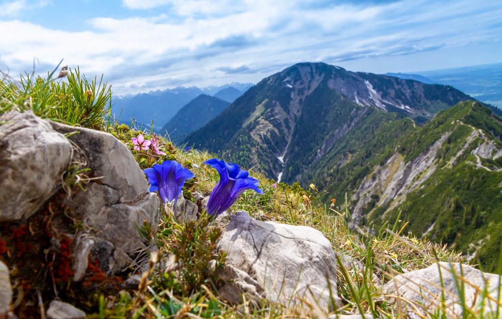
The Bavarian Alps are one of the large mountain ranges in the Eastern Alps. The main feature of the range is that it is the only one from the Alpine system in Germany, so they are also known as the German Alps. They have diverse landscapes with many glaciers, rivers and lakes, as well as rich flora and fauna, and an incredibly well-developed tourism industry with thousands of years of experience in hospitality. The highest point is Großer Krottenkopf (2656 m / 8713 ft) in the Allgäu Alps, the main of several subranges. In a broader sense, however, the range includes Zugspitze (2962 m / 9718 ft), the highest peak in all of Germany. The most prominent mountain is Daniel (2340 m / 7677 ft). In total, there are 2192 named mountains in the Bavarian Alps.
Like almost everywhere else in the Alps, the name of the range comes from Bavarians (Latin Baiovarii), a Germanic peoples tribe, known as inhabitants of the region since about the 5th–6th centuries. In turn, the Bavarians are from the Celtic tribe Boii, who came to these lands from the opposite side of the Alps, retreating from the Romans.
The name of the word itself is not known, but it is closely associated with Boiohaemum, where “haemum” means "home”. That’s how the Romans began to call the lands left to the tribe. The name Bohemia, the largest historical region of the neighboring Czech Republic, is also derived from it.
The name of the range in German is Bayerische Alpen, in Italian: Alpi Bavaresi.
The Bavarian Alps extend as a long and thin strip in northwest of the Eastern Alps from their border with the Western Alps, occupying about half of this part of the mountain system in a west-east direction from the Constance Lake (Bodensee in German) in Switzerland to the Salzach River in Austria.
On the administrative map of the world, despite the word Bavarian in the name, this is the border range between Germany and Austria, located in both countries, namely the Upper Bavaria — the southernmost part of the German state of Bavaria (yes, there is a paradox in its name: upper in the south) and the Austrian regions of Tyrol, Salzburg and Upper Austria in Austria.
In turn, Germany are Austria are two of the eight Alpine states, along with France, Italy, Liechtenstein, Monaco, Slovenia, and Switzerland. However, in percentage terms, Germany “covers” only a small part of the Alps. In other words, the German Alps are very small compared to the others in the area. But they are the key natural region of the country, both for locals and tourists, on a par with the central lowlands and the northern maritime areas. Germany is as well-known and associated with the Alps as the other Alpine countries.
It is worth noting also that the Alps are not the only major mountains in Germany. To the west of them, beyond Constance Lake, are two other large mountain ranges: the Swabian Jura or the Swabian Alps (Schwäbischer Jura or Schwäbische Alb) and the Black Forest (Schwarzwald) range.
To sum up: the Bavarian Alps are mountains primarily in Bavaria and are also called the German Alps, but they extend into neighboring Austria.
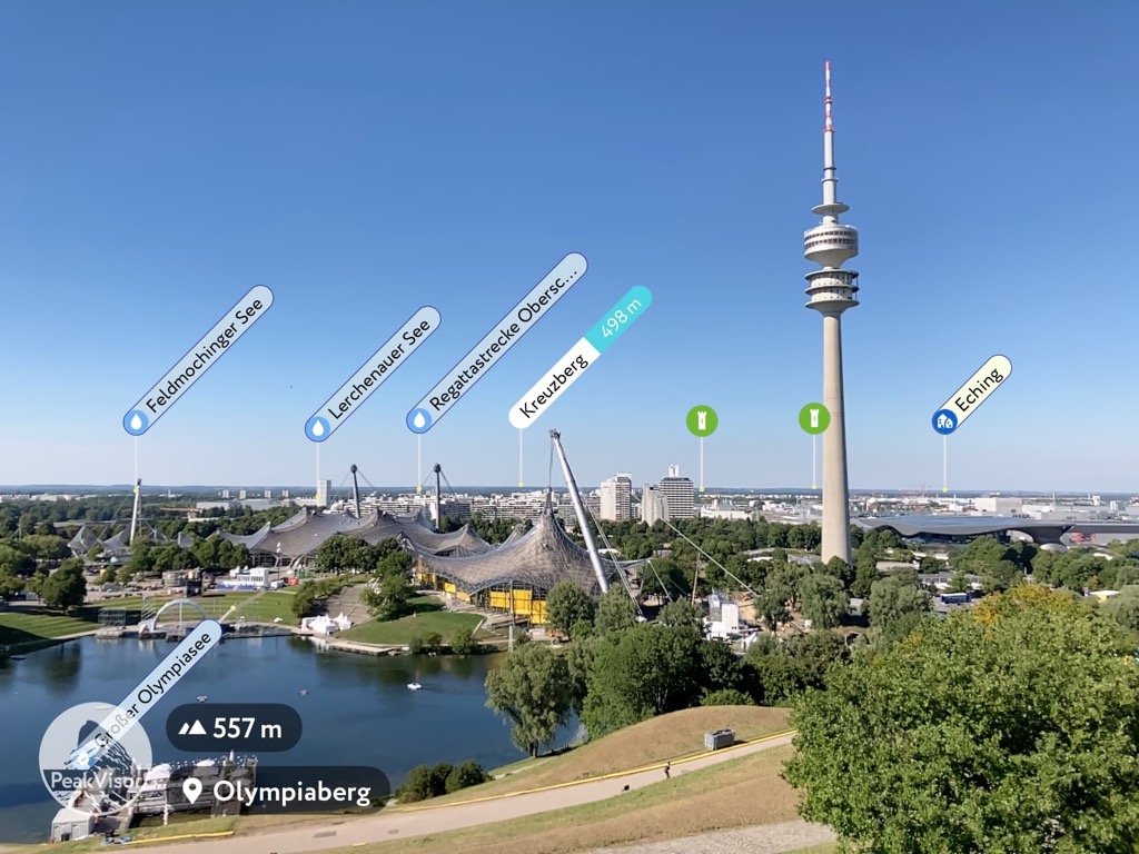
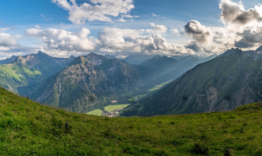
Geologically, the Bavarian Alps have the same set of characteristics as the Alps as a whole. However, among the main features of this particular region is the absence of foothills, i.e. the mountains abruptly “drop off” into the plain, looking like a stone wall, while in the south of the Alps they decrease in height more smoothly. This is clearly visible everywhere—even from the center of Munich.

As has already become clear, the Bavarian Alps or German Alps is a complex mountain range, which often leads to confusion about their boundaries and internal structure. Next, I will try to help you to understand it.
So this part of the Alps can be looked at from two perspectives: the narrow one, or their location in the two most common systems of classification of the Alps: the Italian SOIUSA and German-Austrian AVE, and the broad one, also considering geography, landscape, culture, and history.
The Bavarian Alps is one of the six big mountain ranges in the Northeastern Alps, part of the Eastern Alps in the SOIUSA, where it has number 22.
According to this classification, the mountain range borders the Swiss Prealps in Switzerland and the Western Rhaetian Alps in Italy to the west, the Salzkammergut and Upper Austria Alps and the Northern Salzburg Alps in Austria to the east, the North Tyrol Limestone Alps also in Austria to the south and the Alpine Foreland or the Bavarian Plateau, one of the main regions in Germany in terms of the landscape, to the north.
Internally, the range consists of the following six parts (west to east) with the following highest peaks:
It’s a little different for AVE. There is no such group at all. The Germans and the Austrians themselves distinguish only the central part of the group, which is visible from Munich, and call it Bavarian Prealps (Bayerischen Voralpen, Prealpi Bavaresi). It includes the two main mountain sub-ranges from the list above: the Wallgau Alps, including the Ester Mountains group, and the Mangfall Alps, but also several smaller mountain ranges and regions between, namely Jachenau (municipality) and Isarwinkel (Isar River).
Comparing this classification with SOIUSA, it can be seen that the Bregenz Forest Mountains, the Allgäu Alps, the Ammergau Alps, and the Chiemgau Alps are separate mountain ranges in AVE. They are all part of the Northern Limestone Alps, one of the four large parts of the Eastern Alps in this classification.
From a second, broader geographical and cultural point of view, the Bavarian Alps are a larger mountain range, which also includes the border parts and peaks of the mountain ranges belonging to the North Tyrol Limestone Alps (Alpi Calcaree Nordtirolesi, Nordtiroler Kalkalpen) from the SOIUSA.
By the same classification, but in a broader sense now, the Bavarian Alps also include four of the six parts of this mountain range (excluding the two westernmost Lechtal Alps (Lechtaler Alpen, Alpi della Lechtal) and Lechquellen Mountains (Lechquellengebirge, Monti delle Lechquellen)):
Then again: There are no North Tyrol Limestone Alps in the AVE classification, and all the above-mentioned mountain ranges are separate ones.
In short, the confusion arises because the Bavarian Alps of SOIUSA are partly located in Austria, and the North Tyrol Limestone Alps of the same classification are partly in Bavaria in Germany. Hence the individual parts and peaks of the latter are also called the Bavarian Alps. Looking at these mountains from Munich you see many higher Austrian peaks.
Separately, two major individual peaks should be mentioned one more time:
This is why in other sources you may sometimes see Zugspitze as the highest peak of the Bavarian Alps. For the same reason, you can often find inconsistencies among the highest summits of individual mountain ranges, due to their location in Bavaria or Austria.
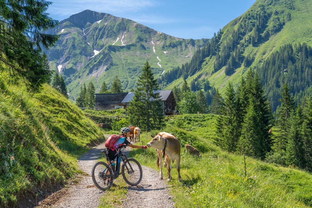
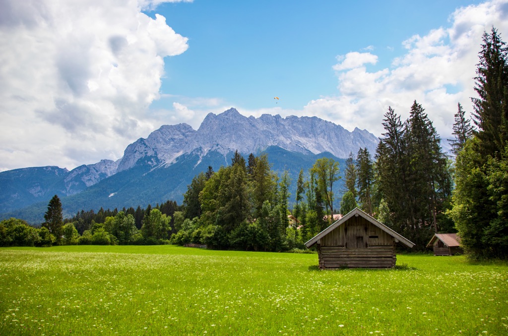
The entire Bavarian Alps (we’ll limit it to the German part this time) is one big hiking area. You can go almost anywhere and find hiking trails, cable cars, ski lifts, mountain huts, and other infrastructure. The most famous trails usually go to the highest and/or most famous peaks listed above, starting with Zugspitze.
The highest mountain in Germany is characterized by the fact that it can be reached in all possible ways: by chairlift (and even a small train that takes you from the plain directly to it through a tunnel right into the mountain!), by a two-day marked hiking trail from one of the surrounding valleys and by a climbing route crossing the glacier that requires equipment, knowledge, and experience. You can also combine the ways, as well as to get to the mountain from Austria.
Zugspitze is such an important mountain that it is considered a tourist region with the same name. In other words, you will find many other natural and cultural attractions in it.
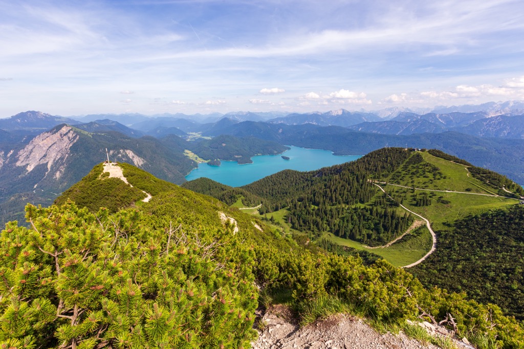
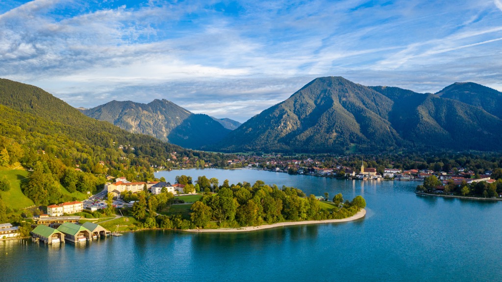
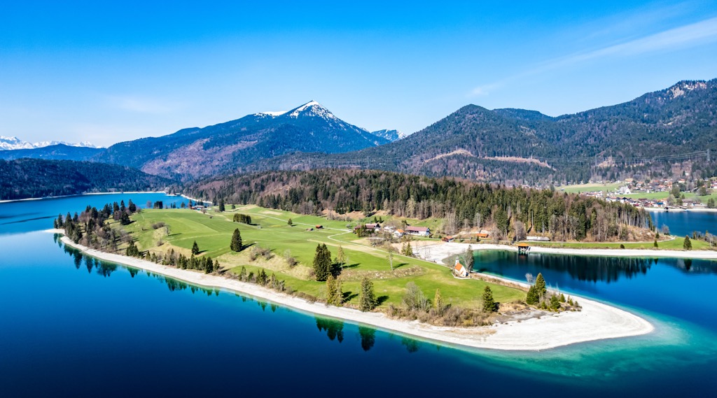
Other best hikes are many large magnificent lakes located at the foot of the mountains (Ammersee and Starnberger See, Staffelsee, Kochelsee and Walchensee, Chiemsee, and others) as well as small lakes located directly in the Alps. Among the latter, the Königssee is considered the most important—a fjord lake with high mountains on all sides. The lake is popular also because of the fact that you can take the Jennerbahn cable car (Jennerbahn) to the Jenner (1874 m / ft) peak, which offers incredible views of the lake and its surroundings.
If we talk about protected areas for hiking on the German side of the Bavarian Alps, this is primarily Berchtesgaden National Park in the west, formed around the aforementioned Königssee and repeated Berchtesgaden Alps (Berchtesgadener Alpen) in the Northern Limestone Alps. This is one of 15 national parks in Germany and is also the UNESCO Biosphere Reserve.
There are also two of the 103 German regional parks in the range: Ammergau Alps Nature Park and Nagelfluhkette Nature Park, covering the mountain ranges of the same name, the first of which is part of the Bavarian Alps and the second, north of it, is not, which does not make it any less interesting to visit.
Finally, the famous German Alpine Road, the automobile route through the Bavarian Alps from Lake Constance to Königssee, should not be missed. Yes, it’s not really about hiking, but it’s a way to see the whole region in one trip. Plus, nothing prevents you from stopping anywhere along the way for a short day hike.
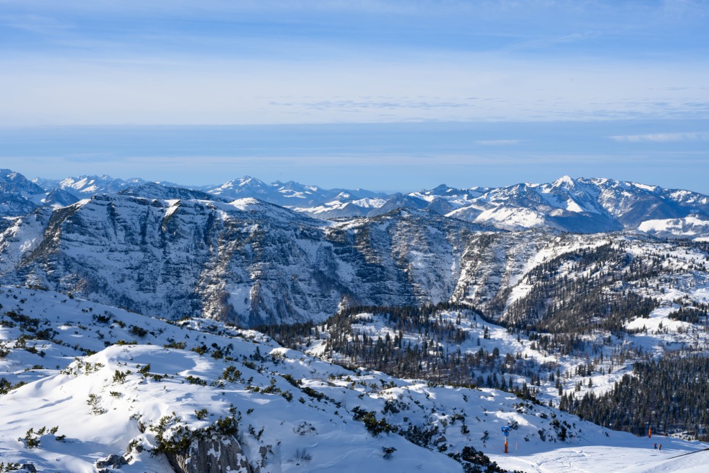
There are a total of 267 ski resorts in Bavaria (yes, that many), most of which are predictably in the Alps.
Learn more about ski resorts in Bavaria and Germany at World Mountain Lifts on PeakVisor, including information on open and closed slopes and lifts in real-time.
Before or after hiking in the Bavarian Alps, visit one of the official tourist offices of the Bavaria region, the main one being located on the Marienplatz central square of its capital, Munich:
Touristeninformation München
Marienplatz, 8, 80331 München, Germany
Monday to Friday: 10 am to 6 pm, Saturday until 5 pm and Sunday until 2 pm
+498923396500
As in other parts of the Alps, the main place to sleep when hiking in the Bavarian Alps is the mountain huts, which here are called "hütte".
Or rather, it's exactly the opposite: this special type of lodging originally came from the German Alps and from neighboring Austria and Italy, and then spread to other Alpine regions and other mountains in other countries of the world. So sleeping in a traditional German hütte is a must-do thing that will definitely make your travel experience more profound.
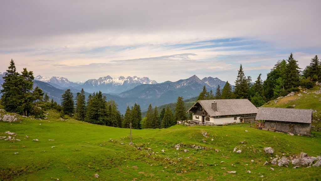
Given the sheer number of huts, it's hard to single out specific ones. They can be divided into different categories: the hardest to reach, the largest in terms of the number of beds or the oldest, and so on. But the most important is of course the height of the hut.
So the highest in Germany is a relatively small Münchner Haus on Zugspitze with 30+ beds. However, the hut is considered Spartan and there are always a lot of people in it. For an overnight stay on the highest mountain in the country, it is better to choose the Knorrhütte below or even more remote in its vicinity, and climb the mountain without an overnight stay.
These and most other huts are run by the German Alpine Club. Interestingly, it also runs some huts in neighboring Austria.
The largest city in the Bavarian Alps with a population of 1,472 million (2019) is Munich, located just a couple of hours from the mountains in the north of it and connected to them by direct train and bus services.
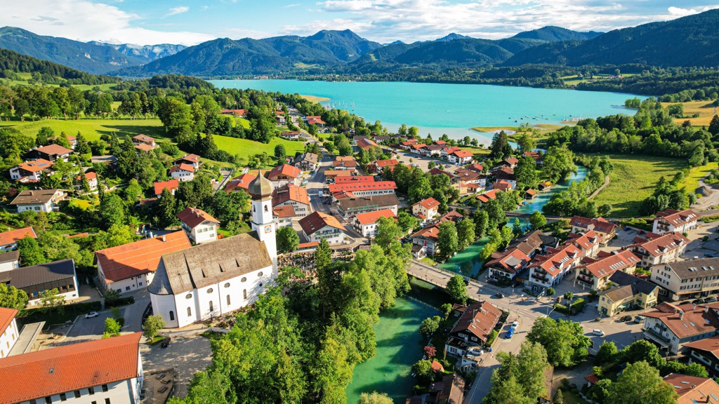
Among the main resorts closer to the range are definitely Garmisch-Partenkirchen, Murnau, and many other towns and villages on the lakes, which usually coincide with it in names like Tegernsee or contain it as Schönau am Königssee, Rieden am Forggensee, and others, from those not yet named in the guide.
The center of life and tourism on the Constance Lake is Lindau, as well as Bregenz on the Austrian side—they are separated by only 9 km (mi). Another important town in the western part of the range is Lindenberg im Allgäu, the capital of the Allgäu Alps.