Scan the QR code and open PeakVisor on your phone
Naturpark Ammergauer Alpen (Ammergau Alps Nature Park in English) is located in Bavaria in southern Germany near the border with Tyrol, Austria. The 227 sq km (88 sq mi) park encompasses part of the Ammergau Alps, six villages with distinct cultural and historical traditions, and a wide range of ecosystems, including some of the most extensive intact moors in the region. There are 96 mountains in the park. Ammergauer Kreuzspitz is both the tallest (2,089 m / 6,854 ft) and has the greatest prominence of 118 m (387 ft).
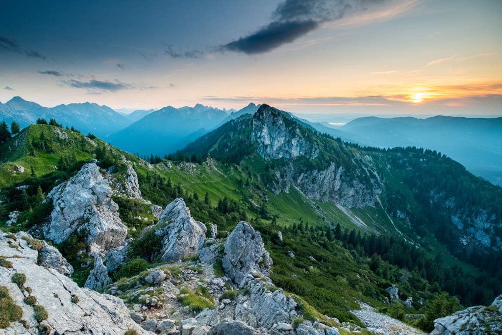
Naturpark Ammergauer Alpen (Ammergau Alps Nature Park) stretches across 227 sq km (88 sq mi) of the Ammergau Mountains in Bavaria, Germany, near the border with Tyrol, Austria. The nature park is a recent addition to Germany’s protected landscape, having been established in 2017. It has over 500 km (310 mi) of trails ranging from short paths to multi-day routes traversing alpine summits.
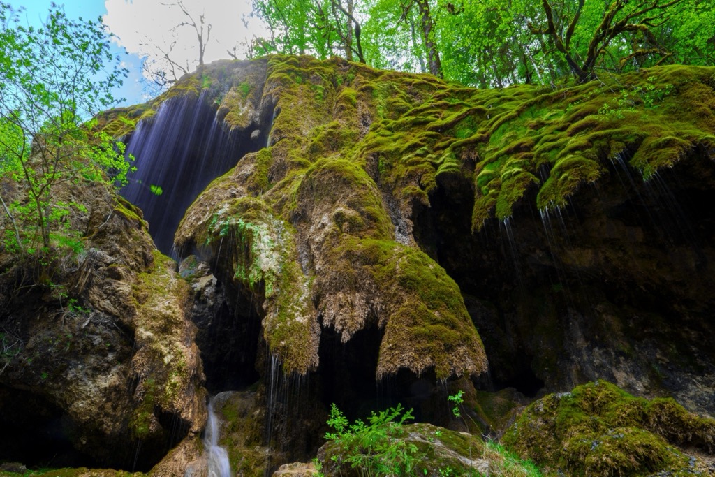
The park protects diverse ecosystems, including forest communities and moors that formed as a result of the last Ice Age. The Walmoos Nature Reserve, located inside the park, is a critical nesting ground for several avian species and supports rare orchids.
The Ammer Gorge, sometimes up to 60 m (195 ft) deep, formed 120,000 years ago and is another of the park’s landmarks. The Ammer River runs wild (not dammed or subject to other forms of human intervention), except for the portion that runs between Oberammergau and Unterammergau.
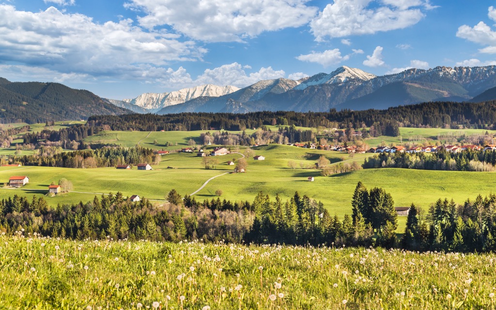
Six villages lie within the Ammer Nature Park. Oberammergau is famous for staging the Passion Play, a centuries-old tradition, as well as for its Lüftl paintings on its buildings and a long history of wood carving. Ettal is home to the Ettal Monastery and the impressive Linderhof Palace, both open for public tours. Unterammergau is known for its history of whetstone making and Saulgrub for its nature. Meanwhile, Bad Kohlgrub and Bad Bayersoien utilize mud from the moors for spa treatments.
The Ammergau Alps are a subrange of the Northern Limestone Alps and, by extension, the much larger European Alps. Rocks in the mountains formed over 200 million years ago from deposits in the ancient ocean Tethys. Shells, mud, and sand accumulated on the bottom of the ocean floor. During the early Cretaceous, around 140 million years ago, the African plate drifted north, pushing and folding deposits on the ocean floor over each other.
The Alps uplifted during the Alpine Orogeny, a mountain-building event that occurred as the African and Eurasian plates collided. This collision has been ongoing since Cretaceous times. Most mountain building occurred between 65 and 2.5 million years ago, although the mountains continue to uplift. However, the uplift rate no longer outpaces erosion, and the Alps are not considered a growing range.
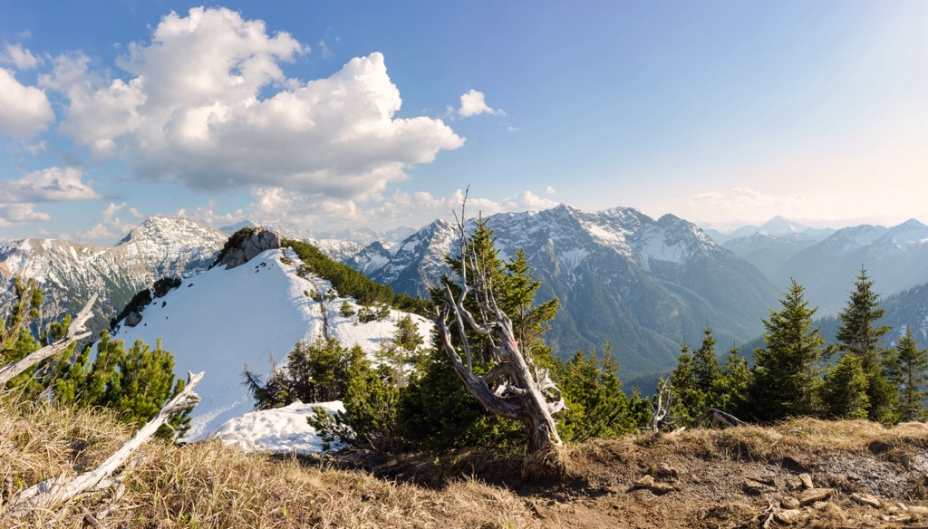
The Ammergau Alps have an interesting composition, as the northern section is much more varied while the southern parts are more uniform. To the north lie the Hochschergen, Hörnle, and Aufacker massifs and the main calcareous ridge of the Ammergau Alps with the peaks of Ettaler Mandl, Kofel, Pürschling, and Klammspitze. The northern section contains a variety of rock types, including Wetterstein limestone, Cenomanian sandstone and conglomerate, radiolarite, siliceous limestone, and soft Partnach layers.
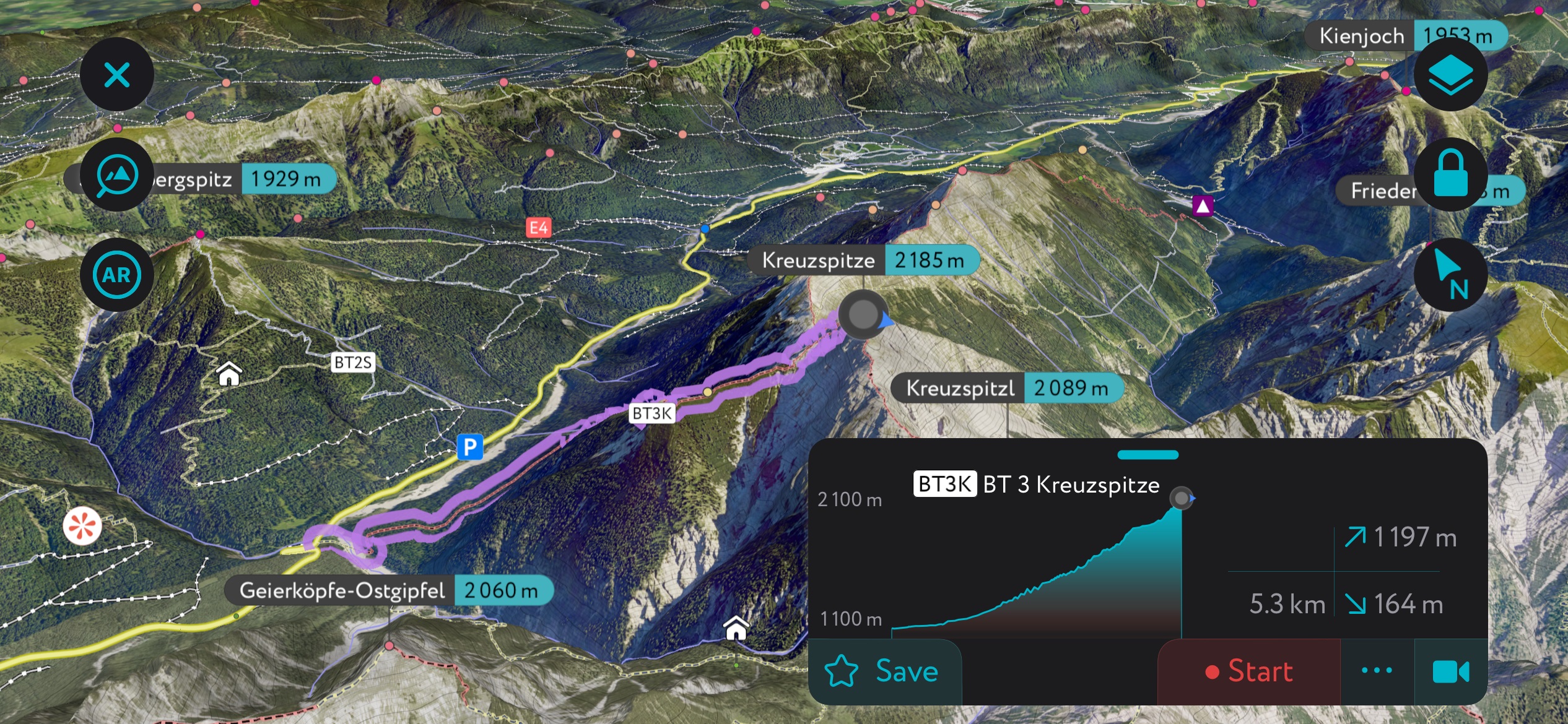
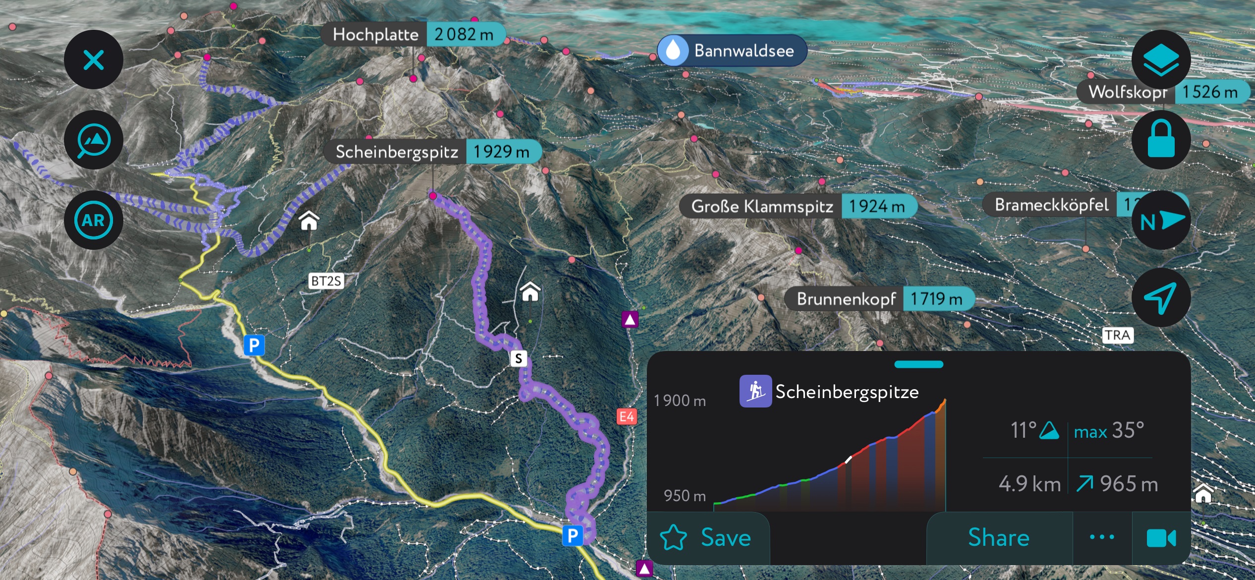
The park's southern portion comprises major dolomite peaks south of the Graswang and Sägerbach valleys. These peaks include Kreuzsspitze, Scheinbergspitze, Kienjoch, and Notkarspitze.
Whetstone mining has existed in the area for centuries, and several old mining quarries remain. The practice tapered out in 1961; however, in modern times, it has been revived for cultural and historical preservation, particularly in the town of Unterammergau.
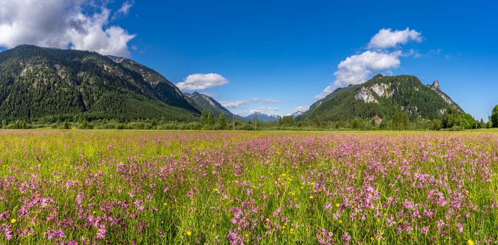
Naturpark Ammergauer Alpen protects several ecosystems, including enormous swaths of moorland. As the Ice Age ended, lakes and moraines were left behind. The area's series of reliefs and water allowed extensive bog networks to form. From an ecological perspective, these wetlands are critical habitats; they are highly productive, meaning they sustain a large amount of biomass and, consequently, biodiversity.
One of the most notable moors in the park is the Ettaler Weidmoos. The area has been protected since 1982 and covers 159 ha (393 acres). It supports numerous bird species, such as the stonechat, red-back shrike, crested tit, and tree pipit. It also acts as the spawning ground for amphibians, and each spring, road passages and fences are erected to protect them as they migrate across the road.
Like many other moors, the Ettaler Weidmoos is home to numerous endangered butterfly species. Flora such as orchids, lung gentian, bog gentian, and carnations grow well here. The yellow-flowered Charlemagne’s scepter (Pedicularis sceptrum-carolinum) thrives in the moors.
The park supports meadow ecosystems outside these wetlands, particularly on the flysch slopes of the Aufacker-Hörnle massif and along the Unterammergau foothills. Along the slopes, a patchwork of grasslands and moors merge and are flanked by deciduous forest.
Alpine pastures contain grasses, sedges, and dwarf shrub heaths (containing alpine rose and blueberry) intermixed with trees and tall shrubs. Some pastures contain the rare bellflower Campanula latifolia. Pastures are prime habitats for black grouse, golden eagles, and mountain pipits. The park is home to endangered birds such as capercaillie, birch grouse, and rock ptarmigan.
Many forest communities appear in the park, such as peat-forming alder swamps, gray alder-spruce swamps, pine forests on the western and southern slopes of Kieneck and Kofel, and subalpine spruce forests. In conjunction with the south slope of the Ammergebirge outside of the nature park, the Kreuzspitz and surrounding massif represent one of the most important areas for conserving beech-spruce-fir forests in the Bavarian Alps.
Riparian ecosystems also support biodiversity, likely second only to the moorland. Sandpipers, beavers, wartbiters, dragonflies, and brown trout thrive along the waterways.
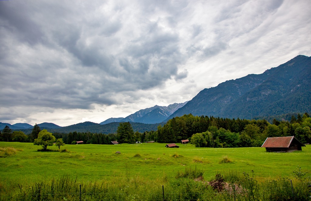
The Ammergau Alps have a long history of alpine farming, whetstone making, and charcoal production. The valleys in the region are dominated by moorland, so for centuries, farmers turned to the steep slopes as a source of fodder for cattle and utilized alpine pasture for grazing.
The forests of the Aufacker-Hörnle ridge were in high demand to make charcoal and fuel for the glasswork made in Grafenaschau. Whetstone making has roots in Unterammergau, with old quarries peppered throughout.
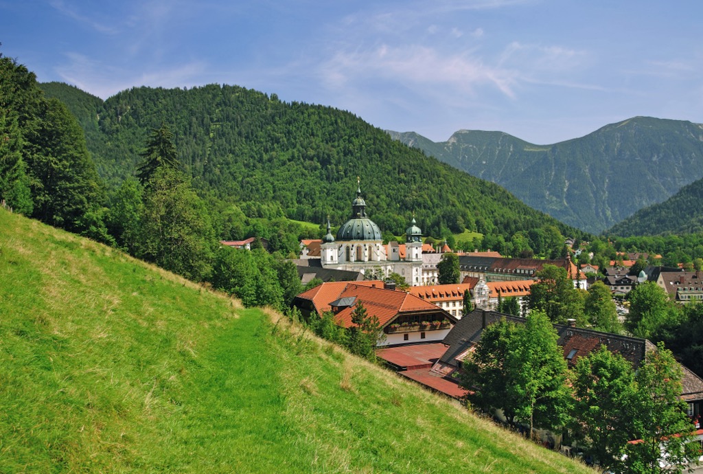
Around the village of Ettal, you can visit the Ettal Monastery and the Linderhof Castle. Emperor Ludwig of Bavaria founded the Benedictine monastery in 1330, and construction was completed in 1370. In 1710, the monastery served as a knight’s academy and was one of the top secondary schools of its time. A fire in 1744 destroyed the church, which was subsequently rebuilt by the court architect Enrico Zucalli. Meanwhile, the monastery boasts some of the best Rococo sacristy in southern Germany.
The Linderhof Castle was built by Ludwig II, the crowned king of Bavaria, and completed in 1878.
Most recently, the park was established in 2017 and is Bavaria’s youngest nature park.
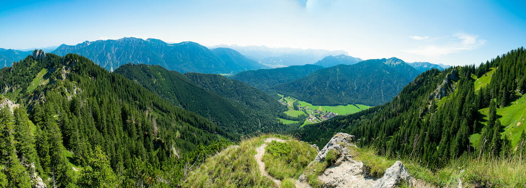
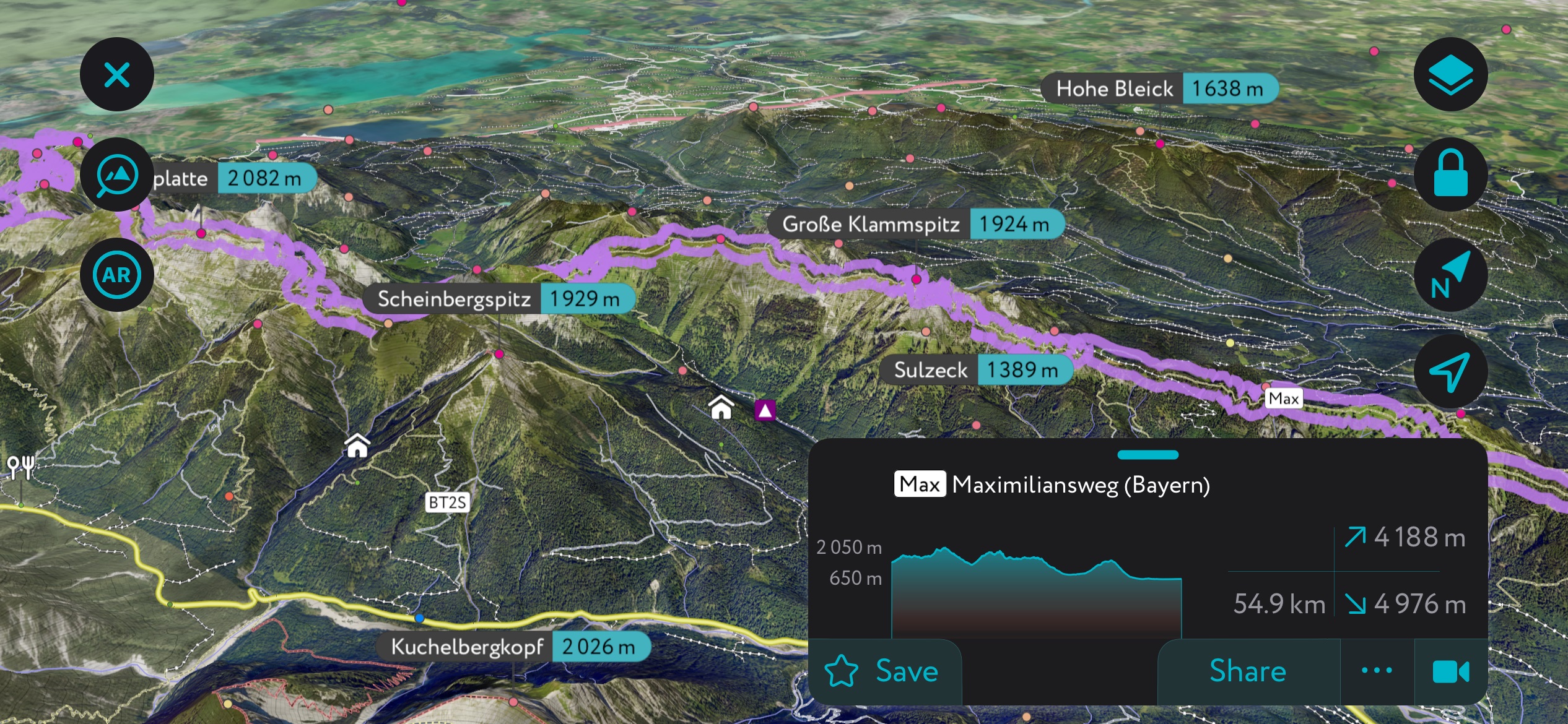
Naturpark Ammergauer Alpen has over 500 km (310 mi) of hiking trails, ranging from short paths to challenging mountaineering routes on Notkarspitze, Kreuzspitze, and Große Klammspitz. Seven long-distance trails span across the park, including the Maximiliansweg. Gentler hikes in the valleys range in distance, with two of the longer options being the nearly 10 km (6.2 mi) Altherrenweg in Oberammergau and the 18 km (11 mi) Ammergauer Wiesmahdweg that runs between Grafenaschau and Oberammergau.
The park is great to visit in all seasons and has an extensive network of cross-country skiing and winter hiking trails. The Hörnle lift offers access to modest downhill skiing options.
A route along Kofel, Königssteig, and Grottenweg makes for a moderately challenging but highly rewarding 8.8 km (5.5 mi) loop with a 590 m (1,935 ft) elevation gain. The climb to Kofel passes through an area where many artifacts have been found tied to the Oberammergau cemetery, where Romans occupied the Alps and foothills in 15 BC.
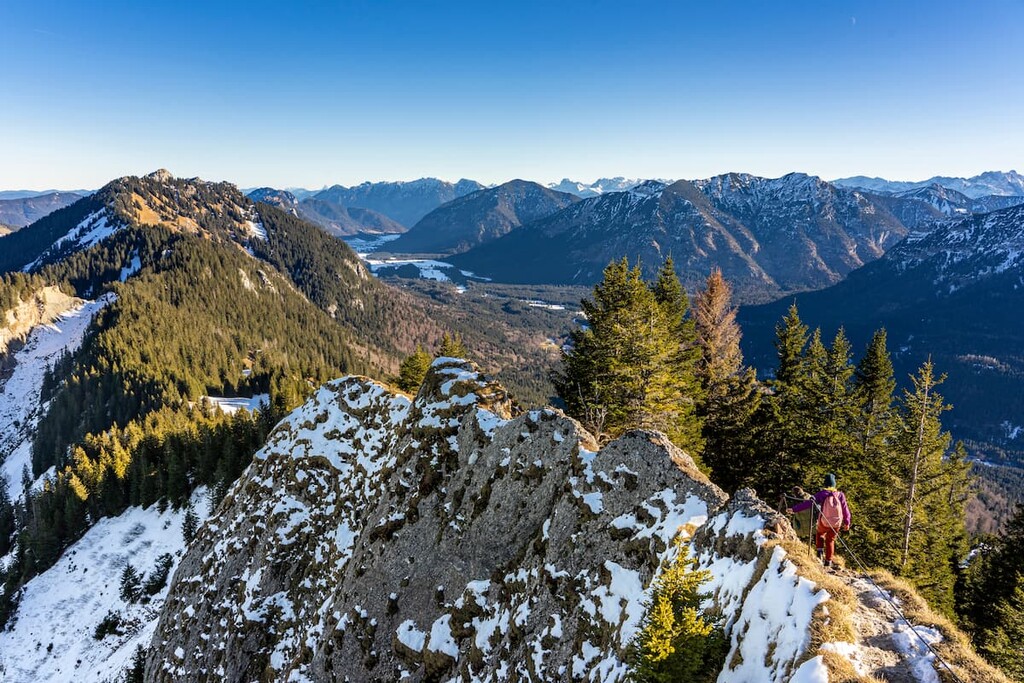
For an extra rush, a small via ferrata is required to reach the summit of Kofel. The top offers views of Pulvermoos to the north and Weidmoos to the southeast.
From Kofel, the trail continues along a scenic trail to Kolbensattel Hut, passing through spruce, beech, silver fir, sycamore maple, wych elm, and ash forest. Kolbensattel Hut provides meals, making for the perfect resting spot.
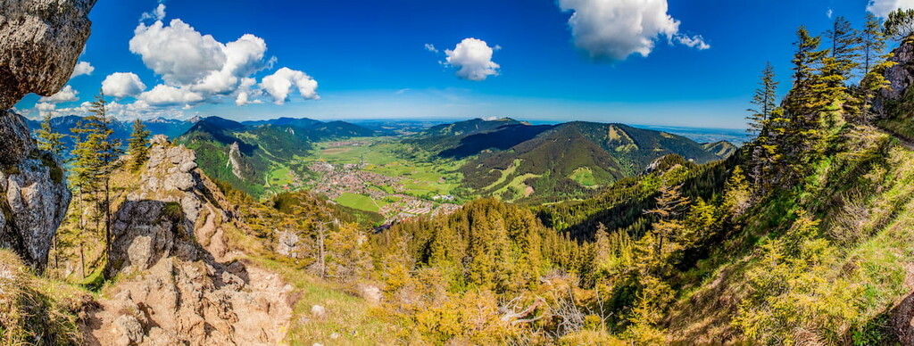
Part of the long-distance Maximiliansweg passes through Naturpark Ammergauer Alpen. Stage 9 is 17.7 km (11 mi) point to point with 1,290 m (4,240 ft) in elevation gain. The trail passes Linderhof Palace before climbing to Pürschling and into forested slopes. There are views from the high point before descending to Hörnlehütte.
Stage 10 of the Maximiliansweg is 14.3 km (8.9 mi) point to point with 250 m (820 ft) elevation. This portion of the route includes a long descent from the Hörnle through Murnauer Moos, over the Hörnle ridge, and through the Garmisch mountains. On a clear day, you’ll get great views of the Stafelsee and Lake Starnberg. This section of the trail is notable as it crosses the most extensive intact moorland in the Alps.
In addition to winter hiking trails, the nature park has a great system of cross-country ski trails. One highlight is the Graswangrunde, a 12.5 km (7.8 mi) circuit with an elevation change of 105 m (345 ft). This section is part of the 50 km (31 mi) King Ludwig trail, which runs from the Graswang to the Ettal Abbey and the Linderhof Castle. In early February each year, 3,000 to 5,000 people gather to ski here.
Those looking for downhill skiing can check out Hörnle - Bad Kohlgrub. The small ski resort is suitable for beginners and intermediate-level skiers and has 9 km (5.5 mi) of slopes and two lifts.
The park offers short educational trails covering themes including moors, forests, whetstone-making history, and native birds. These trails are typically one to three kilometers (0.6 to 1.8 mi) long with little elevation gain, making them an excellent option for families.
Six villages within the Naturpark Ammergauer Alpen have cultural and wellness-related sites. Oberammergau is famous for its Passion plays, Lüftl for painting and wood carving; Ettal for the Monastery and Linderhof Palace; Unterammergau for its whetstone making; Bad Kohlgrub and Bad Bayersoien for their natural spas that incorporate mud from the moors; and Saulgrub for its nature.
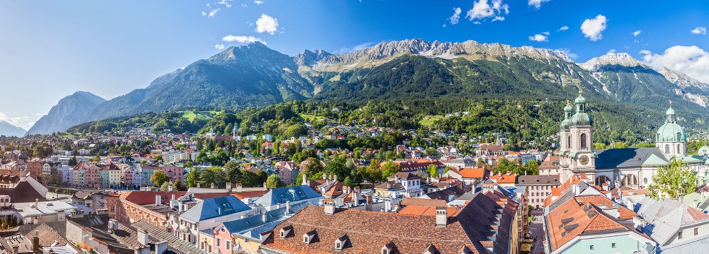
For a bigger city, Innsbruck, Austria, is only about an hour and a half drive from the nature park. With an international airport, extensive outdoor recreation opportunities, and an excellent public transport system, Innsbruck is a great stop to the nature park.
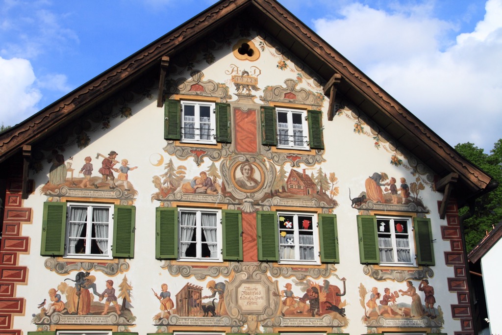
Oberammergau has a population of around 5,000 and is famous for the Passion Play, its beautifully painted buildings, and a long tradition of woodcarving.
The origin of the Passion Play dates to 1633. The story goes that as the plague ravaged the region, residents of the village promised to put on a Passion Play if they were spared from the plague. Supposedly, no one fell ill from the plague the following year, and the village held to its promise and carried on the tradition, making a name for itself with the theatrical production.
The second draw of the village is its painted buildings and frescoes in a style called Lüftlmalerei. This painting technique became popular in the 18th century.
You’ll also be able to find wood carving souvenirs to bring home. Wood carving became popular as the village was advantageously positioned along a trade route linking Augsburg and Venice. The flow of people and goods allowed woodcarvers access to a big market. A vocational school for wood sculptors near the city center has been operational for nearly 140 years.
With less than 1,000 people, Ettal is a small village. However, it’s worth stopping by for the historical sites; Ettal is home to the 14th-century Ettal Monastery and the Linderhof Palace, built between 1869 and 1878. The palace blends French and Bavarian Rococo influences and offers tours every 10 to 15 minutes, while the Ettal Monastery offers tours daily, except in late winter.
With a population of over 310,000 people, Innsbruck is an excellent destination for culture and nature and is near plenty of opportunities for mountain sports. It is the second-largest city in the Alps, after Grenoble, France, but arguably offers better mountain access. The city lies in a valley with steep mountains rising steeply around it; cable cars like the Nordkette and Patscherkofel provide quick access to the slopes for hiking, skiing, mountain biking, and paragliding.
Visitors can stroll through Old Town or pay a few Euros to climb the Town Tower. The Hofkirche church has 28 bronze statues, while the Cathedral of St. James displays Baroque architecture. The Schloss fortress, a medieval fortress turned Renaissance castle for Archduke Ferdinand II’s wife, displays armor and artwork. Innsbruck hosted the Winter Olympics in 1964 and 1976 and the 1984 and ‘88 Winter Paralympics; the stadiums still host sports events.
Purchasing an Innsbruck Card is a worthwhile investment if you want to go to multiple museums, ride some cable cars, and have free transport on buses, trams, and bikes. The passes can be purchased for 24, 48, or 72 hours.