
Scan the QR code and open PeakVisor on your phone
Upper Austria is home to 2,115 named mountains. The highest is Hoher Dachstein at 2,995 m.
Upper Austria (Oberösterreich in German) is one of nine states in Austria and home to impressive mountains in the south. Upper Austria encompasses Kalkalpen National Park (meaning Limestone Alps National Park in English), famed in Austria for its biodiversity and endemic species; the Salzkammergut region boasting mountains, lakes, and the Hallstatt UNESCO World Heritage site; and a portion of the Dachstein massif, including part of the Dachstein West ski resort that straddles Upper Austria and Salzburg. The state has 2115 named peaks. Hoher Dachstein is the tallest (2,995 m / 9,826 ft) and features the greatest prominence, rising 2,139 m (7,018 ft) from its surroundings.
Upper Austria (German: Oberösterreich) is a state in northern Austria. The Northern Limestone Alps demarcate the southern portion, giving rise to a dramatic landscape marked by lakes, glaciers, and forested mountain slopes.
The Northern Limestone Alps feature the Kalkalpen National Park, the Salzkammergut region, and the historic salt-mining town of Hallstatt, a UNESCO World Heritage Site. Kalkalpen National Park is part of the UNESCO Hallstatt-Dachstein/Salzkammergut Cultural Landscape, protecting old beech forests and Austria’s most extensive swath of continuous forest.
Upper Austria is bordered by Germany to the west, the Czech Republic to the north, Lower Austria to the east, and Styria and Salzburg to the south. It lies between the Inn and Enns Rivers, while the Danube runs east-west across the state. The state’s capital is Linz, which is in the northeast.
The Northern Limestone Alps offer fantastic hiking and via ferratas in fair weather and a handful of ski resorts in winter. Dachstein West, on the border with the state of Salzburg, is one of the most popular ski resorts. It’s near the state’s tallest peak, Hoher Dachstein (2,995 m / 9,826 ft), on the Dachstein Massif.
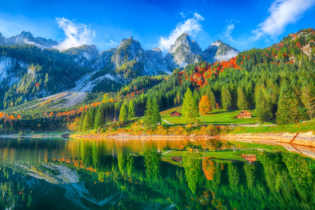
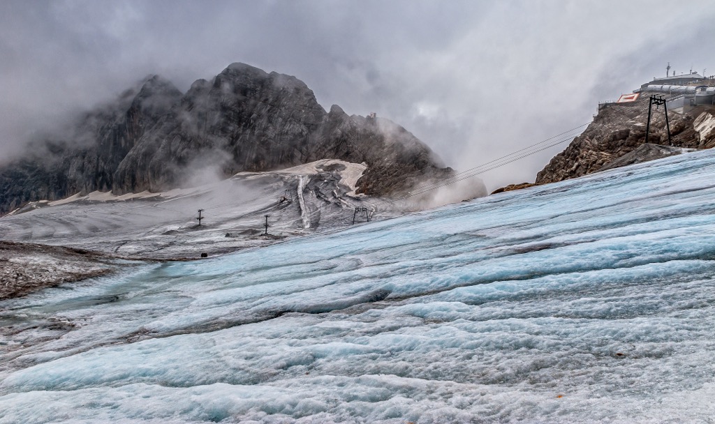
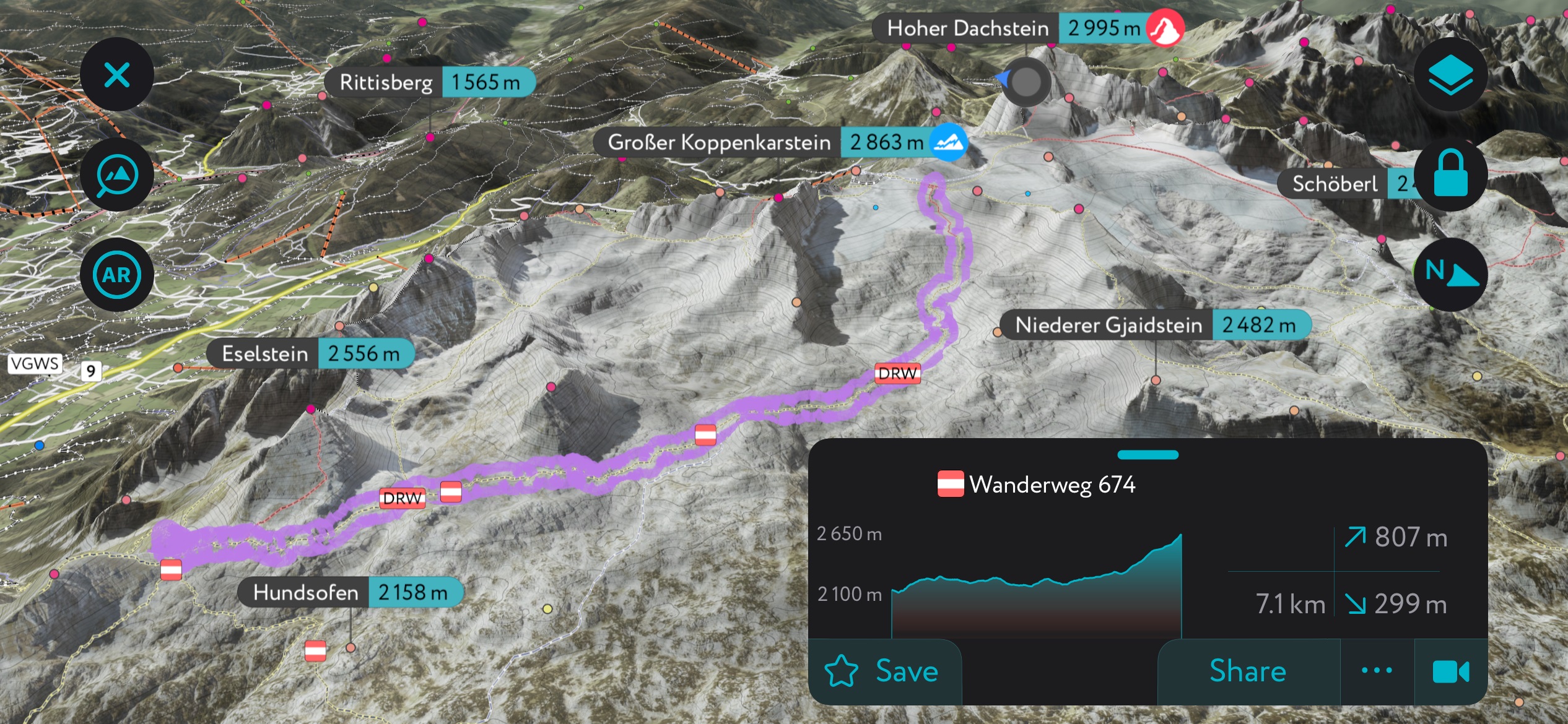
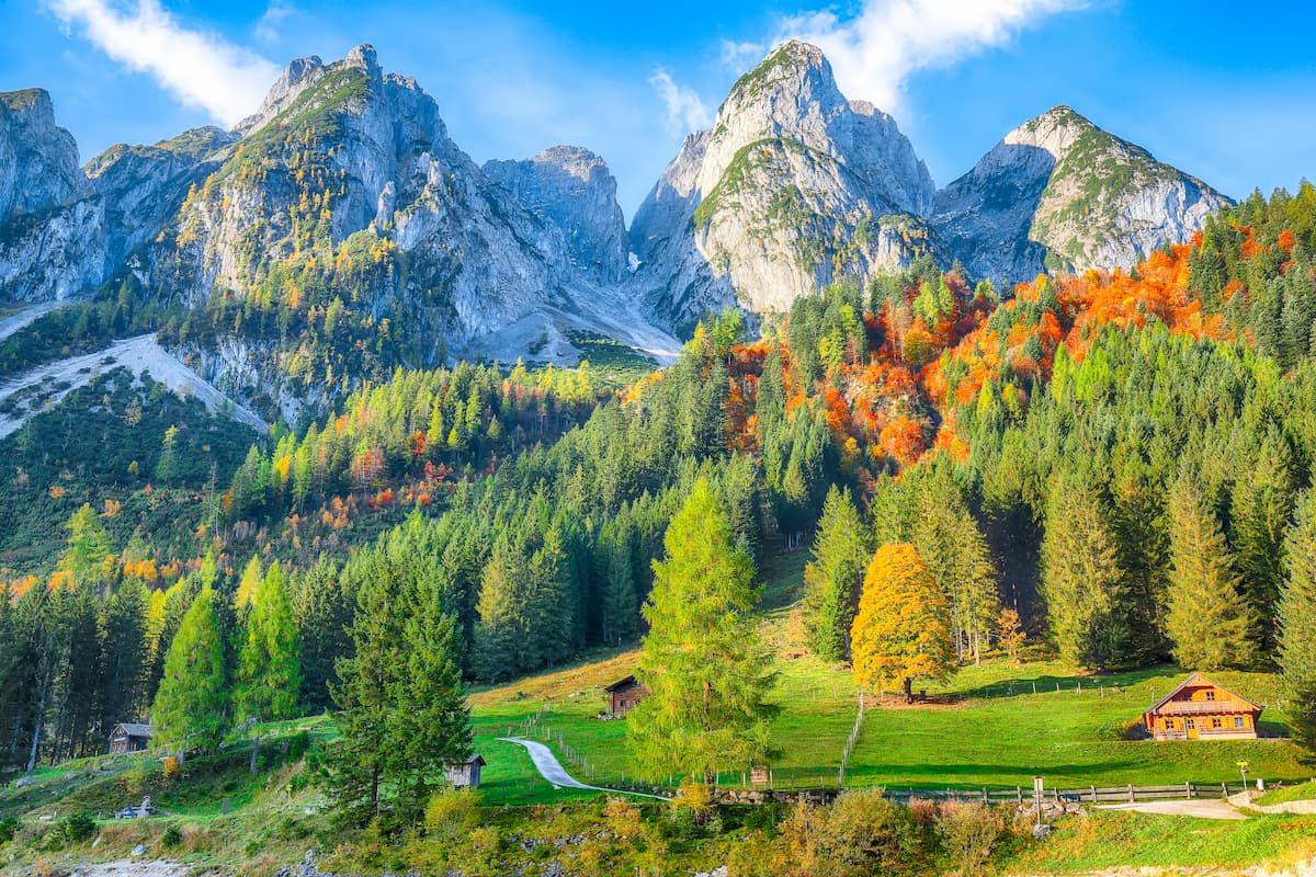
The Dachstein massif is over 20 km (12.4 mi) long, with dozens of peaks towering over 2,500 m (8,200 ft) and glaciers nestled along the upper slopes. Sitting on the border of Upper Austria and Styria with a portion extending into Salzburg, the Dachstein is nicknamed the “three-state mountain” (Drei-Länder-Berg).
The northeast part of Upper Austria comprises a granite plateau called Mühlviertel. It lies north of the Danube and supports poor soil with wooded areas and grasslands at lower elevations. Meanwhile, the Alps geologically characterize the southern portion of Upper Austria.
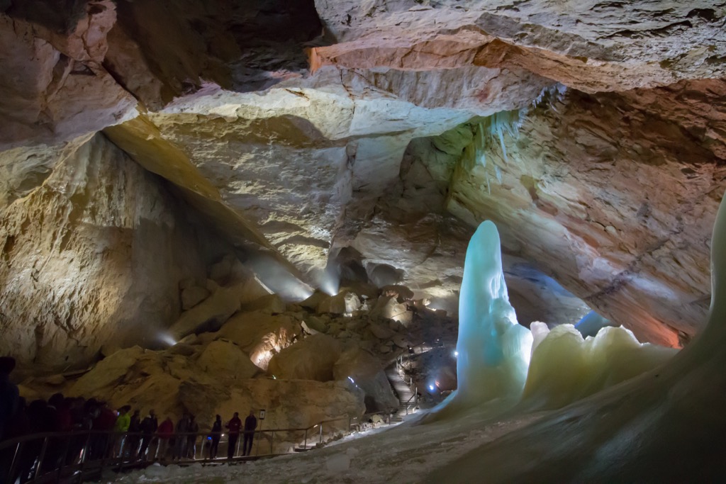
More specifically, the mountains in the south are part of the Northern Limestone Alps and consist primarily of limestone, dolomite, marl, and sandstone. The mountains' karstic nature means they have numerous caves, springs, and sinkholes.
The Alps began forming millions of years ago as the African tectonic plate collided with the European plate, closing the ancient Tethys Sea and uplifting the sediment-filled ocean floor. Today, the Alps continue to uplift slightly (and rebound due to shrinking glaciers) while simultaneously losing elevation due to erosion. These competing forces mean the Alps are not considered a growing range.
During the Pleistocene, glaciers advanced and retreated across the landscape, grinding down rock, leaving behind moraines, and carving out U-shaped valleys. During periods of glacial retreat, rivers wore down V-shaped gorges.
The Salzkammergut region has a long history of human activity due to its salt resources. The slopes of the Hausruck Mountains and Kobernausser Forest in central Upper Austria have brown coal called lignite, and west of Salzkammergut, there are quarries for limestone and granite.
Upper Austria contains a range of ecosystems from the flatter northern landscape to the alpine southern section of the state. Kalkalpen National Park is an endemic hotspot that spans 20,850 ha (51,520 acres) and contains Austria’s largest continuous forest.
The national park houses 32 forest types, including less common forest types such as willow, spruce-fir, and gray alder swamp forests. Of particular importance are the old-growth beech forests, which account for 5,250 ha (12,973 acres) of the park and are part of the UNESCO World Heritage site.
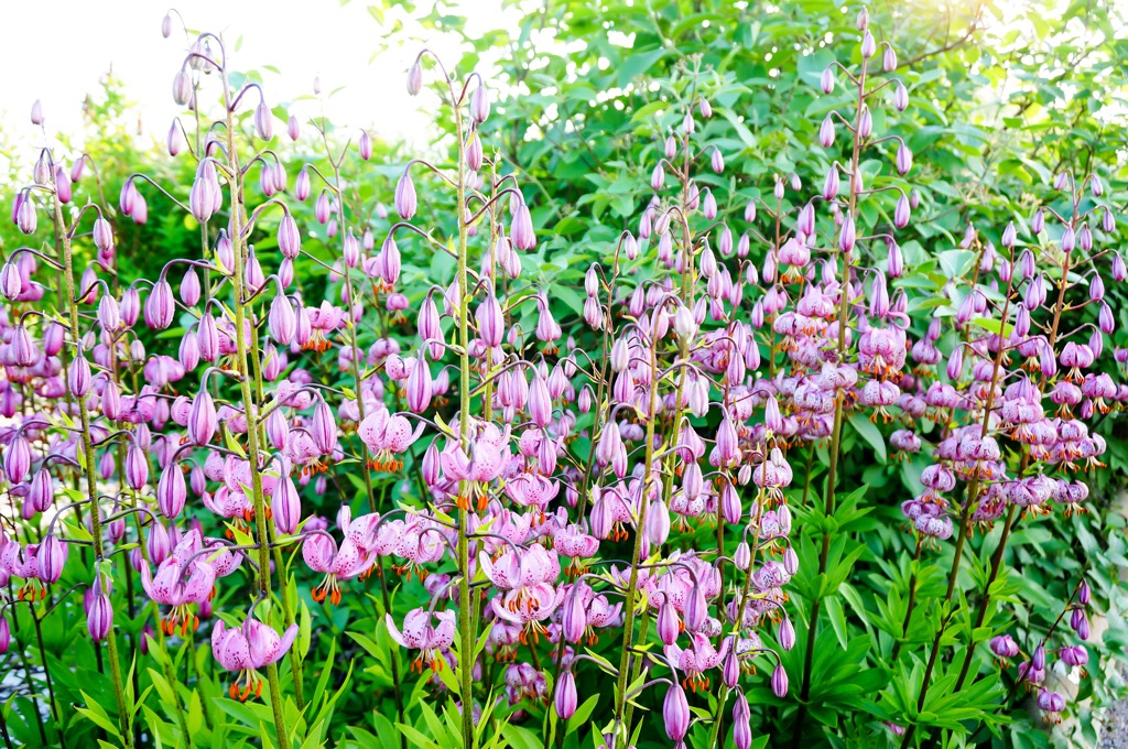
In terms of flora, Upper Austria features 32 of Austria’s native tree species, more than 50 shrub species, and 927 vascular plants, including 42 wild orchid species. You might spot the endemic Austrian spurge (Wolfsmilch in German), which grows to around 80 cm (30 in) and produces white milky sap that can be used to help close wounds. Turk's cap lily grows in the park and is easy to identify as it reaches up to one meter (3 ft) tall and is bright purple.
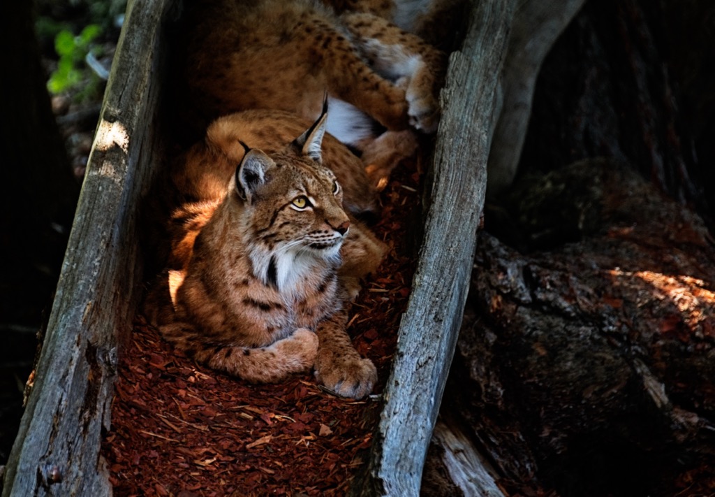
Regarding fauna, the park is home to dozens of mammal species, including red deer and chamois. The only lynx population of the Austrian Alps lives in the forests of Kalkalpen National Park. Birds include Austria’s rarest woodpecker, the white-back woodpecker. Other flying specimens include hundreds of butterfly species and a wide range of other insects. Twenty-two beetle species include the peltis or alpine longhorn beetle.
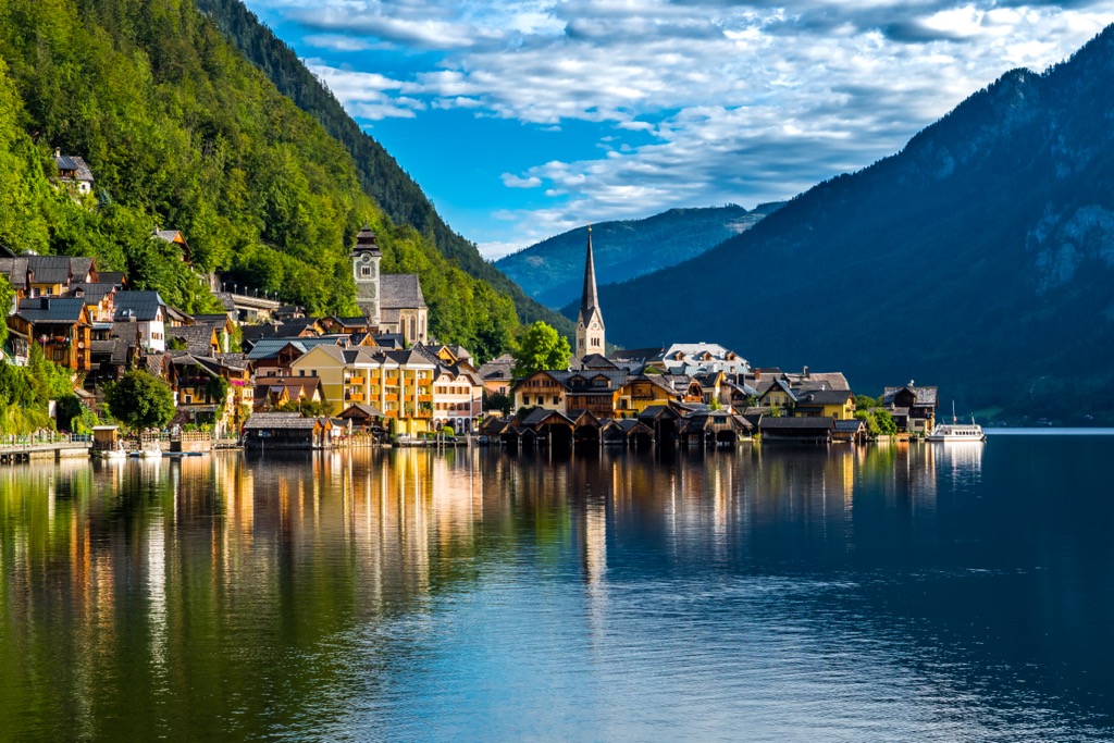
Within Upper Austria, the Salzkammergut region has a long history of human occupation thanks to abundant salt supplies. Particularly well-known is Hallstatt, an early salt mining site with artifacts from the late Bronze and Early Iron Age.
Parts of Upper Austria were ruled for a time under the Roman Empire. In 1192, a central portion fell under the Duchy of Austria. The region was divided from Lower Austria around 1450, and Linz became the official capital in 1490.
During and after World War II, industrial development surged with the production of nitrogen, ironworks, steelworks, manufacturing, and food processing. When WWII ended, more than a hundred thousand refugees came to the state.
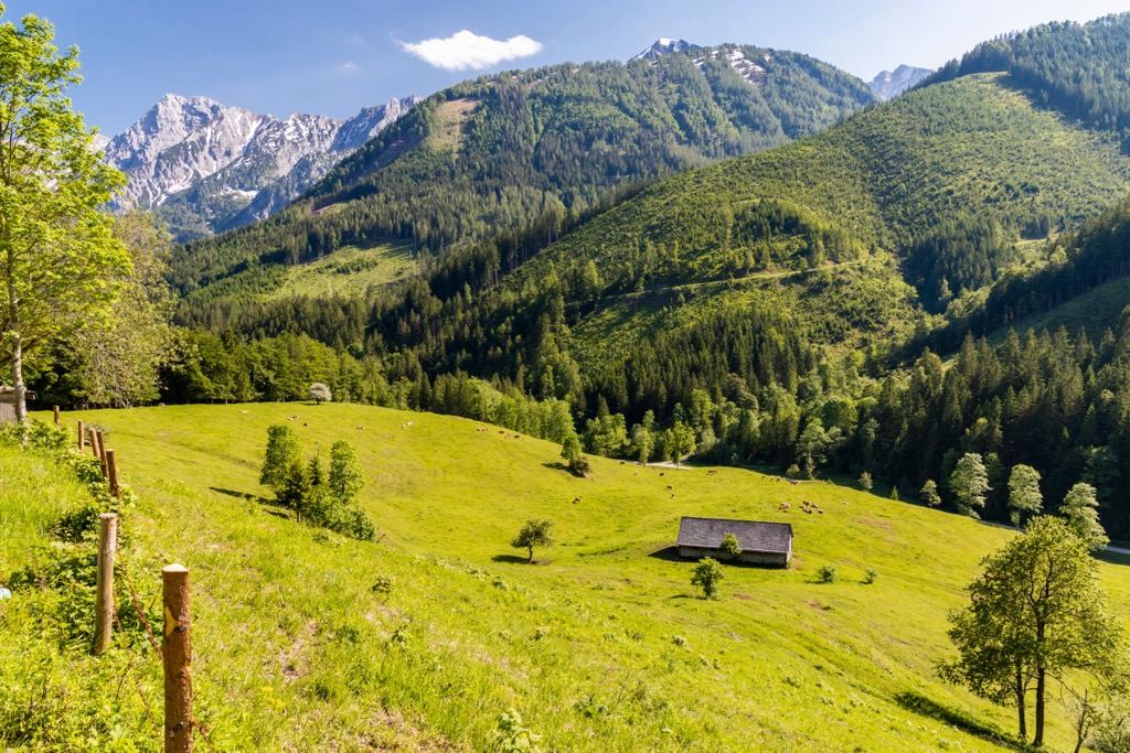
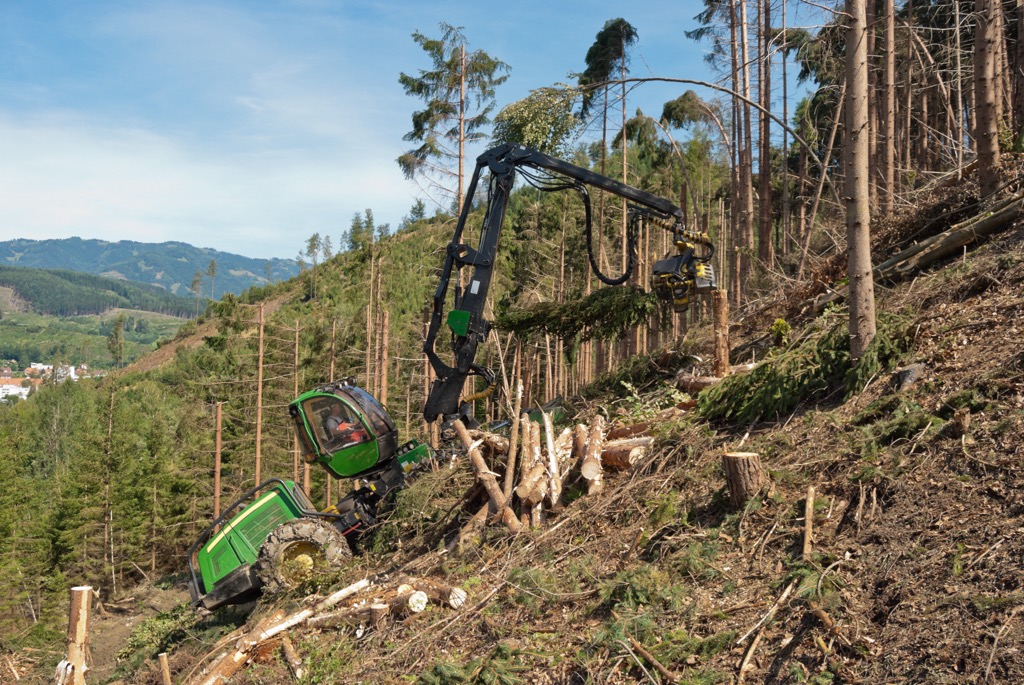
Today, over half the state’s land is used for farming, and forestry accounts for approximately one-third of land use. Many extensive forests, particularly in the Alps, are owned by the state. There continues to be salt mining in Salzkammergut and granite and limestone quarries to the west.
Kalkalpen National Park and the UNESCO Hallstatt-Dachstein/Salzkammergut Cultural Landscape were established in 1997.
Most of Upper Austria’s popular outdoor recreation areas, such as hiking trails, ski resorts, and via ferratas, are concentrated in the mountainous south. An extensive hut system allows hikers to string multi-day mountain routes.
The Upper Austria website lists all trails across the state, including alpine routes and walking trails.
Adamekhütte is a great spot to situate yourself if you want to access some of the longer trails in the Dachstein Mountains. The hut sits below the Gosaugletscher, the glacier below Hoher Dachstein, and offers sweeping views of the Gosauseen, Hohe Tauern, Bischofsmütze, and two lakes in the valley below.
Hikers along the Nordalpenweg, a long-distance trail along the Northern Alps, often use the hut. It is part of the UNESCO World Heritage region that includes Hallstatt - Dachstein/ Salzkammergut.
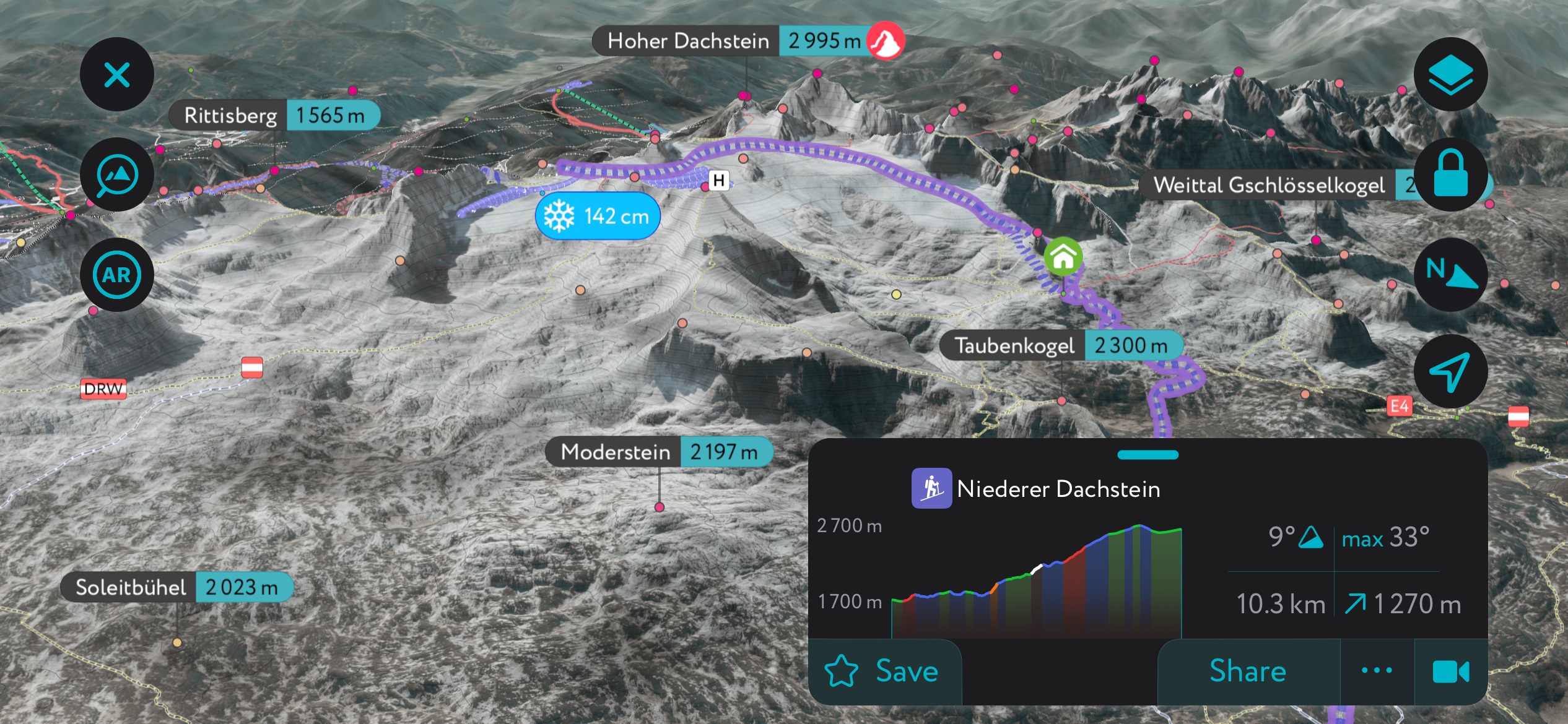
The Linzer Weg is a two-hour trail from Adamekhütte to Oberhofalm, with great views along the way. There’s also a glacial tour that runs to Simonyhütte along a narrow gap called Steinerscharte between Hoher Dachstein and the Niederer Dachstein. This route requires proper equipment and experience crossing ice and snow.
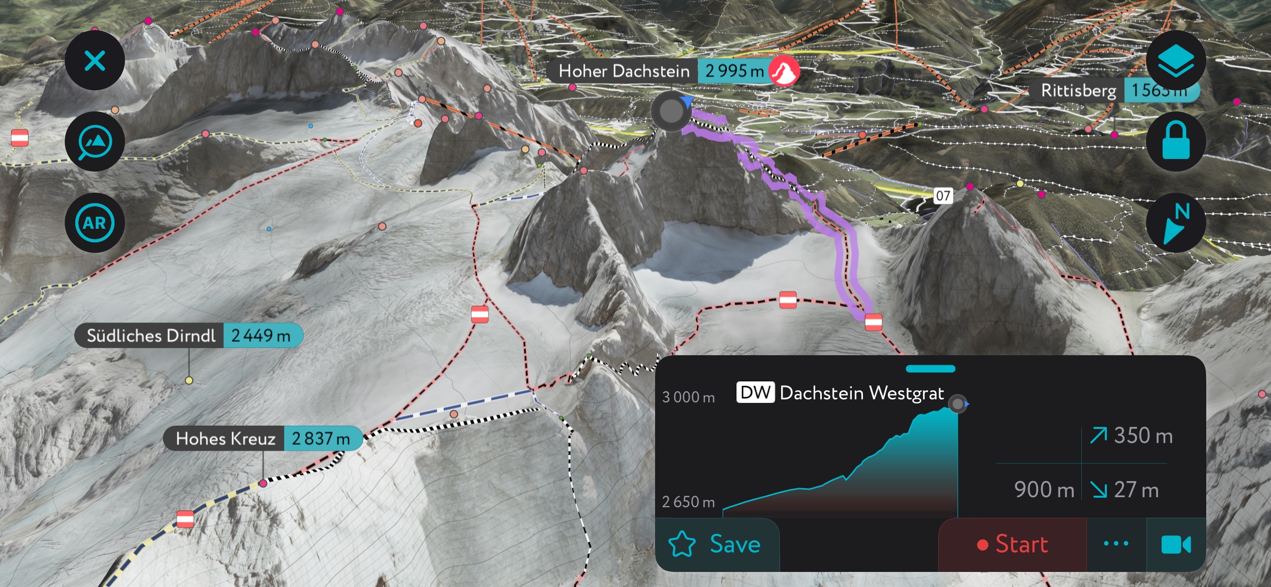
And, of course, there is the option to summit Hoher Dachstein, the tallest peak in the state, with a challenging four-hour climb, including steep trails, exposed ridges, and fixed rope routes.
The trail and via ferrata up Großer Donnerkogel (2,050 m / 6,726 ft) near Gosau is no easy feat but a highlight for those who tackle it. The trail and via ferrata are 8.9 km (5.5 mi) out and back, with a steep 1,088 m (3,570 ft) of elevation gain. For good reason, this area is popular for hiking, climbing, and the via ferrata so it’s best to arrive early if you want to miss the crowds.
The route begins at the Gorsaukammbahn Valley station and includes a thrilling 40 m (130 ft) ladder bridge spanning a deep gorge. The climb gets more challenging after the bridge; this via ferrata is not for beginners and requires a helmet and proper gear.
The via ferrata climbing component can be skipped by taking the trail that runs up the backside of the mountain. This route offers fewer views but nonetheless reaches the summit. Visitors can choose to hike all the way up and down or use the gondola to eliminate additional hiking.
The Dachstein West ski resort sits between the Dachstein glacier, Gosaukamm, and Tennengebirge. The extensive winter complex on the border of Upper Austria and Salzburg offers skiing, ski touring, and snowshoeing routes, as well as hiking and climbing options in the summer.
The resort spans the villages of Russbach, Gosau, and Annaberg, with 51 km (31.7 mi) of slopes via 19 lifts. A large freestyle snow park welcomes freestylers of all levels. The Panoronda, a 44 km (27 mi) long ski circuit featuring prepared slopes and panoramic views, is another highlight of the Dachstein region.
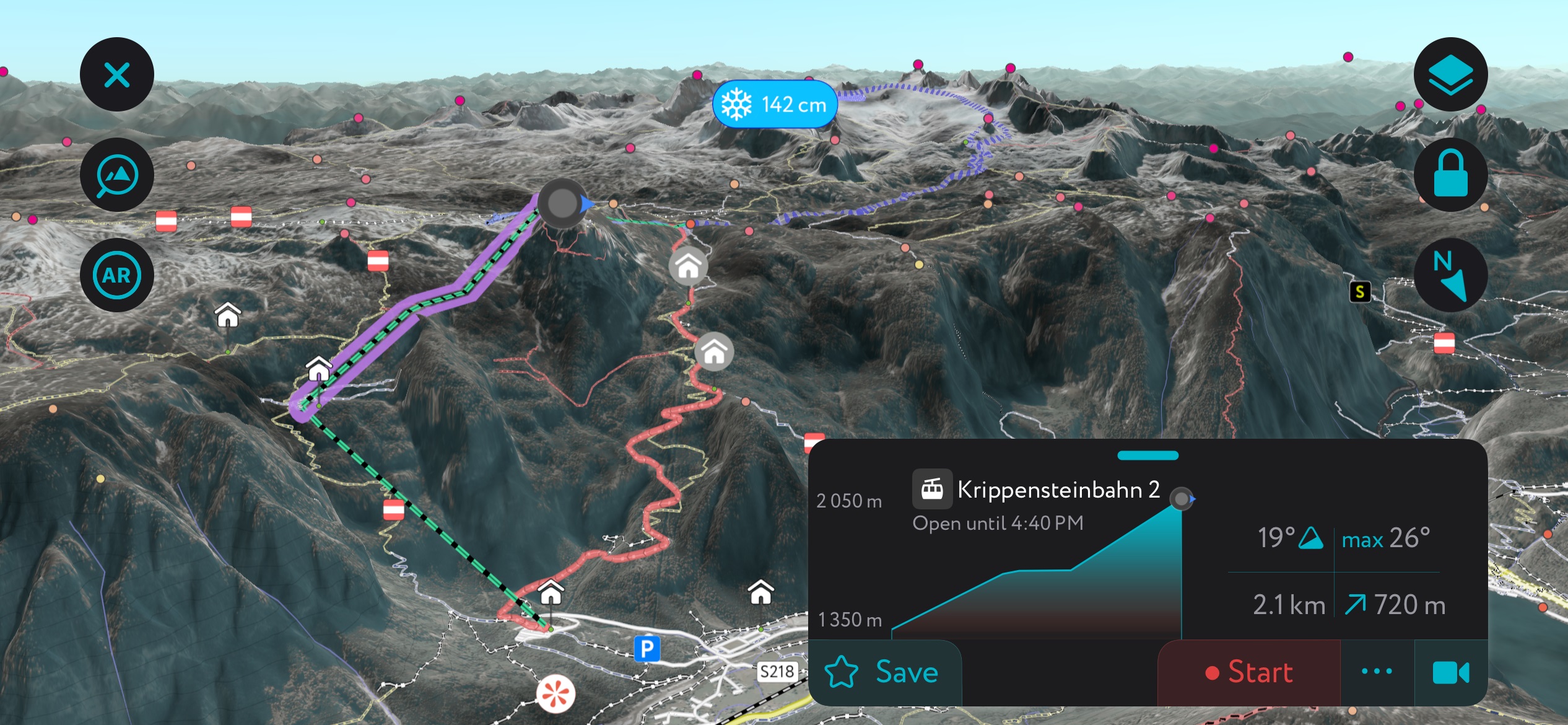
On the backside of Dachstein, the cable car at Krippenstein accesses a vast tract of off-piste terrain. Krippenstein caters to freeriders and backcountry skiers; there is only one groomed piste, so skiers looking for groomers and sun should stick to the Dachstein.
You can use the PeakVisor App’s “Winter Mode” to navigate both the resorts and off-piste areas around the Dachstein Massif.
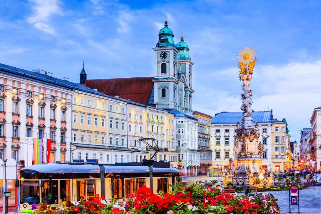
Linz, the capital of Upper Austria, has a small international airport. Once an industrial hub, the city blends old and new and is only 1.5 and two hours from Salzburg and Vienna, respectively. Bad Ischl offers a great base in the Salzkammergut region. Considered the gateway to Salzkammergut, the town is well connected to the mountains, nearby small towns, and cultural sites like the UNESCO World Heritage site at Hallstatt.
With a population of a little over 200,000 people, Linz is Austria’s third-largest city. It doesn’t have quite the reputation of Vienna and Salzburg but still offers a rich historical feel and a dynamic arts and culture scene.
The Danube River flows through the city center, and the Main Square and Old Town give the city a historic feel. The city was once a hub of industry and continues to celebrate this innovative and progressive spirit. You can visit the enormous graffiti gallery, the technology museum Ars Electronica Center, in addition to more traditional sites like the Opera House and the Old and New Cathedrals.
A familiar tourist spot is Pöstlingberg, a 20-minute tram ride from Hauptplatz. The pilgrimage basilica, viewing platform, photo gallery, and zoo are pleasant activities for adults and families.
Bad Ischl has a population of slightly over 14,000 people. This elegant and picturesque spa town is the gateway to the Salzkammergut region. Centrally located, buses and trains run regularly from Bad Ischl to other villages. It is the biggest town in the area with a wide variety of accommodation options, including for travelers on a budget.
The town once served as the summer home of Habsburg emperor Franz Joseph I, and the emperor’s former residence, the Kaiservilla, is open for tours. The guided tours are often lengthy and best if you have more than one day in town.
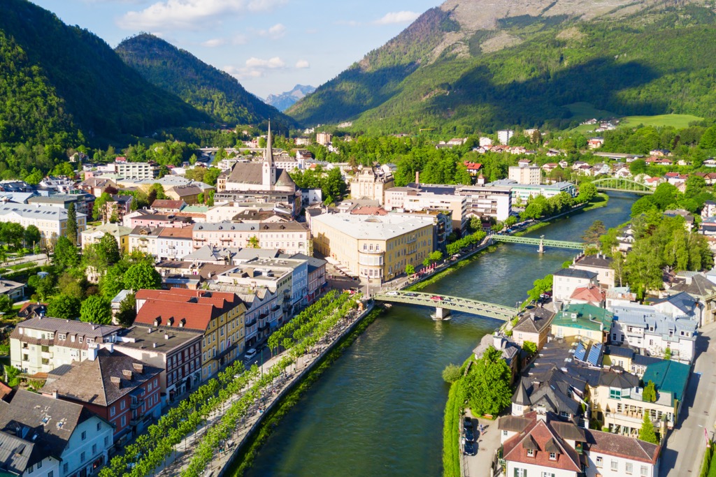
Other attractions include a visit to the City Museum for a look at the town’s local history and a visit to the town’s thermal spa. The Katrin cable car runs to the top of Katrin, where a restaurant offers local dishes with seasonal ingredients. You can also hike up or down in lieu of the cable car.
Its central location makes Bad Ischl an excellent base for day trips to the mountains and other villages. Hallstatt is a popular destination for its location on Lake Hallstatt, access to hiking trails, and proximity to the Dachstein Ice Cave and the Mammut Cave.


Yes. Upper Austria has 2,115 named mountains. The highest is Hoher Dachstein at 2,995 m.
The highest mountain in Upper Austria is Hoher Dachstein, at 2,995 m.
Upper Austria has 2,115 named mountains.


