
Scan the QR code and open PeakVisor on your phone
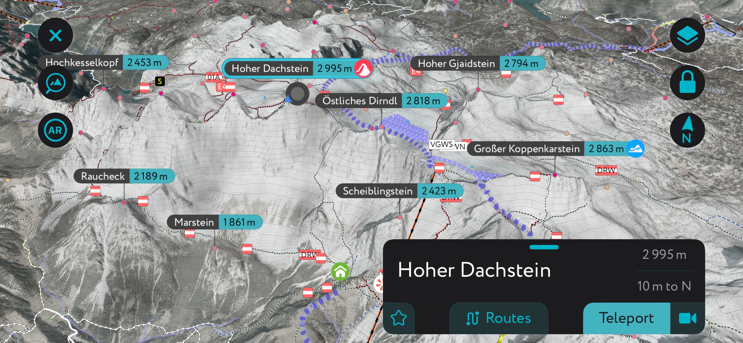
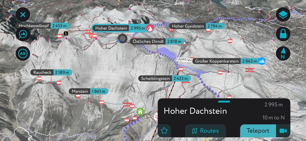
The Salzkammergut and Upper Austria Alps spread across Upper Austria, Styria, and Salzburg. The mountains are part of the Northern Limestone Alps and contain smaller mountain groupings, such as the Dachstein and Salzkammergut massifs. There are 2322 mountains in the range; Hoher Dachstein is the highest (2,955 m / 9,826 ft) and has the greatest topographic prominence (2139 m / 7,018 ft).
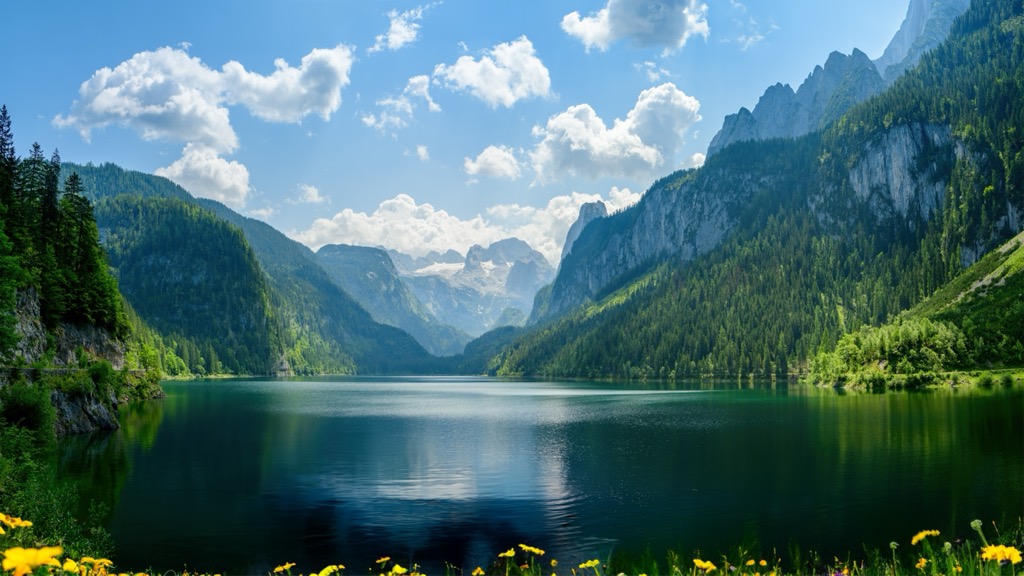
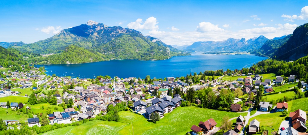
The Salzkammergut and Upper Austria Alps stretch across Upper Austria, Styria, and Salzburg in Austria. They are part of the Northern Limestone Alps and present a dramatic landscape of steep peaks, verdant valleys, picturesque lakes, glaciers, and cave systems running deep within the mountains. The Salzkammergut area is Austria’s lake district, with well-known lakes such as Wolfgangsee, Hallstättersee, and Schwarzensee. The Danube River drains the mountains.
The range includes smaller groups such as the Salzkammergut and Dachstein mountains. The tallest peak in the range, Hoher Dachstein (2,955 m / 9,826 ft), is part of the Dachstein massif. Hoher Dachstein straddles Upper Austria, Styria, and Salzburg, dubbing it the nickname Drei-Länder-Berg (three-state-mountain).
The Dachstein massif as a whole includes dozens of peaks over 2,500 m (8,200 ft). The massif is protected as a Natura 2000 area – a European initiative that conserves areas of high ecological value.
The Salzkammergut and Upper Austria Alps are part of the Northern Limestone Alps and the Alps. The mountains feature towering limestone rocks and extensive cave systems.
The geologic history of the range dates back over 200 million years. Around this time, Pangea began to split along the Eurasian and African plates, creating a shallow seaway known as the Tethys Sea, where sediment and shells collected on the ocean floor.
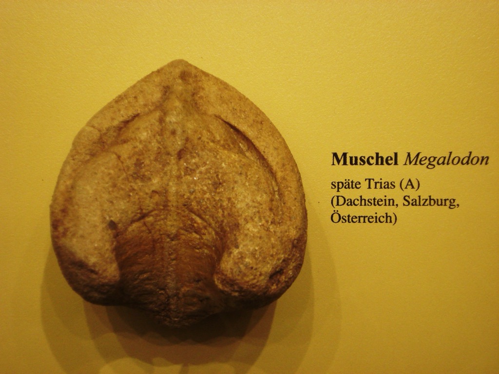
During the early Cretaceous era, around 140 million years ago, the African plate drifted north, pushing sediment and folding deposits on the ocean floor over each other. This process formed Dachstein and Hallstatt limestone, two rock types found in the range. Dachstein limestone contains many fossils from the ancient sea, particularly the bivalve megalodons, whose fossils resemble a cloven cow track.
The Alpine orogeny raised the Alps when the African and Eurasian plates collided. The collision has been ongoing since Cretaceous times. The majority of mountain building occurred between 65 and 2.5 million years ago. The uplift no longer outpaces the rate of erosion, so the Alps are not considered a growing range.
During the Ice Age, glaciers extended down to the base of the mountains and along the valley floors. They formed distinct U-shaped valleys as they retreated. Today, the high peaks still host a few glaciers and icefields, although these are rapidly shrinking and at risk of disappearing entirely over the next century. Glaciers in the range include the Hallstatt Glacier (Hallstätter Gletscher), the Great Gosau Glacier (Großer Gosaugletscher), and the Schladming Glacier (Schladminger Gletscher).
The range is marked by karst features, including some of the largest cave systems in Austria. Among the best-known caves are Mammuthöhle and Hirlatzhöhle. The region has a history of salt mining dating back thousands of years; salt reserves developed as the ancient shallow sea dried up.
Like other parts of the Northern Limestone Alps, the steep slopes of the Salzkammergut and Upper Austrian Alps create numerous ecological niches and microclimates that support a range of biodiversity in a relatively small space.
Habitat composition changes with altitude, ranging from valleys to alpine summits. Mixed forests are typical up to about 1,450 m (4,760 ft) elevation. Among deciduous trees, ash occurs in lower valleys, common beech thrives throughout, and sycamore and mountain ash appear as the elevation increases. Conifer species include spruce, larch, and sometimes fir.
Around 1,650 m (5,415 ft), larch begins to dominate, and other deciduous trees, such as green alder, appear. Forests are increasingly interspersed at higher elevations with stone pine, dwarf pine, and alpine rose. Visitors to the area should keep an eye out for poisonous monkshood, which can cause a rash after contact. Higher altitudes give way to rocky landscapes, alpine meadows, dwarf pines, low brush, and the occasional solitary stone pine.

A range of mammals and birds make their home in the mountains. Golden eagles, along with a variety of owls, woodpeckers, and other forest and rock-dwelling birds, can be spotted here. Marmots live around alpine zones and hibernate for over half the year to survive cold winters. Other mammals include chamois, ibex, foxes, ermines, and several small rodents.

The Salzkammergut region has been home to humans for thousands of years. Early Celts worked the salt mines in the mountains around Hallstatt from the 8th to the 5th century BC. The area supported the early Iron Age Celtic Hallstatt culture.
Prehistoric burial sites discovered in the late 1800s revealed a glimpse into the early culture; over 1,000 graves date from around 1200 BC to 500 BC. Remains of men, women, and children were often buried with items that suggested a lifestyle above simple subsistence.
Although there was a lull in significant events during Roman rule, Hallstatt became a market town in 1311, suggesting that it had remained relevant.
At the base of Schafberg, the town of St. Wolfgang houses a church built in 1183 AD. For centuries, the church has been a pilgrimage destination.
The Schafbergbahn railway was constructed in 1872-1873, opening the area to a much grander scale of tourism. The village of Bad Ischl, today a spa town with thermal baths, was the summer residence of the Habsburg Emperor Franz Josef.
Valleys and mountain meadows have been used for alpine farming for centuries; the tradition continues today. Agritourism in the region gives visitors the chance to stay on local farms and learn about this rural way of life. Hikers should keep their eyes out for cows while on the trail and give them a wide berth.
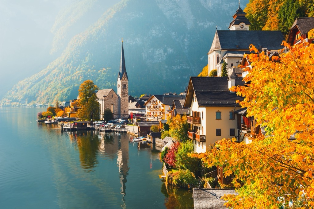
Today, the area is well known as Austria’s lake district and a booming tourist destination. In fact, Hallstatt, with its picturesque village and lake backdrop, is often cited as one of the world’s most prominent examples of over-tourism. The minuscule village boasts a year-round population of 800 residents, while the number of tourists ranges around 3 million.
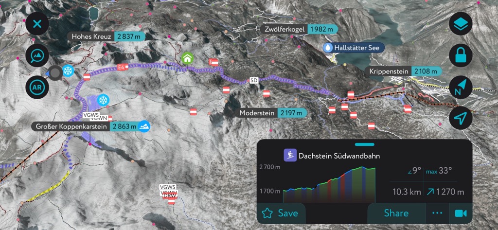
An extensive network of trails and mountain huts opens the mountains to hikers, and the area boasts several ski resorts and ski tours. The mountains also draw visitors for climbing, Via Ferrata routes, and cave and ice cave tours.
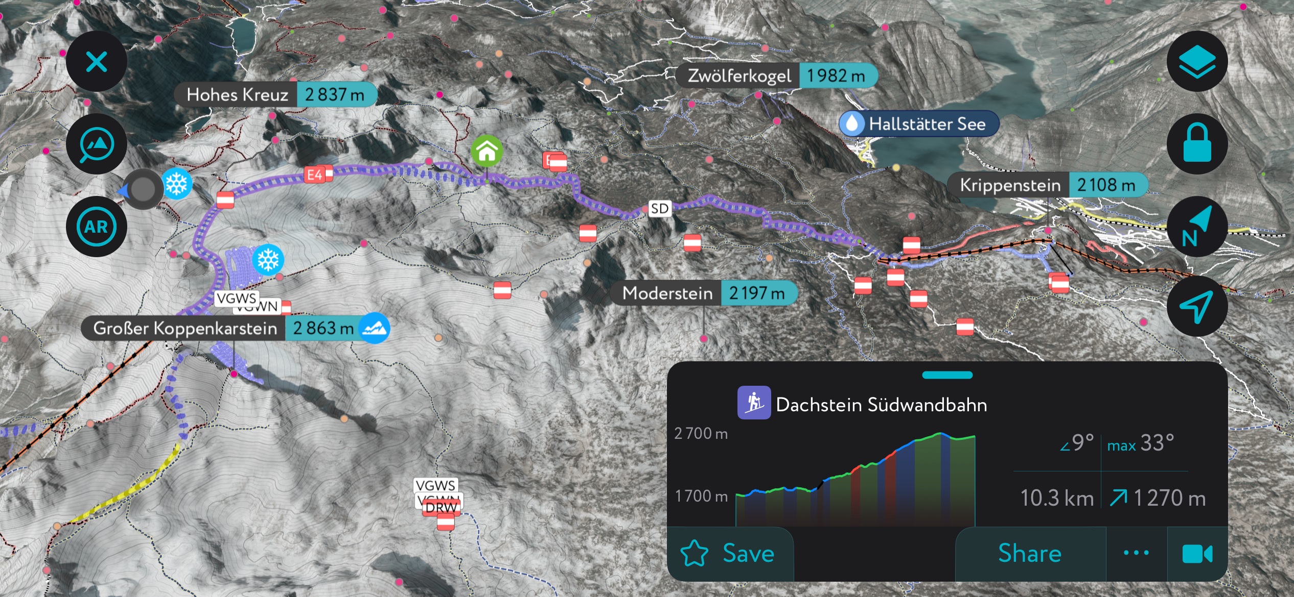
Along the Dachstein massif, you’ll find the highest suspension bridge in Austria and a glass gondola for a unique vantage point of the mountains. With many options for outdoor recreation, here are just a few highlights.
The Dachstein West ski resort is a great place to start if you're looking to ski. The resort spans the villages of Russbach, Gosau, and Annaberg, with 51 km (31.7 mi) of slopes via 19 lifts. A large freestyle snow park welcomes freestylers of all levels. The Panoronda, a 44 km (27 mi) long ski circuit featuring prepared slopes and panoramic views, is another highlight of the Dachstein region.
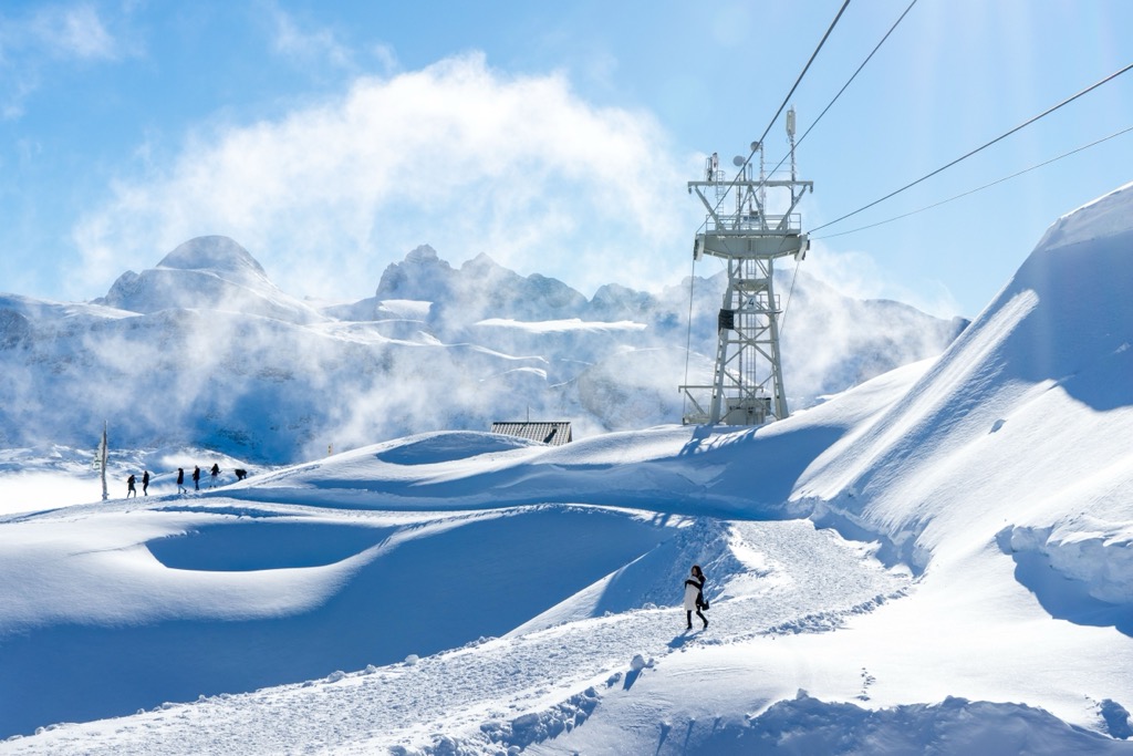
On the backside of Dachstein, the cable car at Krippenstein accesses a vast tract of off-piste terrain. Krippenstein caters to freeriders and backcountry skiers; there is only one groomed piste, so skiers looking for groomers and sun should stick to the Dachstein.
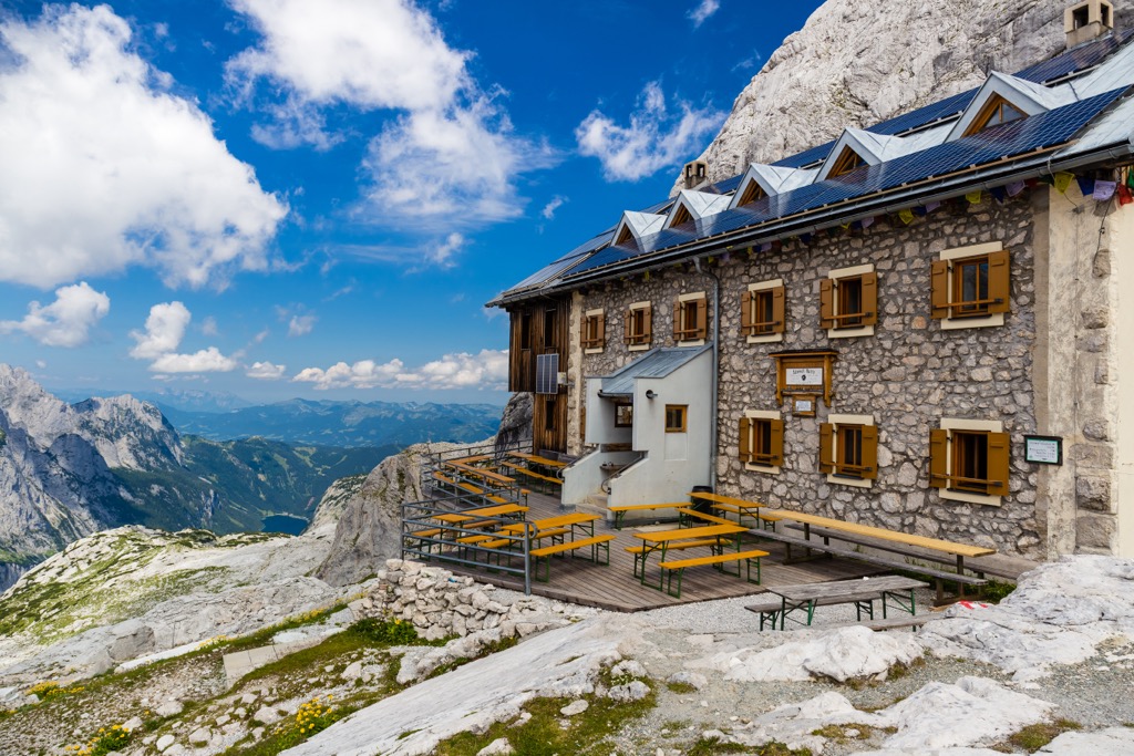
The hike begins leisurely along Lake Gosausee before starting a more challenging ascent. Approaching from the east over the Randkluft ascent, the route follows a well-secured via ferrata. Expect to take five or six hours to cross from Simony Hut to Adamek Hut.
From Adamek Hut, hikers have the option to complete more challenging routes. One example is the Linzerweg that traverses the high glacier. These higher alpine routes require mountaineering experience, with snow and ice persisting through summer. Along the way, it may be possible to spot bivalve megalodon fossils that look like cattle tracks.
Dachstein is a popular area for climbing. A few of the best-known routes are Schulter-Anstieg along the east ridge, Randkluft-Anstieg along the northeast face, and the approach from the west ridge. Those looking for a more exciting route may want to check out Steinerweg (V) and Prichiweg (IV) on the south face.
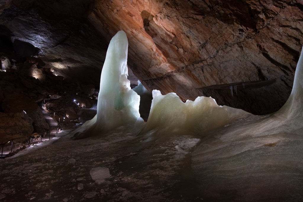
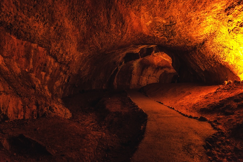
The Mammut Cave, one of the largest karst caves in the world, offers a glimpse into the interior of the Dachstein massif. Over 70 km (43.5 mi) have been explored within the cave system, and about one km (0.6 mi) is open to visitors on a guided tour. General tours are one hour, but those looking for more adventure can schedule a half or full-day tour that goes off the beaten path and deeper into the cave system.
Several mountain huts provide cozy refuge and hot food for hikers in the Salzkammergut and Upper Austria Alps, and the region is dotted with historic small towns. Among the best-known villages are Bad Ischl, Hallstatt, St. Wolfgang, St. Gilgen, and Mondsee (famous as a site used in filming The Sound of Music). Salzburg is only about 1.5 hours away by car. The larger cities of Innsbruck, Vienna, and Munich are several hours away.
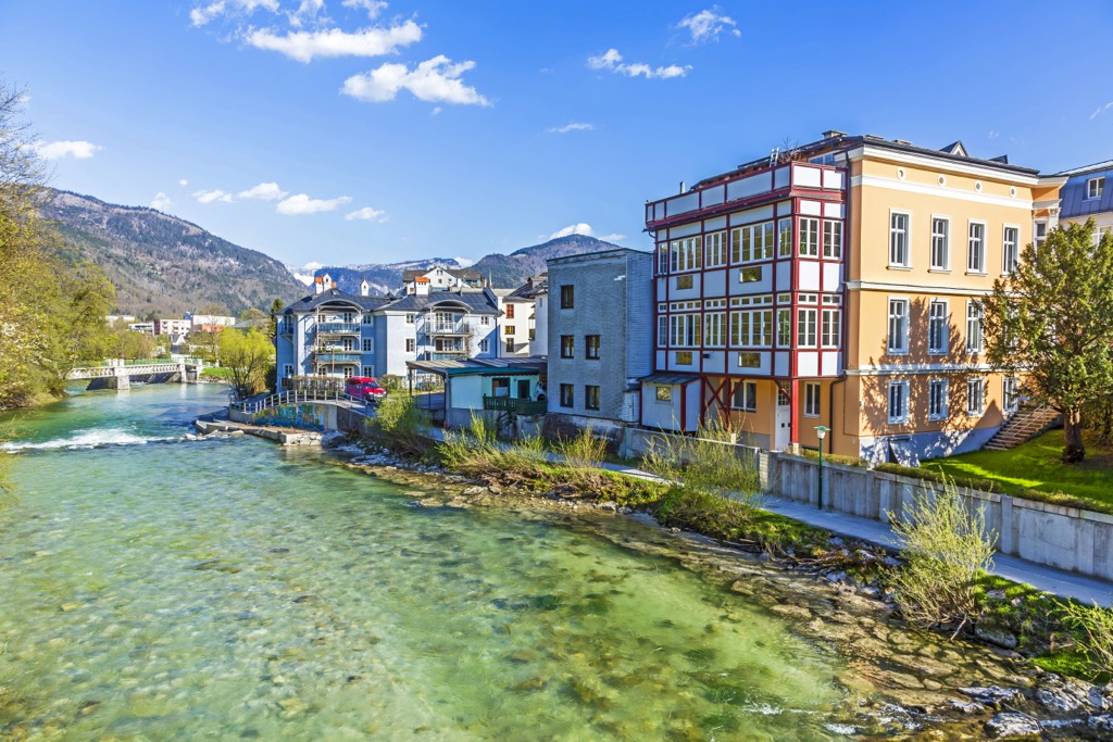
Bad Ischl has a population of slightly over 14,000 people. This elegant and picturesque spa town is the gateway to the Salzkammergut region. Centrally located, buses and trains run regularly from Bad Ischl to other villages. It is the biggest town in the area with a wide variety of accommodation options, including for travelers on a budget.
The town once served as the summer home of Habsburg emperor Franz Joseph I. The emperor’s former residence, the Kaiservilla, is open for tours. The guided tours are often lengthy and best if you have more than one day in town.
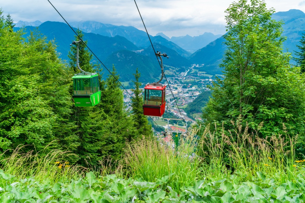
Other attractions include a visit to the City Museum for a look at the town’s local history and a visit to the town’s thermal spa. The Katrin cable car runs to the top of Katrin, where a restaurant offers local dishes with seasonal ingredients. You can also hike up or down in lieu of the cable car.
Its central location makes Bad Ischl an excellent base for day trips to the mountains and other villages. Hallstatt, a UNESCO World Heritage Site, is a popular destination for its location on Lake Hallstatt, access to hiking trails, and proximity to the Dachstein Ice Cave and the Mammut Cave.
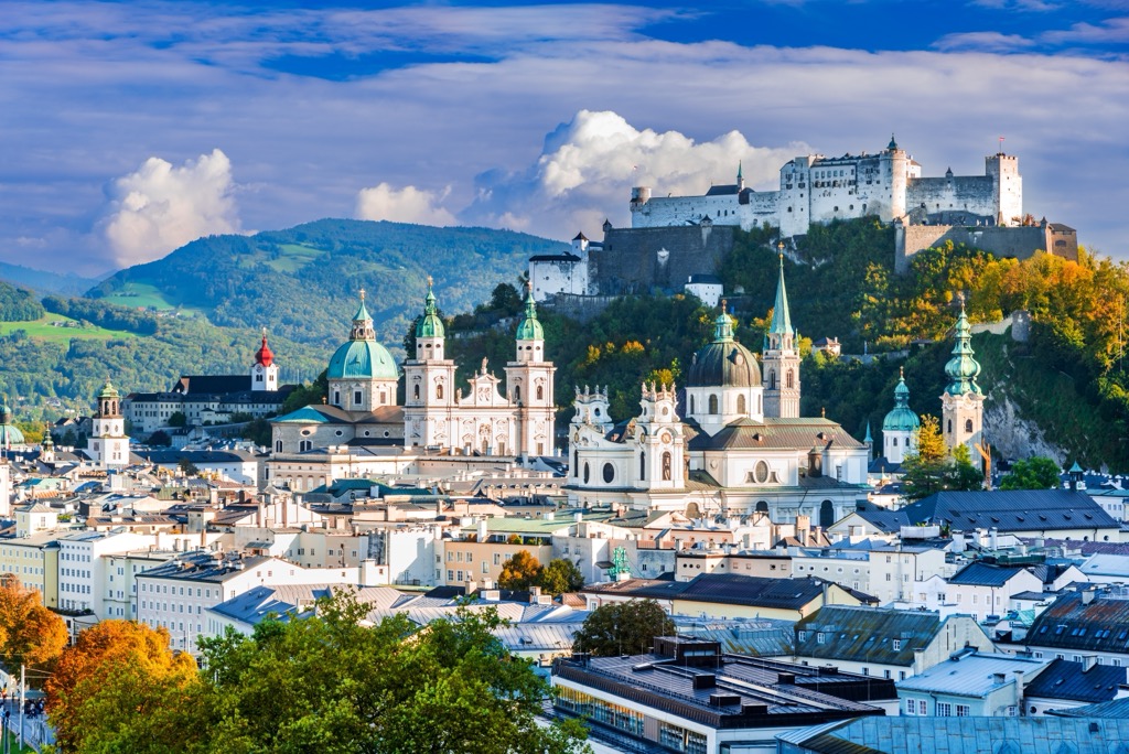
Salzburg is Austria’s fourth largest city and home to just over 150,000 people. It has an international airport and is a UNESCO World Heritage Site. With a well-preserved historic center, festivals throughout the year, and surrounded by mountains and clear lakes, the city draws many tourists each year.
Upon arriving, you can orient yourself to town with a guided or self-guided tour. A few must-see historical sites include the Salzburg Cathedral, the medieval Hohensalzburg Fortress, and Mozart’s home.
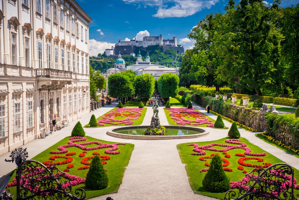
The city hosts numerous festivals, including the Salzburg Festival in July and August and Mozart Week in January. Several elaborate gardens are worth visiting. In just over an hour, visitors can reach the scenic village of Hallstatt on the banks of Lake Hallstatt for a day trip. Salzburg’s proximity to the mountains and its urban amenities offer visitors a cultural experience while working as a base for day hikes or a kick-off point for longer treks.
Salzburg’s downtown is pedestrian-friendly. The city is well connected to the region via buses and trains, making it easy for visitors to get from the urban center into smaller mountain towns.


