
Scan the QR code and open PeakVisor on your phone
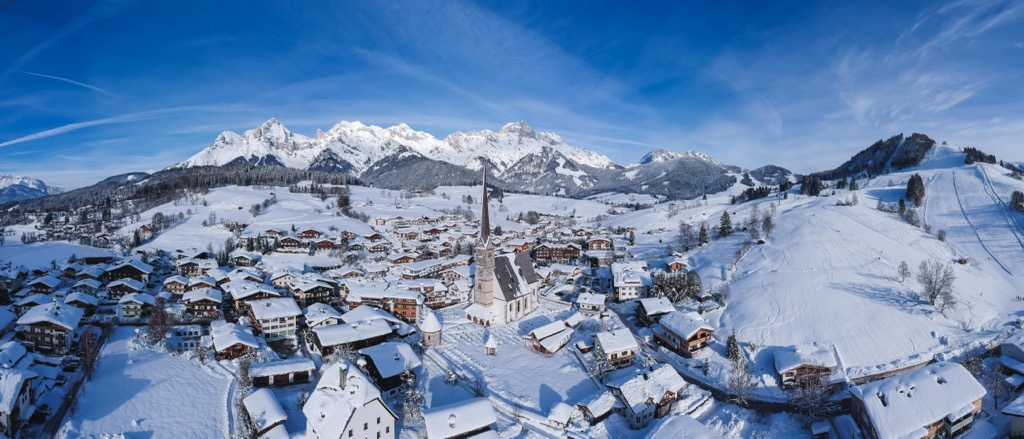
The Northern Salzburg Alps, part of the Northern Limestone Alps, are located in Bavaria, Germany, and Salzburg, Austria. They overlap with the Berchtesgaden Alps as well as several other sub-ranges and small mountain ranges. There are 1056 named peaks in the range; Hochkönig (2,941 m / 9,649 ft) is the highest and most prominent, rising 2,181 m (7,156 ft) from its surroundings to its summit.
The Northern Salzburg Alps are in the states of Salzburg, Austria, and Bavaria, Germany. The range is part of the Northern Limestone Alps and is traversed by the European long-distance trail E4. The range boasts one of Salzburg’s best ski resorts; Hochkönig (the ski area shares a name with the range’s tallest peak) is part of Ski Amadé, Europe’s second-largest ski area, connecting 28 ski resorts and villages.
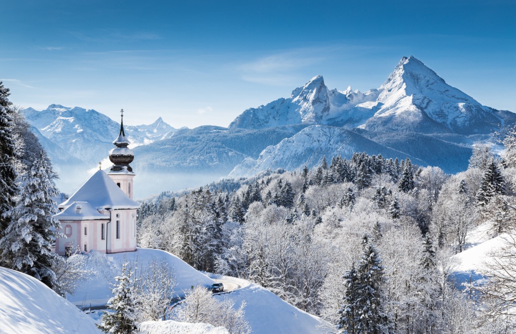
Hochkönig is the range’s tallest peak and lies on the Austrian side. It is part of the Hochkönig mountain group. The plateau glacier of the Übergossene Alm partially covers the Hochkönig region. Across the border in Germany, Watzmann-Mittelspitze (2,713 m / 8,901 ft) is the tallest peak and one of three main peaks along the ridge. It is neighbored by Hocheck (2,651 m / 8,698 ft) and Südspitze (2,712 m / 8,898 ft).
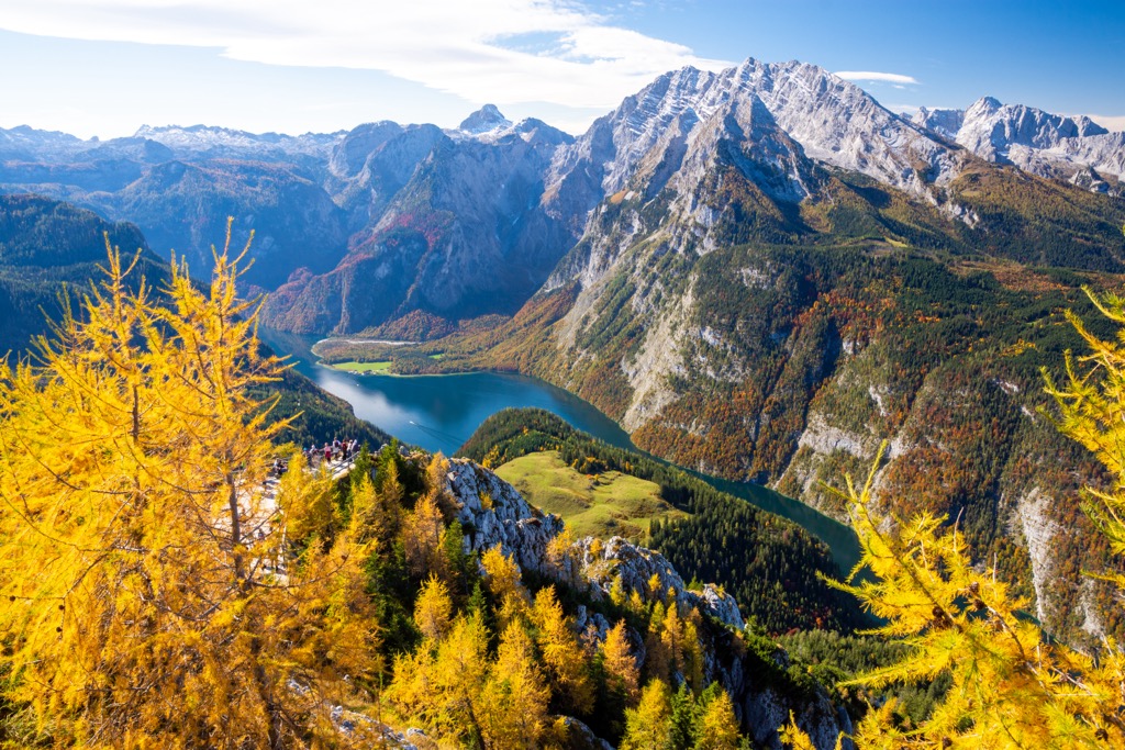
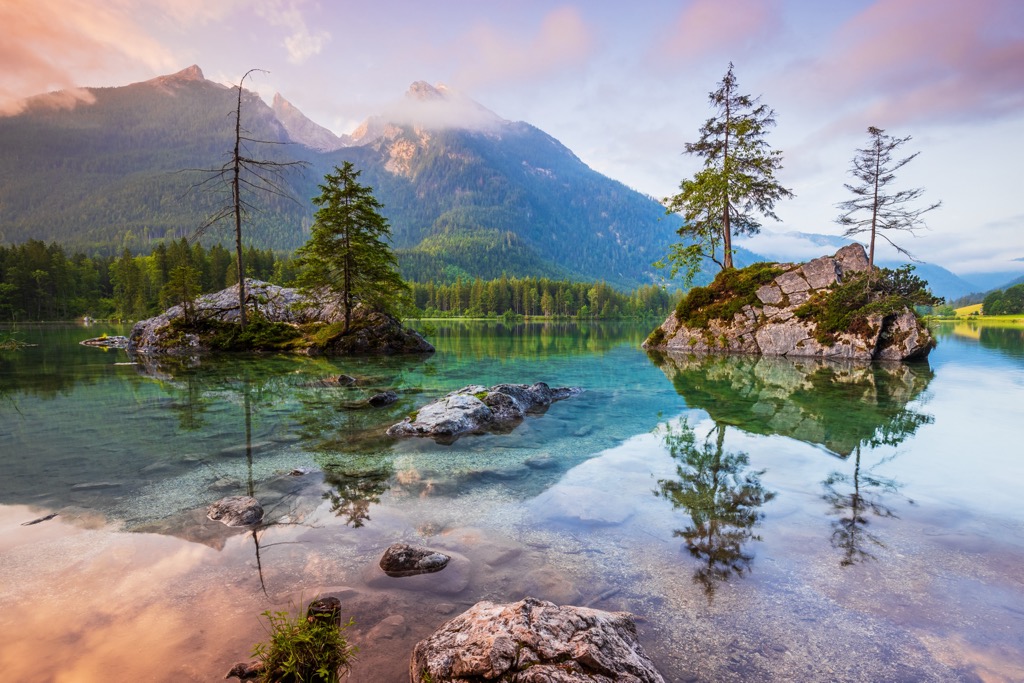
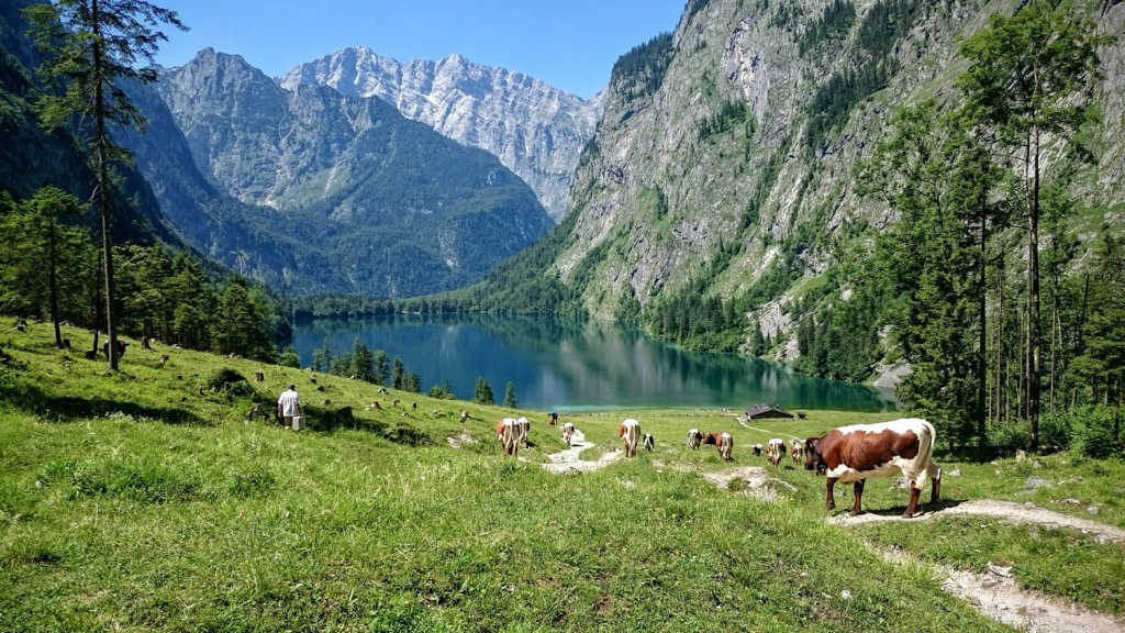
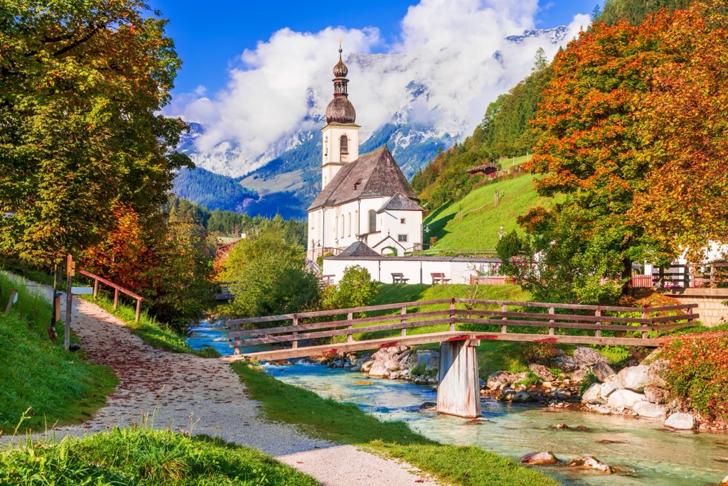
On Watzmann’s eastern side, Lake Königssee sits at the base – a 190 m (625 ft) deep, fresh lake that often has a striking emerald hue. Above the lake rises the Watzmann East Face. Rising nearly 610 m (2,000 ft), it is the highest rock face in the Eastern Alps. The route is only for expert climbers. Hikers can summit via an overnight route that passes Watzmannhaus – one of the many huts dotted across the mountains.
The Northern Salzburg Alps overlap with the Berchtesgaden Alps. Berchtesgaden National Park was created in 1978 and is Germany’s only alpine national park. The park protects habitats typical of the Northern Salzburg Alps – rugged cliffs, thick forests, wild rivers, alpine meadows, and verdant valleys. The UNESCO Berchtesgadener Land Biosphere Reserve protects part of the Northern Salzburg Alps. The biosphere reserve, designated in 1990, covers 83,894 ha (207,307 acres).
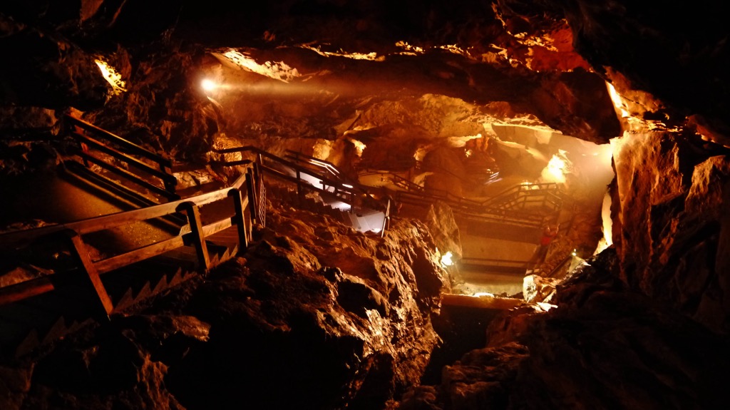
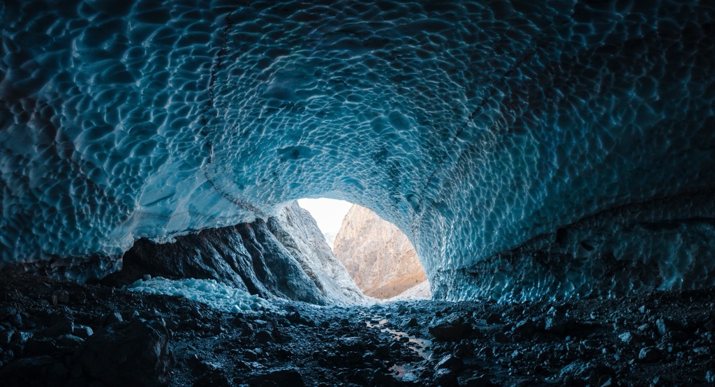
Also contained within the Northern Salzburg Alps are Steinernes Meer and the Hagen Mountains, sub-ranges of the Berchtesgaden Alps, and minor ranges such as Leoganger Steinberge and Loferer Steinberge. There is an extensive cave system in Leoganger Steinberge. The largest cave, Lamprechtsofen, has 700 m (2,300 ft) of the 51 km (32 mi) system open for visitors.
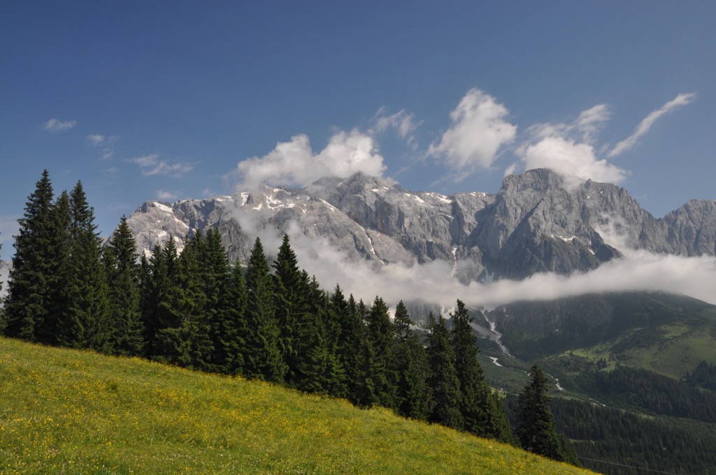
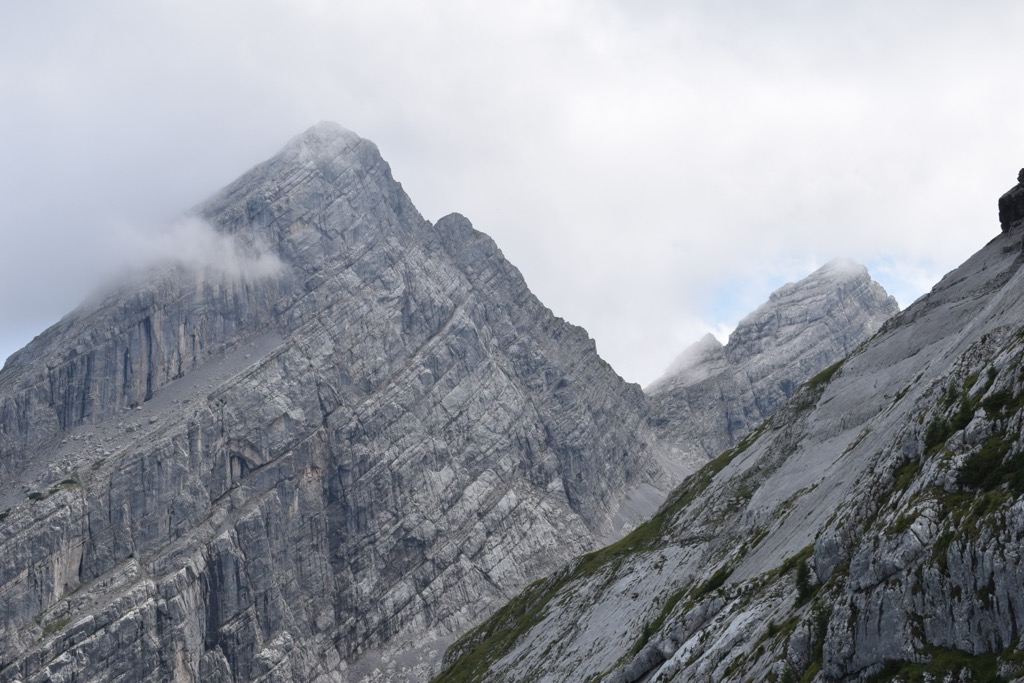
The Northern Salzburg Alps are part of the Northern Limestone Alps and, by extension, the much larger European Alps. The range is characterized by karst and glacial formations.
Rocks in the mountains formed over 200 million years ago from deposits in the ancient ocean Tethys. Shells, mud, and sand accumulated on the bottom of the ocean floor. During the early Cretaceous, around 140 million years ago, the African plate drifted north, pushing and folding deposits on the ocean floor over each other.
The Alps uplifted during the Alpine orogeny, a mountain-building event that occurred as the African and Eurasian plates collided. This collision has been ongoing since Cretaceous times. Most mountain building occurred between 65 and 2.5 million years ago, although the mountains continue to uplift. However, the uplift rate no longer outpaces erosion, and the Alps are not considered a growing range.
The Northern Salzburg Alps show stratified limestone where the brittle Ramsau dolomite makes up the lower layer and is overlaid by the less brittle Dachstein limestone. Fossils appear in the Dachstein limestone, including some of the area's best-known examples of bivalve megalodonts. Visitors to Berchtesgaden National Park may spot these fossils that look like cow tracks and can be larger than a hand.
In recent geological history, the area was shaped by glaciers as they carved out deep valleys, left behind glacial deposits, and influenced waterways. There is a long history of salt mining around Berchtesgaden, while copper mining around Mühlbach am Hochkönig dates back thousands of years.
The Northern Salzburg Alps and the Northern Limestone Alps have great ecological importance, not just for their low disturbance and biodiversity, but as a connection to nearby ranges such as the Carpathians. Protected areas within the range include Berchtesgaden National Park, the UNESCO Berchtesgaden Biosphere Reserve, and the Nature Park Weißbach.
The main terrestrial habitats found in the range include sub-montane, montane, and sub-alpine forests with mountain pine, larch, sycamore, and Norway spruce; alpine limestone grasslands; plant communities on rocky outcroppings and crags; grassland farming; and forestry systems with spruce, larch, beech, and fir. The forests are interspersed with alpine pastures and meadows blooming with summer wildflowers. Several rare orchid species thrive throughout the mountains.
Above the subalpine forest, habitats transition to mountain pine scrub, green alder, willow scrub, dwarf shrub heaths, alpine grasses, and snow valleys. Scree slopes, boulder heaps, firn fields, and rocky terrain define the highest elevations.
The area has been in use by humans for centuries for farming, forestry, mining, and hunting. One of the missions of Berchtesgaden National Park is to convert the mountains’ forests back to their natural mixed-forest composition.
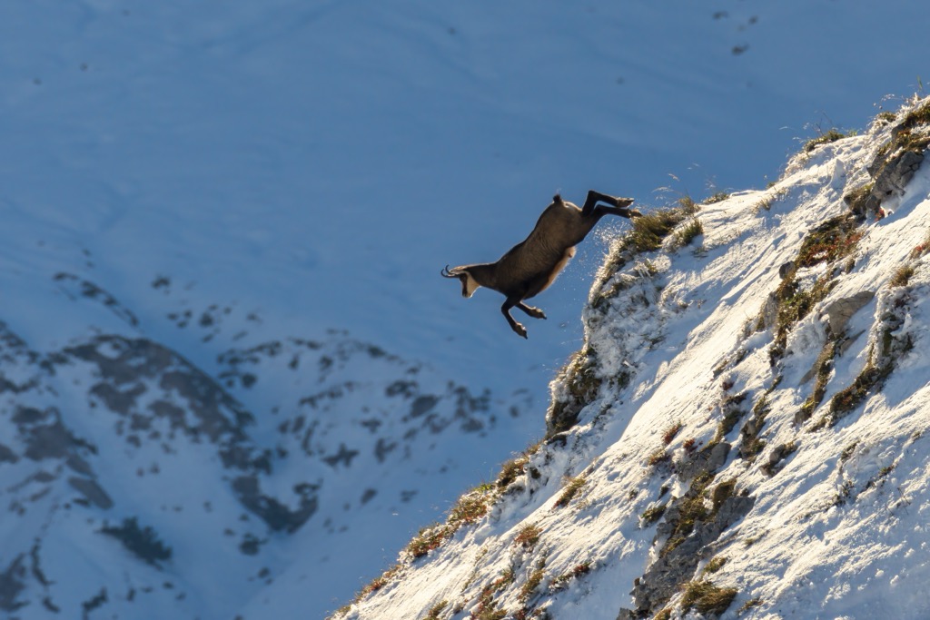
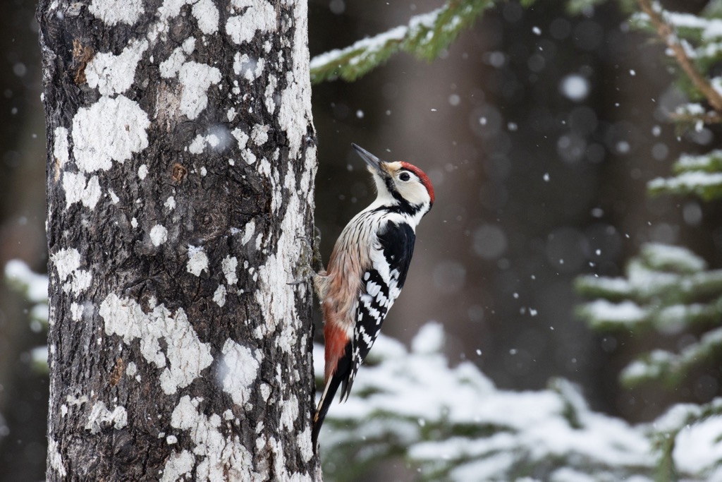
The Northern Salzburg Alps protect a wide range of wildlife, including mammals such as ibex, chamois, marmots, red deer, foxes, badgers, ermines, otters, and martens. Historically, bears, wolves, and lynx lived here but were extirpated in the 1800s. Birds include the celebrated golden eagle, as well as owls, flycatchers, grouse, pitpits, and numerous woodpeckers.
The three-toed, wryneck, and gray woodpeckers love deadwood and natural disturbance areas. White-back woodpeckers occupy deadwood and hardwood zones, while black woodpeckers prefer high montane forests. Great horned and pygmy owls often take advantage of the cavities made by black woodpeckers for their own use. Meanwhile, rock ptarmigan, snow sparrows, and wallcreepers prefer rocky areas.
The mountains support alpine and fire salamanders, mountain newts, mountain and sand lizards, smooth snakes, and adders. There are over 700 butterfly species and many forest beetle species, such as Reiter’s bark, shovel, Scarlet, and Alpine longhorn.
The area of Berchtesgaden extends into Austria and operated as an independent political entity for centuries. From the 1300s onwards, the area was ruled by provosts of the Augustinian abbey. In 1491, some provosts became princes of the Holy Roman Empire. Forests within the mountains have been used for centuries by princes and royal families for hunting and forestry.
The town of Berchtesgaden was occupied by Austrian troops in 1704 before being annexed to Austria in 1805. The French enjoyed a brief rule from 1809 to 1810 before the town became part of the Bavarian kingdom.
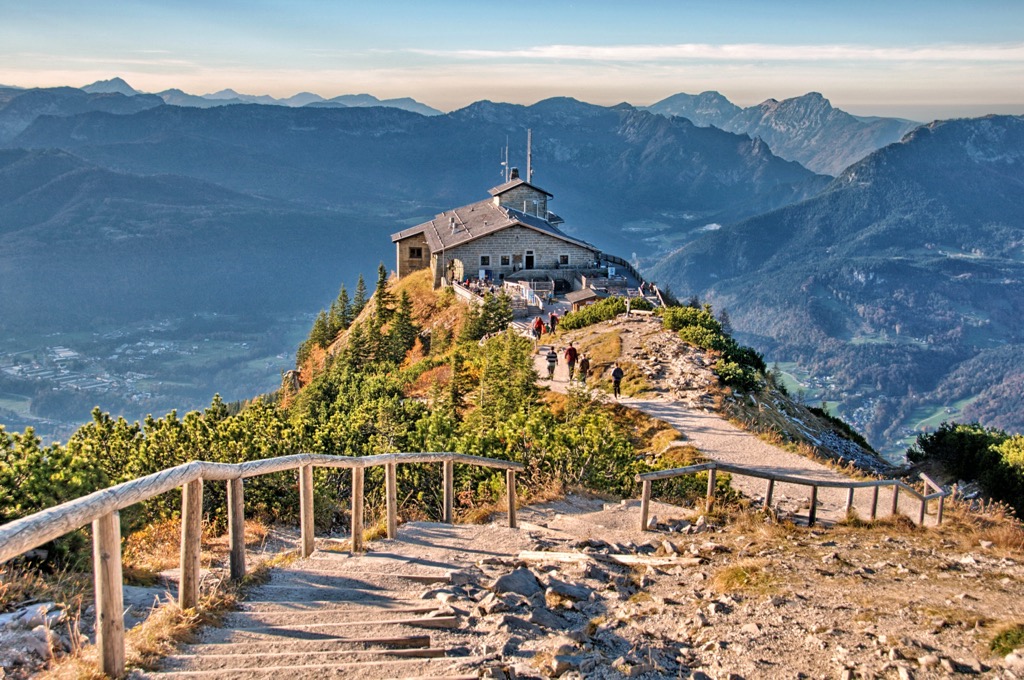
Infamously, above the town on the Obersalzberg stood the chalets of Adolf Hitler, Hermann Göring, Martin Bormann, and other Nazi leaders. Some of these buildings still stand today, including the Eagle’s Nest – a mountain-top building constructed by the Nazis that is today a restaurant and scenic outlook. Following World War II, Berchtesgaden and the surrounding area became popular resorts and recreational destinations.
Over 100,000 inhabitants live within the UNESCO Berchtesgaden site. There are 15 towns, municipalities, and market communities. However, only the towns of Bad Reichenhall and Freilassing have more than 10,000 people living there and still run salt mines. As with mining, the alpine meadows and valleys have been used by local farmers for centuries. Today, agriculture, forestry, and tourism are the main economic activities.
The area around Mühlbach am Hochkönig has a long history of copper mining, with some evidence indicating mining activity dating back to the Bronze Age around 5,000 years ago. Copper mining became a big industry in the 1800s. Today, the area is recognized as the Ore of the Alps UNESCO Global Geopark.
One of the best ski resorts in Salzburg is in the Hochkönig region within the Northern Salzburg Alps. Hochkönig is part of the Ski Amadé region, Europe’s second-largest connected ski area. The area around Hochkönig has 120 km (75 mi) of groomed slopes, 34 lifts, and a great dining scene. It accommodates skiers of all levels, including those looking to freeride or ski tour.
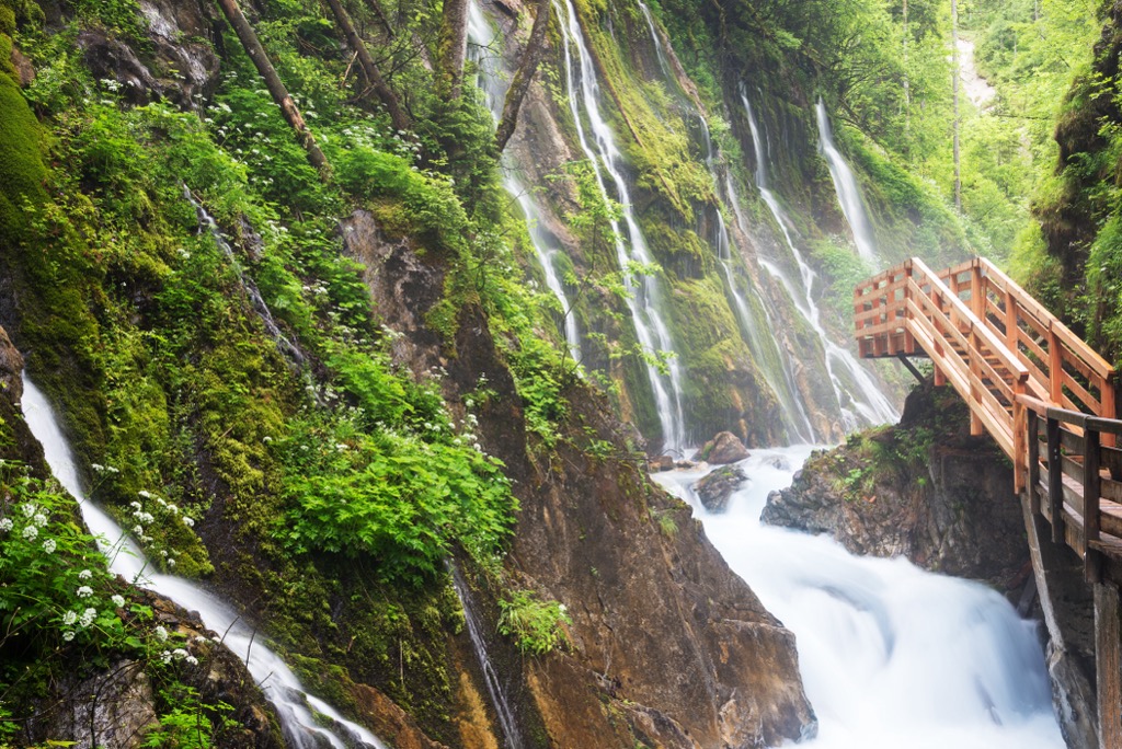
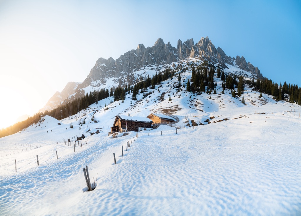
Like many ranges within the Alps, mountain huts lie throughout the range and offer hikers a hot meal or a comfortable spot to overnight on multi-day treks. There are also a handful of well-known rock climbing crags.
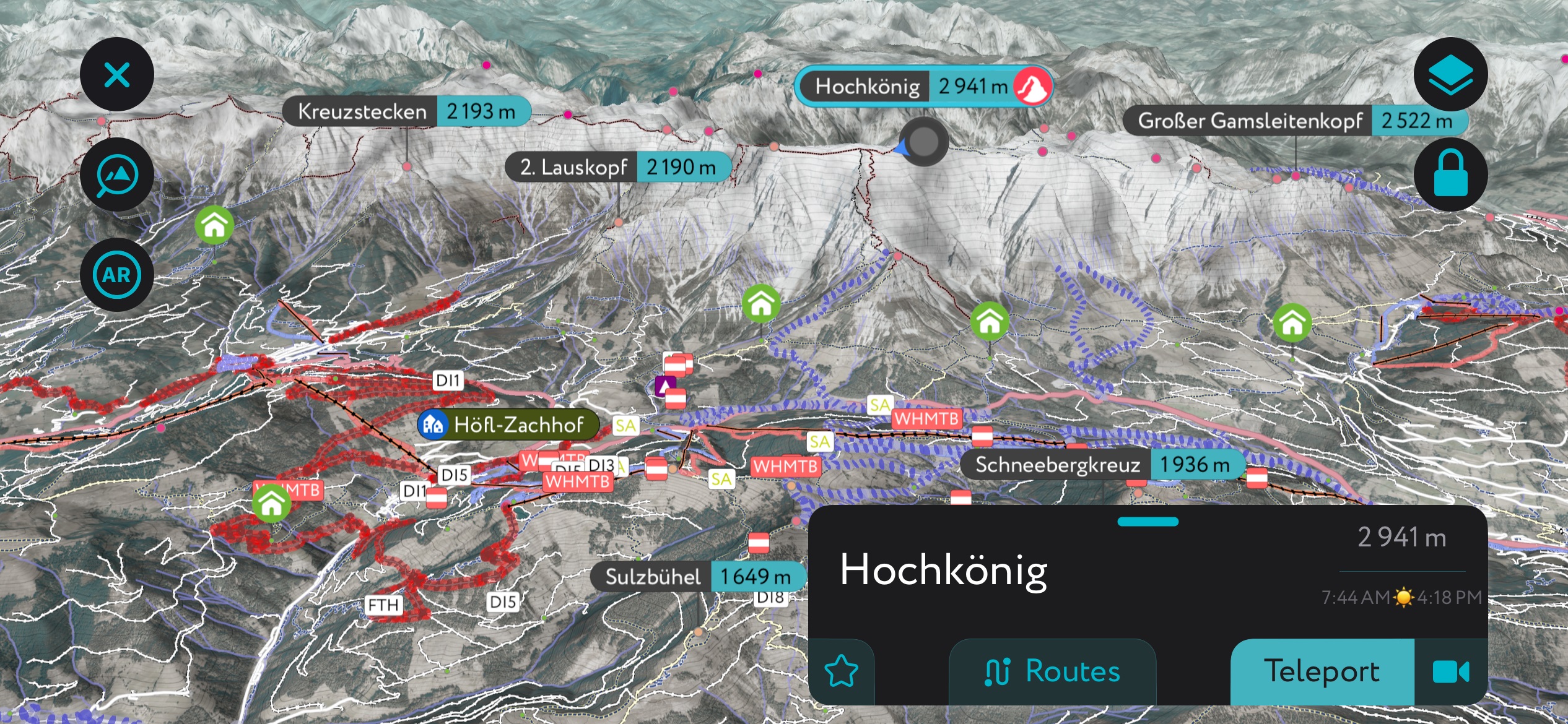
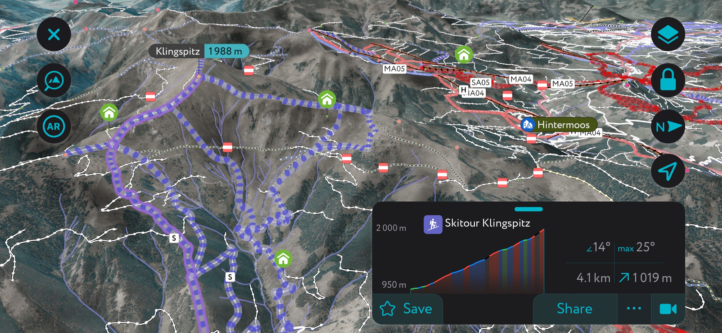
The Hochkönig region is an excellent ski area with over a hundred kilometers of groomed trails, ski touring, winter hiking, snowshoeing, and cross-country ski options. The Königstour is one of the Austrian Alps's most famous ski touring loops. The route covers six peaks, 35 km (22 mi) of slopes, and 7,500 m (24,600 ft) of altitude change. The tour is marked by yellow and orange arrows and filled with panoramic viewpoints and sublime descents.
In summer, hikers can sample the same terrain in a new season. The Königsweg hiking route is 74 km (46 mi), typically with three overnight stays in mountain huts. Those wanting to do a portion of the trail can use summer cable cars and mountain buses to eliminate some walking. A bike route through the area spans 110 km (68 mi) and 5,200 m (17,060 ft) elevation change.
Those visiting in summer may want to purchase a HochkönigCard if they plan to travel around and take advantage of the six summer cable cars. The area has approximately 340 km (210 mi) of hiking trails, as well as trails for e-biking and mountain biking.
If you’re looking to climb, most people begin above Mülbach am Hochkönig at the parking lot by Arthurhaus. The approach to the climbing routes takes about two hours. Routes range from 200-800 m (650-2,625 ft) and are usually bolted.
There are a few ways to enjoy Watzmann, ranging from a day hike to a long traverse, taking in surrounding peaks.
A common route is a 23 km (14.4 mi) loop with around 2,423 m (7,950 ft) of elevation gain. This hike, while popular, is no doubt challenging. The route begins near Wimbach Bridge. Exposed alpine sections are sometimes reinforced with via ferrata structures, but not always. The trail often climbs or descends steeply, and the descent from Watzmann requires a long and strenuous stretch through scree fields.
That said, the trail boasts incredible views and is popular among fit hikers. While it can be completed in a day, many choose to stay overnight at the Watzmannhaus.
Steinernes Meer is a high karst plateau sub-range of the Berchtesgaden Alps. Those hoping to visit the area can do so in a day or form a multi-day route between huts. One example of an overnight trip to the area begins near Lake Königssee and ends at Carl-von-Stahl Haus.
Those wanting a less strenuous hike can take a trail directly to the hut. Those up for a challenge can choose to summit Jenner and Pfaffenkegel before reaching the hut.
The Hochkönig ski area centers around the mountain villages of Maria Alm, Dienten, and Mühlbach in Austria. Summer mountain railways offer a fantastic way to enjoy the mountains. The Karbachalmbahn runs in Mülbach, and the Natrunbahn runs in Maria Alm.
On the German side, the town of Berchtesgaden is perfectly poised for access to Berchtesgaden National Park and Lake Königssee. There is an international airport in Salzburg.
The mountain village Maria Alm is located in the Pinzgau area of Austria and has around 2,000 full-time residents. It is one of the area’s most popular and busiest ski towns and, along with the nearby towns of Dienten and Mühlback, makes up the ski area Hochkönigs Winterreich.
Maria Alm was a quiet village centered around agriculture and forestry for a long time. Ski tourism began flourishing in the 1960s, and the town became a mountain destination for all seasons. The area is open to everyone but does have a posh vibe; it also has a prime location near both the luxury ski towns of Kitzbühel and Salzburg.
The town offers excellent access to the Steinernes Meer. Those interested in history can visit the former hunting chateaux of Poschengut. It was built by Prince Archbishop Matthäus Lang von Wellenburg around 1545.
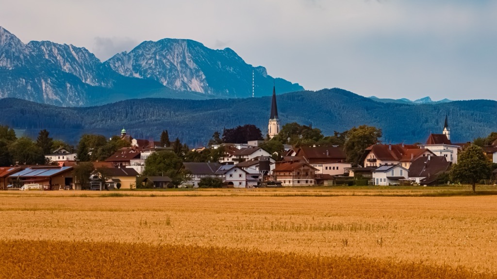
The town of Berchtesgaden in Germany is home to just over 7,500 people. The town is near Lake Königsee and Berchtesgaden National Park. It also offers cultural opportunities for touring salt mines and historic Nazi strongholds.
Many infamous Nazi leaders, including Hitler, used mountaintop chalets and underground bunker systems here. The Documentation Center museum describes the area’s Nazi presence and history and includes a tour of the underground bunker system and air raid chambers. The Eagle’s Nest, previously a chalet gifted to Hitler that sits perched on the Obersalzberg, is today a restaurant with panoramic views.
While in town, visiting one of the salt mines is easy. The industry has been active in the region for centuries, and ‘salz,’ meaning ‘salt’ in German, explains how Salzburg got its name. Lake Königssee is a great day trip from Berchtesgaden. Buses and trains run regularly to Berchtesgaden National Park.
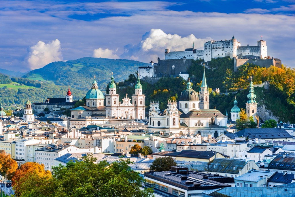
Salzburg is Austria’s fourth largest city and home to just over 150,000 people. It has an international airport and is a UNESCO World Heritage Site. The city is a popular tourist destination with a well-preserved historic center, festivals throughout the year, and copious mountains and lakes nearby.
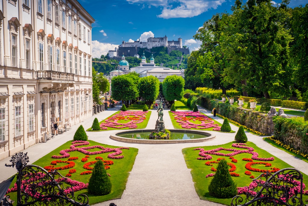
Upon arriving, you can orient yourself to town with a guided or self-guided tour. A few must-see historical sites include the Salzburg Cathedral, the medieval Hohensalzburg Fortress, and Mozart’s home.
The city hosts numerous festivals, including the Salzburg Festival in July and August and Mozart Week in January. Several elaborate gardens are worth visiting. In just over an hour, visitors can reach the scenic village of Hallstatt on the banks of Lake Hallstatt for a day trip. Salzburg’s proximity to the mountains and its urban amenities offer visitors a cultural experience while working as a base for day hikes or a kick-off point for longer treks.
Salzburg’s downtown is pedestrian-friendly. The city is well connected to the region via buses and trains, making it easy for visitors to get from the urban center into smaller mountain towns.


