The Jenner is a mountain in Bavaria, Germany. It is part of the Göll massif within the Berchtesgaden Alps. Its summit, accessible from Schönau by cable car (Jennerbahn) since 1953, offers panoramic views to the Watzmann range and the Königssee below.
Several hiking trails lead to the neighbouring Hohes Brett and Schneibstein peaks, and into the Berchtesgaden National Park area in the south. The mountain is also the site of an Alpine ski resort and a popular destination for ski mountaineers.
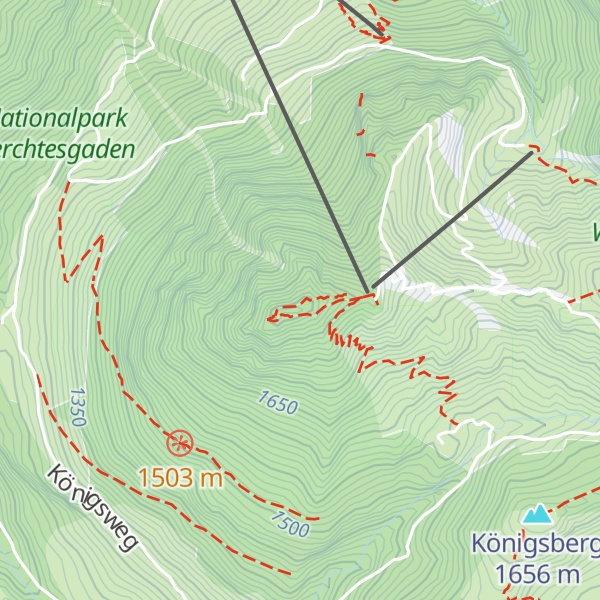
There's a hiking trail (T2) leading to the summit.
The nearest mountain hut is Jenneralm located 234m/768ft E of the summit.
By elevation Jenner is
# 15 out of 47 in the Göllstock
By prominence Jenner is
# 19 out of 172 in Nationalpark Berchtesgaden # 37 out of 321 in Landkreis Berchtesgadener Land # 81 out of 1048 in the Northern Salzburg Alps # 46 out of 590 in the Berchtesgaden Alps # 5 out of 47 in the Göllstock
We use GPS information embedded into the photo when it is available.
3D mountains overlay
Adjust mountain panorama to perfectly match your photos because recorded by camera photo position might be imprecise.
Move tool
Rotate tool
Zoom
More customization
Choose which peak labels should make into the final photo and what photo title should be.
Next
Photo Location
Satellitte
Flat map
Relief map
Latitude
Longitude
Altitude
OR
Latitude
°'''
Longitude
°'''
Apply
Register Peak
Peak Name
Latitude
Longitude
Altitude
Register
Teleport
PeakVisor
This 3D model of Sagarmatha National Park in Nepal was made using the PeakVisor app topographic data. The mobile app features higher precision models worldwide, more topographic details, and works offline. Download PeakVisor maps today.
Download OBJ model
PeakVisor
The download should start shortly. If you find it useful please consider supporting the PeakVisor app.
PeakVisor for iOS and Android
Be a superhero of outdoor navigation with state-of-the-art 3D maps and mountain identification in the palm of your hand!


.jpg)