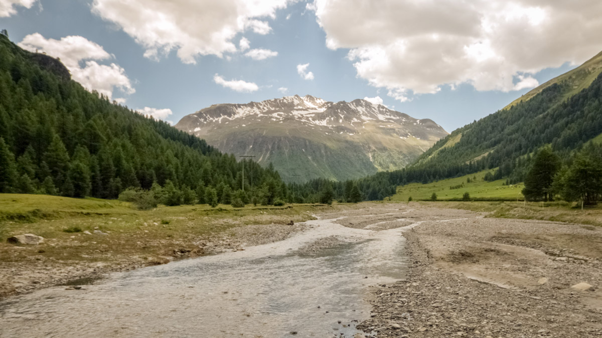
Founded in 1914, the Swiss National Park is the only national park in Switzerland and the oldest in the Alps. It is located in the canton of Grisons (Graubunden), close to the easternmost part of the country. The southern flank of the park goes along Swiss-Italian state border with adjacent Stelvio National Park on the Italian side. Together with Biosfera Val Müstair to the east from the park they form the first high alpine UNESCO biosphere reserve in Switzerland. Encompassing an area of 170 sq.km. Swiss National Park is slightly larger than Lichtenstein.
The only visitor centre is located in Zernez which is the optimal starting point to explore the park. There are 56 named mountains in the Swiss National Park. The highest and the most prominent mountain is Piz Pisoc 3,173m which is the second highest in the whole Sesvenna Range of the Western Rhaetian Alps. Other prominent peaks are Piz Quattervals, Piz Chaschauna (also known as Punta Cassana), Munt la Schera, and looming over the village of Zernes Munt Baselgia.
Stringent rules are applied on the territory of the park with the sole purpose of letting flora and fauna develop freely and allow natural processes to run their course completely unhindered. In fact, the rules are so strict that the Swiss National Park is the only park in the Alps which belongs to the highest category – the «Champions League» – of strict nature reserves (IUCN classification). Below is a brief list of the most important rules:
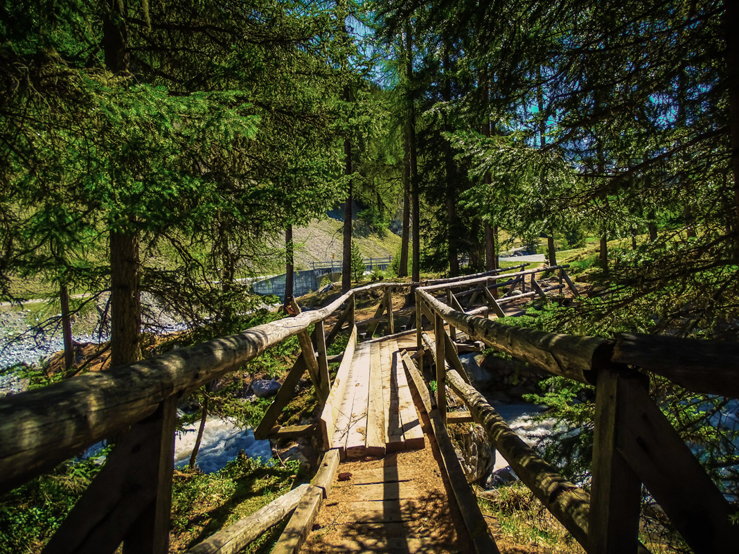
- Do not leave marked trails
- Do not light a fire, no camping on the premises
- Do not sleep outside the Chamanna Cluozza
- Do not pick or remove anything in the park
- Do not disturb animals and plants
- Dogs are not allowed even on a leash
- Do not bathe in the streams, lakes, and pools
- No winter sports are allowed in the park. In fact, the area is completely closed during the winter time in order to keep the habitats undisturbed.
The Swiss National Park in Numbers
- The altitude range in the park: 1,400m – 3,173m above sea level (Piz Pisoc).
- The park is visited by approx. 150,000 tourists per year.
- There are 21 marked trails with a total distance of 80 km.
- Land cover structure: 28% forest, 21% alpine meadows, 51% rock/scree.
- Bedrock: 80% dolomite and limestone.
- 36 species of mammals, 100 species of birds, 650 species of plants.
- During five summer months around 2000 red deer remain in the Park. The red deer rutting period in September and October is one of the highlights.
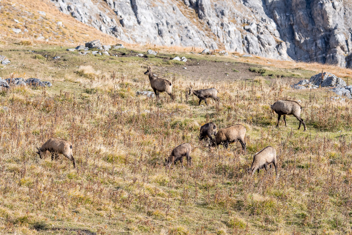
- Chamois population has fluctuated between 1000 and 1700 animals since 1920. Why their numbers have not increased considerably is the subject of scientific research.
The park is home to around 300 ibex. In the middle ages the medicinal properties attributed to its flesh and horns were the primary cause why the ibex had been exterminated in all the Alps except one place. At the beginning of the 20th century, the only remaining ibex lived in the Royal Hunting Reserve of the Gran Paradiso in Italy (nowadays area of the Gran Paradiso National Park in Piemonte). In 1856, two ibex from the Royal Hunting Reserve were poached and smuggled into Switzerland. The Swiss set up a unique breeding station at the Peter & Paul Wildlife Park in Saint Gallen and later repopulated ibex in all Swiss territories, including the Swiss National Park.
There are also thousands of marmots even though nobody tried to count them.
Major Hikes
Given the strict rules of the park and limited number of allowed trail paths one might expect limited recreational opportunities. But worry not. Spectacular hikes in the real wilderness will keep you busy for many days. There are 21 marked trails to choose from. They do not include the trails reaching summits on the border with Italy thus allowing peeking into the Swiss National Park from the state border, e.g. from Punta Cassana and Punta Tropione.
Here are just some of the favourite scenic trails in the Swiss National Park.
Macun Lakes
Looming over the village of Zernez, Munt Baselgia hides a small plateau with numerous alpine lakes. These lakes are called Macun Lakes and the plateau makes part of the Swiss National Park as the only external “island”.
The Macun Lakes trail is a demanding one, departing from the Zernez railroad station one has to gain 1400m of elevation over a distance of 10km to reach the summit of Munt Baselgia. But it is totally worth the effort. You get one of the best alpine panoramas from its top.
From there the trail descends towards the lakes and later leads down the valley spiced up with breathtaking views of the Silvretta Massif. Finally, having reached the village of Lavin you can take the train back to Zernez. In total, the trail takes about 8 hours to complete.
Piz Quattervals
Piz Quattervals 3,164m is the highest reachable peak of the Swiss National Park. It takes 5 hours and 1400 meters of elevation gain from Chamanna Cluozza, including some scrambling close to the top to scale the peak. Being higher than 3.000 meters Piz Quattervals allows unobstructed views for hundred kilometers all way round.
Munt La Schera
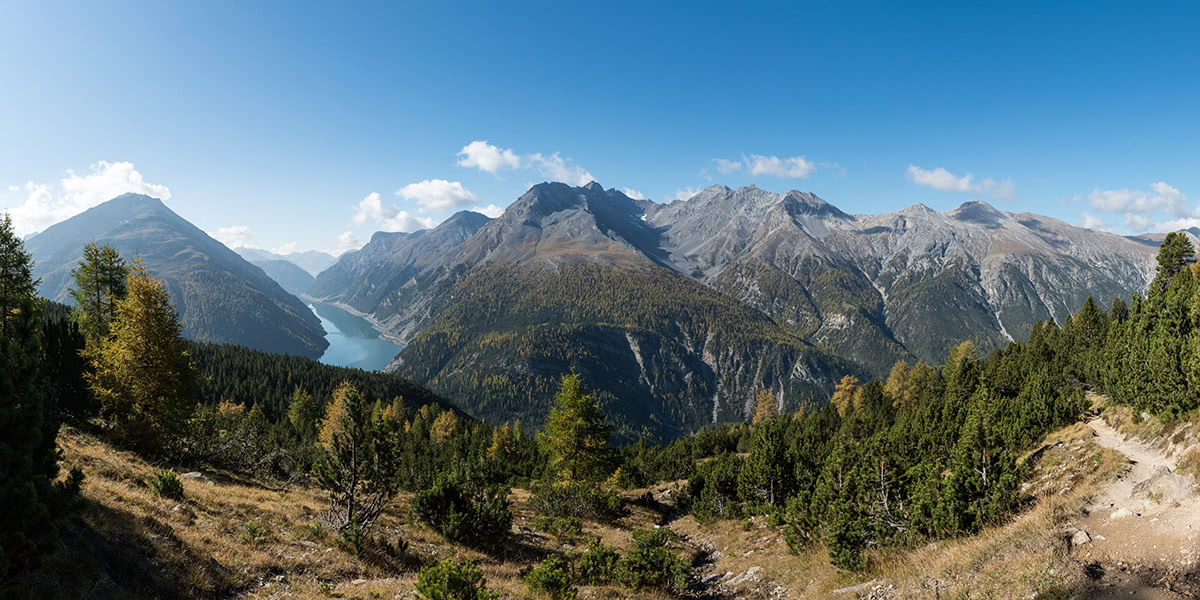
Munt La Schera is the only other mountain lying completely within the park and reachable with a trail besides Piz Quattervals. The mountain hides an important tunnel deep below the surface which connects Swiss Graubunden with Italy. Apart from the geological and historical interest, the trail offers sweeping views of the peaks in all directions and artificial Livigno lake nestled between steep slopes of Monte Cassa del Ferro and Punta dell'Acqua, both over 3000 meters.
The trail can be combined with ascent to Piz Daint in Biosfera Val Müstair. Having a prominence of 731m, Piz Daint boasts a spectacular panorama.
Major Towns
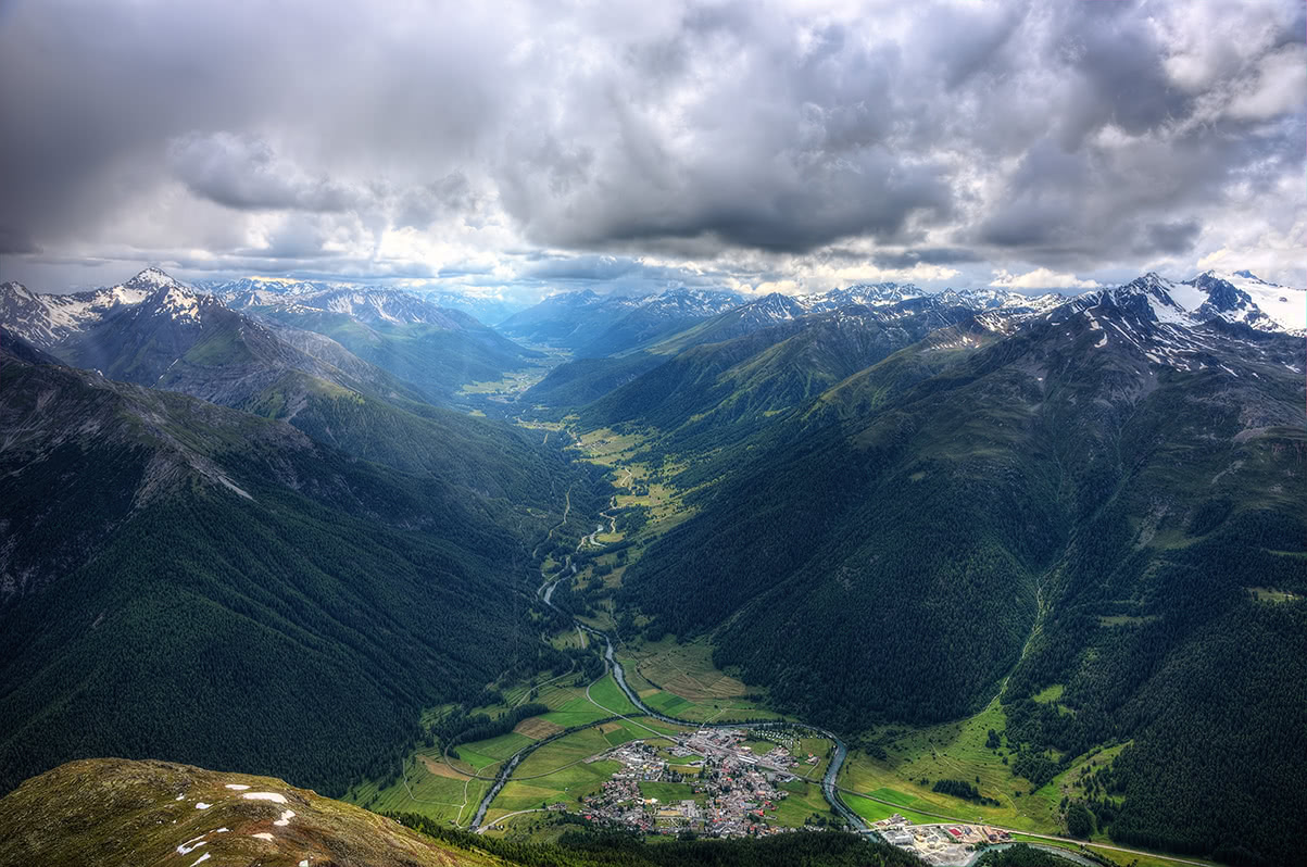
Zernez is the gravitation point for Swiss National Park visitors. But there are many other small villages close to the Swiss National Park, so there are plenty of accommodation options to choose from, including those on the Italian side (a popular ski resort of Livigno).
Zernez
Home to the only visitors center in Swiss National Park, the picturesque village of Zernez is the gateway to the Swiss National Park. It is also a major transport node on the crossroads between Upper & Lower Engadine, and Val Mustair. Traffic from Italy, Austria, and Switzerland meet at this three-country triangle.
Other Nature Parks in Switzerland
There are no other National Parks in Switzerland but there are several other protected areas with unique features and less strict rules:
- Val Müstair is adjacent to the Swiss National Park area of namesake valley, together they make part of UNESCO Biosphere Reserve. Yet, Val Müstair feels more civilized if compared to the untamed wilderness of its big neighbour. Val Müstair is home to a number of special gems, such as the Convent of St. John UNESCO World Heritage Site, the Manufactura Tessanda weaving mill, many museums as well as the typical Graubünden villages – surrounded by a spectacular mountain landscape. From the bottom of the valley of the river Rombach up to the highest mountain peaks, a variety of habitats offer outstanding conditions for a large number of wild animals. 80% of local farmers work entirely organically. This balanced interaction between ecology and economy should also guarantee a livelihood for local people for many years to come.
- Parc Ela lies in a diversified landscape around the Albula, Julier and Septimer passes and offers original nature, intact villages and a living culture in Romanic, Italian and German languages. This park inspired Giovanni Segantini to create his greatest masterpiece. The park runs excursions on which you can observe bearded vultures. There are 850 kilometres of trails, theme paths and guided walks where you can experience the biological, cultural and geological diversity of the park.
- Beverin Nature Park with a magnificent feature of Piz Beverin (2,998m) covers 412 square kilometres from Thusis to Schams and includes large parts of the Safien Valley. It is the habitat of the capricorn (Rhaeto-Romanic for ibex). There are historical bridges that adorn this “evil road”, often referred to as “Sixtina of the Alps”. The Church of St. Martin in Zillis boasts a fully preserved ceiling fresco from the 12th century – the only one of its kind in the world. On the San Bernardino transit route, the Roffla Gorge opens up and farther on towards Splügen, the Hinterrheintal, or Upper Rhine Valley, where the visitor exits the southern end of the Nature Park. The experienced hiker is familiar with this trail, since it is part of the Via Spluga.
- Binntal Nature Park spreads over 6 municipalities. In summer, it is the best place to see the unique wild tulip in the old rye fields of Grengiols. The park is particularly well-known for its minerals. No other region in the Alps is so rich in minerals. Although there are no major tourist destinations in Binntal Nature Park, there are innumerable kilometres of marked hiking trails that invite you to discover the region on foot. In winter, you can enjoy the snow-covered landscape by following beautiful winter footpaths and attractive snowshoe trails. The historical transport link to the neighbouring «Parco Naturale Veglia-Devero» in Italy goes through the Park via the wild and romantic Twingi gorge and over the Albrun pass.
- Pfyn-Finges Nature Park is one of the 12 parks that received National Importance Award for their unique and outstanding natural and landscape values. Apart from varied flora and fauna (including the much famed bearded vulture), this park can also boast of the 6km wine trail where you will discover wine villages, the wine regions and the wine technology.
- Gruyère Pays-d'Enhaut Regional Nature Park is probably the best to enjoy with the family as there are plenty of easy walks doable in a couple of hours. It is a few minutes’ drive from Montreux, and the park offers a multitude of recreational activities. You can opt for guided hiking as well and discover cheese-making centuries-old traditions in Gruyère that are firmly rooted in the heritage. You can immerse in a walk with a historic feel along Witches’ paths (for fantasy lovers), Count paths, botanical works, wood roofers and many more.
- Gantrisch Nature Park lies in the Bern - Freiburg - Thun triangle and includes 24 Bernese and one Freiburg municipalities. A stone’s throw from Bern, the cross-country skiing center in Gantrisch has 45 kilometers of perfectly groomed cross-country trails at a snow-sure elevation of 1450 to 1650 meters above sea level. In general, the area is rich in legends and history, such as the folk song «Vreneli (Verena) from Guggisberg». Low light pollution also allows clear views of the stars. There are wide and extensive moor landscapes and bordering on these lies one of the largest continuous areas of forest. In the Park, there is a great amount of cultural historic objects such as the castles in Gürbetal, the baths in the Gurnigel region (old bathing culture), St. James’s pilgrimage route with the Rüeggisberg Monastery, Schwarzenburg Chapel, Grasburg, lts of farmhouses typical of the area, bridges in Sense and Schwarzwasser region. Eight museums, in some cases of international importance, and three observatories are also located here.
- UNESCO Biosphere Entlebuch
- Diemtigtal Nature Park is seemingly secluded from the rest of the world, it lies in the lowermost but typical side valley of the Simmental. Yet, this 16km-long oasis of wilderness and pristine beauty is a cosmopolitan and welcoming place. The village of Diemtigen with its church and magnificent wooden houses was awarded the Wakker Prize for its intact villagescape. There are fun adventures for kids, such as the Grimmimutz adventure trail that gives visitors all manner of wondrous and fantastical sights. At the end of the valley, children can hear the enthralling story of the “Grimmimutz” and the “evil pepper witch”. Meanwhile, if you are for a more grown-up adventure, take the Wiriehorn bike or a commensurate adrenalin rush. Undoubtedly, you would not like to leave the park without trying mouthwatering cheeses at Switzerland’s largest Alpine cheese dairy.
Some of the Swiss parks are not in the Alps but in the Jura Mountains:
- Jura Vaudois Nature Park is relatively new. It was officially opened in 2010, but the foundations were laid back in 1973 my mountain meadow owners who wanted to preserve the traditional cultural landscape by supporting the conventional agriculture and forestry management. The park extends from the summit of the Dôle at Saint-Cergue to Romainmôtier (about 1,000 m a.s.l), renowned for its Romanesque collegiate church. The park areas can be divided into the gorges of the Orbe and Nozon rivers, the Jura ridge between Col de la Givrine and Col du Mollendruz / Dent de Vaulion, the southern foot of the Jura, the Mont Risoux massif and the Vallée de Joux. From the peaks of the Jura to its south-facing foothills, an overwhelmingly beautiful panorama extends across Lake Geneva and up to the highest peaks of the Alps, captivating the visitors again and again. The well-signposted network of trails is 523km long.
- Chasseral Nature Park is spread over a triangle between La Chaux-de-Fonds, Neuchâtel and Bienne. It was named after the 1606.2 metre highest peak of the Bernese Jura. The top of the mountain is easily accessible, even with public transport. Chasseral, observation deck of the Swiss Jura, has many faces. Vineyards, meadows and plateaus alternate with gorges and valleys. Its proud inhabitants are still leaders in the cutting-edge world-famous watch industry as well as cheese production. It covers an area of 388 sq. km. and offers countless hiking trails such as the “The Anabaptist Trail” or the “Pioneers’ trail”, many mountain-bike, city-bike and e-bike tours as well as horse riding trails. A host of leisure activities are possible in winter too, such as cross-country and alpine skiing, snowboarding, snowshoe hiking or regular hiking. Winter sport enthusiasts will be thrilled!
- Thal Nature Park is the insider's tip within the mountain range of the Solothurn Jura. The landscape can be experienced either on foot or by bike and offers a variety of mountain restaurants, castle ruins and flower meadows. There are numerous thematic trails and museums.
- Aargau Jurapark comprises the hilly landscape of the folded Jura and the tabular Jura between Brugg, Laufenburg, Rheinfelden and Aarau. As a nature and recreational area not far from Basel and Zurich, it is easily accessible. The branch office is in Linn (municipality of Boesberg), near the venerable lime aka linden tree. Things not to be missed here are Cheisacher tower, Zeiher Homberg and Wasserflue mountains. Wine sampling in a winery on the 'Pleasure Route' is a must, as well as a sneak-peek into the country herbal medicine. You should also hear the sounds of the knitting machine or nail smithy in Sulz Handicrafts Centre, and Glögglifrösche folk group. For those who love a drop of spiritual wonders, feel Kneipp baths in Fricktal and enjoy the so-called Power Points - the lime tree of Linn and Buschberg chapel above Wittnau.