
Scan the QR code and open PeakVisor on your phone
Argovia Jurapark, known as Jurapark Aargau in German, is located between Basel and Zurich in Switzerland. The 101 mountains in the park are part of the Jura Mountains. Höchster Punkt des Kantons Aargau is the highest peak at 908 m (2,979 ft), and Strihen (866 m / 2,841 ft) has the greatest proportional prominence (194 m / 636 ft).
Argovai Jurapark (Jurapark Aargau in German) lies in the cantons of Solothurn and Aargau in Switzerland, approximately a 50-minute drive from Zurich to the southeast and Basel to the northwest. It covers 29,900 ha (73,885 acres) and was established in 2012.
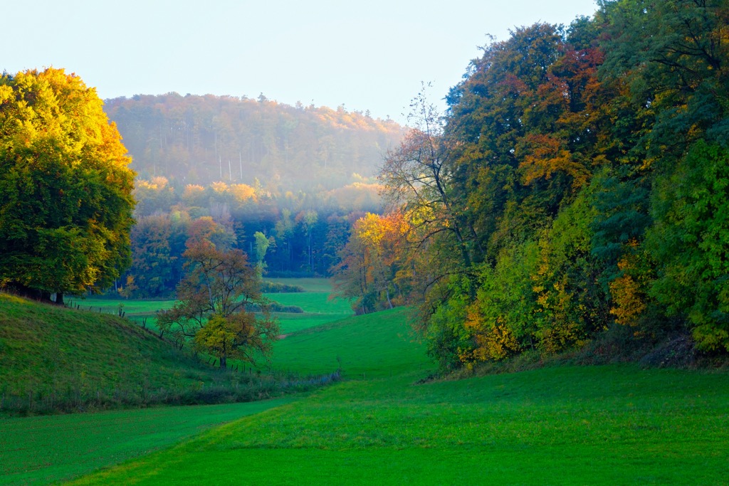
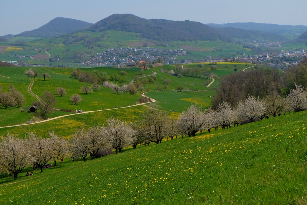
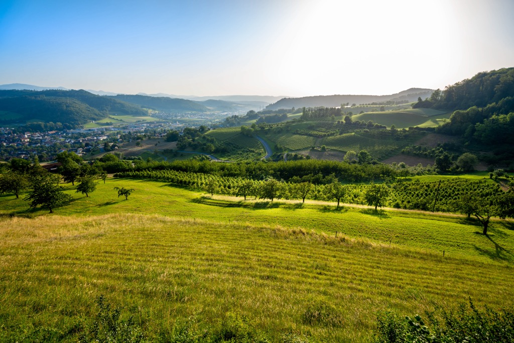
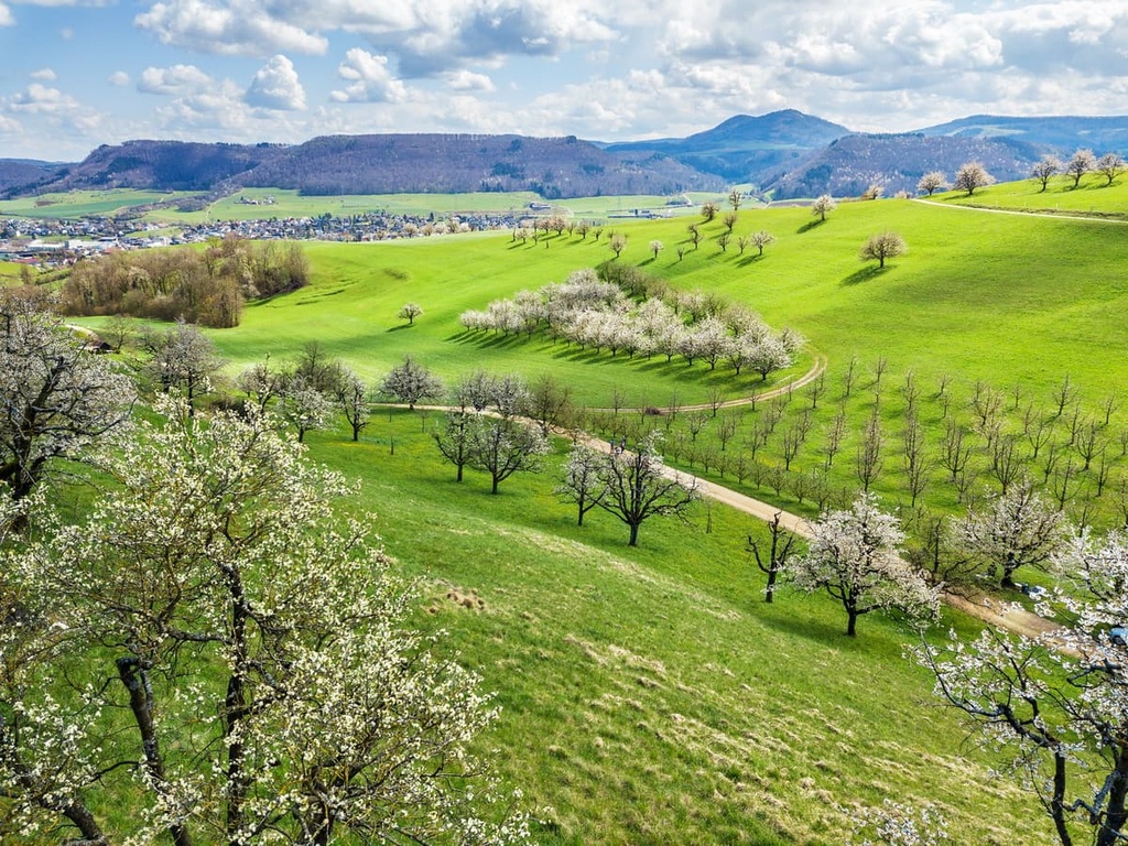
The park covers mountains, plateaus, and valleys between the Aare and Rhine Rivers. Its landscape is a mosaic of forest, rocky steppe, meadows, orchards, and vineyards.
The park supports natural spaces and conservation projects and highlights the rich culture of the region’s villages and agriculture. Popular activities in the park include visiting the Cheisacher Tower for the panoramic views from the top or taking a wine-sampling tour of some of the local vineyards.
The mountains of Argovia Jurapark belong to the Jura Mountains. The Table Jura forms the park's northern edge, and the Jura Chain's foothills make up the southern perimeter.
The Jura Mountains span 360 km (225 mi) across the French-Swiss border from the Rhône River to the Rhine. Most of the range is in Switzerland, but the tallest peaks are in the south, near Geneva.
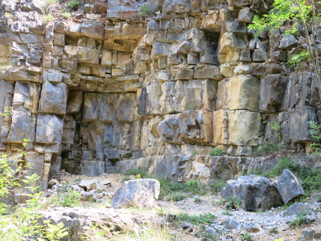
Jura limestone, rich with fossils from the ancient Tethys Sea, is the primary rock type. Its name is related to the naming of the Jurassic Era, as the rocks formed around 200 to 145 million years ago.
The mountains began to form within the past 65 million years during the Cenozoic Era, triggered by the same events that raised the Alps. The main thrust occurred between 5.3 to 2.6 million years ago. Two phases formed the range. The first thrust phase formed the French ridges on the outer edge, while the second thrust formed the higher inner ranges.
Iron-rich rock layers are found within the park, and iron ore has been mined around the villages of Herznach and Wölflinswil.
Argovia Jurapark contains four Federal Landscape Inventory areas, two important water-meadow areas, and open pine forests protected at the European Union level, as well as a regionally significant wildlife crossing zone.
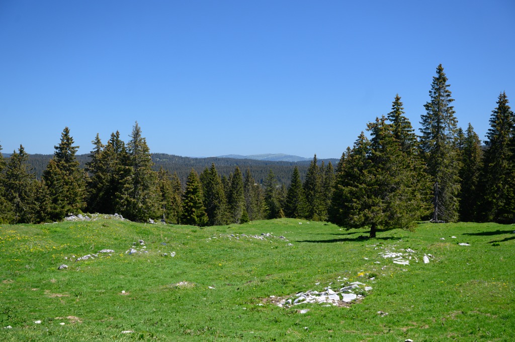
Forests account for nearly 40% of the nature park, with both sparse pine and beech forests rich with deadwood being especially characteristic. Deadwood in the beech forests is vital for black woodpeckers, jackdaws, and several beetle species. Light filters through the canopy, creating optimal conditions for orchids such as helleborine, gentians, and rare yellow-ringed butterflies.
Wet habitats are less common but include ponds, rivers, and floodplains. These areas provide important habitat to bell frogs, fire salamanders, blue-orange feathered kingfishers, rare blue-winged demoiselle dragonflies, orioles, and beavers.
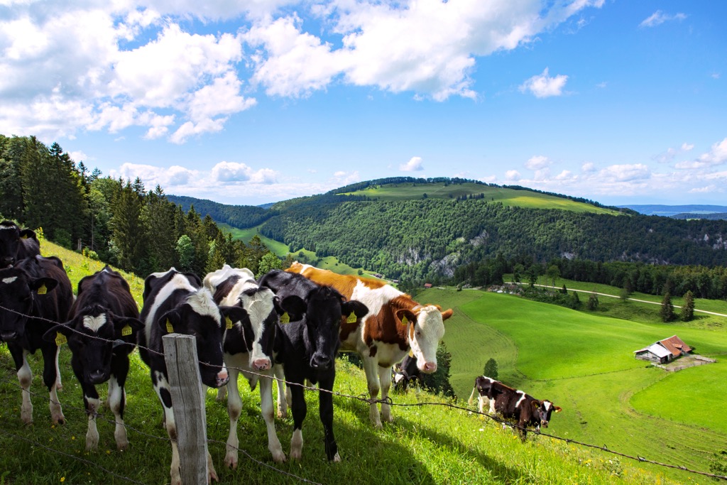
Orchards and vineyards in the park underscore the role of humans within the landscape. Orchards offer ideal habitats for bats, such as the greater horseshoe and gray long-eared bats, as well as birds, including the green woodpecker and common redstart. Sunny vineyards attract a number of reptiles, including wall lizards and grass snakes. Birds like the linnet and cirl bunting can be spotted here.
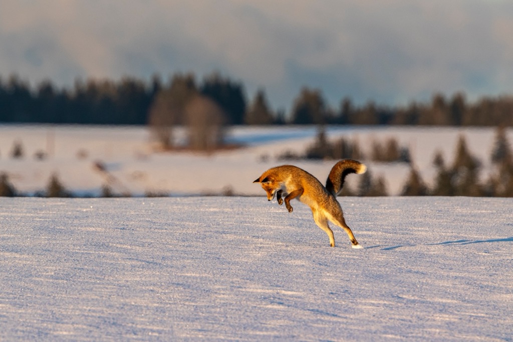
Other animals that live within Argovia Jurapark include hedgehogs, hares, deer, two species of weasel, and 21 additional species of bats.
Argovia Jurapark and the surrounding area have long been home to humans. Romans used the sunny slopes of Jura Hills for viticulture (the growing of grapes for wine). Several ancient sites in the park, including amphitheaters and an army camp, date back to the Romans.
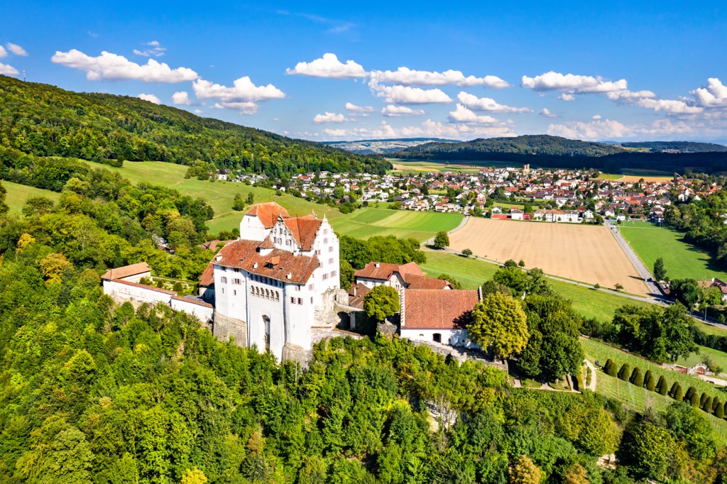
Other historic buildings point to the lengthy presence of the Habsburg Empire in the region. These include the Wildegg Castle, Königsfelden Monastery, and the Habsburg Castle. The Habsburg Castle dates back to the start of the Habsburg dynasty around 1030.
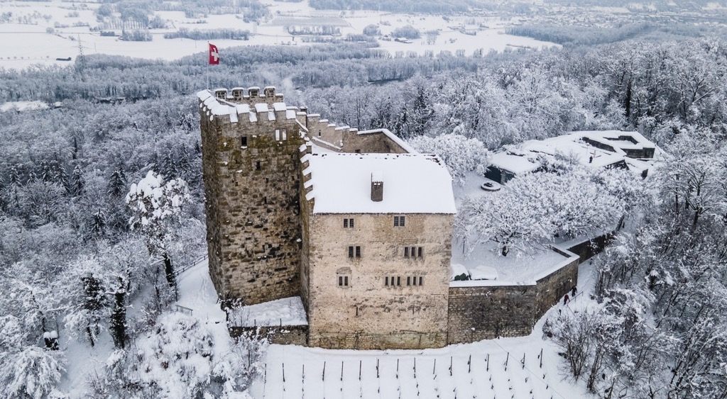
The location was first used as a manorial estate before being expanded into the enormous castle seen today. The castle passed down through family lines. Around 1230, the count’s family moved into a more impressive residence, triggering a series of noblemen to take up residence in the castle over the following centuries. In early 1804, the canton of Aargau took over the ruins and renovated the rear castle. Today, the castle is part of the Aargau Museum, highlighting the start and trajectory of the Habsburg Dynasty.
Other features within the park, such as vineyards, dry stone walls, orchards, and cultivated fields, exhibit the ways in which humans have shaped the landscape over millennia.
Several long-distance trails, including the Jura Crest Trail and the Aargauer Weg, cross through Argovia Jurapark. Cyclists will also find plenty of routes here, such as the Zeiher Hornberg and the Jurapark-Aargau cycling route.
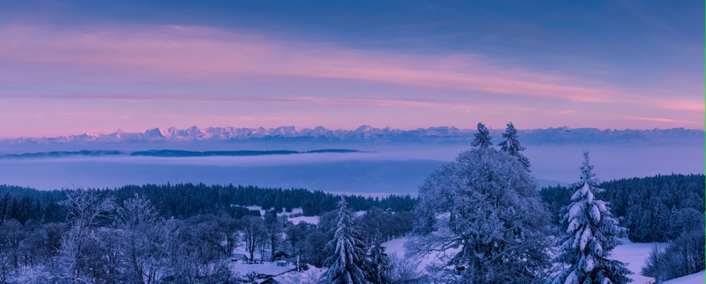
The Jura Crest Trail is Switzerland’s oldest long-distance trail with its first signposts erected in 1905. The route is 320 km (199 mi) with 13,800 m (45,275 ft) of ascent as it arcs from Zurich to Geneva. It is easy to follow, and highlights include beautiful views of the Alps, the Black Forest, and the Vosges. The route passes cliffs, deep ravines, springs, lakes, forests, and sprawling meadows and crosses two linguistic zones, each with its distinct architecture and local cuisines.
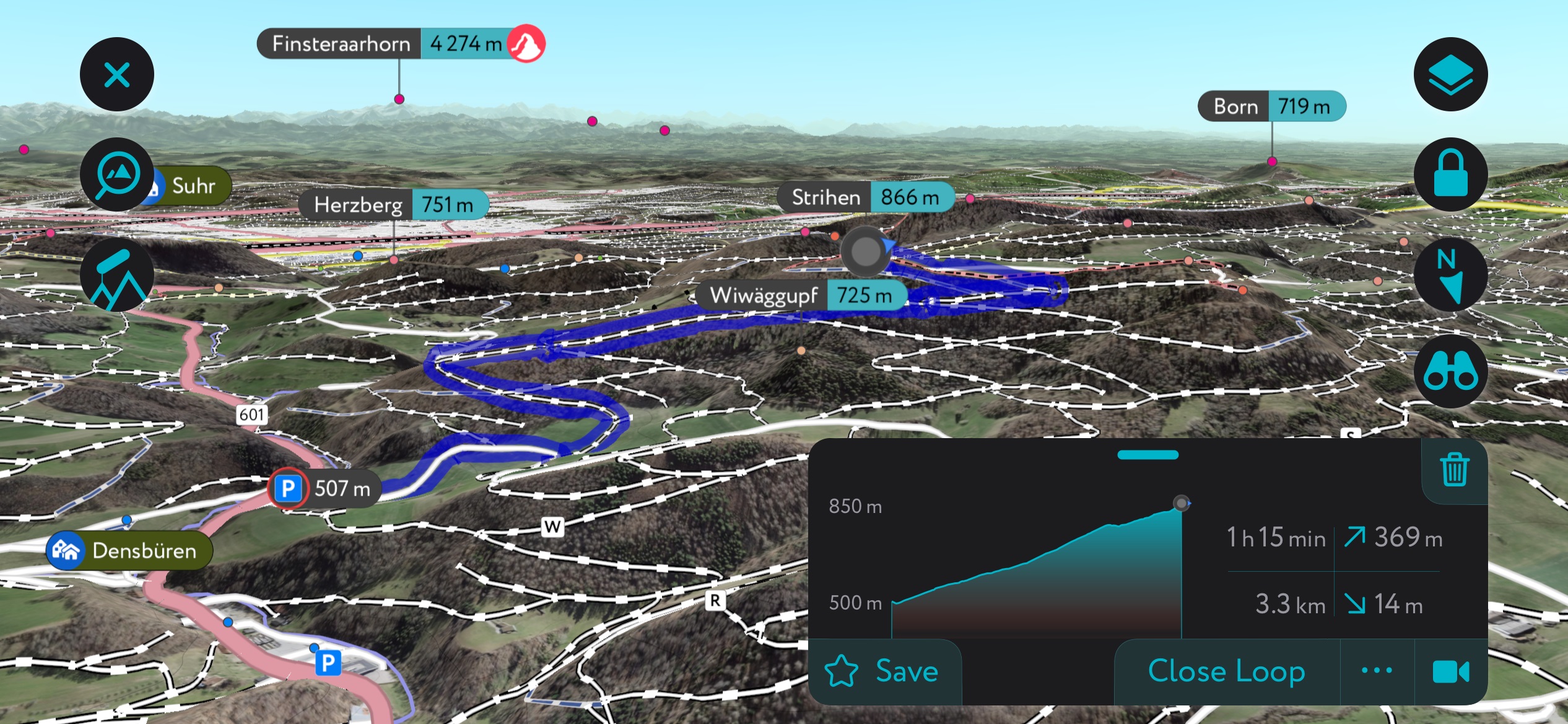
Several sections of the long-distance trail lie within Argovia Jurapark. One section, from Brugg to Staffelegg, is 17.2 km (10.7 mi) long and gains 640 m (2,100 ft) of elevation. It passes the ruins of Schenkenberg. The other section, from Staffelegg to Hauenstein, runs 20 km (12.4 mi) and climbs 855 m (2,800 ft) over five passes: Staffelegg, Bänkerjoch, Salhöhe, Schafmatt, and Untere Hauenstein. Both trails are marked by number 5 on yellow hiking signs in the park.
The Aargauer Weg is a 105 km (65 mi) trail with 2,700 m (8,860 ft) ascent, typically completed in six days. The route runs from the Fricktal Valley across the park’s rolling hills. Highlights include panoramic views, lush meadow landscapes, the Wasserschloss, where the Aare, Reuss, and Limmate Rivers converge, as well as the Wildegg Castle, Habsburg Castle, and Königsfelden Monastery from the Habsburg Empire.
The two-day Jurapark Aargau Cycling Route creates a loop, covering 105 km (65 mi) and 2500 m (8,200 ft) of elevation gain. The first stage, beginning in Brugg, passes a Roman amphitheater and the only Roman legionary camp in Switzerland before reaching the Königsfelden, an old Habsburg monastery. Continuing on, this stage offers views of the Alps, Black Forest, and Vosges Mountains.
The second stage begins in Frick, a well-known site for its dinosaur discoveries. The trail cuts through orchards and meadows, through small villages, and climbs and descends through forest and mountain passes.
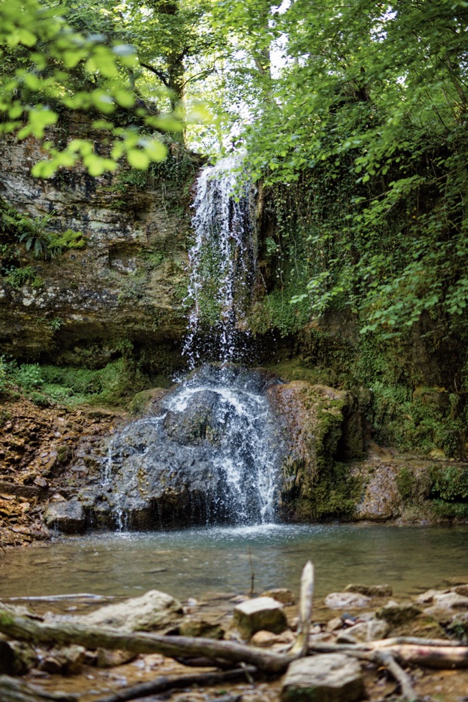
The trail to Linner Waterfall provides an excellent day trip for families or as a running loop. As it winds through forests and meadows, the trail measures around 10 km (6 mi) long with 260 m (850 ft) of elevation gain. It begins at the Linden tree of Linn, passes through the village of Linn to reach the 5 m (16 ft) waterfall, and then continues to Efingen before completing the circuit via Römerweg.
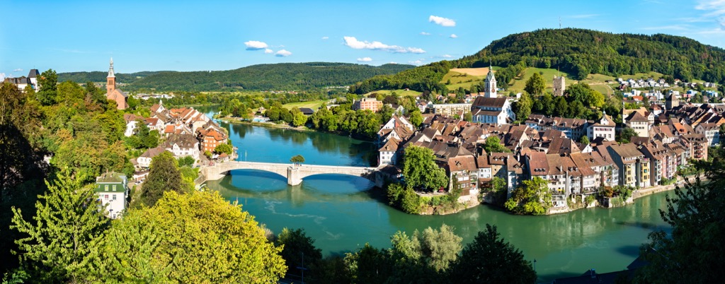
Argovia Jurapark lies about 50 minutes from the larger cities of Zurich and Basel. Baden, a small city, is less than 30 minutes drive from the park. Villages within the park offer accommodation and food for those looking to stay overnight.
The district of Baden is less than a 30-minute drive from the park and has a population of over 100,000. Many people know Baden as a wellness and spa town. The thermal springs have been used for 2,000 years. While the springs initially propelled the city into a wellness destination, today's offerings extend to yoga, dancing, spas, and a focus on healthy foods.
Shopping, restaurants, bars, hotels, and music venues are centered around Limmat. If you’re looking to get to know the city better, a handful of themed walking tours can show you around town. Other destinations in town include the Baden Historical Museum, the Swiss Children’s Museum, and the Villa Boveri Park, the private gardens of the late Walter Boveri.
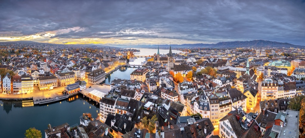
Only a 50-minute drive from the park, Zurich has a population of a little over 400,000 and is the largest city in Switzerland. It is an undeniably pricey city (like the rest of Switzerland). Still, with historic neighborhoods, a robust arts and nightlife scene, snow-capped mountains, and beautiful lakes, it’s not hard to see why Zurich is a centerpiece of the global elite.
Altstadt is the Old Town, running along the Limmat River and filled with shops, cafes, and historic buildings. The Old Town's crown jewel is the Grossmünster, an old Romanesque cathedral that guests can climb for panoramic views over the city, the Alps, and Lake Zurich. Other notable historic sites include the Lindenhof Plaza and the 9th-century church Fraumunster.
Lake Zurich is an easy escape from the city, with options for lakeside strolls, a refreshing swim, or a lake cruise. Hike, bike, or take the train up to Uetliberg Mountain. In the winter, hiking trails turn into tobogganing runs.
Zürich has several museums, including top-notch art museums like Kunsthaus Zurich and Rietberg. Those looking to make the most of their time may find it worthwhile to get a Zurich Card that covers unlimited public transport and free or discounted access to museums and activities.
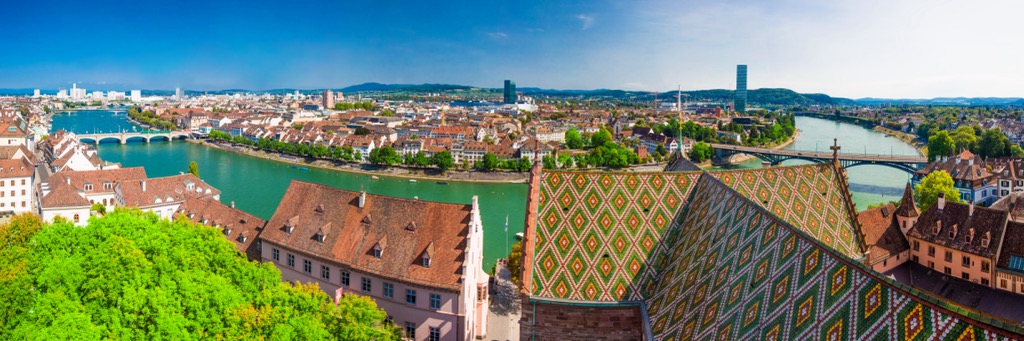
Basel, situated near the border with Germany and France, is home to over 170,000 people. It’s Switzerland’s oldest university city and a cultural hub. The Old Town boasts a large market square, home to the decorated sandstone town hall and the Gothic Cathedral. You can visit 40 museums including the Basel Art Museum, the Museum of Cultures, and the Fondation Beyeler.
Basel also houses the symphony and chamber orchestra, the Basel Theater, and the Playhouse. The Rhine runs through the city, providing a peaceful, scenic reprieve along its banks. Other green spaces around the city include the Botanical Gardens and the Merian Gärten. From Basel, it’s easy to reach Germany, France, the Black Forest, and the Vosges Mountains.


