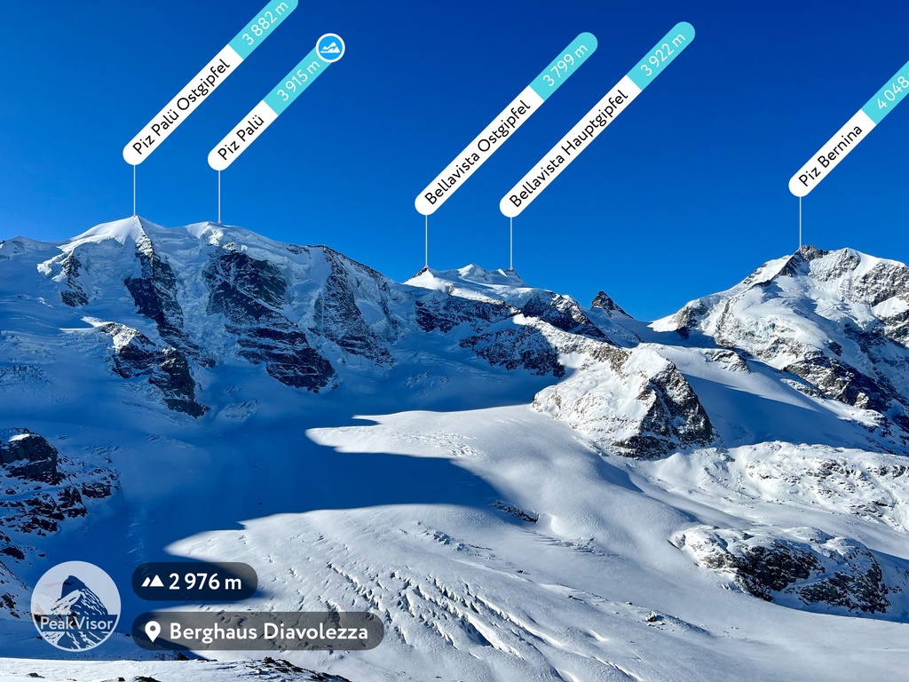
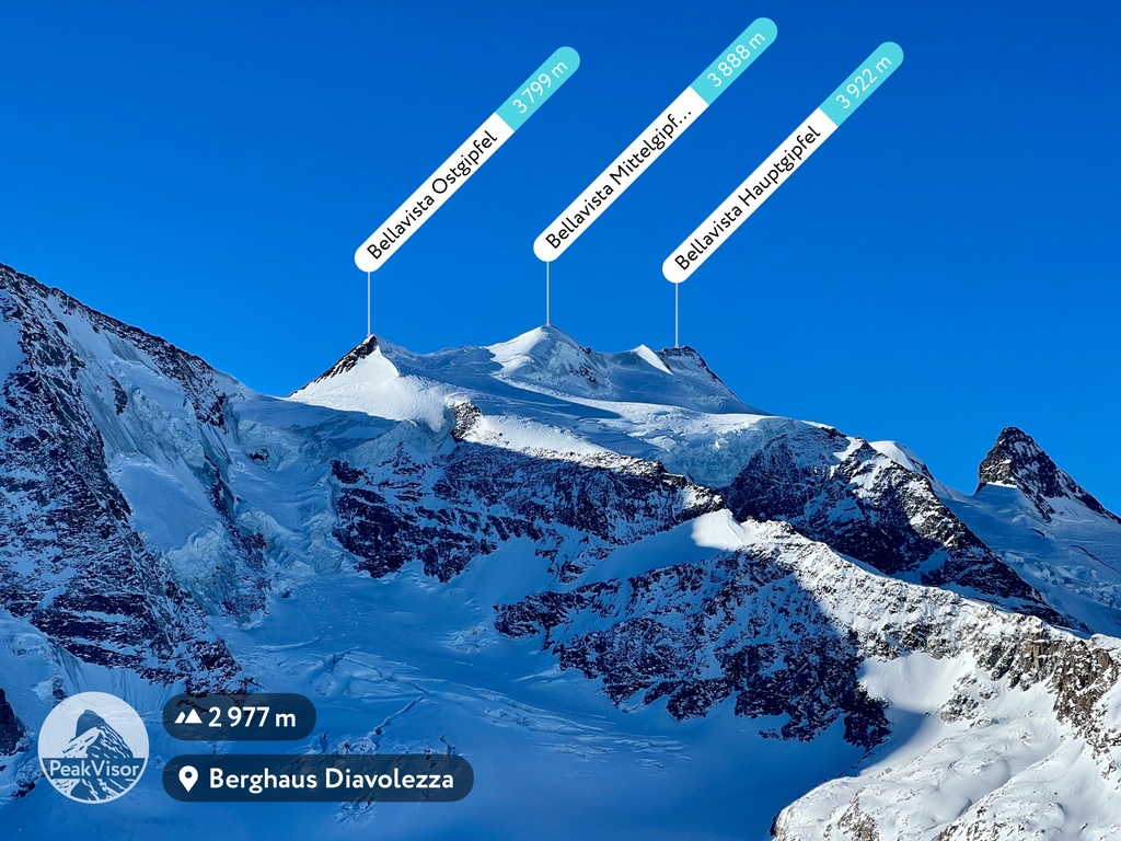
Bellavista is a 3,921-metre (12,864 ft) mountain in the Bernina Range between Switzerland and Italy. The mountain is bounded on the east by the Fuorcla Bellavista and on the west by the Pass dal Zupò. There are four summits on the main ridge, at the heights of 3798 m (Northeast-Top), 3885 m (Middle-Top), 3890 m (Northeastern Fore-Top), and 3921 m (Main-Top/Southwest-Top) from east to west.
The first traverse of all four peaks was made by Emil Burckhardt and Hans Grass on 10 September 1868. C. C. Branch and B. Wainewright with guide Martin Schocher made the first traverse of the Bellavista peaks and the three peaks of the neighbouring Piz Palü on 19 August 1889.
The nearest mountain hut is Vecchia Capanna Marco e Rosa De Marchi located 1 662m/5 452ft W of the summit.
By elevation Monte Bellavista Occidentale is
# 8 out of 2797 in the Western Rhaetian Alps # 8 out of 2367 in Grisons # 8 out of 419 in Maloja # 78 out of 42694 in Italy # 7 out of 3401 in Lombardy # 7 out of 973 in Sondrio # 90 out of 10817 in Switzerland # 8 out of 221 in the Bernina Range
We use GPS information embedded into the photo when it is available.
3D mountains overlay
Adjust mountain panorama to perfectly match your photos because recorded by camera photo position might be imprecise.
Move tool
Rotate tool
Zoom
More customization
Choose which peak labels should make into the final photo and what photo title should be.
Next
Photo Location
Satellitte
Flat map
Relief map
Latitude
Longitude
Altitude
OR
Latitude
°'''
Longitude
°'''
Apply
Register Peak
Peak Name
Latitude
Longitude
Altitude
Register
Teleport
PeakVisor
This 3D model of Sagarmatha National Park in Nepal was made using the PeakVisor app topographic data. The mobile app features higher precision models worldwide, more topographic details, and works offline. Download PeakVisor maps today.
Download OBJ model
PeakVisor
The download should start shortly. If you find it useful please consider supporting the PeakVisor app.
PeakVisor for iOS and Android
Be a superhero of outdoor navigation with state-of-the-art 3D maps and mountain identification in the palm of your hand!