
Scan the QR code and open PeakVisor on your phone
Sondrio is home to 984 named mountains. The highest is Piz Bernina at 4,048 m.
The charming province of Sondrio is the northernmost and very mountainous region of Lombardy. For centuries it has ensured the fastest and most convenient connection between Central Europe and the Italian peninsula. Sondrio proved to be an irresistible temptation for numerous expansionist campaigns of the neighbouring states thus now you can enjoy a perfect blend of traditions both culinary and cultural.
Sondrio is shaped as a wide U letter with the towns of Chiavenna and Bormio at its tips and the province capital Sondrio at the base. In the north, it borders Switzerland, in the south, other Lombardy provinces (Como, Lecco, Bergamo, and Brescia). It also has a short border span with the region of Trentino-Alto Adige.
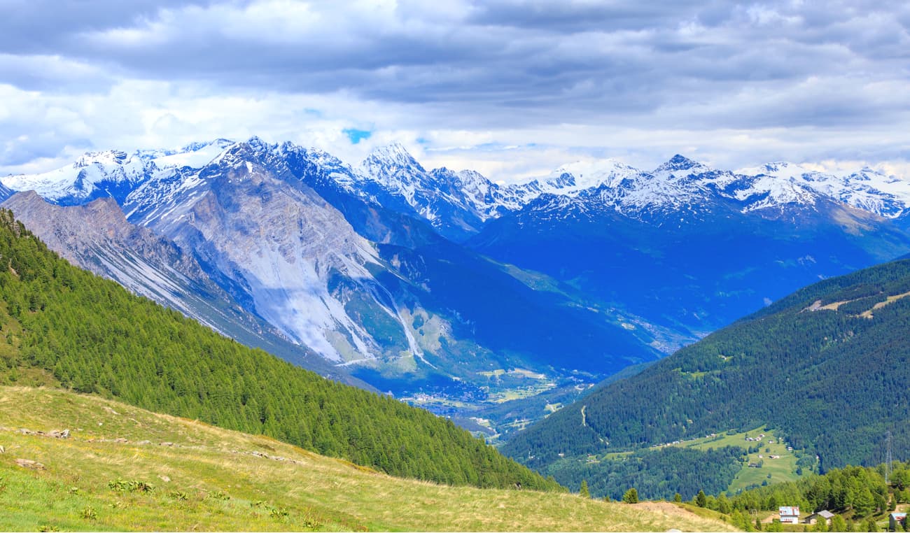
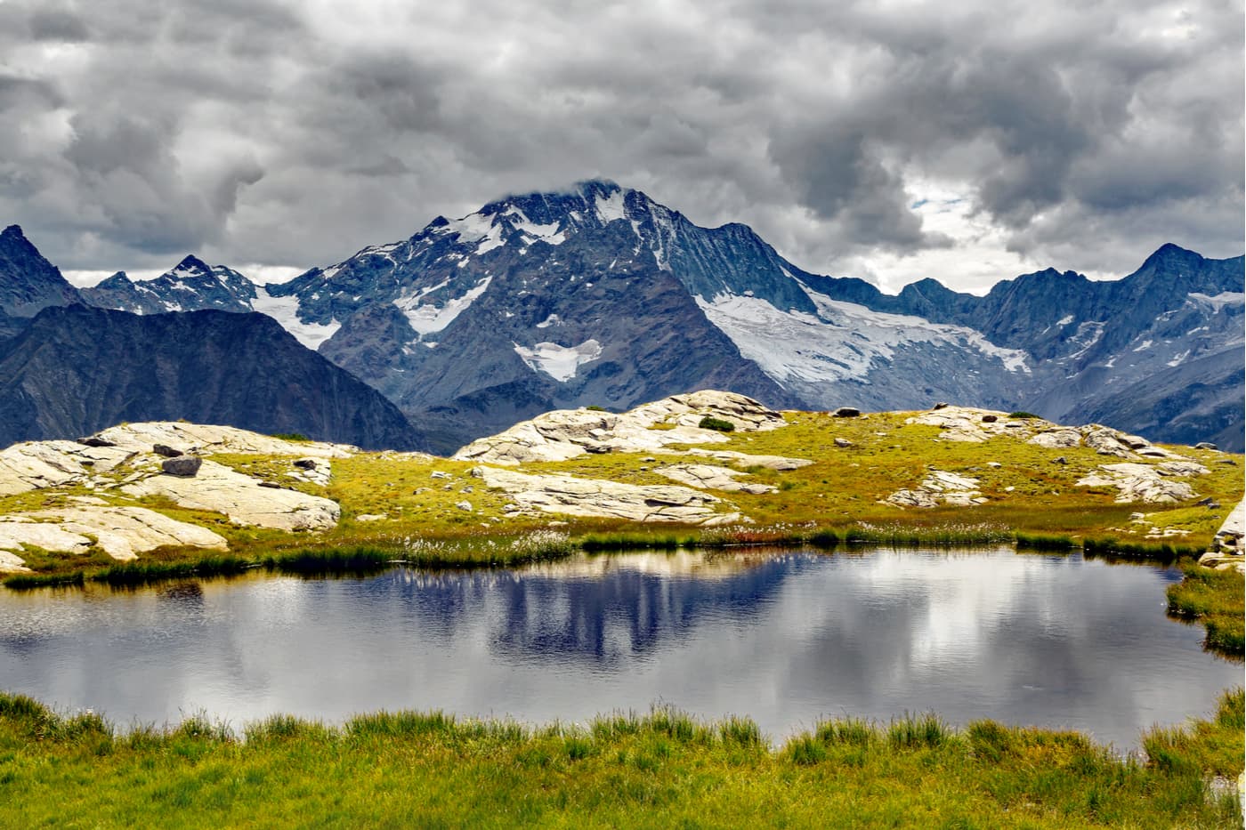
The elevations vary from 198m at the northern tip of Lake Como to 4,018m at the very top of La Spedla - a subpeak of mighty Piz Bernina 4,049m, the easternmost four-thousander of the Alps. Such a drastic elevation difference justifies deep and steep valleys with U-shaped profiles protected by skyscraping craggy peaks from all sides. The peaks in Sondrio belong to the Lepontine Alps in the west, the Western Rhaetian Alps in the north, the Southern Rhaetian Alps in the east, and the Bergamasque Alps (Alpi Orobie) in the south.
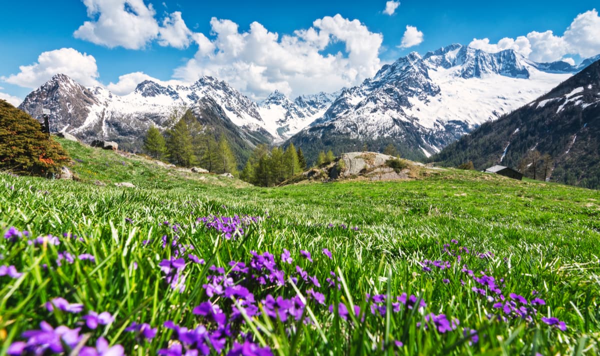
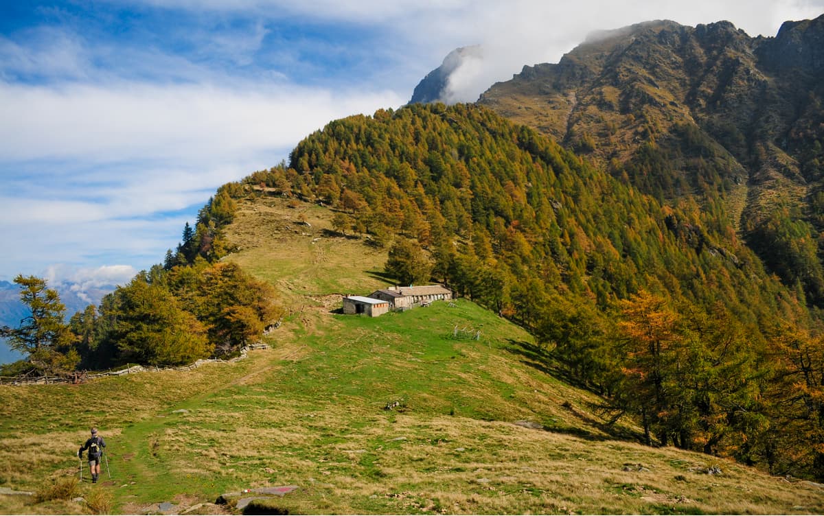
Despite the long history of being a transport hub between Italy and the rest of Europe in this region, now the province of Sondrio is remote and transport connectivity is limited, all the roads go through high alpine passes with only one exception of the highway called Lake Como and Spluga (SS 36). Oftentimes, tourists flock to adjacent cosmopolitan Saint Moritz in the Swiss canton of Graubunden and sadly miss all the hidden gems of Sondrio, which are pretty abundant in the area. Sondrio can be compared to a generous magician in disguise - it opens up only to those inquisitive enough. The province can boast of large and small picturesque lakes, maddeningly rushing waterfalls, quiescent medieval towns, healing hot springs, towering mighty peaks, treacherous glaciers, abyss-like gorges, traces of ancient epochs, and many more. No wonder this province is a mountaineer’s sheer delight.
Located at the altitude of 2,114m, the Spluga (or Splugen in German) Pass is one of the most antique alpine traverses linking the South and the North between Pizzo Tambo (3,279m) and Surettahorn (3,027m). Spluga road (la strada dello Spluga) was constructed in 1823 by Carlo Donegani from Brescia who later implemented the similar masterpiece for the Stelvio Pass at the opposite end of the Sondrio province. After the Gotthard and San Bernardino tunnels were constructed, the popularity of Spluga road has dropped dramatically. Nowadays, Spluga road is only a tourist destination, and not very popular among regular commuters. Yet, don’t underestimate the options it has on offer. There are a great many reasons to traverse Spluga road. It is a divide between the Eastern and the Western Alps, the midsection arch of The Apls mountain range, there are plenty of prehistoric sites and a very pleasant trek Via Spluga from Thusis to Chiavenna.
The high-altitude plateau Pian dei cavalli is in a way a geometrical centre of the Alps. After the last glaciation period 12 thousand years ago the area was frequented by humans of the Stone Age. Located there is a stop for the Mesolithic hunters which is one of the most ancient sites of human presence in the Central Alps.
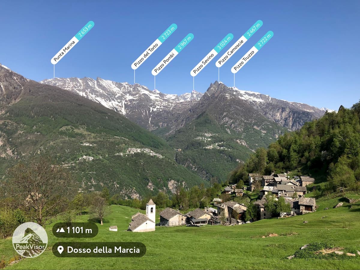
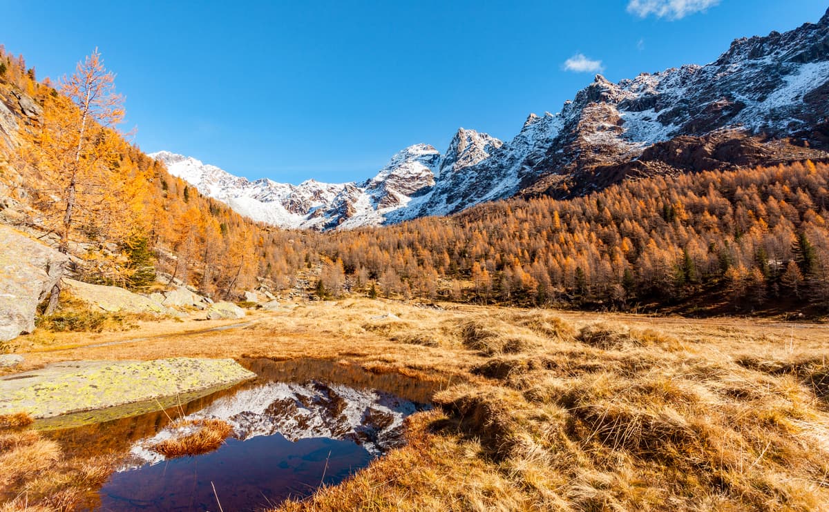
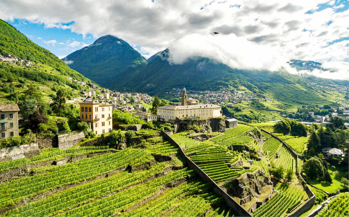
Valtellina, the central part of the province, is chucked between two great mountain ridges and stretches from east to west. The northern wall is composed of many famous peaks among which are Piz Badile - one of the 6 great north faces of the Alps - and the easternmost 4.000er - Piz Bernina. The lower yet nonetheless spectacular southern wall runs from Monte Legnone dominating the northern part of Lake Como to the ultra-prominent peak attracting a great number of alpinists - Pizzo di Coca. Arguably, the most important dish to taste when in Valtelline is called Pizzoccheri, many mountain huts serve this exceptional dish made of buckwheat flour pasta and served with cubes of potato, wilted cabbage and melted local cheese. Even vegetarians can devour this delicious rustic dish because the chefs swap the classical Valtellina Casera and Parmesan cheeses into ones made using vegetable-based rennet.
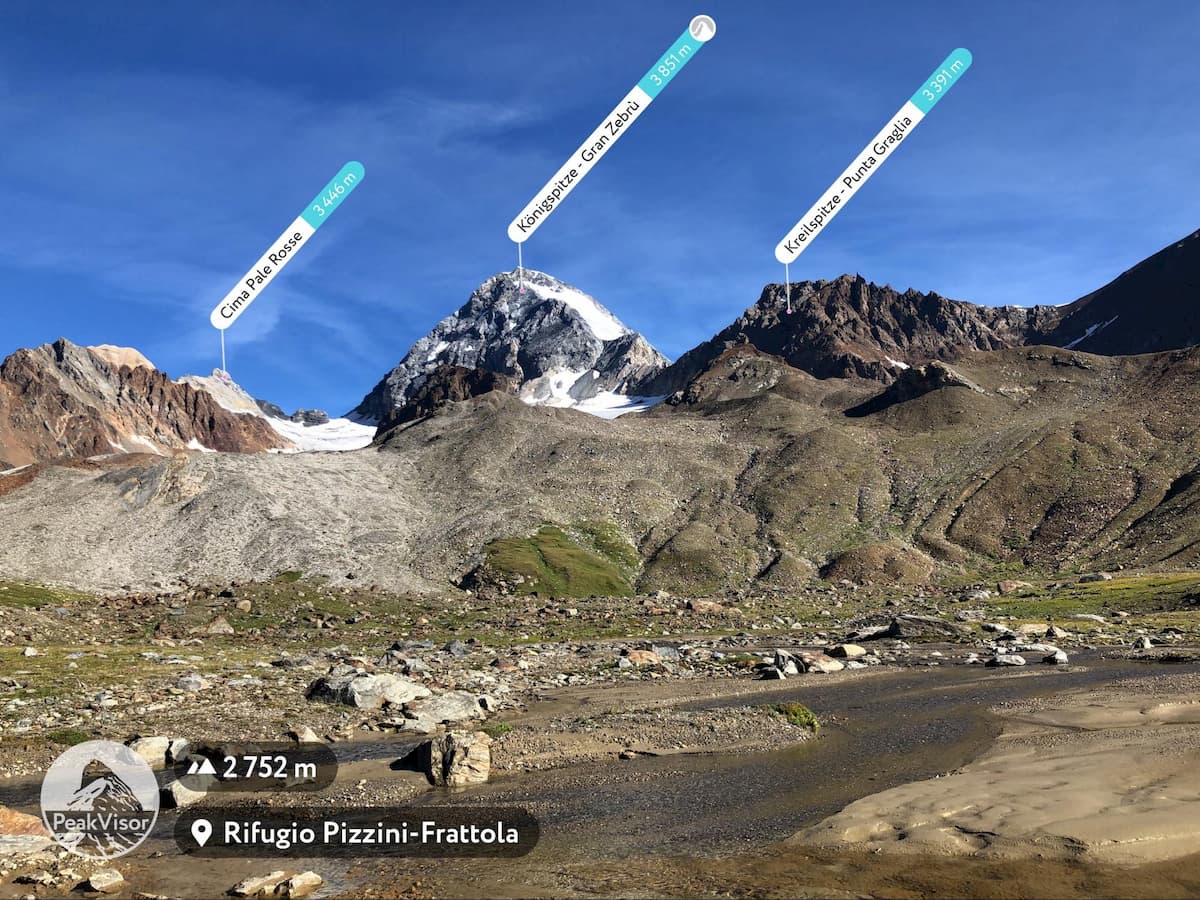
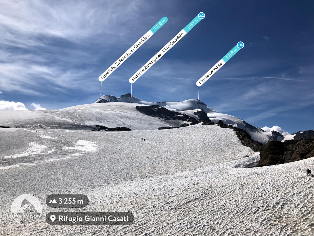
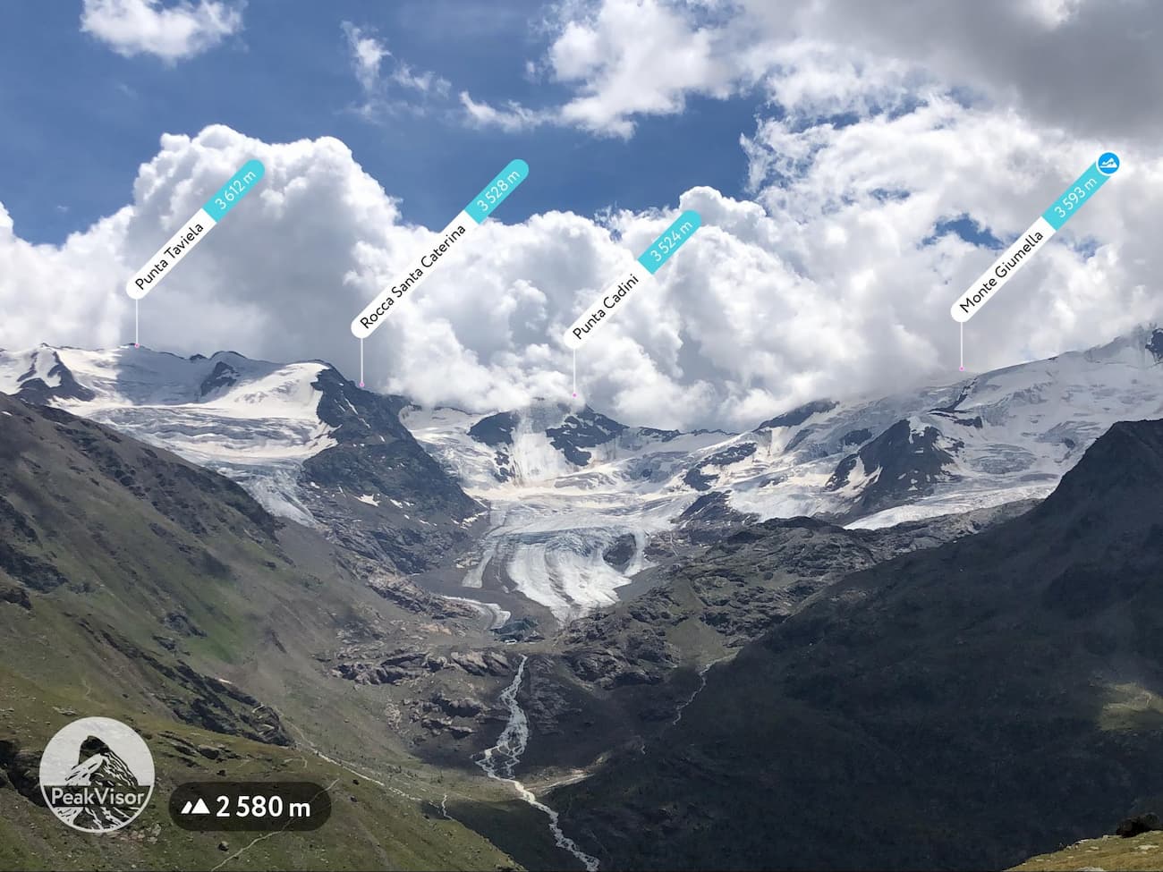
The easternmost part of the Sondrio province is where the Lombardy section of the Stelvio National Park is located. Most famous peaks of this region are Königspitze / Gran Zebrù, Monte Cevedale, and Ortler which is slightly out of the province. Many of the peaks and glaciers in this area bear the grim traces of World War I.
The Via Spluga is a classic cultural trek linking the towns of Thusis in Switzerland and Chiavenna in Italy. It is 65km long. Most of the Via Spluga winds its way gently along old mule-tracks. The trek starts in Thusis (720m), goes along the famous Via Mala gorge towards the small town of Splügen (1,457m). From there, it turns towards the south, climbing up to the Spluga Pass at 2,115m. It is the highest point of the trek and the Swiss-Italian state border where the province of Sondrio begins. From the pass, it descends through the entire length of the San Giacomo Valley eventually reaching the town of Chiavenna at 333m.
Via Spluga ideally takes 4 days to complete but if you’d like to explore the region by day hikes then here are several suggestions:
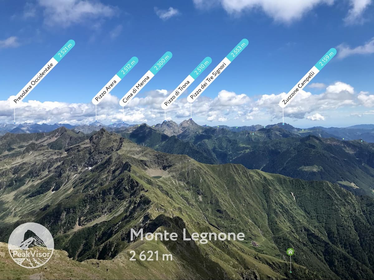
Monte Legnone is a giant granite sentinel with perfect pyramidal slopes that dominates the northern part of lake Como. The mountain is easily recognizable from all the surrounding valleys and the lake. Its prominent position attracts many hikers but its sheer slopes frighten even the hardest daredevils. Due to significant elevation difference, trail distance and exposed sections, oftentimes with strong winds, this trail isn’t fit for families with children, at least the last top section. In return for the energy burned, the trail offers highly probable ibex encounters, amazing 360-degree panoramic views of lake Como, regions of Valchiavenna, Valtellina, and many important peaks: Grigna, Corno dei Tre Signori, Monte Disgrazia, Piz Bernina, and even Monte Rosa on a clear day.
For families with children there’s a smaller version of the mountain nearby - Monte Legnoncino. It is much closer to the Rifugio Roccoli Lorla, and also boasts a scenic view of Lake Como, and a stunning close up of Monte Legnone itself.
Being the southernmost tip of the province, Pizzo dei Tre Signori (2,553m) lies 13km south-east from Monte Legnone. It is a famous hiking destination all year round. It is named so because long ago it used to be a historical dividing line between the State of Milan, the Republic of Venice, and the Graubunden canton of Switzerland. Nowadays three Italian provinces - Sondrio, Bergamo, and Lecco - meet at this point. Besides an unobstructed view of hundreds of alpine peaks on a clear day, one can see Milan and the Apeninnes.
There are 3 trails leading to the panoramic summit of Pizzo dei Tre Signori. One of them starts from a small village called Gerola Alta in the province of Sondrio and passes by highly recommended Rifugio Trona Soliva and Rifugio Falc. Taking into account the dramatic elevation gain and trail distance, chances are you’ll appreciate the place to recharge the batteries and enjoy the delicious Valtellinese cousine.
Monte Disgrazia might be the most misfortunate naming in the Alps. It is a really inappropriate name for such a fine mountain. In fact, the first climbers of this peak even called it “Picco Glorioso” (aka Glorious Peak). In local dialect, the mountain bore the name “Desgascia” (to melt). But the erroneous transcriptions made it into the word “disgrace” and the error stuck into the maps and minds. Don’t be fooled by this historical incident, Monte Disgrazia is one of the finest Alpine peaks and has to be thoroughly explored!
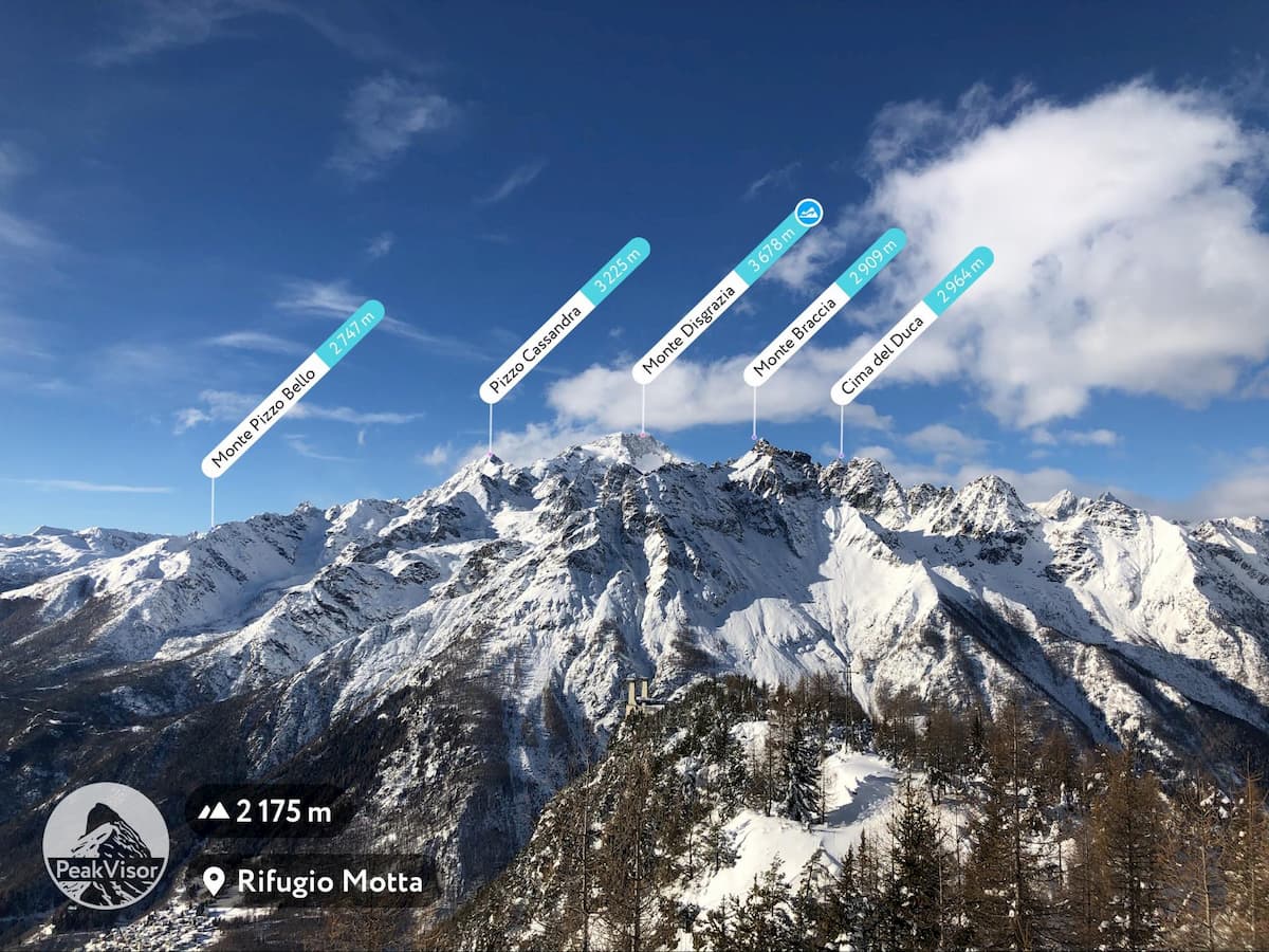
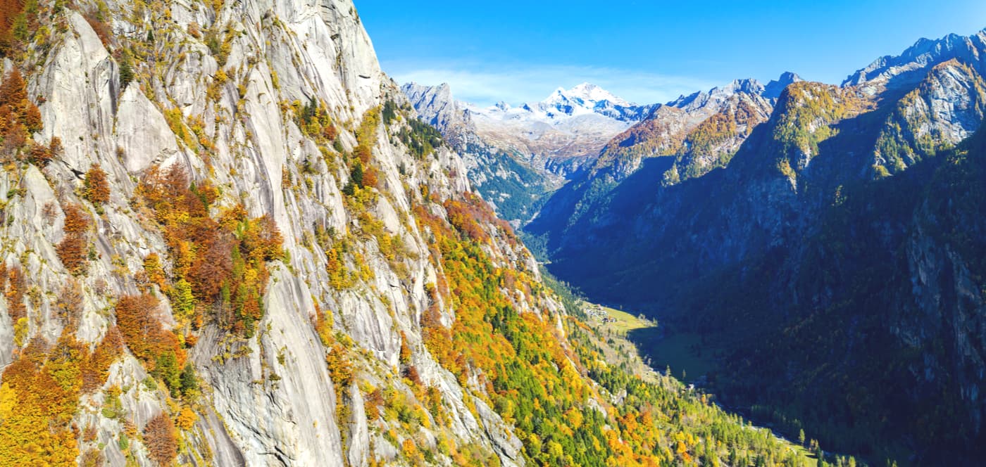
Monte Disgrazia is a huge massif composed of a dozen peaks, the highest of them is 3,678m. It reminds of a prominent craggy island south of the Swiss-Italian border and the Bernina group. Monte Disgrazia is gently hugged by two northbound valleys: the Val Masino and the Valmalenco. Its mountain profile varies a lot depending on the point of view, but it always stands out. It is highly recommended to complete several trails in the surrounding valleys to get a good picture of this gem of a mountain. By the way, speaking of the hidden treasures, the slopes of Monte Disgrazia and neighboring valleys are particularly rich with rare minerals. Those who are into collecting minerals should pay attention to the stones under their feet.
In order to get your first encounter with the mountain, I highly recommend the panoramic ridge walk from the Alpe Granda mountain hut to Alpe Scermendone and Monte Scermendone. It is a simple hike with picturesque views and the trailhead is close to the main road of Valtellina. For a more demanding hike, proceed farther up to lake Scermendone (2,340m). There’s another even more demanding trail passing by the lake. It is the scenic loop around Corni Bruciati (literally, Burnt Horns). Due to high elevation, the loop is feasible only from July to September.
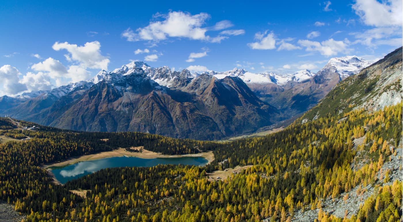
Valmalenco is a large Y-shaped valley exactly to the north of the province capital Sondrio. In wintertime, it is a popular ski resort, in summertime, it turns into a beloved paradise for outdoor enthusiasts of Lombardy. There are great many mountain huts and hundreds kilometers of hiking trails. Also, this valley is home to the oldest larch in Italy - the millennial larch. It was already present here in the year 1000!

Here are some of the treks to explore the valley:
Photographers might appreciate the viewpoint by Lake Zana which at sunrise majestically reflects the sunlit Monte Disgrazia. Other lakes to catch a stunning reflection of Monte Disgrazia are Lake Ciaz (Lago di Ciaz di Fora) near the Longoni mountain hut and numerous small Campagneda lakes on the way to the Campagneda pass.
Val Masino is a smaller Y-shaped Valley to the west of Valmalenco with the entrance near the town of Morbegno. It is a quiet place, yet on summer weekends it might get crowded, especially the shores of a small lake pompously named Bidet della Contessa (yes, it means bidet of the countess) in the Val di Melo Nature Reserve. It is located where the Melo Valley branches from Val Masino.
Predarossa is an ideal itinerary into the Lost World, a Hiker’s Paradise. Geologically, it is the place where the granite of the Masino valley meets the serpentinites of the Valmalenco. It makes the rocky walls take on a reddish color, hence the name Predarossa. It is a seemingly untouched place dominated by glaciers and high peaks of gray and red rocks, furrowed by the spectacular bends of the Duino river that winds like a giant snake. This highly recommended itinerary starts from the parking lot near the first large Predarossa meadow and proceeds high into the mountains to Ponti mountain hut at 2,559m.
Val Masino is also home to the Sentiero Roma, the most popular high-altitude trek in Lombardy. It might be the best way to experience the Val Masino but it is a very challenging adventure, requiring proper Via Ferrata equipment and experience. Trofeo Kima running along the Sentiero Roma is a high altitude marathon considered one of the most demanding of the skyrunning world panorama. It is a biennial race, and since 2010 Kilian Jornet has been winning the men's competition.
The Stelvio National Park is the largest national park in Italy and the Alps, it is also home to the largest valley glacier in Italy, Forni. One third of the park falls into the border of the Sondrio province. Positively, the best way to get to know this part of the park is Giro di Confinale (Confinale Tour). It is a loop trek around Monte Confinale (2,877m) which passes by the most important highlights of the area and can be completed in 2 or 3 days.
Those who’d like to explore the park by day hikes have plenty of options. Here are the most important trails to explore:
The Rifugio Quinto Alpini trail is better to tackle from Bormio, while the other three should be embarked on from a more convenient Valfurva.
Those seeking unobstructed panoramic views shouldn’t miss Piz Umbrail (3,033m) on the Swiss-Italian border not far from the Stelvio Pass. Out of hundreds of visible peaks, the Ortler group pops out. For a closer view of Ortler on the other side of the Stelvio pass road, try to conquer Monte Scorluzzo (3,094m), popular among outdoor enthusiasts.
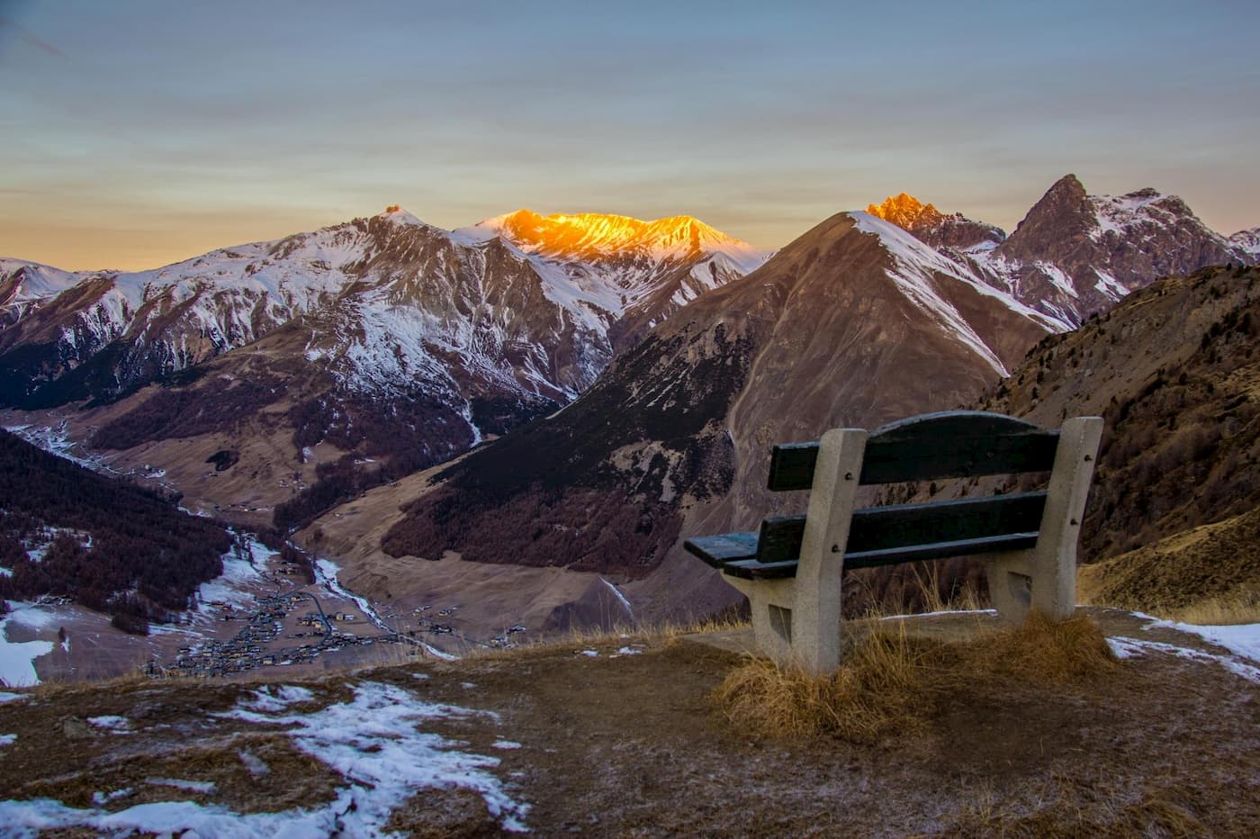
Livigno is a small town situated in a vast valley at 1,800m above sea level. The valley is 18 km long and framed by a chain of mountains higher than 3000m. There are endless recreational opportunities all year round.
In order to get acquainted with the place we highly recommend starting with excursions to La Pare and Il Motto. Both are high above the town and have spectacular panoramic views of the valley, its lake, and the mountains.
For longer excursions, one can venture into the somewhat hidden Federia valley. The hikes start from the parking lot at the edge of Livigno and go to high mountain passes towards Switzerland. Two suggested itineraries are:
Passo Federia 2,899m crossing into Switzerland near Monte Cotschen 3,102m. Apart from allowing an amazing glimpse of the Bernina Group, there’s a nice little lake near the pass.
Passo di Cassana 2,680m is a more popular destination thanks to a convenient mountain hut (rifugio Cassana) and an easy access to Punta Cassana boasting unbeatable panoramic views of the Eastern Alps.
There’s one more trail to mention. Little known yet scenic Alpisella valley and the namesake pass squeezed between Pizzo Aguzzo and Monte Pettini is a great option for a family hike. Here is the source of the river Adda - the most important river of the Lombardy region. This valley is part of the Stelvio National Park.
For skiing and snowboarding enthusiasts, there are 10 ski resorts in Sondrio located throughout the province.
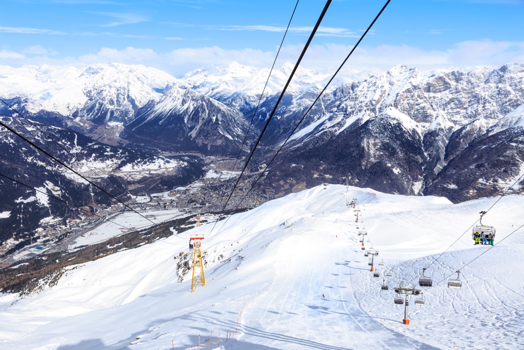
The largest ski resort in Sondrio and in the entire Lombardy region is Livigno with more than 110 km (68 mi) of slopes and more than 30 ski lifts. So Sondrio is one of the main areas for skiing in the Italian Alps in general.
Other major areas for skiing in Sondrio are Bormio–Cima Bianca and Aprica with more than 50 km (31 mi) of slopes and more than 10 ski lifts each, as well as Valchiavenna (Madesimo and Campodolcino) with more than 30 km (19 mi) of slopes and more than 5 ski lifts. There are also several smaller resorts suitable for skiing for a few days: Valmalenco–Alpe Palù, Cima Piazzi/San Colombano–Isolaccia/Oga, and Santa Caterina Valfurva.
The main ski resort near Sondrio, the namesake capital of the province, is Valmalenco again.
Check the Lombardy ski resorts map as well as the larger Italy ski resorts map in the World Mountain Lifts section of the site. It includes information about open ski lifts / slopes in Lombardy in real-time with opening dates and hours. There are also year-round cable cars, funiculars, cog railways, aerial tramways, and all other types of mountain lifts.
There are many hotels in the province and the abundance of accommodation options. Here we list just several towns which might be a good basecamp for those planning to explore the hidden gems of the northernmost province of Lombardy. Apart from the convenience of easy access to the mountains, these towns have a rich history sometimes going back to the acient Roman times.
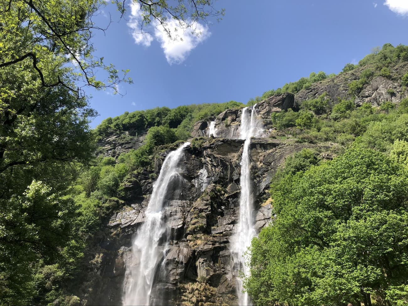
Chiavenna is a small medieval town to the north of lake Como at the important historical intersection of a road to the Spluga pass and the Bregaglia valley leading to Swiss Engadine. It is the only town in the province of Sondrio recognized by the Orange Flag (bandiera arancione) by the Touring Club Italiano, the quality mark of the finest touristic characteristics. It is easy to understand why. Apart from the great many excursions available in the nearby valleys, the town enjoys a charming medieval architecture, the spectacular mountain river Mera crossing the city centre, the scenic Acquafraggia waterfalls, Giants' Pots park (Parco delle Marmitte dei Gigante), and the botanic-archeological park called Paradiso.
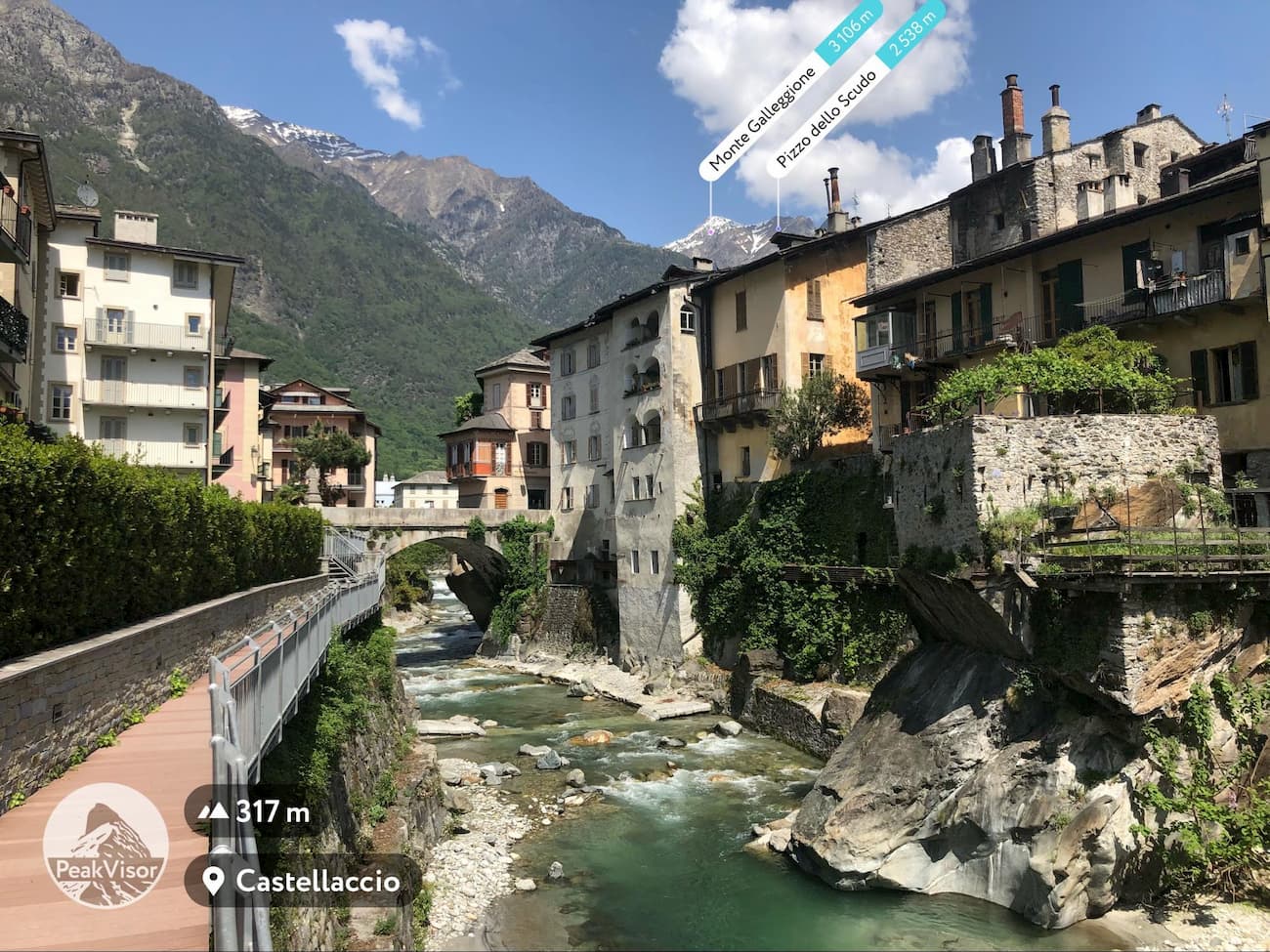
With approximately 21,500 inhabitants it is the smallest province capital in Italy. The town is ideally situated at the very centre of the province and allows convenient access to all the major tourist attractions. As the largest town in the area, it also offers a wide range of accommodation options. Sondrio itself has a variety of landmarks, such as museums, shopping malls, walks through medieval streets, and a castle.
Contrary to popular belief, the town’s name has nothing to do with tyranny. Some etymologists argue that the name comes from “inter amnes” and means between the rivers. The city in fact sits between the river Adda and the Poschiavino. There are signs of prehistoric inhabitants in the area dating back as far as the 18th century B.C.
This small town is especially popular for being a departure point for Swiss Bernina Express running through UNESCO World Heritage Rhaetian Railway and connecting Tirano and Sankt Moritz in Switzerland. The city is an ideal place for those planning to venture in the Poschiavo Valley, Sankt Moritz, and Engadine.
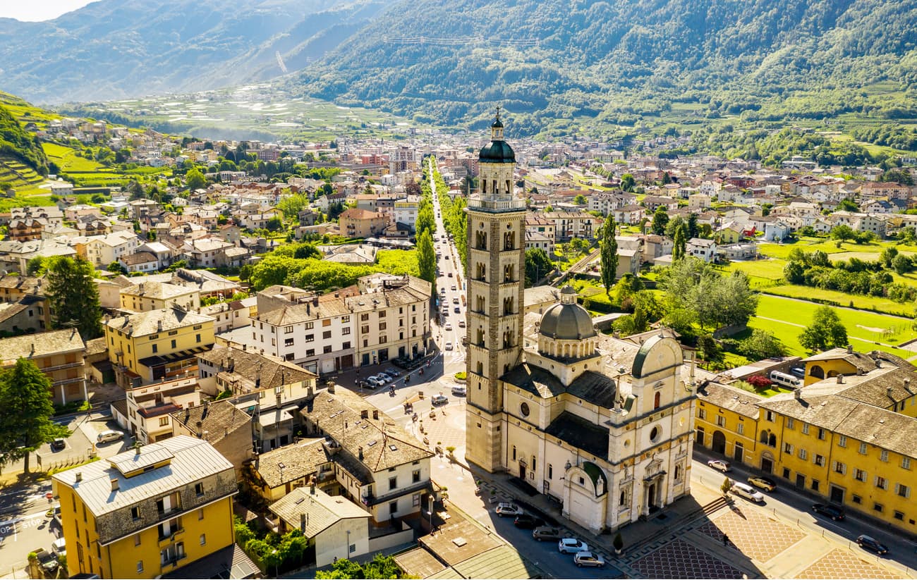
The town itself has a charming medieval centre with arguably the most important shrine in the whole valley. The Catholic shrine of the Madonna di Tirano is a major tourist attraction. It was dedicated to the appearance of the Blessed Mother here in 1504.
A popular ski resort with thermal sources at especially attractive prices can easily beat its celebrity neighbors. Most likely, the town name comes from the Ghaelic term bormo meaning a hot source. These thermal sources were already famous in the Roman Empire and they alone make a stay in Bormio worthy. There are a great many hiking destinations around the town: Stelvio Pass, Valdidentro (the road to Livigno crosses this valley), Valdisotto (to the south of Bormio), Valfurva, and the Stelvio National Park. You’ll need at least a week to explore the most important trails just around the town.


top50
ultra
glacier
alps-4000ers
italy-ultras
switzerland-ultras
top50
ultra
glacier
alps-4000ers
italy-ultras
switzerland-ultras
Yes. Sondrio has 984 named mountains. The highest is Piz Bernina at 4,048 m.
The highest mountain in Sondrio is Piz Bernina, at 4,048 m.
Sondrio has 984 named mountains.


