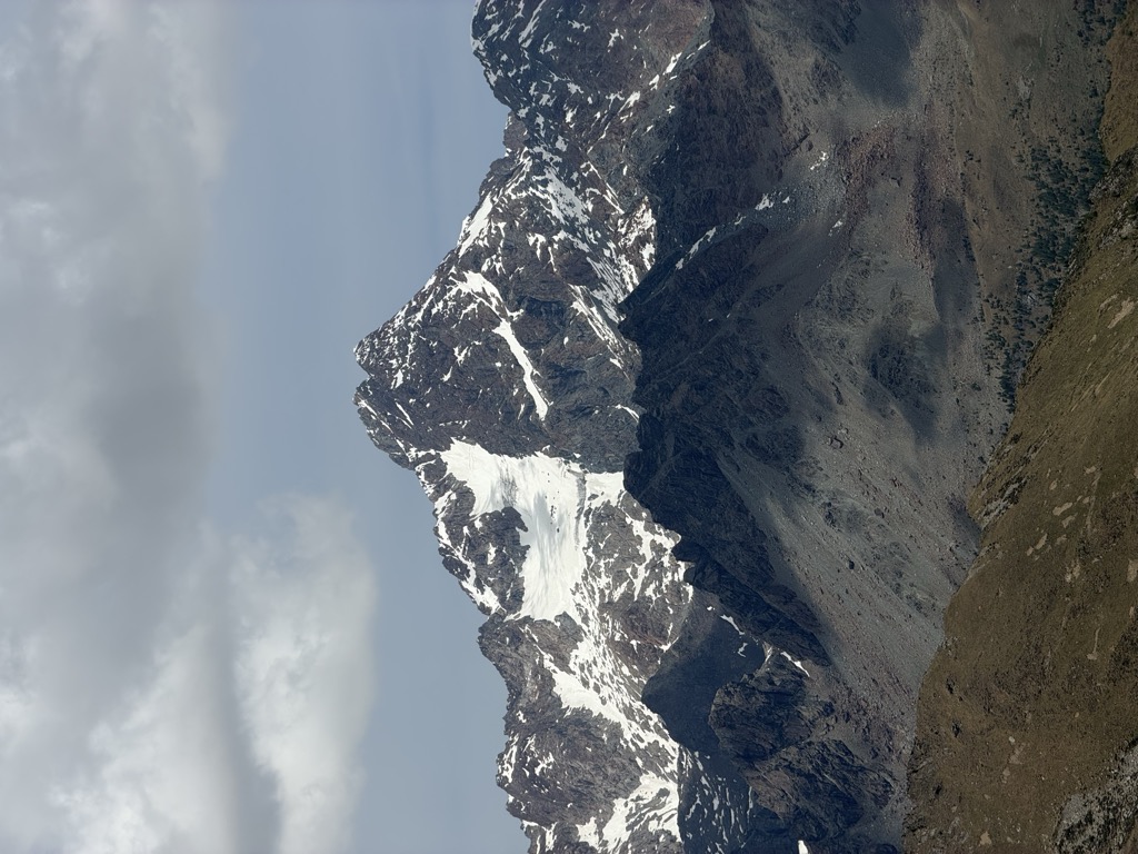
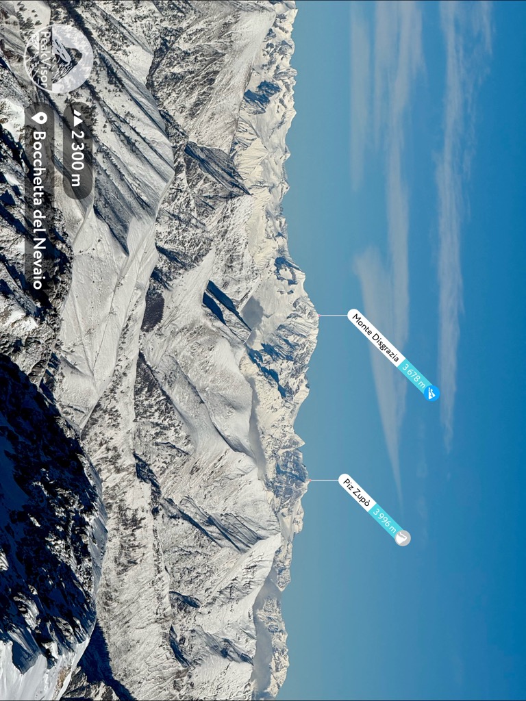
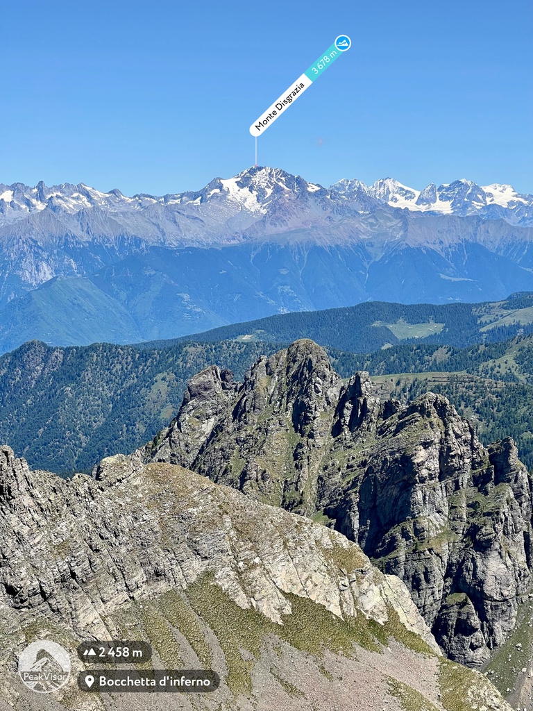
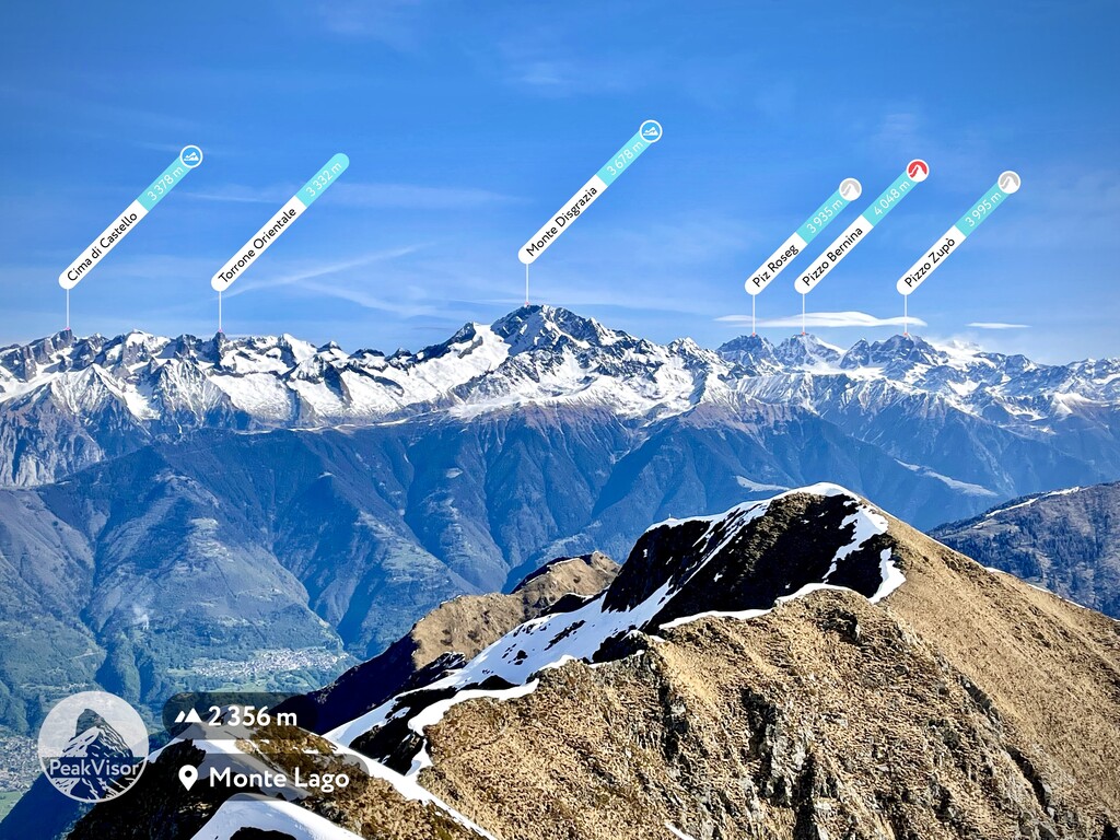
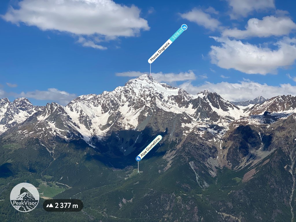
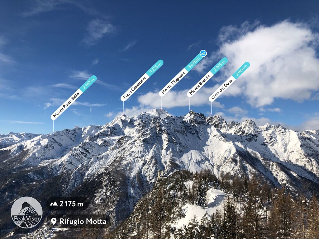
Monte Disgrazia ('Mount Disgrace'; adapting Lombard: Mont Des'giascia, lit. 'Mount Defrost'; 3,678 m) is a mountain in the Bregaglia range in the Italian Alps. It is the highest peak in the Val Masino group, situated south of the Bernina Range.
It has five glaciers and five wild ridges and is a demanding climb.
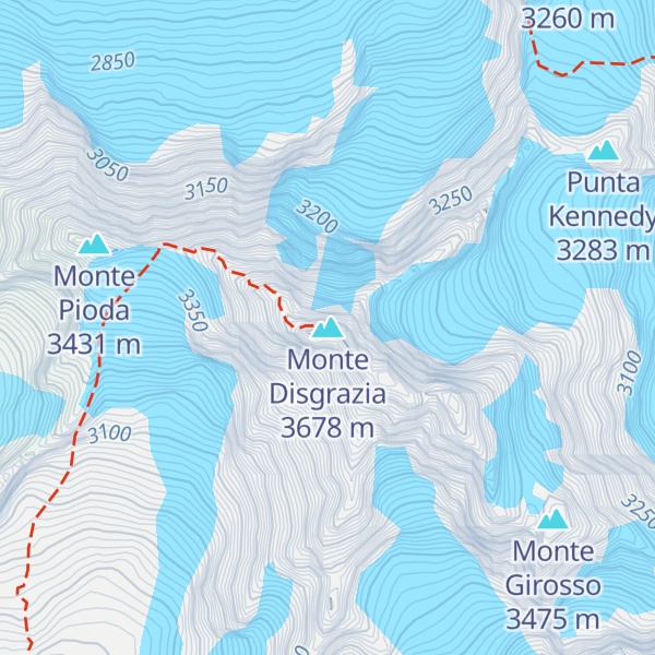
The first ascent was by Leslie Stephen, E. S. Kennedy and Thomas Cox with guide Melchior Anderegg on 23 August 1862. Their route over the Preda Rossa glacier and the northwest ridge is the easiest one and has remained the normal climbing route.
There's a difficult alpine trail (T6) leading to the summit.
The nearest mountain hut is Bivacco Rauzi located 63m/206ft SE of the summit.
By elevation Monte Disgrazia is
# 20 out of 2797 in the Western Rhaetian Alps # 23 out of 3401 in Lombardy # 23 out of 973 in Sondrio # 1 out of 246 in the Val Bregaglia
By prominence Monte Disgrazia is
# 6 out of 2797 in the Western Rhaetian Alps # 78 out of 42694 in Italy # 9 out of 3401 in Lombardy # 5 out of 973 in Sondrio # 1 out of 246 in the Val Bregaglia
We use GPS information embedded into the photo when it is available.
3D mountains overlay
Adjust mountain panorama to perfectly match your photos because recorded by camera photo position might be imprecise.
Move tool
Rotate tool
Zoom
More customization
Choose which peak labels should make into the final photo and what photo title should be.
Next
Photo Location
Satellitte
Flat map
Relief map
Latitude
Longitude
Altitude
OR
Latitude
°'''
Longitude
°'''
Apply
Register Peak
Peak Name
Latitude
Longitude
Altitude
Register
Teleport
PeakVisor
This 3D model of Sagarmatha National Park in Nepal was made using the PeakVisor app topographic data. The mobile app features higher precision models worldwide, more topographic details, and works offline. Download PeakVisor maps today.
Download OBJ model
PeakVisor
The download should start shortly. If you find it useful please consider supporting the PeakVisor app.
PeakVisor for iOS and Android
Be a superhero of outdoor navigation with state-of-the-art 3D maps and mountain identification in the palm of your hand!