
Scan the QR code and open PeakVisor on your phone
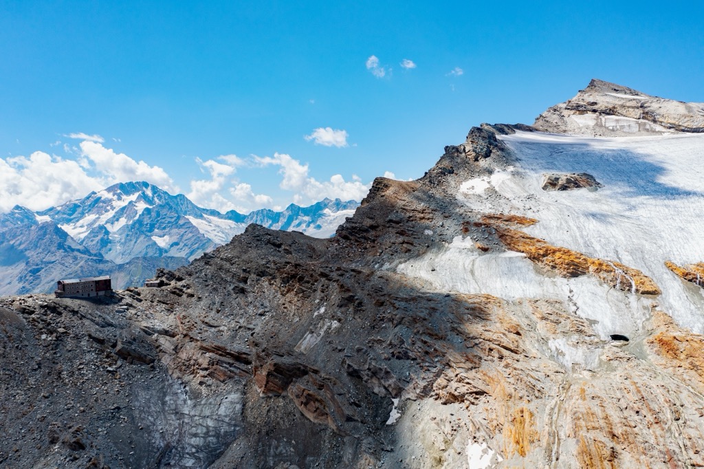
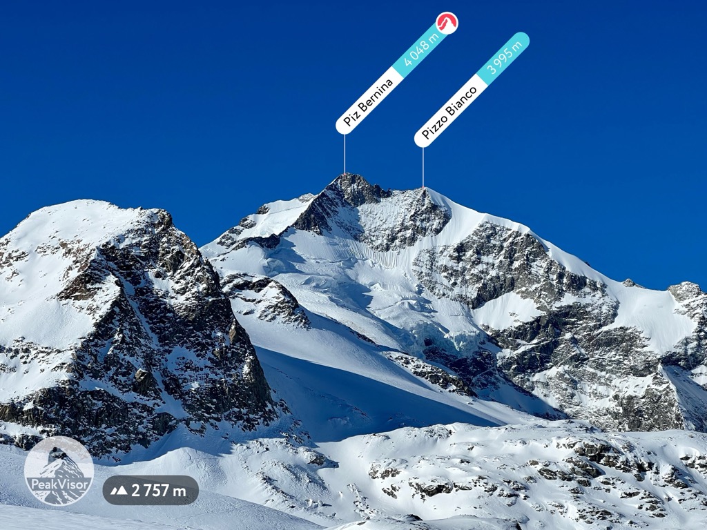
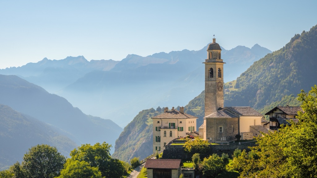
Maloja is a small village in the canton of Grisons (Graubünden in German) located at the beginning of the Engadine and the southwestern end of Lake Sils, Switzerland. The Maloja Pass connects two fascinating landscapes: the Upper Engadine Lake district and the southern Grisons Valley of Bergell (Val Bregaglia). There are 417 named mountains in Maloja. The highest and most prominent mountain is Piz Bernina (4,048 m / 13,283 ft).
Maloja is a village on the Maloja Pass between the Upper Engadine and Bergell in the Swiss canton of Grisons. As the largest canton in Switzerland (7,105 sq. km / 2,742 sq. mi), the village forms its southeastern region.
Grisons is a typical mountain and highland area. About 90 percent of its land is at least 1,200 meters (3,937 ft) above sea level. Due to its geographical conditions, it is the most sparsely populated canton in Switzerland, ranking only 14th in population.
Grisons borders the canton of Ticino in the southwest, Uri in the west, and Glarus and St. Gallen in the north. Grisons forms the national border of Switzerland with Liechtenstein and Austria in the north, the Italian South Tyrol in the east, and Lombardy in the south.
Interestingly, Grisons is the only trilingual canton. This area has three official languages: Swiss German, Italian, and Romansh. The latter is one of the descendant languages of the spoken Latin language of the Roman Empire.
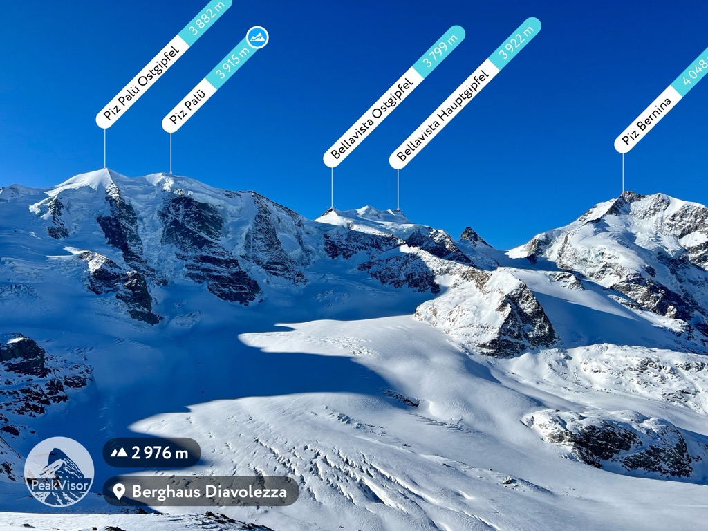
There are 2,094 named mountains in Grisons canton. The highest and most prominent mountain is Piz Bernina, the easternmost 4000’er, with an elevation of 4,048 m (13,283 ft). There are many “Piz” mountains here, as it means “Peak” in the Romansh language. Other well-known “Pizes” in the Engadine include Piz Kesch (3,418 m / 11,214 ft), Piz Palü (3,900 m / 12,795 ft), and Piz Julier (3,380 m / 11,122 ft).
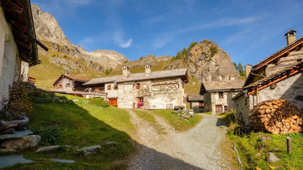
Maloja includes the villages of Capolago, Creista, Mota d'Orden, and Pila, in addition to the main town. Furthermore, the hamlet of Isola on Lake Sils, almost four kilometers away, also belongs to Maloja.
Maloja is celebrated as an inspiration and home to Italian painter Segantini, famous for his large landscapes of the Alps. Segantini's house with the atelier is at Maloja.
Philosopher Friedrich Nietzsche also found his inspiration at Maloja, where he spent seven summers.
The area around Maloja has numerous geological peculiarities. For example, the region’s signature green rocks, found near the Lägh da Cavloc in the Fornotal (valley of the Forno glacier), initially formed in the ocean between the African and European continental plates.
During displacements, these rocks have been reshaped (rock metamorphism). In the Fornotal, for example, the famous andalusite schist formed by contact metamorphism. This process is also called thermometamorphism because the process takes place at rising temperatures. Furthermore, constant low pressure is essential. In this process, the original rock is changed grain by grain (recrystallization).
There are 417 named mountains in Maloja. Some of the most important peaks in the area include:
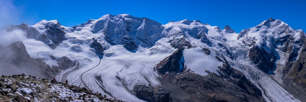
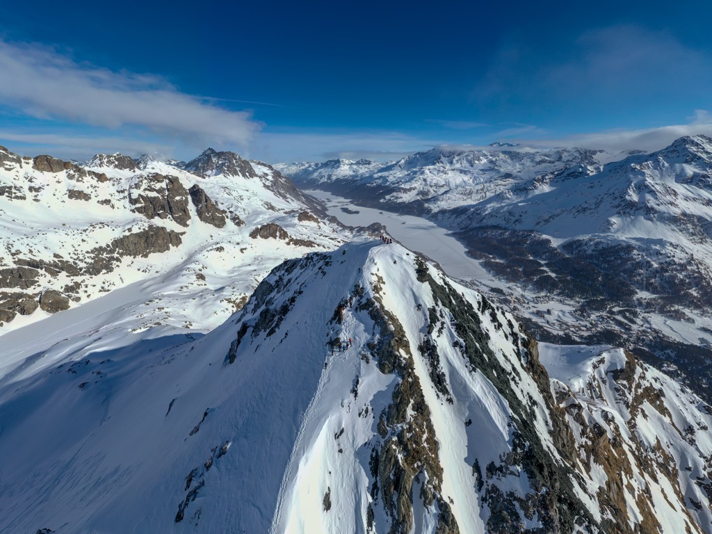
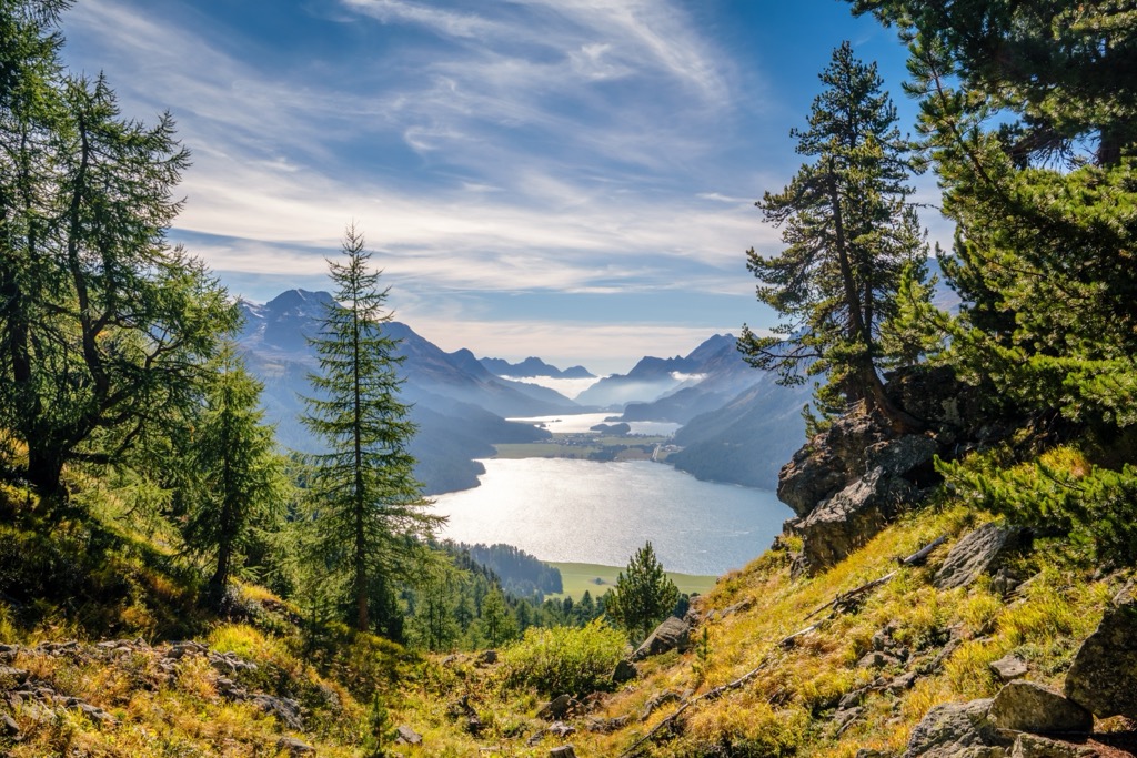
The area around Maloja is geographically, geologically, and botanically one of the most exciting areas in the Alps. As part of the Engadine, the high valley is characterized by its many lakes and beautiful landscape with pastures, forests, and glaciers.

The Inn River flows through the valley. A scenic feature is the lakes of the so-called Engadin Lake Plateau with Lake St. Moritz, Lake Silvaplana, Lake Champfèr, and Lake Sils.
Botanically, the Engadine is of remarkable richness. Pine and larch forests, glaciers, and an elevation of 1,600-1,800 m (5,249 - 5,905 ft) contribute to the area’s ecology. The green meadows in the valley are surrounded on both sides by snow-covered mountains. The slopes of the southern mountains feature coniferous forests; alpine pastures extend above them.
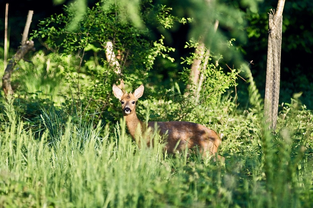
Red and roe deer live in the forests of the Engadine, while chamois and ibex roam the mountainous regions. The rocky side valleys are home to golden eagles and bearded vultures.
Here’s a quick look at the different natural regions close to Maloja:
This side valley of the Upper Engadine is under nature protection because of its rare flora and fauna. For this reason, the valley is car-free, with a few exceptions. Visitors can explore the valley by taking a horse-drawn carriage. The mountain church in Fex Crasta is also worth a visit. It was built around 1500 and is decorated with frescoes by an Upper Italian master.
On the border with Italy, in the Engadin/Val Müstair, lies the Swiss National Park, the oldest national park in the Alps. Here, nature has the upper hand and is protected from human interference. With several thousand animal and plant species, the national park is a unique ecosystem that preserves the natural Alps in its original state. Only interventions that directly serve the preservation of the park are allowed.
This region's forests, alpine grasslands, and mountains dominate the landscape. Nature lovers can explore the untouched beauty on numerous hiking trails (over 80 km / 50 mi) with varying degrees of difficulty. You’ll likely encounter marmots, golden eagles, and ibex. The rare edelweiss still grows in this protected spot of alpine idyll.
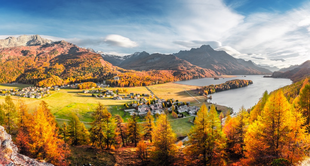
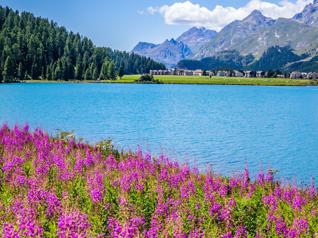
The Engadine owes its world-famous beauty not least to the unique lake plateau at 1800 m (5,905 ft) between Maloja and St. Moritz, which has inspired numerous poets and thinkers.
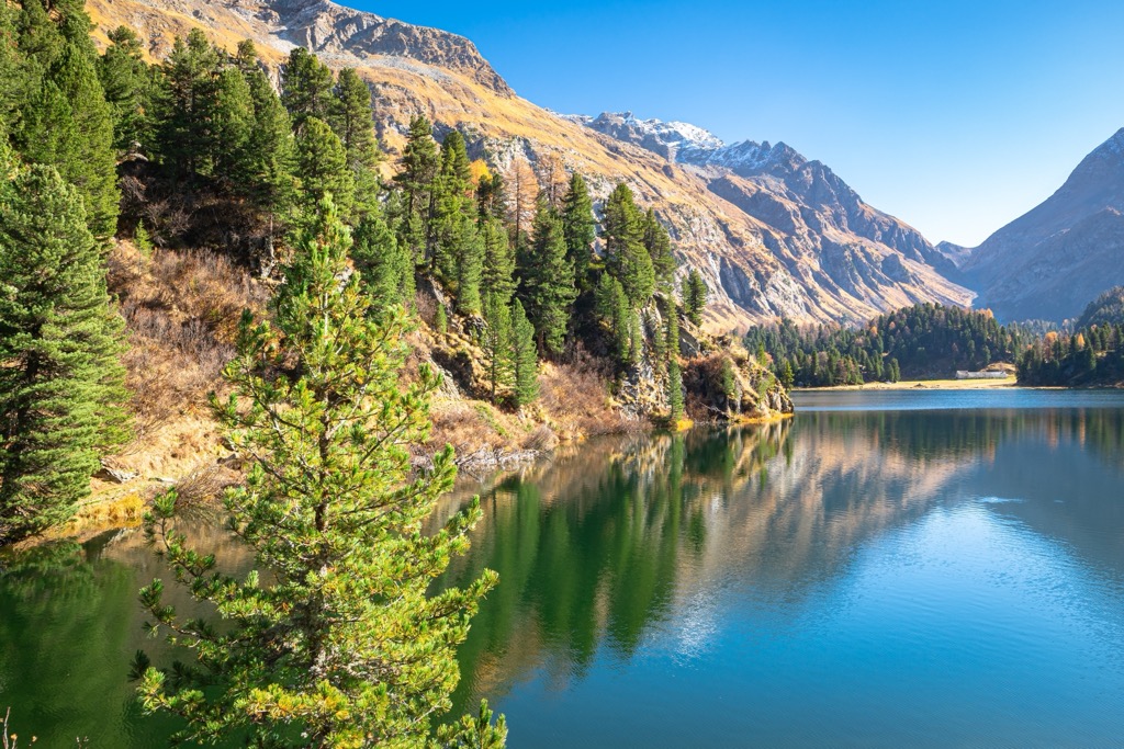
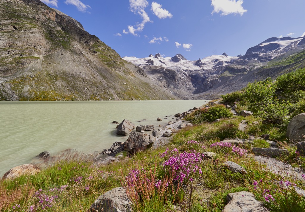
In addition to the four large lakes (Lake St. Moritz, Lake Silvaplana, Lake Champfèr, and Lake Sils), other romantic mountain lakes hide in the forests. Lake Sils is the largest and most scenic of the Upper Engadine lakes and is a popular spot for water sports enthusiasts and nature lovers during the summer. In winter, the lake freezes, and walking, cross-country skiing, and snowkiting are possible.
Anatomically modern humans probably arrived in the region around 40,000 years ago. However, limited evidence of these early pioneers exists.
Celtic tribes occupied most of the pre-Roman Alps. The Romans likely subdued the Riguscans (whom historians suppose were living in the area at the time) by 125 B.C. After the fall of the Roman empire and throughout the Dark Ages, the region passed through the hands of many rulers.
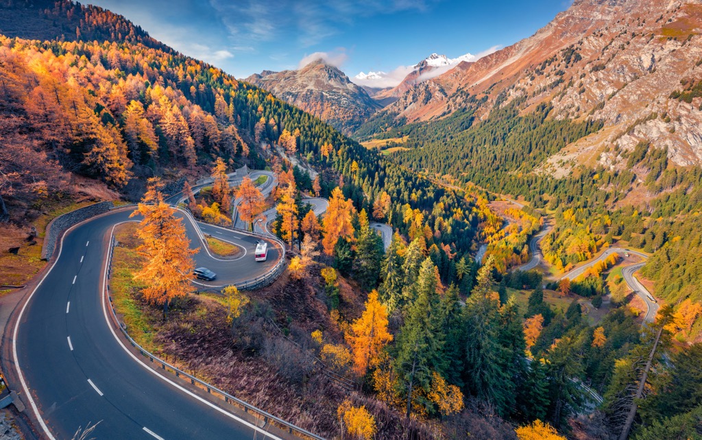
From the time of the Romans, Maloja's location on the pass road attests to its importance. Roman traces still dot the footpath from Maloja to Cavril. Other passes used as crossings since the earliest historical times are the Julier (northeast of Maloja), the Splügen (west), the Septimer, and the Muretto. The latter two are still only possible by foot.
Economic, political, and cultural history suggests that these routes were also integral for all types of smuggling.
From the 15th century on, Maloja was developed for summer settlements by the farmers of Stampa (Bergell). The original construction still exists in the surrounding hamlets of Cresta, Cà de Maté, Orden sopra / Orden dent, and Pila.
At the end of the 18th century, the area's population suffered the effects of the Napoleonic wars, when alternating French and Austrian armies engaged in occupations, devastations, and cattle raids. For the peasants of Bergell, the retreat up to Maloja was an attempt to survive the times.
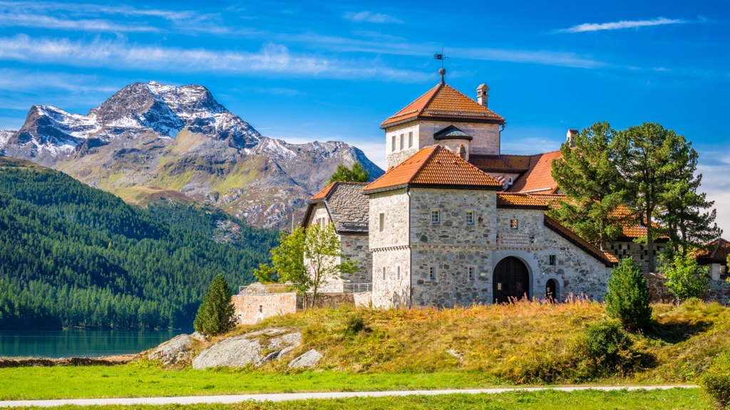
At the end of the 19th century, spa tourism began to take hold in Maloja. Count Camille de Renesse envisioned making Maloja the "Monte Carlo of the Alps." Thus, he initiated planning for a resort catering to the aristocracy. He built the Palace Hotel from 1882 to 1884, which was still used as a recreation home for children and young people until the beginning of 2008 (it has now been repurposed as a hotel once again).

The following is a list of some of the best trails and hikes that Maloja and its surroundings offer.
This classic hike (5 km/3 mi, 1:00) leads you from the village of Maloja to the Bergell Lägh da Cavloc—a magnificent mountain lake at the mouth of the Forno and Muretto valleys. Lined by fir trees on its northern and western shores, the lake is easily accessible by its southern shore, thanks to a small beach.
The short but moderately challenging hike starts from the parking lot at the Orden dam and continues steadily uphill along a wide path. Once at the top, hikers are rewarded with beautiful mountain lake idylls and treated to culinary delights in a small mountain restaurant directly on the shore. The way back is on the same path or hiking trails back to Maloja.
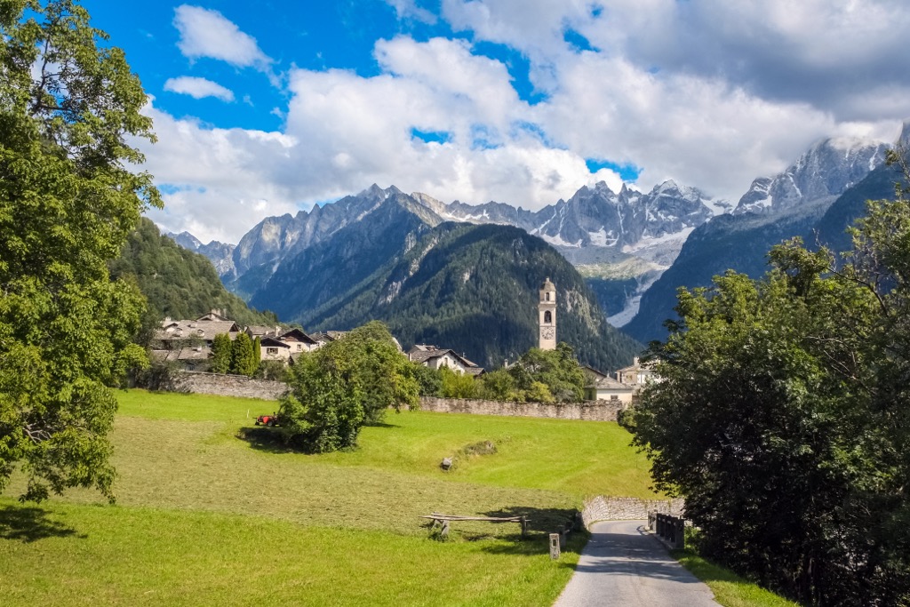
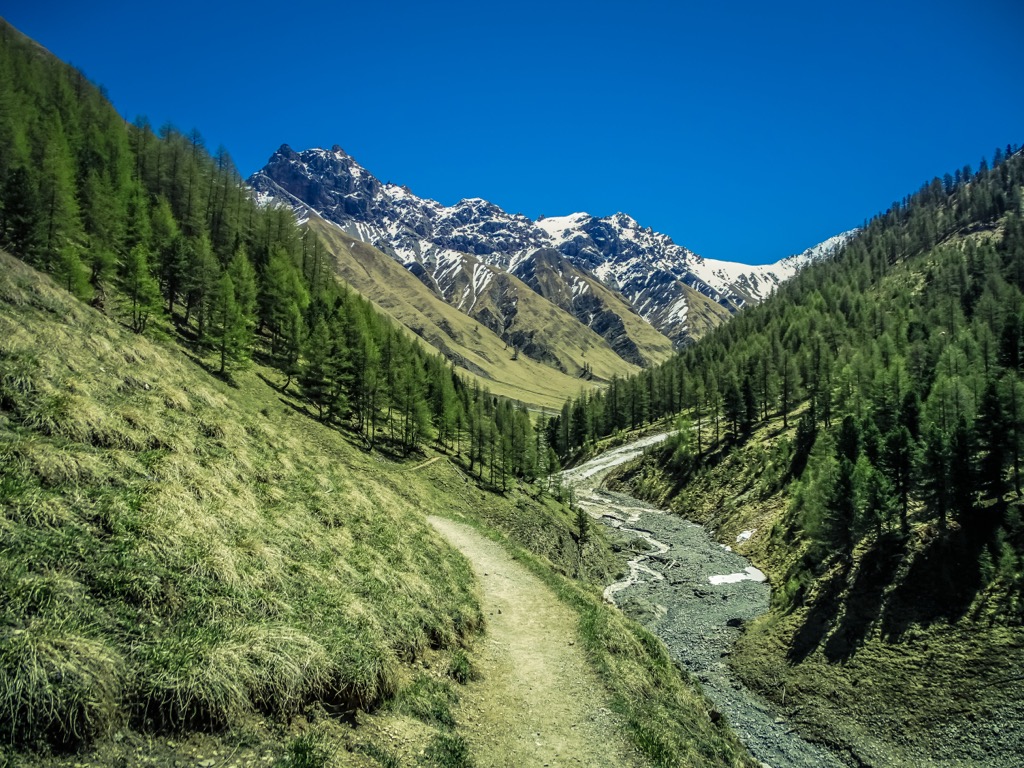
A scenic and spectacular high trail (14 km / 8.7 mi, 4:30) leads you through Val Bregaglia—one of the most secluded valleys in Switzerland. Hike through luminous mixed forests and over massive granite slabs on ancient paths with tremendous views.
The hike starts in Maloja and continues leisurely downhill. Passing historic buildings such as the ruins of the S. Gaudenzio church and the impressive dam of the Albigna reservoir, you reach the extensive mixed forests.
The path leads uphill to a high trail on the valley's sunny southern flank. Here, you can take a break in seclusion at Alp Durbegia, while granite peaks on the valley’s opposite side offer a magnificent view. The route then continues in the direction of Soglio.
This panoramic hiking trail (8 km/ 5 mi, 3:00) takes you high above Lake Silvaplana. You float with the cable car from Surlej over treetops and alpine meadows to the Corvatsch mid-station in a few minutes. A detour to the Piz Corvatsch is worthwhile.
Corvatsch has the highest restaurant in the canton of Grisons, and you can enjoy a fabulous 360-degree view of the mountains and the Upper Engadine lake district.
After a refreshment, dreamily drift back to the mid-station, where you will continue downhill on foot. Along the slope, high above Lake Silvaplana, the easily accessible mountain hiking trail leads from the Corvatsch middle station, always following the signs "Segl," "Segl Maria," and "Segl Baselgia" to Alp Prasüra, from where Sils is easy to find along many paths.
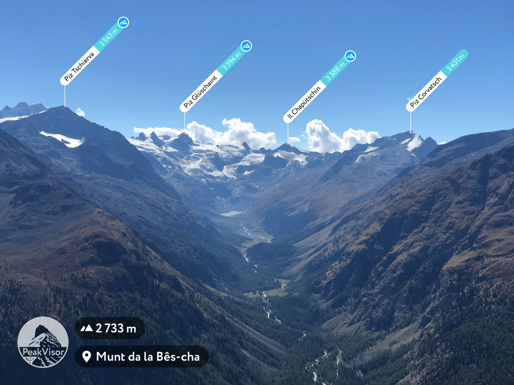
Hike high above the Val Roseg on one of the most beautiful high-altitude trails in the Alps (9.6 km/5.9 mi, 4:00).
After about 20 minutes, the mountain trail leads you to the emerald green shining Lej da Vadret (glacier lake). In the subsequent glacier foreland, you will discover geological peculiarities at every step and witness the glaciological development.
Across the moraine of the Vadret da Tschierva, you finally reach the Chamanna da Tschierva at the starting point of the famous Bianco ridge up to the Piz Bernina - the only 4000m peak in Grisons and the Eastern Alps.
The circumnavigation of the Silsersee (16.8 km/10 mi, 4:20) is a popular tour in the Upper Engadin. The lake delights with its deep blue intensity in summer or its frozen, windswept tundra in winter.
The circular hike begins in the village of Sils-Maria and leads past typical Engadine houses to Segl-Baselgia. The hiking trail now leads along the shore of Lake Sils through a beautiful larch forest to Isola. Passing the hamlet of Isola, the path leads back to the lake a little later. The trail continues along the shore to the fork, where you turn off to Maloja. Continue on the other side of the lake toward Splüga and back to the starting point in Sils-Maria.
If you’re coming to Maloja and need a place to stay, here are some of the region's best places to check out.
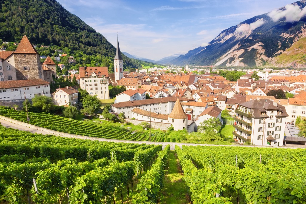
Chur is the capital of Grisons and is the oldest city in Switzerland, inhabited since 3000 BCE. It thrives in an imposing mountain world with winding alleys and historic buildings. Numerous boutiques, restaurants, bars, museums, and galleries create an almost Mediterranean flair in its pedestrian-only old town.
Right from the old town of Chur, the Brambrüesch cable car ascends to a plateau with trails, panoramic views, and winter ski slopes. The routes to Fulhorn and Fulenberg start there and offer exceptional panoramic views of several valleys and numerous peaks, including Parpaner Rothorn, Aroser Rothorn, Parc Ela’s Lenzerhorn, and Piz Beverin (the highest peak of Beverin Park).
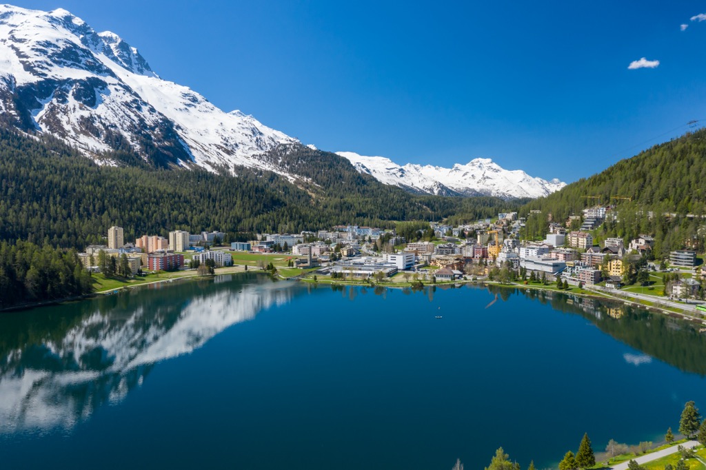
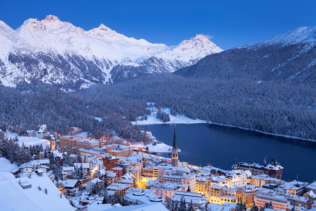
St. Moritz is not just a resort town but a village of extraordinary importance in mountain tourism and winter sports history. The sophisticated mountain resort in the heart of the Upper Engadine has attracted the world's wealth and fame for over a century.
St. Moritz is the birthplace of alpine winter tourism (1864) and has been the site of two Winter Olympic Games. It has also twice served as a filming location for James Bond movies, "The Spy Who Loved Me" and "A View to Kill." However, it originally owes its importance to the healing springs, known for 3000 years and making the place a summer spa early in history.
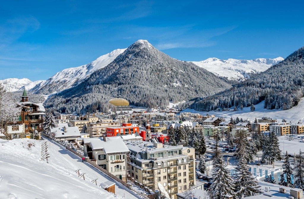
Davos is a winter sports mecca for ski and snowboard fans from all over the world. It’s the largest ski resort in Switzerland, the highest town (not village) in the Alps (1,560 m (5,118 ft), and a high-altitude health resort with a long tradition. Davos is also famous for hosting the World Economic Forum (WEF), an annual meeting of the global political and economic elite. In summer, the vast area around Davos transforms into a hiker's paradise.
In the heart of Davos, visitors can expect a wide range of accommodations and diverse shopping opportunities with countless boutiques, cafes, and restaurants. Naturally, Davos provides entertainment with bars, a casino, and discos at night.


top50
ultra
glacier
alps-4000ers
italy-ultras
switzerland-ultras
top50
ultra
glacier
alps-4000ers
italy-ultras
switzerland-ultras


