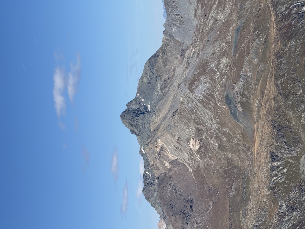
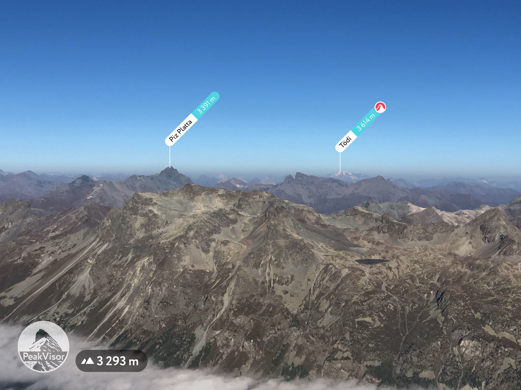
Piz Platta is the highest peak in the Oberhalbstein Alps. It is 3392 metres high (Source: Landeskarte der Schweiz no.1256 - 1991), and is notable for its similarity in shape to the Matterhorn. Piz Platta is located between the localities of Avers and Mulegns, both in the Swiss canton of Graubünden.
There's a demading hiking trail (T3) called Aufstieg Piz Platta leading to the summit.
By elevation Piz Platta is
# 52 out of 2797 in the Western Rhaetian Alps # 1 out of 195 in the Oberhalbstein Alps # 50 out of 2367 in Grisons # 3 out of 226 in Albula # 3 out of 202 in Parc Ela
By prominence Piz Platta is
# 7 out of 2797 in the Western Rhaetian Alps # 1 out of 195 in the Oberhalbstein Alps # 8 out of 2367 in Grisons # 3 out of 226 in Albula # 3 out of 202 in Parc Ela # 23 out of 10817 in Switzerland
We use GPS information embedded into the photo when it is available.
3D mountains overlay
Adjust mountain panorama to perfectly match your photos because recorded by camera photo position might be imprecise.
Move tool
Rotate tool
Zoom
More customization
Choose which peak labels should make into the final photo and what photo title should be.
Next
Photo Location
Satellitte
Flat map
Relief map
Latitude
Longitude
Altitude
OR
Latitude
°'''
Longitude
°'''
Apply
Register Peak
Peak Name
Latitude
Longitude
Altitude
Register
Teleport
PeakVisor
This 3D model of Sagarmatha National Park in Nepal was made using the PeakVisor app topographic data. The mobile app features higher precision models worldwide, more topographic details, and works offline. Download PeakVisor maps today.
Download OBJ model
PeakVisor
The download should start shortly. If you find it useful please consider supporting the PeakVisor app.
PeakVisor for iOS and Android
Be a superhero of outdoor navigation with state-of-the-art 3D maps and mountain identification in the palm of your hand!