Scan the QR code and open PeakVisor on your phone
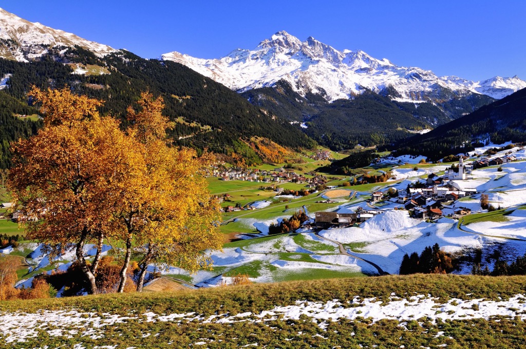
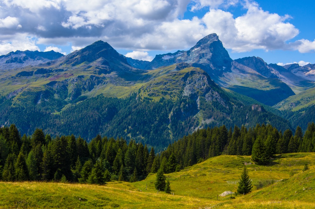
The Oberhalbstein Alps (Oberhalbsteiner Alpen), also known as the Platta Group or Avers Mountains, are a mountain range perched on the Swiss-Italian border. Home to over a dozen 3,000ers, they’re a hidden gem for hiking and ski tours. There are 197 named mountains in the Oberhalbstein Alps; the highest and most prominent is Piz Platta (3,391 m / 11,125 ft).
The Oberhalbstein Alps are a cross-border mountain range in southeastern Switzerland and northern Italy. It's the easternmost sub-group of the Eastern Alps and a part of the Western Rhaetian Alps. The range is almost entirely within the Swiss canton of Grisons (Graubünden).
Several other mountain chains encircle the Oberhalbstein Alps. The Splügenpass (2,114 m / 6,936 ft) separates the Oberhalbstein Alps from the Lepontine Alps to the west. At the eastern end of the Oberhalbstein Alps are the Albula Alps, with the Septimer Pass (2,310 m / 7,580 ft) serving as a boundary.
The Plessur Alps are north of the Oberhalbstein Alps, just across the Albula River. To the south, over the Italian border, is the Bernina Range near the Val Bregaglia.
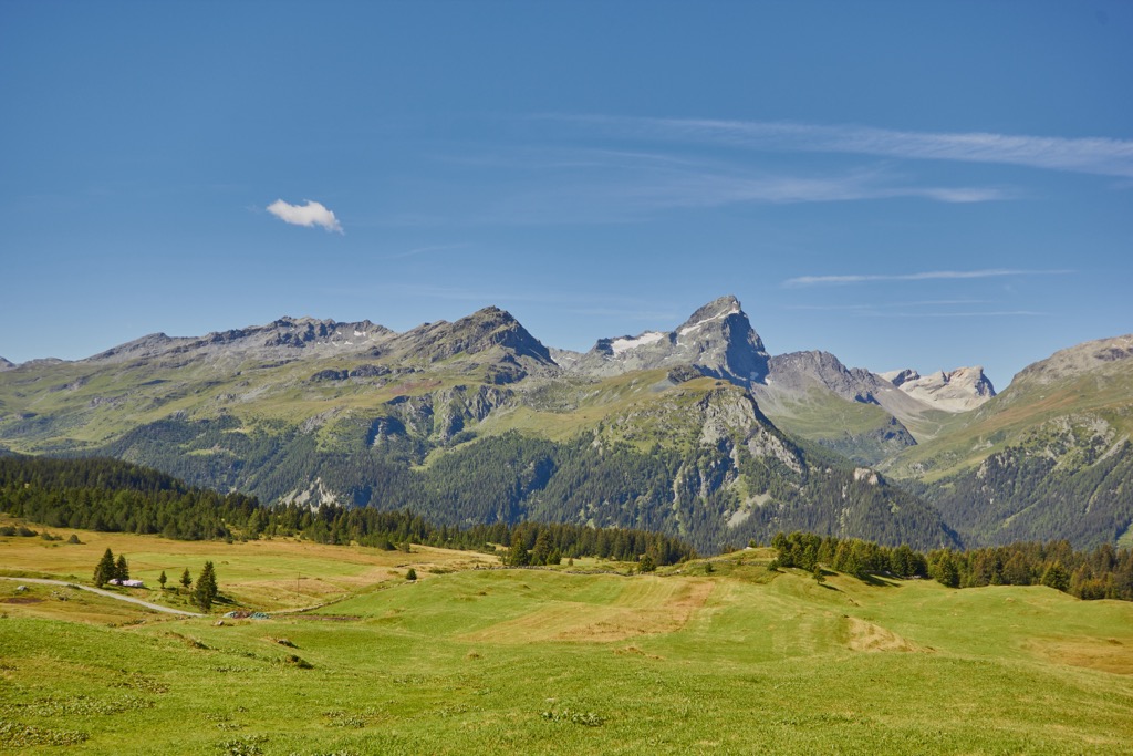
The Oberhalbstein Alps is a relatively compact Alpine mountain range with a latitudinal length of approximately 40 km (25 mi) between Thusis and Chiavienna. Pizz Gallagiun (Monte Galleggione) (3,107 m / 10,193 ft) and Piz Curvér (2,972 m / 9,750 ft) are the southernmost and northernmost significant summits, respectively.
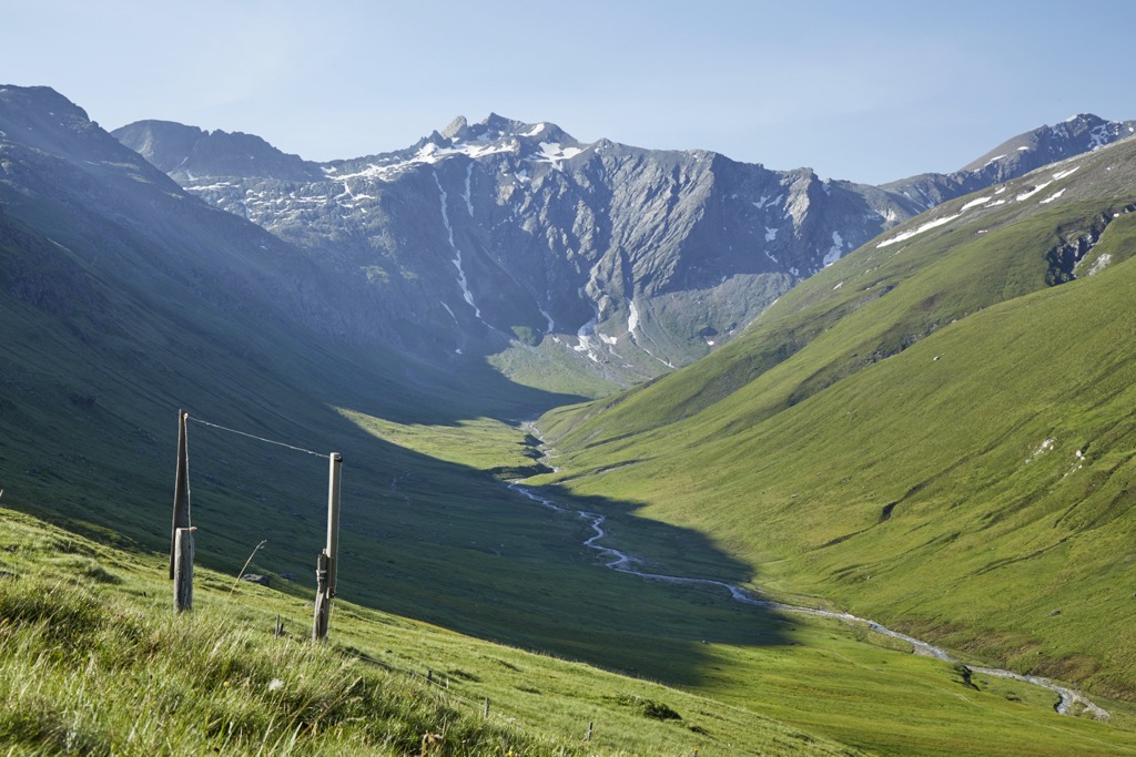
Several important rivers drain the Oberhalbstein Alps, including the Mera, Liro, Hinterrhein, and Gelgia. The Oberhalbstein Alps serve as one of the sources for the Rhine River, with many of its tributaries springing from within the range.
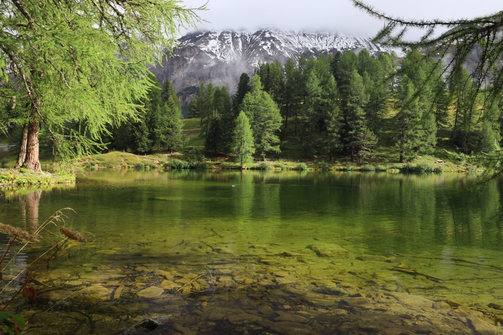
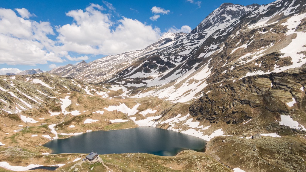
The Lago di Lei, a reservoir within the Valle di Lei, is the Oberhalbstein Alps' largest body of water, with a surface of approximately 4.1 sq km (1.5 sq mi).
One of the most famous settlements in the Platta Group is Juf, the highest year-round inhabited village in the Alps at 2,126 m (6,975 ft). Other notable settlements in the Oberhalbstein Alps include Sils im Domleschg, Andeer, and Splügen.
Several of the Oberhalbstein Alps' northeastern summits, including Piz Platta and Piz Toissa (2,657 m / 8,717 m), fall within the boundaries of Parc Ela, the largest nature park in Switzerland at nearly 600 sq km (231.5 sq mi). To the west of the Oberhalbstein Alps is Beverin Nature Park (Naturpark Beverin).
According to the German and Swiss Alpine Clubs (DAV, SAC), the Oberhalbstein Alps are split into twelve subdivisions.
Here's a list of the Oberhalbstein Alps' subdivisions as well as their highest summits:
The Oberhalbstein Alps are considered part of the Western Limestone Alps region of the Eastern Alps. Along with the rest of this extensive mountain range, the Oberhalbstein Alps formed due to the Alpine Orogeny.
The Alpine Orogeny is an ongoing mountain-building event that began approximately 66 million years ago during the Late Mesozoic Era. The African, Arabian, Indian, and Cimmerian tectonic plates to the south collided with the Eurasian Plate to the north.
The collision between these plates caused convergent movement, forming many prominent subranges across the Alps. Geologists consider the Alpine Orogeny one of the most influential orogenies in history, helping create many of the world's largest mountain ranges, including the Himalayas, the Atlas Mountains, and the Caucasus Mountains.
The Eastern Alps had a much drier climate than the Western Alps during the Würm glaciation, the last glacial period of the Alps. As a result, the Eastern Alps have a significantly higher number of endemic plant species than their Western counterpart.
As a part of the Western Limestone Alps, the Oberhalbstein Alps consist primarily of limestone. Marl, dolomite, and sandstone are also present. They differ from the Western Alps, which comprise crystalline rocks like granite, gneiss, and slate.
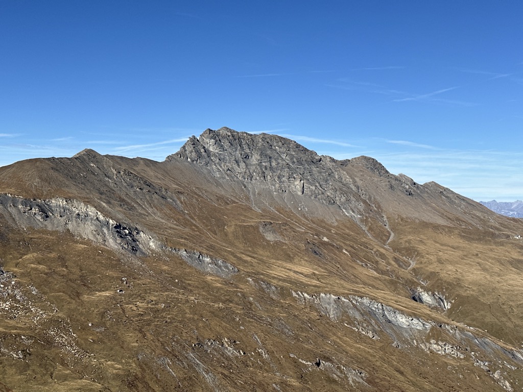
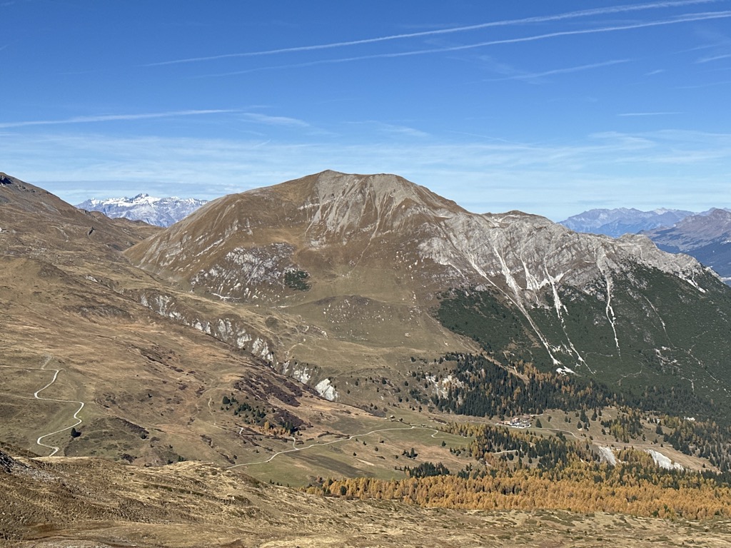
The Oberhalbstein Alps have a general elevation of between 2700 m (8,858 ft) and 3300 m (10,827 ft), making them slightly lower than the nearby Albula Alps.
The Alpine forests and snow-covered slopes of the Oberhalbstein Alps are a haven for many flora and fauna.
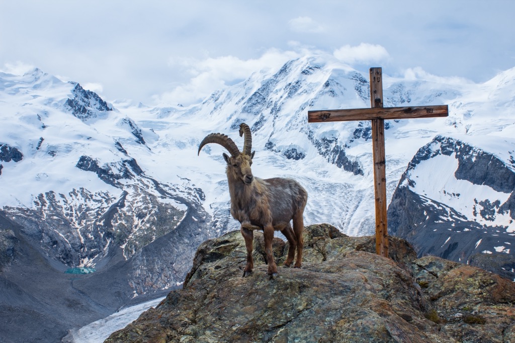
The region’s mountain specialists include ibex, chamois, and Alpine marmots. Other notable mammal species in the Oberhalbstein Alps include red deer, mountain hares, snow voles, and red foxes. Numerous bird species include golden eagles, bearded vultures, eagle owls, sparrow hawks, ptarmigans, and grouses.
There are two native venomous snake species in the Oberhalbstein Alps: the common European adder and the aspic viper. Aspic vipers are more dangerous but rare in the Oberhalbstein Alps, preferring the region's lower mountains and hills. Several reptile and amphibian species, like the Alpine salamander, are endemic to the Eastern Alps.
The Oberhalbstein Alps' lakes and rivers boast a wealth of aquatic life, with Lago di Lei home to a healthy trout population.
Approximately 4,500 vascular plant species grow across the Alps, around 8% of which are endemic. Most of the Oberhalbstein Alps' landscape consists of fields, forests, and alpine pastures.
The composition of the Oberhalbstein Alps' forests changes drastically depending on elevation.
In subalpine zones between 1,200 m (3,937 ft) and 1,400 m (4,593 ft), forests consist mainly of conifers and deciduous trees, such as oaks, beeches, and elms. Higher in the mountains, up to 2,200 m (7,217 ft) in elevation, hardier species such as larches and Arolla pines dominate the forests.
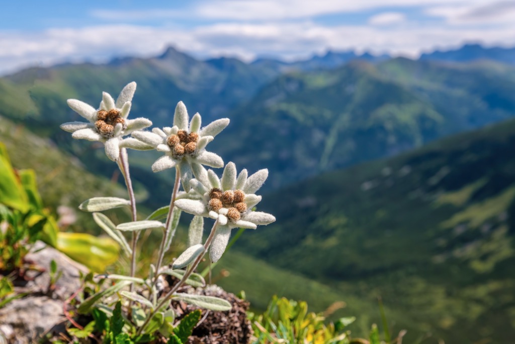
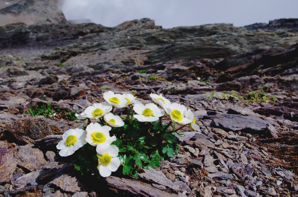
Forests give way to lush alpine pastures above the tree line. Mountain flowers thrive here, including rock jasmine, alpenroses, and Switzerland's national flower, edelweiss. The glacier buttercup is thought to be the highest-flowering plant in the Alps, with sightings at over 4,000 m (13,123 ft) in elevation.
The Oberhalbstein Alps share their early hiking history with much of the surrounding Central Eastern Alps. The first successful recorded attempt to reach Piz Platta's summit was on November 7, 1866, by Arnold Baltzer and Stephan Hartmann.
Baltzer and Hartmann summited Piz Platta during the silver age of alpinism between 1865 and 1882. During this era, many mountaineers, primarily British, attempted to scale the remaining significant peaks in the Alps not summited during the golden age of alpinism. Other notable mountains, like Dreiherrnspitze (3,499 m / 11,479 ft) and Monte Zebrù (3,735 m / 12,253 ft), were also summited for the first time in 1866.
However, it’s possible that the Oberhalbstein Alps region saw exploration and summit attempts far earlier than the mid-19th century.
The Splügenpass, which separates the Lepontine Alps and the Oberhalbstein Alps, reaches an elevation of over 2,100 m (6,889 ft) and has been used since the Roman era.
On the saddle between Piz Curvér and Piz Toissa is Ziteil, a Roman Catholic pilgrimage site dating back to the 16th century. At an elevation of 2,429 m (7,969 ft), Ziteil is believed to be the highest pilgrimage site in Europe.
The Oberhalbstein Alps' position on the Swiss-Italian border means it has a unique human history and some fascinating culture.
Like the rest of the Grisons, the Oberhalbstein Alps are home to a minority of Romansh speakers. At the start of the 19th century, around 50% of the Grisons' population spoke this Rhaetian language. Now, only around 60,000 Romansh speakers remain.
The Oberhalbstein Alps are not considered a popular area of the Eastern Alps. As a result, many mountains feature no marked paths and are very isolated.
Anyone hiking within the Oberhalbstein Alps should bring plenty of provisions and appropriate hiking gear. Check local weather forecasts, map out your route carefully, inform others of your itinerary, and bring a GPS device if necessary.
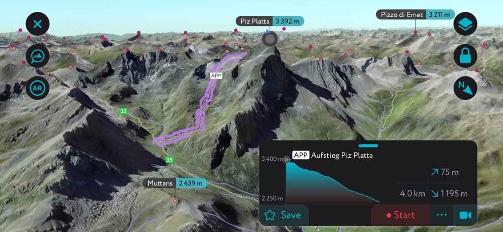
Piz Platta (3,391 m / 11,125 ft) is the roof of the Oberhalbstein Alps and the highest summit for over 11.5 km (7 mi) until Piz Calderas (3,397 m / 11,145 ft).
Piz Platta sits in the eastern Oberhalbstein Alps between the Julia and Avers valleys, roughly 5.5 km (3.4 mi) to the northeast of Juf. Its isolation and similarity to the Matterhorn (4,478 m / 14,692 ft) make it a must for experienced hikers visiting the Oberhalbstein Alps.
The standard route to Piz Platta in the summer is from Cresta in the Avers Valley (Averstal) to the southwest. The suggested route leads over the mountain's southeast flank, whose Vadret da Piz Platta (2,973 m / 9,753 ft) glacier has receded enough that you won't need ice climbing equipment in the summer.
Piz Platta is considered a T6 on the Swiss Alpine Club (SAC) hiking scale and involves a UIAA Grade I climb over Tälihorn (3,164 m / 10,380 ft) during your ascent.
From the Piz Platta's summit, you'll have breathtaking views stretching as far as the Bernese Alps and Pennine Alps. This walk is approximately 15.5 km (9.6 mi) out and back.

Piz Timun (Pizzo di Emet) (3,211 m / 10,534 ft) is the third-highest peak in the Oberhalbstein Alps and the highest summit on the eastern side of the Valle Spluga. It forms part of a 9 km (5.5 mi) long ridge from north to south, starting with Pizzo della Palù (3,179 m / 10,430 ft) and ending at Monte Mater (3022 m / 9,914 ft).
Piz Timun and its ridge are popular because of its panoramas of the Oberhalbstein Alps' largest lake, Lago di Lei. There are several ways to climb Piz Timun, the shortest of which is from the Rifugio Giovanni Bertacchi (2,175 m / 7,136 ft) near Lago di Emet (2,144 m / 7,037 ft). This challenging route involves a Grade II climb via the mountain's south and southwestern ridge. The out-and-back trail is approximately 6 km (3.7 mi) in length.
Gletscherhorn (3,107 m / 10,193 ft) is in the southeast of the Oberhalbstein Alps, on the edge of the Bergalgatal, a side valley of the 30 km (18.6 mi) long Averstal. The Bergalgatal is excellent for nature watching and is one of the largest marmot populations in the Alps.
Gletscherhorn is a pleasant day hike and makes for an excellent ski-touring destination in the spring. Its isolated location means you're unlikely to see many other people on your adventure.
The best route up Gletscherhorn is from Juppa near Juf to the mountain's north. From the Gletscherhorn's summit, you can spot Piz Duan just to the southeast and Pizz Gallagiun to the west; the out-and-back hike is approximately 15.3 km (9.5 mi) in length.
Pizzo Spadolazzo (2,722 m / 8,930 ft) is the most popular mountain in the Valle Spluga on the Italian side of the Oberhalbstein Alps. It's not a major summit, but its central position in the valley affords stunning views of surrounding peaks. You'll also find several picturesque glacial lakes in the region.
Pizzo Spadolazzo isn't a technical mountain, with the northern side the easiest to navigate, whether skiing or hiking. The eastern, western, and southern slopes feature huge rocks separated by narrow passages, which make it easy to get lost.
One of the best routes up Pizzo Spadolazzo is from the Lago di Montespluga (1,900 m / 6,234 ft) to the mountain's west. This route heads north around Lago Azzurro (2,428 m / 7,966 ft) before turning east and passing near Bivacco Suretta (2,752 m / 9,032 ft).
Descending south, you'll skirt along the northern shore of Lago di Emet (2,144 m / 7,037 ft) near Rifugio Giovanni Bertacchi (2,175 m / 7,136 ft) before returning to your starting point. This looped trail is approximately 16 km (10 mi) in length.
Piz Curvér (2,972 m / 9,750 ft) is one of the most popular mountains in the northern Oberhalbstein Alps. It's the highest summit in the range north of the Furcla Cotschna (2,514 m / 8,251 ft) pass. Piz Curvér is renowned for its beauty and appears in several of Giovanni Segantini's works, including The Bad Mothers.
On Piz Curvér's eastern flank is Ziteil, a 16th-century Roman Catholic pilgrimage site (reported to be the highest in Europe) related to an apparition of the Virgin Mary. Ziteil is popular with hikers and can be reached on a wide gravel path.
A popular route up Piz Curvér is from the Sars parking lot (Sars parkplatz) to the mountain's east. From Sars, the ascent of Piz Curvér is a T3/T4 graded hike and is a demanding walk. This walk is approximately 10 km (6 mi) out and back.
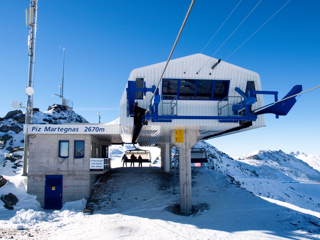
It's also possible to explore Piz Curvér on a ski tour from Station Martegnas just below the summit of Piz Martegnas (2,681 m / 8,796 ft). The tour leads north near the summit of Piz Curvér before descending to the village of Mon. This tour is approximately 13.5 km (8.3 mi) in length.
Piz Toissa (2,657 m / 8,717 m) is one of the best-developed mountains in the Oberhalbstein Alps. It features two marked alpine trails on its north and south sides. Additionally, Piz Toissa is popular due to its unusual summit. The summit resembles a collapsed crater rim, earning it the nickname the "Oberhalbstein Volcano."
Despite its appearance, Piz Toissa is a relatively easy climb due to its clear paths and gently sloping south side. One of the most popular routes up Piz Toissa is on a looped hike from Salouf to the mountain's east.
The route ascends from the south and descends to the north. Piz Toissa's summit provides one of the finest views of Parc Ela, with the likes of Piz Kesch (3,418 m / 11,214 ft), Piz Ela (3,339 m / 10,954 ft), and Piz Mitgel (3,159 m / 10,364 ft) visible. This looped hike is approximately 17 km (10.5 mi) in length.
The Oberhalbstein Alps are not among the Alps' most popular areas for winter sports. But, with over a dozen 3,000ers and several ski resorts, it's ideal for a skiing adventure off the beaten track.
Notable ski resorts in the Oberhalbstein Alps include:
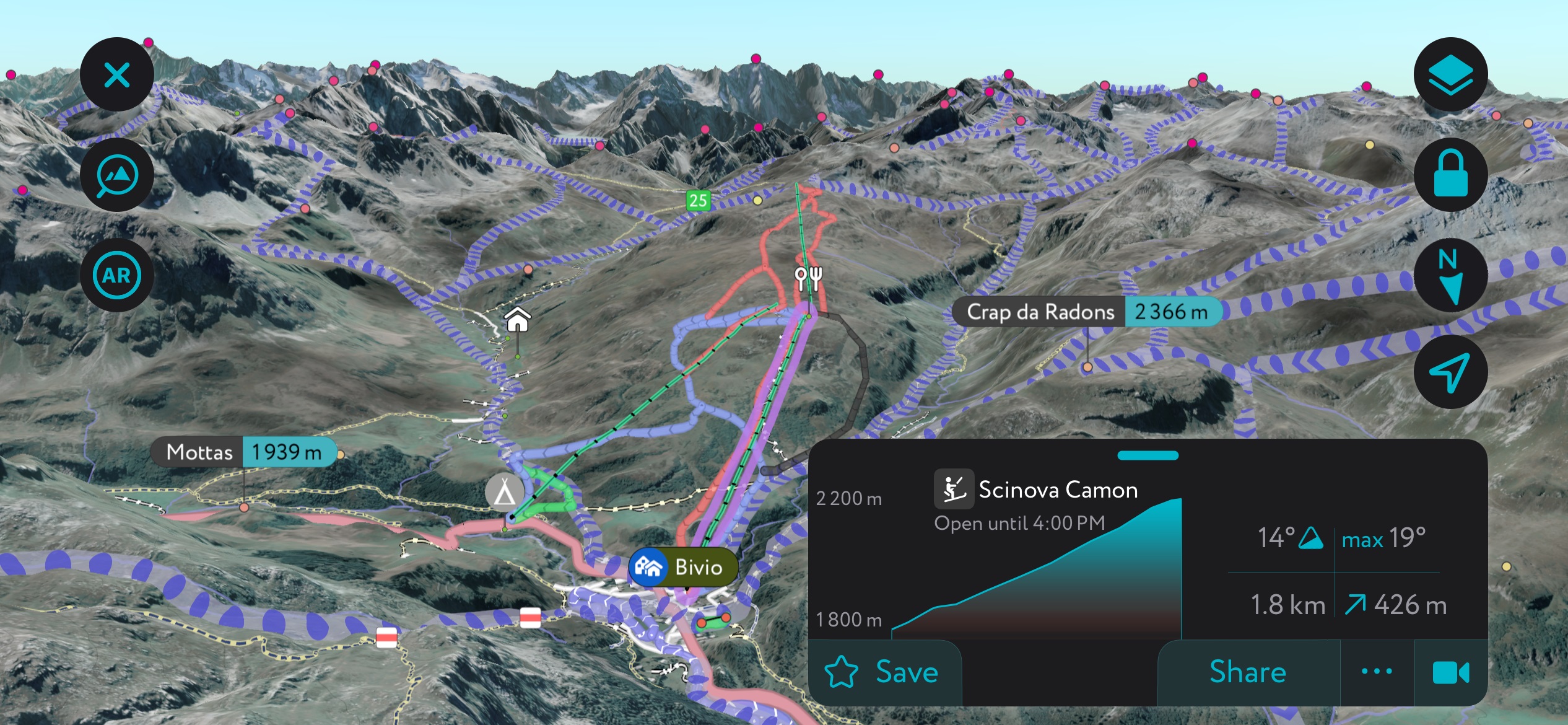
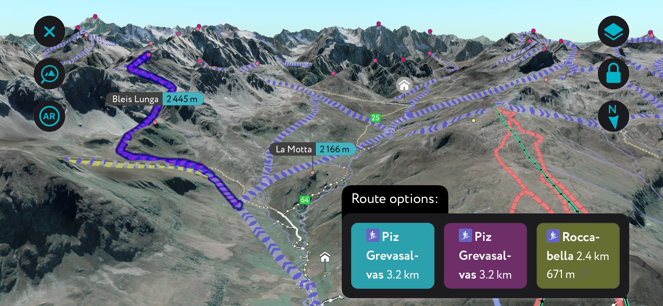
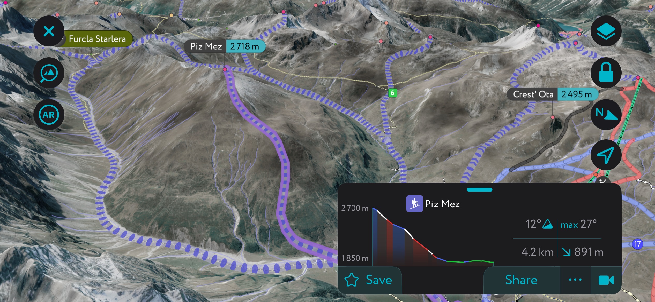
The PeakVisor Mobile app is an excellent tool for both resort skiing and touring in the Oberhalbstein region. Using winter mode, the app shows ski touring routes, as well as mountain huts and lifts at ski resorts, including timetables.
You'll find several charming Swiss alpine villages in and around the Oberhalbstein Alps, which make great bases to plan an unforgettable hiking adventure.
Chur is the nearest major town to the Oberhalbstein Alps, with over 35,000 people. Chur is the capital of the Grisons and is known for its unique culture due to the canton's trilingual identity. Locals in Chur speak Romansh, Italian, and Grisonian German.
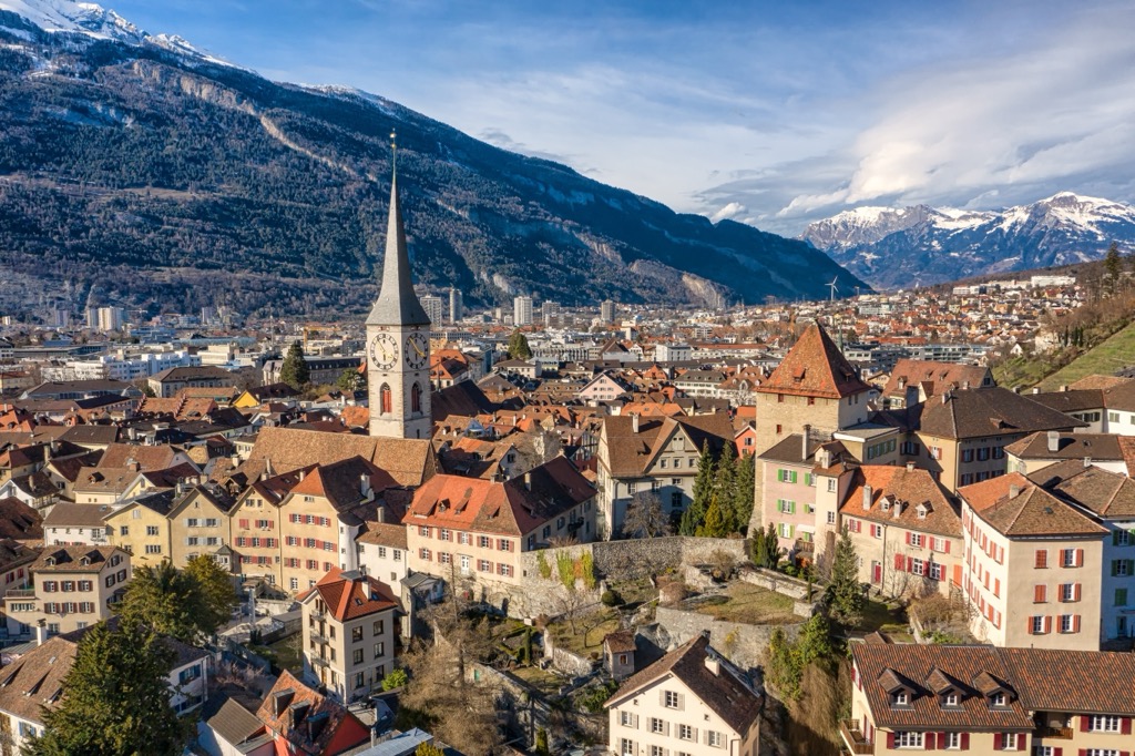
Chur is one of the oldest settlements in Switzerland, dating back over 5,000 years. Most of Chur's most prominent attractions are historical sites, such as the medieval Old City and Welschdörfli prehistoric settlement.
Chur is the perfect base for exploring the Oberhalbstein Alps, with Piz Curvér less than 40 km (25 mi) to the south. Chur is roughly 120 km (70 mi) from Zürich by train. The nearest international airport is Zürich Airport, located 130 km (80 mi) to the north.
Davos is another significant town close to the Oberhalbstein Alps. Originally a popular health resort, modern Davos is famous for hosting the annual World Economic Forum. It has a permanent population of over 10,000 people.
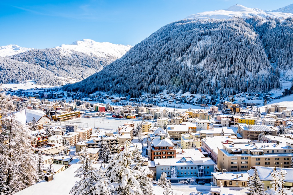
Davos' location within the Albula Alps makes it a population destination for winter sports and hiking. There are several ski areas in Davos, including Parsenn and Jakobshorn.
Davos is less than 50 km (31 mi) northwest of the Oberhalbstein Alps and is the perfect place to stay if you want to explore Parc Ela. Zürich Airport is the nearest international airport, located 160 km (99 mi) to the northwest.
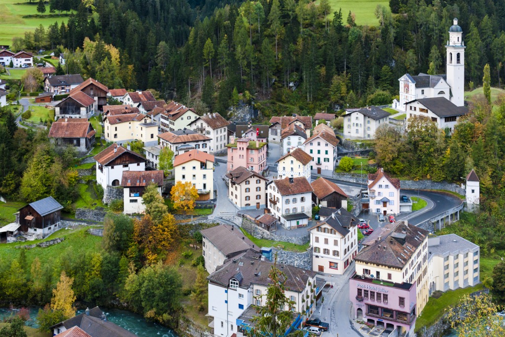
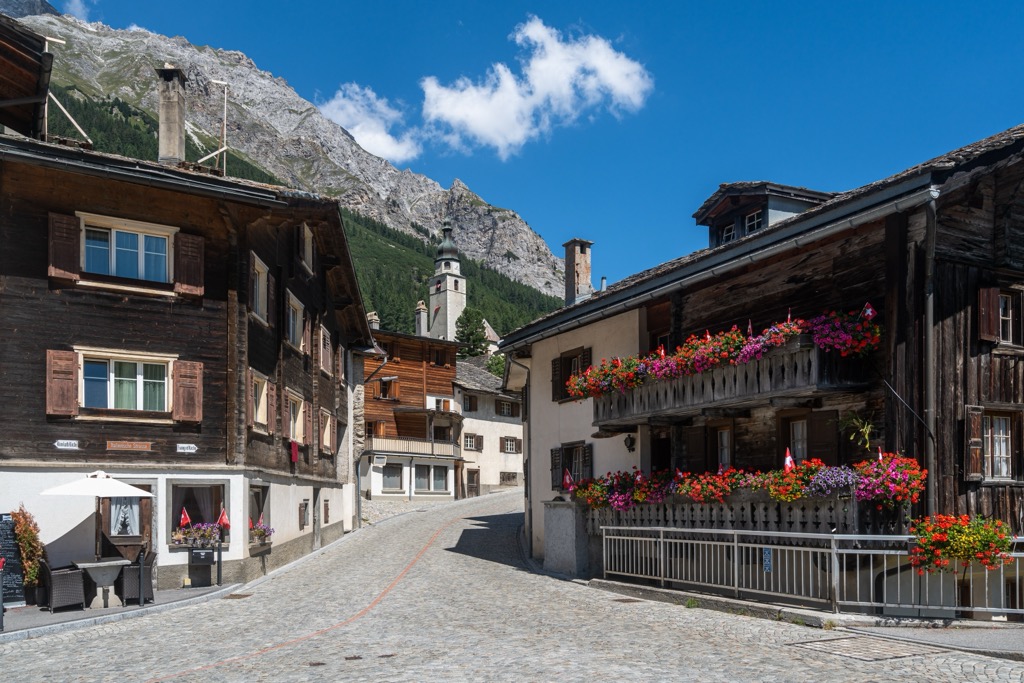
Sils im Domleschg is one of the largest settlements in the Oberhalbstein Alps. The village has a population of just over 940 people.
Sils im Domleschg sits on the northern edge of the Oberhalbstein Alps, less than 10 km (6 mi) from Piz Curvér. Despite its small size, Sils im Domleschg is home to some fascinating attractions, like the Carschenna petroglyphs and the ruins of the 11th-century Hohenrätien Castle.
The nearest international airport to Sils im Domleschg is Zürich Airport, located 170 km (105 mi) to the northwest.
Splügen isn't as large as other nearby villages like Andeer, but its position near the Splügenpass makes it one of the region's most popular tourist destinations.
Splügen sits between the Lepontine Alps and the Oberhalbstein Alps, with the Splügen-Tambo taking skiers into the mountains. It's also excellent for hiking, with Piz Por (3,028 m / 9,934 ft), Piz Timun, and Pizzo Tambo (3,279 m / 10,757 ft) within 10 km (6 mi) of the village.
Milan Malpensa Airport is the nearest international airport to Splügen, located 170 km (105 mi) to the south.