
Scan the QR code and open PeakVisor on your phone
Consisting of four countries, each with diverse and breathtaking landscapes to explore, the United Kingdom is an epic hiking destination. There are 35178 named mountains in the United Kingdom. The highest and most prominent mountain is Ben Nevis (1,345 m/4,411 ft).
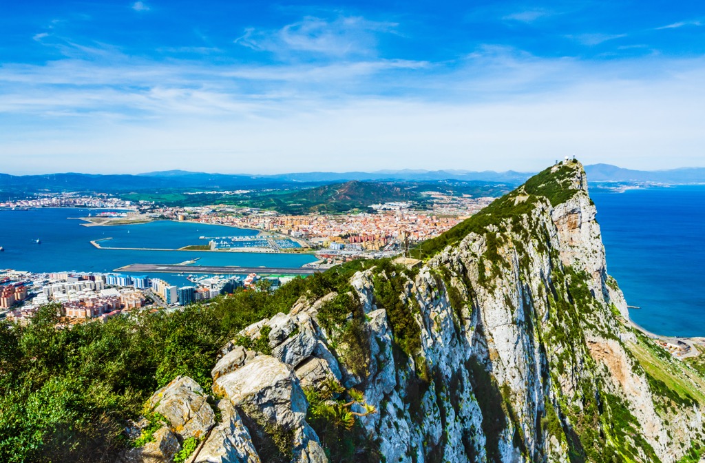
The United Kingdom of Great Britain and Northern Ireland, or the United Kingdom (U.K.), is a country located northwest of mainland Europe. It comprises four separate countries and covers an area of 93,628 sq mi (242,495 sq km).
The U.K. consists of England, Scotland, and Wales, which form the island of Great Britain, and Northern Ireland, which encompasses roughly 17% percent of the island of Ireland.
The island of Great Britain is the largest island in Europe and the ninth-largest island in the world. Great Britain is the third most-populated island in the world.
England is the largest country in Great Britain, encompassing the central and southern two-thirds of the island. England covers an area of approximately 50,301 sq mi (130,279 sq km), constituting 53 percent of the U.K.'s total landmass.
It's the closest country in the U.K. to mainland Europe, with the English Channel separating England from France by 21 mi (33 km). England borders Wales to the west and Scotland to the north.
Four bodies of water border England: the English Channel to the south, the North Sea to the east, and the Irish Sea and the Atlantic Ocean to the west.
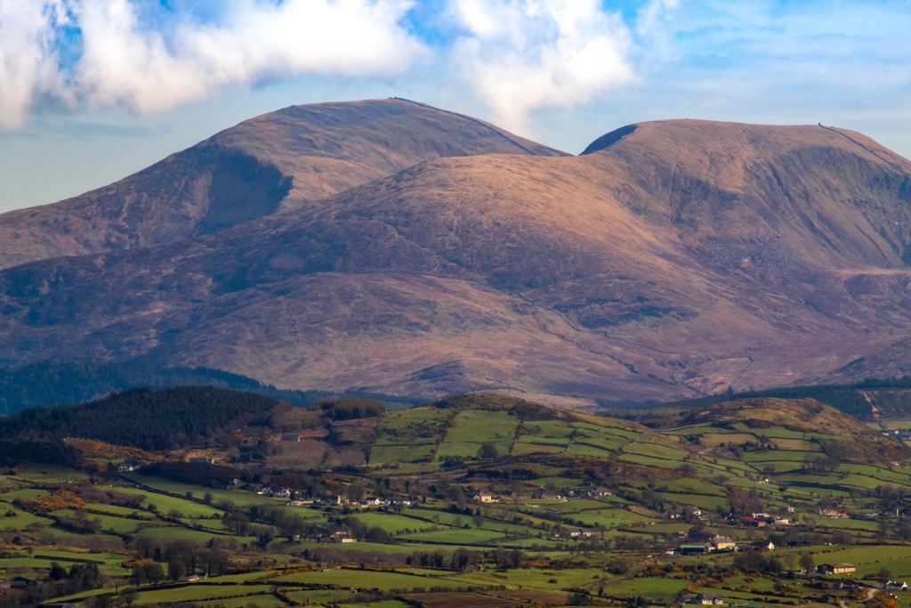
Grasslands, woodlands, and low hills characterize England's southern and central areas. England's landscape becomes increasingly hilly to the north.
The Pennines, a 268 mi (429 km) long mountain chain that stretches from the Anglo-Scottish border through the Peak District near Sheffield, is the largest upland area in England.
It's often described as the "backbone of England" and incorporates parts of several national parks, including the Peak District National Park, the Lake District National Park, and the Yorkshire Dales National Park.
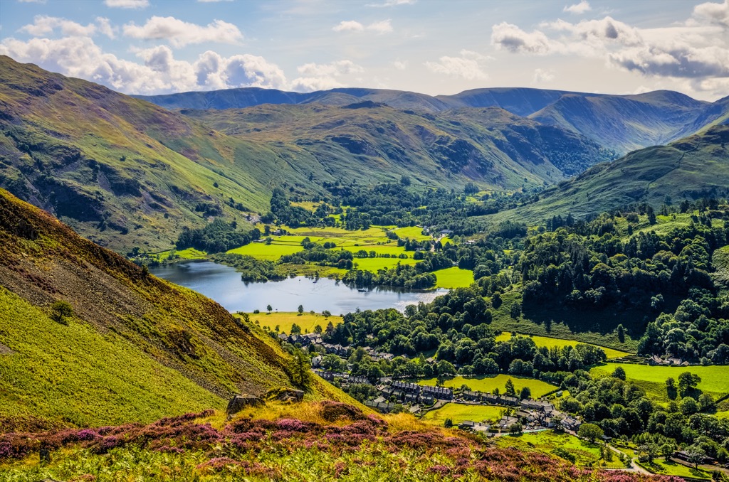
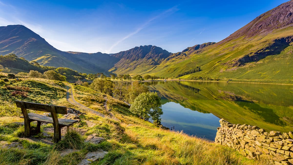
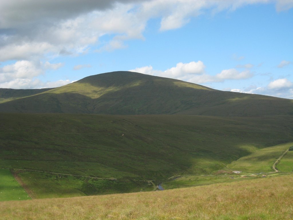
The Lake District is the most mountainous area of England. It contains Scafell Pike (978 m/3,208 ft), the highest mountain in England. This beautiful region of England also contains the country's largest lake, Windermere, which covers an area of 6 sq mi (16 sq km).
There are over 6,000 islands in the British Isles, many of which form a part of England. The largest island of the English mainland is the Isle of Wight, which encompasses an area of 148 sq mi (384 km2) and is located approximately 5 mi (8 km) off the coast of Hampshire.
The longest river solely in England is the River Thames, with a length of 215 mi (346 km). The River Severn, which runs through Wales and England, is the longest river in the U.K., with a length of 220 mi (354 km). Other significant rivers in England include the River Trent, River Wye, and River Great Ouse.
There are 10 national parks in England and 34 Areas of Outstanding Natural Beauty (AONBs) in England. The largest national park in England is Lake District National Park which covers an area of 911 sq mi (2,362 sq km). The largest AONB in England is the Cotswolds AONB which covers an area of 790 sq mi (2,038 sq km).
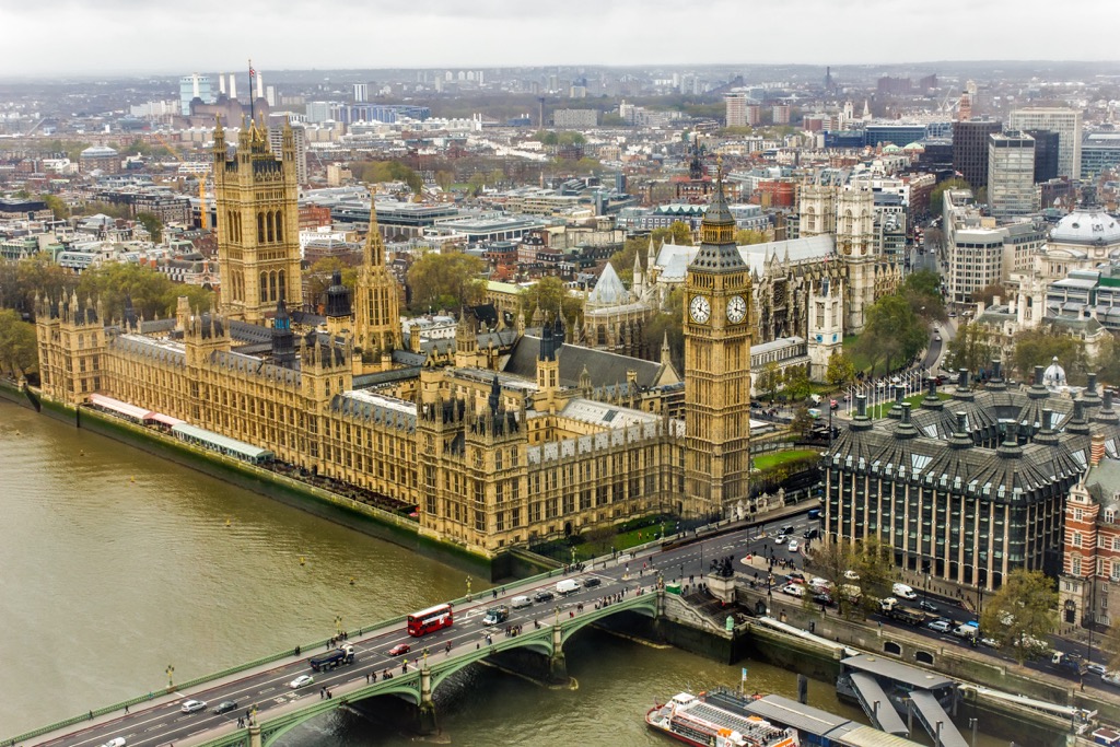
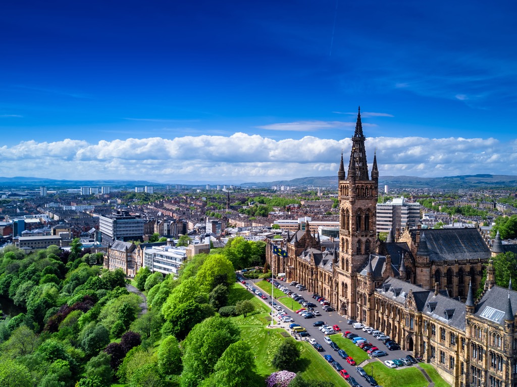
London is the capital of England and the largest city in the U.K. Other notable cities in England include Birmingham, Liverpool, Bristol, and Manchester.
Scotland (Alba) encompasses the northern third of Great Britain with an area of 30,090 sq mi (77,900 sq km), constituting roughly 32 percent of the U.K.’s total landmass.
Scotland’s only land border is with England to the south. Two bodies of water border Scotland: the Atlantic Ocean to the west and the North Sea to the east.
Scotland can be separated into two distinct regions on either side of the Highland Boundary Fault: the Highlands (a' Ghàidhealtachd) to the north and the Lowlands (a' Ghalldachd) to the south. Scotland's landscape is diverse, consisting mainly of moorlands, forests, rolling lowlands, dramatic mountains, lochs, and glens.
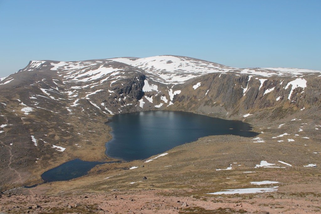
The Scottish Highlands are the most mountainous area in the U.K. The Highlands feature the Grampian Mountains (Am Monadh), the largest mountain range in the U.K.
The Great Glen (An Gleann Mòr), a 62 mi (100 km) long valley, separates the Grampian Mountains to the south from the Northwest Highlands. In the western Highlands is Ben Nevis (Beinn Nibheis) (1,345 m/4,411 ft), the highest mountain in the U.K.
The Highlands contain both Scotland's national parks. Cairngorms National Park (Pàirc Nàiseanta a' Mhonaidh Ruaidh) is the largest national park in the U.K., and Loch Lomond and The Trossachs National Park (Pàirc Nàiseanta Loch Laomainn is nan Tròisichean) sits on the Highland's southern boundary.
The Scottish Lowlands are less mountainous than the Highlands but are by no means flat, with Merrick (A' Mhearag) (843 m/2,765 ft) in the Galloway Hills, the highest point in the region. The Scottish Lowlands are generally split into two areas: Southern Uplands to the north and the Central Lowlands to the south.
The longest river in Scotland is the River Tay (Tatha). At 120 mi (193 km) long, the River Tay is the seventh-longest river in the U.K. Other notable rivers in Scotland include River Clyde (Abhainn Chluaidh), River Spey (Uisge Spè), River Tweed (Abhainn Thuaidh), and River Dee (Uisge Dhè).
Freshwater bodies of water in Scotland are called lochs. The largest loch in Scotland is Loch Lomond (Loch Laomainn), with an area of 27 sq mi (70 sq km). Other significant lochs include Loch Ness (Loch Nis), Loch Awe (Loch Obha), and Loch Maree (Loch Ma-ruibhe).
Scotland has over 900 islands, the largest of which is Lewis and Harris (Leòdhas agus na Hearadh), with an area of 860 sq mi (2,200 sq km).
Three main island groups are located to the north and west of Scotland: the Shetlands, Orkney, and Hebrides (Innse Gall). The Cuillin on the Isle of Skye (An t-Eilean Sgitheanach) is the largest mountain range not on the Scottish mainland.
Glasgow (Glaschu) is the largest city in Scotland, while Edinburgh (Dùn Èideann) is the country's capital. Other settlements in Scotland include Aberdeen (Obar Dheathain), Dundee (Dùn Dè), Paisley (Pàislig), and Inverness (Inbhir Nis).
Wales (Cymru) occupies the western central area of Great Britain. It covers an area of approximately 8,024 sq mi (20,782 sq km), constituting roughly 8.35 percent of the U.K.’s total landmass.
Wales' only land border is with England to the east. Wales borders two bodies of water: the Irish Sea to the west and the Bristol Channel to the south.
Wales is largely mountainous and rural. The country's landscape is defined by deep valleys, forests, moorlands, and rugged mountains. The Cambrian Mountains (Mynyddoedd Cambria), a series of mountain ranges that run in a northwest to southeast trend, occupy most of central Wales.
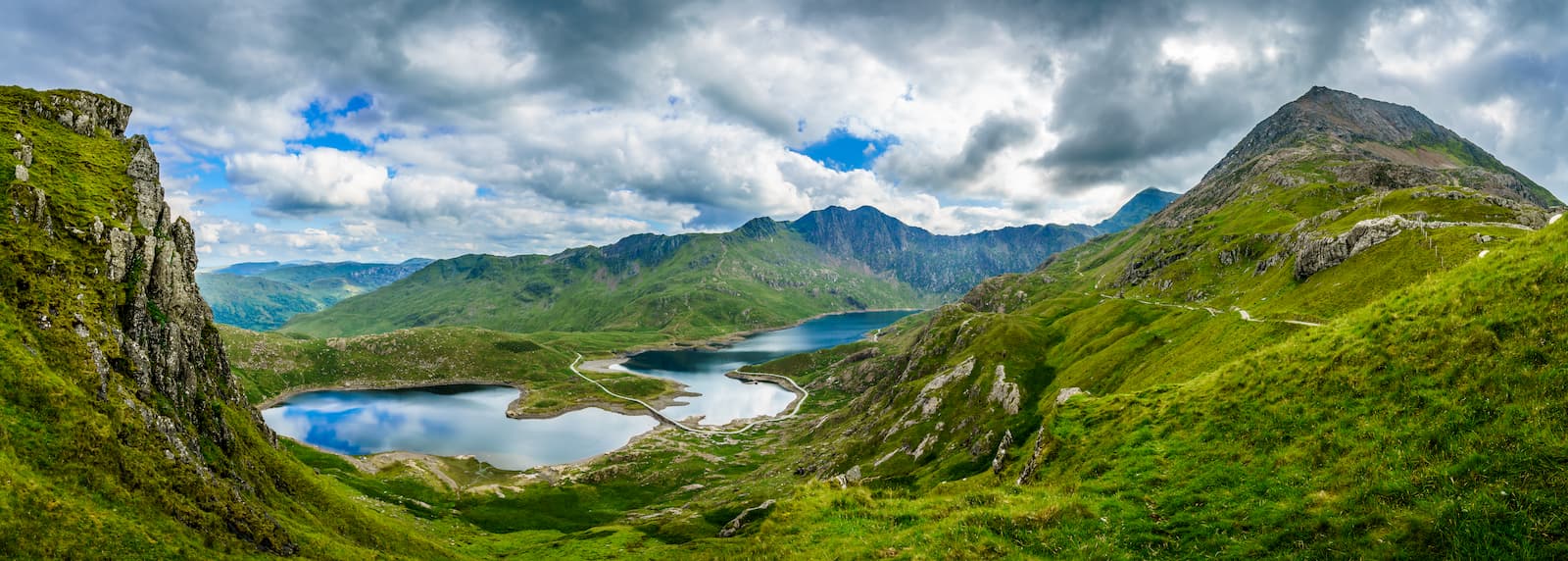
At the far northern end of the Cambrian Mountains is Eryri (Snowdonia), a mountain range that contains Wales' highest summit, Yr Wyddfa (Snowdon) (1,085 m/3,560 ft).
There are 15 mountains in Eryri over 3,000 m (9,842 ft) in elevation, known collectively as the Wales 3000s. Eryri is a part of the largest of Wales' three national parks, Snowdonia National Park (Parc Cenedlaethol Eryri).
To the south of Eryri are several minor ranges, including the Berwyn Mountains (Y Berwyn) and Cadair Idris. In northeast Wales, between the Clwyd Valley (Afon Clwyd) and the Dee Estuary, is the Clwydian Range.
At the southern end of the Cambrian Mountains is the Brecon Beacons (Bannau Brycheiniog). The Brecon Beacons is a mountain range that contains Pen y Fan (886 m/2,907 ft), the highest mountain in South Wales.
The Brecon Beacons form part of the Brecon Beacons National Park (Parc Cenedlaethol Bannau Brycheiniog). Other mountain ranges in the park include the Black Mountains (Y Mynyddoedd Duon) and, confusingly, Black Mountain, which lies further to the west.
The lowlands of Wales are located on the northern coastal plains near Anglesey, Wales' biggest island.
The main rivers in Wales are the River Dee (Afon Dyfrdwy) and River Conwy (Afon Conwy), which form natural borders with England to the north and south, respectively. Bala Lake (Llyn Tegid) is the largest lake in Wales, with a total area of 1.8 sq mi (4.8 sq km).
The capital and largest city in Wales is Cardiff. Other notable settlements include Swansea, Newport, and Wrexham.
Northern Ireland (Tuaisceart Éireann) is a country in the U.K. occupying the northeastern six counties of Ireland. Northern Ireland covers an area of approximately 5,460 sq mi (14,130 sq km), constituting about 5.7 percent of the U.K.'s total landmass.
Northern Ireland is a mixture of low-lying grasslands, swamps, and uplands. Northern Ireland is the least forested area in Europe — only around 8 percent of the country is forested.
The largest upland areas in Northern Ireland are the Sperrins (Speirín) in the northwest and the Morne Mountains in the southeast. Slieve Donard (Sliabh Dónairt) (850 m/2,790 ft) in the Mourne Mountains (Beanna Boirche) is the highest mountain in Northern Ireland.
One of the defining features of Northern Ireland is Lough Neagh. With a surface area of 151 sq mi (392 sq km), Lough Neagh is the largest freshwater lake in the whole of Britain and Ireland.
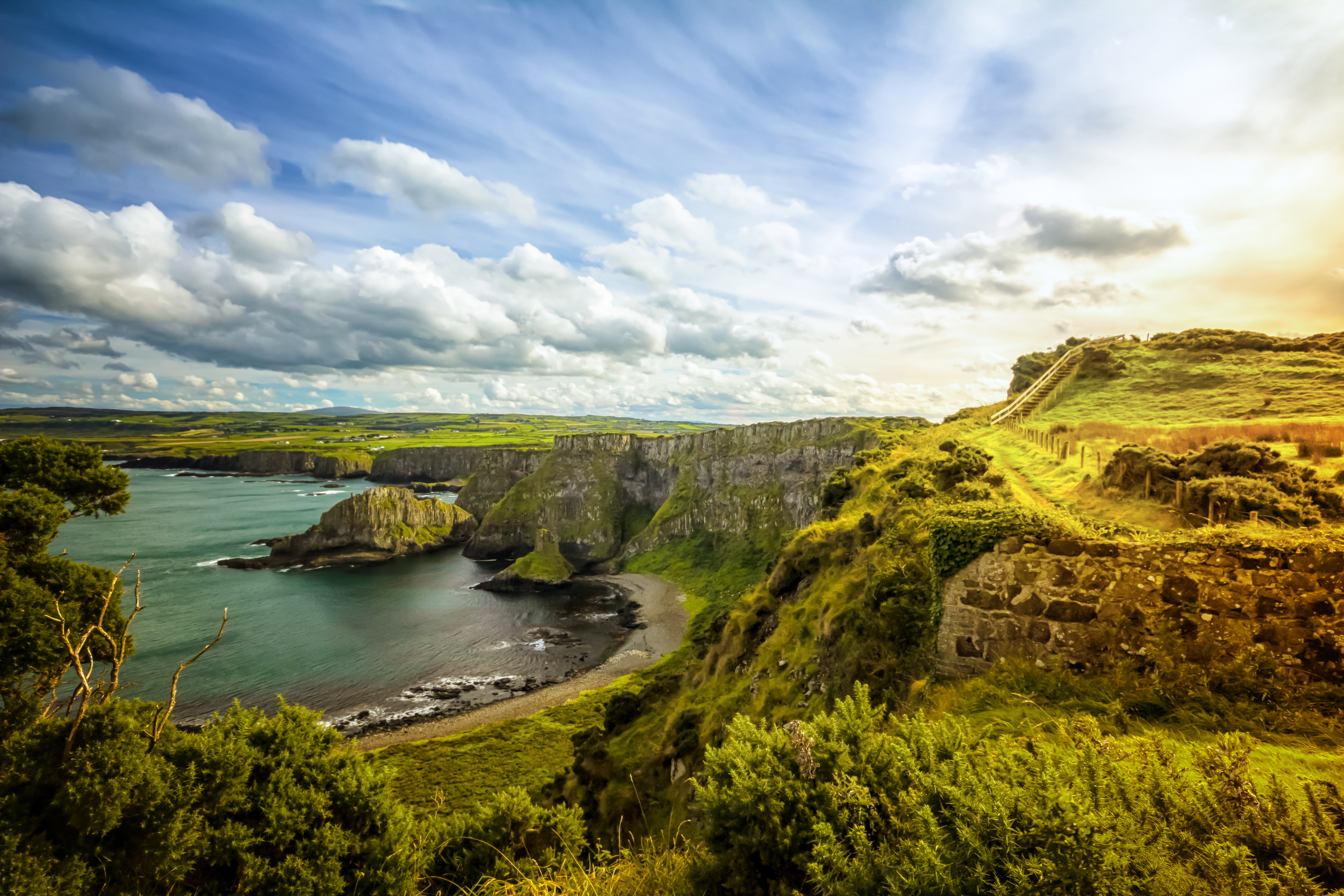
Another famous natural feature of Northern Ireland is the Giant's Causeway, one of the great natural wonders of the United Kingdom. The Giant's Causeway is composed of roughly 40,000 basalt columns on the northern coastline of Co. Antrim.
The River Bann (An Bhanna), which springs from Slieve Muck (Sliabh Muc) (670 m/2,199 ft) and flows through Lough Neagh, is the longest river in Northern Ireland at 80 mi (129 km) in length.
Northern Ireland’s capital, Belfast (Béal Feirste), is the country’s largest city. Other notable settlements include Derry (Londonderry), Ballymena (Baile Meánach), and Coleraine (Cúil Rathain).
Great Britain and Ireland have a complex and long geological history, with the oldest rocks in Northern Ireland dating back over 1.7 billion years ago. Read on to learn more about the United Kingdom's geology.
The oldest rocks in Great Britain is Lewisian gneiss, which dates back around 4,600 million years to the Archean Eon. Lewisian gneiss can be found in Scotland and on the Hebrides.
During the Proterozoic Eon, Great Britain was split in two, with Scotland a part of the supercontinent Laurentia and the rest of the island a part of Gondwana. At this time, England and Wales were near a subduction zone and submerged below a shallow ocean dotted with volcanic islands.
The Cadomian Orogeny, a mountain-building event, transformed large parts of western Europe into a mountainous landscape, including England and Wales.
Around 500 million years ago, during the Cambrian period, rising sea levels eroded these mountains, creating sediment on the seafloor. The evolution of shelled creatures and fauna during this period increased the number of fossils found in rocks in later geological eras.
By 440 million years ago, England and Wales had broken away from Gondwana, separating itself from North America. Evidence of volcanic activity in Wales at this time can still be seen at Rhobell Fawr (734 m/2,408 ft) and in the Lake District.
In the Silurian period, the Caledonian Orogeny created large mountain ranges across northern England caused by the closure of the Iapetus Ocean and the collision of Laurentia, Baltica, and Avalonia. At this time, Baltica and Avalonia collided, adjoining Scotland to England and Wales.
This collision continued in the Devonian period, uplifting volcanic deposits which can now be found in Ben Nevis. Fluctuating sea levels and shifting coastlines caused erosion and the deposition of sedimentary rocks in coastal areas.

The Devonian period takes its name from Devon, a coastal county in southwest England, which was formed during these geological events. Sedimentary rocks from the Devonian can be found across Great Britain, including the Brecon Beacons and the Central Lowlands of Scotland.
The Carboniferous period was important to the geological formation of Great Britain. Great Britain lay under the warm shallow Rheic Ocean near the equator. Carboniferous limestone followed by shales, siltstones, and Millstone Grit were deposited in the Mendips, Peak District, Pennines, and southern Scotland.
The Variscan Orogeny greatly changed southwestern England, folding the land and exposing copper and tin deposits in Cornwall. The Variscan Orogeny ended in the formation of the supercontinent Pangea.
Pangea drifted away from the equator by the start of the Triassic period roughly 250 million years ago. New Red Sandstone, formed from beds of red mudstones and sandstones, was eroded from southern France and deposited across central England.
At the start of the Jurassic period, Pangea began to break up, with Great Britain drifting on Eurasian Plate by 30 to 40 degrees to the north. Rising sea levels meant Great Britain was underwater again, with sedimentary rock deposited. Evidence of this is visible in outcrops in Yorkshire and Dorset.
By the Cretaceous period, the final period of the Mesozoic Era, sedimentation had retreated across most of Great Britain. Stratas of the Wealden Group and Purbeck confined to the Wessex and Weald basins.
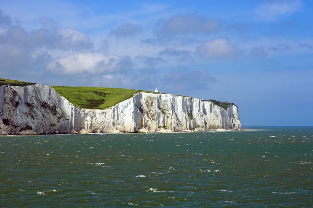
The Aptian age saw flooding in most of southern England, with deposits of Upper and Lower Greensand, as well as Gault Formations. During the Late Cretaceous, around 100 million years, the Chalk Group formed across most of Great Britain, notably at the White Cliffs of Dover.
At the start of the Cenozoic Era about 50 million years ago, the Alpine Orogeny led to the formation of several major hill ranges in England, such as the Chilterns, North Downs, and South Downs.
Around this time, the North Sea and the English Channel began to form, and Great Britain was subjected to tectonic uplift. The Neogene Period, roughly 20 million years ago, saw Great Britain's climate start to change, becoming cooler and drier.
Glaciation dominated the beginning of the Quaternary Period, with ice 1,000 m (3,280 ft) deep covering parts of southern England during the Anglian Glaciation.
Some of the earliest human evidence in England dates from just after the Anglian Glaciation. Glaciation between 350,000 to 100,000 years ago helped form many major valleys across Great Britain, including the Wye Valley and Usk Valley.
Northern Ireland has an equally complex geological history to Great Britain. Geologists have found it difficult to correctly identify rock sequences in the region due to early glaciation and tectonic upheavals.
Like Great Britain, Ireland was split in two during its early existence. At the end of the Precambrian, one half was a part of Laurentia, while the other was part of Avalonia. Both halves lay under the sea at this time.
The two halves of Ireland slowly moved together, eventually meeting around 440 million years ago. Many of the mountains in northwestern Ireland were formed during the collision, and the island was raised above sea level.
As with much of Europe, Ireland sank back below a shallow tropical sea around 300 million years ago. It was during this period that limestone, which is found across over 65 percent of Ireland, was formed.
Around 60 million years ago, Ireland was subjected to volcanic activity. This activity resulted in the formation of the Mourne Mountains. Brown coal formed in deposits near Lough Neagh due to vegetation from the Antrim Depression.
Glaciation across Ireland around 2 million years ago resulted in the formation of some of Ireland's most famous valleys, like Glendalough in Co. Wicklow.
The basement rocks of Northern Ireland can be split into four distinct areas, with each rock type only appearing in its specific quadrant.
Large areas of Co. Antrim and Antrim Plateau are composed of basalt lava and sedimentary rocks from the Palaeogene. Co. Derry (Londonderry). Most of the northwest of Northern Ireland is made up of Dalradian rocks, as well as intrusions from the Ordovician Tyrone Igneous Complex and Ordovician-early Silurian Pomeroy Inlier.
Co. Fermanagh and Co. Tyrone in the southwest are composed mainly of Carboniferous and Devonian rocks. Co. Armagh and Co. Down in the southeast are mainly Ordovician and Silurian rocks.
With its complex geological history, the U.K. has diverse topography, ranging from heathlands in southern England to the craggy Highlands of Scotland. Many of the highest mountains in the U.K. are located in northern England, Scotland, and northern Wales.
Aside from the highest summits in each of the four countries of the U.K., notable mountains include Ben Macdui (Beinn MacDuibh) (1,309 m/4294 ft), Helvellyn (950 m/3,116 ft), Carnedd Llewelyn (1,064 m/3,490 ft), and Sawel Mountain (Samhail Phite Méabha) (678 m/ 2,224 ft).
The U.K. is very biodiverse, with over 70,000 known flora, fauna, and microorganism species across the country. Read on to learn about the U.K.'s wildlife.
Large mammals are uncommon in the U.K. Many large mammal species, such as bears, wolves, reindeer, and boar, are extinct in the U.K.
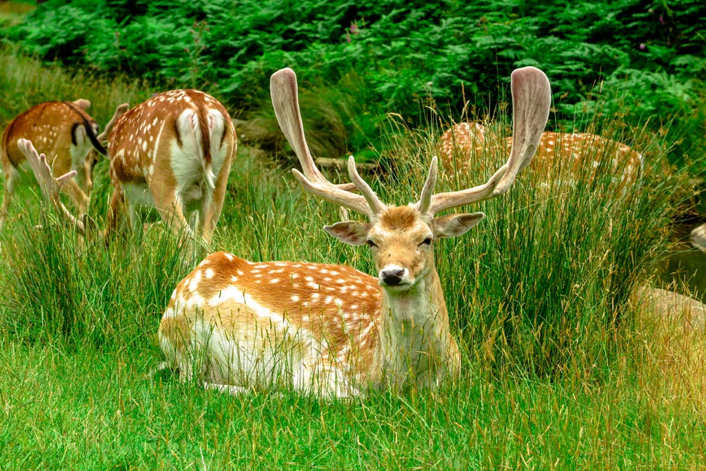
The largest mammal that inhabits the country is the red deer which is common across England, Wales, and Scotland. Other deer species are also present, including fallow deer, roe deer, and sika deer.
Some carnivorous mammals can be found across the U.K., including red foxes, pine martens, otters, and European badgers. One of the rarest mammals in Great Britain is the Scottish wildcat, which is limited to northern and eastern Scotland.
Other significant mammal species in the U.K. include grey squirrels, red squirrels, hedgehogs, pygmy shrews, and European rabbits.
The concentration of bird species in the U.K. is similar to mainland Europe but with fewer breeding species. Approximately 250 bird species are regularly recorded in Great Britain. Ireland is a popular stopping point for many migratory birds, with 400 bird species recorded across the island.
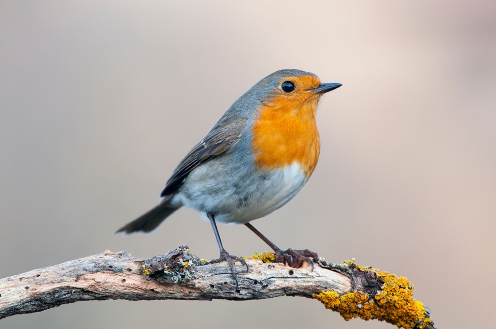
Notable birds of prey include buzzards, golden eagles, sparrowhawks, and red kites. Other common species include wood pigeons, robins, house sparrows, and starlings. The robin is considered the national bird of Britain.
Reptile and amphibian species are limited across the U.K. In fact, Northern Ireland is home to just one reptile species and one amphibian species: the viviparous lizard and smooth newt. There are no snakes in Ireland. The only venomous snake found in Great Britain is the European adder.
Other reptile species in Great Britain include grass snakes, slowworms, and land lizards. Notable amphibians in Great Britain include pond frogs, great crested newts, and common toads.
Insects are the most numerous fauna in the U.K., with over 20,000 species in Great Britain alone. Notable insect species include stag beetles, emperor dragonflies, common blue butterflies, and painted lady butterflies.
Northern Ireland is home to rare insect species absent from the rest of the U.K., such as Irish damselflies, whirligig beetles, and marsh fritillary butterflies.
U.K.'s rivers are home to numerous freshwater species, including perch, pikes, salmon, carp, and bream. Northern Ireland has only 11 freshwater fish species, some of which are genetically different from the rest of the U.K. One example is the Irish pollan, which inhabits Lough Neagh.
The U.K. is heavily forested, with woodlands covering an area of over 5,444 sq mi (14,100 sq km) across the four countries. This statistic is despite Northern Ireland being one of the least forested countries in Europe.
The most common trees in the U.K. are alders, beeches, English oaks, hawthorns, silver birches, hollies, and hazels. The largest forest areas in the U.K. are in northeastern Scotland, Gwynedd in Wales, Northumberland, Sussex, and Norfolk.
Moorland and heathlands carpet approximately 25 percent of the U.K. Common vegetation in these areas includes heather, bell heather, peat moss, and bilberry.
Throughout the year, vibrant wildflowers bloom across the U.K. Some of the most famous wildflowers that grow in the U.K. include bluebells, foxgloves, daisies, lilies of the valley, and pyramidal orchids.

Other examples include corncockles, wood anemones, columbines, cornflowers, and welsh poppies.
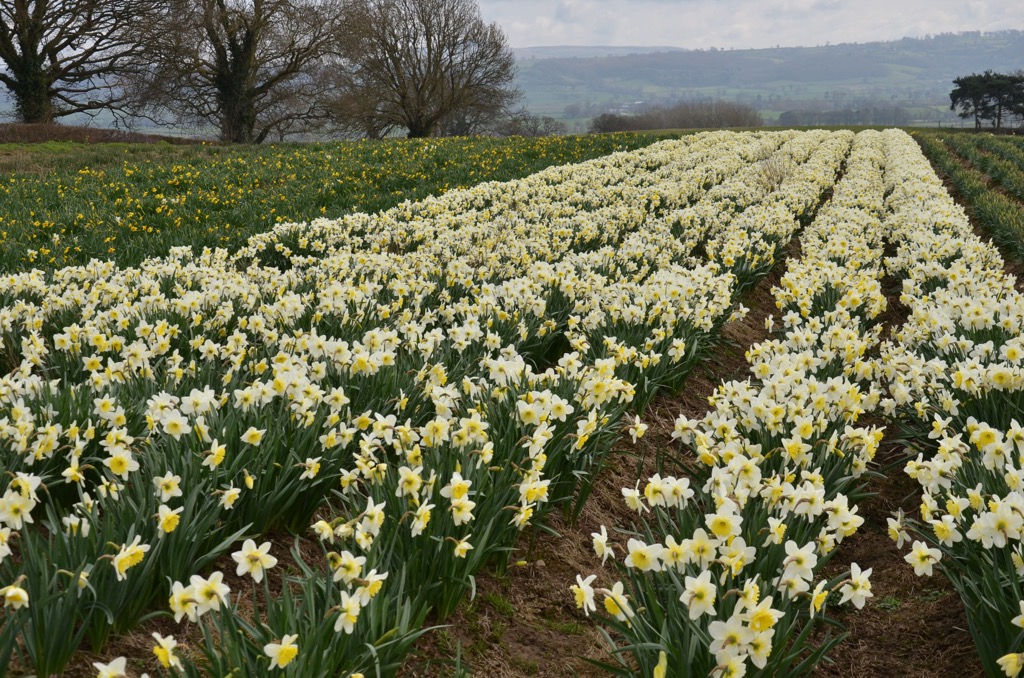
The rose is England's national flower and the country's most popular cultivated flower. The daffodil is the national flower of Wales, while the shamrock is Northern Ireland's national flower. The thistle is the national flower of Scotland.
Great Britain's earliest human remains date back 500,000 years and belonged to a six-foot-tall Homo heidelbergensis.
Evidence of human inhabitants of Great Britain dates back 900,000 years when archeologists uncovered flint tools near Happisburgh in Norfolk.
By contrast, archeologists believe humans settled in Ireland much later, around 10,000 years ago.
Read on to learn how England, Scotland, Wales, and Northern Ireland came to be the United Kingdom.
Great Britain was formed in 1707 when the Kingdom of England, which included Wales, was combined with the Kingdom of Scotland. This union, known as the Treaty of Union, began at the end of the Tudor dynasty, with James VI of Scotland becoming the king of England.
As the son of Mary, Queen of Scots, and cousin of the previous English monarch, Queen Elizabeth I, James VI (known as James I in the Kingdoms of England and Ireland) became monarch of both kingdoms, leading to a personal union between the two.
Despite attempts at forming Great Britain failing in 1606, 1667, and 1689, terms of the treaty were eventually agreed upon in 1706 under Queen Anne. The Treaty of Union took political effect in 1707.
Despite being joined in union, parts of England and Scotland's institutions differed; for example, education and the state church.
Following the expansion of the British Empire, Great Britain set out to create another legislative union with the Kingdom of Ireland. The treaty, which was enacted on 1 January 1801, joined the Kingdom of Ireland with Great Britain.
The bill to unite the two kingdoms passed easily due to Protestant Ascendancy and a lack of Catholic representation. Politicians also bribed opponents with peerages and honors to sway voters. As a result, the separate parliaments of Great Britain and Ireland were replaced with the Parliament of the United Kingdom.
Catholics were banned from sitting in parliament. As a compromise, the Act of Union in 1800 granted Catholic Emancipation.
Catholic Emancipation would remove restrictions put in place by the Act of Uniformity, penal laws punishing Catholics for not accepting the Church of Ireland. However, King George III blocked Catholic Emancipation, citing it broke his Coronation Oath.
By the mid-nineteenth century, the political focus in the U.K. turned to issues surrounding Catholic Emancipation not being respected as part of the Act of Union 1800.
Daniel O'Connell, nicknamed "The Liberator," campaigned successfully to have Catholic Emancipation respected and for Catholics to sit in parliament. The Great Famine hit Ireland in 1846, leading to mass emigration and drastically reducing the country's population.
A rise in nationalism and the establishment of the Irish Parliamentary Party led to Home Rule Bills introduced by the U.K. Prime Minister Gladstone. Home Rule Laws sought for Ireland to govern itself from within the U.K.
Heavy opposition from a group of Irish Unionists resulted in the Home Rule Crisis. The Unionist Covenant opposing Home Rule was signed by 500,000 Unionists. They threatened violence, and began smuggling weapons from Imperial Germany.
Unionists argued that if Home Rule couldn't be prevented, then some of the majority Unionist counties in Ulster should be excluded from the law.
Following the First World War, the 1916 Easter Rising, an attempt by Irish nationalists to force the creation of an independent Ireland, was a turning point in Irish history. The rebellion marks the start of the Irish Revolutionary Period and the Partition of Ireland.
A committee headed by English unionist politician Walter Long decided that two devolved governments should be established. Six of the nine majority Protestant counties of Ulster were partitioned from the rest of Ireland and eventually became Northern Ireland.
Pro-independence party Sinn Féin won the 1918 Irish general election, and the British government outlawed the Irish Parliament (Dáil Éireann). The resulting conflict between British forces and the Irish Republican Army (IRA) led to the Irish War of Independence.
The Anglo-Irish Treaty was signed by the British and Irish governments in 1921, creating the Irish Free State. Northern Ireland would join the Irish Free State unless it opted out in an address to King George V. The Parliament of Northern Ireland opted out of joining the Irish free State on 7 December 1922.
Between 1925 and 1965, Northern Ireland was controlled solely by the Unionist Party and lacked any political independence outside of the party. The disputed status of Northern Ireland led to the Troubles, a 30-year conflict with over 50,000 casualties.
The Troubles ended with the 1998 Good Friday Agreement, in which both sides agreed that Northern Ireland would remain a part of the United Kingdom until a vote could pass on Irish unity with a clear majority. The power-sharing Northern Ireland Assembly at Stormont was established due to the Good Friday Agreement.
In 1973, the U.K. joined the European Economic Community (ECC), also known as the Common Market. The ECC served as the precursor to the European Union (EU).
In 1997, referendums were held on establishing devolved governments in Scotland and Wales. Scotland voted overwhelmingly "yes," while Wales' voted "yes" by a slim majority.
In the late 2000s, independence movements began to gather support in Scotland. In 2007, the Scottish National Party (SNP) won its first election. A decisive election victory in 2011 saw the SNP put forward a motion for a Scottish independence referendum.
The 2014 Scottish independence referendum ended with 55 percent of Scotland voting to remain a part of the U.K. The SNP won decisive victories in 2016 and 2021 under the policy of a second independence referendum.
The 2016 EU referendum ended with 51.9 percent of the U.K. voting to leave the European Union. The long-term effects of Brexit on the U.K. remain to be seen.
The U.K. has no shortage of idyllic hiking destinations, from the Mourne Mountains to the Cairngorms to the Lake District.
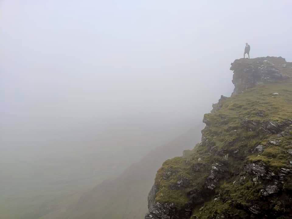
Ensure you're well-prepared before setting out on a hike in the U.K. Some areas of the U.K., especially in North Wales and the Scottish Highlands, are remote and potentially dangerous.
Bring along warm clothing, good hiking boots, and plenty of food and water. Map out your route carefully, and inform others of your itinerary. Check local weather reports before setting out on a hike. Check trail conditions at a local visitors center if you’re hiking in a national park.
Read on to learn about some of the best hikes in the United Kingdom.
England's landscape is varied, but anyone looking to scale the country's highest mountains should head to northern England. Most of England's highest mountains and dramatic hiking spots can be found in the Lake District, Peak District, and the Yorkshire Dales.
Read on to learn about some of the best hikes in England.
The Lake District National Park is the second-largest national park in the U.K. and the largest in England. It covers an area of 912 sq mi (2,362 sq km) and centers around the Lake District, England's most mountainous region and home to 16 lakes. The Lake District attracts over 23 million day visitors annually.
The Lake District is home to the ten highest mountains in England, including Scafell Pike (978 m/3,208 ft). The easiest way to climb England's highest mountain, Scafell Pike, is via Brown Tongue from Wasdale.
You can pick up this trail from the Wasdale Head Green car park. The trail is strenuous, with steep scree slopes to navigate in places. The hike up Scafell Pike via Brown Tongue is approximately 8 mi (12.8 km) in length.
England's third-highest mountain, Helvellyn (950 m/3,116 ft), is among the most evocative in the Lake District. The mountain was visited by poets Samuel Taylor Coleridge and William Wordsworth, who both lived close to the mountain.
Helvellyn is considered easier to scale than the two higher peaks of Scafell Pike and Sca Fell (964 m/3,162 ft). The mountain does offer some challenging routes, including scrambles across two arêtes, Striding Edge and Swirral Edge.
The views from atop Helvellyn are the clearest in the Lake District, with views stretching as far as Wales and Scotland. The easiest way to climb Helvellyn is from Thirlmere by following the Helvellyn Gill Path.
You can pick up this trail from the Swirls car park. This out-and-back trail is approximately 4.5 mi (7.2 km) in length and takes around 4 hours to complete.
Skiddaw (931 m/3,054 ft) is the sixth-highest mountain in England. It's hugely popular with hikers as it's considered one of the easiest fells to climb in the Lake District. It's also one of the Lake District's most attractive mountains, with its gills and smooth slopes.
The view from Skiddaw's summit affords panoramas across the Vale of Derwent towards the rest of the Lake District's fells. The most popular route up Skiddaw is the Jenkins Hill Path.
You can pick up this trail by joining the bridleway along Brundholme Road outside Keswick. The Jenkins Hills Path is approximately 10.5 mi (16.8 km) in length.
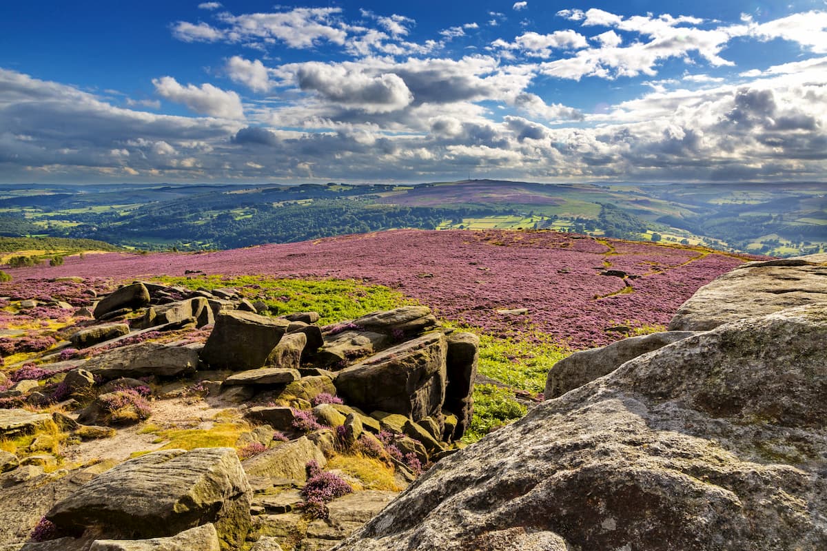
The Peak District is an upland area located at the southern end of the Pennines. The Peak District National Park covers an area of approximately 555 sq mi (1,440 sq km) and receives over 13 million visitors annually.
The Peak District is famed for its granite escarpments, valleys, and limestone gorges. Most of the Peak District is above 300 m (1,000 ft) in elevation.
One of the most popular hikes in the Peak District is to the region’s highest summit, Kinder Scout (636 m/2,087 ft). Kinder Scout's moorland plateau offers the finest views in the Peak District, with mountains like Pen-y-ghent (2,277 feet/694 m) in the Yorkshire Dales and Yr Wyddfa (1,085 m/3,560 ft) in Wales visible on clear days.
One of the best ways to scale Kinder Scout is via Jacob's Ladder and the Pennine Way. You can pick up this trail from the Old Nag's Head in Edale. The walk is approximately 9 mi (14.4 km) and takes 4 or 5 hours to complete.
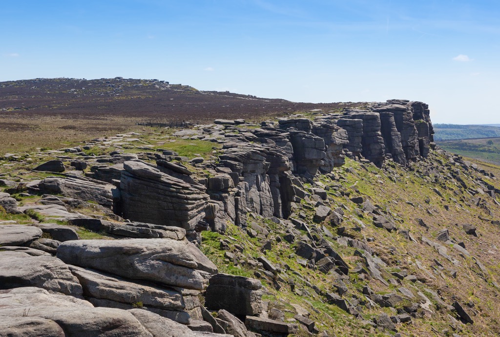
No trip to the Peak District is complete without visiting one of the region's dramatic escarpments, known as edges. Stanage Edge (458 m/1,503 ft) is arguably the finest edge of them all. It stretches for 3.5 mi (6 km) and offers unbeatable views of Mam Tor (517 m/1,696 ft) and Kinder Scout.
One of the best trails leading up Stanage Edge starts from the Hathersage car park. Along the way, you'll pass the sixteenth-century North Lees Hall, which served as Mr. Rochester's home in Jane Eyre. This trail is approximately 9 mi (14.4 km) in length.
The Yorkshire Dales National Park encompasses an area of 841 sq mi (2,178 sq km) within the Yorkshire Dales, an upland area that forms part of the Pennines. The Yorkshire Dales National Park is famous for its undulating hills and valleys, limestone rock formations, and picturesque villages.
The Yorkshire Dales are popular with walkers and cyclists, attracting over 4 million visitors annually. Many hikers visit the area to climb the Yorkshire Dales' Three Peaks: Whernside (736 m/2,415 ft), Ingleborough (723 m/2,372 ft), and Pen-y-ghent (2,277 ft/694 m).
It's possible to scale the three highest mountains in the Yorkshire Dales in one day by following the Three Peaks trail, a rigorous 24 mi (38.6 km) hike, which should be completed within 12 hours. The best place to start this trek is from Horton in Ribblesdale.
Alternatively, you can climb each of Three Peaks separately on shorter, less demanding trails. To climb Whernside, the highest mountain in the Yorkshire Dales, park at the Ribblesdale Visitor's Center next to the scenic Ribblehead Viaduct.
The trail is approximately 7.5 mi (12.5 km) in length. From atop Whernside, you'll be able to spot the Howgills, Morecambe Bay, and the Lake District.
Ingleborough is arguably the most impressive mountain in the Yorkshire Dales, with its limestone rock formations, including Gaping Gill and Ingleborough Cave. Navigating the summit of Ingleborough can be difficult due to low visibility, so map your route carefully.
You pick up the trail to Ingleborough from the Yorkshire Dales National Park Car Park in Clapham. The trail is approximately 10 mi (17 km) in length.
The last of the Three Peaks, Pen-y-ghent, is the easiest with many hikers choosing to bag its summit first. Much of the trail follows the long-distance Pennine Way, passing fascinating rock formations like Hull Pot and Hunt Pot.
You can pick up the trail to Pen-y-ghent from Horton car park. The trail is approximately 6 mi (10 km) in length.
Plan a hiking itinerary in Scotland if you're searching for a wild adventure in the U.K. With its 282 Munros (Scottish mountains over 914.4 m/3000 ft), including the U.K.'s highest mountain, Ben Nevis ( 1,345 m/4,411 ft), Scotland offers challenging walks for even the most experienced hikers.
Read on to learn about some of the best hikes in Scotland.
Cairngorms National Park is the U.K.’s largest national park, covering an area of 1,748 sq mi (4,528 sq km). The park centers around the Cairngorms (Am Monadh Ruadh) mountain range and the surrounding hills. Cairngorms National Park attracts around 2 million visitors annually.
Cairngorms is one of the U.K.'s premier hiking destinations, containing 5 of the 6 highest mountains in the country and over 50 Munros. It's also one of the few places in the U.K. where snow persists year-round, making it one of the most dependable ice climbing locations in Great Britain.
One of the most challenging and rewarding day walks in Cairngorms National Park is the climb up Ben Macdui (1,309 m/4294 ft), the U.K.'s second-highest mountain.
You can add an extra challenge to this hike by scaling the U.K.'s sixth-highest mountain, Cairn Gorm (Cairngorm) (1245 m/4084 ft), on the way to Ben Macdui. Despite being shorter than its neighbor, Cairn Gorm offers better views than Ben Macdui, with sublime panoramas of Rothiemurchus Forest.
You can pick up the trail to Cairn Gorm and Ben Macdui from the Cairngorm Ski Centre car park. The hike is approximately 11 mi (17.5 km) in length.
From Braeriach (Am Bràigh Riabhach) (1,296 m/4,252 ft) to Lochnagar (Beinn Chìochan) (1,156 m/3,792 ft), Cairngorms National Park boasts some of the finest mountain treks in the U.K. But casual hikers should consider climbing The Cairnwell (An Càrn Bhailg) (933 m/3,061 ft) to bag some of the easiest Scottish Munros.
You can pick up this trail from the Glenshee Ski Centre car park. Along this route, you'll also pass over the summits of Càrn Aosda (917 m/3,009 ft) and Càrn a'Ghèoidh (975 m/3,198 ft), two neighboring Munros. This trail is approximately 8 mi (13 km) in length.
Loch Lomond and the Trossachs National Park is the smaller of Scotland's two national parks, covering an area of 720 sq mi (1,865 sq km). It's the fourth-largest national park in the British Isles and receives roughly 7 million day visitors annually.
Loch Lomond and the Trossachs National Park is located in the southern Highlands and centers around Loch Lomond and the glens and hills of the Trossachs. Loch Lomond is the largest lake in Great Britain by surface area (27.5 sq mi/71 sq km).
One of the best ways to see Loch Lomond is from the slopes of Ben Lomond (Beinn Laomainn) (974 m/3,196 ft), which sits on the loch's eastern shore. Ben Lomond is among the most popular and famous Scottish Munros due to its stunning views and easy ascent. Around 50,000 people climb Ben Lomond every year.
The best place to start your ascent of Ben Lomond is from the Rowardennan car park. The trail is approximately 7.5 mi (12 km) in length.
A more challenging walk within Loch Lomond and the Trossachs National Park is the ascent of Ben More (Beinn Mhòr) (1,174 m/3,852 ft), the park's highest summit. With its conical summit, Ben More is a steep and exciting climb.
The most popular route up Ben More also passes over neighboring Stob Binnein (1,165 m/ 3,822 ft), an equally beautiful mountain. You can pick up this path to Ben More and Stob Binnein from Ben More Farm. The trail is approximately 7.5 mi (12 km) in length.
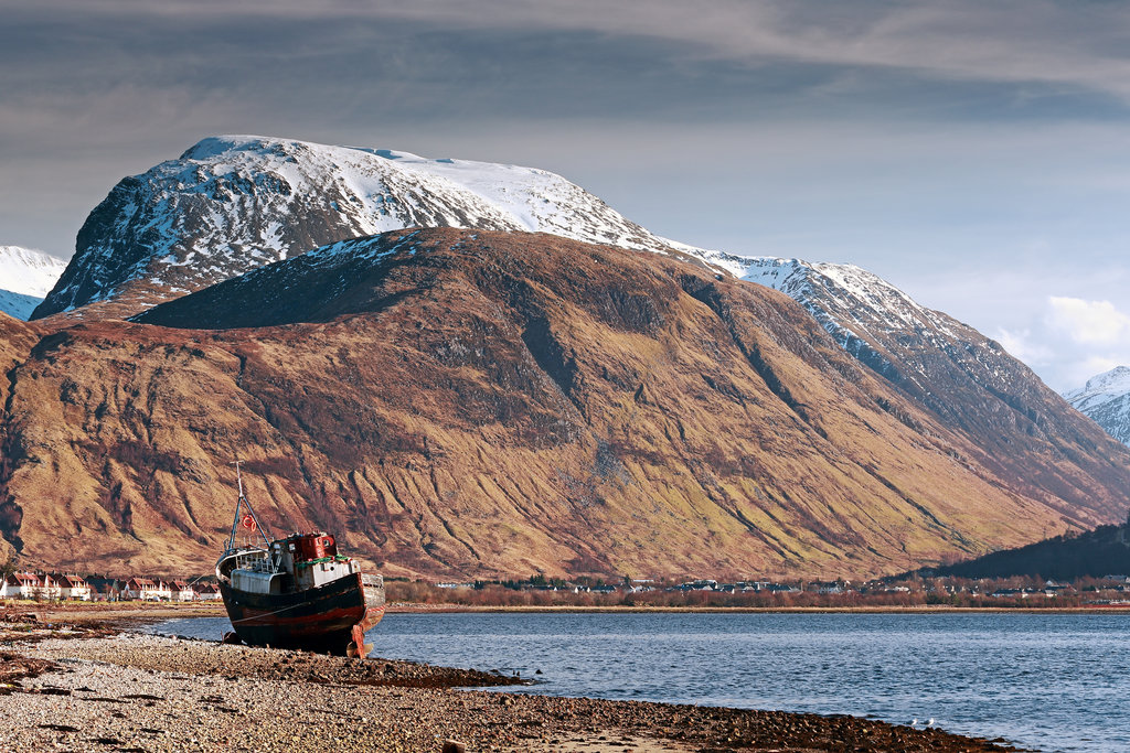
Ben Nevis ( 1,345 m/4,411 ft) is the highest mountain in the U.K. and the highest summit in any direction for 459 mi (739 km). Ben Nevis is not located in any national park, but that doesn't make it any less popular — over 125,000 climb Ben Nevis annually.
Ben Nevis is not only popular with hikers but rock climbers too. The cliffs on Ben Nevis' north face are over 700 m (2,300 ft), making them some of the highest cliffs in Scotland.
Ben Nevis is located at the western end of the Grampian Mountains, near the town of Fort William. Approximately 75 percent of people that climb Ben Nevis take the Mountain Path from Glen Nevis.
The Mountain Path is well-trodden but steep and unrelenting. Ensure you map out your route carefully when climbing Ben Nevis to avoid straying from the path into dangerous terrain.
The views from Ben Nevis are arguably the finest in the U.K., with Northern Ireland visible on a clear day. You'll also be able to spot famous Scottish mountains like Ben Lomond and Morven (A' Mhòr Bheinn) (706 m/2,316 ft).
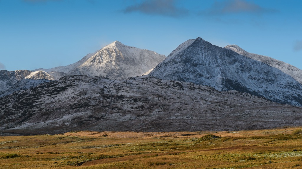
With varied landscapes, from its famous mountains to its beautiful coastline, Wales attracts hikers from around the world. Wales is home to many challenging mountains, including the highest mountain in the British Isles outside Scotland, Yr Wyddfa (Snowdon) (1,085 m/3,560 ft).
Read on to learn about some of the best hikes in Wales.
Snowdonia National Park, or Eryri National Park, is the largest national park in Wales, covering an area of 823 sq mi (2,130 sq km). This large park encompasses 9 different mountain ranges and roughly 1,497 mi (2,409 km) of trails. Around 10 million people visit Snowdonia National Park annually.
Eryri (Snowdonia) is the park's namesake and largest mountain range. It contains Yr Wyddfa, one of the U.K.'s most popular mountains. Around 600,000 hikers attempt to climb Yr Wyddfa annually.
The most popular and easiest route up Yr Wyddfa is the Llanberis Path. The Llanberis Path is Yr Wyddfa's longest trail, following the Snowdon Mountain Railway to the summit. Along the way, you'll be treated to views across the Glyderau mountain group down into the Pass of Llanberis.
You can pick up the Llanberis Path from the village of Llanberis. The trail is approximately 9 mi (14.5 km) in length. Despite being the easiest route, you should come well-prepared with hiking gear and navigational equipment. Scrambling may be necessary on some sections of the Llanberis Path.
Or, consider following the Pyg Track to Yr Wyddfa if you're searching for one of Wales' most exciting hikes. The Pyg Track begins at Pen y Pass (370 m/1,213 ft) and allows you to navigate Crib Goch (923 m/3,028 ft), a knife-edged arête that's considered the best ridge walk in Great Britain.
Crib Goch is only suitable for experienced hikers due to its Grade 1 scrambles. Despite its difficulty, Crib Goch provides one of the finest views of Yr Wyddfa. The Pyg Track is approximately 7 mi (11 km) in length.
Plan a day hike up Cadair Idris (893 m/2,929 ft) if you want to avoid the busy slopes of Yr Wyddfa. Cadair Idris is an iconic mountain thanks to its unique geological formations created by glacial erosion.
You'll find three main paths up Cadair Idris, including the popular Minffordd Path. The trail takes you up the southern slopes of Cadair Idris, starting from the Dôl Idris car park.
The path is popular as it takes you along the rock wall above Cwm Cau past Llyn Cau, a glacial lake that's one of Cadair Idris' most famous features. The Minffordd Path is strenuous with scrambling required in places. The path is approximately 5.5 mi (9 km) in length.
Brecon Beacons National Park covers an area of approximately 519 sq mi (1,344 sq km) and receives around 4.4 million visitors annually. It centers around the Brecon Beacons mountain range in southern Wales and also includes the Black Mountains and Fforest Fawr.
Hikers flock to Brecon Beacons National Park to scale Pen-y-Fan (886 m/2,907 ft), the highest mountain in South Wales. The easiest hike up Pen-y-Fan is the Storey Arms Pen y Fan to Pont ar Daf trail.
The walk starts at the Storey Arms Outdoor Centre at around 440 m (1,312 ft) in elevation, making the hike more manageable. From atop Pen-y-Fan on a clear day, you can see the Bristol Channel, the Black Mountains, and the Cambrian Mountains. The Storey Arms Pen y Fan to Pont ar Daf trail is approximately 4 mi (6.5 km) in length.
Or, hike the Beacons Circuit if you want to experience more of the Brecon Beacons. This hike from the Stoney Arms is approximately 11 mi (18.5 km) in length and takes in Pen-y-Fan as well as two other classic summits, Corn Du (873 m/2,864 ft) and Cribyn (795 m/2,608 ft).
Sugar Loaf (Mynydd Pen-y-fâl) (596 m/1,955 ft), the southernmost summit in the Black Mountains, is one of the Brecon Beacons National Park's easiest and most rewarding climbs.
![]()
The summit of this modest mountain affords views of the Cotswolds to the east, Pen-y-Fan to the north, and the Bristol Channel to the south. The quickest route up Sugar Loaf starts from the Sugar Loaf car park at an elevation of around 300 m (984 ft). This walk is approximately 4.5 mi (7.2 km) in length.
Home to the Giant's Causeway and the Mourne Mountains, Northern Ireland is one of the U.K.'s most underrated hiking destinations. Isolated mountain summits, breathtaking geological formations, and the biggest lake in the British Isles make Northern Ireland ideal for adventure seekers.
Read on to learn about some of the best hikes in Northern Ireland.
Mourne & Slieve Croob AONB, also known as the Mourne AONB, is one of the most popular natural areas of Northern Ireland and has been proposed as Northern Ireland's first national park. It covers an area of approximately 220 sq mi (570 sq km).
Mourne & Slieve Croob AONB's main feature is the Mourne Mountains, which are home to the highest summits in Northern Ireland, including Slieve Donard (849 m/2,790 ft). The AONB also incorporates the Mourne Mountains’ northern outlier, Slieve Croob (534 m/1,751 ft).
You can climb Northern Ireland's highest mountain, Slieve Donard, along with its neighbors, Slieve Commedagh (767 m/2,516 ft) and Slieve Bearnagh (739 m/2,424 ft), from the Trassey car park near Newcastle.
The views from Slieve Donard are extensive, stretching across Wales, Co. Wicklow, the Isle of Man, and Scotland. The circular trail from Trassey car park is approximately 12 mi (19.3 km) in length.
Slieve Binnian (745 m/2,451 ft), Northern Ireland's third-highest mountain, is another hike worth undertaking. With its flat rocky northern and southern tors and views of Ben Crom reservoir, Slieve Binnian is one of Northern Ireland's most striking mountains.
You can pick up the trail to Slieve Binnian from the Carrick Little car park. From atop Slieve Binnian, you'll be able to see the Wicklow Mountains to the south past Dublin and the Isle of Man to the east. The walk is approximately 3 mi (4.8 km) in length.
The Sperrins, also known as the Sperrin Mountains, is the largest upland area in Northern Ireland. The range is spread across the northwestern counties of Co. Tyrone and Co. Derry (Londonderry). The Sperrins AONB covers an area of approximately 467 sq mi (1,211 sq km).
Sawel Mountain (Samhail Phite Méabha) (678 m/2,224 ft) is the highest mountain in Northern Ireland outside the Mournes and the county top of both Co. Derry and Co. Tyrone. It's a moderately challenging mountain with some of the finest views in the Sperrins.
The shortest route up Sawel Mountain is to the east from Sperrin Road. From here, it's possible to walk straight to the summit of Sawel Mountain. This out-and-back trail is approximately 3 mi (5 km) in length.
The walk up Sawel is boggy, so wear waterproof hiking boots. Weather permitting, you'll get to enjoy views of nearby mountains to the east, including Mullaghaneany (Mullach an Ionaidh) (627 m/2,057 ft) and Mullaghmore (Mullach Mór) (550 m/1,804 ft).
Despite being by no means the highest mountain in the Sperrins, Benbradagh (Binn Bhradach) (465 m/1,526 ft) is very popular with hikers. Benbradagh has a distinctive summit with panoramic views and some interesting US military history.
You can climb from Curragh Road to the west of Benbradagh. There's a circular route that will take you past the Former Dungiven U.S. Navy Transmitter Site. The walk is approximately 7 mi (11 km) in length.
Each of the four counties in the U.K. boasts bustling cities with their own unique history, culture, and cuisine. Read on to learn about some of the main cities in the U.K.
London is the capital and largest city of the U.K. It's one of the best cities in Europe for sightseeing, with a seemingly endless list of iconic attractions.
Take in views of the Thames from the London Eye, rub shoulders with royalty at Buckingham Palace, uncover forgotten English history at the Tower of London, and much more. London is also ideal for foodies and is home to some of the best restaurants in the world.
Located in southeast England, London is around 200 mi (321 km) from hiking areas like the Peak District and Lake District. Popular nearby hiking areas include the Chiltern Hills AONB, South Downs National Park, and the Cotswolds AONB.
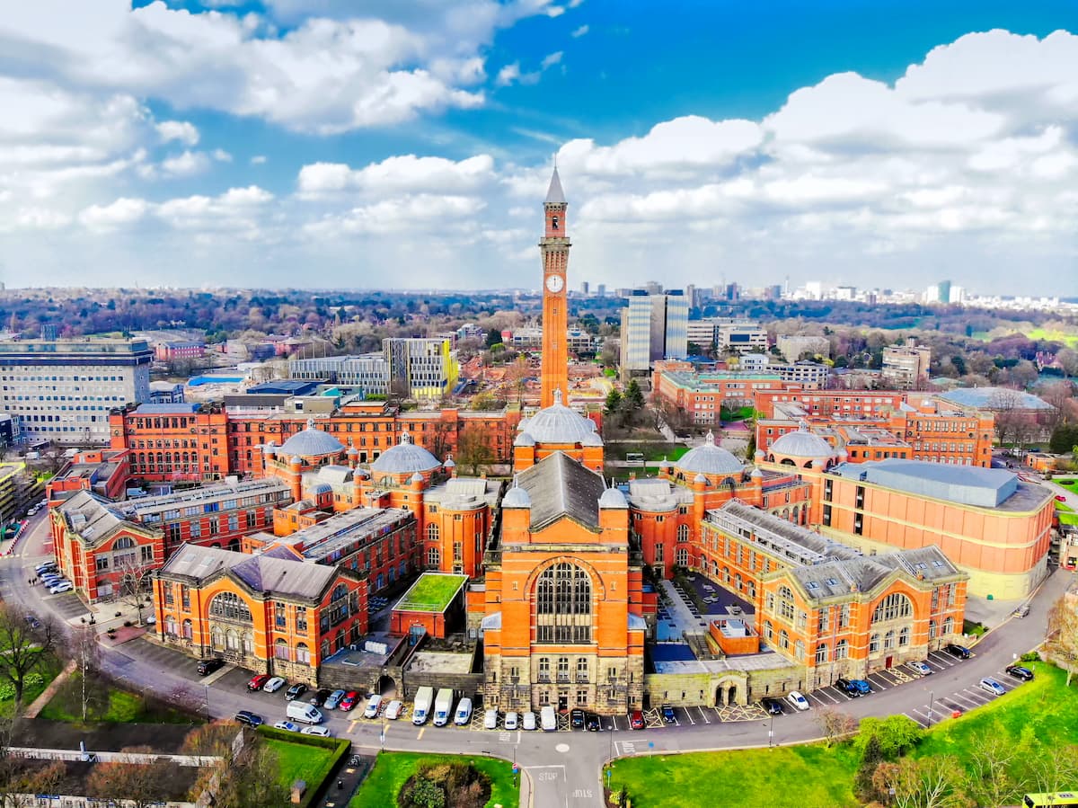
Birmingham is the second-largest city in England. Home to Heavy Metal and over 50 annual festivals, Birmingham is one of England's finest cultural gems. The city is home to fun attractions that'll please all ages, like Cadbury World, the National Sea Life Centre, and Winterbourne House.
Located in the Midlands, Birmingham makes a great base from which to explore England's parks, with the Peak District National Park located 50 mi (80 km) to the north and the Cotswolds AONB located 60 mi (96 km) to the south.
Edinburgh (Dùn Èideann) is the capital and second-largest city in Scotland. Edinburgh is widely considered one of the most attractive cities in Europe, with its unique architecture, cobbled streets, and natural beauty.
Edinburgh is the second most popular tourist destination in the U.K. and with good reason. Hike up Arthur's Seat (251 m/822 ft) and take in the city's skyline. Or, learn about ancient Scottish history at the twelfth-century Edinburgh Castle.
Edinburgh is well positioned for exploring some of Scotland and northern England's best hiking destinations. Edinburgh is less than 60 mi (96 km) from Northumberland National Park and Loch Lomond and the Trossachs National Park.

Glasgow (Glaschu) is the largest city in Scotland and the fourth-largest in the U.K. Perched on the River Clyde, Glasgow is a historic port city famed for its Victorian and art nouveau architecture. It's home to some of the best cultural attractions in the U.K., like Kelvingrove Gallery, the twelfth-century Glasgow Cathedral, and the Riverside Museum.
Glasgow is an excellent place to stay if you're planning to visit Scotland's two national parks. Loch Lomond and the Trossachs National Park is less than 25 mi (40 km) to the north, and Cairngorms National Park is less than 100 mi (160 km) to the northeast.
Cardiff (Caerdydd) is Wales's capital and largest city and the eleventh-largest city in the U.K. Sat overlooking Cardiff Bay, Cardiff is a port city and was once the world's largest exporter of coal.
Today, Cardiff is home to some of Wales' top attractions, like the lavish medieval Cardiff Castle, the National Museum Cardiff, and the Wales Millennium Centre.
Located in southeastern Wales, Cardiff affords access to several U.K. parks. Cardiff is roughly 35 mi (56 km) south of Brecon Beacons National Park and 30 mi (48 km) southeast of Wye Valley AONB.

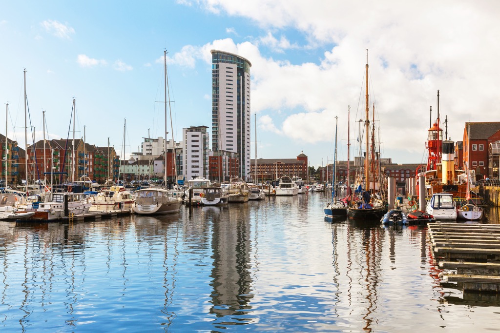
Swansea (Abertawe) is Wales' second-city and twenty-fifth largest city in the U.K. Situated 45 mi (72 km) down the coast from Cardiff, Swansea is known for its vibrant nightlife, gorgeous waterfront, and for being the birthplace of poet Dylan Thomas. Popular attractions in Swansea include the National Waterfront Museum and Clyne Gardens.
Swansea is the perfect base if you're planning a stroll along Wales' picturesque limestone coastline. Gower AONB is adjacent to Swansea, while the Pembrokeshire Coast National Park is around 65 mi (104 km) to the west.
Belfast (Béal Feirste) is the capital and largest city in Northern Ireland. Belfast is perhaps most famous for being where the RMS Titanic was built and set sail.
Badly damaged during the Troubles, Belfast has been rejuvenated into one of the most exciting cities in the U.K. Top attractions in Belfast include the Ulster Museum, Titanic Belfast, and St George's Market.
Belfast is close to some of the best hiking areas in Northern Ireland, with the Mourne Mountains less than 50 mi (80 km) to the south and Lough Neagh less than 12 mi (20 km) to the west.

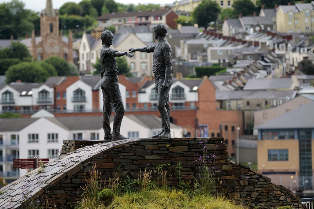
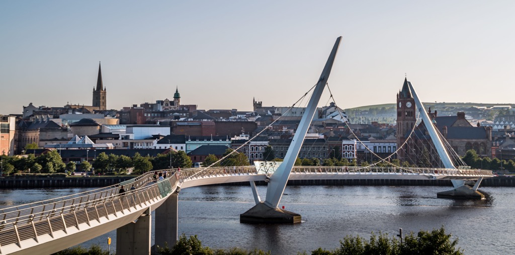
Resting on the River Foyle in the northwestern corner of Northern Ireland is Derry (Londonderry). Derry is the second-largest city in Northern Ireland and the fifth-largest city on the island of Ireland.
One of Derry's most famous features is its seventeenth-century intact city walls. They're considered some of the finest city walls in Europe. Other attractions in Derry include Free Derry Corner and the Tower Museum.
Derry is located less than 20 mi (32 km) from the Sperrins. You could also pass over the border into Co. Donegal and visit Glenveagh National Park (Gleann Bheatha), which is located less than 35 mi (57 km) from Derry.


tgo40
nuttalls
hewitts-gb
marilyns-gb


