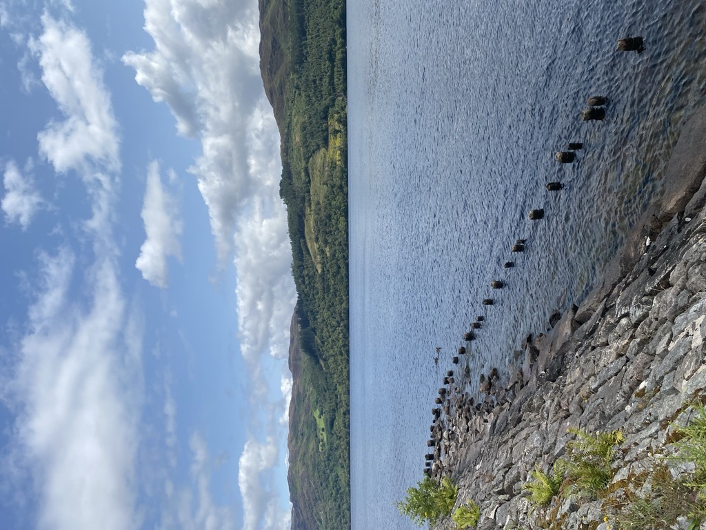
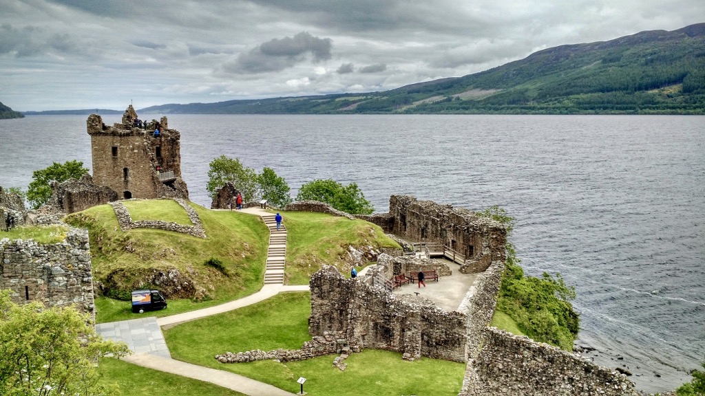
Loch Ness (; Scottish Gaelic: Loch Nis [l̪ˠɔx ˈniʃ]) is a large freshwater loch in the Scottish Highlands extending for approximately 37 kilometres (23 miles) southwest of Inverness. It takes its name from the River Ness, which flows from the northern end. Loch Ness is best known for claimed sightings of the cryptozoological Loch Ness Monster, also known affectionately as "Nessie" (Scottish Gaelic: Niseag). It is one of a series of interconnected, murky bodies of water in Scotland; its water visibility is exceptionally low due to the high peat content of the surrounding soil. The southern end connects to Loch Oich by the River Oich and a section of the Caledonian Canal. The northern end connects to Loch Dochfour via the River Ness, which then ultimately leads to the North Sea via the Moray Firth. At 56 km2 (22 sq mi), Loch Ness is the second-largest Scottish loch by surface area after Loch Lomond, but due to its great depth it is the largest by volume in Great Britain. Its deepest point is 230 metres (126 fathoms; 755 feet), making it the second deepest loch in Scotland after Loch Morar. It contains more water than all the lakes in England and Wales combined, and is the largest body of water in the Great Glen, which runs from Inverness in the north to Fort William in the south. Its surface is 16 metres (52 feet) above sea level. It contains a single, artificial island named Cherry Island (Scottish Gaelic: Eilean Muireach) at the southwestern end. There are nine villages around the loch, as well as Urquhart Castle; the village of Drumnadrochit contains a "Loch Ness Centre and Exhibition".
Show more
Sun and Moon
Mon
Tue
Wed
Thu
Fri
Sat
Sun
May 2022
Date and time
00:00
06:00
12:00
18:00
Today
--
--
Sunrise
--
Sunset
--
Moonrise
--
Moonset
Phase
🌔 Waxing Gibbous
The perfect light time for beautiful photos:
--
Sunrise
--
Sunset
PeakVisor app
Get the app on your smartphone
New Panorama Tools
Trace location on the map
Measure distances
All the instruments are available in the context menu as well.
We use GPS information embedded into the photo when it is available.
3D mountains overlay
Adjust mountain panorama to perfectly match your photos because recorded by camera photo position might be imprecise.
Move tool
Rotate tool
Zoom
More customization
Choose which peak labels should make into the final photo and what photo title should be.
Next
Photo Location
Satellitte
Flat map
Relief map
Latitude
Longitude
Altitude
OR
Latitude
°'''
Longitude
°'''
Apply
Register Peak
Peak Name
Latitude
Longitude
Altitude
Register
Teleport
PeakVisor
This 3D model of Sagarmatha National Park in Nepal was made using the PeakVisor app topographic data. The mobile app features higher precision models worldwide, more topographic details, and works offline. Download PeakVisor maps today.
Download OBJ model
PeakVisor
The download should start shortly. If you find it useful please consider supporting the PeakVisor app.
PeakVisor for iOS and Android
Be a superhero of outdoor navigation with state-of-the-art 3D maps and mountain identification in the palm of your hand!