Scan the QR code and open PeakVisor on your phone
The Pembrokeshire Coast National Park is one of the most popular hiking destinations in Wales thanks to its historic sites, stunning coastline, and fascinating flora and fauna. Uniquely, Pembrokeshire Coast National Park is the only coastal national park in Britain. Along with Brecon Beacons National Park and Snowdonia National Park, it is one of three national parks in Wales.
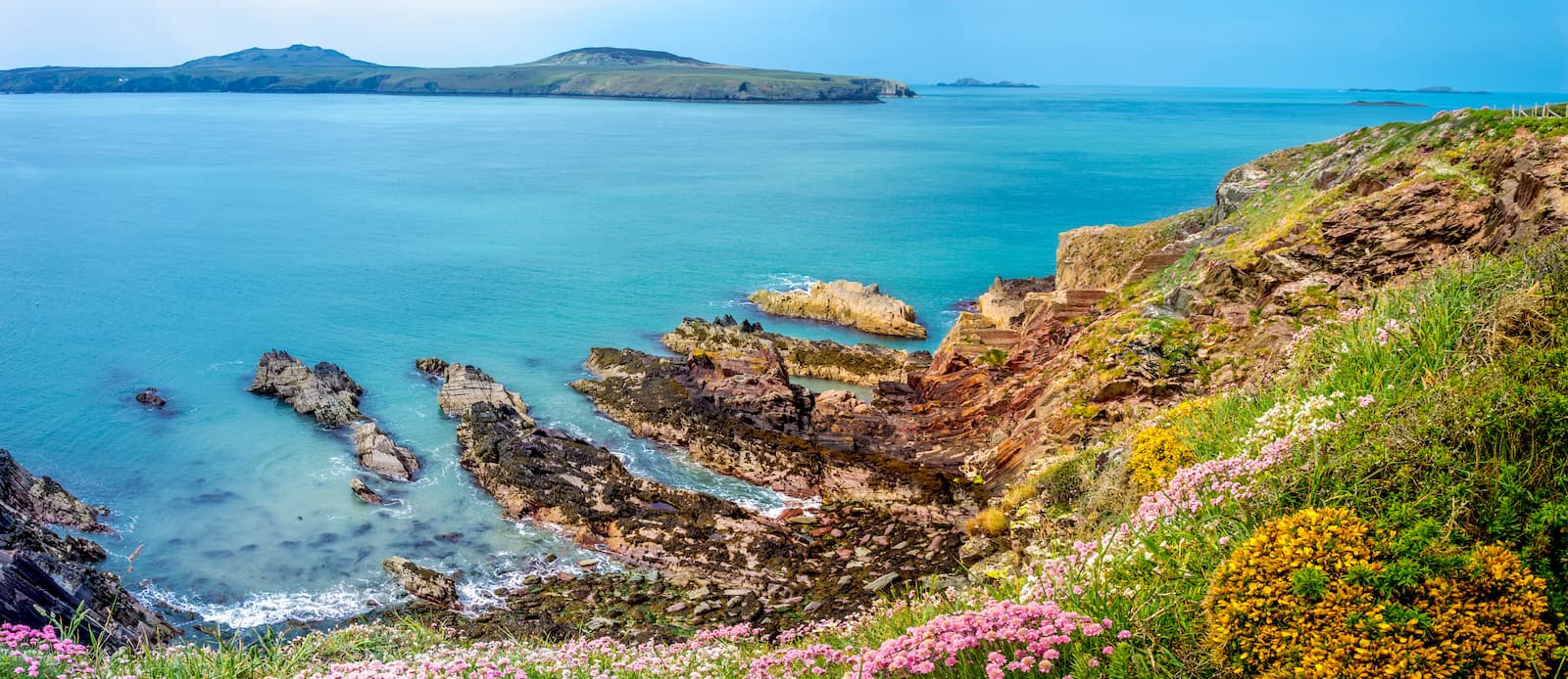
The main reason tourists visit Pembrokeshire Coast National Park is to discover it's postcard-perfect coastline. You'll find dozens of pristine sandy beaches, with some of the best examples located near Tenby, Amroth, and Marloes. These beaches are popular with sunbathers and are ideal for watersports such as surfing, kayaking, and fishing.
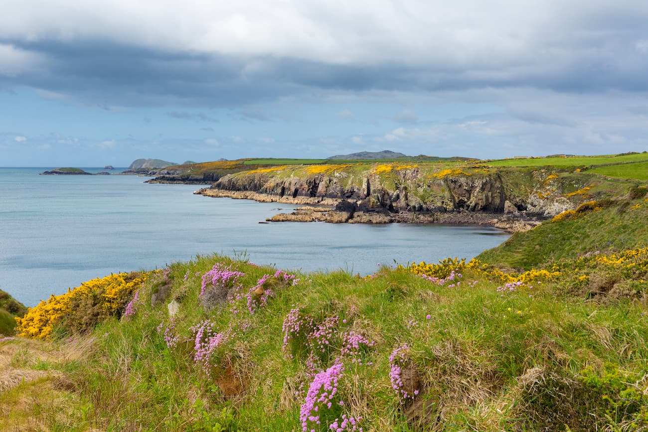
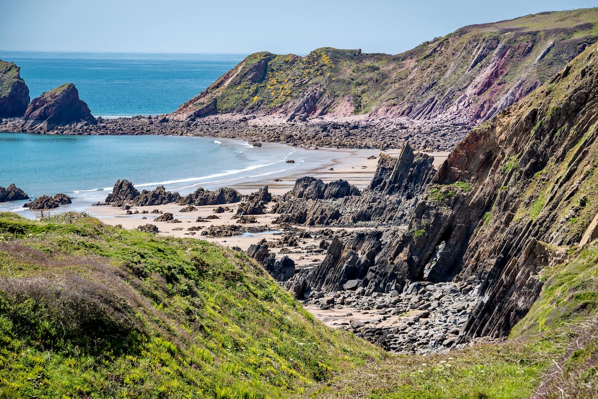
Avid hikers will love discovering the acclaimed Pembrokeshire Coast Path. This pathway meanders along the full length of the park's oceanfront for 186 miles. Along the path, you'll be treated to sweeping vistas of Pembrokeshire's rugged coastline, fascinating historical sights, and unique limestone rock formations. The area is also great for nature watchers, with an array of rare animals and plants inhabiting the Pembrokeshire coast. One of the best natural sights in the park is the Atlantic grey seals that rear their young on the remote beaches.
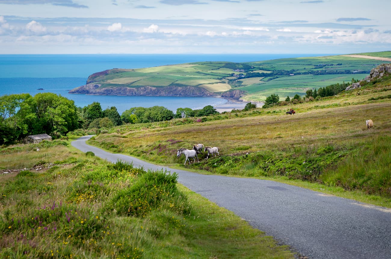
While Pembrokeshire Coast National Park isn't home to any official mountains, there are several notable hills. For example, the Preseli Hills (also known as the Preseli Mountains) is one of the most popular hiking areas in the park. The highest peak in the Preseli Hills is Foel Cwmcerwyn (534 m). Other notable hills include Foel Eryr (467 m) and Carn Ingli (343 m). Despite their small size, the Preseli Hills provide a challenging trek. They also afford remarkable views, with Ireland and Snowdonia National Park visible from atop the hills on a clear day.

The Pembrokeshire Coast Path runs for 186 miles from Amroth to St. Dogmaels and is one of Wales's most challenging walks. If you're looking to complete the entire 186-mile trek, it will take between 10 and 15 days. The trail rises and falls along the park's coastline for over 35,000 feet. Trekking the whole coastal trail is very difficult, and should only be undertaken by hikers who’re well-prepared. Many hikers choose to complete only a short section of the hike before stopping at a nearby village or catching the local bus back to their starting point.
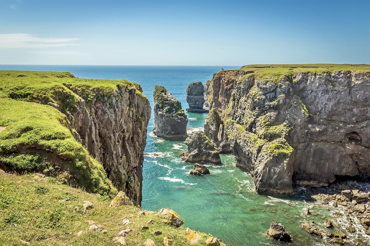
One of the most popular short walks along the Pembrokeshire Coast Path is the hike from Stack Rocks to St Govan's. This hike is around 6 and a half miles and should take around 2 or 3 hours. You can pick up this trail from the Stack Rocks car park 8 miles northwest from Pembroke Docks.
This route is easy to follow, thanks to the well-signposted trail system. Along this walk, you'll pass some amazing sights, including an Iron Age fort and St Govan's, a legendary 6th-century Irish chapel. One of the best sights along the walk is the Stack Rocks. These two limestone columns rise out of the ocean and are the ideal spot for birdwatching, with razorbills, guillemots, kittiwakes, and fulmar nesting on the stacks.
The route from Trefin to Strumble Head can vary depending on whether you fancy a long trek or a relaxing stroll. The hike is generally around 8 miles and should take about three hours. The best way to tackle this walk is to first park near Strumble Head and get the Strumble Shuttle to the starting point in Trefin.
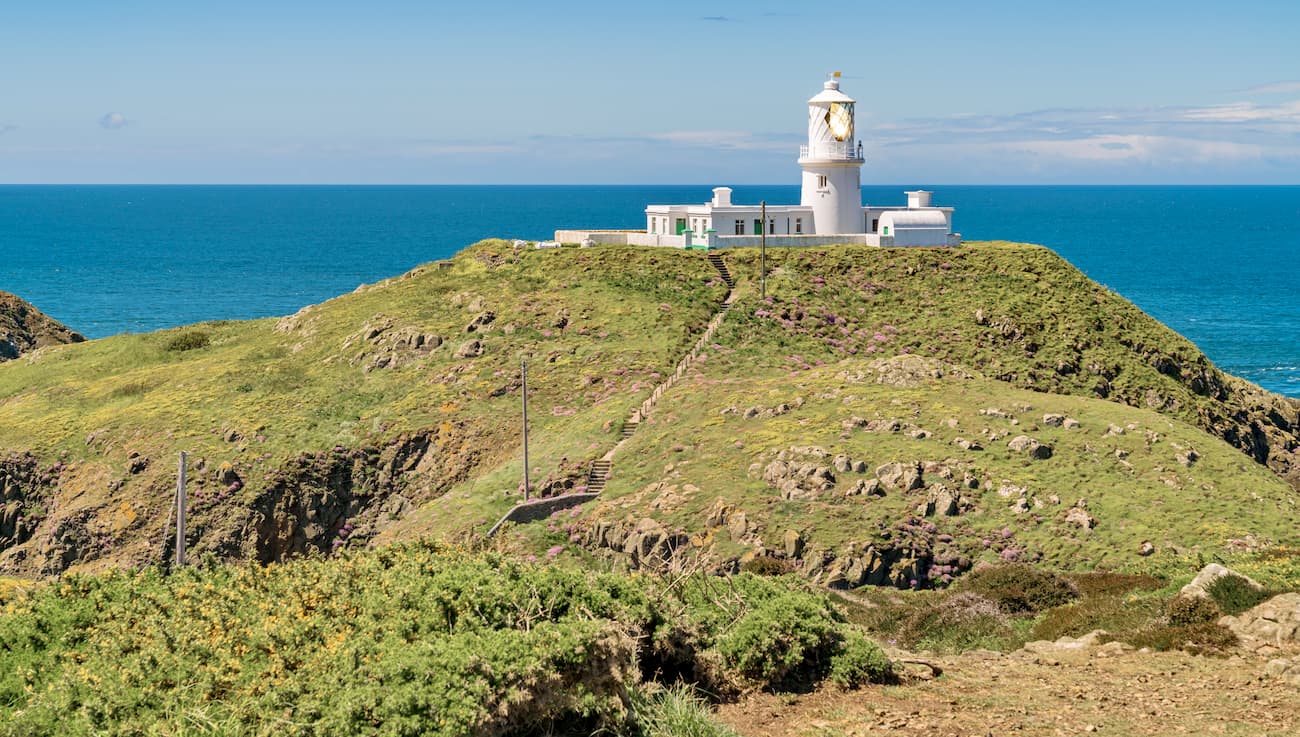
Following the Coast Path, you'll walk north towards Abercastle. Just before Abercastle, you can take a short detour to Carreg Samson, a 5,000-year-old ancient burial mound. Continue along the path to the Pwll Deri section of the coastline. If you fancy extending your walk, you can head off the track to the west through the old farmland, up to the top of Garn Fawr (212 m). The rest of the walk is leisurely and downhill. You'll find some great spots for watching local wildlife near Carreg Onnen Bay, with porpoises, grey seals, and bottle-nosed dolphins frequenting the area. To end the hike, take the bridge across to Strumble Head and check out the scenic lighthouse.
Marloes Peninsula provides some of the best coastal views and sandy beaches in Pembrokeshire Coast National Park. This hike is around 4 miles and should take 1 to 2 hours. You can pick the trail from Marloe Sands car park, which is approximately 8 miles west of Milford Head. Along your walk, you'll come across three viewing areas, which afford gorgeous views of the peninsula's coastline. This grassy trail runs alongside the Pembrokeshire Coastal Path and is easily recognizable.
While on this walk, keep an eye out for the gateways and signposts leading to the viewing areas. The first one is located just left of the youth hostel towards the start of the trail. Birdwatchers will enjoy hiking through Marloes Mere, a marshy area frequented by short-eared owls, hen harriers, and an array of waterfowl. You'll also pass by an old Iron Age fort. From the cliffs in the fort, you'll be able to spot the islands of Grassholm, Skokholm, and Skomer.
Preseli Hills is ideal for hikers looking to explore the inland region of Pembrokeshire Coast National Park. The range stretches across the northern part of Pembrokeshire for roughly 13 miles. Despite not having any official Hewitts, scaling many of the Preseli Hills at once can be strenuous, but should be manageable for hikers who exercise regularly.
The Golden Road is one of the most challenging uphill treks in Pembrokeshire Coast National Park. Weaving through the Preseli Hills' verdant heathlands and forests, this trial will take you over craggy hilltops and past historic sites and quaint villages. The hike is fairly long at 8 miles and will take approximately 4 hours one way. You pick up the trail along the BwlchGwynt road near Foel Eryr.
Start by climbing to the summit of Foel Eryr, which offers excellent views and is marked with a Bronze Age burial cairn. Next, head south past the Pantmaenog Forest, where you'll see the park's highest point, Foel Cwmcerwyn. You'll see a footpath to the east which leads off towards Foel Cwmcerwyn, in case fancy extending your walk. From here, head for the precipitous summit of Carn Bica (390 m). From Carn Bica, you'll have the perfect view of the historic Bedd Arthur, thought at one time to be the burial place of the legendary King Arthur.
The third highest point in the park, Foel Feddau (464 m), is your next stop. This hill features one of the best Bronze Age burial cairns in the park. At the end of the walk, you'll pass by Foel Drygarn (361 m). Atop Foel Drygarn is one of the region's most impressive Iron Age forts, which dates back to 350 BC. You can end your hike at the village of Rosebush by resting your feet at the Tafarn Sinc pub.
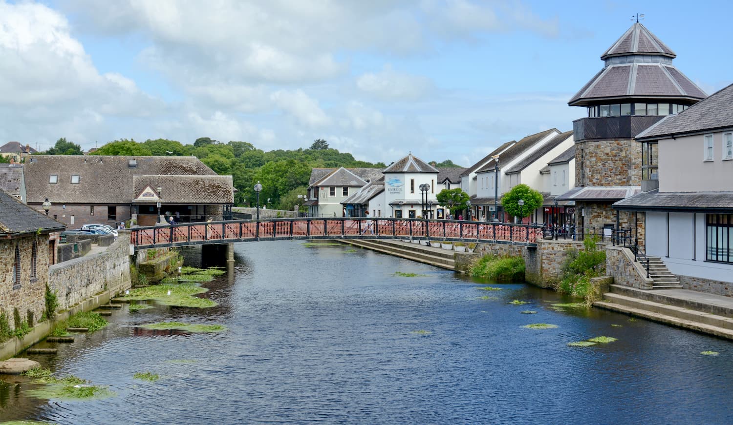
Haverfordwest is the largest town and country seat of Pembrokeshire. Despite being the largest settlement in the area, Haverfordwest is still a sleepy town by most standards, with quaint shops, scenic river views, and welcoming locals. There are plenty of interesting historical landmarks in and around Haverfordwest, such as Picton Castle, Haverfordwest Priory ruins, and the Welsh Spitfire Museum. Haverfordwest is also just a short drive from the picture-perfect town of Narberth, which is home to many family-friendly attractions like Oakwood Theme Park.
If you're planning to stay in Haverfordwest, consider booking a room at the County Hotel or the Hotel Mariners. Haverfordwest makes a great base from which to explore Pembrokeshire Coast National Park, with the Preseli Hills just 16 miles north and the coastline 6 miles west.
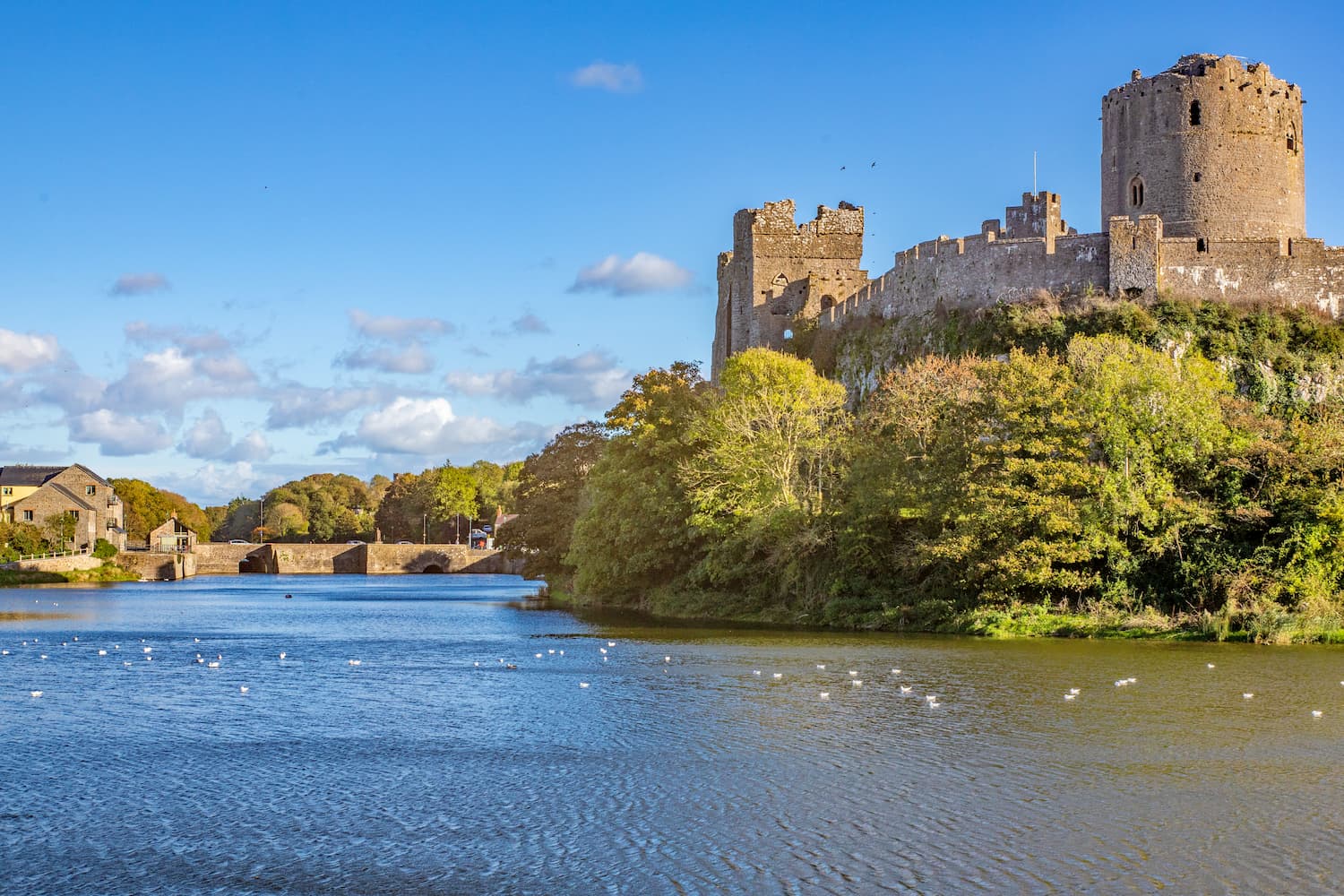
The seaside settlement of Pembroke is one of the best known towns in Pembrokeshire due to its famous castle and port. Pembroke Castle sits upon the Pembroke River, as is notable for being the birthplace of King Henry VII. Despite dating back to the 11th century, much of the castle remains intact, making it a popular tourist destination for history buffs. Pembroke is near some of the county's best hotels, including the Best Western Lamphey Court Hotel and the Stackpole Inn.
To reach the center of Pembrokeshire Coast National Park from Pembroke, follow the A477 north for around 16 miles. The Preseli Hills are roughly 25 miles north along the A4075 and B4313.
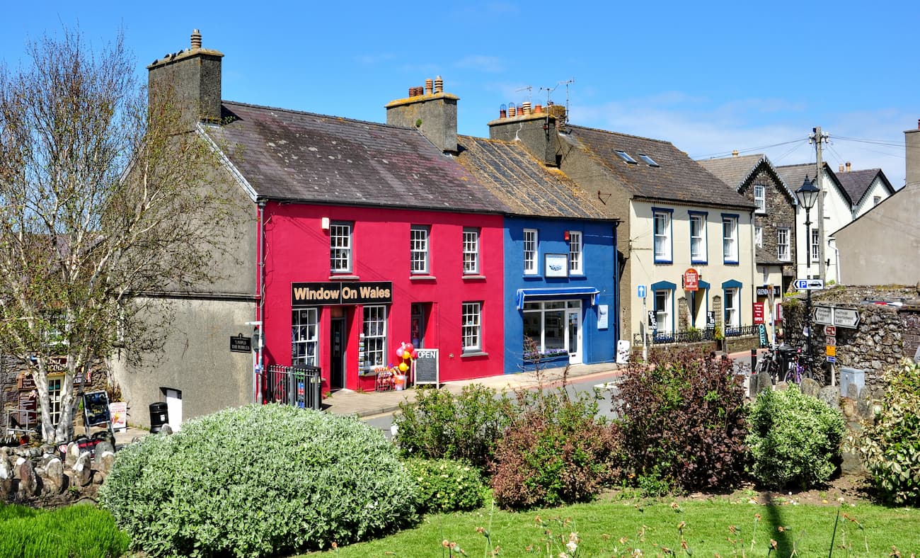
St Davids is a cathedral city perched on a peninsula overlooking the Irish Sea. St Davids is a city due to its cathedral rather than its size. It is the smallest city in the UK with a population of around 2,000 people. The city takes its name from the patron saint of Wales, Saint David, who was buried in the local area.
While there isn't much to do in the city other than visiting the St Davids Cathedral, St Davids is located right by the seaside, meaning you can pick up the Pembrokeshire Coastal Path from beautiful areas such as Porthclais Harbour or Whitesands Bay. There are plenty of superb hotels near St Davids, including Twr y Felin Hotel, The Grove Hotel, and The City Inn.
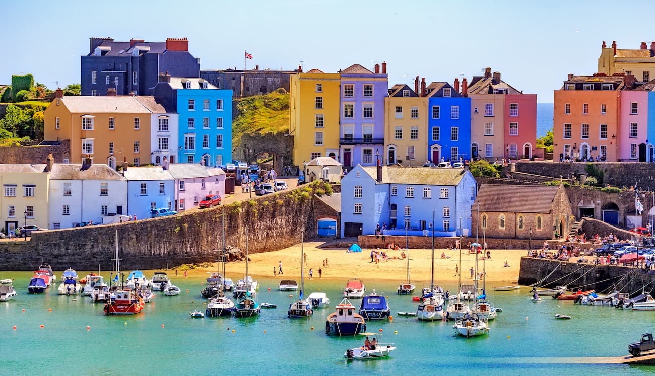
Tenby is undoubtedly one of the most beautiful seaside towns in Wales. A popular holiday destination, Tenby is known for its pristine beaches, warm ocean currents, and sunny weather. While at Tenby's oceanfront, you'll see some intriguing islands nearby, such as Caldey Island and St Catherine's Island. Kids are sure to enjoy Tenby, and this seaside town is even home to great family-friendly attractions like Dinosaur Park.
Travelers planning on staying in Tenby will want to book a room at No 1, The Esplanade, which boasts clifftop seaside views which make for the perfect holiday experience. Tenby is also close to the start of the Pembrokeshire Coastal Trail, with Amroth just ten miles away.