
Scan the QR code and open PeakVisor on your phone
Avid explorers looking for a challenge will love Snowdonia National Park. Snowdonia is the largest national park in Wales, covering 823 square miles of glacial valleys, peerless mountains, and tranquil lakes. Snowdonia National Park sits within the counties of Gwynedd and Conwy in the northwestern corner of the country. It's one of the three national parks in Wales along with Brecon Beacons National Park and Pembrokeshire Coast National Park.
Most of the prominent mountain ranges in Snowdonia National Park are located in the north of the region and are part of the Snowdonia Massif. This massif includes the Glyderau, Carneddau, Moelwynion, and Moel Hebog mountain ranges. The first three of these ranges contain all 15 Welsh Furths, also referred to as the Welsh 3000s. Due to the proximity of these mountains, it's possible for climbers to summit all 15 peaks within 24 hours.
The presence of these Furths is the main reason Snowdonia has become one of the UK's most popular hiking destinations. The Snowdonia Massif is home to Snowdon (1,085 m), the highest mountain in the UK outside of Scotland. Snowdon is also often referred to by its Welsh name, Yr Wyddfa. Other notable Furths located within the Snowdonia Massif include Garnedd Ugain (1,065 m), Glyder Fach (994 m), Crib Goch (923 m), and Tryfan (917 m).
You'll also find several standalone mountains and minor ranges located in southern Snowdonia which are worth discovering. Cadair Idris (879 m) is a popular location for hiking thanks to its stark ridges and dramatic lake views. Meanwhile, Aran Fawddwy (905 m) is the highest mountain in Wales outside the Snowdonia Massif and the only mountain in southern Snowdonia to exceed 900 meters.
Snowdon is one of the most popular climbs in the UK, with 6 main routes that lead to the mountain top. Despite its popularity, Snowdon is a dangerous climb and should only be undertaken by experienced and well-prepared hikers. The easiest and most popular way of climbing Snowdon is via the Llanberis Path. This hike is a 9-mile round trip, ascends 975 meters, and should take around 6 hours.
To find the start of the Llanberis Path by locating the beaten trail at the end of Victoria Terrace. After passing the Penceunant Isaf teahouse and some farmland, be on the lookout for a path to the left signposted "Llanberis Path". The initial part of this walk is gentle as the path runs alongside the mountain railway. After passing the Halfway House, the track becomes steeper. When the path forks at Allt Moses, keep left towards Llechog (734 m).
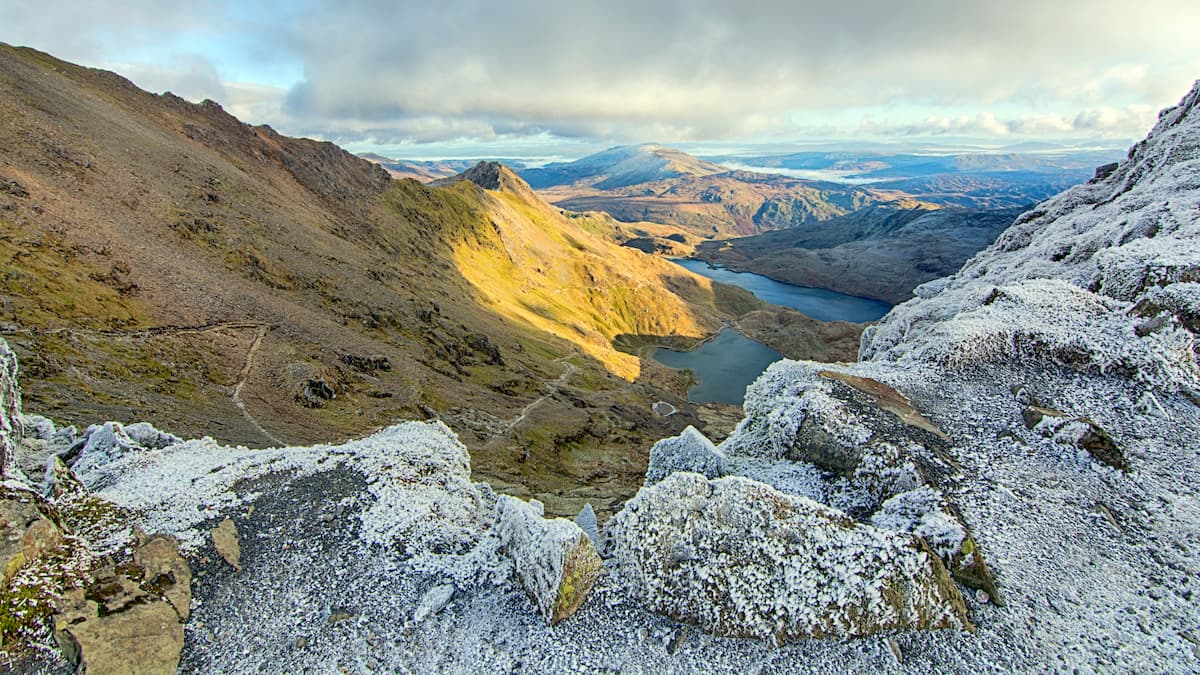
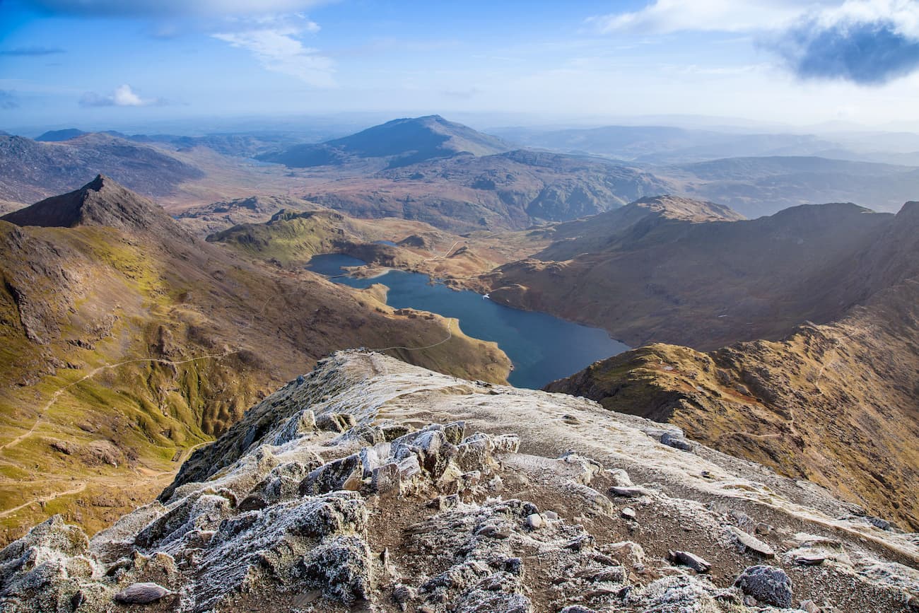
The most dangerous part of this walk is around Cwm Glas Bach, where stark cliffs flank the path. You'll also want to be careful when the path runs onto the slopes of Garnedd Ugain. You'll know you're on the final part of your ascent when the Pyg Track and Miners' Track join onto the Llanberis Path. From atop Snowdon on a clear day, you'll have fantastic views of 18 different lakes and peaks of the 14 Welsh Furths. When the path forks on your way down from the summit past the stone at Bwlch Glas, make sure you keep left to avoid heading for Crib Goch and Garnedd Ugain.
The Pyg Track is considered the most difficult method of scaling Snowdon and should only be undertaken by highly experienced hikers. Come well-prepared, and thoroughly map out your route. This hike is around seven miles there and back, ascends 723 meters, and takes roughly 6 hours.
Start by taking the beaten path in the right hand corner of the Pen y Pass car park. Be careful not to take the Miner's Path accidentally, another popular hiking route explained on the main Wales page. The first hour of the climb is rough and steep up to Bwlch y Moch. When Lliwedd (874 m) and Llyn Llydaw come into view, take the left fork in the road for Snowdon. The right track leads up to the dangerous and narrow ridge to Crib Goch.
Further along the trail, the Pyg Track and the Miners' Track cross each other. The intersection is marked with a stone. From here, the hike becomes much steeper up to Bwlch Glas. Keep to the right while zigzagging up the mountainside to avoid the open mine shafts. The track then joins onto the Llanberis Path and the Snowdon Ranger Path for a final ascent to the summit. Follow the same route down, using the stone markers as a guide.
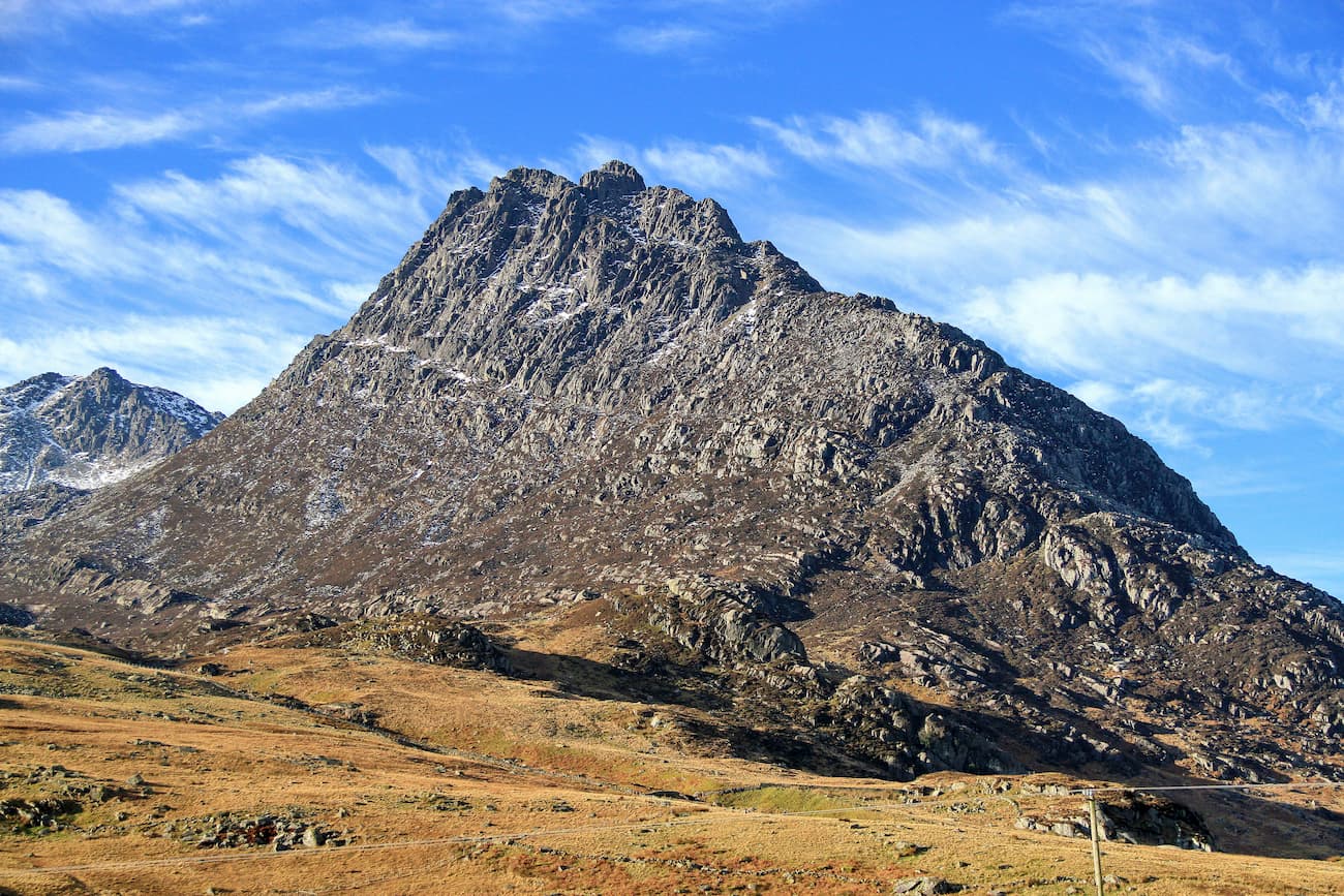
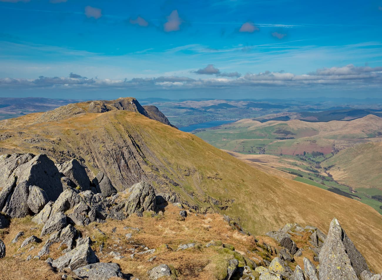
The Glyderau mountain range is a favorite amongst hikers thanks to Tryfan, which is considered one of Snowdonia's most exciting climbs. One of the most popular ways of scaling Tryfan is via the Devil's Kitchen, but this route doesn't include Glyder Fawr (1,000 m) and Glyder Fach, the group's two highest mountains. If you want to take all three peaks at once, start from the NE ridge of Y Garn (947 m). This walk is around 7 miles, ascends 1,061 meters, and takes roughly 6 hours. The hike is considered complicated and fraught with danger, with lots of scrambling required. Ensure you map out the best route before climbing.
The quickest way to get onto the NE ridge of Y Garn is by following the path along the western edge of Llyn Idwal to Cwm Idwal. Turn right at the rock known as Tin Pan Alley to begin your ascent. To climb onto the ridge, follow the clear eroded path straight up. The climb up the spine of the ridge is steep but doesn't require scrambling. If you fancy a break, you'll find a shelter at the summit of Y Garn, which is a few minutes away.
Descend down to Llyn y Cwn and start your climb to the summit of Glyder Fawr. Scaling the scree chute here is tricky, so you may want to make the journey easier by following the nearby stream up the mountain. After taking in the unique rock formations which litter the summit of Glyder Fawr, continue across the cairns to Glyder Fach. Some scrambling is necessary to reach the top of Glyder Fach. The best way of continuing on to Tryfan is via the Miner's Track to Bwlch Tryfan. From Glyder Fach's famous cantilever, locate the path to the left of some boulders. It's hard to locate at first but become apparent past the boulders.
When the road forks near Llyn Caseg Fraith, take the left turn. Be careful not to turn too early, as there are several forks along this trail. Scrambling is required on some sections of this trail. You'll scale Tryfan from the southern ridge, which requires lots of scrambling to the craggy summit. Atop Tryfan is the famous Adam and Eve boulders, ideal for a photo opportunity. Once you've scrambled off Tryfan's summit, take the path to Bochlwyd, which leads back to Ogwen village.
Cadair Idris is another highly popular hiking destination in Snowdonia, with 3 main routes to the top. The main path to the summit of Cadair Idris is the Pony Path from Ty Nant. While considered a safer hike than Snowdonia, Cadair Idris is still a very strenuous climb that inexperienced hikers should avoid. The Pony Path route is a 6-mile round trip, ascends 727 meters, and will take approximately 5 hours.
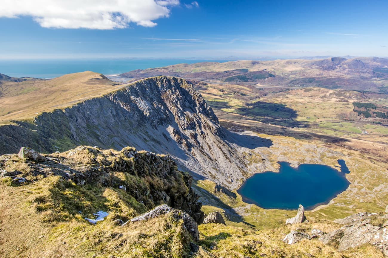
From the Ty Nant car park, head past the farmhouse towards the Cadair Idris Ridge. Initially, the trail leads through woodlands and is rugged but not challenging. The path will become noticeably steeper once you cross the stone bridge after the gate. You'll soon come to a set of stone steps, with the sublime cliffs of Cyfrwy (800 m) to your left. Once climbing the hill to the right of the sheep pen, head left at the fence blocking your progress.
After passing the Rhiw Gwredydd, take care along the exposed cliffs overlooking Llyn y Gader and Bwlch y Gwynt, which can be perilous in windy and snowy conditions. The final section of the climb requires scrambling. If you need to rest, you'll find a shelter near the summit. During your descent, keep to the right to avoid heading towards Bwlch Cau to the mountain's southside.
Along with Cadair Idris, Aran Fawddwy is one of the best hikes in southern Snowdonia. While Aran Fawddwy isn't one of the Wales 3000s, it's the highest mountain in southern Snowdonia and is only 9 meters short of being considered a Furth. Despite not being as popular as Cadair Idris, Aran Fawddwy and its sister peak Aran Benllyn (880 m) is still a rewarding and strenuous trek. This hike is around 14 miles, ascends 1202 meters, and takes roughly 8 hours. While generally easy to follow, the trail up to Aran Fawddwy is boggy in places, so avoid this trek during bad weather and wear decent hiking boots.
Pick up the trail by following the track opposite the Llanuwchllyn car park. The trail is easy to navigate, thanks to a fence that runs alongside you for most of the journey. You'll start with an ascent to the top of Moel Ffenigl (610 m), before scaling Aran Benllyn. From atop Aran Benllyn, you'll be able to spot the peak of Aran Fawddwy beckoning to the south. After passing over the rugged landscape, you'll reach a wall that signifies the start of your final ascent up Aran Fawddwy. Reaching the peak of Aran Fawddwy is the toughest part of the ascent and requires some scrambling. A shelter marks the top of Aran Fawddwy, which is ideal for resting.
You'll pass by a couple of notable points on the descent from Aran Fawddwy. Start by heading to the cairn on Erw Y Ddafad-Ddu (873 m) and keep left down the grassy slope. Down the slope, the Creiglyn Dyfi lake will come into view on the right. Follow the fence over the summit of Foel Hafod Fynydd (681 m) before heading down the steep Bwlch Sirddyn. From here, you can either extend your walk over Esgeiriau Gwynion (679 m) or continue down along the track and join the path back to Llanuwchllyn.
Wrexham is the largest town in North Wales and the closest major settlement to Snowdonia National Park. With a population of over 60,000, Wrexham offers some intriguing local attractions, from the medieval St. Giles Church of Wales to the 18th century Erddig Hall. While in Wrexham, make sure you take a boat ride down the postcard-perfect Pontcysyllte Aqueduct.
Wrexham affords several reasonably-priced hotels, such as the Lemon Tree Hotel, Ramada Plaza, and Grove Guest House. You can get to Snowdonia National Park from Wrexham via the A5. The journey is roughly 40 miles and takes approximately an hour.
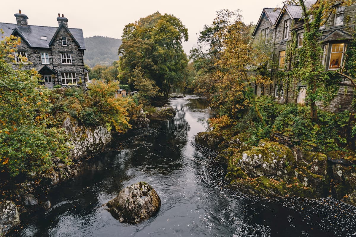
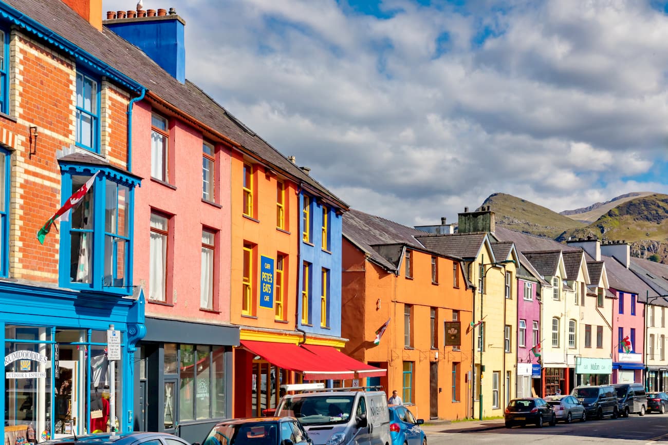
Adventure seekers looking to be as close to the center of Snowdonia National Park as possible should stay in Betws y Coed. Encircled by the Gwydir Forest, Betws y Coed features the historic Betws y Coed Train Station and is just a short drive from the medieval Dolwyddelan Castle. While staying in Betws y Coed, take a stroll down the Conwy River and admire the serene Rhaeadr Y Graig Lwyd waterfall. Betws y Coed is a hotspot for mountain climbers, with popular hiking destinations such as Glyder Fach, Tryfan, and Moel Siabod (863 m) a 20-minute drive from the village. You'll find several quaint hotels within Betws y Coed, such as the Coed y Fron Guest House, the Royal Oak Hotel, and Tŷ Gwyn Hotel.
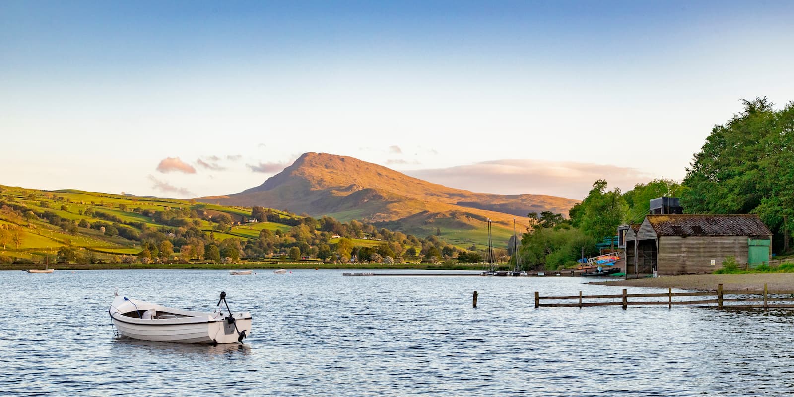
Watersport enthusiasts will want to book a room in Bala. Located on the northeastern edge of Wales' largest lake, Llyn Tegid, Bala offers easy access to ranges in the Snowdonia Massif and southern Snowdonia. Hikers will love taking the lengthy 14-mile trek around Llyn Tegid. You'll also be within 15 miles of Aran Fawddwy and less than 10 miles from Arenig Fawr (850 m). Some of the best accommodation in Bala includes the White Lion Royal Hotel, Plas Yn Dre, and Gwesty' r Plas Coch Hotel.
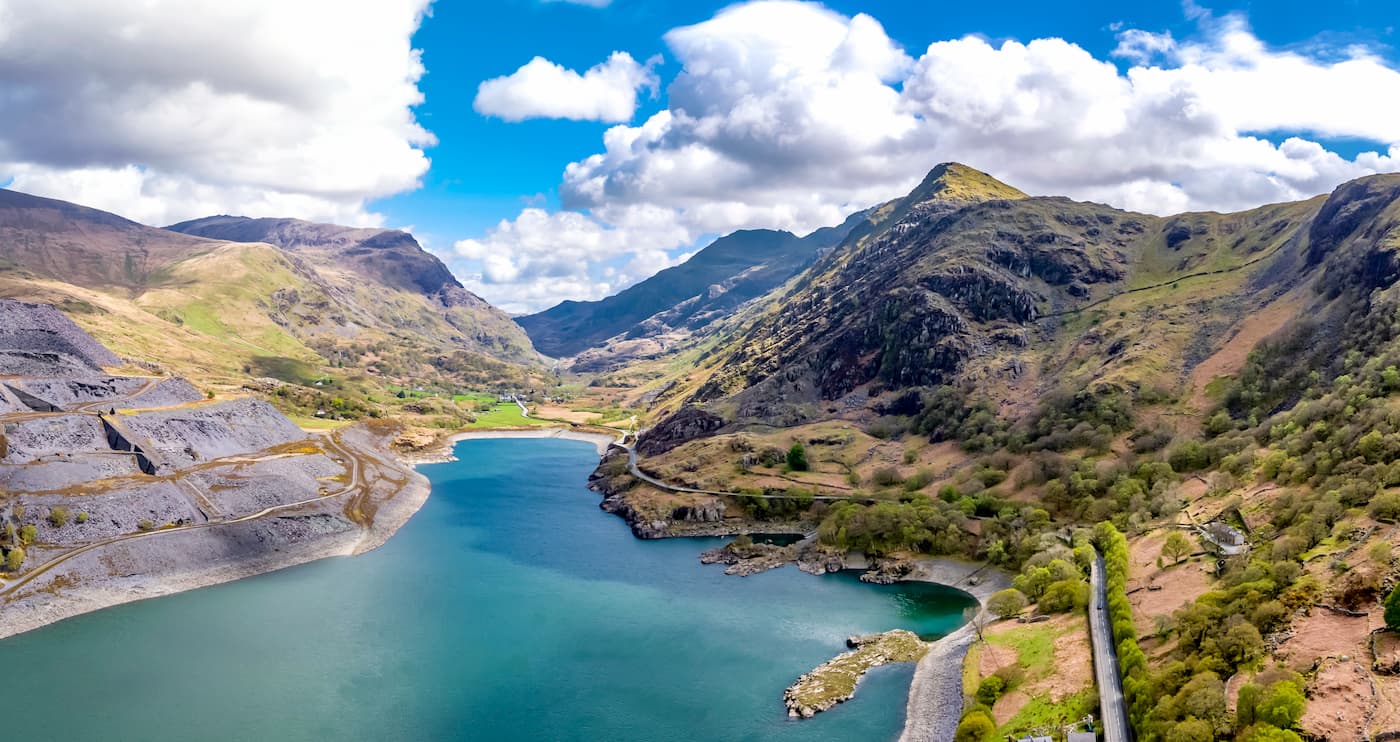
Llanberis is the ultimate place to stay if you're looking to scale Snowdon. Situated at the foot of Wales' highest mountain, Llanberis is one of the most popular holiday destinations in Snowdonia. Nearby Llyn Peris and Llyn Padarn are also great for kayaking, fishing, and scuba diving. If you don't fancy trekking it up Snowdon, book a seat on the Snowdon Mountain Railway for a once-in-a-lifetime train ride up the mountain. You'll also be within 5 miles of the Glyderaus. There are several lakeside hotels in Llanberis, including the Royal Victoria Hotel, Padarn Hotel, and the Alpine Lodge Hotel.
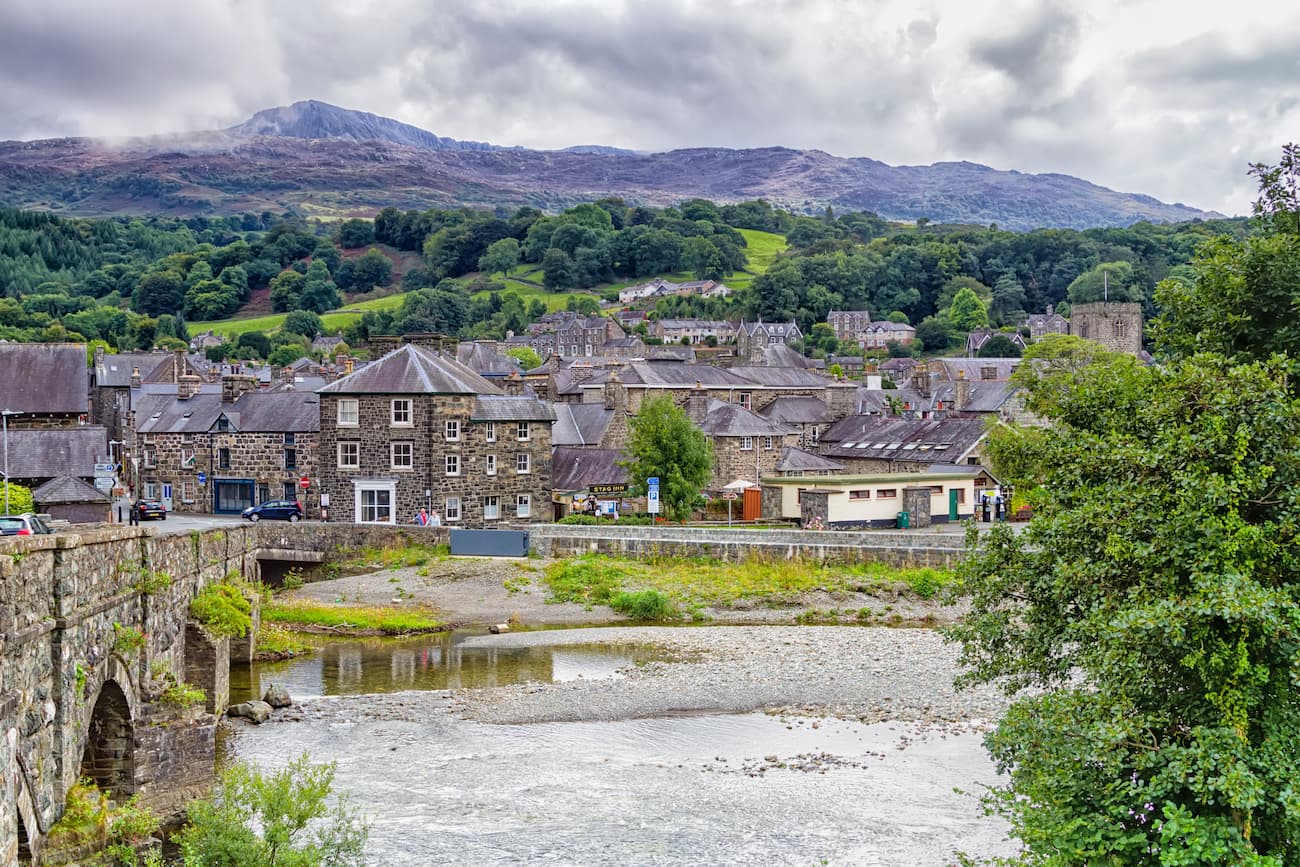
Dolgellau is an excellent vacation spot if you're looking to climb the beautiful peaks of southern Snowdonia. During your stay in Dolgellau, take a hike through the serene Coed y Brenin forest and admire the ruins of the 11th-century Cymer Abbey. Dolgellau is under 15 miles from Cadair Idris and is under 10 miles from Aran Fawddwy. You'll have a choice of beautiful hotels in Dolgellau, including Penmaenuchaf Hall Hotel, Tŷ’r Graig Castle, and the Royal Ship Hotel.


tgo40
nuttalls
hewitts-gb
marilyns-gb
nuttalls
hewitts-gb
furths-ew
marilyns-gb
nuttalls
hewitts-gb
furths-ew
marilyns-gb
tgo40
nuttalls
hewitts-gb
furths-ew
tgo40
nuttalls
hewitts-gb
marilyns-gb
nuttalls
hewitts-gb
furths-ew
marilyns-gb
nuttalls
hewitts-gb
furths-ew
marilyns-gb
tgo40
nuttalls
hewitts-gb
marilyns-gb
tgo40
nuttalls
hewitts-gb
marilyns-gb


