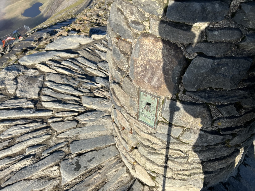
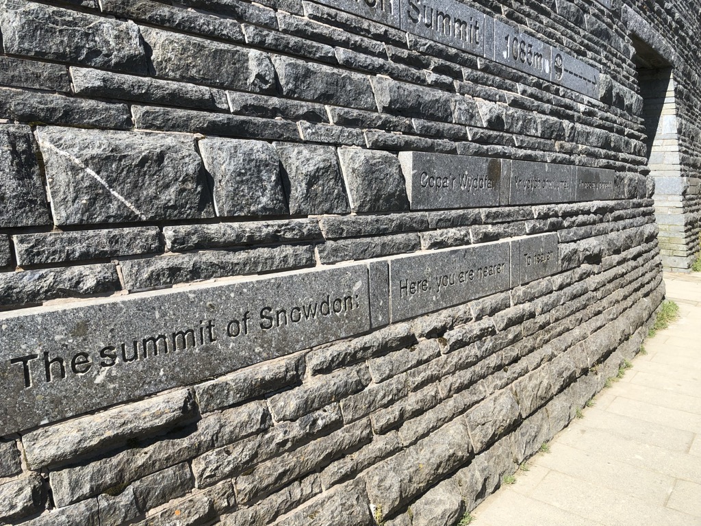
Snowdon (), or Yr Wyddfa (pronounced [ər ˈʊɨ̞̯ðva] ), is a mountain in the Snowdonia region of North Wales. It has an elevation of 1,085 metres (3,560 ft) above sea level, which makes it both the highest mountain in Wales and the highest in the British Isles south of the Scottish Highlands. Snowdon is designated a national nature reserve for its rare flora and fauna, and is located within Snowdonia National Park.
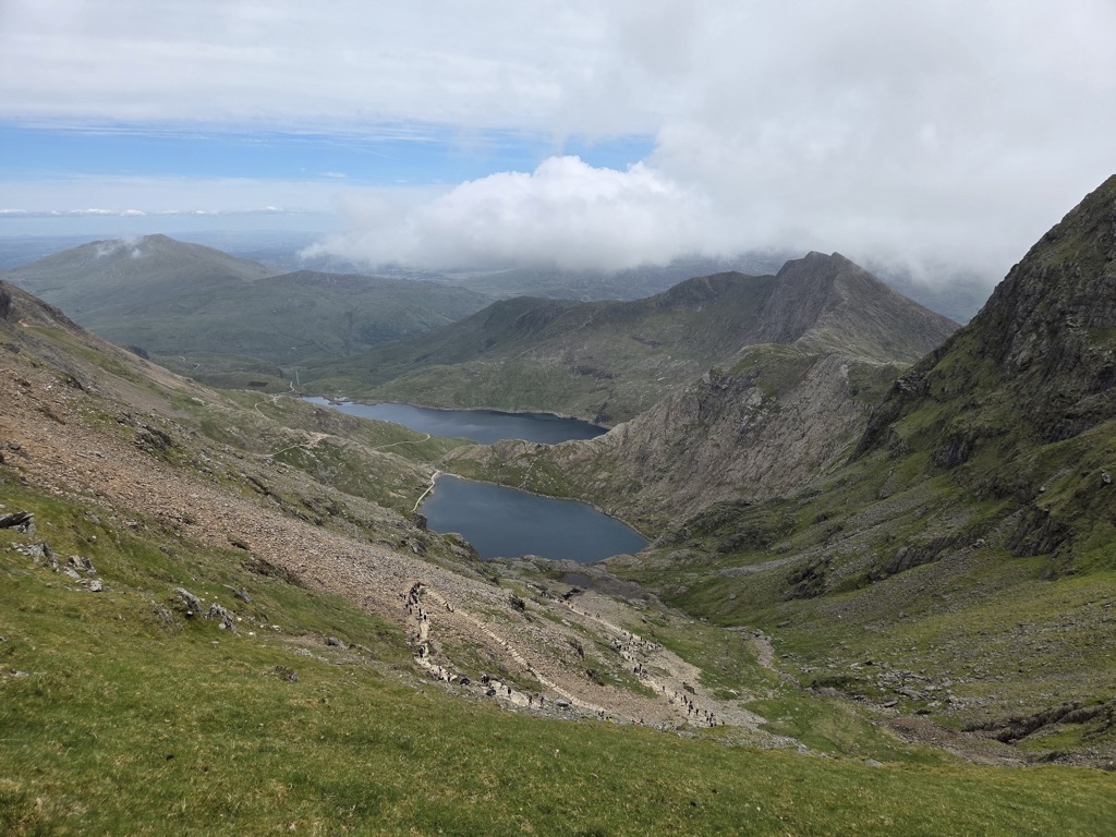
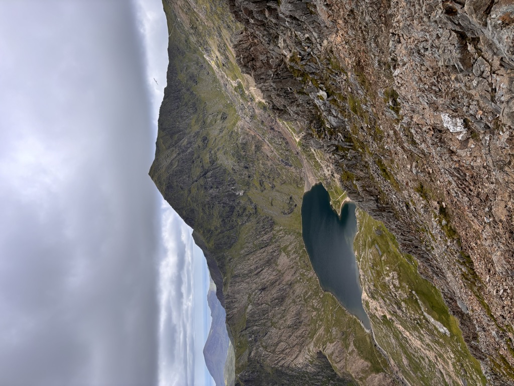
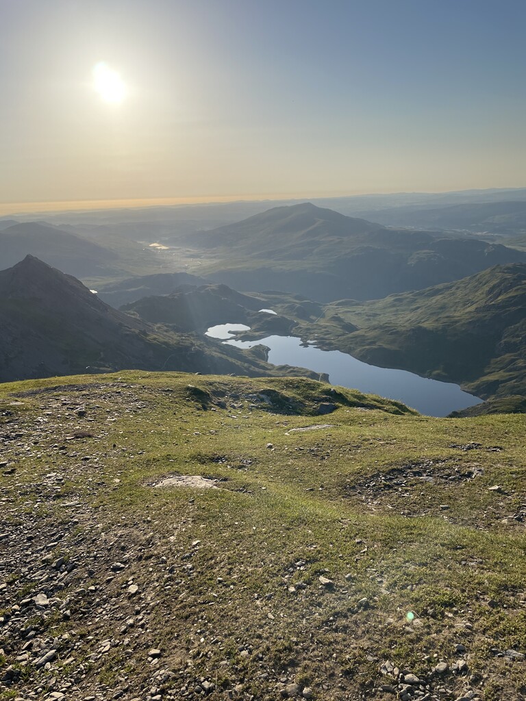
The rocks that form Snowdon were produced by volcanoes in the Ordovician period, and the massif has been extensively sculpted by glaciation, forming the pyramidal peak of Snowdon and the arêtes of Crib Goch and Y Lliwedd. It is part of the larger Snowdon range, which includes Garnedd Ugain, Yr Aran, and Moel Eilio. There are several lakes on the mountain, the largest of which is Llyn Lydaw (110 acres (45 ha)), located on the eastern flank at 1,430 ft (440 m).
The mountain is the busiest in the United Kingdom and the third most visited attraction in Wales. In 2019 it was climbed by 590,984 walkers; there are six main paths to the summit, the most popular of which begins in the town of Llanberis, to the north of Snowdon. The summit can also be reached using the Snowdon Mountain Railway, which carried 140,000 passengers in 2019. The rack railway, which opened in 1896, operates over 4+3⁄4 miles (7.6 kilometres), from Llanberis to the Summit station. It generally operates from March to the end of October, with trains running to the summit station from May. The cliff faces on Snowdon, including Clogwyn Du'r Arddu, are significant for rock climbing, and the mountain was used by Edmund Hillary in training for the 1953 ascent of Mount Everest. The mountain, alongside Ben Nevis in Scotland and Scafell Pike in England, is climbed as part of the National Three Peaks Challenge.
There's a trail leading to the summit.
By elevation Yr Wyddfa is
# 1 out of 3092 in the Wales Mountains # 1 out of 572 in Snowdonia National Park # 1 out of 731 in Gwynedd # 1 out of 3083 in Wales # 99 out of 34760 in United Kingdom
By prominence Yr Wyddfa is
# 1 out of 3092 in the Wales Mountains # 1 out of 572 in Snowdonia National Park # 1 out of 731 in Gwynedd # 1 out of 3083 in Wales # 3 out of 34760 in United Kingdom
We use GPS information embedded into the photo when it is available.
3D mountains overlay
Adjust mountain panorama to perfectly match your photos because recorded by camera photo position might be imprecise.
Move tool
Rotate tool
Zoom
More customization
Choose which peak labels should make into the final photo and what photo title should be.
Next
Photo Location
Satellitte
Flat map
Relief map
Latitude
Longitude
Altitude
OR
Latitude
°'''
Longitude
°'''
Apply
Register Peak
Peak Name
Latitude
Longitude
Altitude
Register
Teleport
PeakVisor
This 3D model of Sagarmatha National Park in Nepal was made using the PeakVisor app topographic data. The mobile app features higher precision models worldwide, more topographic details, and works offline. Download PeakVisor maps today.
Download OBJ model
PeakVisor
The download should start shortly. If you find it useful please consider supporting the PeakVisor app.
PeakVisor for iOS and Android
Be a superhero of outdoor navigation with state-of-the-art 3D maps and mountain identification in the palm of your hand!