
Scan the QR code and open PeakVisor on your phone
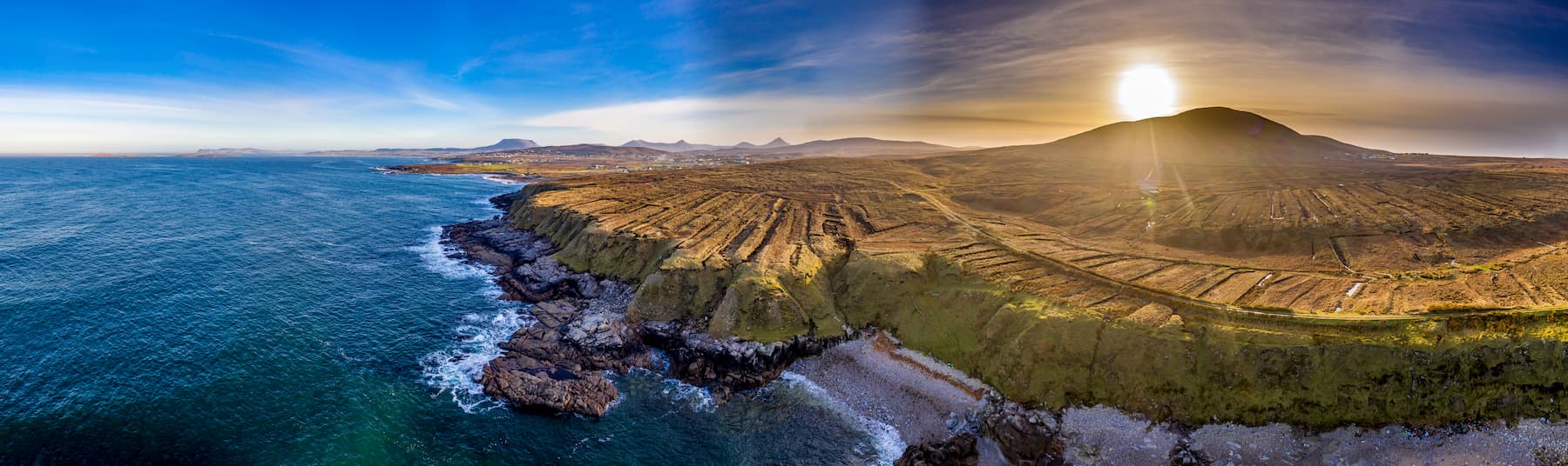
With over 30 sublime mountain ranges throughout the Republic of Ireland, thrillseekers keen to explore the peaks of the Emerald Isle are spoiled for choice. Many of Ireland's mountains are in coastal areas, with high concentrations in counties such as Wicklow, Kerry, and Galway.
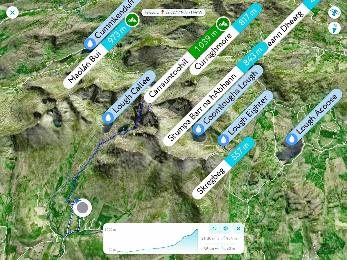
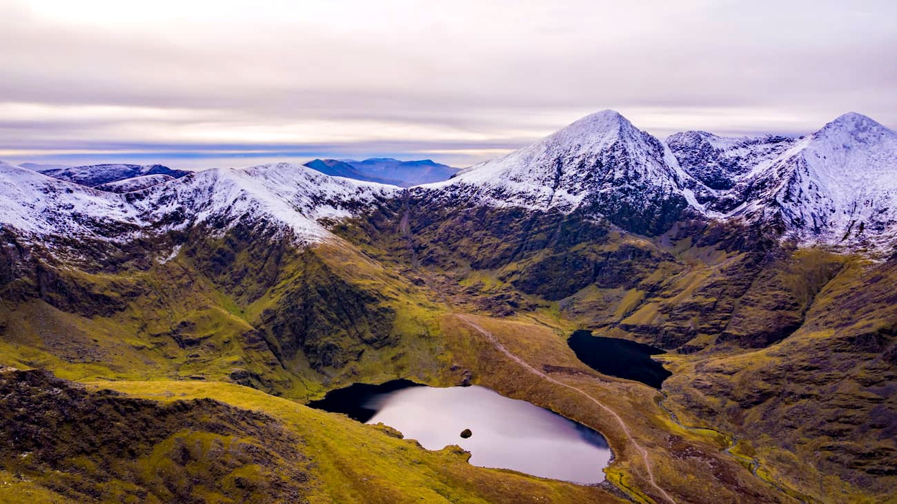
Two of Ireland's best-known mountain ranges are MacGillycuddy's Reeks and the Wicklow Mountains. MacGillycuddy's Reeks is in County Kerry on the Iveragh Peninsula and features Ireland's highest mountain, Carrauntoohil, which stands at 1,039 m. MacGillycuddy's Reeks is also home to many of Ireland's other highest peaks, including Beenkeragh, Cnoc na Péiste, and Caher.
Meanwhile, the Wicklow Mountains are famous for being the largest stretch of uplands in the country and home to Lugnaquilla. At 935 m, Lugnaquilla is the tallest mountain outside of County Kerry. Wicklow Mountains National Park is one of the most popular parks for hikers in Ireland due to its picture-perfect, varied landscape and its proximity to Dublin.
Kerry is home to many of Ireland's noteworthy mountains, making it the perfect spot for backpackers, campers, and hikers. Most of Ireland's highest peaks are within Macgillycuddy's Reeks; however, there are a few Munros outside this range. Mount Brandon, part of the Brandon Group, is the tallest mountain in Ireland outside of Macgillycuddy's Reeks, and is perched on Kerry's stunning Dingle Peninsula.
Another impressive mountain on the Dingle Peninsula is the Baurtregaum. Part of the Slieve Mish range, Baurtregaum is a steep mountain encircled by three valleys, offering a breathtaking climb on a clear day.
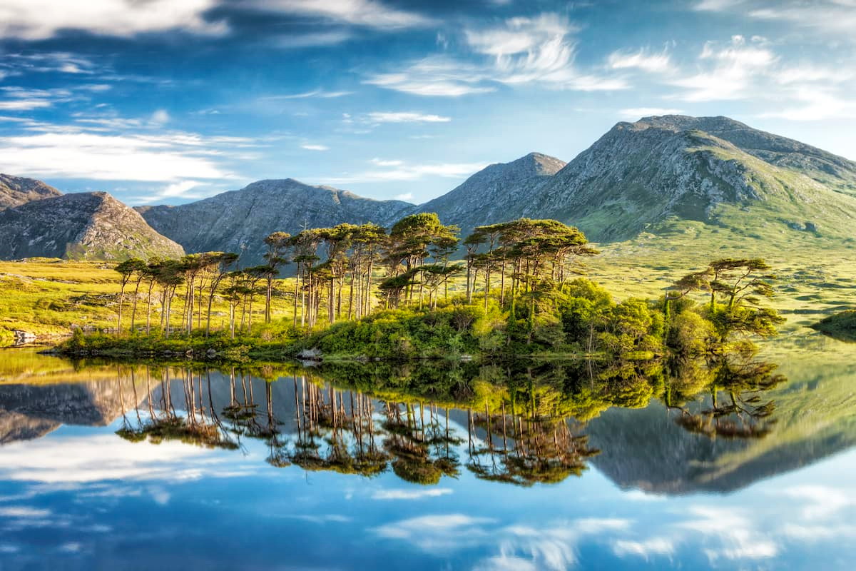
As you travel north along Ireland's western coastline into County Galway, you'll come across the Twelve Bens. Climbing the Twelve Bens is the perfect way to discover Galway's famed region of Connemara. The Twelve Ben's highest mountain, Benbaun, affords climbers panoramas of the Connemara countryside and the Atlantic Ocean.
Even further north into County Mayo is the Mweelrea Mountains. The range's namesake Mweelrea is the highest peak in Connacht. The name Mweelrea means 'bald hill with the smooth top,' which aptly describes the geography of the mountain.
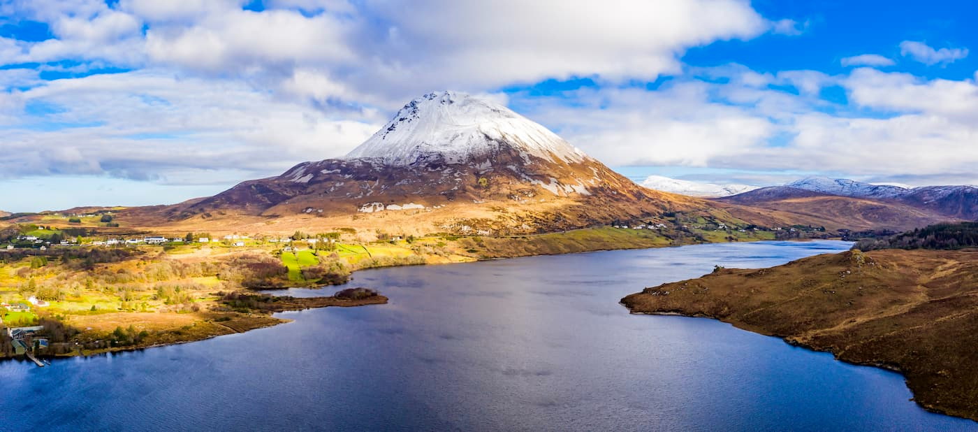
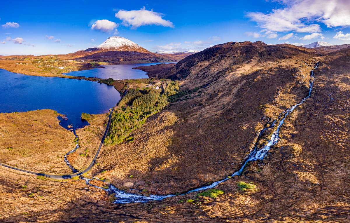
If you're planning a hiking adventure in Ireland's most northern county, consider visiting the Derryveagh Mountains. This Donegal mountain range is one of the best in Ulster, with the verdant slopes of Errigal, the highest mountain in the County Donegal at 751 m.
At the other end of the country in County Waterford, you'll encounter the Comeraghs and Knockmealdown Mountains. The Knockmealdown Mountains run along the border between County Tipperary and County Waterford, while the Comeraghs are positioned in the heart of the County Waterford. Both are perfect for intermediate hikers, with rugged landscapes and peaks of around 800 m.
To the northeast, straddling the border of County Carlow and County Wexford, are the Blackstairs Mountains. The Blackstairs Mountains feature Mount Leinster, the highest point in the two counties and the fifth-highest in Leinster. Mount Leinster is one of the most popular mountains in the southeast of Ireland, as it's perfect for an array of activities, including cycling, hang-gliding, and hiking.
While many of Ireland's mountains are coastal, there are also inland mountain ranges. For example, the Galtee Mountains stretch across County Limerick and County Tipperary. The Galtees feature the country's largest inland mountain, Galtymore, which stands at 917 m tall. The Galtee Mountains are a favorite tourist destination, thanks in part to the area's serene glacial lakes, Lough Curra, Borheen Lough, and Lough Dineen.
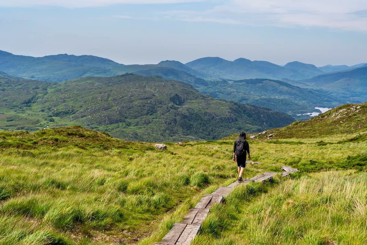
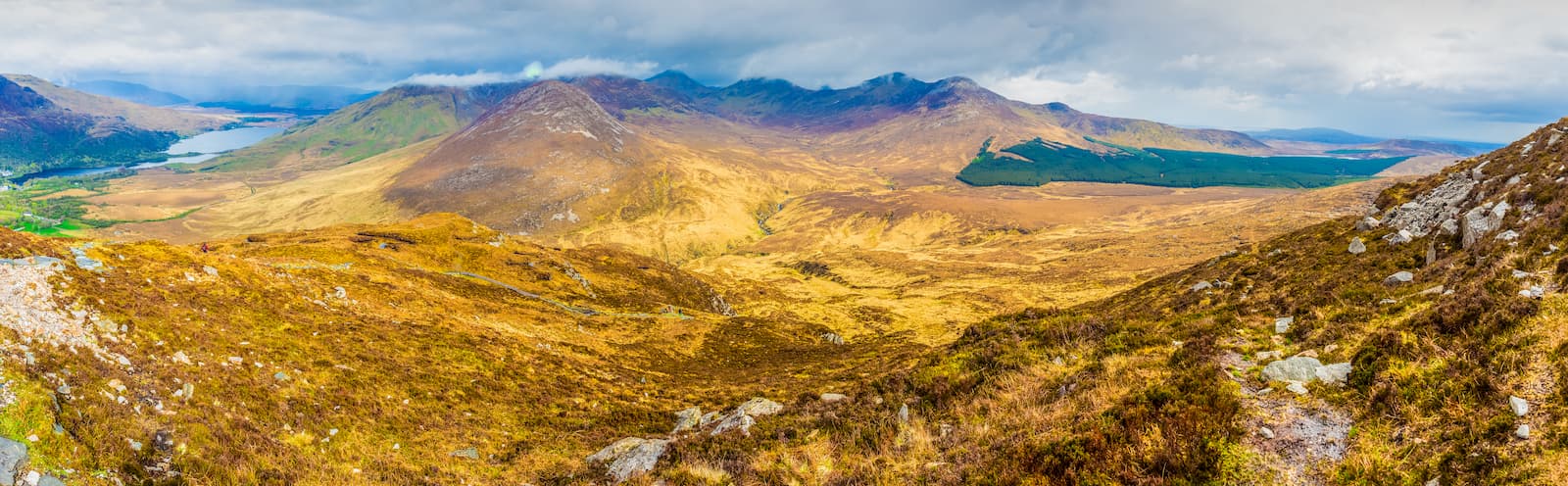
Macgillycuddy's Reeks is unquestionably among the top hiking locations in Ireland, thanks to its towering mountains and challenging climbing conditions. This craggy mountain range features 11 different peaks, with several possible routes that only experienced climbers should attempt to tackle. The best way to reach Macgillycuddy's Reeks is by taking the exit off the N72 from Killarney.
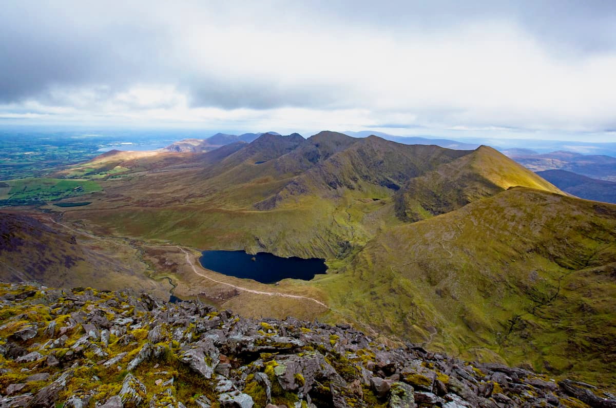
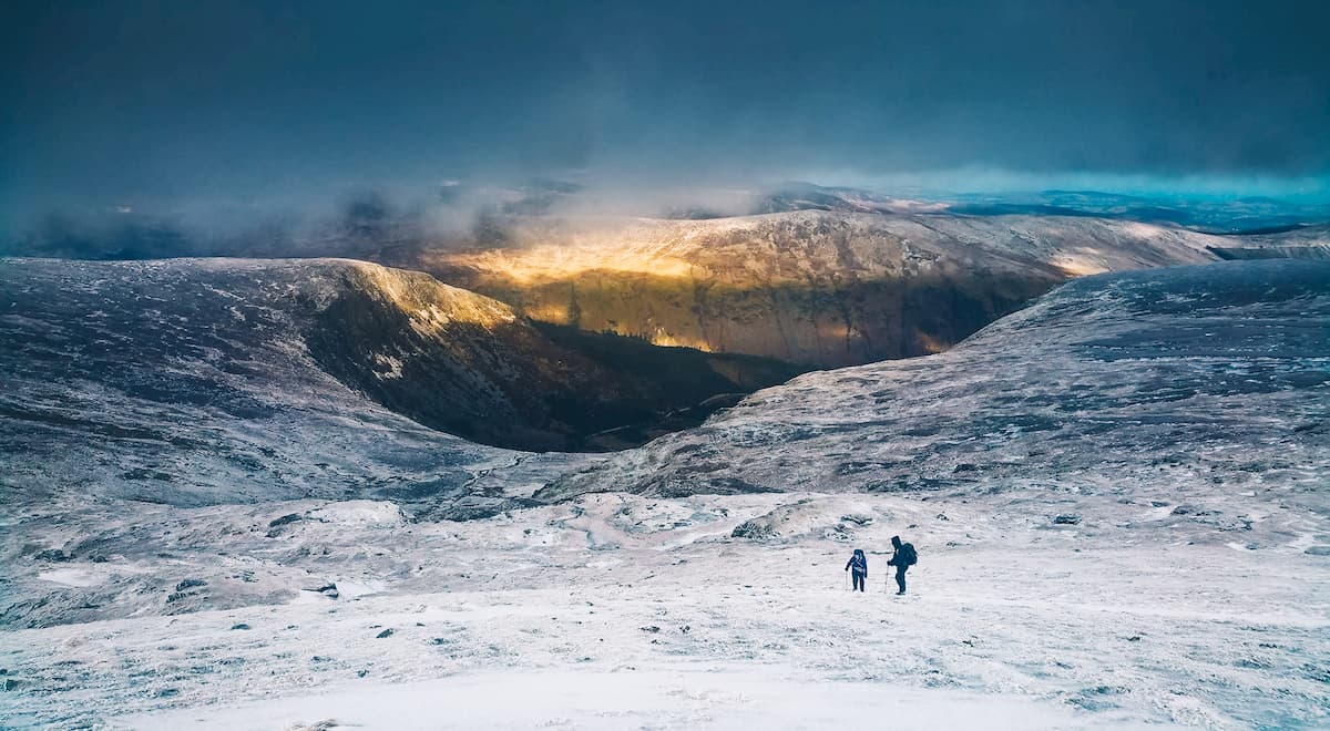
The Coomloughra Horseshoe is one of the most popular trails for climbers looking to traverse the three highest Irish Munros, Carrauntoohil, Beenkeragh, and Caher. The Coomloughra Horseshoe runs for about 12 km and takes around 7 hours to complete. This ridge walk is not for the faint-hearted, due to sheer drops off the Beenkeragh Ridge and scrambling required in some areas. As the name suggests, this route runs in a horseshoe clockwise from Cnoc Íochtair (739 m) past some of the range's smaller peaks before ascending the second-highest mountain in Ireland, Beenkeragh (1,010 m). Next, you'll have to traverse the problematic Beenkeragh Ridge on your way to the highest point in Ireland, Carrauntoohil (1,039 m).
Once you reach the summit of Carrauntoohil, head south to Caher (1,001 m). From here, you'll begin your descent towards the picturesque Lough Eighter. Traveling clockwise along the Coomloughra Horseshoe is the preferable route, as the descent down Caher isn't as steep, making for an easier climb.
Hikers looking only to climb Carrauntoohil should consider the Devil's Ladder trail. The Devil's Ladder is the most common and direct route for climbing Carrauntoohil. This route is roughly 11 km long and will take experienced mountain climbers around 6 hours. Despite being the most common route, The Devil's Ladder is a grueling climb. It's also quite easy to get lost on the way up, so make sure you map out a route, and it's wise to bring a compass. Some sections of The Devil's Ladder are fairly steep, and scrambling is required.
Killarney National Park is one of Ireland's most scenic areas, with 26,000 acres of tranquil loughs, dense woodlands, and breathtaking mountains. Killarney National Park contains several mountain ranges, including the Mangerton Mountain Group, Purple Mountain Group, and the Shehy Mountains. Killarney National Park gets over a million visitors each year, who come to hike the mountains and marvel at the beautiful landscape. To reach Killarney National Park, follow the N22 from Cork or the N71 from Killarney.
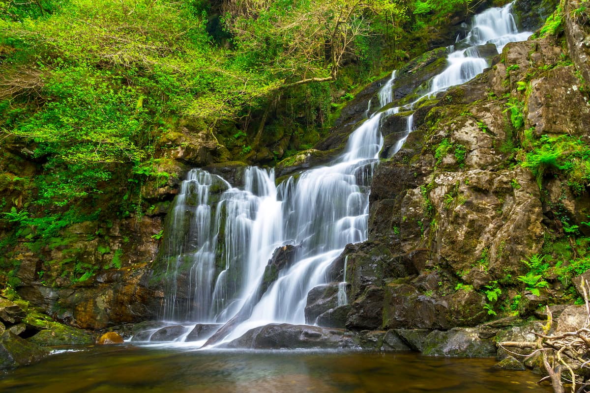
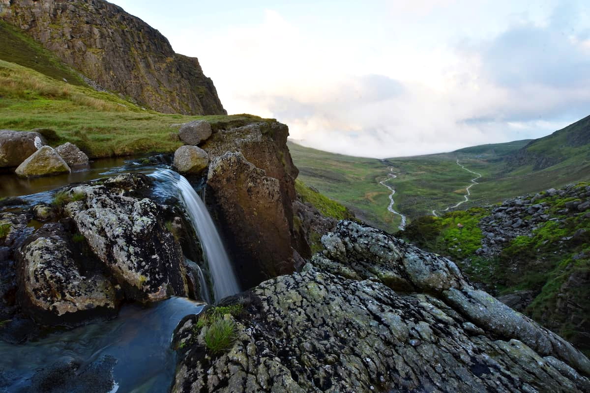
If you're planning a hike, consider scaling Torc Mountain. You can plan a short walk along the red and yellow trails which will lead you past the stunning Torc Waterfall. These trails are fairly leisurely and run for around 3 km.
Alternatively, you can take a walking route to the summit of Torc Mountain (525 m). This trail starts at the Torc Waterfall car park along the Old Kenmare Road. All you need to do is follow the signposts to the path which leads through woodlands up the mountain. The summit of the mountain affords sublime vistas of the park and Macgillycuddy's Reeks.
One of the most arduous hikes in Killarney National Park is up Mangerton Mountain. Mangerton stands at 838 m high, making it one of the tallest mountains in Killarney National Park. Tourists often overlook the Mangerton Loop trail due to its boggy conditions and the accessibility of nearby Torc Mountain. In many ways, Mangerton Mountain is a better climb than Torc Mountain as it offers sweeping views of Killarney and Macgillycuddy's Reeks. Mangerton Mountain's peak is the only one viewable from the center of Killarney.
The Mangerton Loop is around 9 km long and takes about 5 hours to complete. Some low-level scrambling may be required on the most challenging portions of the hike. Along the way, you'll pass by four loughs: Devil's Punchbowl, Horse's Glen, Stoompa, and Lough Garagarry. These loughs don't just make for magnificent scenery but can be used as waypoints. Mangerton's peak is easily recognizable thanks to a small cairn.
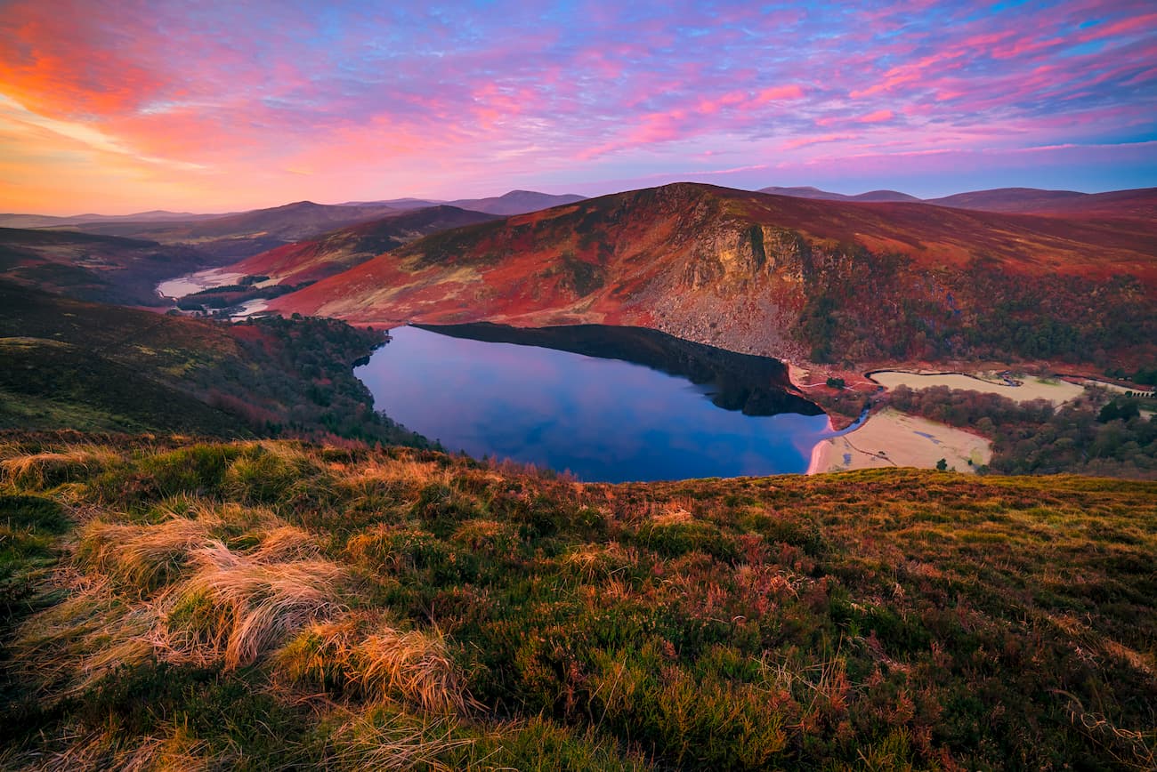
Positioned just south of Dublin is Wicklow Mountains National Park. Wicklow Mountains National Park is the largest national park in Ireland, covering roughly 50,000 acres of uplands, bogs, and heaths. It is also the only national park located in the east of the country. Wicklow Mountains National Park is also one of the most popular in Ireland, with over a million visitors each year. The park is easily reached by following the R115 from Dublin.
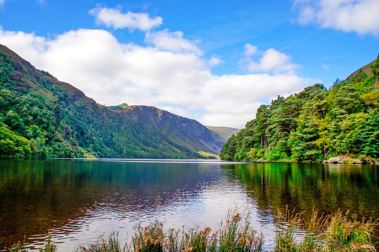
Glendalough Valley is arguably one of the most scenic districts in Ireland. Roughly translated as the "valley of two lakes," Glendalough features rolling hills and peaceful lakes. Despite being one of the most popular areas in Wicklow National Park, Glendalough Valley is largely untouched by humans. Glendalough features 9 marked walking trails, which range from 1 km to 11 km in length.
The Miner's Road Walk is ideal for anybody looking for a relaxing lakeside stroll. This 5 km long trail runs along Glendalough's Upper Lake and through Scots Pine woodland. Along this walk, you'll see the ruins of an old mining village and a cave known as St. Kevin's Bed. Feral goats are common along this path, in case you fancy some nature watching.
Hikers looking for a more challenging hike should look at Spinc and Glenealo Valley. This is one of the most popular walks due to the array of scenery along the way. In places, this path is very steep, especially leading up to the Poulanass Waterfall. After admiring the waterfall, you can climb 600 steps up to a scenic viewpoint, which affords vistas of the Upper Lake. Towards the end of the walk, you'll follow a boardwalk through a blanket bog back towards the visitor's center.
Lugnaquilla towers over Wicklow National Park at around 925 m and is one of 13 Irish Munros. The mountain pass is accessible from three different areas: Glen of Imaal, Glenmalure, and Aughavannagh. The Lugnaquilla Mountain Trail is around 13 km long and takes 4 to 6 hours to complete.
Lugnaquilla is considered to be one of the hardest climbs in Ireland. This is because of poor weather conditions and a lack of markers along the route. As a result, mountain climbers should map out a route, come well-prepared, and bring warm clothing. One of the most difficult parts of the journey is the Lugnaquilla Plateau at the summit of the mountain. The plateau is tricky due to low visibility in adverse weather conditions, which causes inexperienced hikers to become lost.
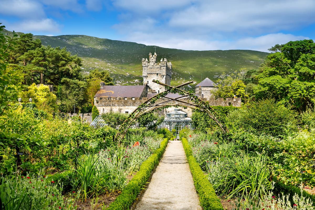
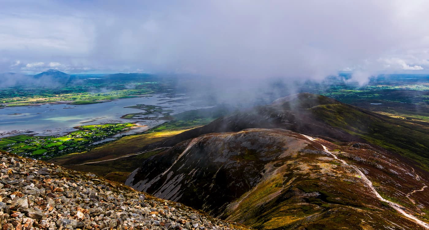
Glenveagh National Park is the second-largest national park in Ireland and offers some of the best hiking opportunities in Ulster. Glenveagh covers around 40,000 acres of pristine loughs and wilderness encircling the 19th-century Glenveagh Castle. Glenveagh National Park is popular with hikers due to the Derryveagh Mountains, which contain Errigal, the tallest mountain in County Donegal. To reach Glenveagh National Park, follow the N56 north from Letterkenny.
At 733m, Errigal can be tough to climb but should be manageable for people who exercise regularly. One of the best ways to climb Errigal is along the trail from Falcarragh. This route is 4km long and isn't a loop, so prepare to walk there and back. This path is not well signposted but is generally a straight line to the top of the mountain. Be cautious at the start of your journey, as it's easy to get stuck in the peat bogs. If the weather is bad, consider circling around the bog. This may be a longer route but will take less time.
Scrambling isn't generally required along this trailhead but may be necessary in inclement weather on the rugged parts of the trail. Once you're high enough, you'll have views of Glenveagh's loughs and valleys, as well as the Atlantic Ocean.
Visitors who are not looking to climb mountains might want to consider a stroll along Lough Veagh. This walk starts by Glenveagh Castle and runs along the lough for 3.5 km. Along the walk, you'll cross a bridge spanning the babbling Owencarrow River, weave through pine forests, and pass by the region's vast peatlands, which are bustling with an array of wildlife. This walk is not a loop; however, you can catch a bus back to the castle if you don't feel like repeating your journey.
Located in County Galway, Connemara National Park features 5,000 acres of woodlands, bogs, and heaths. As well as one of the most scenic parts of Ireland, Connemara National Park is home to the Twelve Bens, which are popular with hikers, due to their varied inclines and heights. Connemara National Park is located along the N59 midway between Galway and Westport.
Benbaun is the highest mountain in County Galway at 729 m. The walk up to the top of Benbaun can be challenging due to the boggy terrain and a lack of markers. You can start your climb from the Westport Road near Letterfrack. This walk is 9km and should be a 5-hour round trip. The best way to reach Benbaun is by first climbing the smaller peak of Knockpasheemore at 412 m.
There's no discernable path on the way up Knockpasheemore, but you can walk in a straight line up to the summit. From Knockpasheemore, head southwest, keeping the small lake on your left. The terrain here is boggy, so progress may be slower during winter. Towards the top of Benbaun, the terrain will turn rocky, and you'll likely find a worn path trodden by previous hikers. Once you reach the summit, head back down the way you came, following the beaten trail.
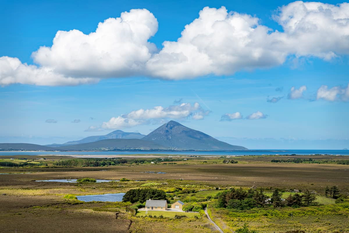
Ballycroy National Park is situated in County Mayo and covers over 25,000 acres. This national park consists mainly of the Owenduff Bog and the Nephin Beg Mountain Range. The Owenduff Bog is significant as it is one of the last complete peatland systems in Europe. The Nephin Beg Range also contains Nephin (802 m) and Mweelrea (813 m), the two highest mountains in Connacht.
The Bangor Trail is a road dating back to the 16th century that winds through the Nephin Beg Range and the Owenduff Bog. The road is around 40 km long and will take most hikers around 12 hours to complete. The Bangor Trail is often described as one of the remotest pathways in Ireland. Anybody planning on undertaking this long trek should come prepared with a map, compass, warm clothes, and more.
As this path is well-worn, it is relatively easy to follow. However, due to the trek's length, ensure you start very early in the morning, so you can finish before sunset. It is recommended you hike the Bangor Trail during the height of summer; therefore, you'll get as much sunlight as possible.
Mweelrea is an imposing climb with steep, rocky sections. The best way to reach Mweelrea is from the west near the Silver Strand. You can park your car in Leenane village and walk to the start of the trailhead at Doo Lough. This hike is 13 km to the summit and back, and should take around 7 hours.
Head southwest along the northern shores of Doo Lough, and you'll cross two streams and pass old sheep pens before reaching a corrie. Follow a small stream into the corrie, keep left, and head up the hill. Eventually, you'll head into an area known as "the Ramp", which is lined with awe-inspiring 400 m high sandstone cliffs. From here, the mountain passes can be perilous, so exercise caution and hire a guide if you are an inexperienced hiker.
You'll find small cairns mark the descent route and the summit of Mweelrea. First, you'll reach the top of Mweelrea, and then its sister peak, Ben Bury. After you reach the summit of Mweelrea, head back down the mountain passage and go northeast towards Ben Bury. Similar to Mweelrea, Ben Bury is marked with a cairn. The peaks of Ben Bury and Mweelrea afford remarkable views of Croagh Patrick, Clare Island, and County Mayo's countryside.
The Comeraghs are one of two mountain ranges in County Waterford and consists of 12 mountains. It is a popular range due to its varied landscape and charming miniature loughs. The Comeraghs are easily accessible from Dungarvan and Waterford City, with the Comeraghs clearly signposted. To reach the Mahon Falls Car Park, take the exit off the N25 at Kilrossanty and follow the signposts to the Comeragh Drive.
After admiring Mahon Falls, consider taking the Coumshingaun Lake Walk. The longest version of this walk is around 8 km long and takes about 5 hours. This hike leads to the clifftops over Coumshingaun Lough, one of the most breathtaking corrie lakes in Europe.
Firstly, you'll have to climb up a narrow ridge to the top of clifftops. This area is rocky, and some scrambling will be necessary to traverse the path safely. Once you reach the clifftop, enjoy the panoramas of the lake below and the rolling hills of Waterford in the backdrop.
You can turn back at this point or continue and scale two of the highest points in the Comeraghs. Be very careful climbing the next steep section, and scramble if necessary. After this abrupt climb, you'll reach a plateau, which is the highest point in the Comeraghs, Fauscoum (777 m).
To begin your descent, head clockwise around the edge of the corrie. At one point, you'll reach a spur to the east, which you should follow. Be careful not to leave this path too early; otherwise, you could become stuck on a steep grassy cliff. After a while, you'll come across a path that will lead back down to the start of the trail.
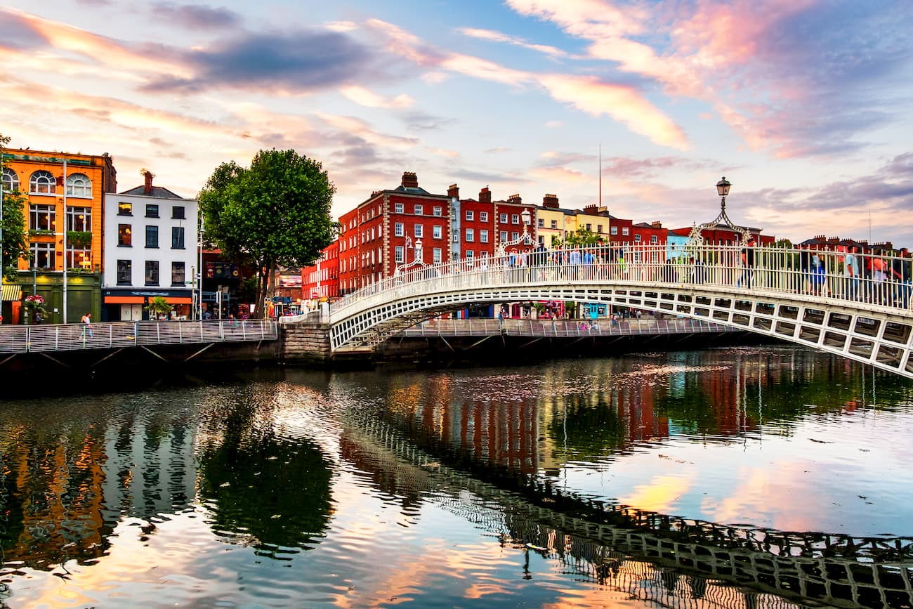
Major Settlements and Where to StayIreland's capital and largest city, Dublin, is an ideal base for branching out and visiting some of the best hiking spots in Ireland. Dublin has an array of accommodation options, from classy hotels to cheap hostels. Dublin is also home to some of the biggest attractions in Ireland, including the Guinness Storehouse and the National Gallery. As well as providing an array of great local attractions, Dublin is the best-connected city in the country, with national bus and train services running across Ireland.
One of the best reasons hikers should stay in Dublin is its proximity to the Wicklow Mountains National Park, which is located just 25 km south of the city. Due to the small size of Ireland, most mountain ranges are reachable from Dublin. For example, you can reach Macgillycuddy's Reeks at the other end of the country in around 4 hours.
Killarney is a picturesque town in County Kerry and acts as an entranceway to Ireland's best hiking spots. While Killarney isn't full of big attractions like some other settlements in Ireland, it has several quaint restaurants and boutique hotels for tourists looking for a peaceful vacation.
Killarney sits directly on the northern edge of Killarney National Park, about 9 km from Torc Mountain and Mangerton Mountain. If you fancy hiking the best of the Irish Munros, Macgillycuddy's Reeks is less than 20 km to the west of Killarney. For tourists traveling from outside of Ireland, you can fly directly into Killarney, thanks to Kerry Airport, just 16 km north of the town.
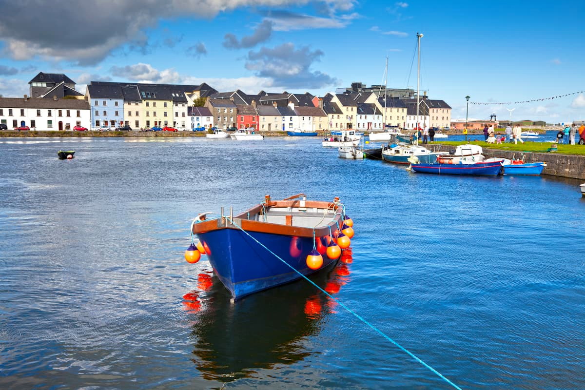
The seaside city of Galway is full of culture, arts, and exquisite food. Galway has some exciting local attractions and some of the best pubs in Ireland, making it one of the country's most popular holiday destinations.
Galway is also within driving distance of some of the best hiking locations in western Ireland. Galway is within 2 hours of several mountain ranges, including the Twelve Bells, the Partry Mountains, and the Maumturks. Those looking to branch out even further can take a trip to the Galtee Mountains, the largest inland mountain range in Ireland.
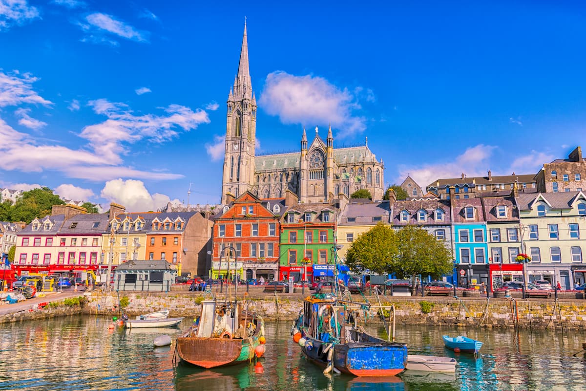
Cork is Ireland's second city and is a superb place to stay if you're looking for easy access to the mountains in the south of Ireland. If you're spending a few days in Cork, make sure you kiss the Blarney Stone, grab lunch at the English Market, and take a tour of the Cork City Gaol.
Cork is less than 2 hours from several popular mountain ranges, including the Galtee Mountains, the Comeraghs, and the Ballyhoura Mountains. County Cork also borders County Kerry, with Macgillycuddy's Reeks and Killarney National Park around 2 hours away.
Perhaps best known for its crystal, Waterford is excellent for hikers planning to scale some of the mountain ranges in the southeast. Waterford is the oldest city in Ireland, dating back to 914 AD. Keep an eye out for Waterford's famous landmark, Reginald's Tower, the oldest municipal building in Ireland.
The Comeraghs and Knockmealdown Mountains are situated within the County Waterford, with adventurers flocking from across the country to reach the precipices of Fauscoum and Knockmealdown. Waterford is also within 2 hours of the Galtee Mountains and the Blackstairs Mountains.


