Scan the QR code and open PeakVisor on your phone
Home to the wildest landscapes in Ireland, County Kerry boasts some of the best hikes on the Emerald Isles. There are 434 named mountains in County Kerry. The highest and most prominent mountain is Carrauntoohil (1,039 m/3,408 ft).
County Kerry is both Ireland's southwesternmost county and the fifth largest of the traditional 32 counties, covering approximately 4,807 square km (1,855 square miles) in area. It shares its borders with two other counties: County Limerick to the east and County Cork to the southeast.
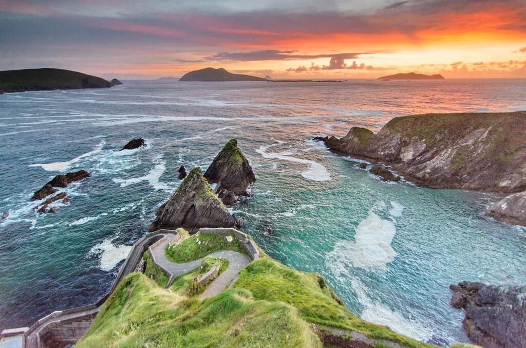
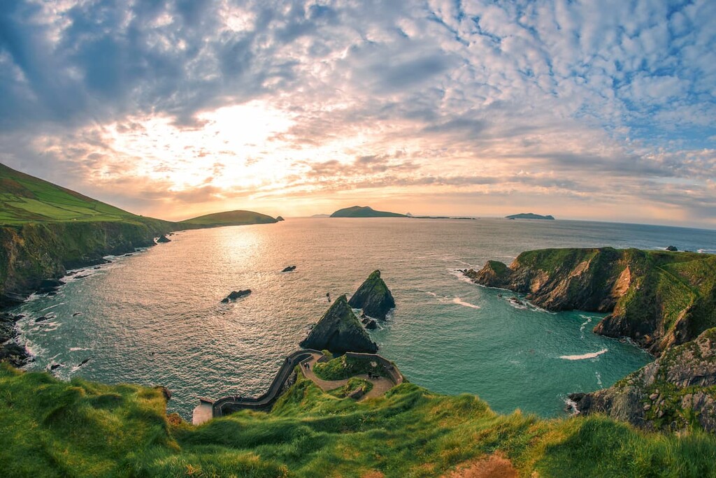
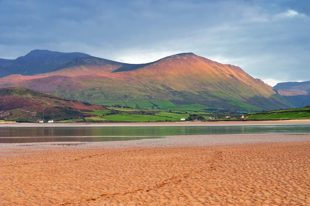
The county's coastline is characterized by the many inlets and peninsulas that jut into the Atlantic Ocean. There are four peninsulas—Kerry Head, Beara, Dingle, and Iveragh—the longest of which is the Dingle Peninsula, which extends for 64 km (40 miles) from Tralee to the Blasket Islands. The Dingle Peninsula is also home to Dunmore Head, Ireland's westernmost point.
The Iveragh Peninsula is the largest of the four peninsulas, at 48 km (30 miles) long and 24 km (15 miles) wide. The Iveragh Peninsula is popular among tourists due to the presence of Killarney National Park and MacGillycuddy’s Reeks.
Just off County Kerry's rugged coastline are several island chains, including the renowned Skelligs. This string of islands includes Skellig Micheal, a World Heritage Site known for its medieval cliffside monastery.
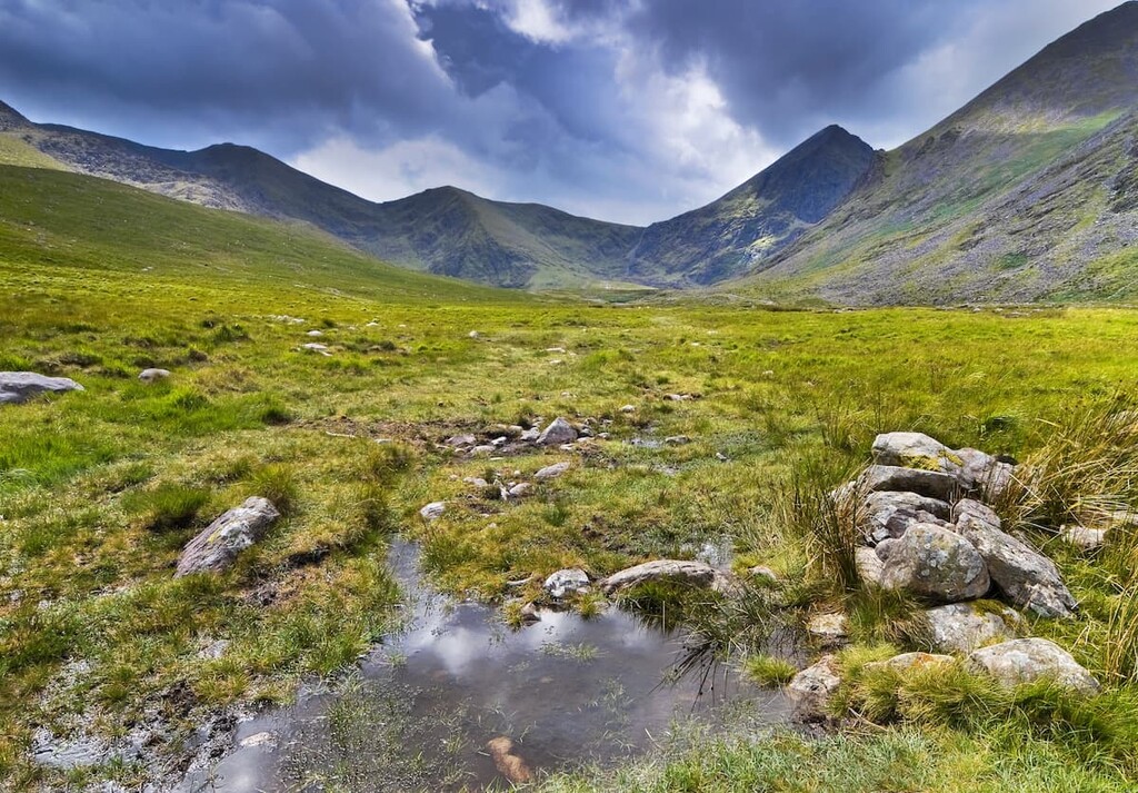
Heading inland from the coast, you'll find the landscape consists of lush woodlands, rolling hills, craggy mountains, and serene lakes. The county's skyline is dominated by MacGillycuddy's Reeks, a mountain range that stretches for 19 km (12 miles) across the base of the Iveragh Peninsula. Another notable feature of the landscape are the beautiful Lakes of Killarney, the largest of which is Lough Leane.
Kerry's largest and county town is Tralee. Kerry's second-largest settlement, Killarney, is among its most popular vacation destinations, as it is home to one of Ireland's six national parks— Killarney National Park—which is just 5 km (3 miles) from the town. County Kerry is 100 km (62 miles) from Ireland's second-largest city, Cork, and 300 km (186 miles) from the capital, Dublin.
County Kerry is home to Ireland's highest mountains and the only peaks over 1,000 m (3280 ft). There are three peaks over 1000 m (3280 ft) in the country, including Ireland's highest mountain—Carrauntoohil—as well as Beenkeragh (1,010 m/3,313 ft) and Caher (1,001 m/3,284 ft).
In fact, the Reeks District boasts 10 peaks over 914 m (3,000 ft), all of which are collectively known as Furths or Irish Munros, including Cnoc na Péiste (988 m/3,241 ft), Maolán Buí (973 m/3,192 ft), and The Bones (959 m/3,146 ft). County Kerry also contains the highest mountain in Ireland outside the Reeks, Mount Brandon (952 m/3,123 ft), which is part of the Brandon Group on the Dingle Peninsula.

The geology of County Kerry differs depending on the region. Much of the mountainous landscape across Killarney National Park and MacGillycuddy's Reeks was formed during the Devonian period over 310 million years ago.
The region consists mainly of Old Red Sandstone, which was heavily glaciated, carving out the valleys and peaks visible across Killarney National Park and the Reeks.
While much of the landscape of County Kerry's coastline dates back to the Devonian period when Ireland was south of the equator, the peninsulas formed roughly 2.5 million years ago as a result of erosion from melting glaciers.
Due to its varied, untouched landscape and mild climate, County Kerry is home to a diverse range of fauna and flora.
For example, over 140 bird species have been recorded in Killarney National Park alone. Notable bird species include kingfishers, ring ouzels, and merlins. During the winter, over 30,000 Greenland white-fronted geese spend winter in County Kerry, accounting for roughly half the world's population.

The cliffs and islands of County Kerry are popular nesting spots for a variety of seafaring birds. The nature reserves on Skellig Michael and Little Skellig are especially important to international bird conservation and are nesting grounds for puffins, Manx shearwaters, and gannets.
County Kerry also features some rare and unique mammals and invertebrates. Kerry slugs are well-known for their unusual distribution and are only native to County Kerry and County Cork, as well as northern Spain and Portugal.
Ireland's last native herd of red deer can be found within the Killarney Valley. Other rare mammal species native to County Kerry include pine martens, Irish hares, and red squirrels.
The woodlands of County Kerry are considered internationally important to conservation. Killarney National Park and the surrounding wilderness features the largest remaining stretch of semi-native forest in Ireland, encompassing an area of roughly 120 square kilometers (46 square miles) of oak and yew woodlands.
As well as boasting extensive broadleaf and conifer forests like Glanageenty Forest and Lickeen Wood, County Kerry features an array of interesting flora. A common sight around the Ring of Kerry is a wide variety of lichen and saxifrage found exclusively in Southern Europe.
St Patrick's cabbage is a common saxifrage in County Kerry that is only native to Ireland, Spain, and Portugal. You'll also find some rare plants in County Kerry listed under the Flora Protection Order, including slender cudweed, Killarney fern, and betony.
County Kerry's human history is extensive, predating modern records. The name Kerry is believed to be derived from the word "Ciar" which is believed to refer to the sons of Fergus, King of Ulster, a kingdom that existed in the region during pre-Gaelic times.
In the twelfth century, the land was divided between the kingdoms of North and South Munster before the Anglo-Norman invasion in the thirteenth century. County Kerry has been at the forefront of several conflicts throughout Irish history, including the Second Desmond Rebellion and the Irish Rebellion of 1641.
There's plenty of evidence of Kerry's ancient civilization across the county. Stones inscribed in Ogham, the first form of Irish writing, are common in Kerry. There's a large concentration of these stones on the Dingle Peninsula, with roughly 60 of the 360 recognized Ogham stones in Ireland located here.
Due to Kerry's isolation on the fringes of Ireland, the county has managed to retain much of its Irish culture, ranging from language to music. The largest Gaeltacht (Irish-speaking area) in County Kerry is the Dingle Peninsula. In northern County Kerry, the Sliabh Luachra region is famed for its traditional Irish music, including fiddle playing.
Planning an adventure in The Kingdom of Kerry? Read on to find out about some of the main hiking trails and areas.
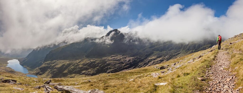
Hikers looking to experience one of the most iconic ridge walks in Ireland will want to try the Coomloughra Horseshoe. Located within MacGillycuddy's Reeks, this popular yet challenging trek takes you up Ireland's three highest mountains, Carrauntoohil, Beenkeragh, and Caher.
With the knife-edge Beenkeragh Ridge and several areas that require scrambling, the Coomloughra Horseshoe should only be attempted by seasoned climbers in good weather. The walk is around 12 km (8 miles) and takes approximately 5 hours.
You can start this walk from either end of the horseshoe, but it's recommended you head in a clockwise direction as you’ll get the most strenuous parts of the walk out the way early. From the Hydro Road car park, head up the Hydro road ascending steeply to Cnoc Íochtair (747 m/2,450 ft). From the summit, you'll be able to see the horseshoe route around the Coomloughra bowl and the surrounding Reeks.
From Cnoc Íochtair, make the easy ascent over Skregmore (848 m/2,782 ft) and then head east to Beenkeragh, Ireland's second-highest peak. There's a boulder field you'll have to cross carefully to reach the summit of Beenkeragh, but the views of Carrauntoohil are worth the extra effort.
Take a rest here before tackling the infamous Beenkeragh Ridge towards Carrauntoohil. Traversing the Beenkeragh Ridge requires an excellent head for heights and a decent scrambling ability, as you'll have to scramble for around 750 m (2,460 ft). You should avoid this ridge in bad weather and strong wind due to exposure.

At the summit of Ireland's highest mountain, Carrauntoohil, snap a selfie with the iron cross and enjoy views across the Reeks, Kenmare Bay, and the Dingle Peninsula. The climb across the Caher Ridge isn't as testing as Beenkeragh but it’s still a steep, challenging trek to Caher's summit.
The descent back to the car park is completely downhill and you can make it even easier by starting the route in a clockwise direction, which isn't as steep or hazardous.
Perched on the Dingle Peninsula, Mount Brandon (or Cnoc Bréanainn) is the highest mountain in Ireland outside MacGillicuddy's Reeks and the most prominent peak after Carrauntoohil. Part of the Brandon Group, Mount Brandon is steeped in local mythology and culture and is the endpoint of the Cosán na Naomh (The Saint's Road) pilgrimage for the mountain's namesake, St. Brendan.
There are a few popular ways of climbing Mount Brandon, including via the tricky Faha Ridge or as part of a longer walk across the whole of the Brandon Group. Perhaps the easiest way to hike up Mount Brandon is on the Esk route via the range’s paternoster lakes. The Esk route is 10 km (6 miles) and takes approximately 6 hours.
Pick up this trail from the Faha car park roughly 3 km (2 miles) from the village of Cloghane. From here, follow the steep grassy path uphill to a small grotto. Then, follow another well-worn path uphill towards the eastern slopes of Mount Brandon.
Once you're in the Owennafeana River Valley, you'll be able to spot the Faha Ridge to your right, which is home to one of the highest Iron Age forts in Ireland, at around 800 m (2,6,24 ft) high. Within the valley are several picturesque paternoster lakes, glacial chain lakes connected by a single stream.
Once you're past the paternoster lakes, the path becomes even steeper, with a short scramble up a loose gully. Upon reaching the summit of Mount Brandon, you'll get to enjoy stunning views across the Dingle Peninsula and the surrounding Brandon Group.
To descend, head back the way you came. If you have any extra energy on the way back, consider making a detour to the crash site of a World War 2 German plane that crashed into the slopes in 1940.
Purple Mountain (832 m/ 2,729 ft) is a popular hike and ideal for anybody searching for excellent views of the Gap of Dunloe. Situated on the Iveragh Peninsula, Purple Mountain is the highest mountain in the Purple Mountain Group and is separated from MacGillycuddy's Reeks to the west by the Gap of Dunloe. The group gets its name from the color of the Old Red Sandstone that the mountains are made from.
The best place to start your walk is from Kate Kearney's Cottage just west of Lough Leane at the base of the Gap of Dunloe. The walk is around 14.5 km (9 miles) and takes approximately 5 hours.
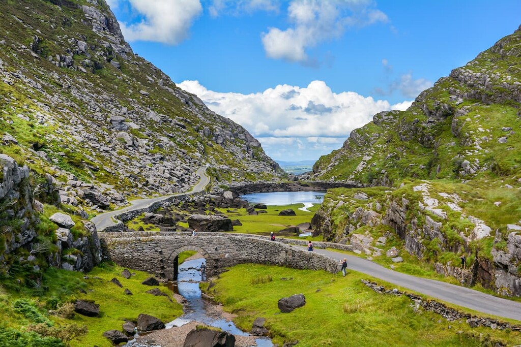
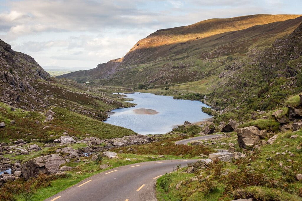
Begin your walk with an hour trek through the stunning Gap of Dunloe. You'll pass several lakes here, including Black Lough, where Ireland's last wolf was killed over 200 years ago. At the head of the gap, leave the main path and walk northeast along a well-trodden trail towards Glas Lough at around 470 m (1,541 ft).
From Glas Lough, the path up Purple Mountain becomes steeper, and some scrambling up is required in areas with loose scree. You'll first reach a minor summit at 793 m (2,601 ft), before walking along the mountain's saddle to the true summit.
The views from Purple Mountains are among the best in County Kerry, with the Gap of Dunloe to the north, Lough Leane to the northeast, and Ireland's three highest peaks to the southeast.
To descend, head northeast and descend onto Tomies Mountain (735 m/2,411 ft). The trail down Tomies Mountain is the quickest and easiest way to descend the mountain. The trail leads back onto the Gap of Dunloe road, which you can follow back to Kate Kearney's Cottage.
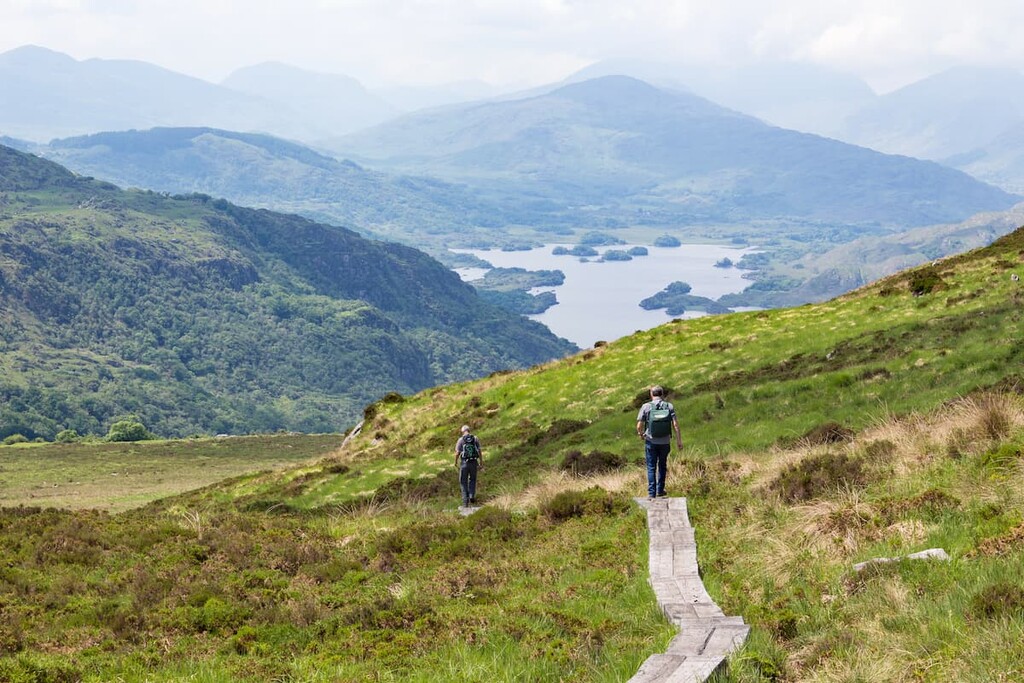
One of the most popular hill walks in Killarney National Park is up Torc Mountain (535 m/1,755 ft). Part of the Mangerton Group, Torc Mountain is far more popular than the range's namesake neighbor Mangerton (839 m/2,752 ft), as it's a suitable climb for hikers of all abilities and affords better views of the Lakes of Killarney.
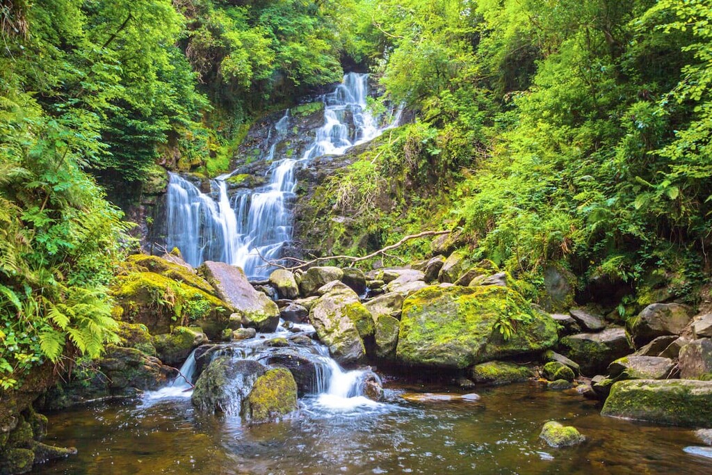
You can climb Torc Mountain from two different starting points. You can start from the lower car park next to Torc Waterfall or from the upper car park, which can be accessed by leaving the N71 and taking the first left after the entrance to Muckross House. This short route from the upper car park is around 8 km (5 mi) and takes about 3 hours.
Follow the obvious woodland trail towards Torc Mountain and turn left after the wooden bridge over the Owengarriff river. Out of the woodlands, you'll be on mountain slopes with the southern face of Torc Mountain to your right.
After a short walk, you'll come across a signpost for the Torc Mountain summit trail on your right, which you follow to the summit. The summit trail weaves up the mountainside, with boardwalks to help you avoid the boggy ground below. These slopes are an excellent place to spot the last remaining herd of red deer in Ireland.
As you near the summit, the boardwalks turn into a stony track. The summit offers some of the best views of the Killarney Valley below, with the Lakes of Killarney to the north and the Dingle Peninsula visible to the west. This is a linear trail, so follow the same route back down the mountain.
Another small range on the Dingle Peninsula, the Slieve Mish Mountains are often overlooked but provide challenging climbs with sweeping vistas of Dingle Bay. The Derrymore Glen Horseshoe (or the Slieve Mish Circuit) is among the most popular hill walks in Slieve Mish, taking hikers over the range's main summits, including Baurtregaum (851 m/2,791 ft) and Caherconree (835 m/2739 ft).
The Derrymore Glen Horseshoe is around 11 km (7 miles) and takes approximately 5 hours. You can pick up this walk from the north side of the Derrymore Glen, just off the N86 south of Derrymore Island. The walk starts out following the Dingle Way before heading south/southwest, ascending gently to the summit of Gearhane (845 m/2,772 ft).
From Gearhane, the horseshoe route becomes clear as you walk along the ridge clockwise towards the summit of Caherconree, the second-highest of the Slieve Mish Mountains. The route then loops around the horseshoe to the highest of the Slieve Mish Mountains, Baurtregaum.
There are two ways you can descend from Baurtregaum. You can either descend via Baurtregaum NW Top (776 m/2,545 ft) or Baurtregaum NE Top (872 m/2,860 ft). Both routes lead back to the bottom of the valley, with the NW top providing a more leisurely descent. You can then follow the stream through the valley back to your starting point.
Hikers looking for a long-distance trek across County Kerry should consider the Kerry Way. The longest waymarked trail in Ireland, the Kerry Way follows a similar route to the famed Ring of Kerry, taking walkers through the best of the Iveragh Peninsula's epic landscape. The walk is around 200 km (124 miles) and takes about 8 days to complete.

This looped trail starts and ends in Killarney. You can find the way's starting point at the beginning of Muckross Road. The Kerry Way is generally completed in a clockwise direction, with your first stop at the Torc Waterfall. On the way, you'll pass by another popular tourist spot, the eighteenth-century Muckross House.
From here, the route follows the Old Kenmare Road parallel to the Owerngariff River. There are some great views of surrounding mountains including Mangerton and Torc Mountain along this section. The section ends at Galway's Bridge on the way to Black Valley. At Galway's Bridge, you will have walked just under 15 km (9 miles).
Heading for Black Valley, the Purple Mountain Group will become visible to the north. You'll also pass by Upper Lake and the base of MacGillycuddy's Reeks across the valley. Just past Upper Lake is Lord Brandon's Cottage, which offers refreshments during the summer.
From the center of Black Valley, you'll walk to Bridia Valley. During this section, you'll pass by Cummeenduff Lough and get to enjoy vistas of Brassel Mountain (575 m/1,886 ft) and Broaghnabinnia (745 m/2,444 ft) to the north. At the Bridia Valley, you'll have completed about 30 km (18 miles).
From Birdia Valley, you'll hike to Glencar, with excellent vistas over Lough Acoose towards the Dingle Peninsula along the way. From Glencar, your next stop is Glenbeigh, passing through the tranquil Lickeen Wood. You'll then walk 6 km from The Climber's Inn in Glenbeigh to near Drom West, where you can rest up after a long day hiking. At Drom West, you'll have walked around 60 km (37 miles).
Next, you'll walk to Kells via the old coach road, which passes Drung Hill (693 m/2,273 ft) and the forest at Coomshanna. Next, you'll pass the western foot of Been Hill (704 m/2,309 ft) to Foilmore and then over Coomduff (231 m/757 ft), which affords panoramas of the surrounding mountains.
Ensure you stop in the town of Cahersiveen if you're looking for somewhere to spend the night. At Cahersiveen, you'll have walked approximately 95 km (59 miles) of the Kerry Way.
From Cahersiveen, you'll walk past the Coars National School and over Knockovahaun (369 m/1,210 ft) to the village of Mastergheeny and then onto Waterville. At Waterville, you'll have the choice of following a coastal or inland route to Caherdaniel. The coastal path is recommended as it's much shorter at 12.5 km compared to 27.5 km. At Caherdaniel, you'll have walked around 125 km (77 miles).

Once you reach Caherdaniel, continue onto the Staigue Stone Fort, a popular tourist attraction dating back to the Iron Age. You'll then walk to Sneem village along the riverside and on forested trails. Then you'll walk 10 km from Sneem to Tahilla, a small fishing village. If you’re looking for something to do along the way, stop at the Brushwood Studios art gallery.
From the church in Tahilla, you'll need to follow the Ring of Kerry road signposted for Glencar at first, before following the old coach road to Lough Fadda and through Derrenamacken Wood to Blackwater Bridge. At Blackwater Bridge, you'll have walked over 155 km (96 miles).
At this point, you'll only have around 40 km (25 miles) left of the Kerry Way. From Blackwater Bridge, head for Templenoe and then over Gortamullin (194 m/636 ft) to Kenmare. At Kenmare, make a short detour to visit the 4,000-year-old Reenagoppul Stone Circle.
The final stretch sees you trek from Kenmare to Galway's Bridge and back to Killarney. From Galway's Bridge to Killarney, you'll pass over the saddle between Cromaglan Mountain (356 m/1,167 m) and Stumpacommeen (367 m/ 1,204 ft). Finally, you'll pass by Muckross Estate on the way back to Killarney.

Make the most of your next hiking adventure in Kerry by spending the night in one of the county’s many picture-perfect towns and villages.
There are few better places to stay in County Kerry than Killarney. Kerry’s second-largest town, Killarney sits a stone's throw from the Killarney National Park, in the shadow of Torc Mountain on the northeastern shore of Lough Leane.
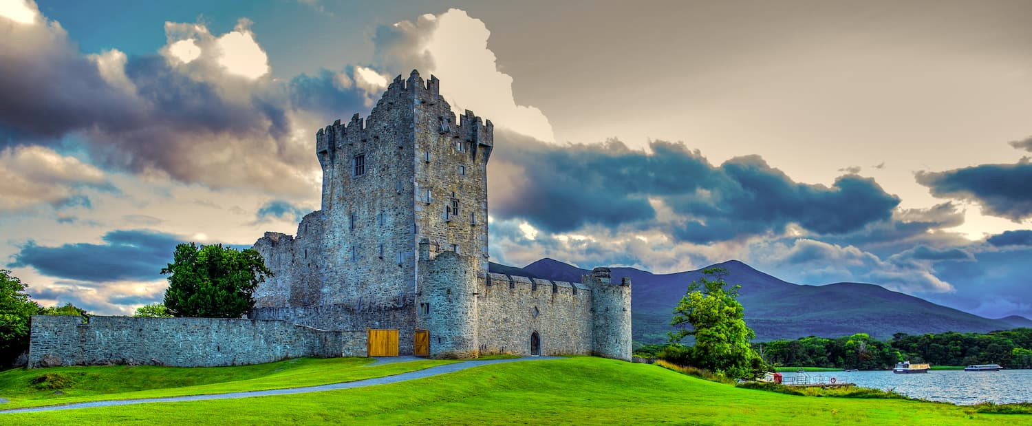
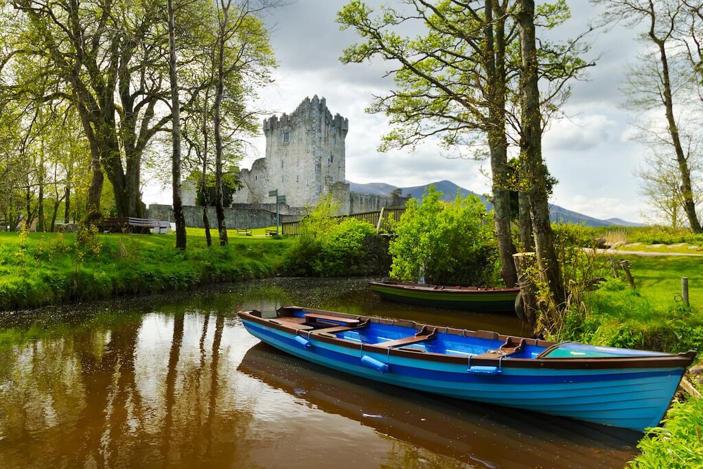
As well as being perfectly positioned for exploring the best of County Kerry's mountains, Killarney also boasts some fascinating historical sights, like the fifteenth century Ross Castle and the abbey ruins on Innisfallen Island. If you're planning a vacation in Killarney, consider renting a room at the Killarney Tower Hotel or the Killarney Plaza Hotel.
Kerry's largest and county town, Tralee is perfect for soaking up local culture while exploring the county's countryside. Sat at the base of the Dingle Peninsula, Tralee is less than 20 km (12 miles) from the Slieve Mish Mountains and 40 km (24 miles) from Killarney National Park.
You'll find a range of family-friendly attractions in Tralee, including the Kerry County Museum and the Aqua Dome water park. If you're planning on visiting Tralee, plan your trip in late August to coincide with the Rose of Tralee Festival. There are some superb hotels in Tralee, too, including The Ashe Hotel and the Manor West Hotel.
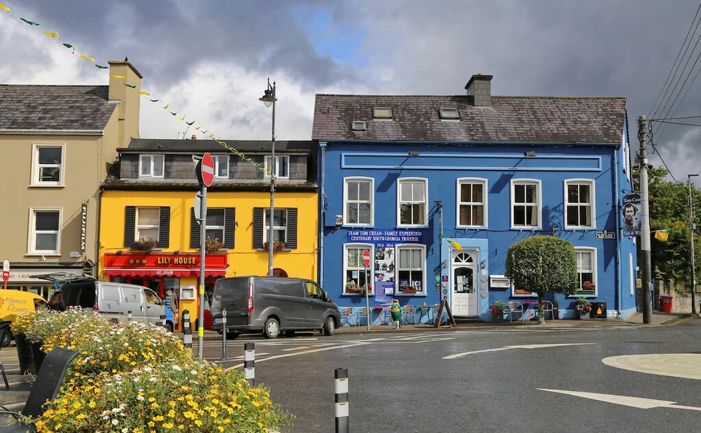
Looking to hike MacGillycuddy's Reeks? Then spend the night in Killorglin. A sleepy village bursting with Irish culture and history, Killorglin is one of the most popular resort towns in County Kerry. Killorglin is the nearest major settlement to MacGillycuddy's Reeks, which is located just 15 km (9 miles) south of the village.
During your stay in Killorglin, pick up some information about your next hike at the Reeks District Visitor's Centre or visit in early August and experience one of Ireland's oldest festivals—the Puck Fair. You'll find a few quaint hotels in Killorglin, too, like the Bianconi Inn and Hotel Ard na Sidhe.
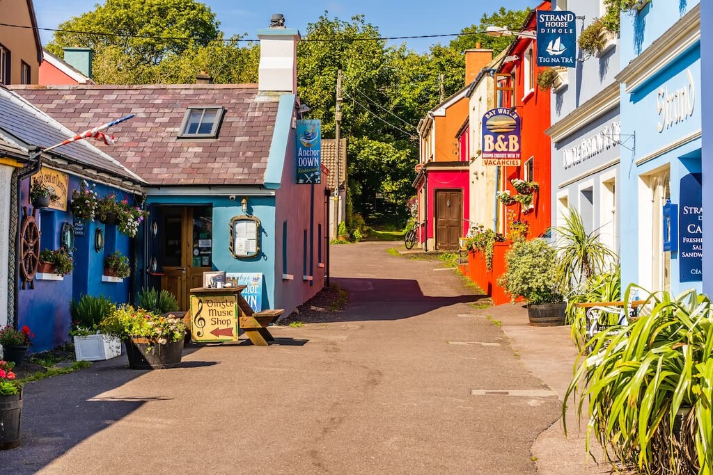
Experience the best of County Kerry's Atlantic coastline with a vacation in Dingle. Perched on the southern coast of the Dingle Peninsula overlooking Dingle Harbour, Dingle is one of the best places to stay if you're looking to hike Mount Brandon, which is just 15 km (9 miles) to the north.
While in Dingle, see what lurks in Dingle Harbour at the Dingle Oceanworld Aquarium or visit the Gallarus Oratory and learn about ancient Irish architecture. Accommodation in Dingle includes the Dingle Bay Hotel and Hotel Ceann Sibeal.
Another popular resort town and hub for hikers is Kenmare. This town of 2,000 people is very popular as it sits within the Ring of Kerry and Ring of Beara scenic driving routes and is less than 30 km (18 miles) from Killarney National Park.
Kenmare is also home to some ancient Irish history, like the Kenmare Stone Circle, thought to be one of the oldest in Ireland dating back 4,000 years. Popular hotels in Kenmare include the Kenmare Bay Hotel and the Brook Lane Hotel.