
Scan the QR code and open PeakVisor on your phone
Adventure seekers looking for a remote hiking area in Ulster will love Glenveagh National Park. Glenveagh National Park is the second-largest national park in Ireland, covering over 40,000 acres of rugged mountains, verdant forests, tranquil loughs, peat bogs, and more. It is located in County Donegal in the northwestern corner of the country.
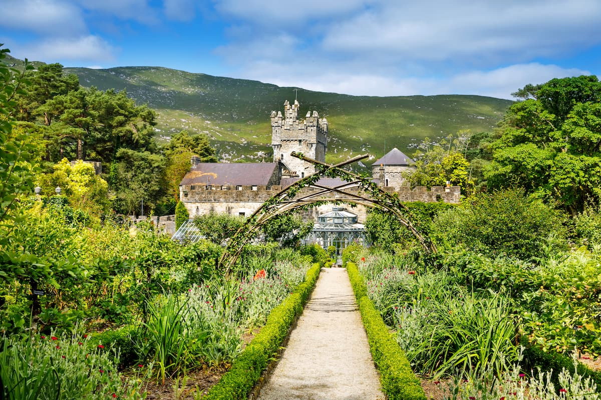
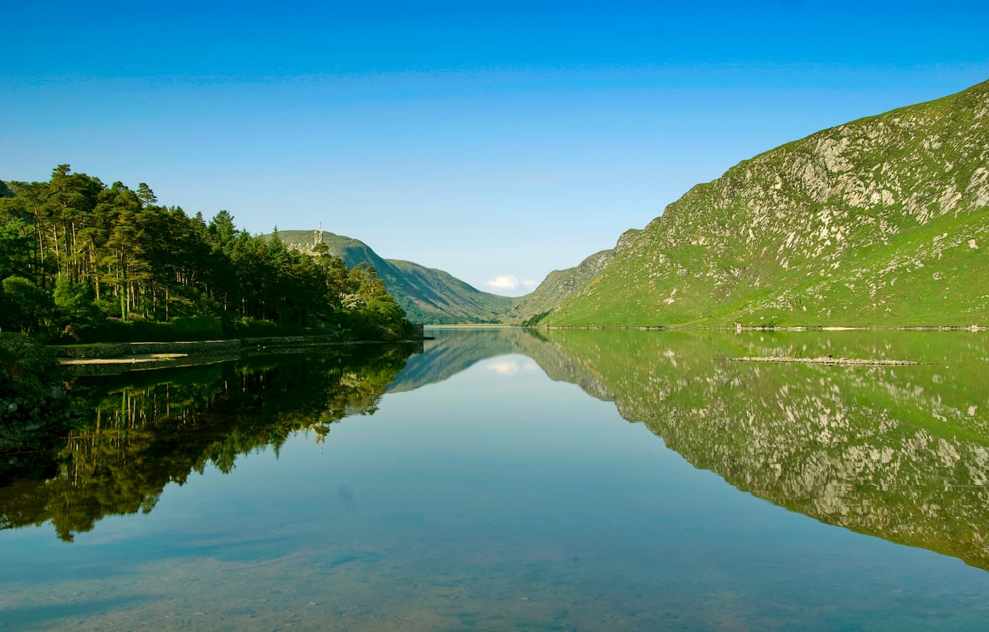
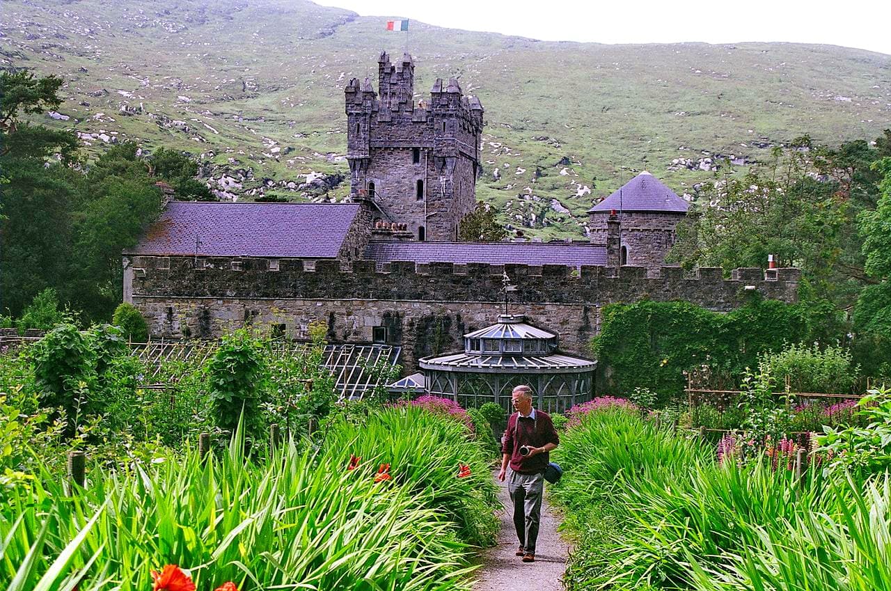
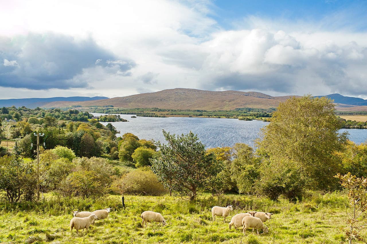
Glenveagh National Park centers around Glenveagh Castle and Lough Veagh. Sometimes referred to as Lough Beagh, Lough Veagh covers roughly 640 acres, making it one of the county's largest loughs. Perched on the edge of Lough Veagh is the picturesque Glenveagh Castle. The castle was constructed in the 1860s under the order of John George Adair, a wealthy landowner from County Laois. Glenveagh Castle is famed for its gardens, which boast hundreds of different plant species, including a diverse rhododendron collection. There are three distinct gardens within the castle's courtyards—the Walled Garden, the Woodland Gardens, and the Pleasure Grounds.
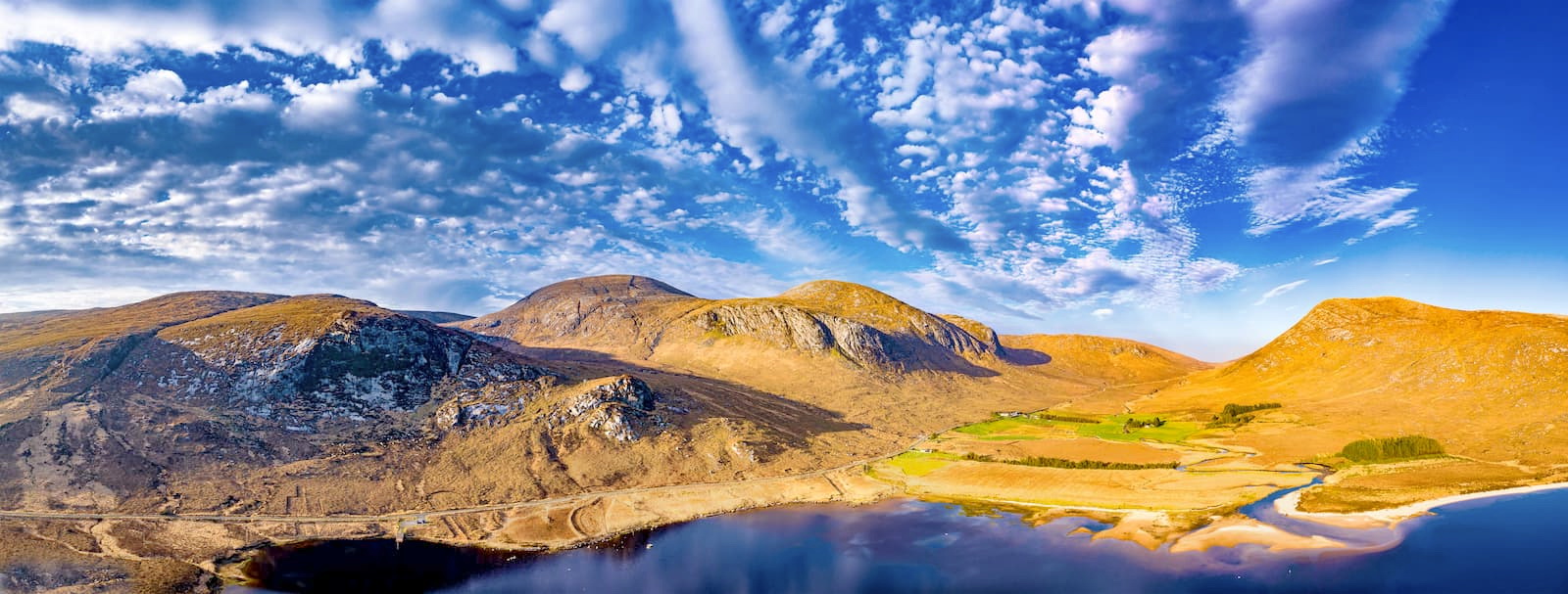
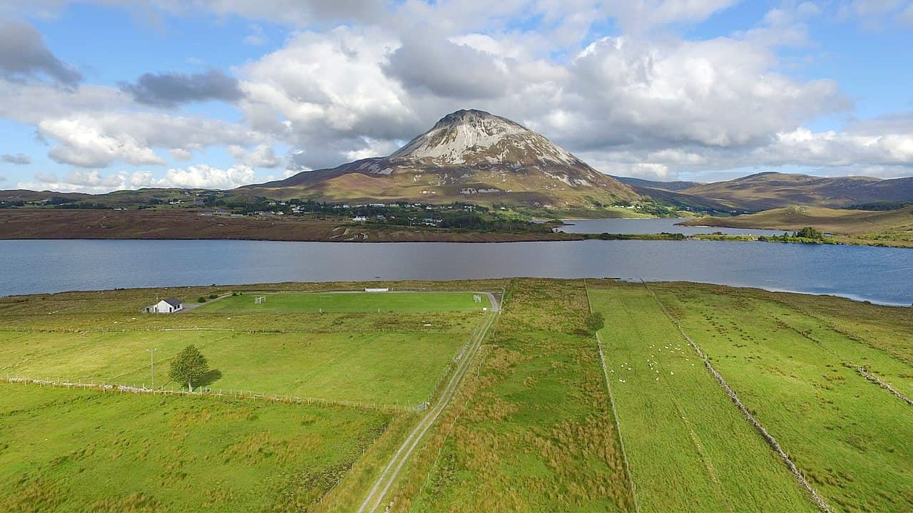
Encircling Lough Veagh and Glenveagh Castle are the stark granite cliffs of the Derryveagh Mountains. On the western edge of the park is Errigal (733 m), the highest mountain in County Donegal. The highest and most prominent mountain completely within the boundaries of Glenveagh National Park is Slieve Snaght (678 m). There are several other challenging mountains in Glenveagh which experienced hikers will enjoy. You'll find five other peaks which are over 500 m tall in Glenveagh. Notable examples include Dooish (642 m), Drumnalifferny Mountain (600 m), and Bingorms (573 m).
The most popular activities at Glenveagh National Park are hiking, fishing, and nature watching. Glenveagh is home to seven marked trails, with 37 named mountains for avid explorers to scale. Anglers have been fishing in Lough Veagh for hundreds of years and it's known for its abundance of brown trout.
You'll find a diverse variety of flora and fauna in Glenveagh, from its boglands to its uplands. You undoubtedly see some rare birds and mammals during your trip, including recently reintroduced golden eagles and herds of red deer.
On the northern edge of Lough Veagh, there's a visitor's center, where you can find out more information about marked trails and the natural environment of Glenveagh. There's also a restaurant which is open from April to September, in case you get peckish after trekking through the Derryveagh Mountains.
To reach Glenveagh National Park, head along the N56 from Letterkenny. If you're traveling to Glenveagh from the south, drive from Church Hill village along the R251.
The Lakeside Walk is one of the most popular trails in Glenveagh and is suitable for hikers of all abilities. The trail is 3.5 km long and should take roughly 40 minutes to complete. This walk starts at the visitor's center and runs along Lough Veagh to Glenveagh Castle. Note that this isn't a looped walk, so you will have to either walk back or take the bus. Tickets for the bus can be obtained at the visitor's center.

Along this trail, you'll initially pass through a beautiful stretch of woodlands filled with Austrian pine, birch, rowan, and more. Continue past the boathouse and across the Owencarrow River bridge. Next, you'll walk by heathlands and peat bogs, a common sight in western Ireland. This stretch of the trail boasts stunning vistas of Lough Veagh with Glenveagh's mountains and hills in the background. The walk ends once you reach Glenveagh Castle.
Hikers searching for a long but not particularly arduous trek should consider the Lough Inshagh Walk. This walk is 7 km long and should take around an hour and a half. This is not a looped walk, so you will have to walk back or arrange transport from the Lacknacoo car park at the end of the trail.
This dirt road was once the main road from Glenveagh Castle to Church Hill. You can pick up the trail around 0.5 km away from Lough Veagh. You'll be treated to wonderful views of the Derryveagh Mountains and the region's blanket bogs along the walk. Nature watchers should be on the lookout for some of the area's rare birds along this trail. Ravens, golden eagles, and meadow pipits are often spotted on the Lough Inshagh Walk.
If you're looking for a short walk that provides stunning views of Lough Veagh, consider the View Point Trail. This route is around 1.5 km and will take about 50 minutes. While the trail's surface is good, it's very steep in places, so ensure you have appropriate footwear. This is a looped trail that starts and ends at Glenveagh Castle.
You can pick up this trail by following the road that runs behind the castle. From here, the route is easy to track and is well signposted. From the observation point at the top of the hill, you'll have beautiful views of the castle and Lough Veagh. On the way down, the trail runs through a wooded area into the castle's lower gardens.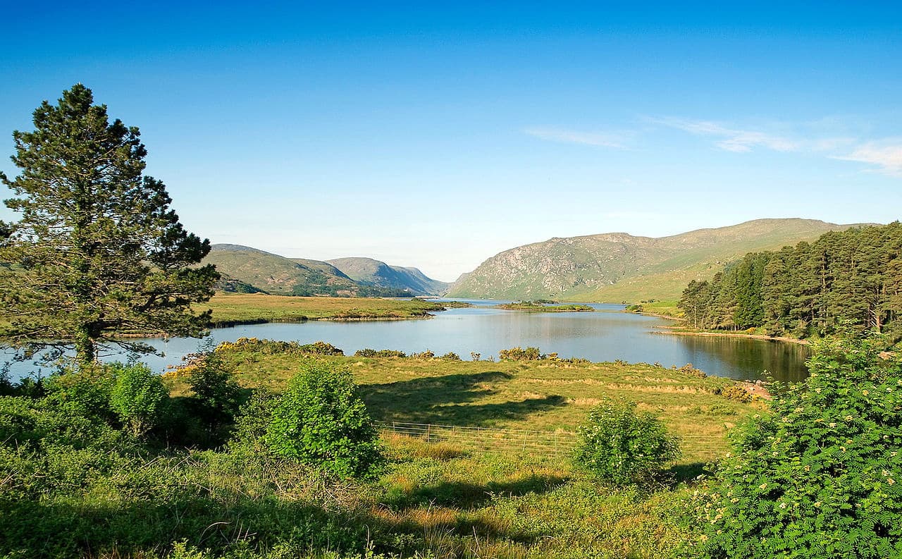
Visitors looking to experience the best of Glenveagh Castle's gardens should take the Garden Trail. This looped walk is about 1 km and should take an hour at a leisurely pace. The trail is relatively flat but is steep in a couple of areas. The castle's gardens contain a huge array of exotic flowers and trees, meticulously laid out across the gardens. If you're looking to learn more about the plants on display here, check out the visitor's center for details.
Errigal is the highest mountain in County Donegal. If you plan on hiking up Errigal, ensure you come well prepared and plan your route thoroughly. No special equipment is needed to climb Errigal, but use caution during your climb. One of the most popular routes up Errigal is the Out and Back Trail, which starts at Falcarragh. This trek is around 4 km one way and should take 3 hours, depending on weather conditions. From the small car park at the bottom of the mountain, begin your ascent. There's no defined trail or markers, so ensure you plan accordingly.
You'll be walking through boglands for the first half-hour of the trek, so be careful not to get stuck. You'll also encounter many steep areas with lots of loose scree, so scrambling is necessary. From atop Errigal, you'll have sweeping views of the sea, the Donegal countryside, and the Seven Sisters mountain range. The descent down the mountain is fast and steep and will require scrambling. To descend, head left down the mountain pass towards Mackoght (549 m).
Slieve Snaght is a difficult yet rewarding trek that should only be undertaken by experienced hikers. The Slieve Snaght hike is around 14 km long and will take approximately 6 or 7 hours. You'll start this walk in the scenic Poisoned Glen by following the deer path to the glen's left. Midway along the hike before making your final ascent, you'll have stunning panoramas of An Cnoc Fada (481 m), Drumnalifferny Mountain (600 m), and the summit of Slieve Snaght (678 m).
Foggy conditions can obscure the route up the summit of Slieve Snaght, so make sure you plan to plan your route carefully before setting off. To descend down the mountain, head toward the Devlin River, passing by a ruined church.
Letterkenny is the nearest major settlement to Glenveagh National Park. Letterkenny is home to around 20,000 people and offers some excellent local attractions. Letterkenny is also known as "the Cathedral Town" due to the stunning St Eunan's Cathedral. Great family-friendly attractions like the Tropical World Zoo and Donegal County Museum. Popular accommodation in Letterkenny includes the Radisson Blu Hotel and McGettigan's Hotel.
You can reach Glenveagh National Park from Letterkenny by following the N26 road north, then head left at Termon onto the R255. This drive is around 23 km and should take about 25 minutes. If you're heading to Glenveagh from abroad, Donegal Airport is located about 60 km northeast of Letterkenny. While Donegal Airport is small, there are flights to some international destinations.
Lifford is the county town of Donegal and is perfect if you're looking for access to both the Republic of Ireland and Northern Ireland. This border community has a small population but boasts some intriguing historical and natural sights, such as the Beltany Stone Circle, Raphoe Castle, and Gortletteragh Waterfalls.
To reach Glenveagh National Park from Lifford, head northeast along the N14 to Letterkenny. The drive is just under 50 km and should take 45 minutes.
Church Hill is ideal for hikers looking to stay as close to Glenveagh as possible. Church Hill is a small village which is perfect for a relaxing vacation in the Irish countryside. Despite its small size, Church Hill has a few yearly events and local activities, including an annual fair and several nearby golf courses. If you're looking for somewhere to stay in Church Hill, consider the Bridgeburn House B&B.
You can get to Glenveagh National Park from Church Hill by heading north along the R251. The drive is a straight shot and provides some lovely scenery. It’s around 10 km and takes 15 minutes.
For those looking to stay directly in Glenveagh, consider Poisoned Glen House. This rentable property sits in the shadow of Errigal, only 3 km from the mountain. The guesthouse offers a shared kitchen, free WiFi, and a continental breakfast every morning. Poisoned Glen House comes highly recommended and is one of the best and only places to stay in Glenveagh National Park.


.jpg)
.jpg)
.jpg)